
Map of Virunga Mountains


![]()
Mount Mikeno is an extinct volcanic mountain located in the Democratic Republic of the Congo section of the Virunga Mountains along with Mount Nyiragongo, Mount Nyamuragira, Mount Karisimbi, Mount Bisoke and Mount Sabyinyo. At 4,437 metres (14,557 ft) Mount Mikeno is the second highest peak in the Virunga Mountains after Karisimbi, and the 13th highest in Africa. Mikeno means “poor” and is so named for its harsh slopes which preclude human habitation. [4]
Mount Mikeno lies completely within Virunga National Park and is known for the critically endangered mountain gorillas that live on its slopes.[5] Expeditions to observe Mikeno’s gorillas typically leave from the nearby Bukima Patrol Post.[6]
Mount Mikeno is the type locality of the yellow-crested helmetshrike Prionops alberti.[7]
It was featured in the movie Congo where the city of Solomon diamond mine is located.
This article uses material from the Wikipedia article Mount Mikeno, which is released under the Creative Commons Attribution-Share-Alike 4.0 International License (view authors).
 (WT-shared) Cai (Wikipedia) | 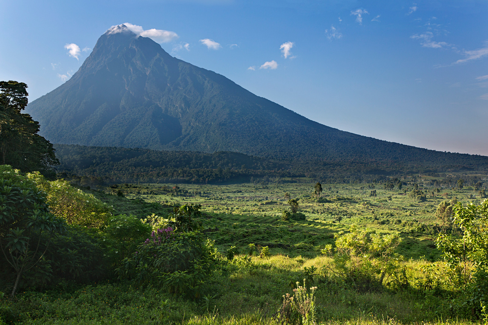 Flickr I |
 Cai Tjeenk Willink (Wikipedia) | 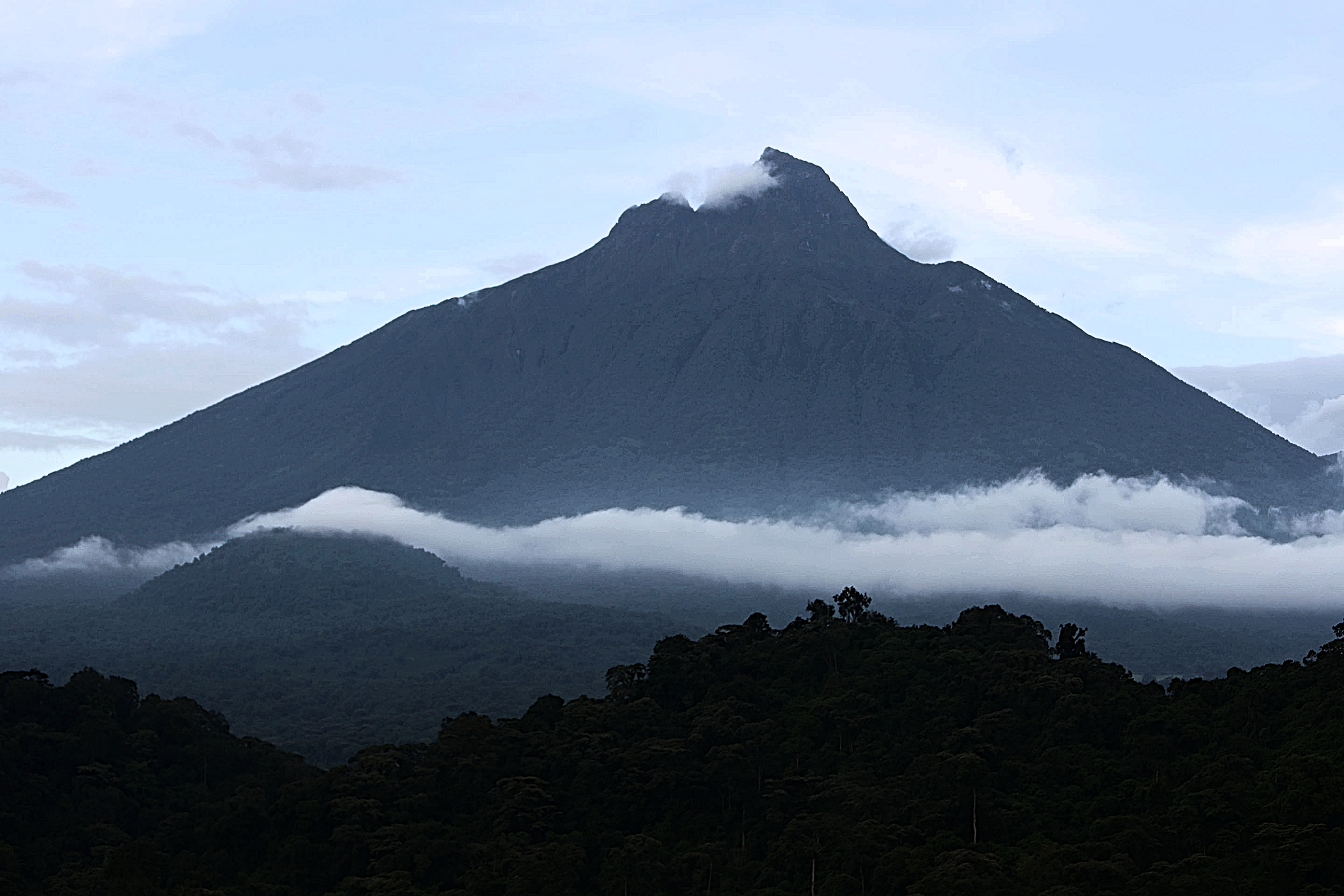 MONUSCO Photos (Wikipedia) |

![]()
![]()
Mount Bisoke (also Visoke) is an active volcano in the Virunga Mountains of the Albertine Rift, the western branch of the East African Rift. It straddles the border of Rwanda and the Democratic Republic of the Congo, but the summit is located in Rwanda. It is located approximately 35 km northeast of the town of Goma and the adjacent Lake Kivu.
Geology
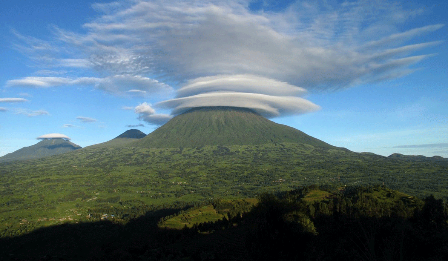
Bisoke, like all the peaks in the Virunga Mountain Range, is a volcano created by rift action on the forming divergent boundary of the East African Rift which is slowly bisecting the African Plate. Bisoke has two recorded eruptions which happened in 1891 and 1957. The most recent eruption happened 11 km north of the summit, and it formed two small cones on the volcano’s north flank. There is evidence that the area where this eruption occurred is still geologically active, suggesting the likelihood of future activity at Bisoke. The volcano has two crater lakes, one being the largest of the range.[1]
Geography
The mountain is within the Rwandan Volcanoes National Park and the Congolese Virunga National Park. The steep slopes of the peak are densely covered with equatorial rainforest and alpine meadows. The summit does not gather snow, but is often shrouded in fog. Bisoke is one of the mountains that provide habitat for the endangered mountain gorilla, and the Karisoke Research Center founded by Dian Fossey is in the valley to the west.
Industry/Tourism
Being within two national parks, it is by law off-limits to most standard wilderness industries such as logging, farming, or mining. Aside from visitors to the parks searching for gorillas or other wildlife, the peak is popular with mountaineers. It can be climbed in a day from the Rwandan side, and the Rwanda Development Board (RDB) leads two-day excursions to it and nearby Mount Karisimbi, most often out of the nearby city of Ruhengeri. The climb is considered steep but walkable.[2]
The local tourism industry was devastated during the 1990s by several bloody uprisings and wars in central Africa including the Rwandan Civil War (1990–1994), Rwandan genocide (1994), First Congo War (1996–1997) and Second Congo War (1998–2003), and Burundian Civil War (1993–2005). During this time, military action and refugee relocation wreaked ecological havoc (including deforestation and poaching of endangered species) upon the Volcanoes and Virunga National Parks and the surrounding area. In recent years, both parks have been somewhat secured, and the tourism industry of the area has been recovering, despite ongoing conflicts and, from 2020-2022, the damage caused by COVID-19 lockdowns.[3][4]
This article uses material from the Wikipedia article Mount Bisoke, which is released under the Creative Commons Attribution-Share-Alike 4.0 International License (view authors).
 MONUSCO Photos (Wikipedia) | 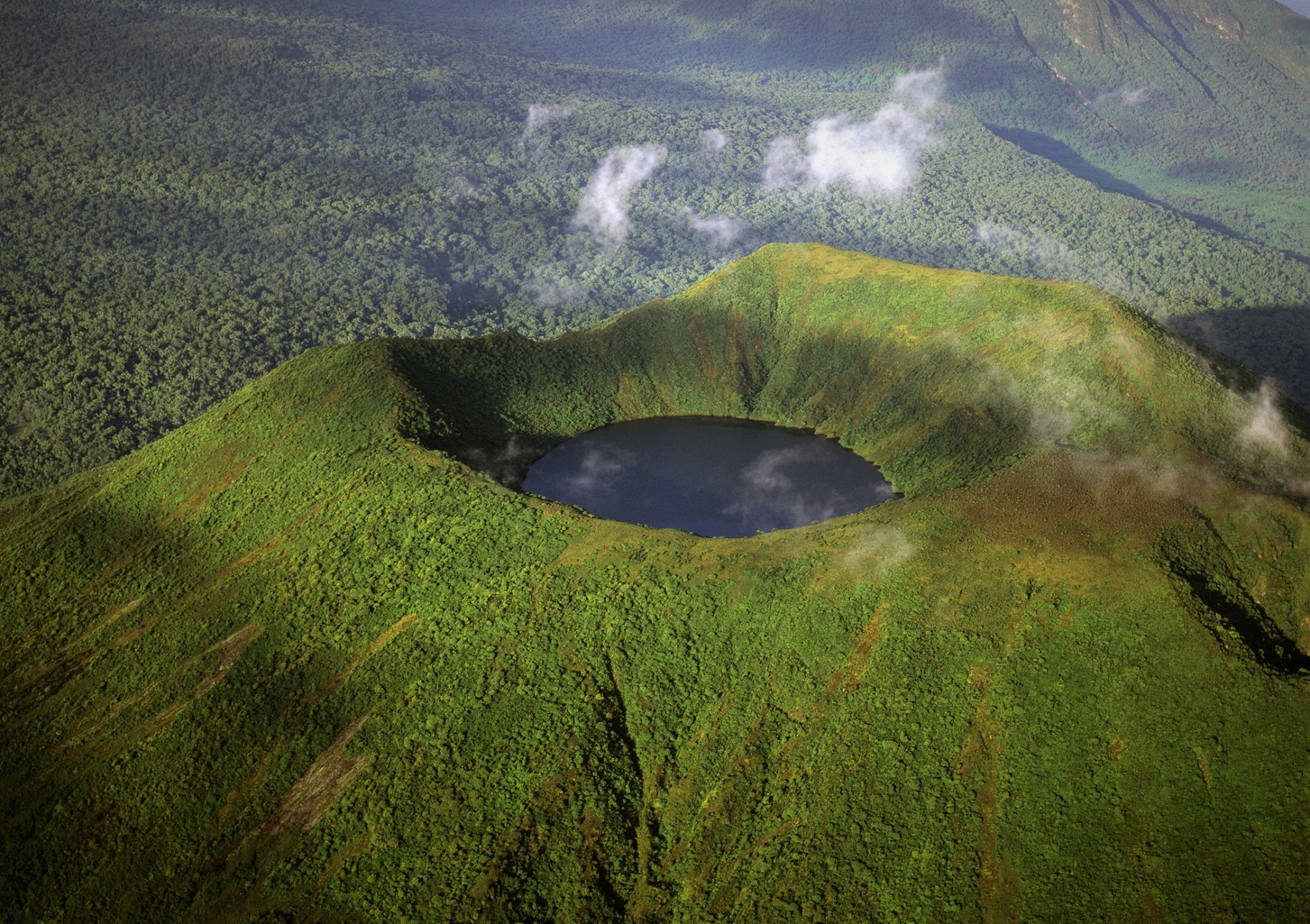 I I |

![]()
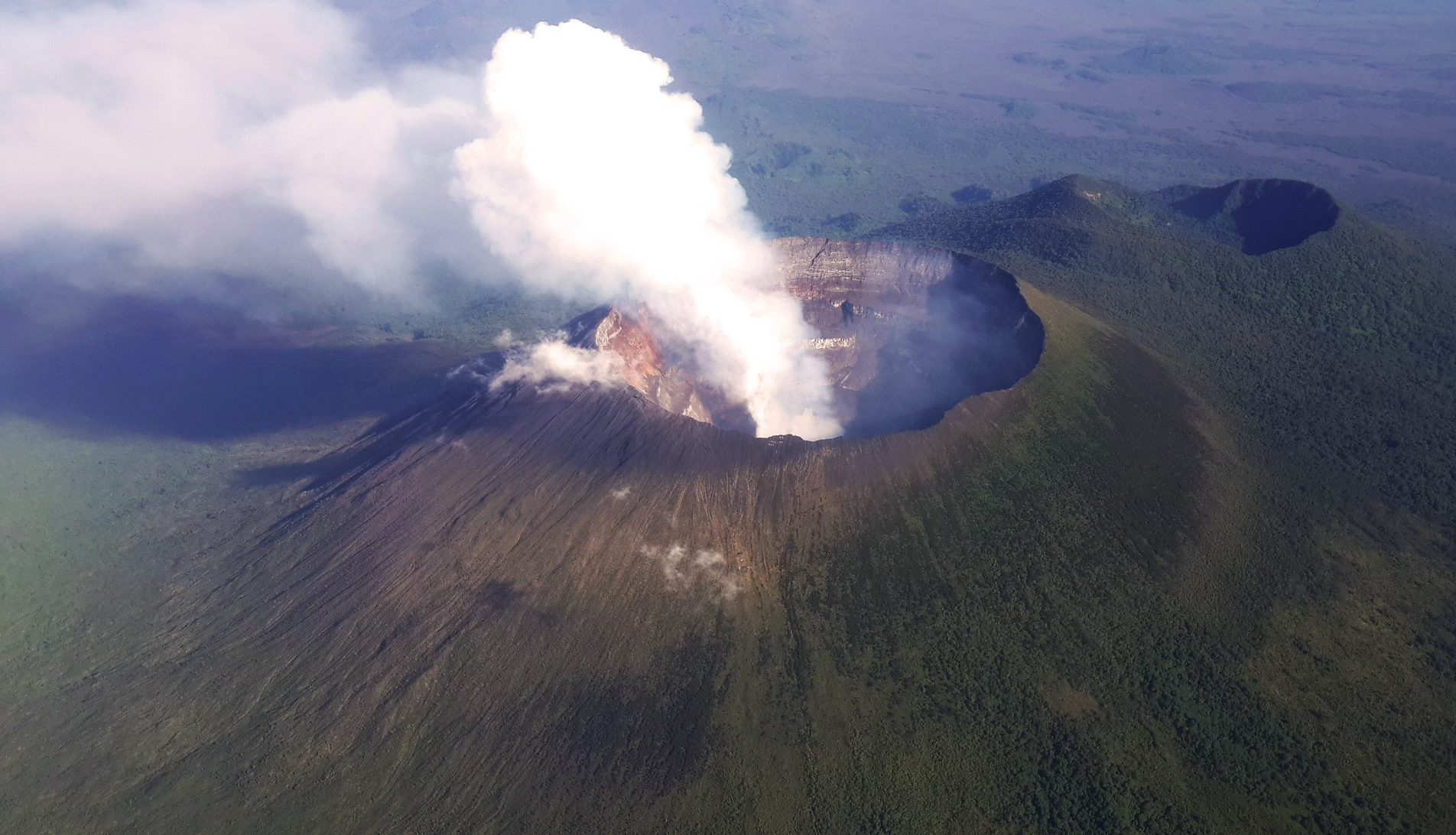
Mount Nyiragongo (/ˌnɪərəˈɡɒŋɡoʊ, -ˈɡɔːŋ-/ neer-ə-GONG-go) is an active stratovolcano with an elevation of 3,470 m (11,385 ft)[1] in the Virunga Mountains associated with the Albertine Rift. It is located inside Virunga National Park, in the Democratic Republic of the Congo, about 12 km (7.5 mi) north of the town of Goma and Lake Kivu and just west of the border with Rwanda. The main crater is about two kilometres (1 mi) wide and usually contains a lava lake. The crater presently has two distinct cooled lava benches within the crater walls – one at about 3,175 m (10,417 ft) and a lower one at about 2,975 m (9,760 ft).
Nyiragongo’s lava lake has at times been the most voluminous known lava lake in recent history. The depth of the lava lake varies considerably. A maximum elevation of the lava lake was recorded at about 3,250 m (10,660 ft) prior to the January 1977 eruption – a lake depth of about 600 m (2,000 ft). Following the January 2002 eruption, the lava lake was recorded at a low of about 2,600 m (8,500 ft), or 900 m (3,000 ft) below the rim.[3] The level has gradually risen since then.[4] Nyiragongo and nearby Nyamuragira are together responsible for 40% of Africa’s historical volcanic eruptions.[5]
Geology
The volcano partly overlaps with two older volcanoes, Baruta and Shaheru, and is also surrounded by hundreds of small volcanic cinder cones from flank eruptions.[citation needed]
Nyiragongo’s cone consists of pyroclastics and lava flows.[6] Nyiragongo’s lavas are low-silica, alkali-rich, ultramafic extrusive rocks essentially free of feldspars. They range from olivine-rich melilitites through leucites to nephelinites, containing, in various proportions mainly the minerals nepheline, leucite, melilite, kalsilite, and clinopyroxene.[6][7][8] This very low silica composition results in eruptions with unusually fluid flows. Whereas most lava flows move rather slowly and rarely pose a danger to human life, Nyiragongo’s lava flows may race downhill at up to 100 km/h (60 mph).[9]
Active history
Not much is known about how long the volcano has been erupting, but it has erupted at least 34 times since 1882, including many periods where activity was continuous for years at a time, often in the form of a churning lava lake in the crater. The existence of the lava lake had been suspected for some time but was not scientifically confirmed until 1948.[10] At that time, it was measured at nearly 120,000 square metres (1.3×10⁶ sq ft).[10] Subsequent expeditions showed that the lake fluctuated in size, depth, and temperature over time.[10]
The lava lake activity is ongoing.[11][4][12] As of 2020, the lake is mostly confined within a broad, steep-sided cinder cone (roughly 18 m (60 ft) high by 180 m (600 ft) wide) on the crater floor.[12][13]
This article uses material from the Wikipedia article Mount Nyiragongo, which is released under the Creative Commons Attribution-Share-Alike 4.0 International License (view authors).
 MONUSCO-Neil Wetmore (Wikipedia) | 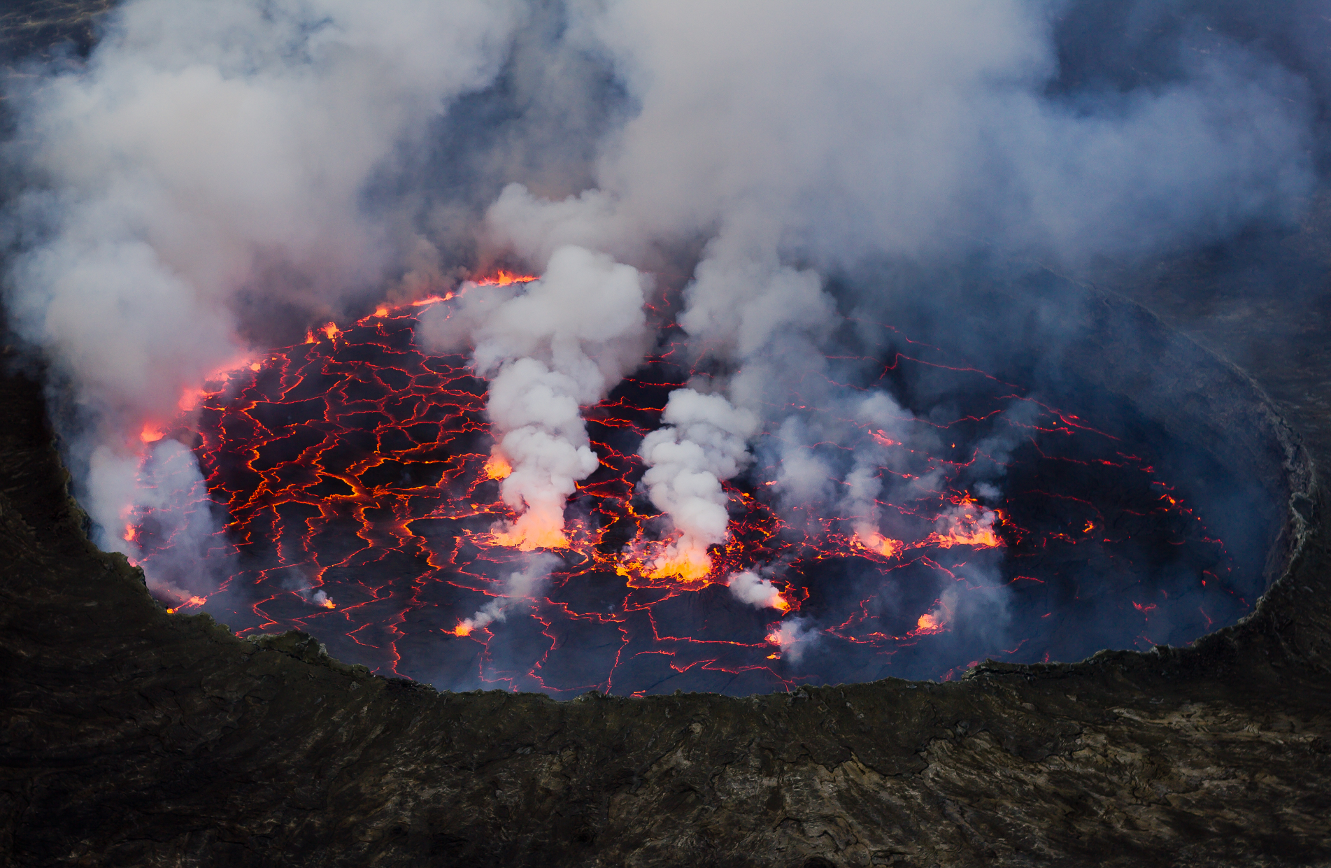 Cai Tjeenk Willink (Wikipedia) |

![]()
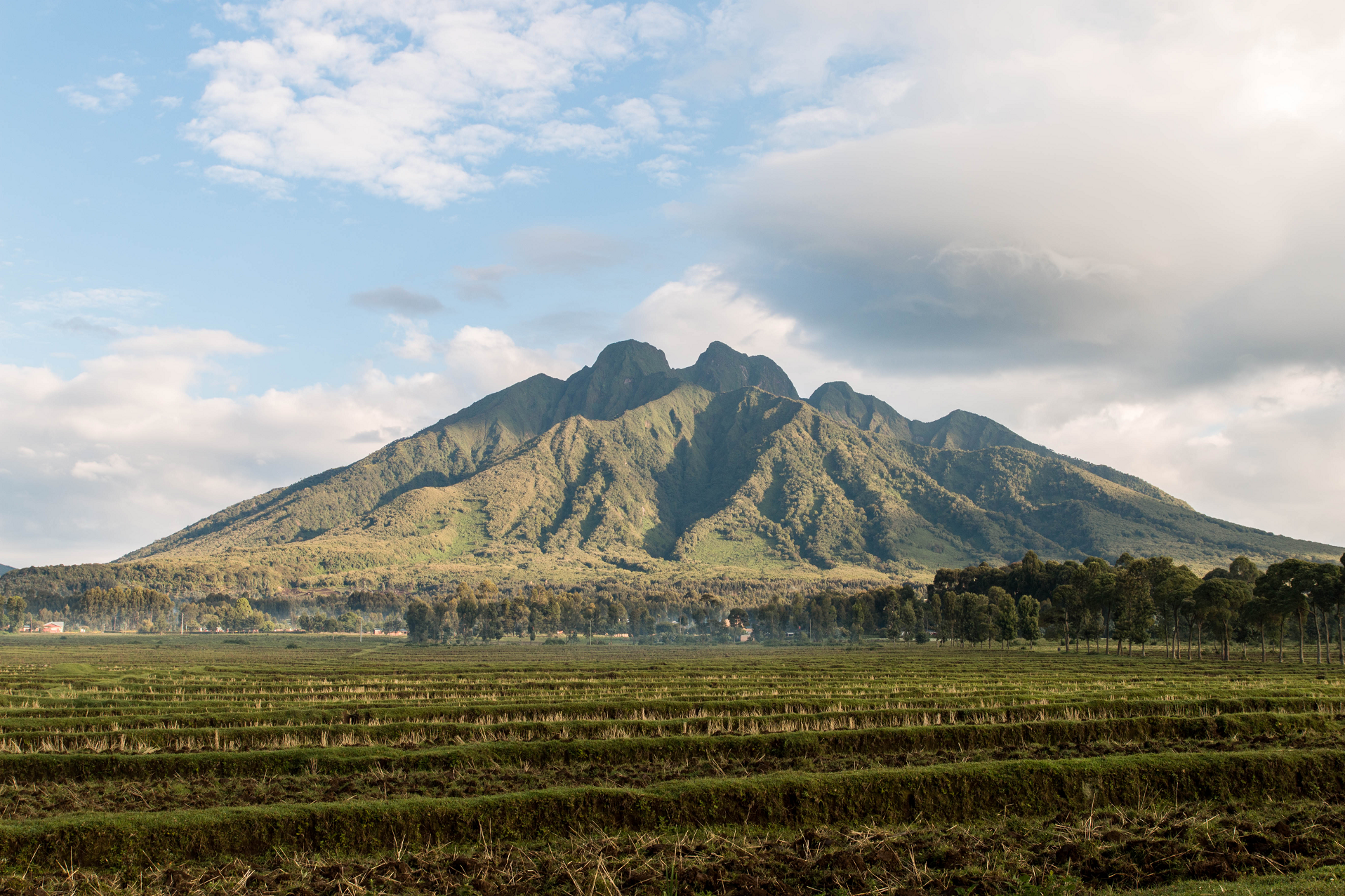
Mount Sabyinyo (“Sabyinyo” is derived from the Kinyarwanda word “Iryinyo”, meaning “tooth”; also “Sabyinyo, Sabyinio”) is an extinct volcano in eastern Africa in the Virunga Mountains.
Mount Sabyinyo is the oldest volcano of the range. It is north-east of Lake Kivu, one of the African Great Lakes, and west of Lake Bunyonyi in Uganda. The summit of the mountain, at 3,669 metres (12,037 ft),[3] marks the intersection of the borders of the Democratic Republic of the Congo (DRC), Rwanda, and Uganda, and holds religious significance for local tribes. It also is within the adjoining national parks established by these countries: Virunga National Park in the DRC, the Volcanoes National Park in Rwanda, and Mgahinga Gorilla National Park in Uganda.
The slopes of Mt. Sabyinyo are a habitat for the critically endangered mountain gorilla.[4][5] The mountain carries the local nickname “Old Man’s Teeth,” because its serrated summit resembles worn teeth in a gum line (in contrast to the perfect conical summits of the adjacent mountains in this range).[6]
The peaks of Mountain Sabyinyo,[7] can be easily done and accessed and trekked along the foothills from the side of Mgahinga National park. in Uganda.
This article uses material from the Wikipedia article Mount Sabyinyo, which is released under the Creative Commons Attribution-Share-Alike 4.0 International License (view authors).
 Maciej (Wikipedia) I | 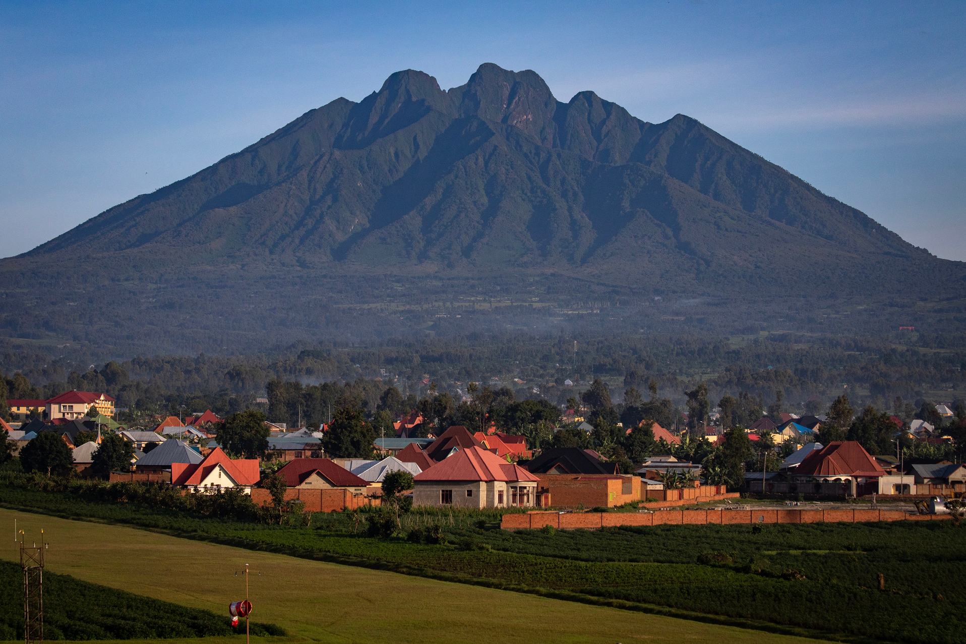 Andrew Moore (Wikipedia) |
 Lionpock (Wikipedia) | 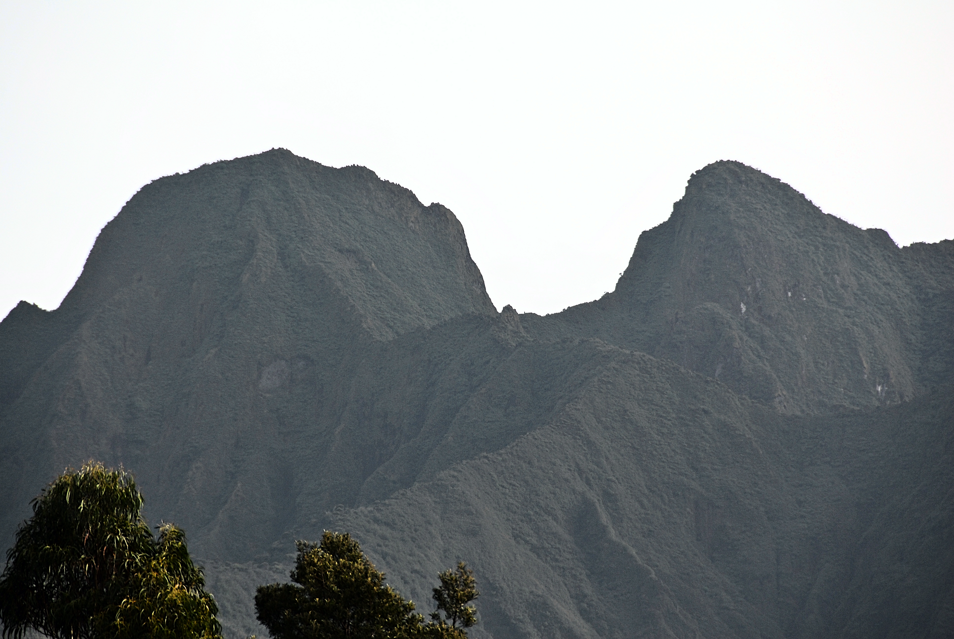 Dave Proffer (Wikipedia) |
