
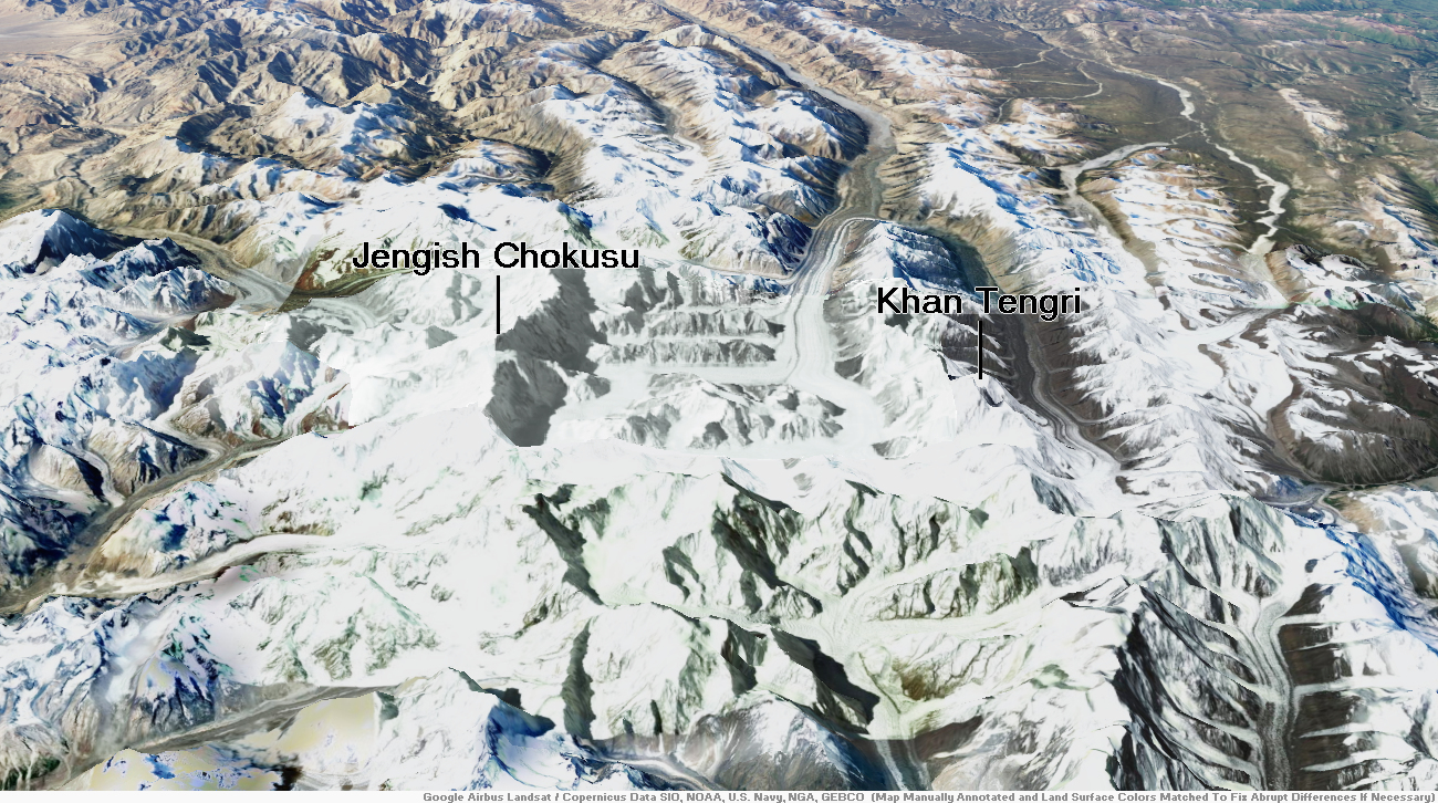
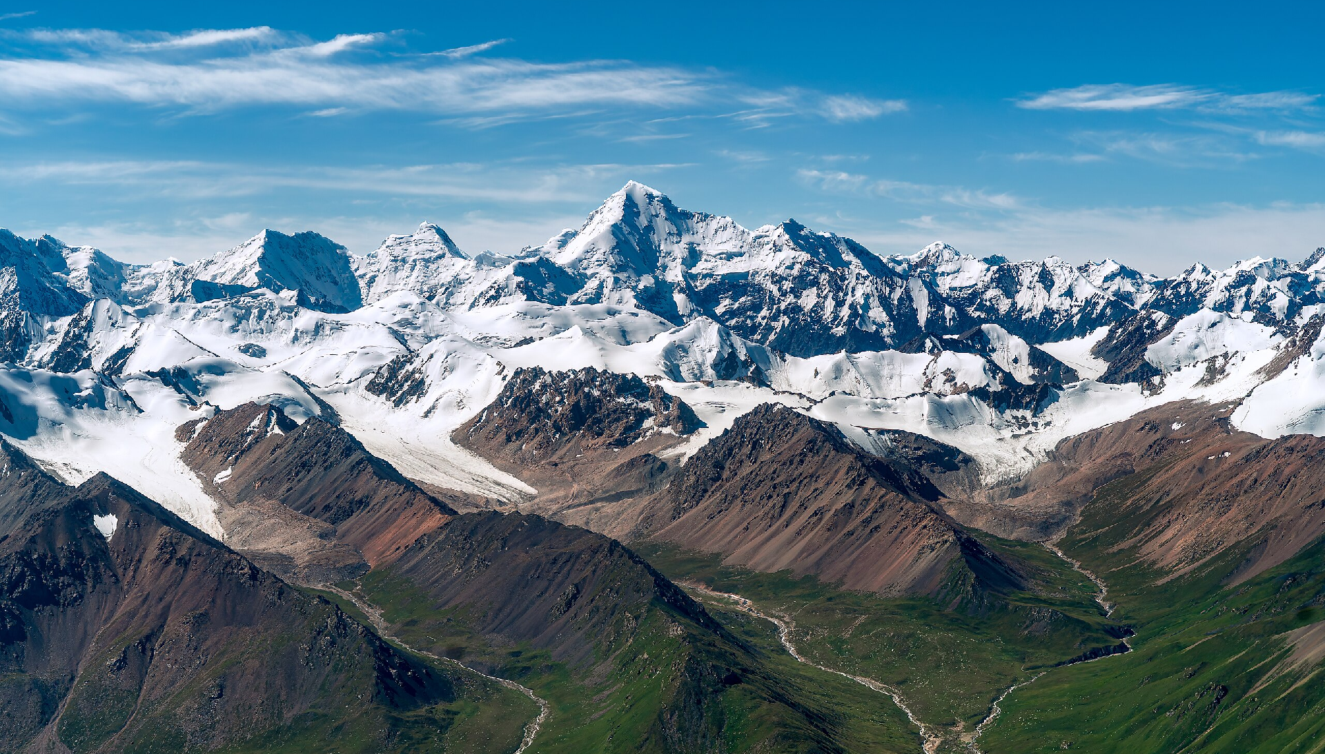
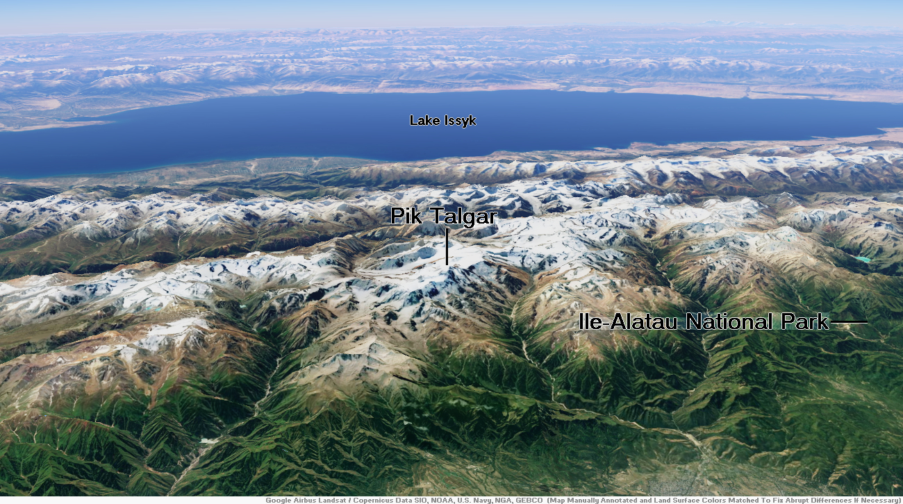
Map of Tian Shan

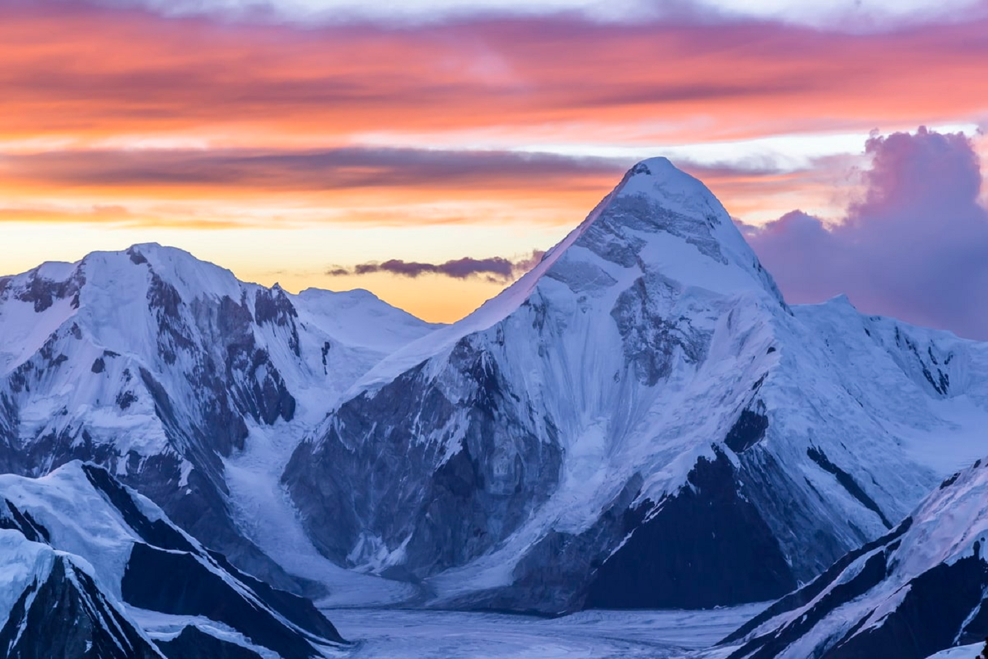
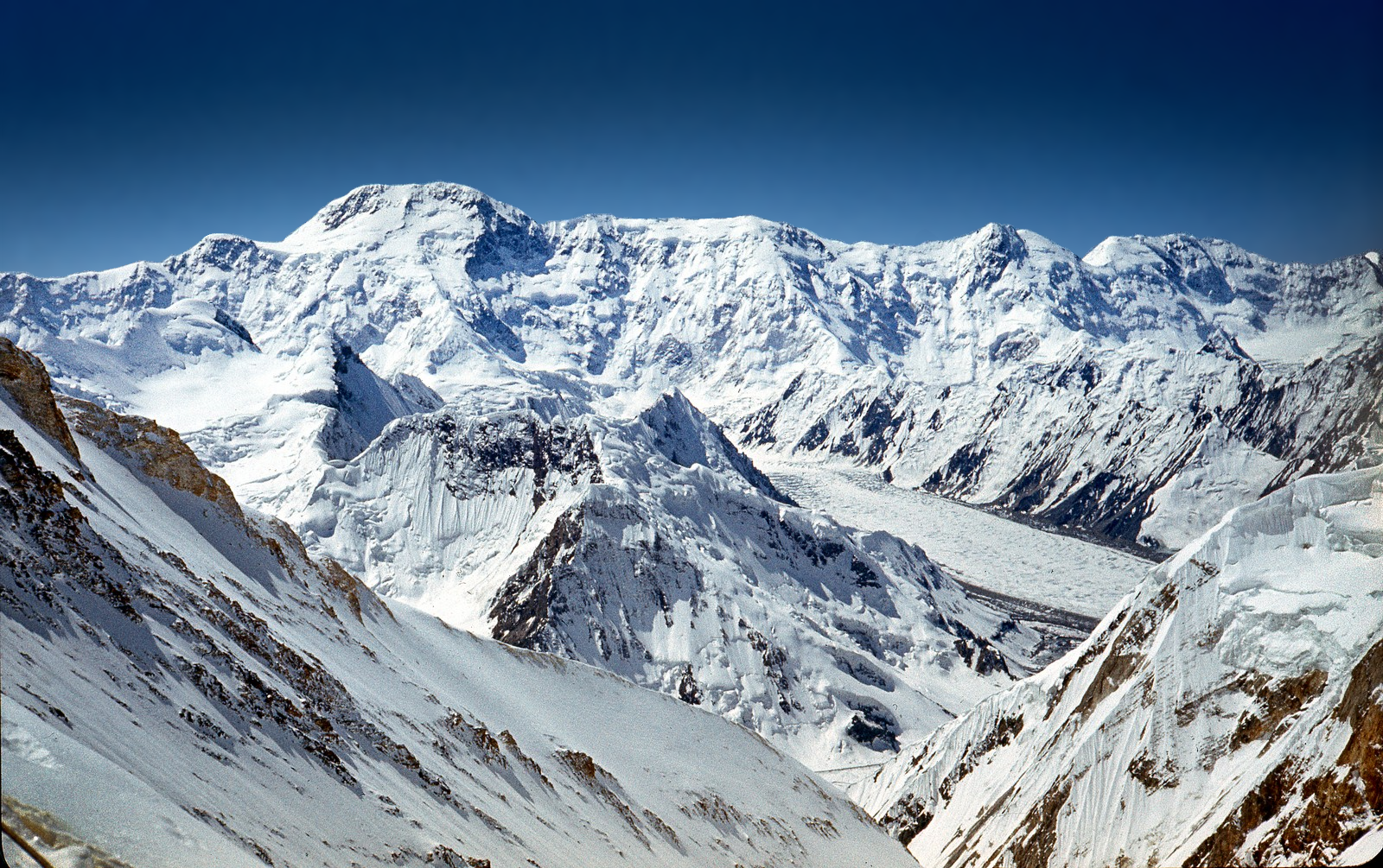
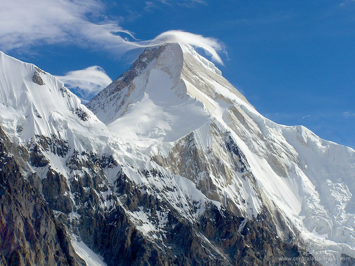
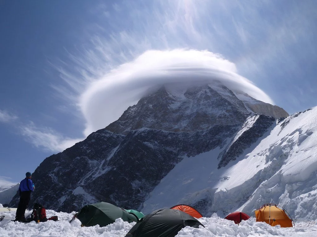
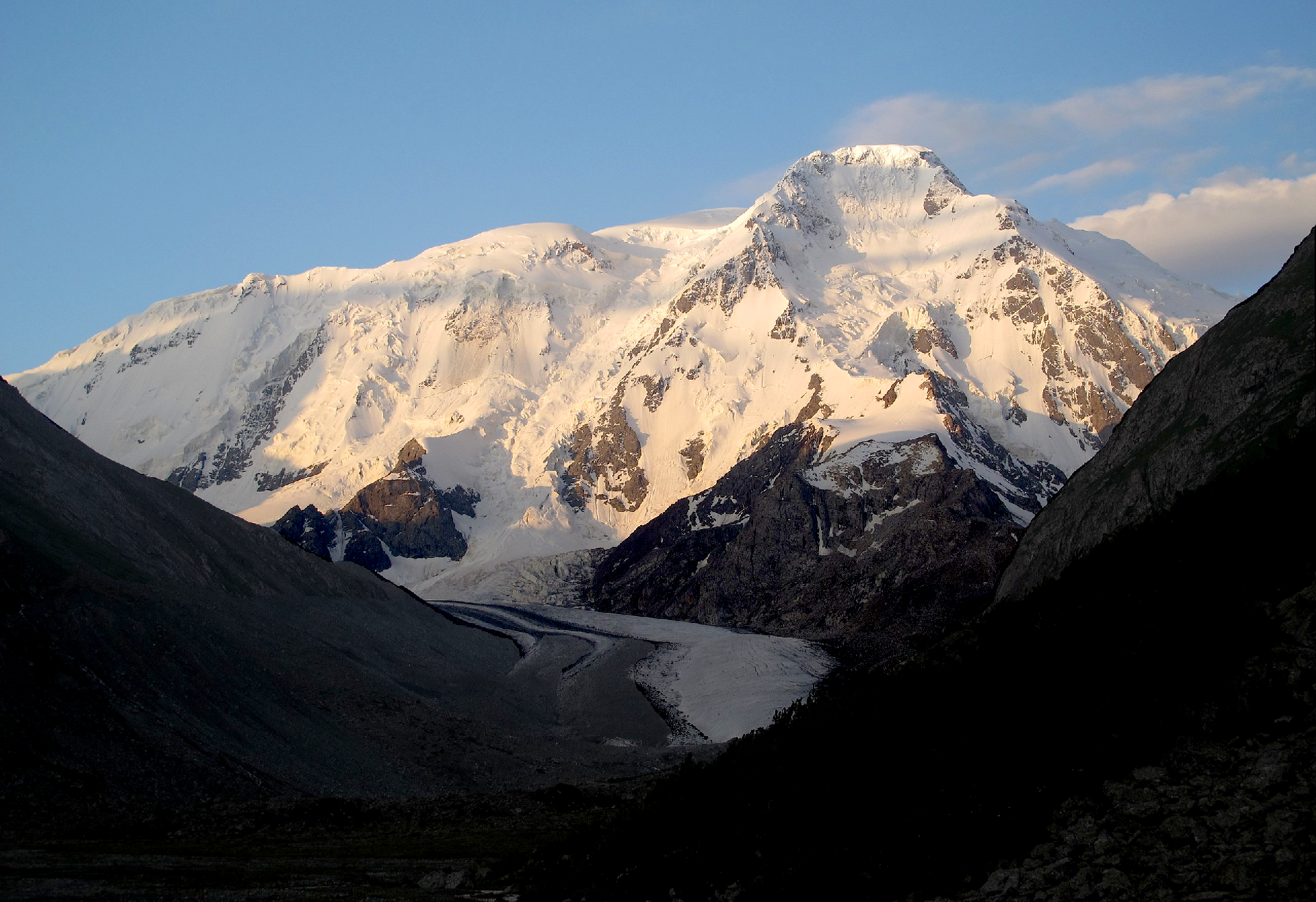
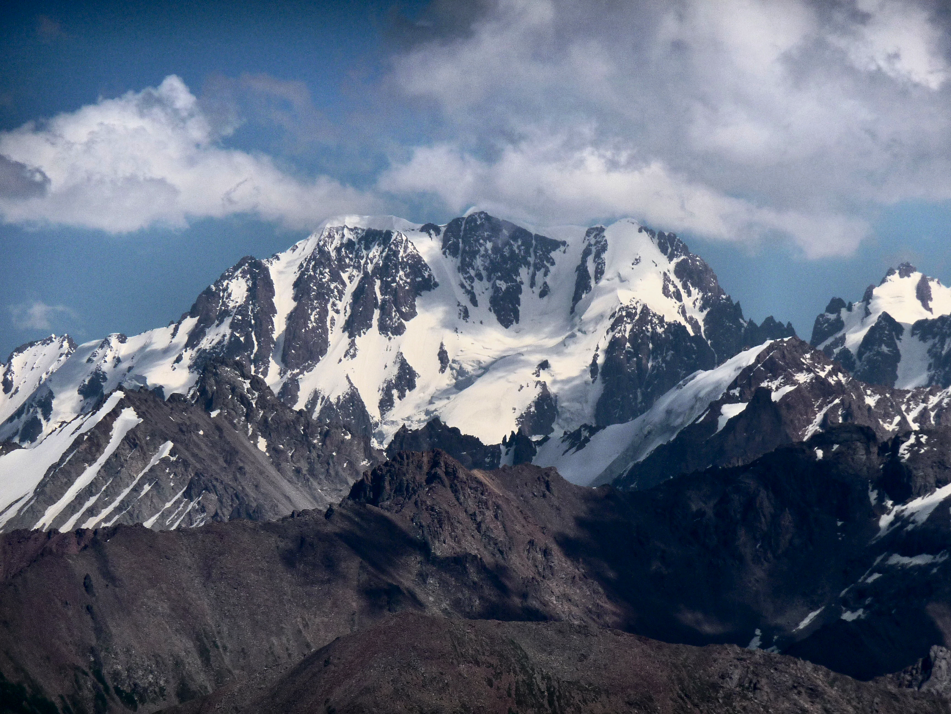
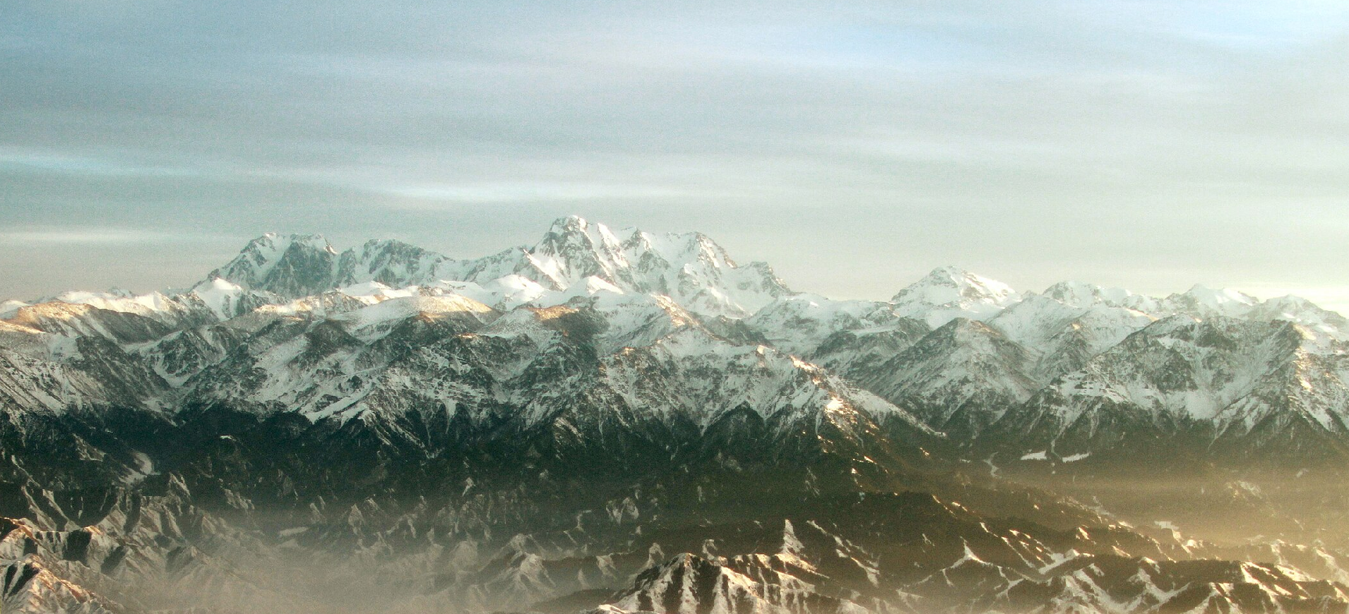
Jengish Chokusu Region
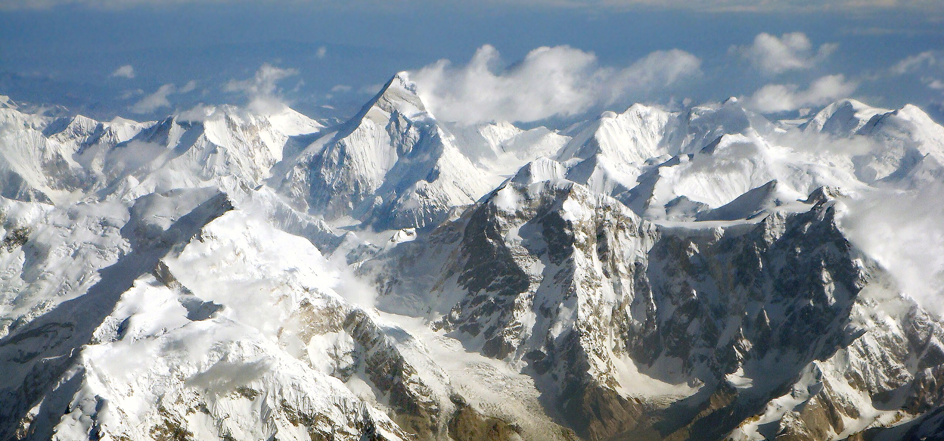
Jengish Chokusu Panoramic
Chen Zhao (Flickr)


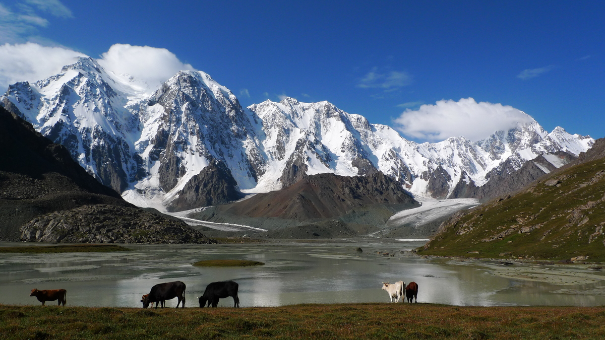
Jengish Chokusu or Victory Peak[note 1] is the highest mountain in the Tian Shan mountain system in Central Asia at 7,439 metres (24,406 ft). It lies on the China–Kyrgyzstan border between the Ak-Suu District in the Issyk-Kul Region of far Eastern Kyrgyzstan and Wensu County, Xinjiang, China. It is part of the Kakshaal Too, the highest part of the Tian Shan, and is southeast of lake Issyk-Kul. Jengish Chokusu is the 16th most topographically prominent peak on Earth.
Names
The mountain is called Jengish Chokusu (its official[citation needed] Kyrgyz name) or Pobeda Peak (from the Russian name Pik Pobedy), both names translating as “Victory Peak.” On the Chinese side it is known as Tomur Peak (Tuomuer Feng in Chinese) from its Uyghur name Tömür meaning “iron.”
Description
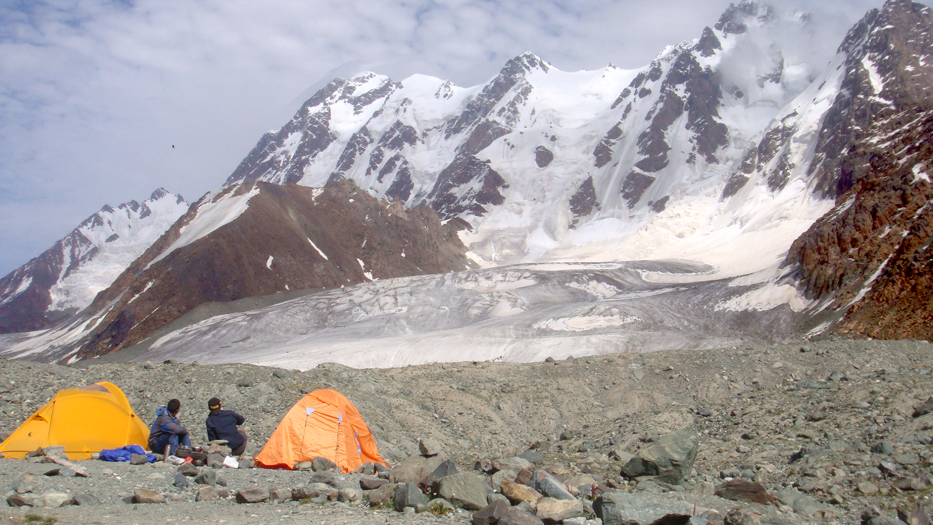
Jengish Chokusu is a massif, with several summits along its lengthy ridge. Only its main summit breaks 7,000 metres (22,966 ft). It is 16 km (9.9 mi) southwest of Khan Tengri (7,010 m/23,000 ft), from which it is separated by the South Engilchek Glacier, where base camps for both mountains are usually located.
The massif runs at right angles to the glaciers which flow from it into three alpine valleys in Kyrgyzstan on the north, all eventually running to the Engilchek Glacier, the largest in the Tian Shan. Its main summit is usually approached from the Zvozdochka (Russian for “little star”) glacier, which is coloured red with rocks from Jengish Chokusu.
Administratively, the Kyrgyzstan side of the mountain is in the Ak-Suu District of Issyk-Kul Region, and the Chinese side in Wensu County of the Aksu Prefecture of Xinjiang Uyghur Autonomous Region.
This article uses material from the Wikipedia article Jengish Chokusu, which is released under the Creative Commons Attribution-Share-Alike 4.0 International License (view authors).
 |  |
 |  |
 Maryliflower (Wikipedia) | 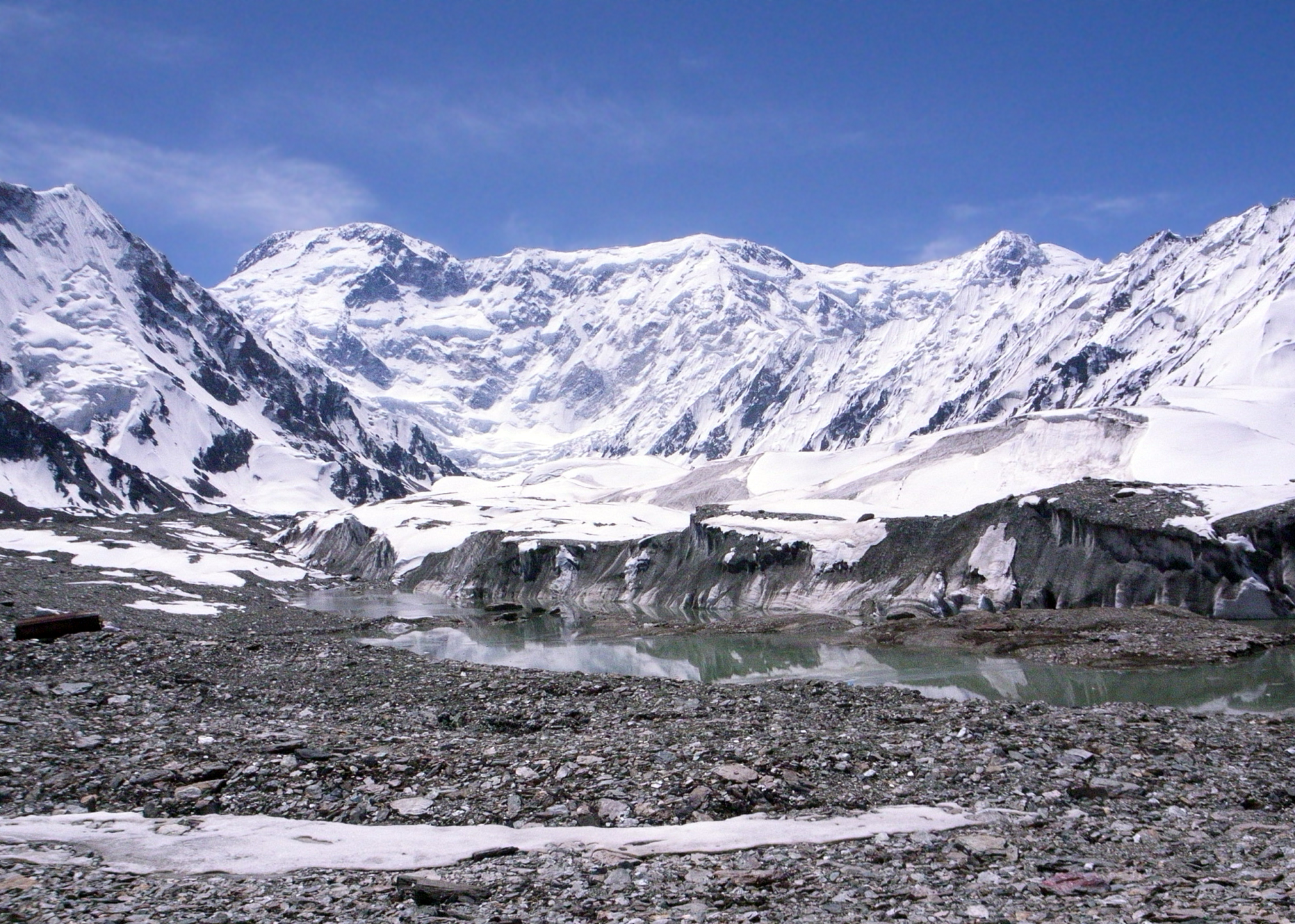 Chen Zhao (Wikipedia) |
 Jaan Künnap (Wikipedia) | 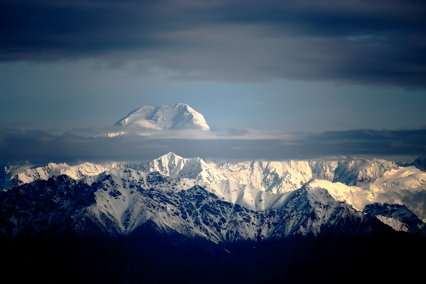 Landagent (Wikipedia) |
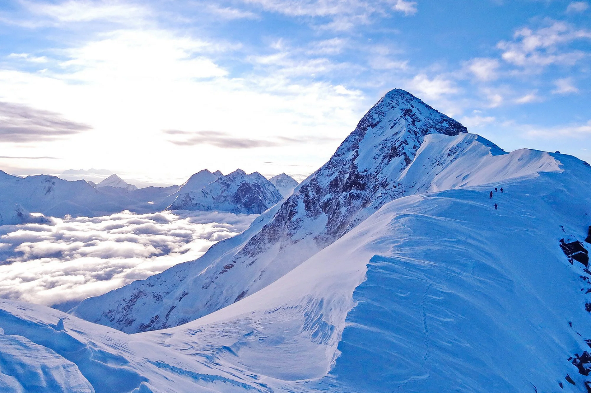
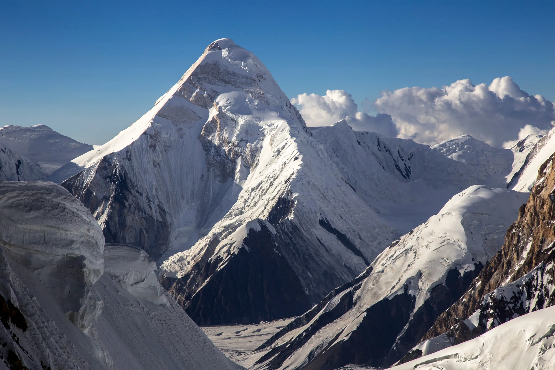
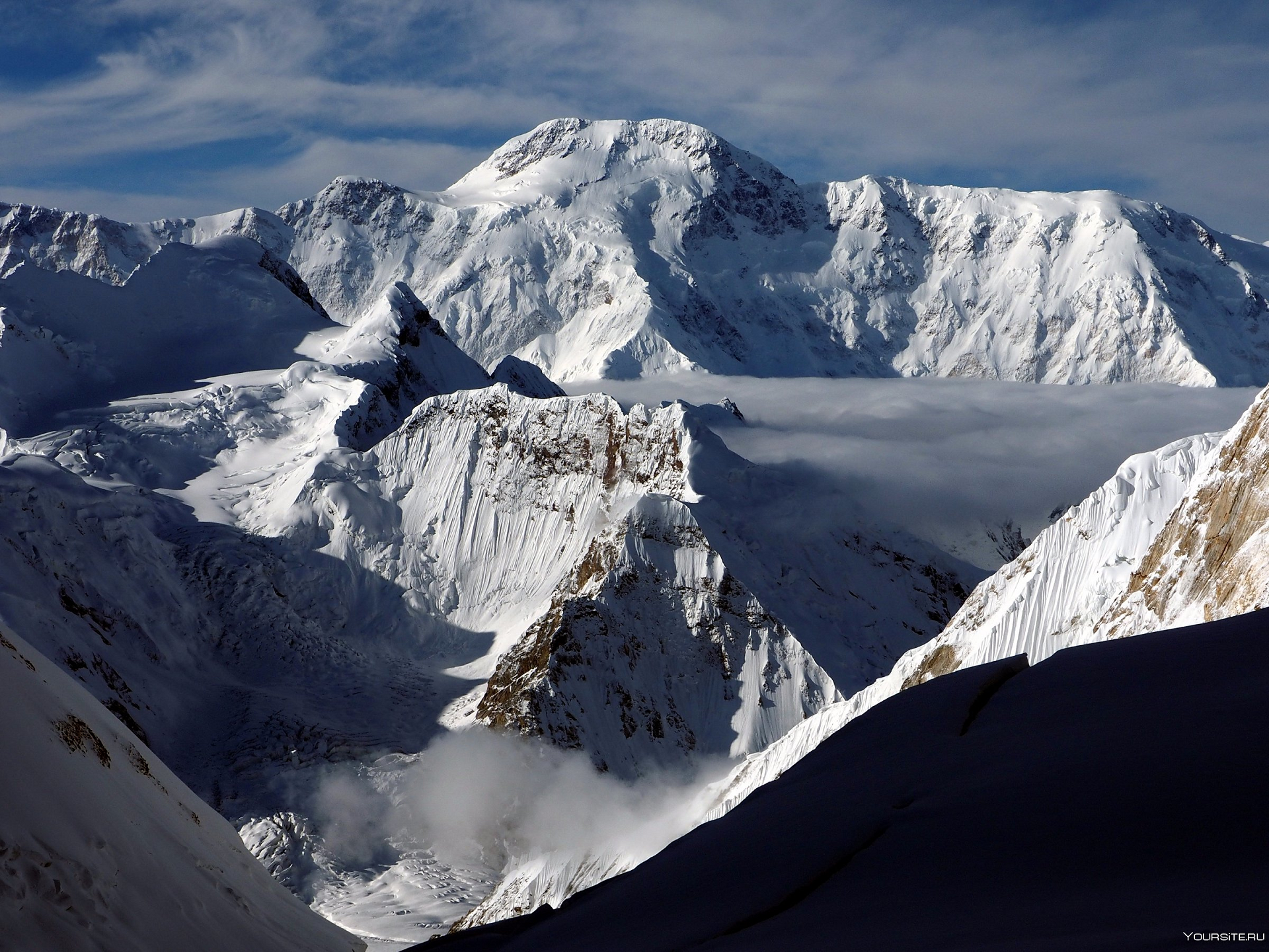
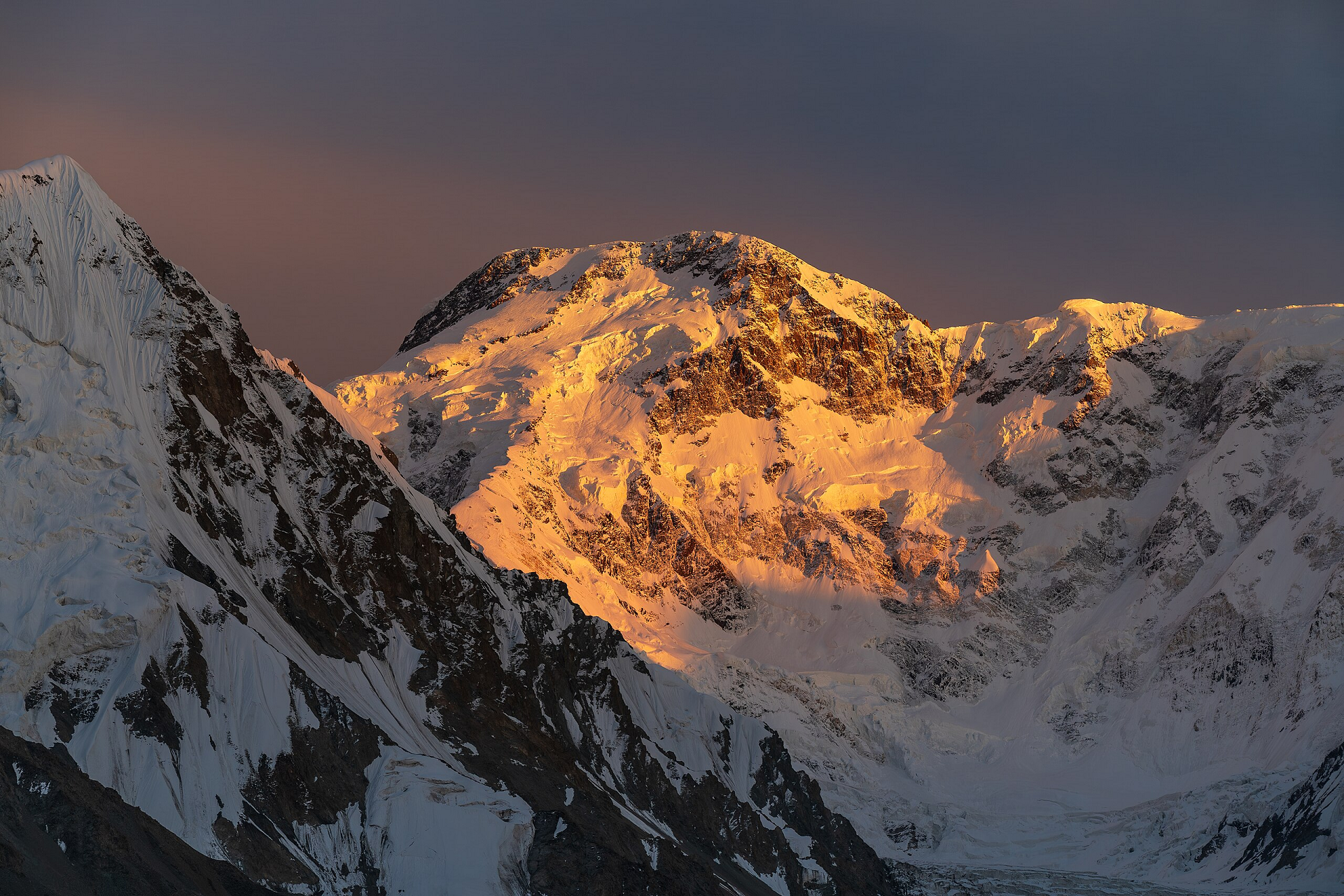
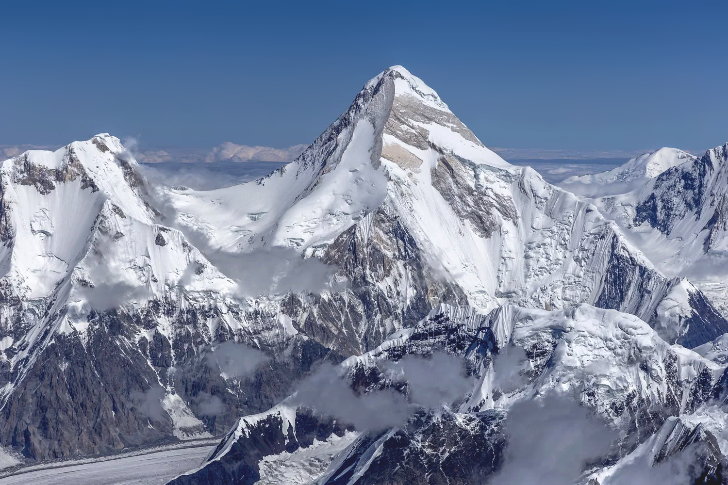
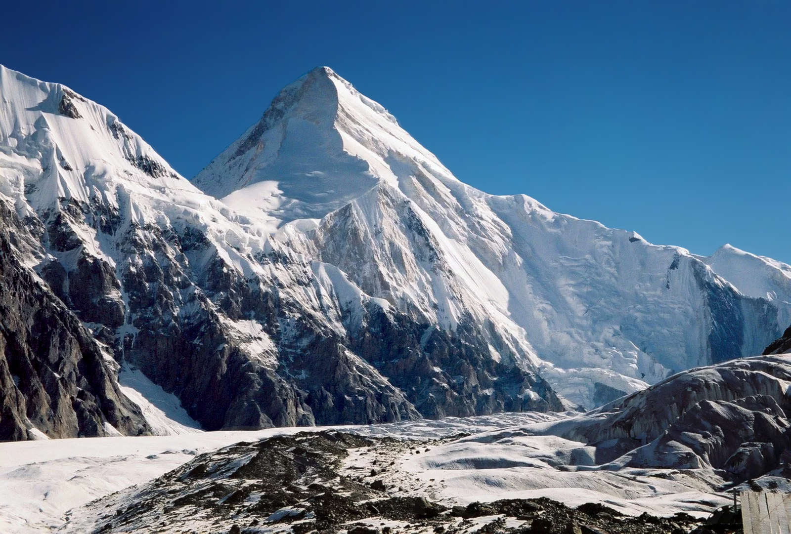
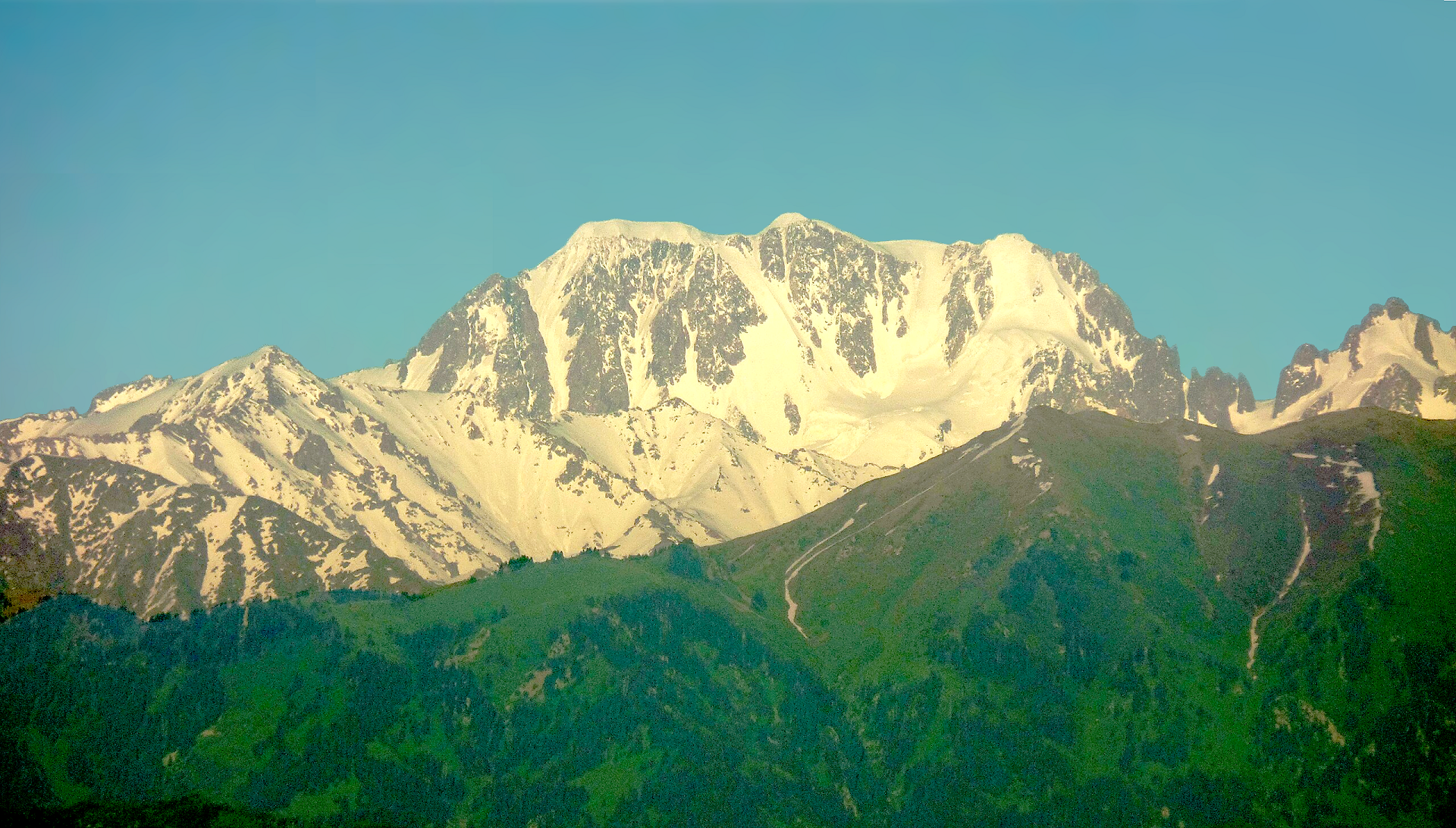
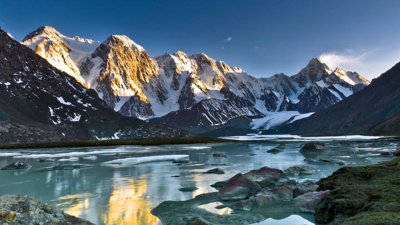
Khan Tengri Panoramic

Max Zolotukhin (iStock)

Khan Tengri is a mountain of the Tian Shan mountain range in Central Asia. It is on the China—Kyrgyzstan—Kazakhstan tripoint, east of lake Issyk Kul. Its geologic elevation is 6,995 m (22,949 ft), but its glacial icecap rises to 7,010 m (22,999 ft). For this reason, in mountaineering circles, including for the Soviet Snow Leopard award criteria, it is considered a 7,000-metre peak.
Khan Tengri is the second-highest mountain in the Tian Shan, surpassed only by Jengish Chokusu (means “Victory peak”, formerly known as Peak Pobeda) (7,439 m). Khan Tengri is the highest point in Kazakhstan and third-highest peak in Kyrgyzstan, after Jengish Chokusu (7,439 m) and Avicenna Peak (7,134 m). It is also the world’s most northern 7,000-metre peak, notable because peaks of high latitude have a shorter climbing season, generally more severe weather and thinner air.
Names
The name “Khan Tengri” literally means “King Heaven” in Kazakh or “King Sky” in Mongolian and possibly references the sky deity Tengri that both exist in the religion of Tengrism and Central Asian Buddhism. In some other local languages, it is known as Khan Tangiri Shyngy, Kan-Too Chokusu, Pik Khan-Tengry, and Hantengri Feng. (Mongolian: Хан Тэнгэр, Kazakh: Хан Тәңірі, Han Táńiri, حان تأڭئرئ; Kyrgyz: Хан-Теңири Han-Teñiri, حان-تەڭىرى; Uyghur: خانتەڭرى; simplified Chinese: 汗腾格里峰; traditional Chinese: 汗騰格里峰; pinyin: Hànténggélǐ Fēng, Xiao’erjing: هًا تٍْ قْ لِ فعْ). Local residents named the mountain Khan-Tengri for the unique beauty of snow giants.
Features
Khan Tengri is a massive marble pyramid, covered in snow and ice. At sunset the marble glows red, giving it the name “blood mountain” in Kazakh and Kyrgyz (Kazakh: Қантау; Kyrgyz: Кан-Тоо). Located just across the South Engilchek (or Inylchek) glacier, 16 km north of Jengish Chokusu, Khan Tengri was originally thought to be the highest peak in the Tian Shan because of its dramatic, steep shape, compared to the massive presence of Jengish Chokusu. This perception was probably also due to Khan Tengri’s visibility across the plains of southern Kazakhstan while Jengish Chokusu remains out of view of civilization. Khan Tengri is the highest peak in the rugged Tengri Tag subrange, also known as the Mustag, that also contains Chapaev Peak (6,371 m; 20,902 ft) and Gorky Peak (6,050 m; 19,849 ft). Anatoli Boukreev considered Khan Tengri perhaps the world’s most beautiful peak because of its geometric ridges and its symmetry.
This article uses material from the Wikipedia article Khan Tengri, which is released under the Creative Commons Attribution-Share-Alike 4.0 International License (view authors).
 Maryliflower (Wikipedia) | 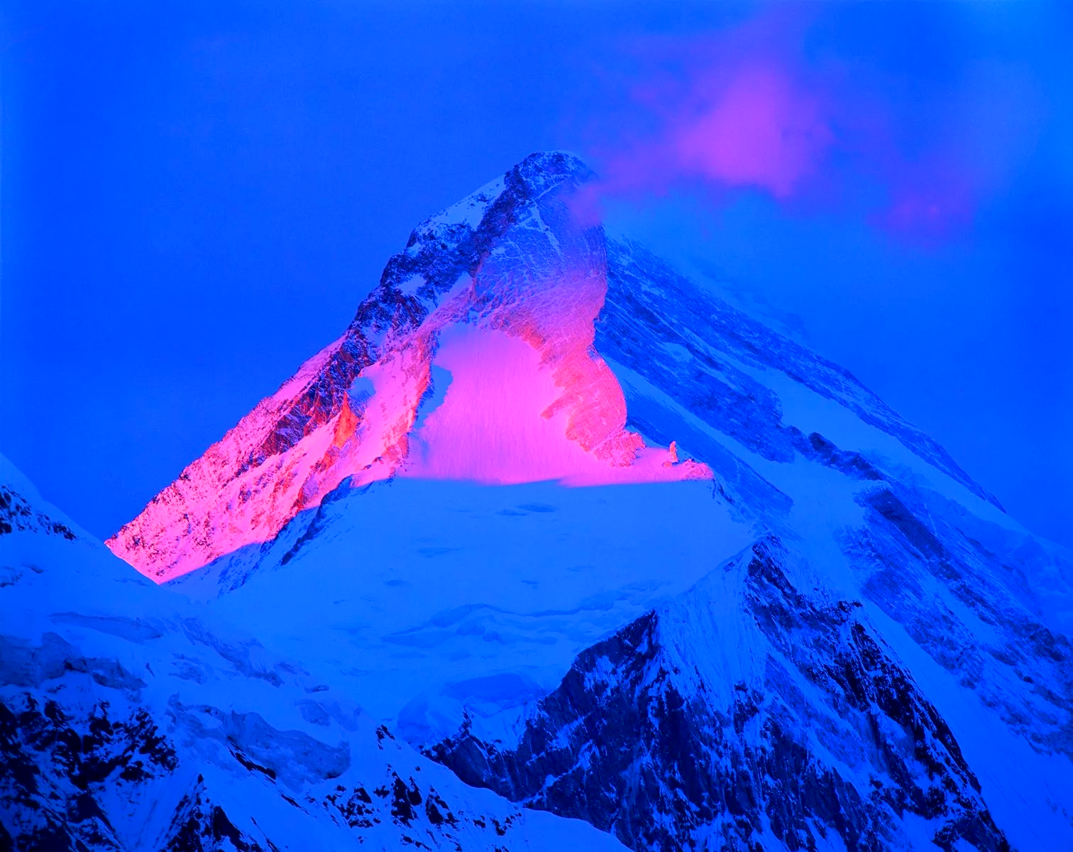 I |
 IMaryliflower (Wikipedia) | 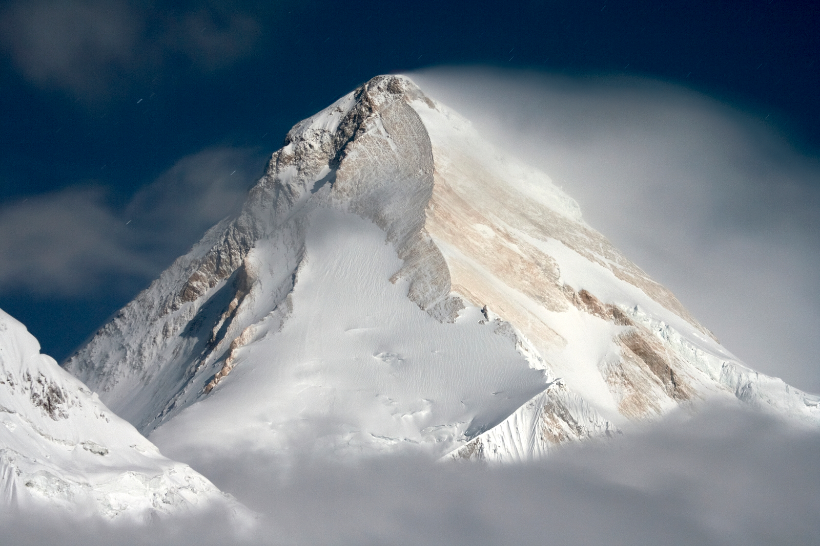 I |
 |  |
 |  |
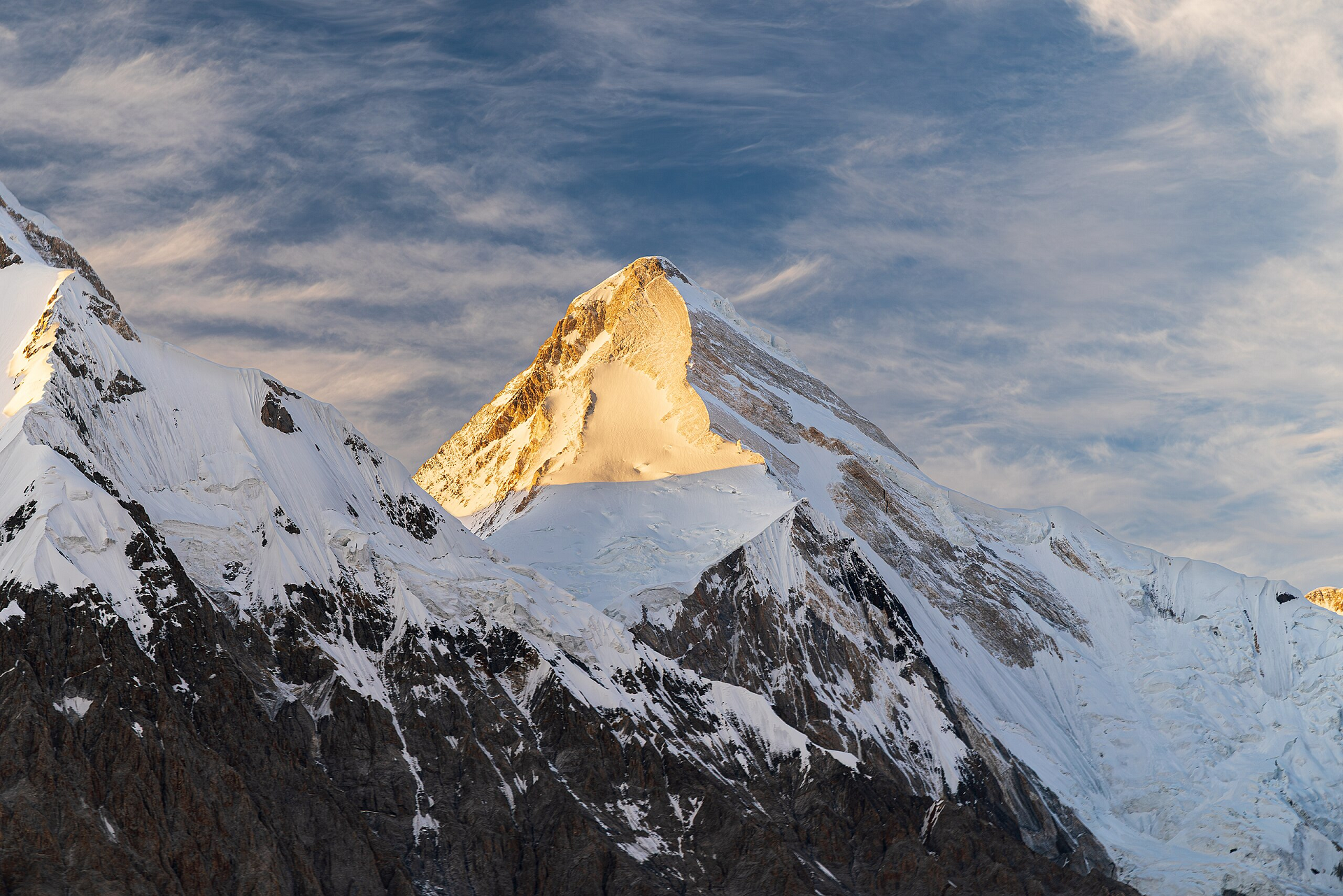
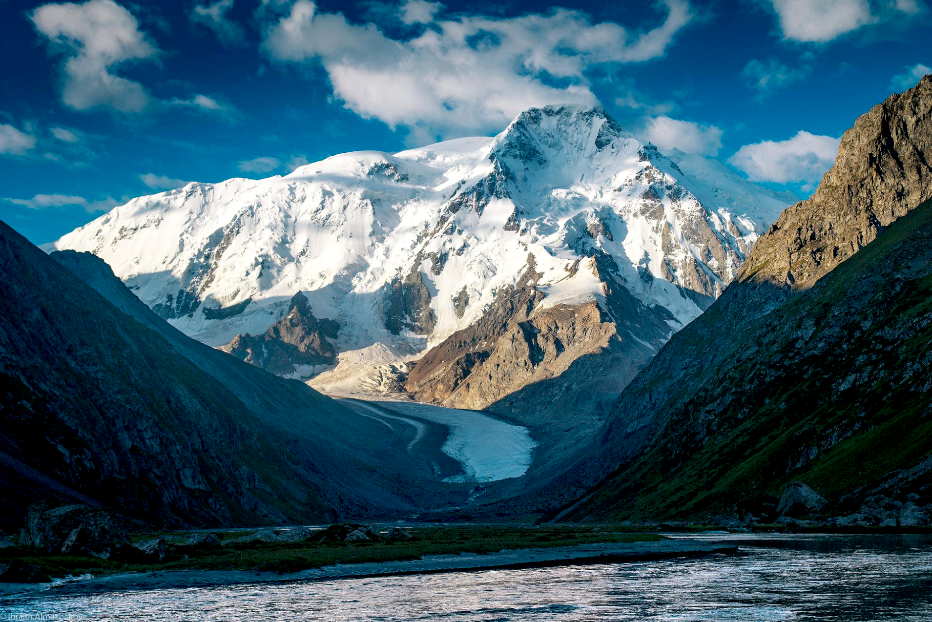
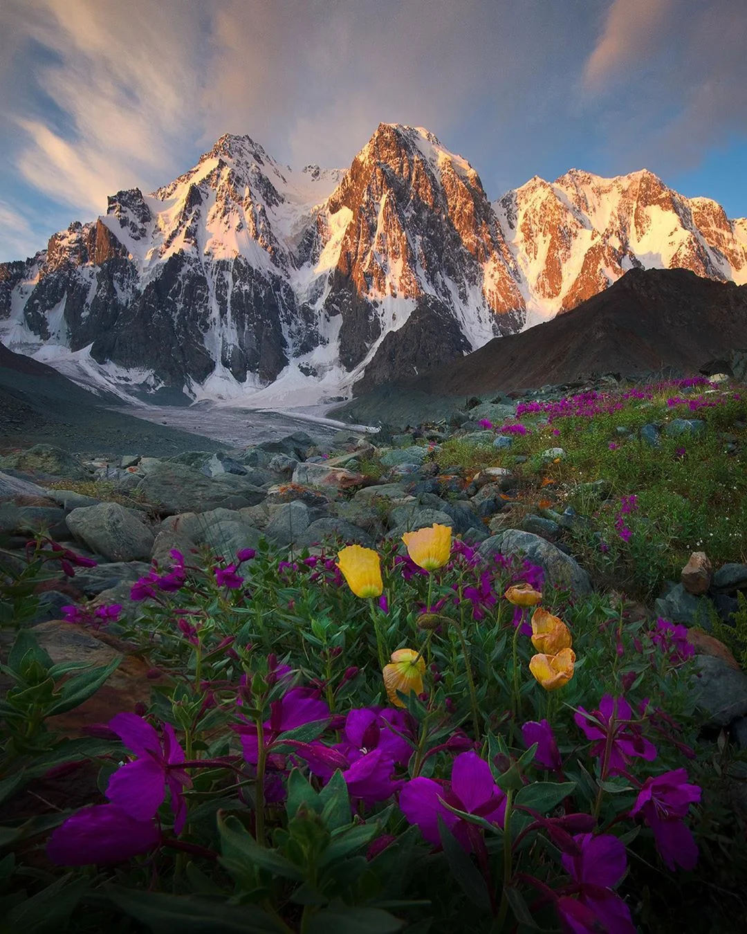
Pik Karakol Region
![]()
![]()
Karakol Peak (Russian: Пик Каракол, romanized: Pik Karakol, Kyrgyz: Каракол чокусу, romanized: Karakol çokusu) is a mountain in the Terskey Ala-too of the Tian Shan. It is located in the Issyk-Kul Region in east Kyrgyzstan.[1]
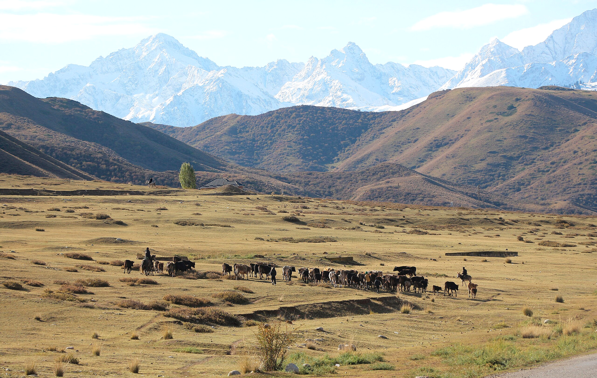
Karakol Peak is a prominent mountain located in the Terskey Alatau range of the Tian Shan Mountains in Kyrgyzstan. It is a popular destination for outdoor enthusiasts due to its scenic landscapes and accessibility via several trekking and horseback riding routes.
Location and Accessibility
Karakol Peak is situated near the town of Karakol, a major hub for trekking in the Terskey Alatau range. The trails leading to the peak pass through alpine meadows, forests, and mountain streams. It is a highlight on various hiking and horseback riding routes in the region.
Activities and Tourism
The area surrounding Karakol Peak offers opportunities for hiking, trekking, and horseback riding. Many visitors use the trails to explore the natural landscapes and experience Kyrgyzstan’s nomadic culture. The peak also provides panoramic views of nearby mountains and valleys, making it a popular stop for tourists.
Conversation
Karakol Peak is part of the protected Terskey Alatau range, which is home to diverse flora and fauna. Local efforts focus on promoting eco-tourism and preserving the environment while supporting sustainable livelihoods for nearby communities.[2]
History
It was first climbed in 1937 by N. Popov, G. Beloglazov, V. Ratsek, and K. Baygazinov.[3]
This article uses material from the Wikipedia article Karakol Peak, which is released under the Creative Commons Attribution-Share-Alike 4.0 International License (view authors).
 Ibraim Almazbekov |  Evgeny_D (iStock)I |
 Tadeáš Gregor (Wikipedia) | 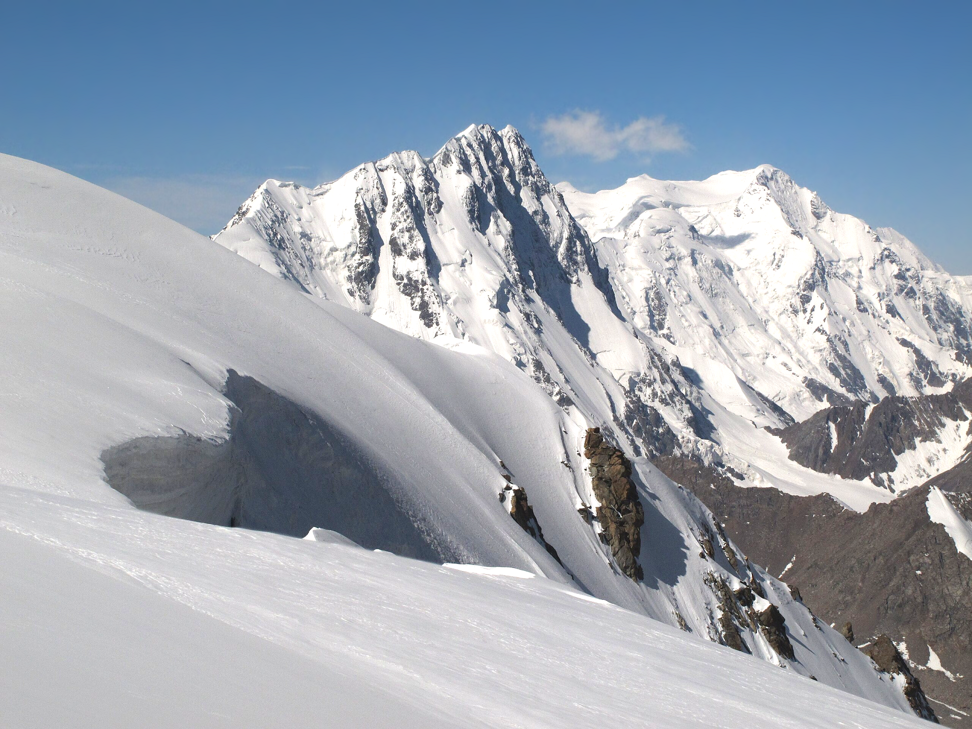 Tadeáš Gregor (Wikipedia)I |
 Bgag (Wikipedia) |  I |
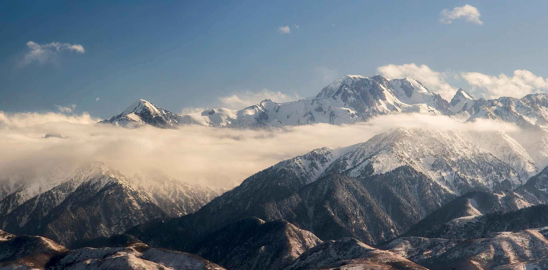
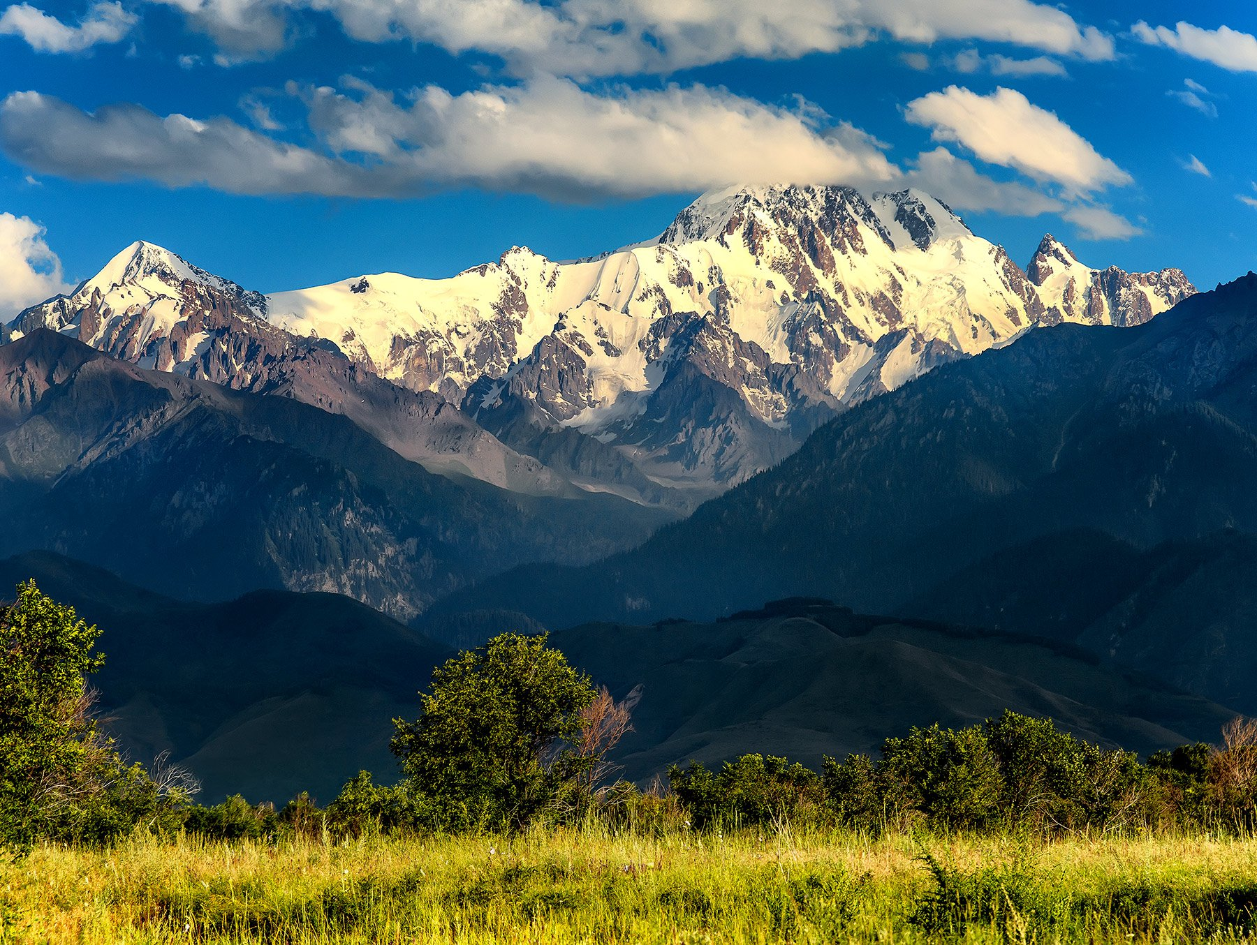
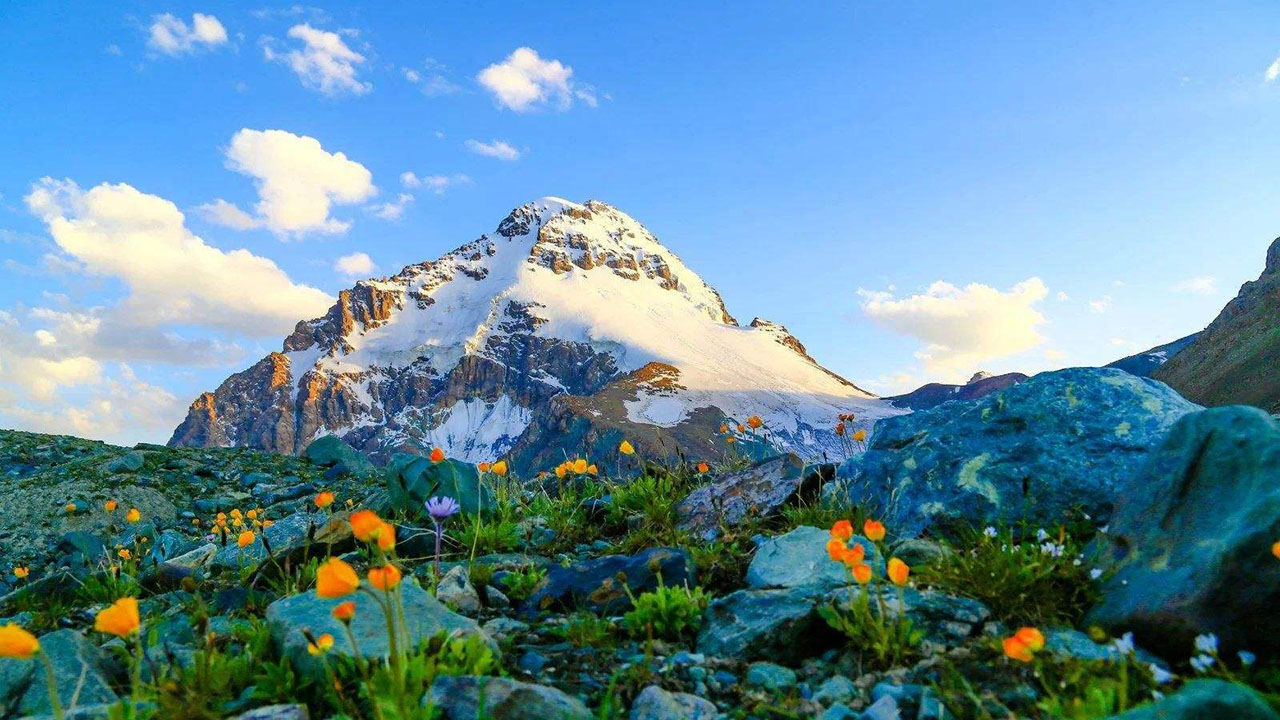
Pik Talgar Region
Pik Talgar Panoramic
Мирсаитов Ислам (Wikipedia)

![]()
Peak Talgar (Kazakh: Талғар шыңы Talğar Şyñy; Russian: Пик Талгар, romanized: Pik Talgar) is a northern peak in the Tian Shan mountain range in Kazakhstan, named after Talgar river and city. It is the highest peak of the Trans-Ili Alatau. Due to its close proximity to the former capital of Kazakhstan, Almaty, it is a popular mountaineering destination.[2] Sources differ on Peak Talgar’s elevation, but the 4,979 m height is widely quoted.
The summit has precipitous slopes, especially in the west, crevasses and buttresses packed with snow and ice.
On the southern slopes of the Talgar massif is the largest glacier in the Trans-Ili Alatau – the Korzhnevsky glacier. The length of the glacier is about 12 km. The snow boundary on the northern slopes passes at about 3,700-3,900 m.
History
In 1935 H. Rakhimov’s group approached Talgar Peak, climbing from the north to the shoulder of the massif, the reached place was named Kopr.[3]
The first ascent of the main summit of Talgar Peak was made in 1938 by a group from Stalinsk (now Novokuznetsk), consisting of L. Kutukhtin, G. Makarov, and I. Kropotov. A local veteran climber A.E. Kolokolnikov gave a detailed description of Talgar Peak.
In 1958 the group led by Snesarev used one of the most difficult routes to date to Talgar Peak on the west face to the south top. Later on this wall two more routes 5B of the touring group and the route of 1966 by M.Akimenkov and I.Meshkov’s group, passed in 1978, will be done.[4]
Since 1939, in the gorge of the Middle Talgar River, there was a climbing camp “Metallurg”, later renamed “Talgar”. The camp existed almost until 1990. During this time, 11 routes were laid to the top of Talgar, not counting the very beautiful and diverse paths to nearby peaks, such as Metallurg (4600m), Kopr (4631m), Chekist (4550m), Aktau (4686m), Sportivnaya (4117m) ), Karaulchatau (4504m).[5]
This article uses material from the Wikipedia article Pik Talgar, which is released under the Creative Commons Attribution-Share-Alike 4.0 International License (view authors).
 I I | 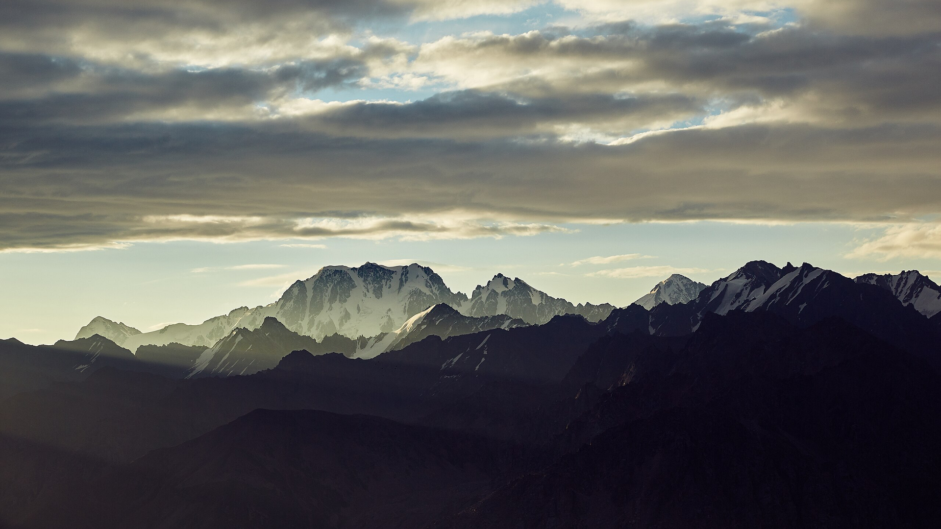 Dina Julayeva (Wikipedia) |
 Dmccarhty (Wikipedia) I |  Мирсаитов Ислам (Wikipedia) |
 Салиха at Kazakh (Wikipedia) | 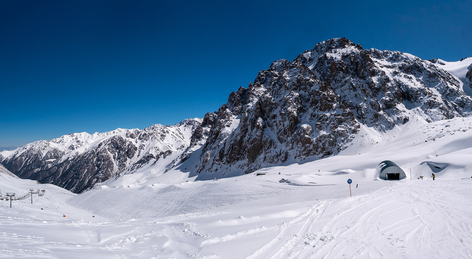 Matti Blume (Wikipedia) I |
Bogda Peak Region
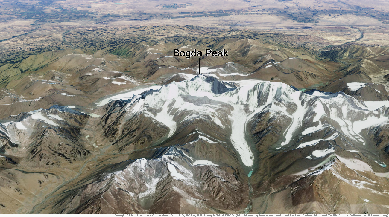
Bogda Peak Panoramic
Wayne Lord (Wikipedia)

![]()
Bogda Peak or Bogda Feng (simplified Chinese: 博格达峰; traditional Chinese: 博格達峰; pinyin: Bógédá fēng, sometimes referred to as Mount Bogda) is the highest mountain in the Bogda Shan range, in the eastern Tian Shan mountains, China, at 5,445 m (17,864 ft) and the northernmost 5,000 m (16,400 ft) or higher peak in Eurasia. Bogda Peak is the 17th most topographically prominent peak on Earth.
Bogda Peak is a challenging climb due to its steep relief. Its sides slope at angles of between 70° and 80°. It was first climbed in 1981 by an 11-person team from Kyoto.[2]
This article uses material from the Wikipedia article Bogda Peak, which is released under the Creative Commons Attribution-Share-Alike 4.0 International License (view authors).
 |  |
 |  |
 罗布泊 (Wikipedia) |  罗布泊 (Wikipedia) |
