
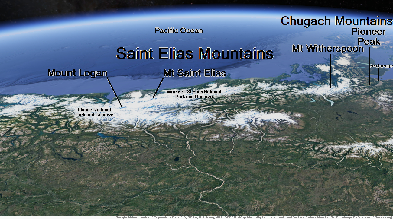
Map of Saint Elias Mountains
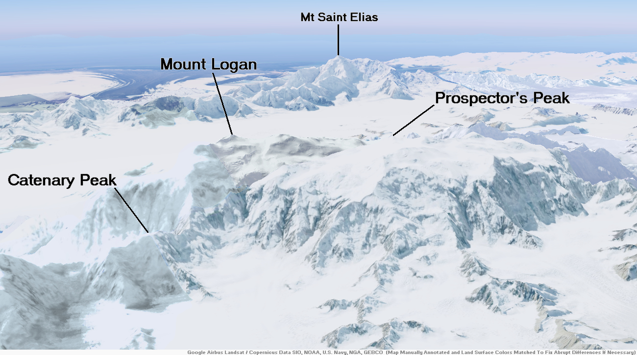
Mount Logan Region

![]()
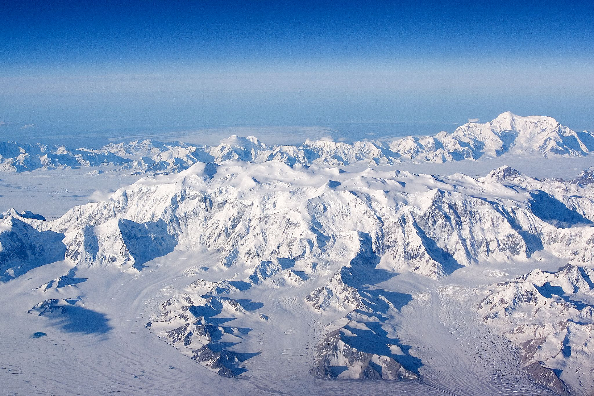
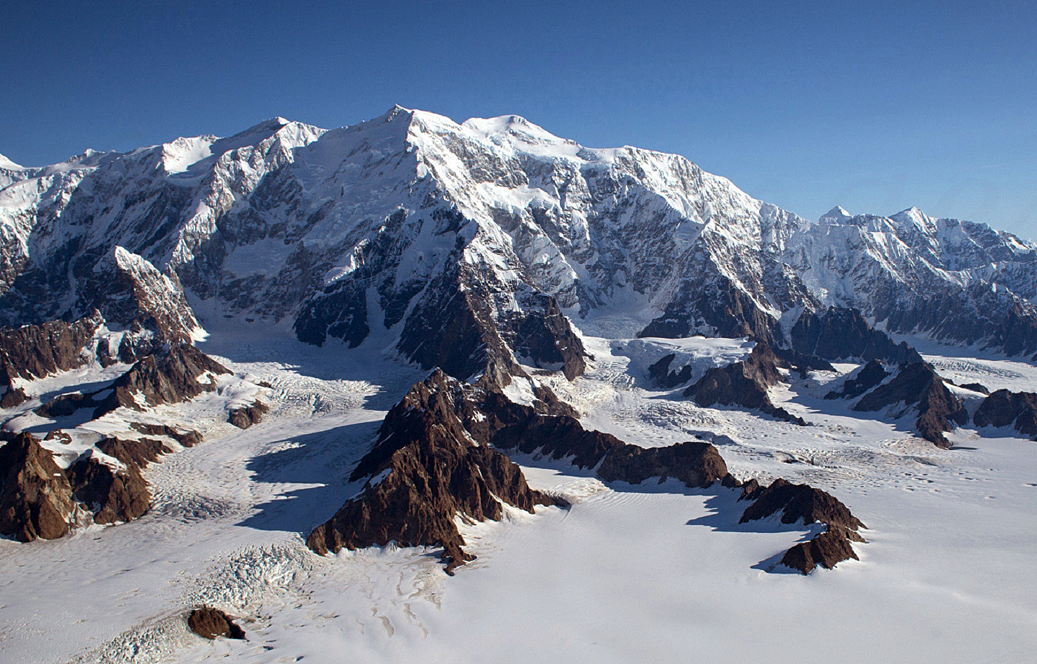
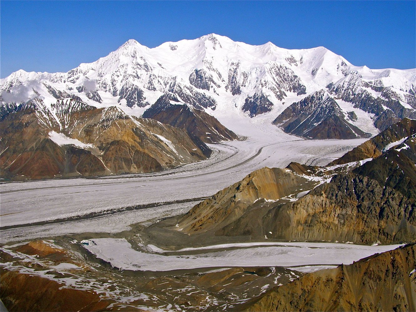
Mount Logan (/ˈloʊɡən/ LOH-ghən) is the highest mountain in Canada and the second-highest peak in North America after Denali. The mountain was named after Sir William Edmond Logan, a Canadian geologist and founder of the Geological Survey of Canada (GSC). Mount Logan is located within Kluane National Park Reserve[6] in southwestern Yukon, less than 40 km (25 mi) north of the Yukon–Alaska border. Mount Logan is the source of the Hubbard and Logan glaciers. Although many shield volcanoes are much larger in size and mass, Mount Logan is believed to have the largest base circumference of any non-volcanic mountain on Earth,[7] including a massif with eleven peaks over 5,000 m (16,000 ft). Mount Logan is the 6th most topographically prominent peak on Earth.[8][9]
Due to active tectonic uplifting, Mount Logan is still rising in height (approximately 0.35 mm (0.014 in) per year).[10] Before 1992, the exact elevation of Mount Logan was unknown and measurements ranged from 5,959 to 6,050 m (19,551 to 19,849 ft). In May 1992, a GSC expedition climbed Mount Logan and fixed the current height of 5,959 m (19,551 ft) using GPS.[8][11][12]
Temperatures are extremely low on and near Mount Logan. On the 5,000 m (16,000 ft) plateau, air temperature hovers around −45 °C (−49 °F) in the winter and reaches near freezing in summer with the median temperature for the year around −27 °C (−17 °F). Minimal snow melt leads to a significant ice cap, almost 300 m (980 ft) thick in certain spots.[9]
This article uses material from the Wikipedia article Mount Logan, which is released under the Creative Commons Attribution-Share-Alike 4.0 International License (view authors).
 Jack French (Wikipedia) |  Cavan Images (iStock) |
 |  |
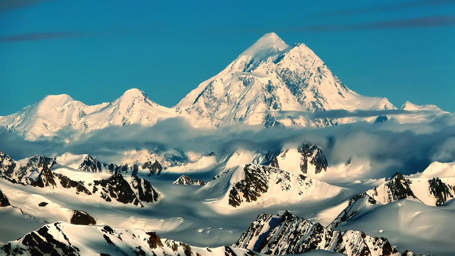
Mount Saint Elias (Was’eitushaa also designated Boundary Peak 186),[2][4] the second-highest mountain in both Canada and the United States, stands on the Yukon and Alaska border about 26 miles (42 km) southwest of Mount Logan,[5] the highest mountain in Canada. The Canadian side of Mount Saint Elias forms part of Kluane National Park and Reserve, while the U.S. side of the mountain is located within Wrangell-St. Elias National Park and Preserve.
History and features
The name of the mountain in Tlingit, Yasʼéitʼaa Shaa or Was’eitushaa, means “mountain behind Icy Bay“; the Yakutat Tlingit occasionally call it Shaa Tlein “Big Mountain”. It is one of the most important crests of the Kwaashkʼiḵwáan clan, who used it as a guide during their journey down the Copper River.[5] Mount Fairweather at the apex of the British Columbia and Alaska borders at the head of the Alaska Panhandle is known as Tsalx̱aan; legend states that this mountain and Yasʼéitʼaa Shaa (Mt. St. Elias) originally stood next to each other, but had an argument and separated. Their children, the mountains in between the two peaks, are called Tsalx̱aan Yátxʼi (“Children of Tsalxaan”).
European explorers first sighted the mountain on July 16, 1741, with the arrival of the expedition commanded by Vitus Bering, a Danish-born Russian explorer. While some historians contend that Bering named the mountain, others believe that eighteenth-century mapmakers named it after Cape Saint Elias when Bering left the peak unnamed.[2]
Mount Saint Elias is notable for its immense vertical relief. Its summit rises 18,008 feet (5,489 m) vertically in just 10 miles (16 km) horizontal distance from the head of Taan Fjord, off of Icy Bay.
In 2007 Gerald Salmina directed an Austrian documentary film, Mount St. Elias, about a team of skier/mountaineers determined to make “the planet’s longest skiing descent” by ascending the mountain and then skiing nearly all 18,000 feet down to the Gulf of Alaska; the movie finished editing and underwent limited release in 2009. The climbers ended up summiting on the second attempt and skiing down to 13,000 ft (3,960 m).[6]
This article uses material from the Wikipedia article Mount Saint Elias, which is released under the Creative Commons Attribution-Share-Alike 4.0 International License (view authors).
 Neal Herbert National Park Service (Wikipedia) |  Walter Stiedenroth (Dreamstime) I |
 |  |

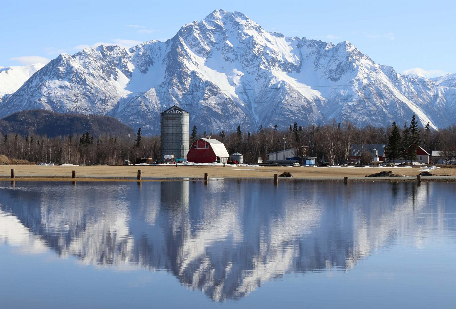
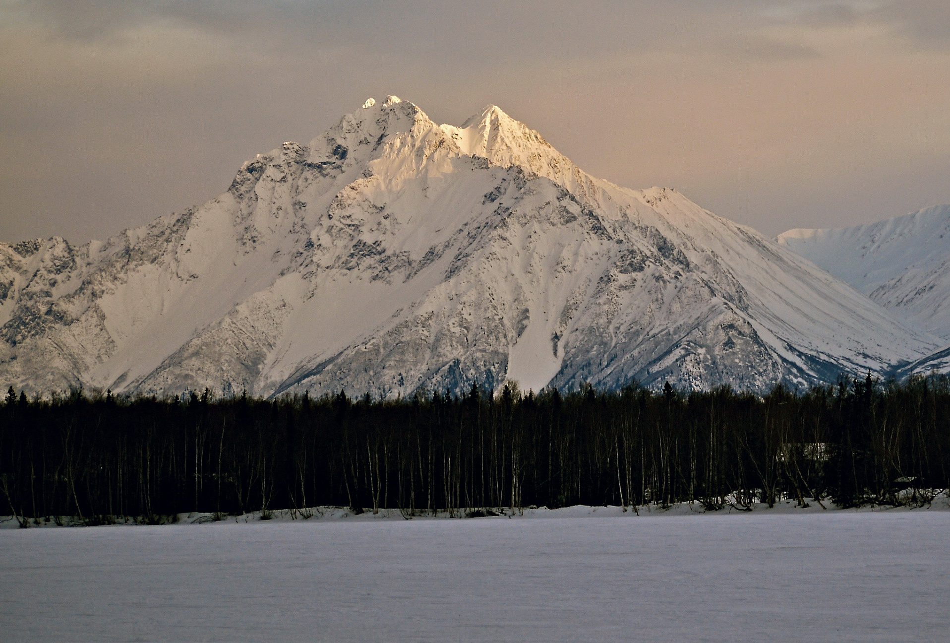
Pioneer Peak (Ahtna: Tnel’aay; Dena’ina: Dnal’iy) is a 6,398-foot (1,950 m) mountain in the Chugach Mountains in the U.S. state of Alaska. Located beside the Knik River just nine miles (14.5 km) south of Palmer and about six miles outside the Municipality of Anchorage limits, it is a prominent landmark in the Matanuska-Susitna Valley, as well as a popular hiking destination. Its Ahtna name means “the object is standing still” and its Dena’ina name means “the one that watches us“.[3] The name was given in 1939 in honor of the pioneers of the Matanuska agricultural colony of the mid-1930s.[2] The Pioneer Ridge Trail leads up the eastern shoulder, beginning below 200′, it allows access to the South summit. The North summit, and true summit of Pioneer Peak does not have a trail, and advanced mountaineering techniques are required. The first ascent of this peak was made June 1936 by Vernon Haik and John Wolffe via the Northwest Face.[4]
Climate
Based on the Köppen climate classification, Pioneer Peak is located in a subarctic climate zone with long, cold, snowy winters, and mild summers.[5] Weather systems coming off the Gulf of Alaska are forced upwards by the Chugach Mountains (orographic lift), causing heavy precipitation in the form of rainfall and snowfall. Temperatures can drop below −20 °C with wind chill factors below −30 °C. The months May through June offer the most favorable weather for climbing or viewing.
This article uses material from the Wikipedia article Pioneer Peak (Alaska), which is released under the Creative Commons Attribution-Share-Alike 4.0 International License (view authors).
 Tim Sorenson (Facebook) | 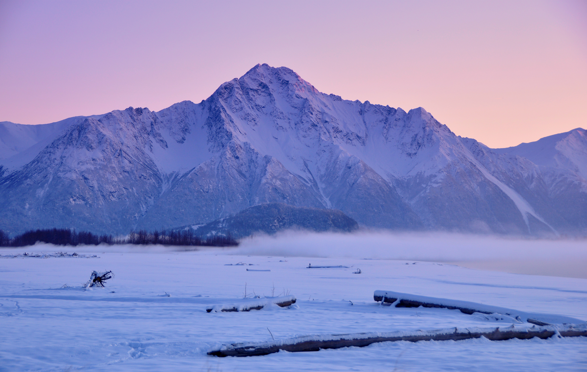 Cecil Sanders (Wikipedia) |
 Joseph Cabin On The Road (Wikipedia) | 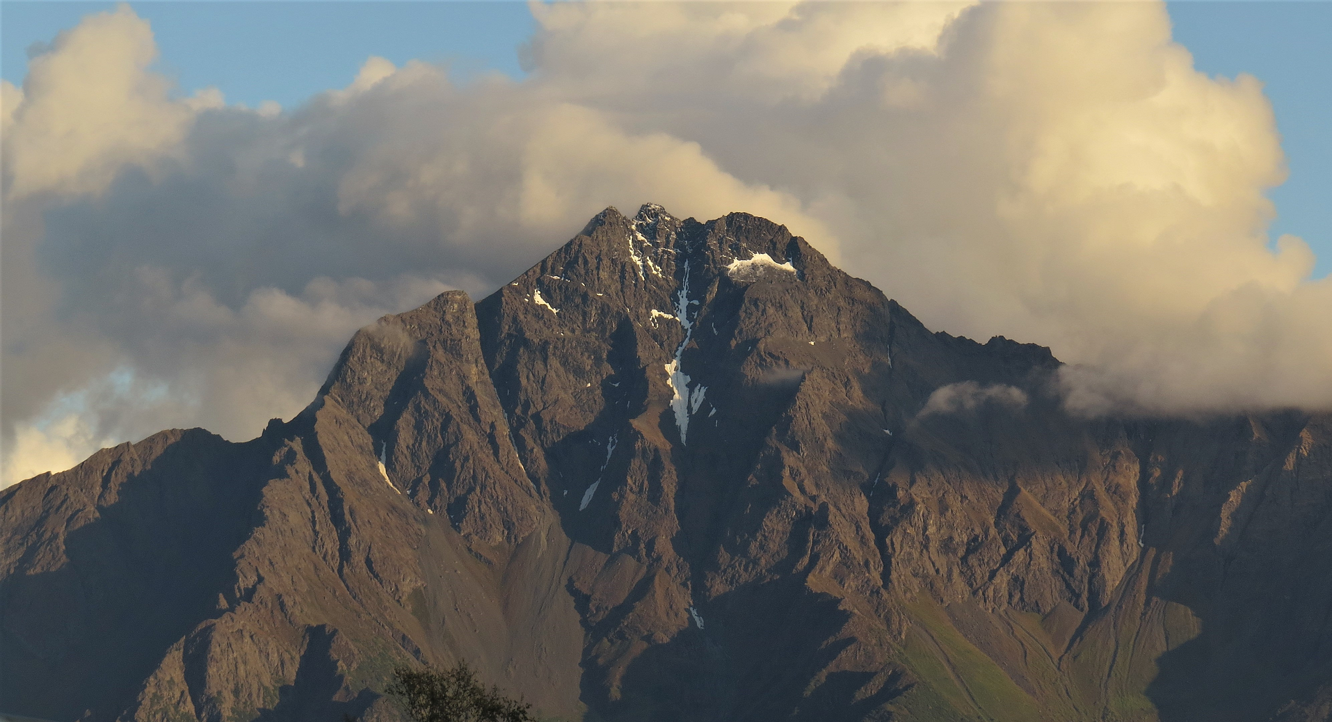 I I I |
![]()
