
Map of Pyrenees

Monte Aneto Region
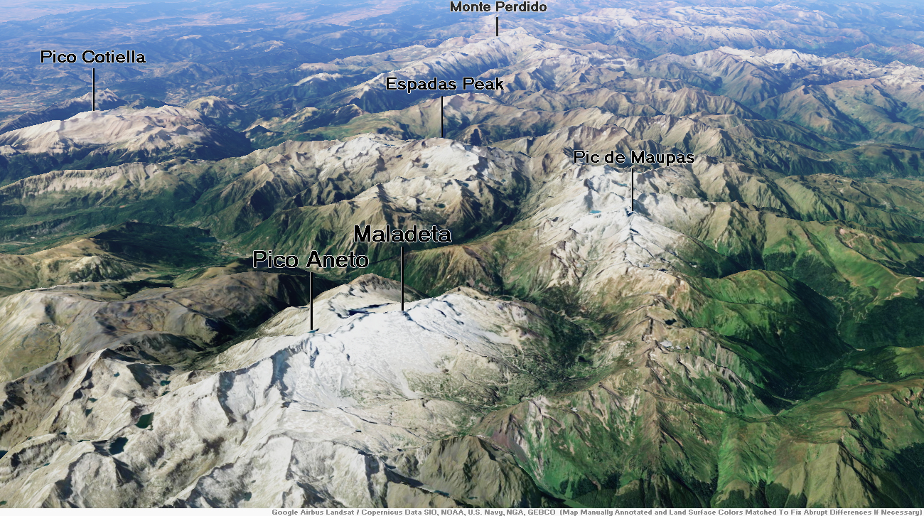
Aneto[2] is the highest mountain in the Pyrenees and in Aragon, Spain‘s third-highest mountain,[3] reaching a height of 3,404 metres (11,168 feet). It is in the Spanish province of Huesca, the northernmost of three Aragonese provinces, 6 kilometres (4 miles) south of the France–Spain border. It forms the southernmost part of the Maladeta massif.
Aneto is located in the Posets-Maladeta Natural Park, in the municipality of Benasque, Huesca province, an autonomous community of Aragon, Spain. It is part of the Maladeta massif and is located in the Benasque valley. It consists of Paleozoic terrain of a granitic nature and Mesozoic materials. Its northern side holds the largest glacier in the Pyrenees, covering 79.6 hectares (196+3⁄4 acres) in 2005; it is shrinking rapidly due to warming summer temperatures and decreasing winter precipitations over the 20th century – it covered 106.7 ha in 1981, and over 200 ha in the 19th century.[4] It is estimated that it has lost more than half of its surface in the last 100 years, and may disappear around 2050.[5]
Toponym
Initially, the mountain did not even have a name. There are indications that the shepherds and hunters from the southern valleys referred to it as Malheta or Malahita or Punta. It was also previously known as La Malahite.[6][7] The first traveller who is recorded as having seen it from the port (or pass) of Benasque, Louis Ramond de Carbonnières, simply described its appearance as “needles of ice” in 1787.[8][9]
The highest point of the Pyrenees eventually inherited the name of a village on its south-eastern side: Aneto.[8][9] The French, on hearing the Aragonese pronunciation of “Aneto”, retained the last two clearly accentuated phonetic syllables, “ne” and “tu“, ignoring the first syllable “a“. Based on such oral transcription, the French name “Netou” came to exist along with several historical variants: Nelto, Nettou, Anetthou, Annetton, Anelthou, Nethom or Aréthon, all used by various cartographers. Even though the summit and slopes are entirely within Spanish territory, the first extensive studies of the Pyrenees – and the only ones for the following 100 years – were French ones from the 19th century – starting with the very detailed study by Jean Daniel François Schrader (1844–1924) in 1874. So these names were the toponyms that were then used.[10] It took Émile Belloc’s renown work on the Pyrenees (notably on its hydrology, glaciology and etymology) to establish the name of Aneto as the official toponym; by 1898, he referred to it only by this name.[11]
This article uses material from the Wikipedia article Aneto, which is released under the Creative Commons Attribution-Share-Alike 4.0 International License (view authors).
 I |  Rutas Pirineos |
Monte Perdido Region

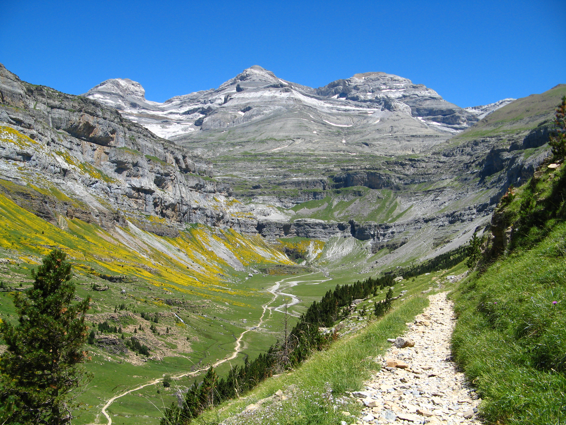
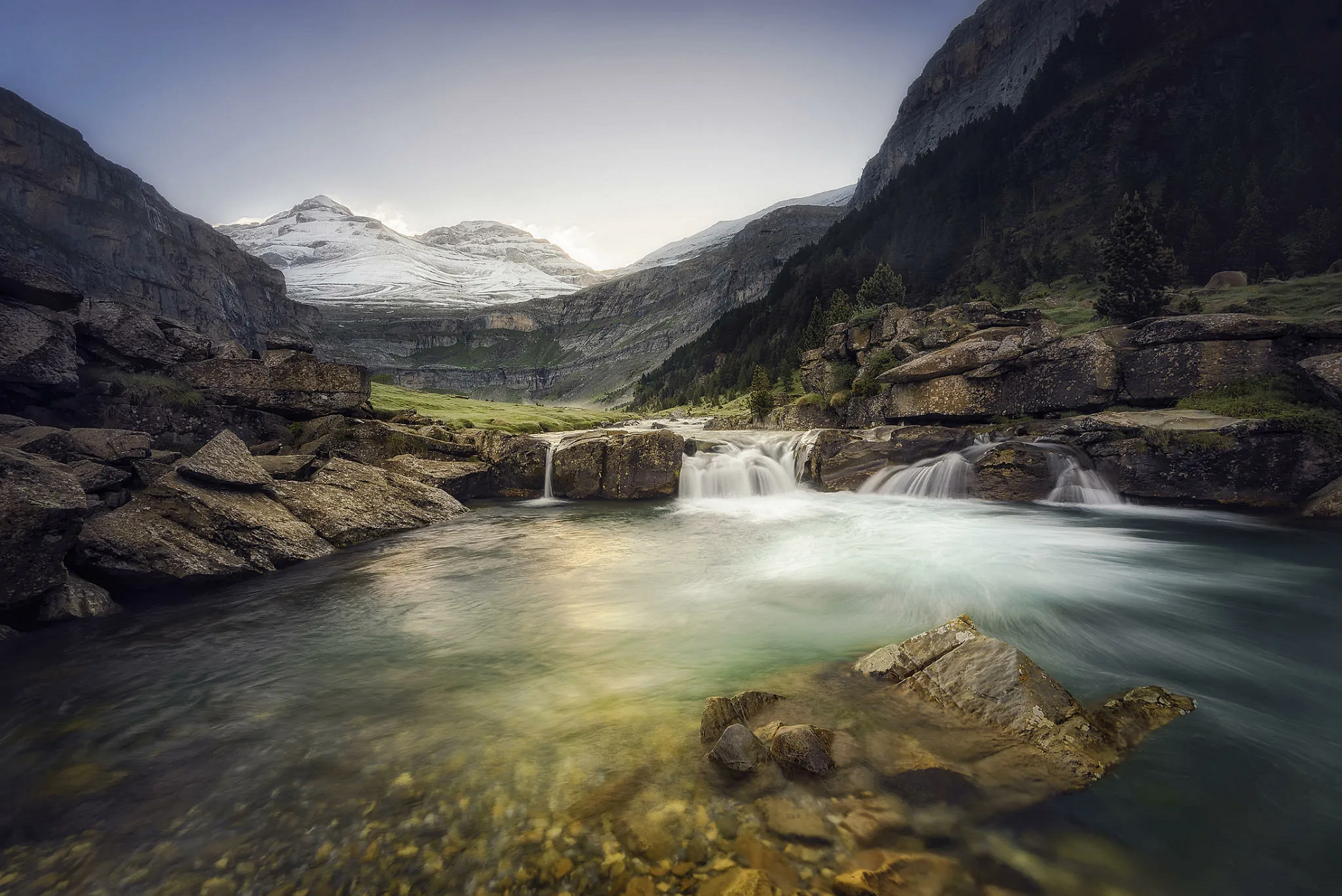
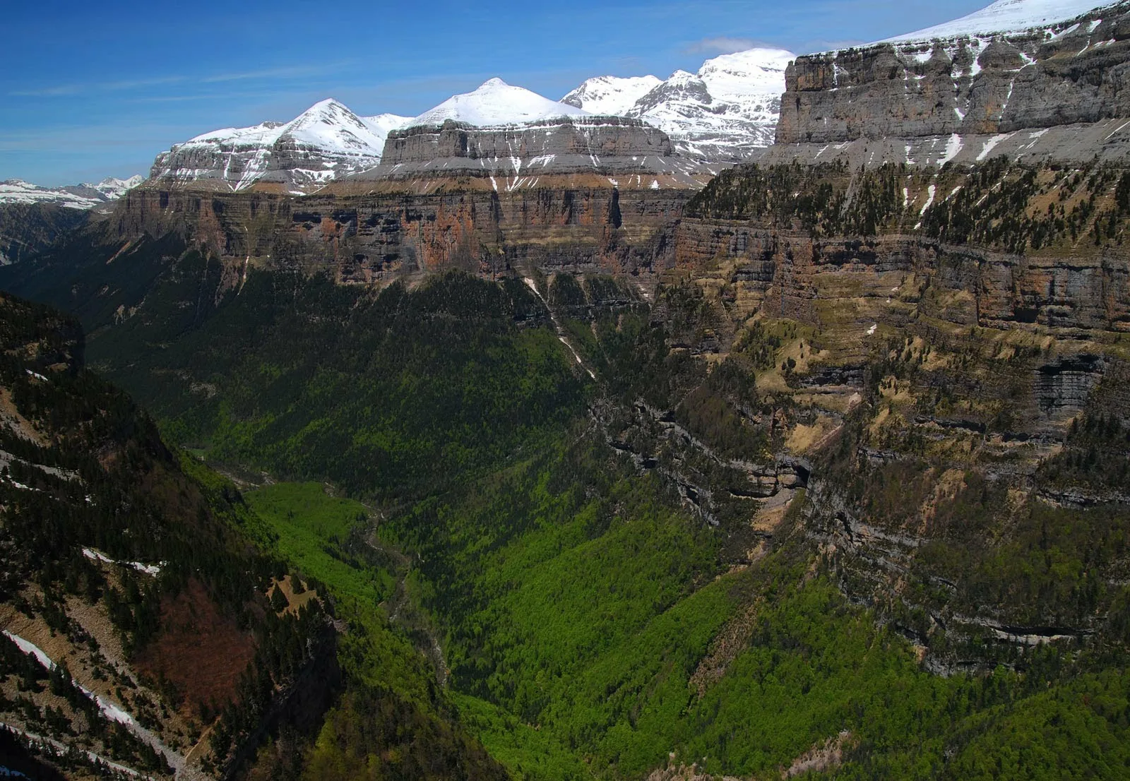
Monte Perdido (in Spanish; Mont Perdu in French; Mont Perdito in Aragonese; all three meaning lost mountain) is the third highest mountain in the Pyrenees. The summit of Monte Perdido (3355 m), located in Spain, lies hidden from France by the seemingly impenetrable peaks of the Cirques of Gavarnie and Estaubé. It stands in the north of Huesca province. The mountain forms part of the Monte Perdido Range and is located in the Ordesa y Monte Perdido National Park, in the western part of the Pyrenees, in the community of Aragon, Spain.
Description
Monte Perdido Glacier, located on the north-facing slope of Monte Perdido, is the third-largest glacier in the Pyrenees. It is surrounded by vertical cliffs up to 800m in height.[1] Similar to most European glaciers, the Monte Perdido Glacier has been shrinking since the Little Ice Age, and since 1981, the glacier has lost 48 hectares of surface area.[1] The rate of retreat is continuing to accelerate due to the effects of global climate change.
Access to the mountain is easier from Spain than from France. The route starts near the village of Torla, Aragon, at the Ordesa Valley and ascends the Cirque de Soaso towards the Refuge of Góriz before the stiff climb to the summit. It is a dangerous climb with snow.
National park
Monte Perdido is the centrepiece of the Spanish Ordesa y Monte Perdido National Park which was established in 1918 with just 21 square kilometres/hectares of land. In the 1970s work began to build a dam in the nearby Añisclo Canyon with the objective of creating hydroelectric energy but institutions and citizens demonstrated against this and succeeded in stopping it. In 1982 the park was expanded significantly to 156 square kilometres/hectares and now incorporates the whole of the Añisclo Canyon.[2] There are more than 1,500 species of flowers, 171 species of birds, 32 different mammals and 8 types of reptile in the Ordesa. Among these is the lammergeier (bearded vulture) with a 3-metre wingspan. The Pyrenees is one of the few places in Europe where these birds can be seen.
Because of its imposing landforms, the national park was inscribed on the UNESCO World Heritage List in 1997 as part of the Pyrénées – Mont Perdu World Heritage Site.[3]
This article uses material from the Wikipedia article Monte Perdido, which is released under the Creative Commons Attribution-Share-Alike 4.0 International License (view authors).
 Patrick Rouzet (Wikipedia) | 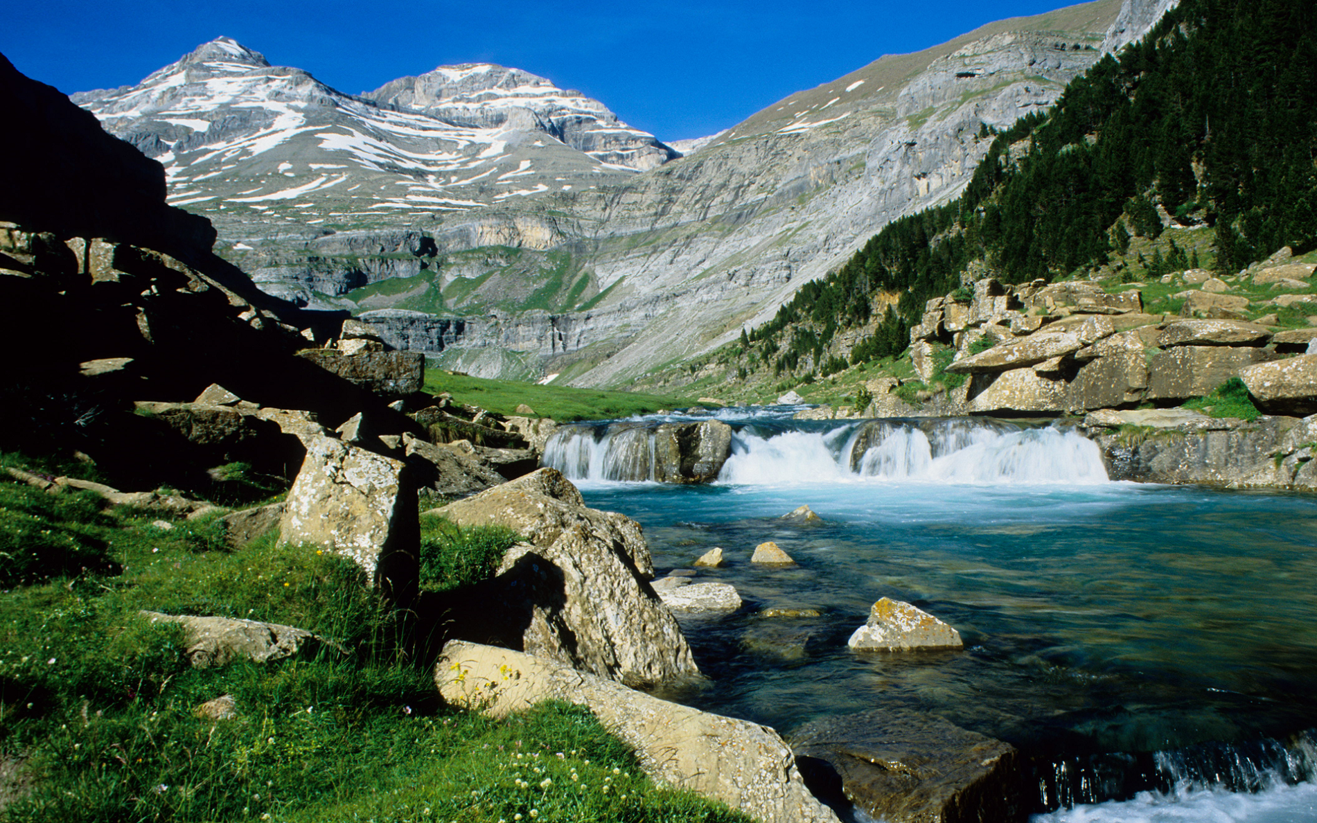 I I |
 |  |
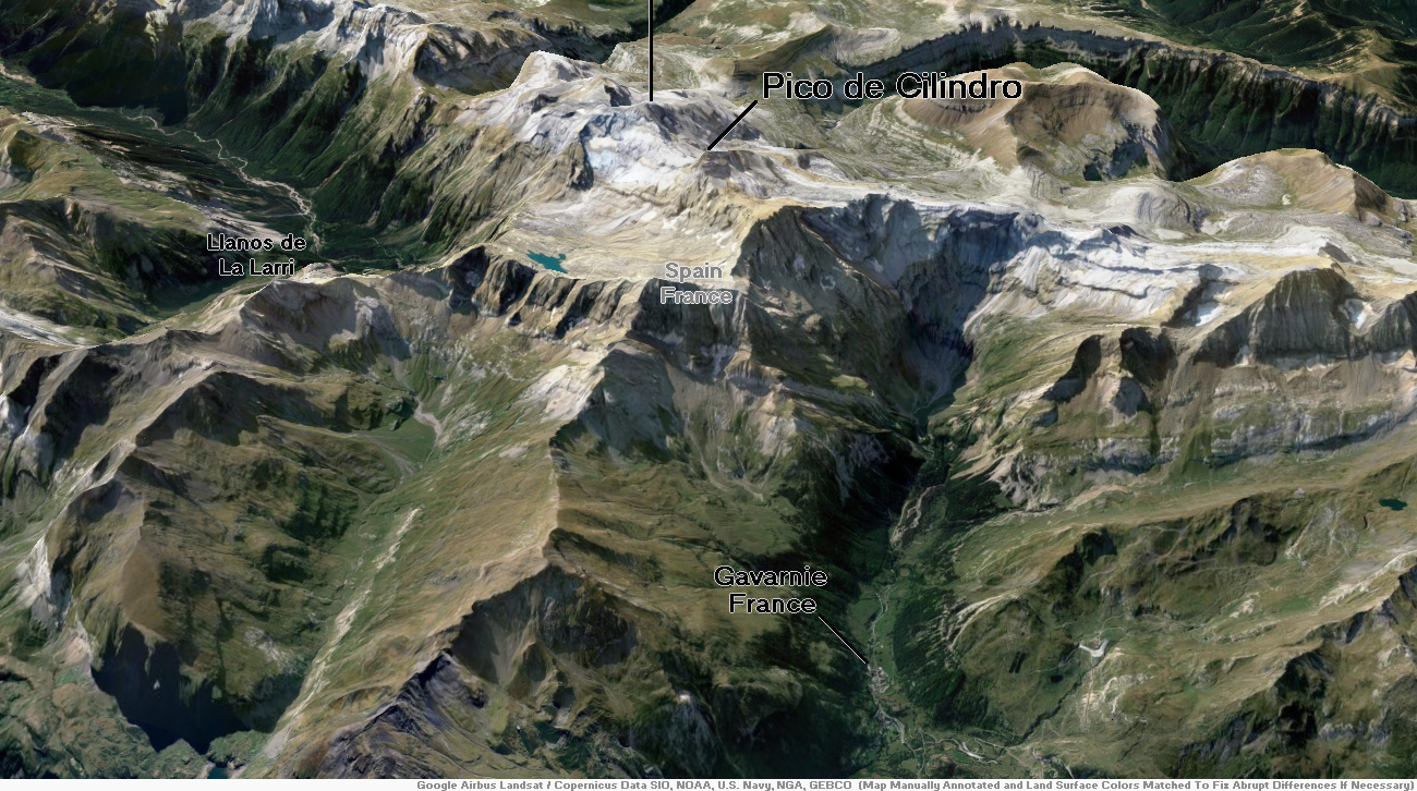
Cilindro de Marboré (3,328 m) (also known as Pico Cilindro and Pic du Cylindre) is a mountain in the Monte Perdido massif in the Pyrenees.
It is one of the three mountains comprising Las Tres Sorores (the three sisters), the others being Monte Perdido (3,355 m) and Soum de Ramond (3,263 m).
It is the northernmost point of Spain crossed by the IERS Reference Meridian.
This article uses material from the Wikipedia article Cilindro de Marboré, which is released under the Creative Commons Attribution-Share-Alike 4.0 International License (view authors).
Looking From France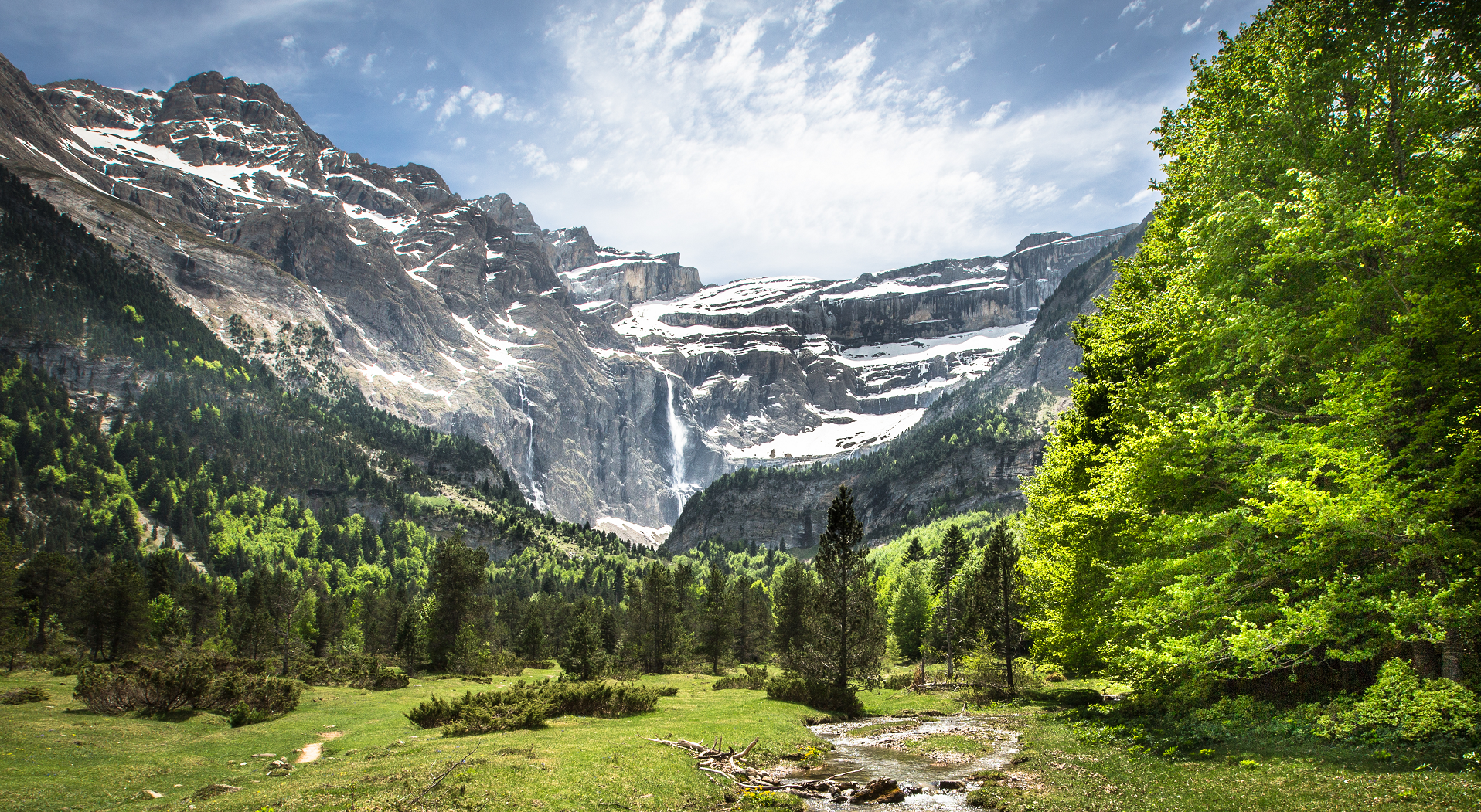 | Looking From France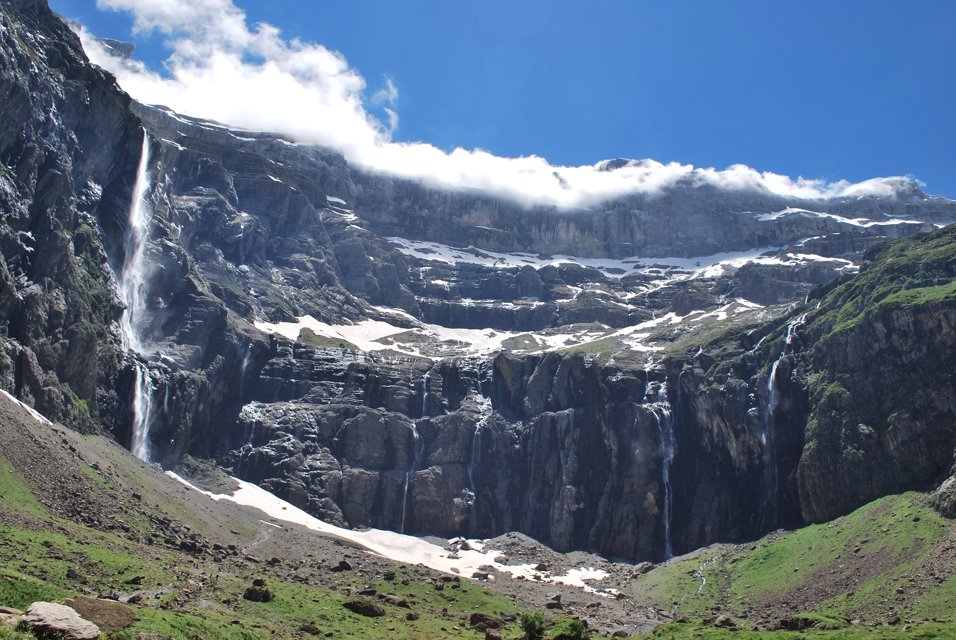 |
Looking From France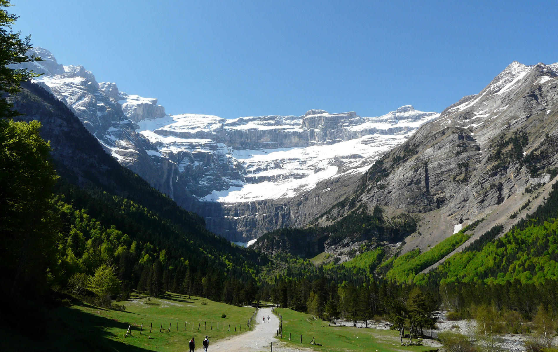 Pere Igor | Looking From Spain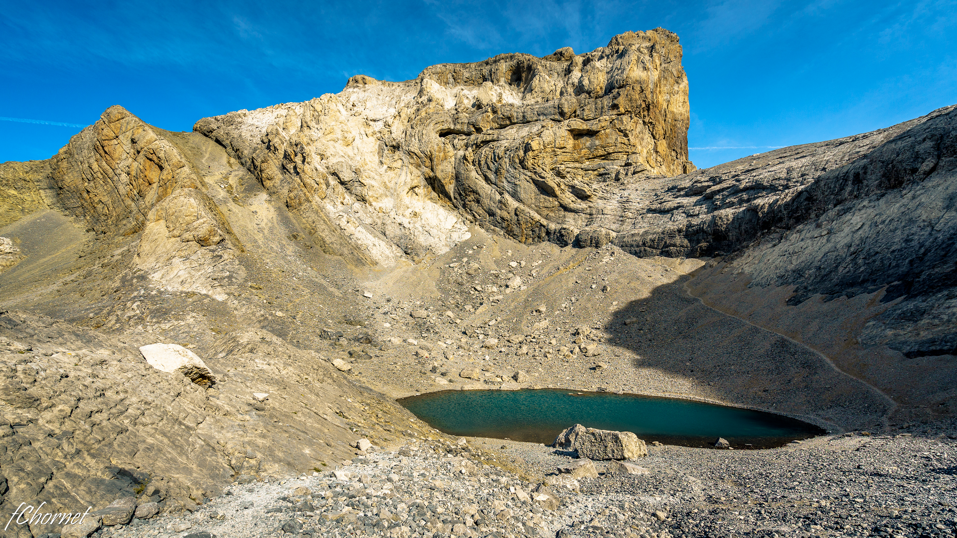 Francisco Chornet |
![]()
![]()
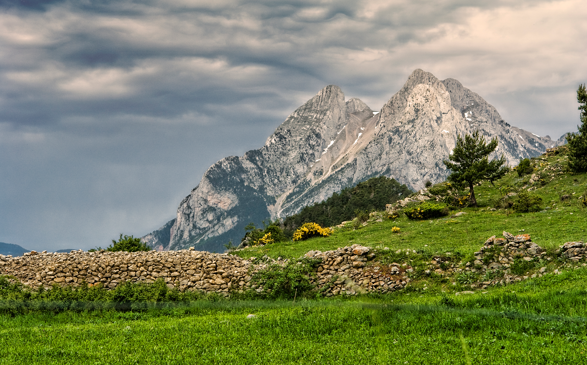
Pedraforca (Catalan: [peðɾəˈfɔrkə]; Spanish: [peðɾaˈfoɾka] ⓘ) is a mountain in the Pre-Pyrenees, located in the comarca of Berguedà. The mountain’s rare form, along with the fact that it is not visibly connected to any other adjacent mountains or ridges, has made it one of the most famous and emblematic mountains in Catalonia, the northeasternmost region of Spain.
Description
The mountain has a peculiar, forked shape composed of two parallel peaks (the pollegons) joined by a neck (the enforcadura). The loftier peak, called Pollegó superior, has an elevation of 2,506.4 m,[1] with a secondary peak, el Calderer, at 2,496.4 m in height. The lower peak, the Pollegó inferior is 2,444.8 m tall, while the Enforcadura’s highest point lies at 2,356.2 m, with a scree field (tartera in Catalan) on both faces of the mountain.
Location
Located within the Cadí-Moixeró Natural Park, Pedraforca has been declared a Natural Site of National Interest by the Generalitat de Catalunya.[2]
The closest villages to Pedraforca are Gósol to the west and Saldes to the east. Pedraforca marks the boundary between the two municipalities, as well as between the provinces of Barcelona and Lleida.
Significance
Pedraforca is, along with the mountains of Montserrat and Canigó, one of the emblematic mountains of Catalonia. This fame has made Pedraforca a popular destination for hikers and rock climbers, as well as being used by the comarca of Berguedà in its coat of arms.
This article uses material from the Wikipedia article Pedraforca, which is released under the Creative Commons Attribution-Share-Alike 4.0 International License (view authors).
 Mikipons (Wikipedia) I | 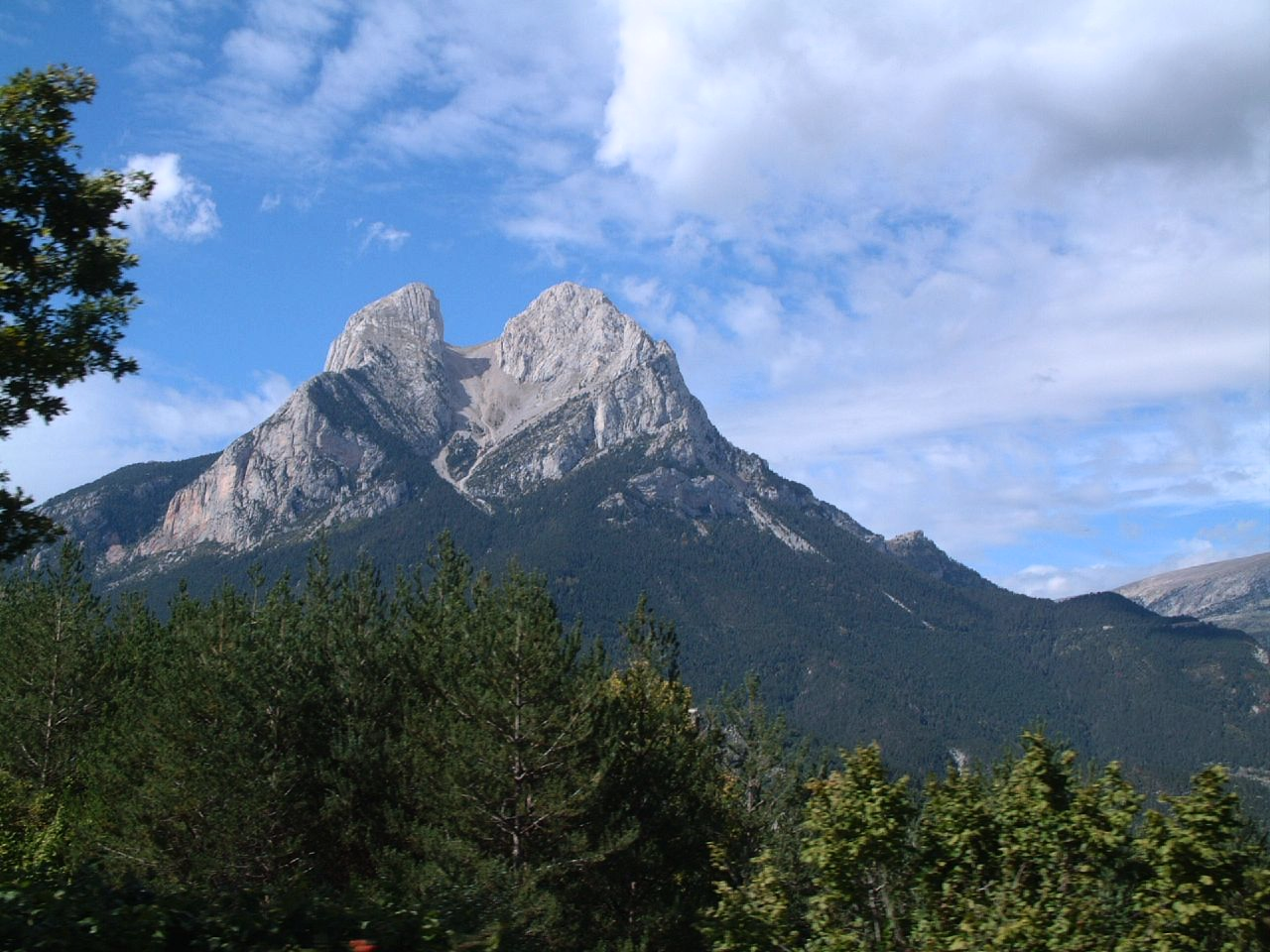 Eduard Maluquer (Wikipedia) |
