
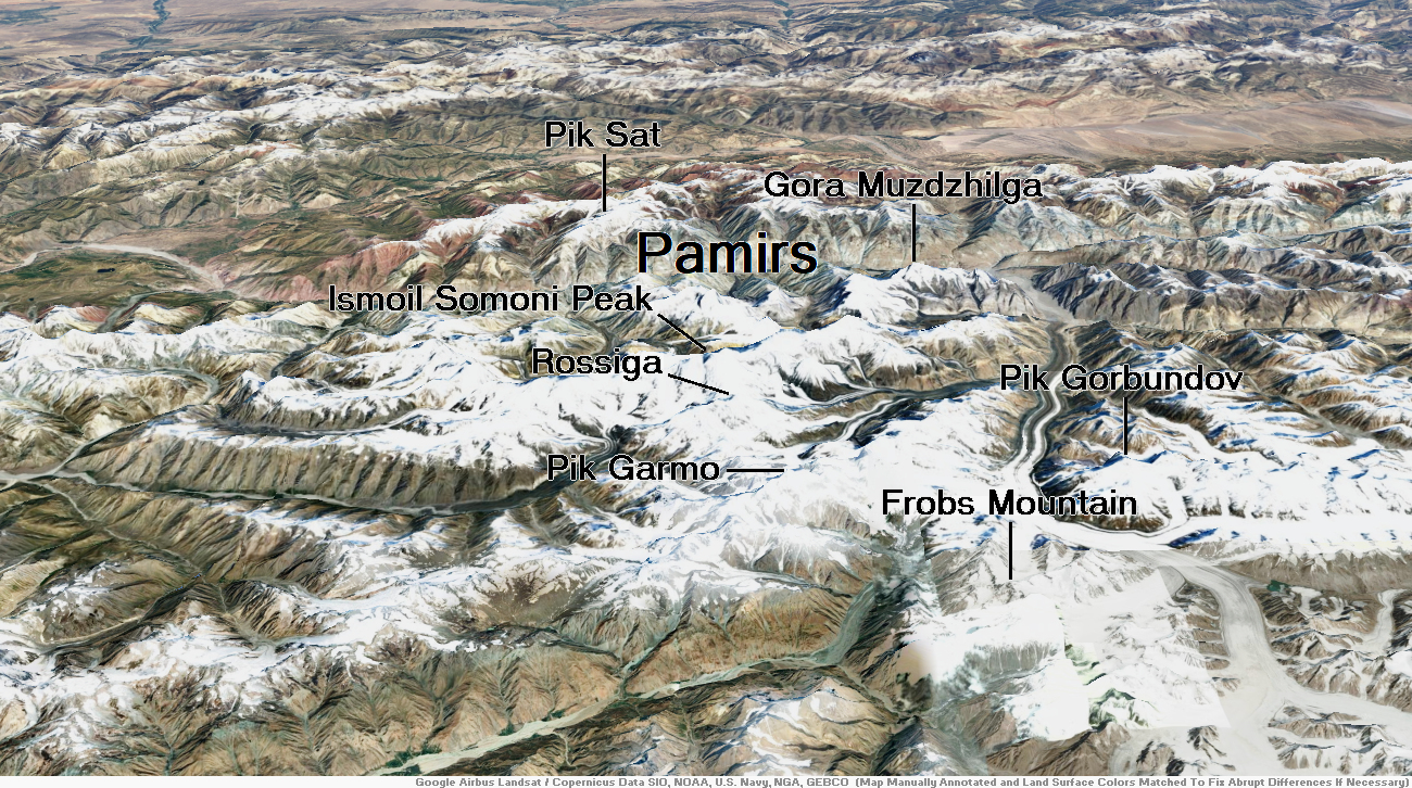
Map of Pamirs
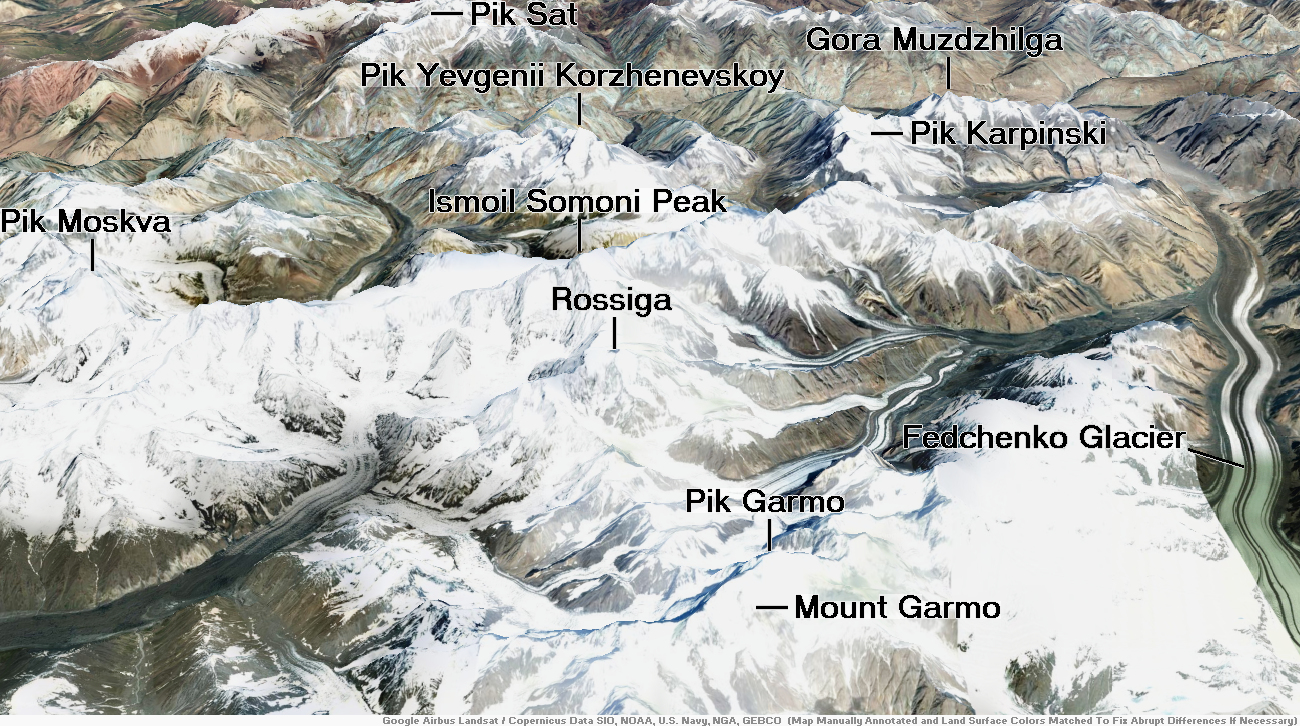
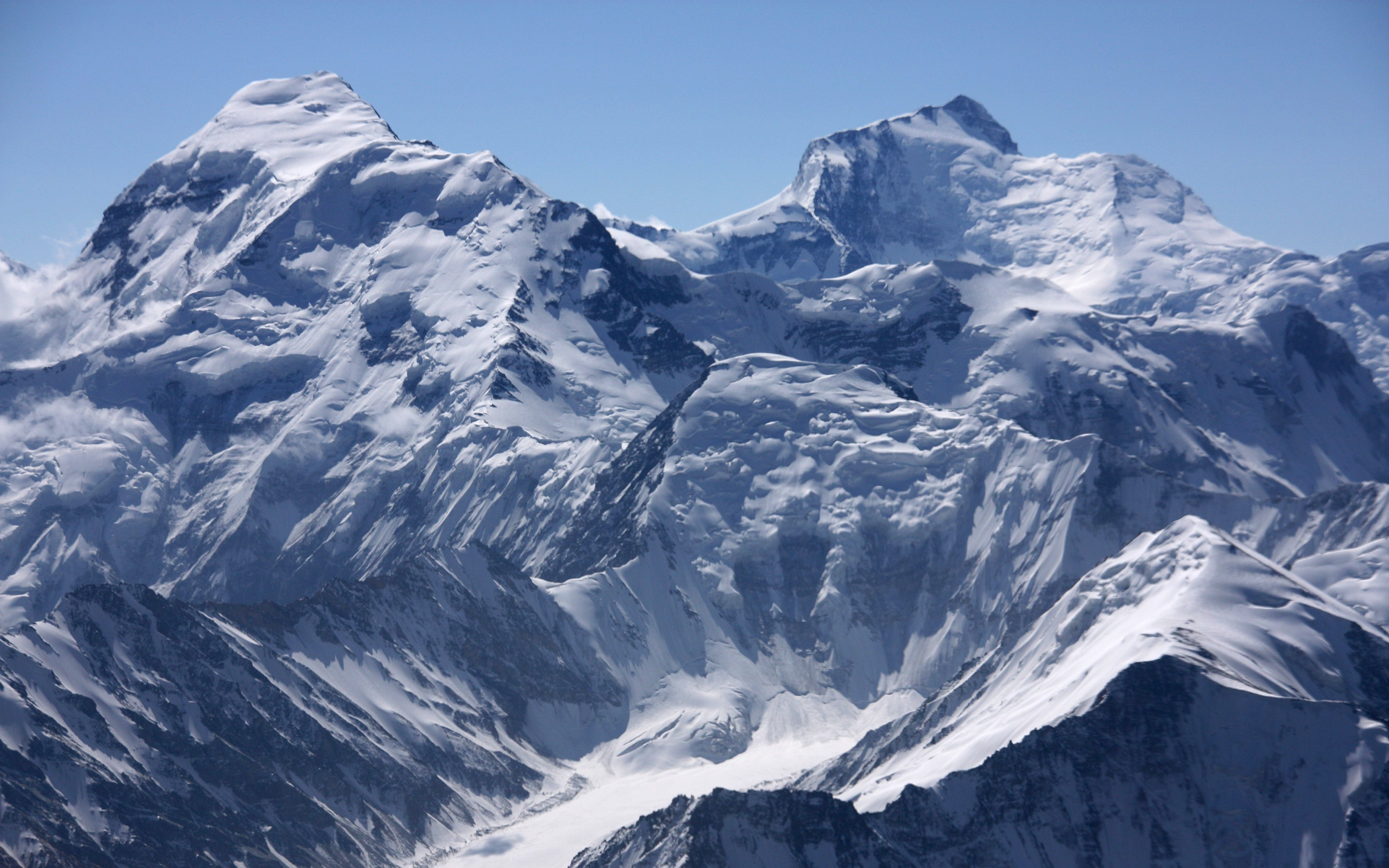
Ismoil Somoni Region
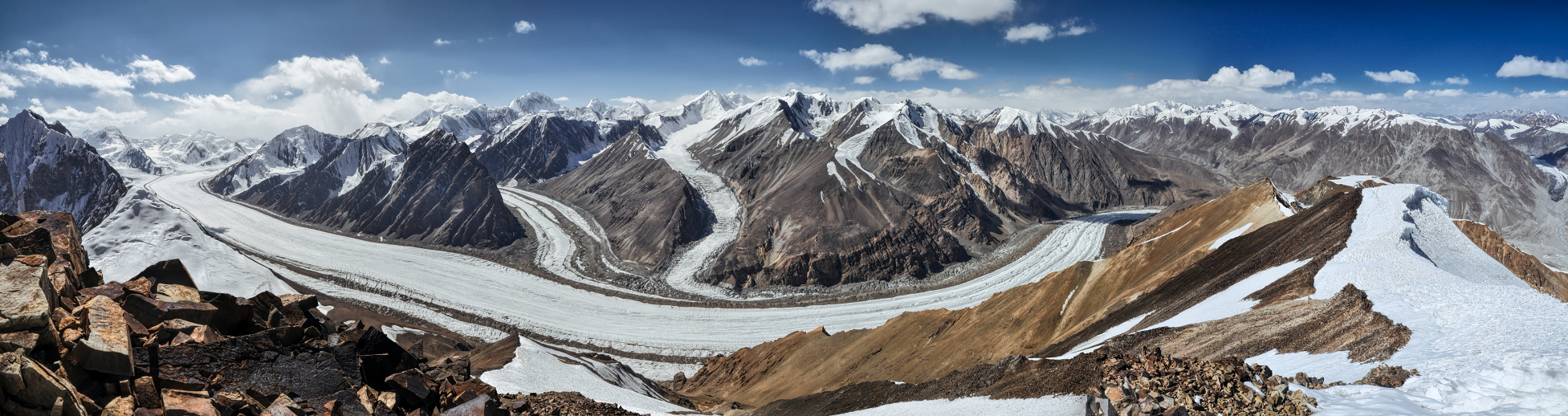
Isomoil Somoni Panoramic 1
 MisoKnitl (iStock) |
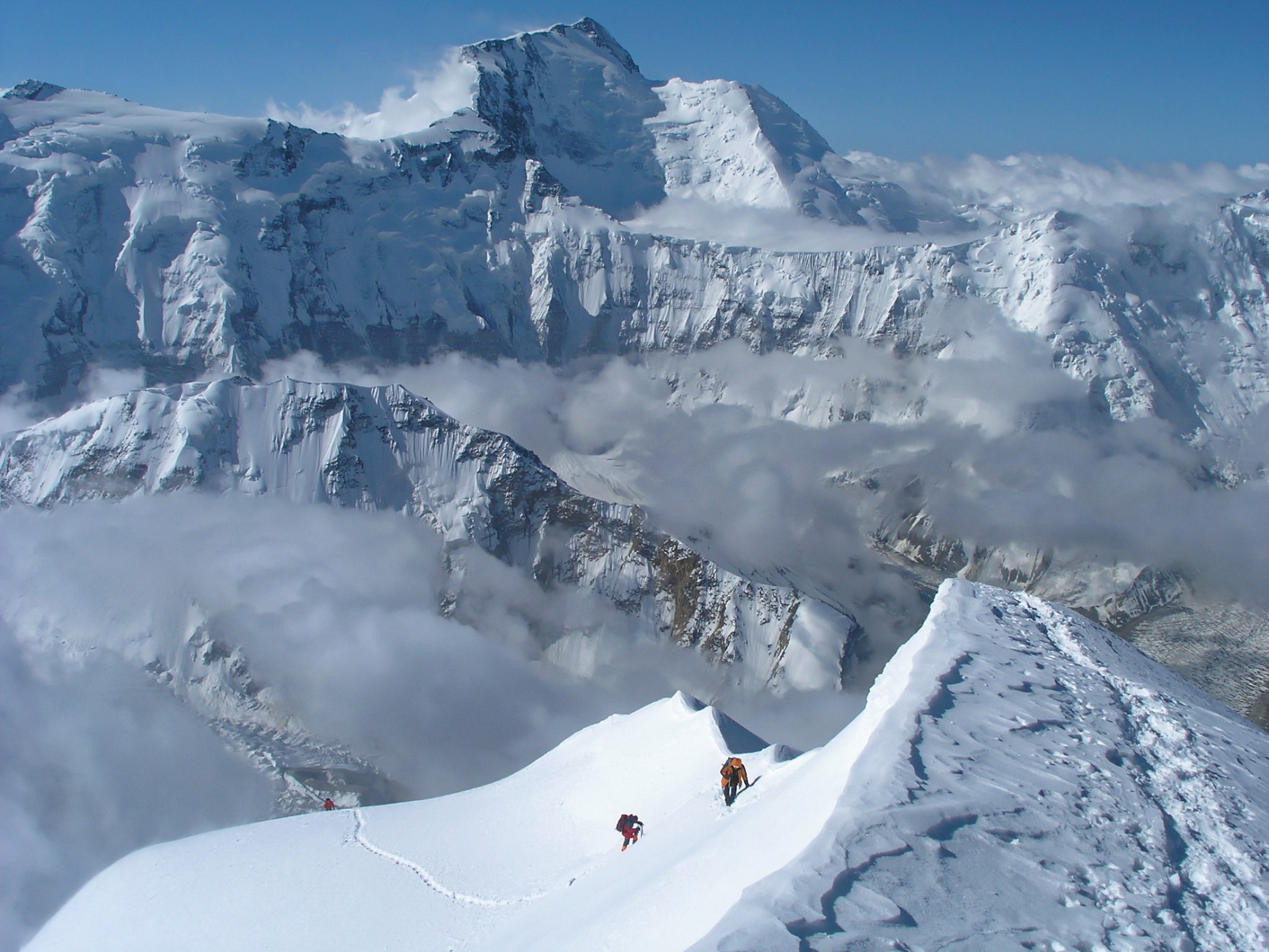
Isomoil Somoni Panoramic 2
 Avner Magen (Univeristy of Toronto) |
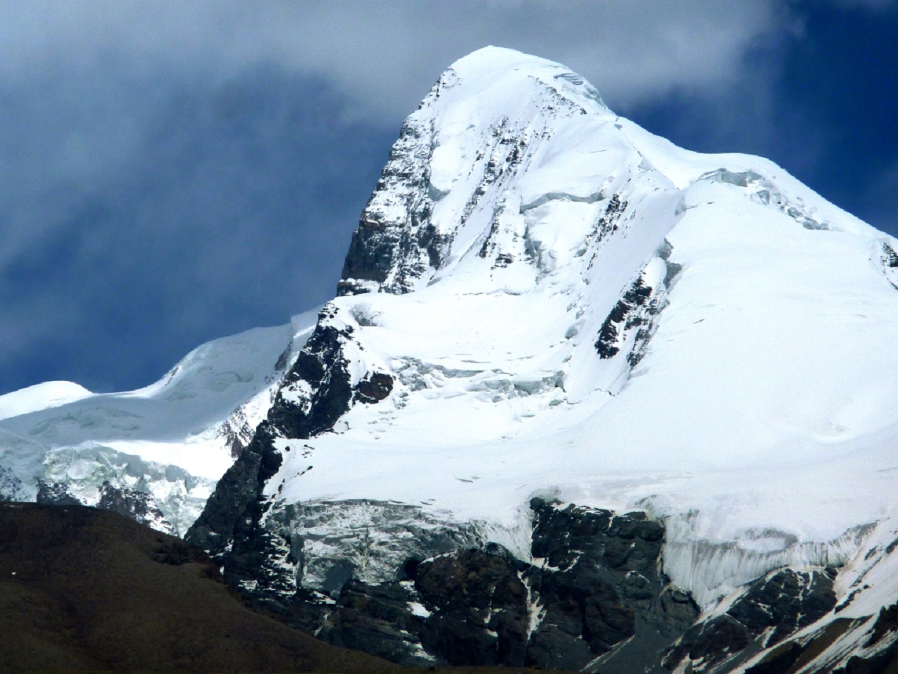
Ismoil Somoni Peak (Tajik: Қуллаи Исмоили Сомонӣ, romanized: Qulla-i Ismō‘il-i Sōmōnî/Qullaji Ismojili Somonī; Persian: قلّهٔ اسماعیل سامانی; Russian: Пик Исмои́ла Сомони́, romanized: Pik Ismoíla Somoní) is the highest mountain in Tajikistan.[1][3][7][8][9][4][5][6] Because it was within the territory of the former Russian Empire and the former Soviet Union, it was the highest mountain in the Russian Empire and Soviet Union before Tajikistan became independent. The mountain is named after Ismail Samani, a ruler of the Samanid dynasty. It is located in the Pamir Range.
Name
When the existence of a peak in the Soviet Pamir Mountains higher than Lenin Peak was first established in 1928, the mountain was tentatively identified with Mount Garmo.[2] However, as the result of the work of further Soviet expeditions, it became clear by 1932 that they were not the same, and in 1933 the new peak, in the Academy of Sciences Range, was named Stalin Peak[8][9] (Russian: Пик Ста́лина, romanized: Pik Stálina), after Joseph Stalin. In 1962, as part of Khrushchev’s nationwide de-Stalinization process, the name was changed to Communism Peak (Tajik: Пики Коммунизм, romanized: Piki Komunizm Russian: Пик Коммуни́зма, romanized: Pik Kommunízma), a name by which it is still commonly known. The name Communism Peak was officially dropped in 1998 in favour of the current name, commemorating the 9th-10th century Samanid emir, Ismail Samani.[10]
History
By the end of the 1880s, a Russian expedition, led by V.F. Oshanin, conducted research named various regions in the area. He noted in his diary: “I believe that the eastern peak has a height of up to 25,000 feet (7,600 metres).”[11][12] The central Pamirs would continue to be visited by the expeditions of Kosineko, Korzhenevsky, Lipsky, Novitsky, Musketov, and others, but they failed to reach the Academy of Sciences Range.
In 1913, the central part of the Pamirs was explored by an expedition led by the German mountain explorer and climber Willi Rickmer Rickmers. The expedition penetrated the upper reaches of the Obikhingou River, where they saw a 6650 m peak. It was given the name Garmo Peak, according to the name given by the Tajiks from Pashimgar. Subsequent expeditions to the area of the Range of the Academy of Sciences took place in Soviet times.
This article uses material from the Wikipedia article Ismoil Somoni Peak, which is released under the Creative Commons Attribution-Share-Alike 4.0 International License (view authors).
 Voldymur Khytrykov | 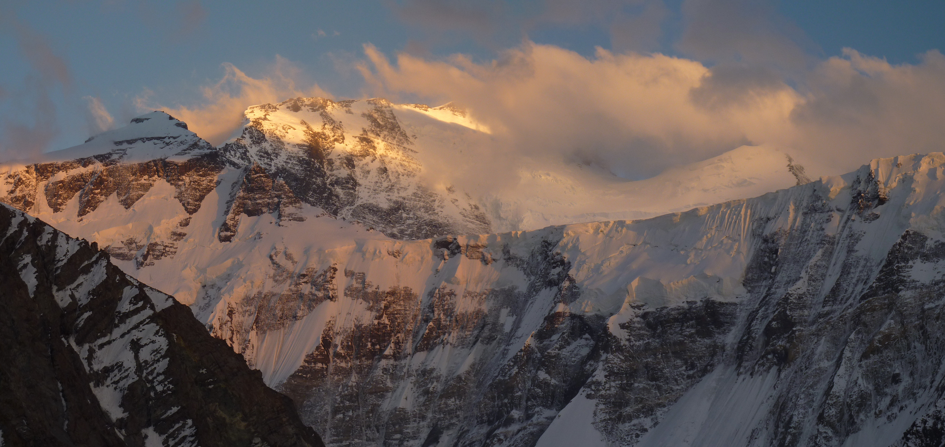 I |
 Oleg Kiryanov I | 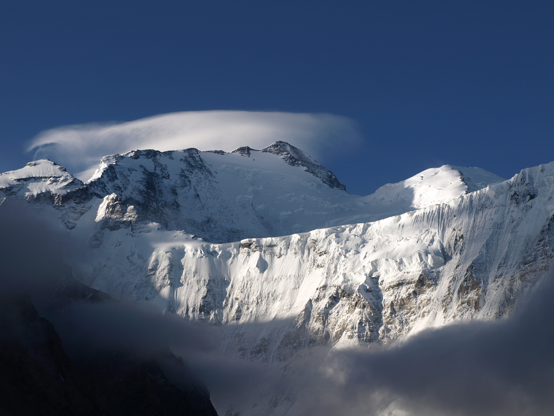 Avner Magen (Univeristy of Toronto) |
 Marvel Treks | 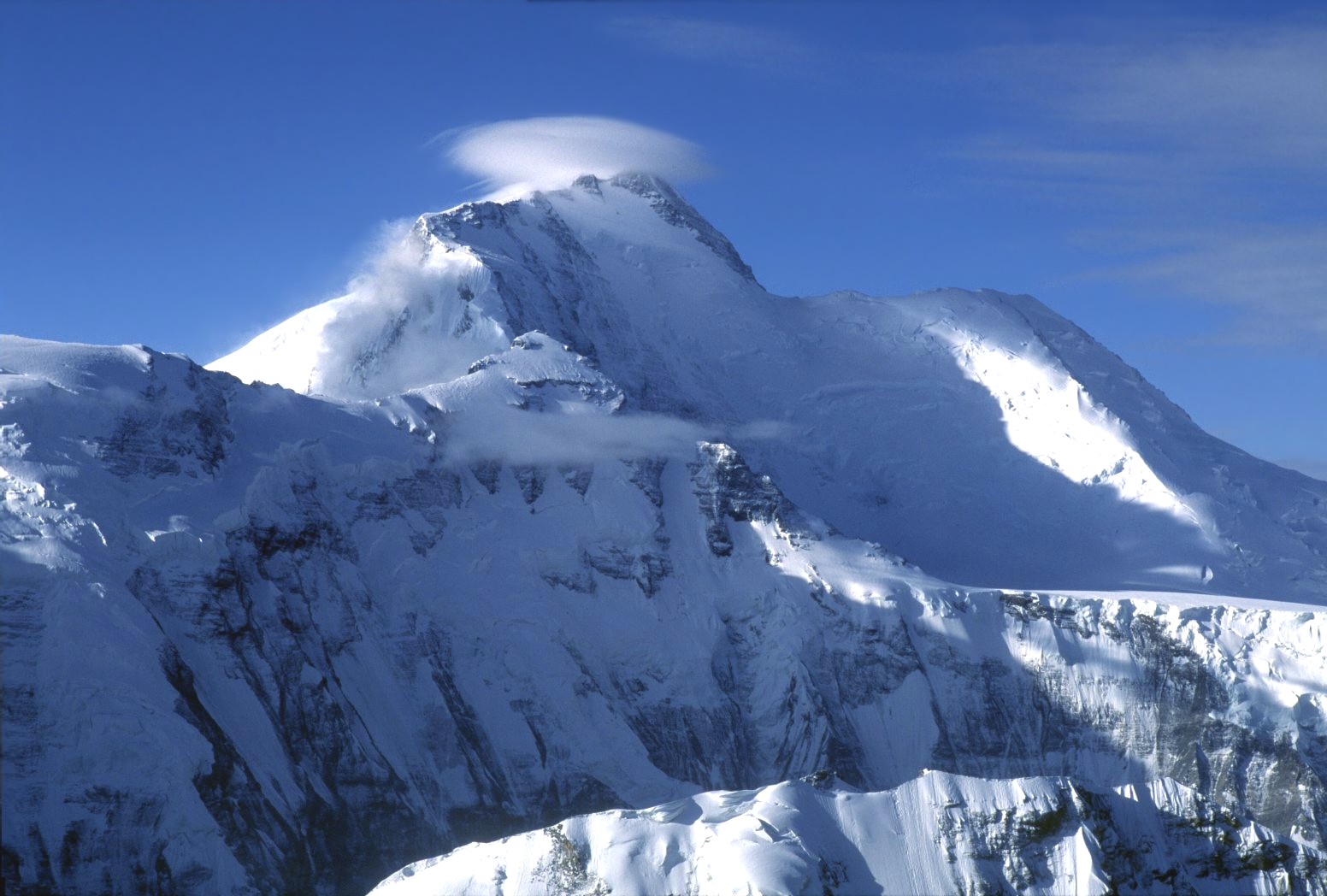 I |
 Martin Mergili (University of Graz) I | 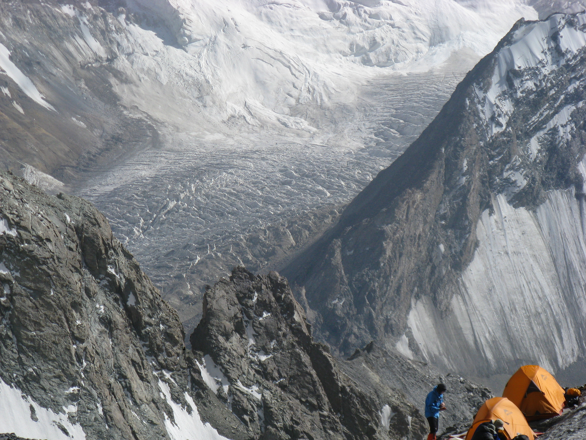 Avner Magen (Univeristy of Toronto) I |


![]()
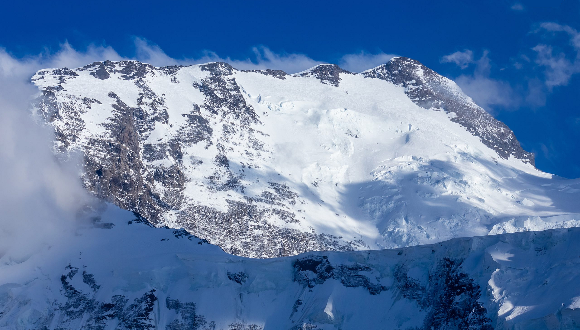
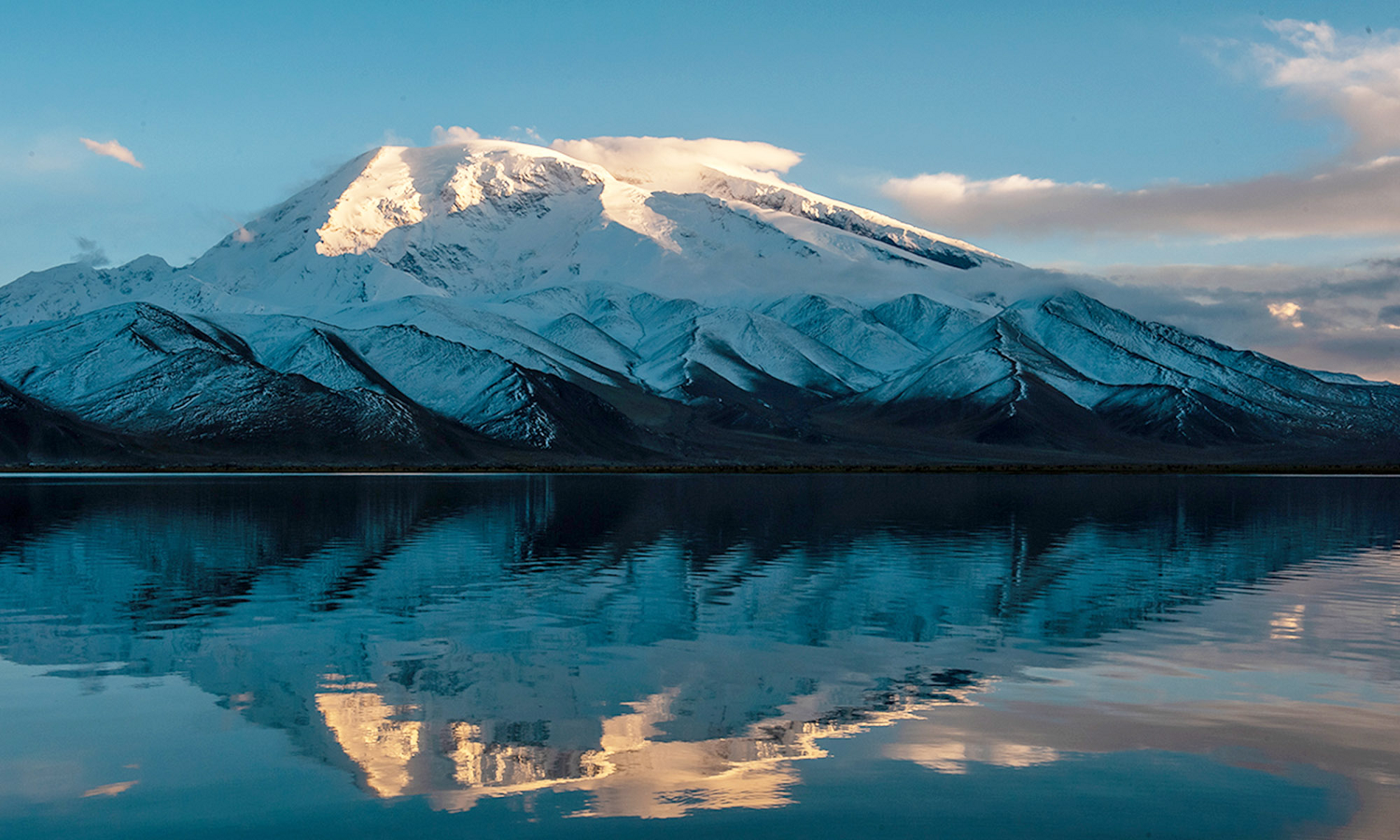
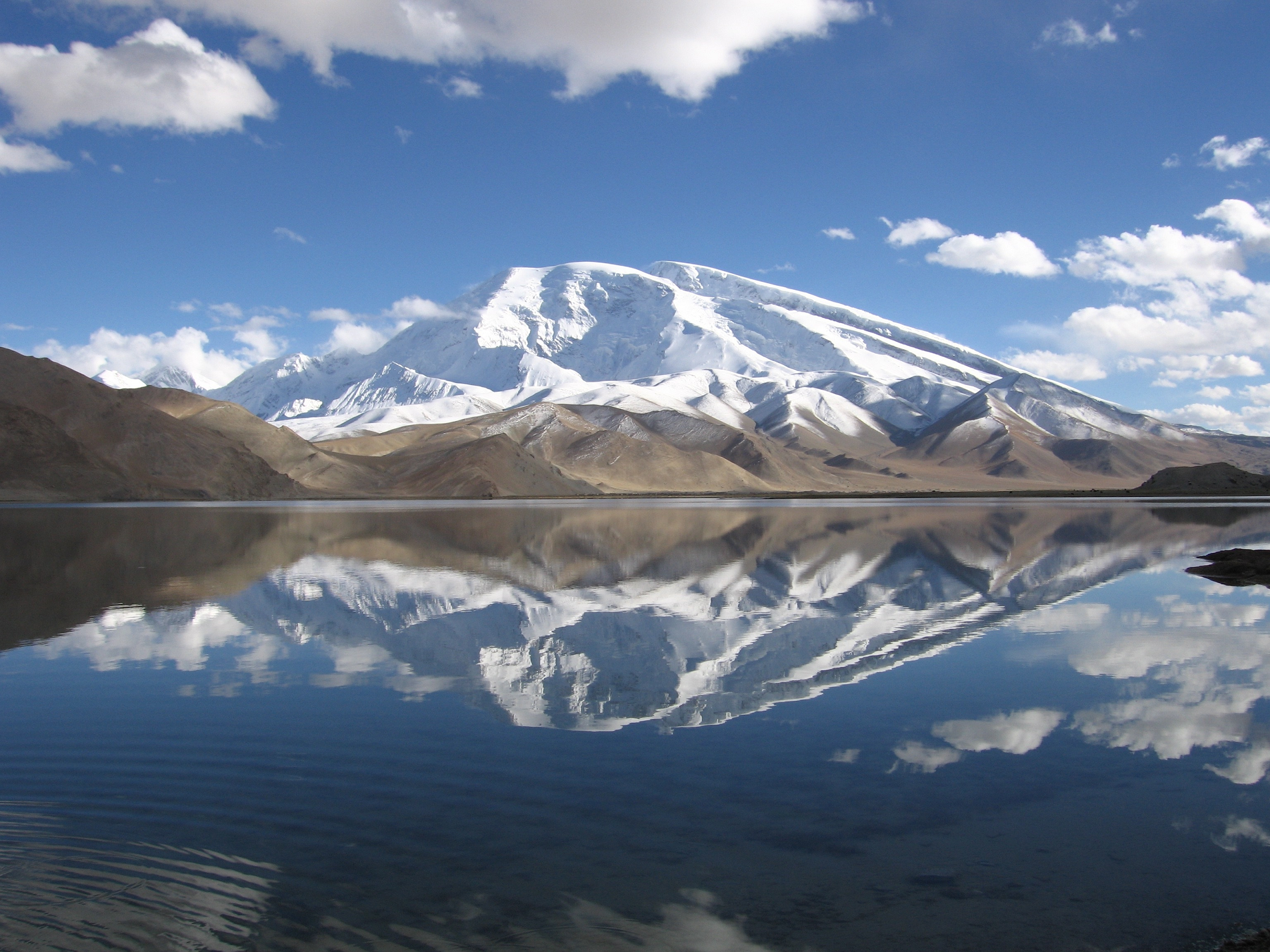
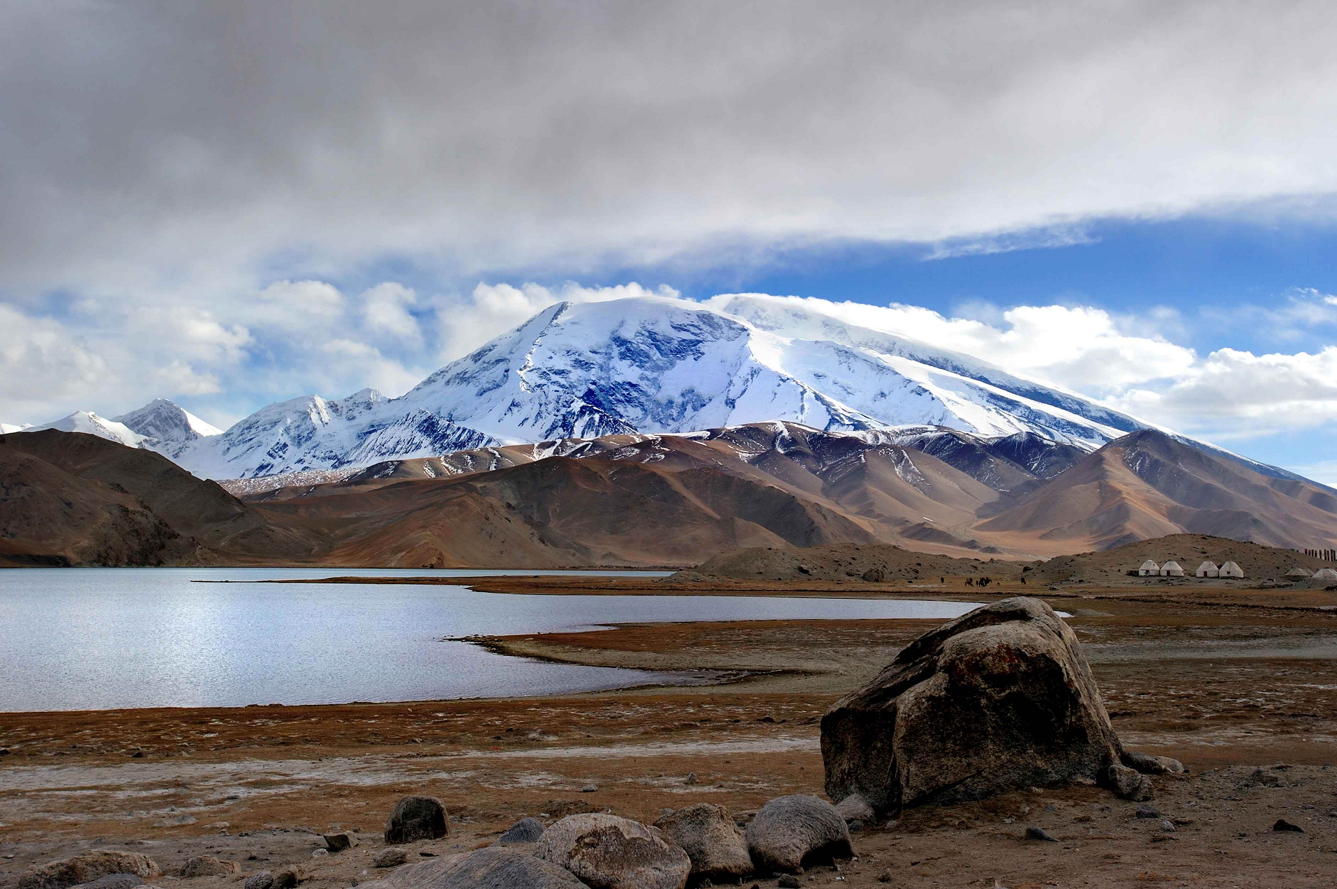
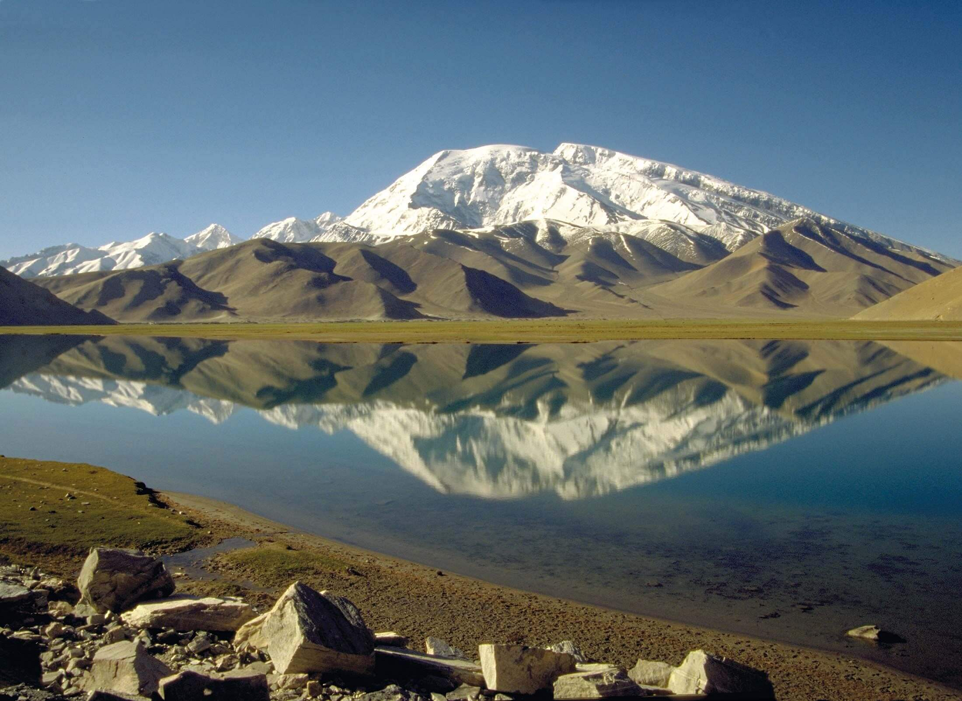
The Kongur Tagh (meaning ‘Brown Mountain’ in English) is the highest peak in the Pamir Mountains, and also the highest mountain wholly within the Xinjiang Uyghur Autonomous Region, China. With an elevation of 7,649 metres (25,095 ft), it is also the highest mountain outside of the Hindu Kush/Karakoram and Himalaya ranges.
Geography
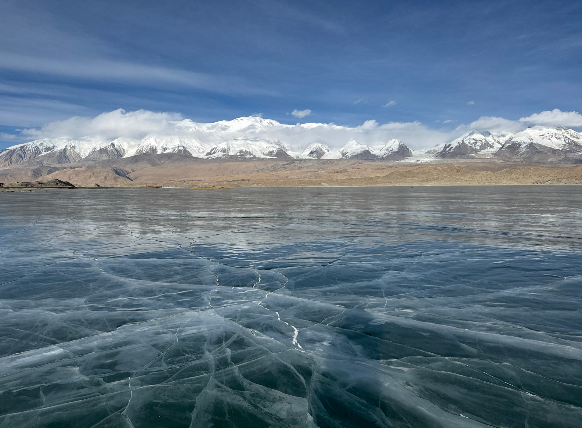
Kongur Tagh is within a range called the Kongur Shan (Chinese: 公格尔山; pinyin: Gōnggé’ěr Shān.) Kongur Tagh is located just north of Muztagh Ata and visible from Karakul Lake. Some sources use “Kongur Shan” mistakenly to refer to the peak itself. The Kongur Shan range, including Muztagh Ata, is separated by the major Yarkand River valley from the Kunlun Mountains and thus is included in the “Eastern Pamirs“.[2] Kongur Tagh is the highest peak in the Pamirs. Due to its remoteness and being hidden by nearby peaks, Kongur was not discovered by Europeans until 1900. However, the building of the Karakoram Highway from Pakistan to China, which runs past nearby Tashkurgan and Karakul Lake, has now made it more accessible.
Administratively, the Kongur Range is within Akto County.
Climbing history
The first ascent of Kongur Tagh was made in 1981 by a British expedition consisting of Chris Bonington, Alan Rouse, Peter Boardman and Joe Tasker.[3]
Elevation
Kongur Tagh is 7,649 metres (25,095 ft) high. Some sources list the peak’s elevation as 7,719 m (25,325 ft), but this is likely incorrect. The main summit is close enough in height to the 7,625 m (25,016 ft) high northeastern summit that climbers standing on the main summit could not tell which was taller, thus it can not be 7,719 m (25,325 ft) high.[4]
This article uses material from the Wikipedia article Kongur Tagh, which is released under the Creative Commons Attribution-Share-Alike 4.0 International License (view authors).
 John Hill (Wikipedia) |  Hiroki Ogawa (Wikipedia) |
 PeakVisor | 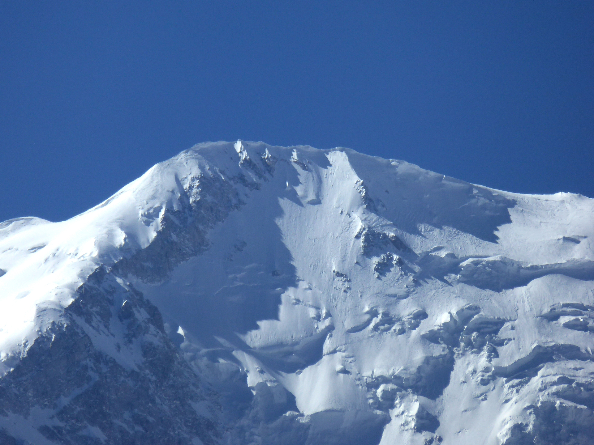 Hiroki Ogawa (Wikipedia) |
 Hiroki Ogawa (Wikipedia) |  Hiroki Ogawa (Wikipedia) |

![]()
Muztagh Ata (meaning ‘Iceberg Father’ in English), formerly known as Mount Tagharma and Wi-tagh, is the second highest of the mountains which form the northern edge of the Tibetan Plateau, with an elevation of 7,546 m (24,757 ft).[2] It is sometimes regarded as being part of the Kunlun Mountains, although physically it is more closely connected to the Pamirs. It is also one of the relatively easier 7,000 m peaks in the world to climb, due to its gentle western slope and the comparatively drier weather of Xinjiang, though a thorough acclimatization period and a very strong physical condition are crucial for success.
Location
Muztagh Ata lies just south of Kongur Tagh, the highest peak of this somewhat isolated range that is separated from the main chain of the Kunlun by the large Yarkand River valley, and thus generally included in the “Eastern Pamirs“.[3] Not far to the north and east of this group are the lowlands of the Tarim Basin and the Taklamakan Desert. The Karakoram Highway passes very close to both peaks as well as Karakul Lake, from which the mountain is conveniently viewed. The closest city is to the mountain is Tashkurgan, the westernmost town in China and very close to the border with Tajikistan and Pakistan.
History
According to Michael Witzel:[4]
the Ṛgveda mentions the mountain Mūjavant (“Having Mūja”), from where the best soma comes. A Muža tribe is also found in the Avesta in an eastern area that has Vedic-like names. The name seems to survive as the impressive 7,549-meter-high Muzh Tagh Ata Mountain in the Uyghur and Sariqoli (Saka) lands of southwestern Xinjiang.
This article uses material from the Wikipedia article Muztagh Ata, which is released under the Creative Commons Attribution-Share-Alike 4.0 International License (view authors).
 IslamiChina Travel |  IslamiChina Travel |
 |  |
 |  |
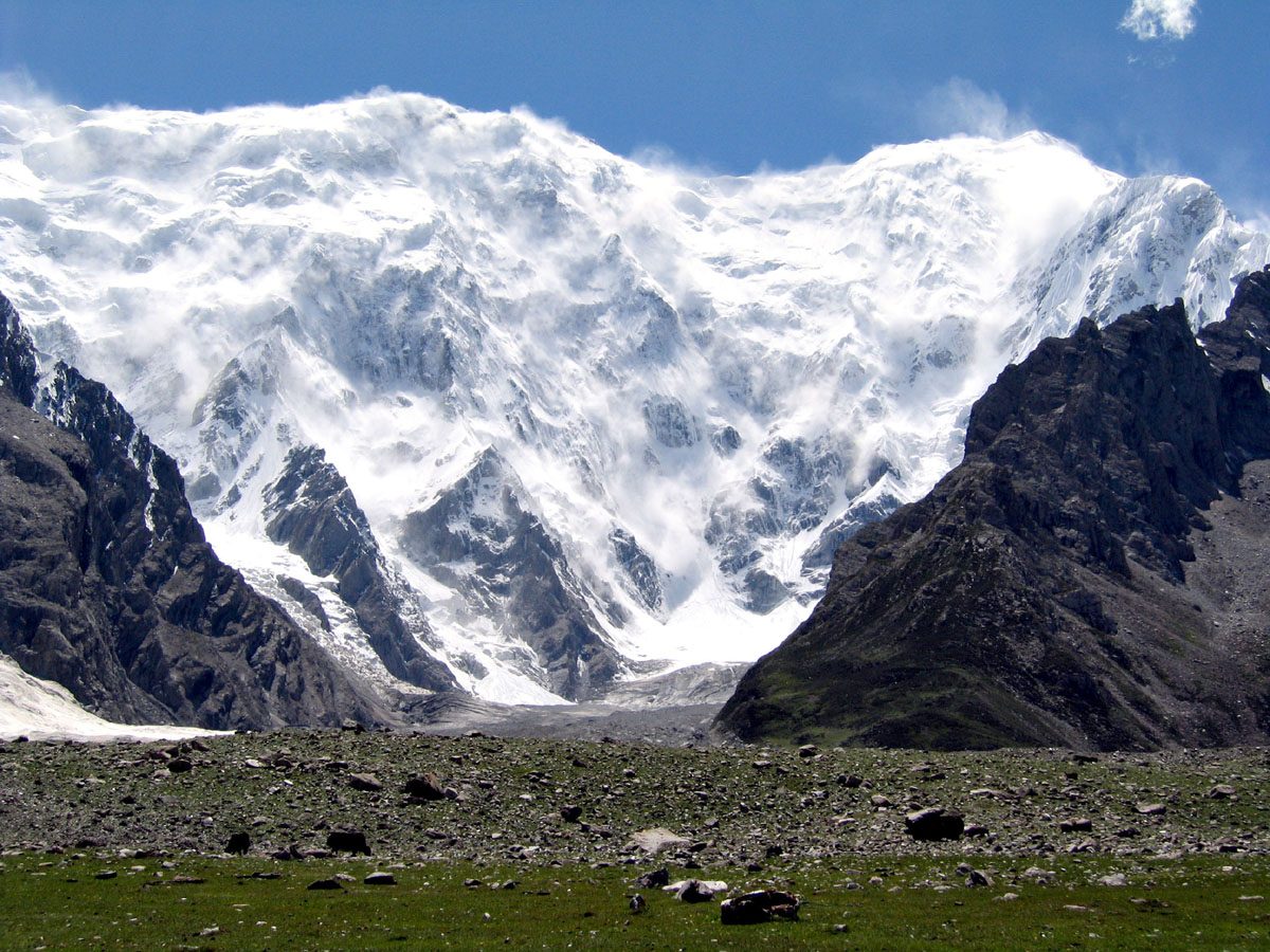
Kongur Tagh, which means “a brown mountain” in Uyghur language, has a significant subpeak known as Kongur Tiube (公格尔九别峰 which means in the local language “the mountain with a white cap”,[2] also Kongur Tiubie / Jiubie and Kungur Tjube Tagh), 38°36′57″N 75°11′44″E; elevation = 7,530 metres (24,700 ft).Ranked 46th[3] It is moderately independent, with a topographic prominence of 840 m (2,760 ft). It was first climbed in 1956.
In 2015, Chinese state media reported about a huge body of the Kongur Tiube glacier collapsing causing a 20 km long and one kilometre wide ice rock avalanche.[4]
This article uses material from the Wikipedia article Kongur Tiube, which is released under the Creative Commons Attribution-Share-Alike 4.0 International License (view authors).
 Tao Jiang |  I |
 V. Odokhovsky | 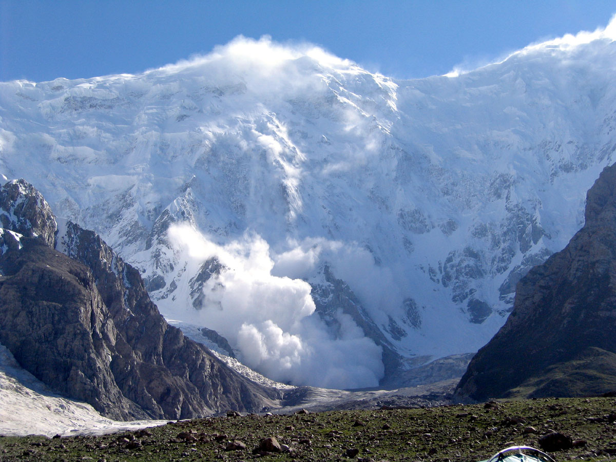 V. Odokhovsky |
