
Map of Sierra Madre Oriental


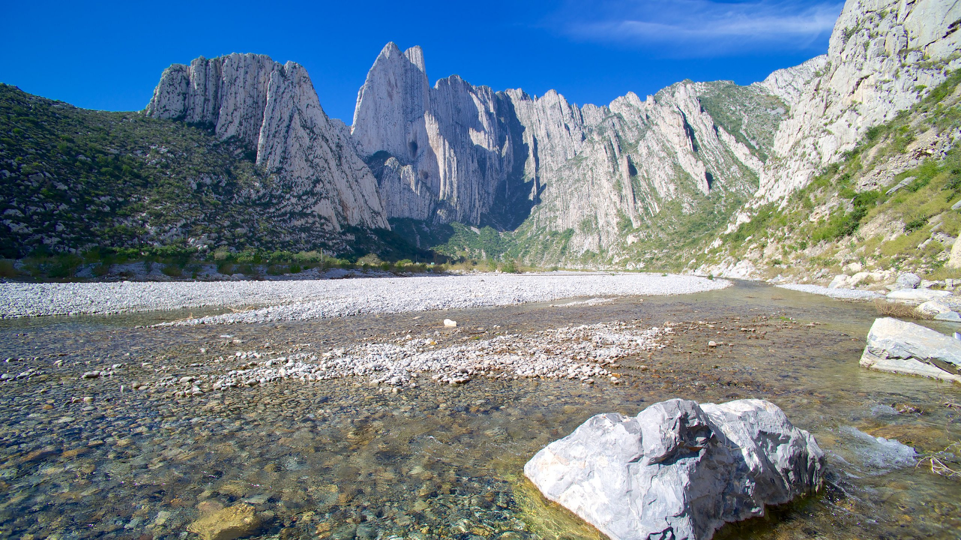
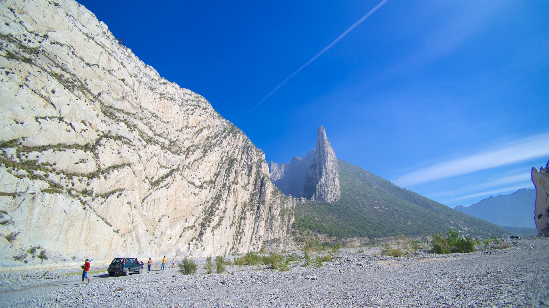
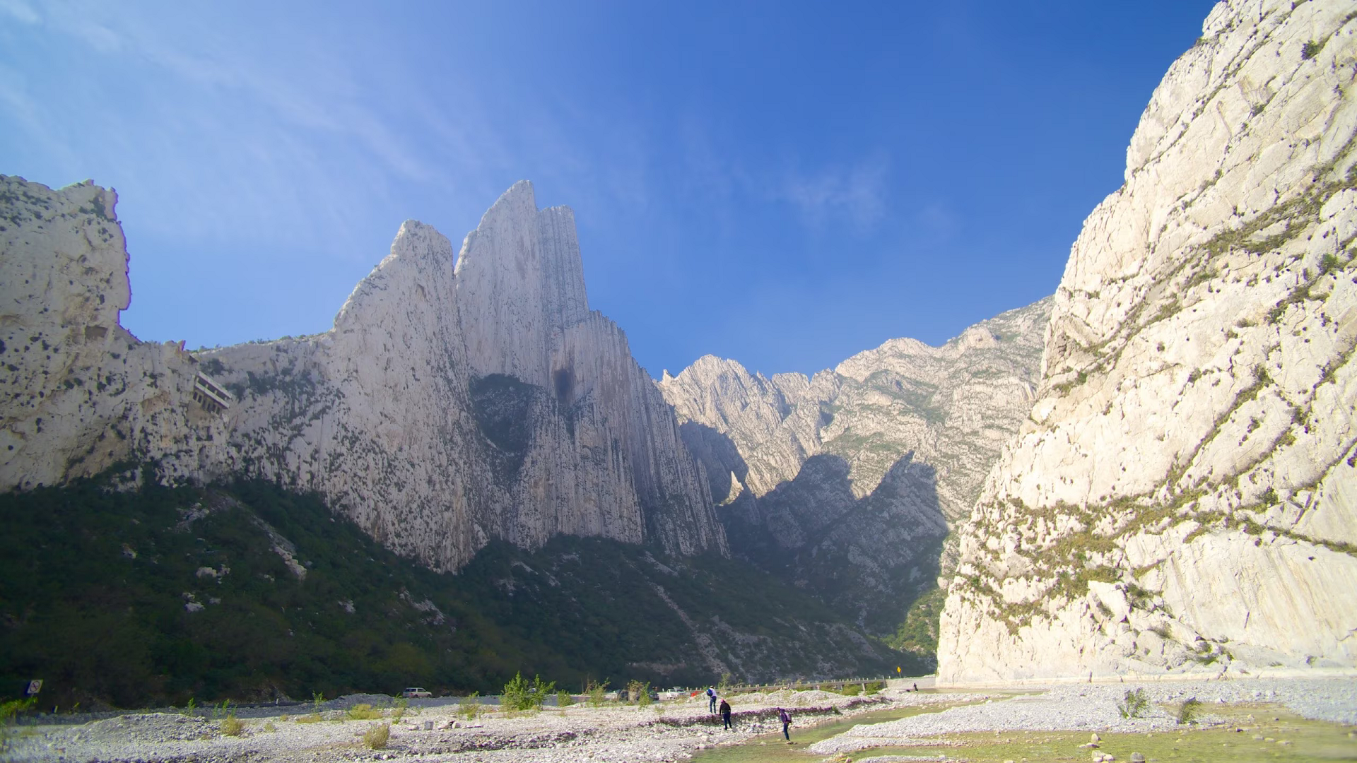
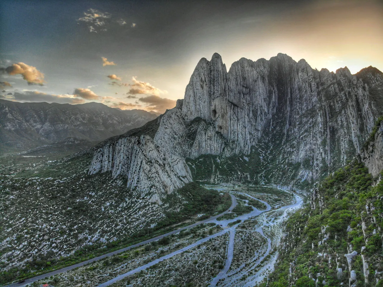
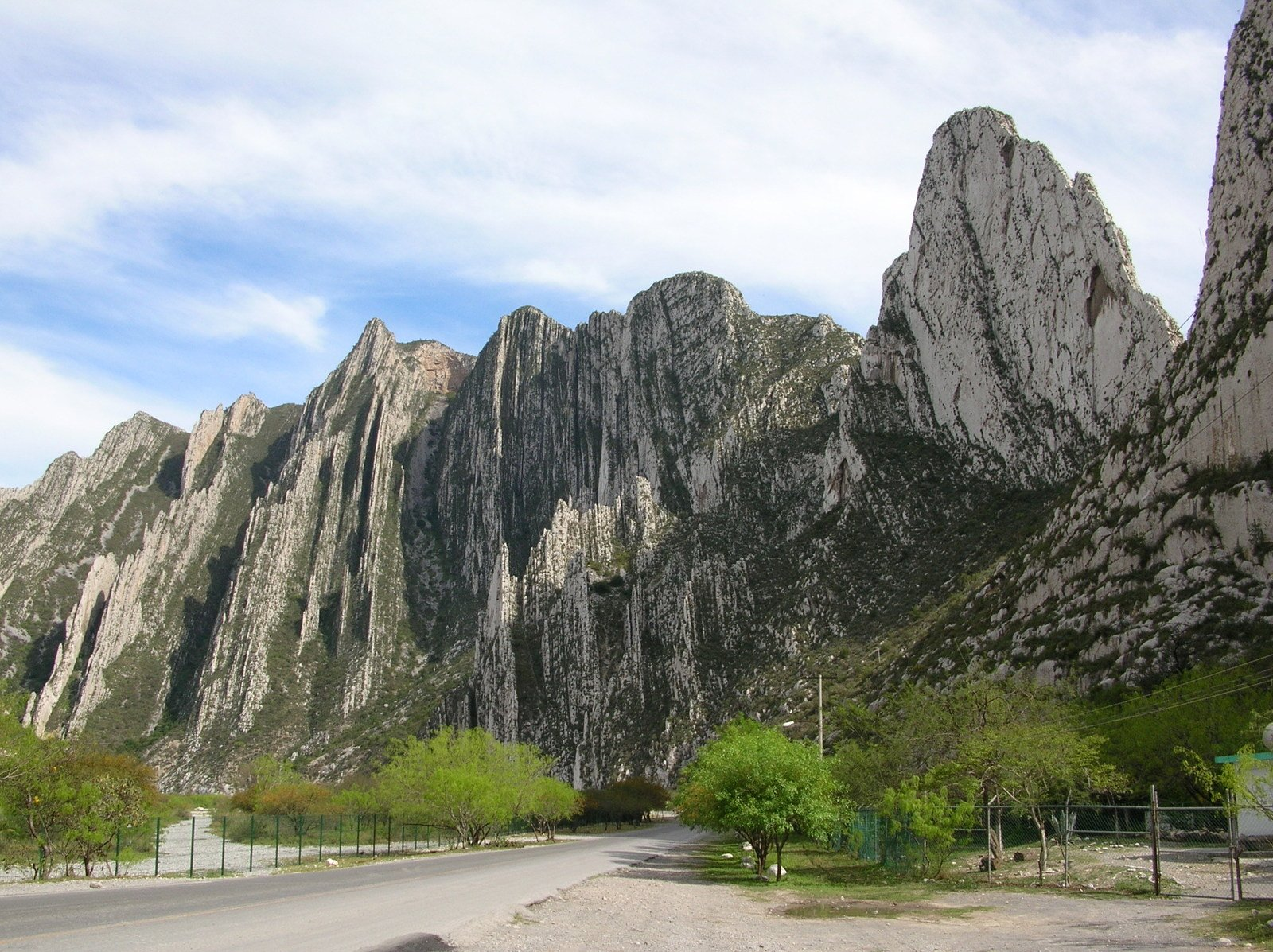
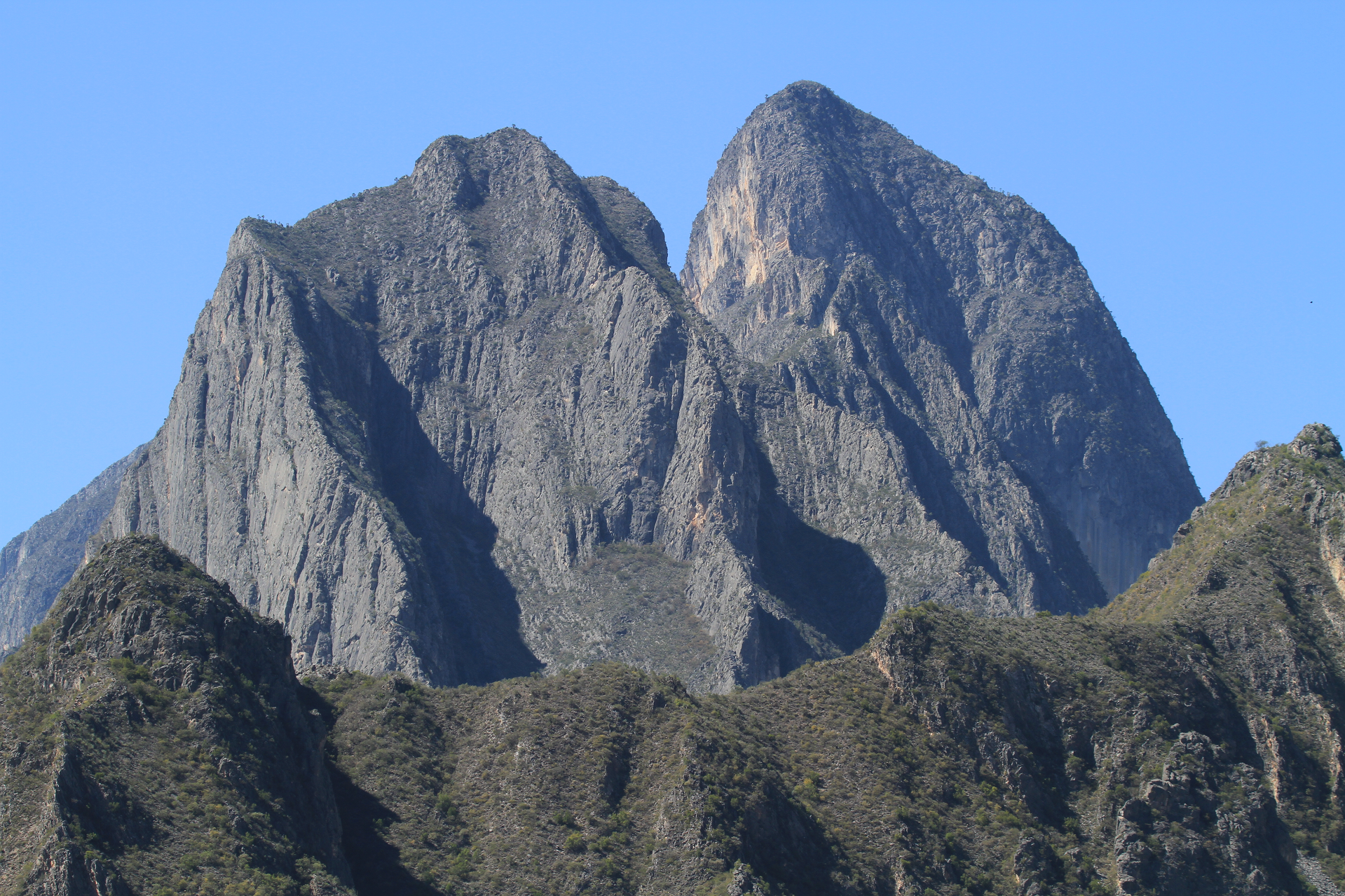
Canon de la Huasteca Region


![]()
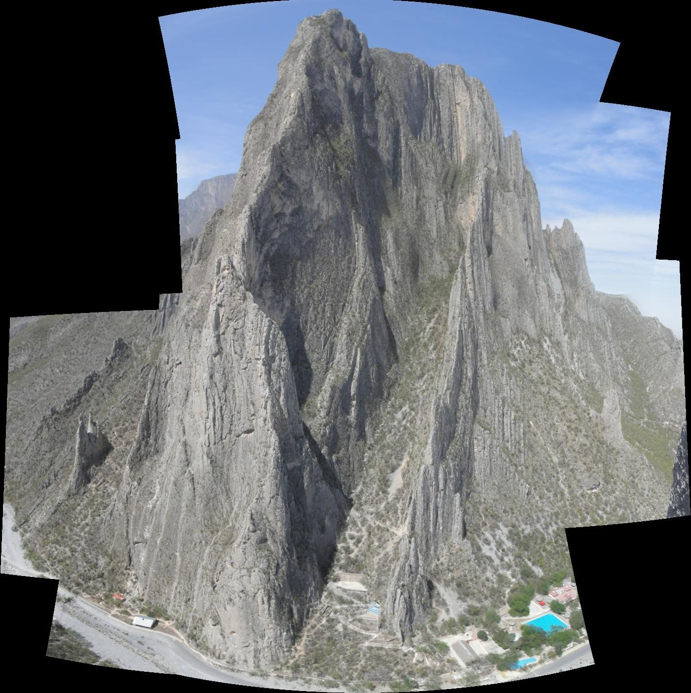
Parque La Huasteca is a municipal park in Monterrey, Mexico. It was first established by president Lázaro Cárdenas in November 1939, then in October 2006, it was declared a UNESCO Biosphere Reserve. It is part of the Sierra Madre Oriental mountain range, and its part of the Huasteca Region, from where it derives its name. It is a natural canyon formed by the Santa Catarina River. Being around 200 hectares.[1] It also has the highest precipitation of the state, Nuevo Leon., and is home to La Presa Rompepicos. The canyon is mostly conformed of limestone, reaching heights of over 550 meters. This limestone comes from the Late Jurassic, nearly 161 million years ago. Though the formation of the mountain itself was during the Laramide orogeny, around 40 to 20 million years ago.[2][3] Having nearly 400 bolted routes with grades from 5.4 to 5.14, and no entrance fee for most climbing areas, it has become a very popular site for climbers.
History
In 1939, Parque La Huasteca was established by then president Lázaro Cárdenas.
In 1954 Federico Ramírez García, also known as “Lico”, climbed the first summit of La Huasteca. Today that summit is known as “Pico Lico” in his honor. Pico Lico is nearly 70 meters high.
In 1957 the most famous peak in La Huasteca was conquered by a climbing club called Pirineos, hence the autonomous name of the peaks “Los Pirineos”.
In 1960 the West Face was first climbed: Alberto Perez from Pirineos climbed almost all the route except the last 60 meters, then a couple of friends threw him a rope from above to complete the climb. The first person to climb the West Face without any assistance was Juan de Dios De Leon Camero. Others followed, conquering more summits and bolting some routes.
It the late 1980s and 1990s, sport climbing began with Francisco Medina, and Andres Medina, two brothers and students of the Juan de Dios climbing school. They bolted and climbed the hardest routes in La Huasteca, Veneno and El Sueño que de Niño, both 5.13c.
In the 2000s climbing became more popular, when the Universidad de Monterrey and the ITESM, two well-recognized universities, started giving climbing courses at La Huasteca.
In 2005, the first guidebook was written by Ramón Narváez, a local climber. The area appears in the larger English-Spanish Guía de Escalada en México (Zona Norte), using the exact drawings and contents of the original Huasteca guidebook without permission from the author.
In 2006, it was declared a UNESCO Biosphere Reserve.[2]
This article uses material from the Wikipedia article La Huasteca (climbing area), which is released under the Creative Commons Attribution-Share-Alike 4.0 International License (view authors).
 |  |
 |  |
 |  |

![]()
 I | 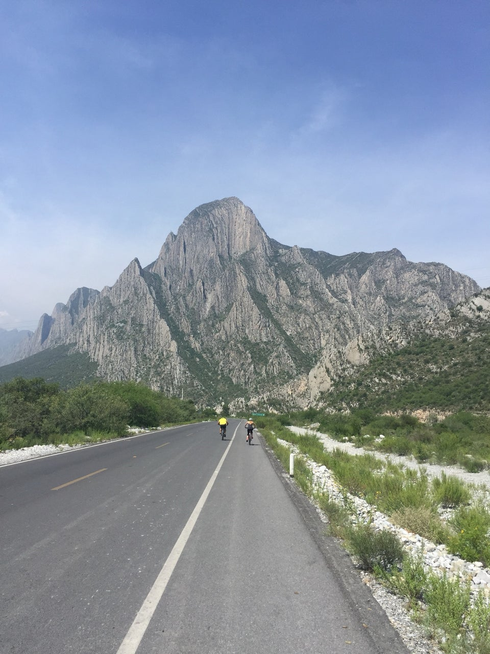 Dani G |
![]()
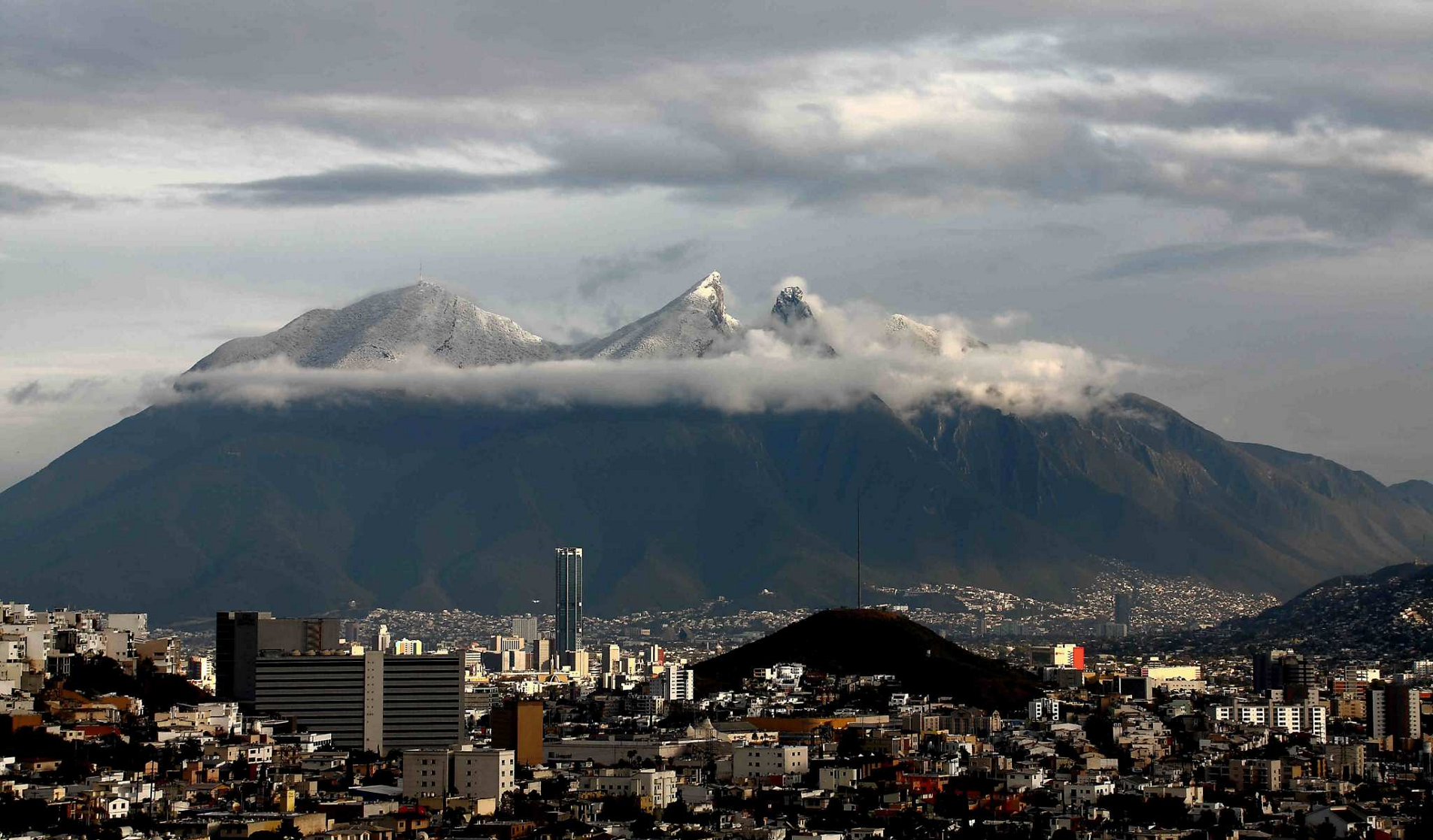
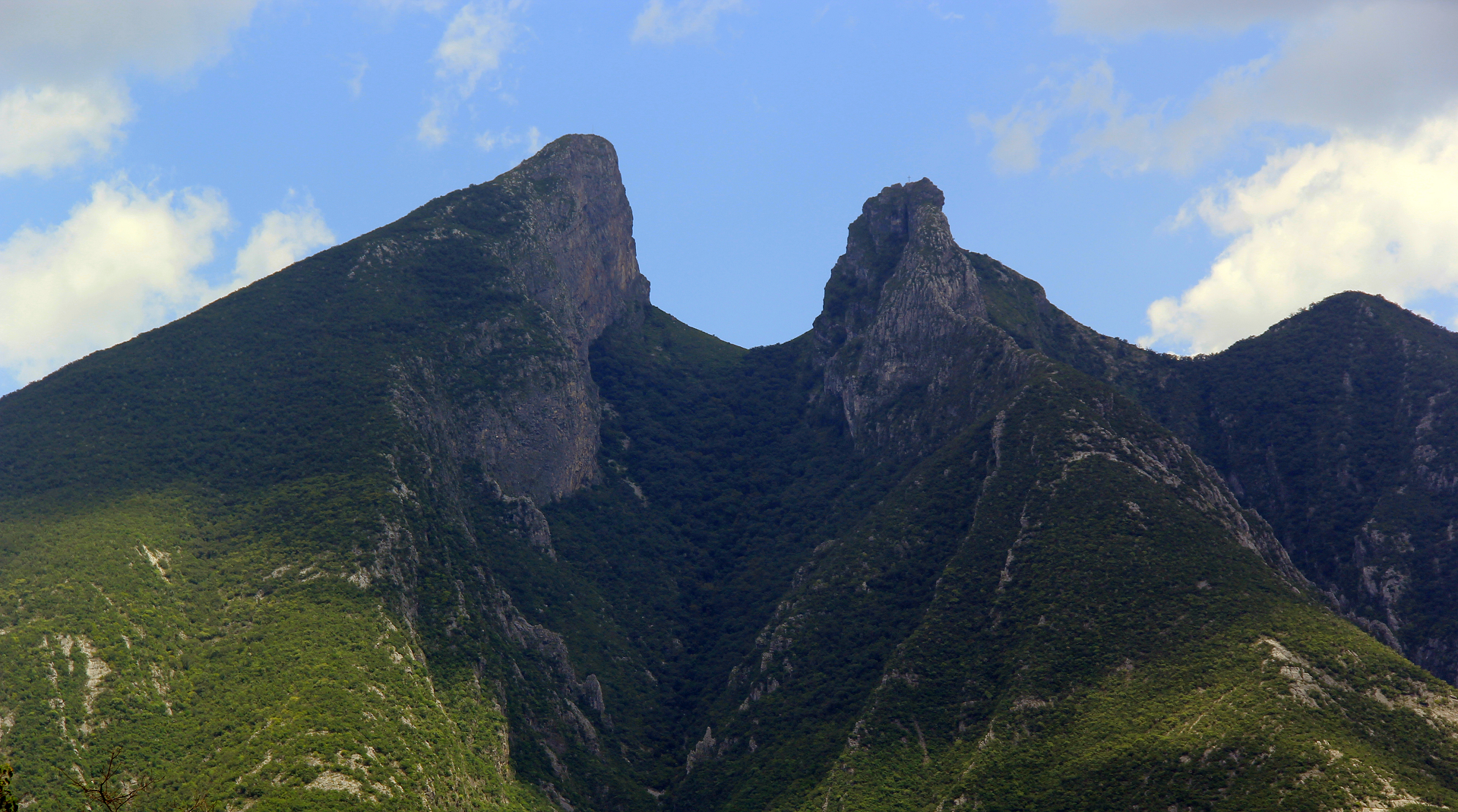
The Cerro de la Silla (“Saddle Hill”) is a mountain and natural monument, It is part of the foothills system of the Sierra Madre Oriental. It is found covering territorial parts of the municipalities of Guadalupe (31.62%), Monterrey (13.23%) and Juárez (55.15%), in the state of Nuevo León,[1][2] and constitutes an icon of the city of Monterrey and a symbol for the people of Monterrey.
It covers an area of 60.5 square kilometres (23 mi2). The mountain has four peaks: Pico Antena, Pico Norte, Pico Sur and Pico la Virgen; Pico Norte (North Peak) is the highest at 1,820 m (5,970 ft) while Pico la Virgen (Virgin’s Peak) is the lowest at 1,750 m (5,740 ft).
Set aside as a natural monument by the Mexican government in 1991, the mountain, or hill, as mountains are often referred to in Mexico, is a popular recreational area and is often climbed by hikers who take a 5.3 km (3.3 mi) trail to reach the top. The ascent is considered to be fairly difficult, taking approximately 3 hours to complete. A panoramic view of the city of Monterrey can be seen from the top.
In the second half of the 20th century, an aerial tramway (Teleférico en Monterrey) was built on the north side of the mountain to give a fastest access to the iconic mountain for the population.[3] The day of its inauguration on June 2, 1961, was also the day of its closure, as a tragic accident took the lives of five people, including the engineer Jesús Fernández, its designer. Only the upper station remains of the tramway. Several plans have been announced to rebuild another tramway with no results.[citation needed]
Some other known mountains or elevations of the zone are: Cerro de las Mitras, the Sierra Madre Oriental with the Cerro de Chipinque —the M-shaped figure visible from various parts of the city—, the Cerro del Topo Chico, Cerro del Obispado, Cerro de la Loma Larga and La Huasteca.
This article uses material from the Wikipedia article Cerro de la Silla, which is released under the Creative Commons Attribution-Share-Alike 4.0 International License (view authors).
 |  |
 Cvmontuy (Wikipedia) I | 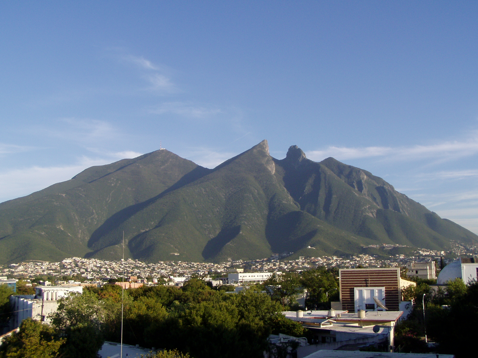 Nathaniel C. Sheetz (Wikipedia) |
![]()
 Panza Rayada (Wikipedia) |
![]()
![]()
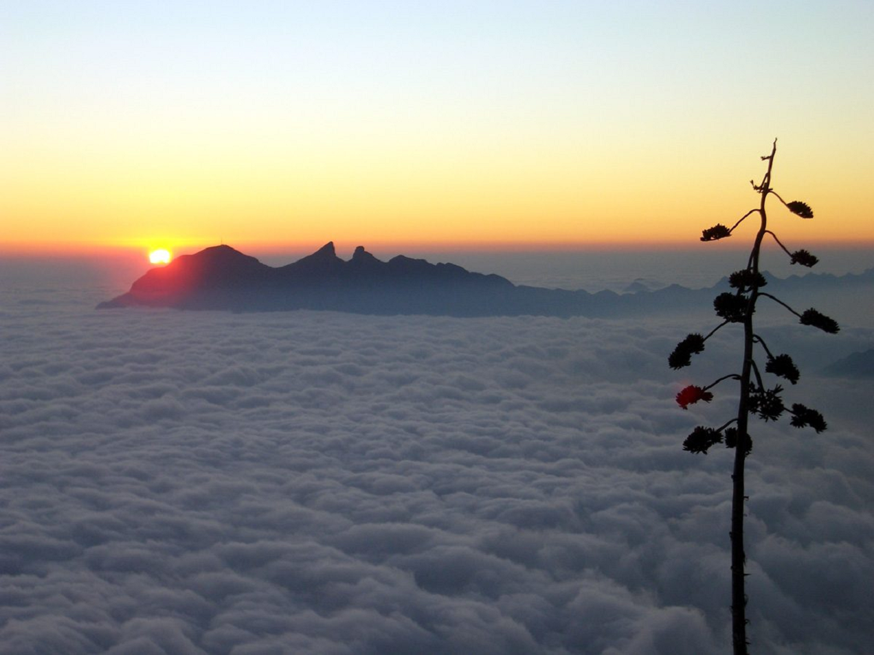
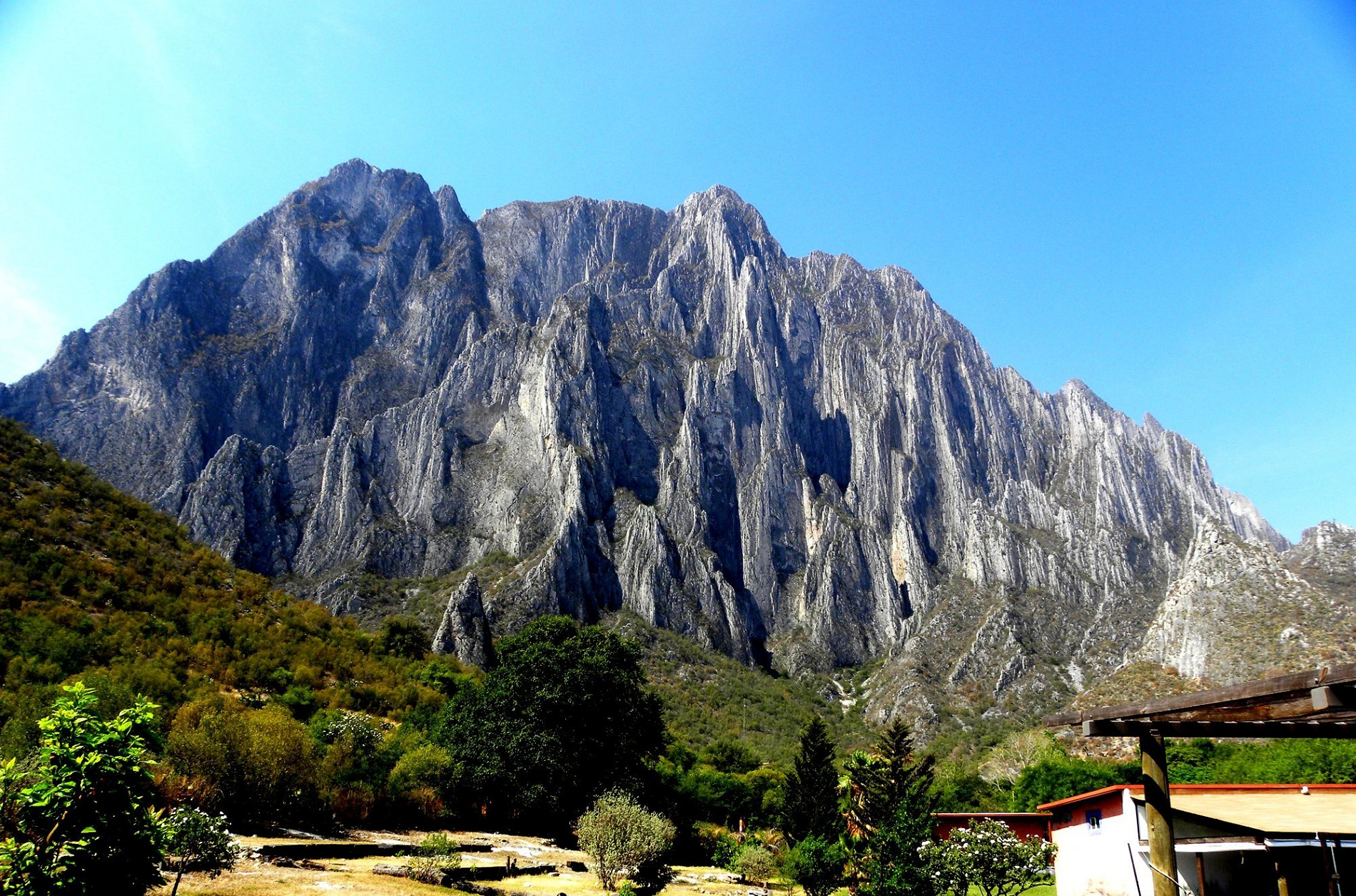
El Sendero Luminoso
El Sendero Luminoso is the name of a big wall climbing bolted route at El Potrero Chico, Nuevo León, Mexico that rises over 1500 ft (~450 m) up the front side of El Toro mountain. It is one of the hardest big wall routes in the area and 11 of its 15 pitches are graded at over 5.12 (7b/+). The route was established by Jeff Jackson, Kurt Smith, and Pete Peacock and is graded 5.12+ V overall.
On January 15, 2014, Alex Honnold became the first person to free solo the route, taking just over three hours.[2] On November 27, 2019, the American rock climber Brad Gobright fell approximately 300 meters to his death while descending from the route with his climbing partner, Aidan Jacobson, who fell between 20 and 30 meters but survived.[3][4]
This article uses material from the Wikipedia article El Sendero Luminoso, which is released under the Creative Commons Attribution-Share-Alike 4.0 International License (view authors).
 Daniel De Regil | 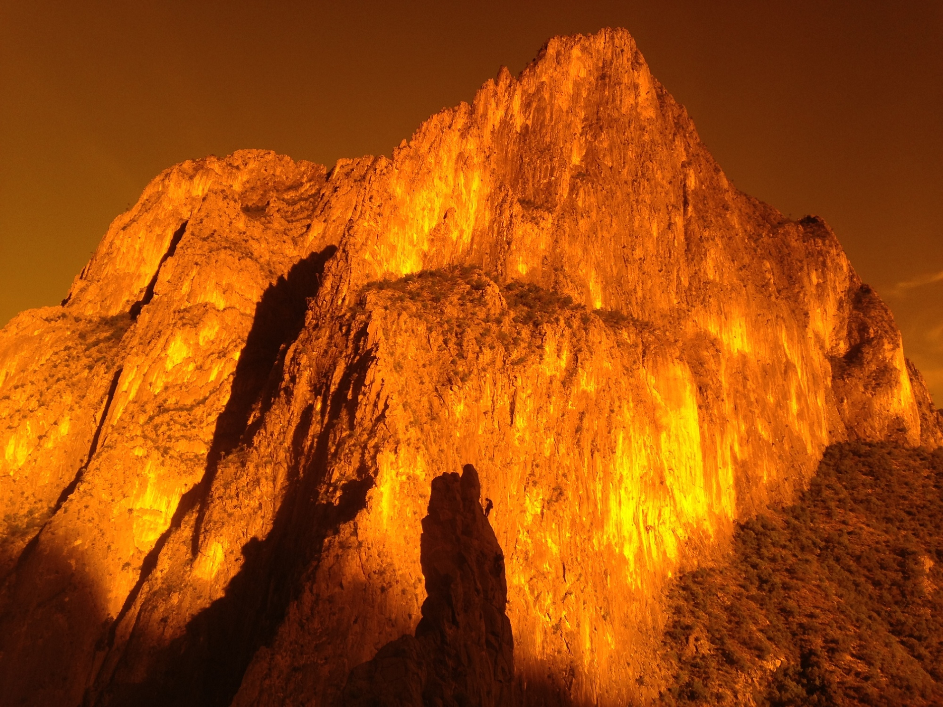 Marcus Floyd |
 Paul-B | 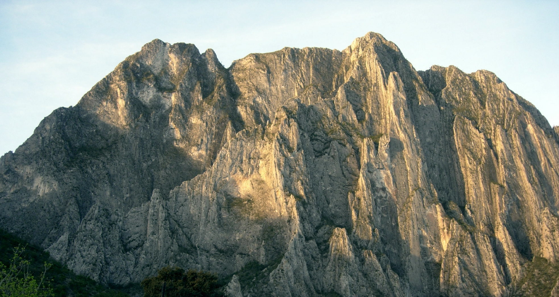 Grizz Burton |
