
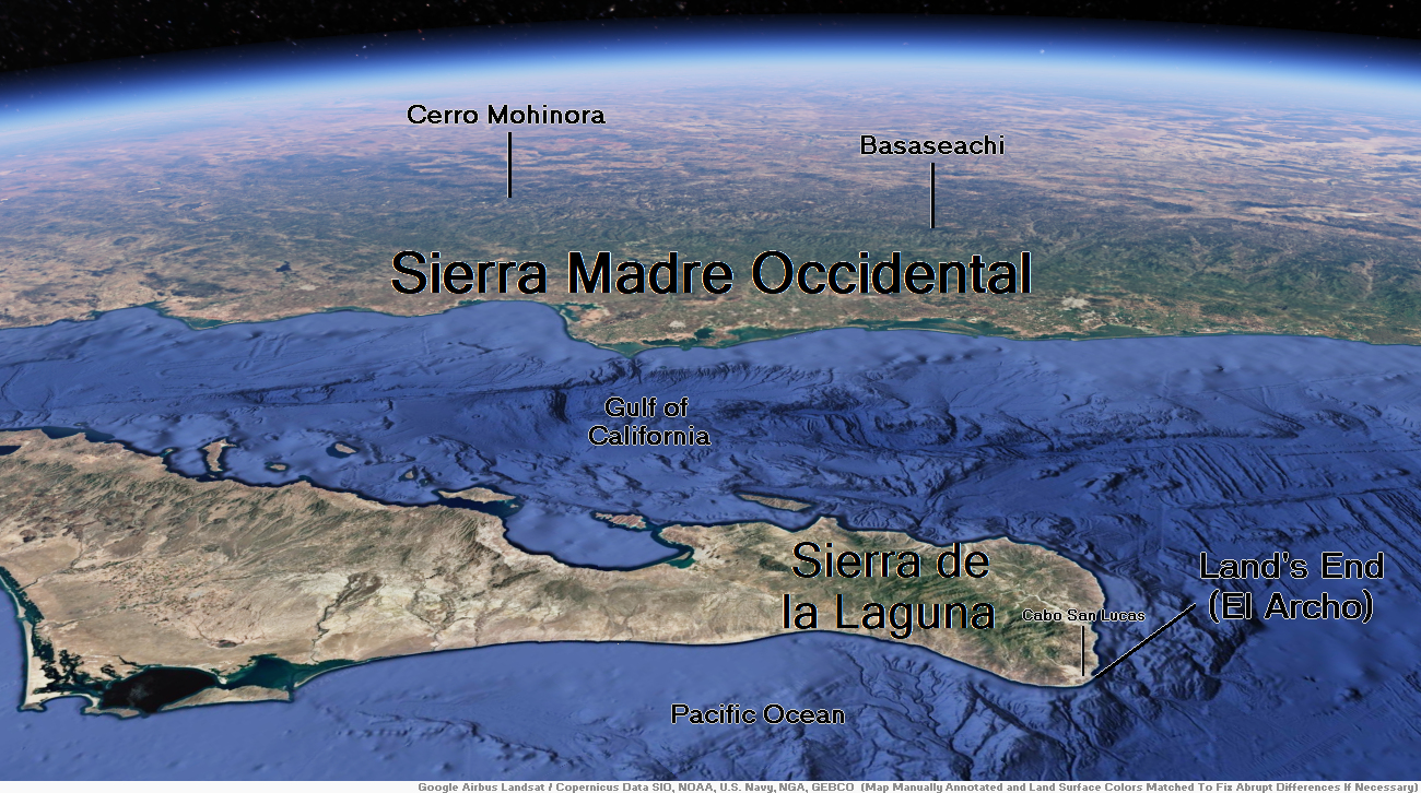
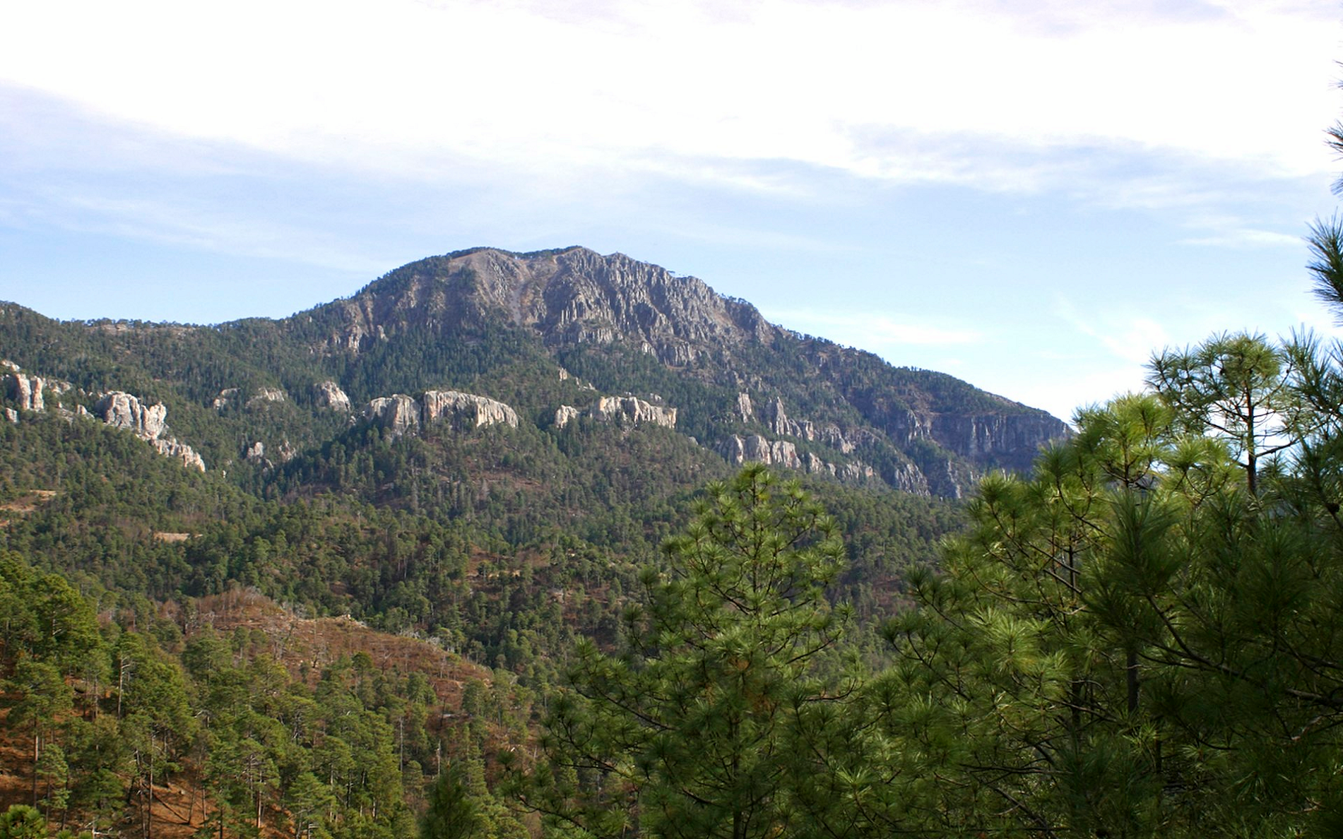
Map of Sierra Madre Occidental


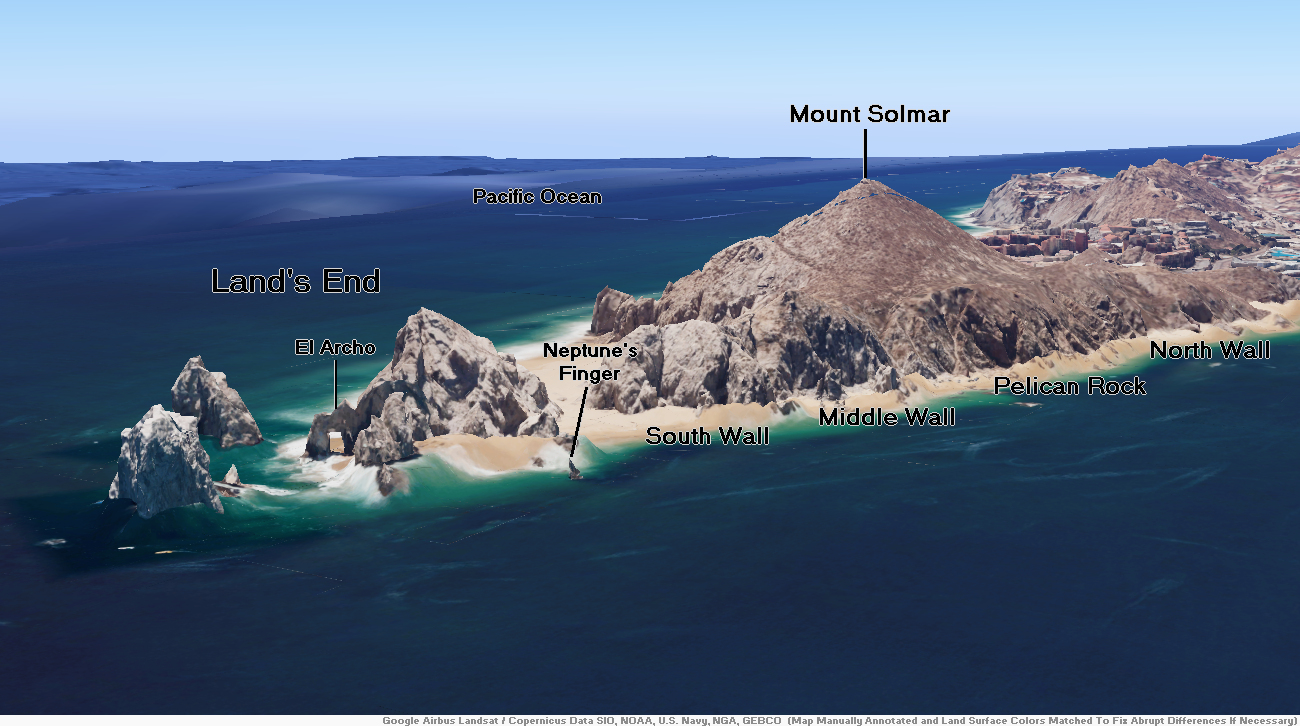
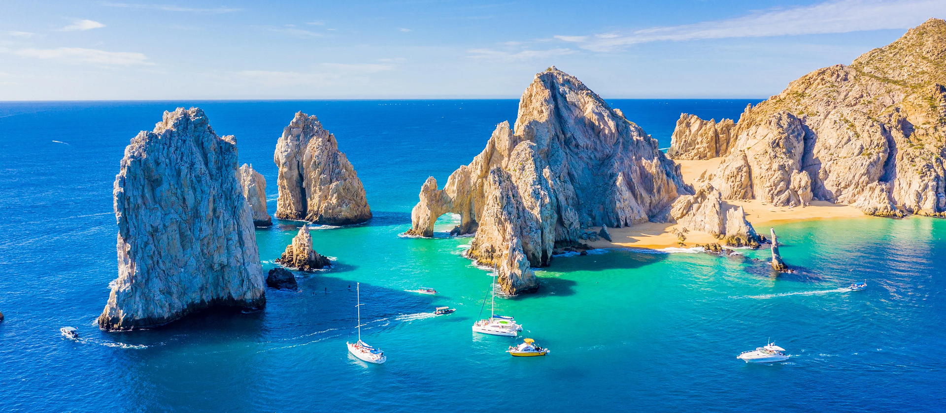
Land’s End Region

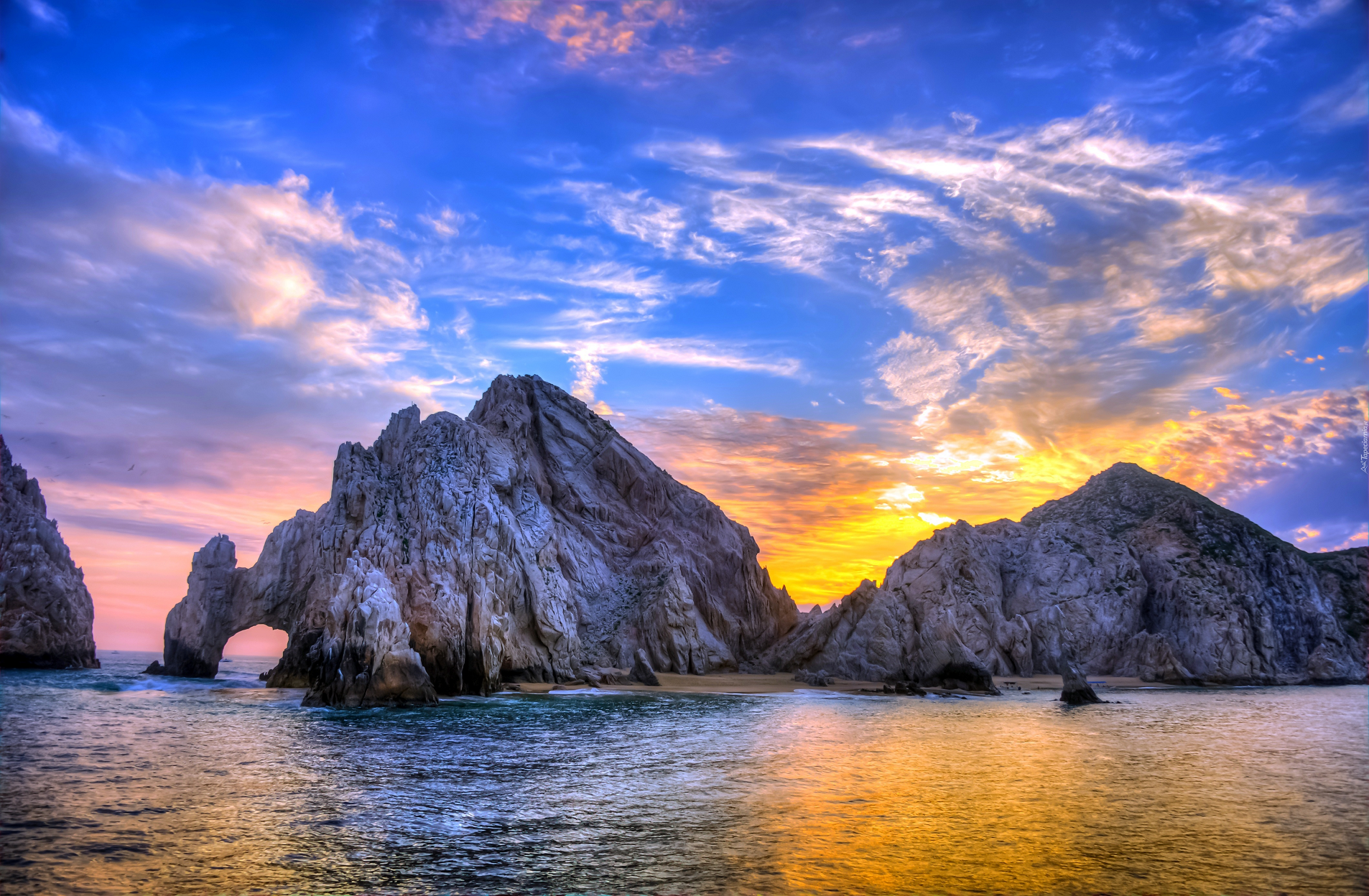
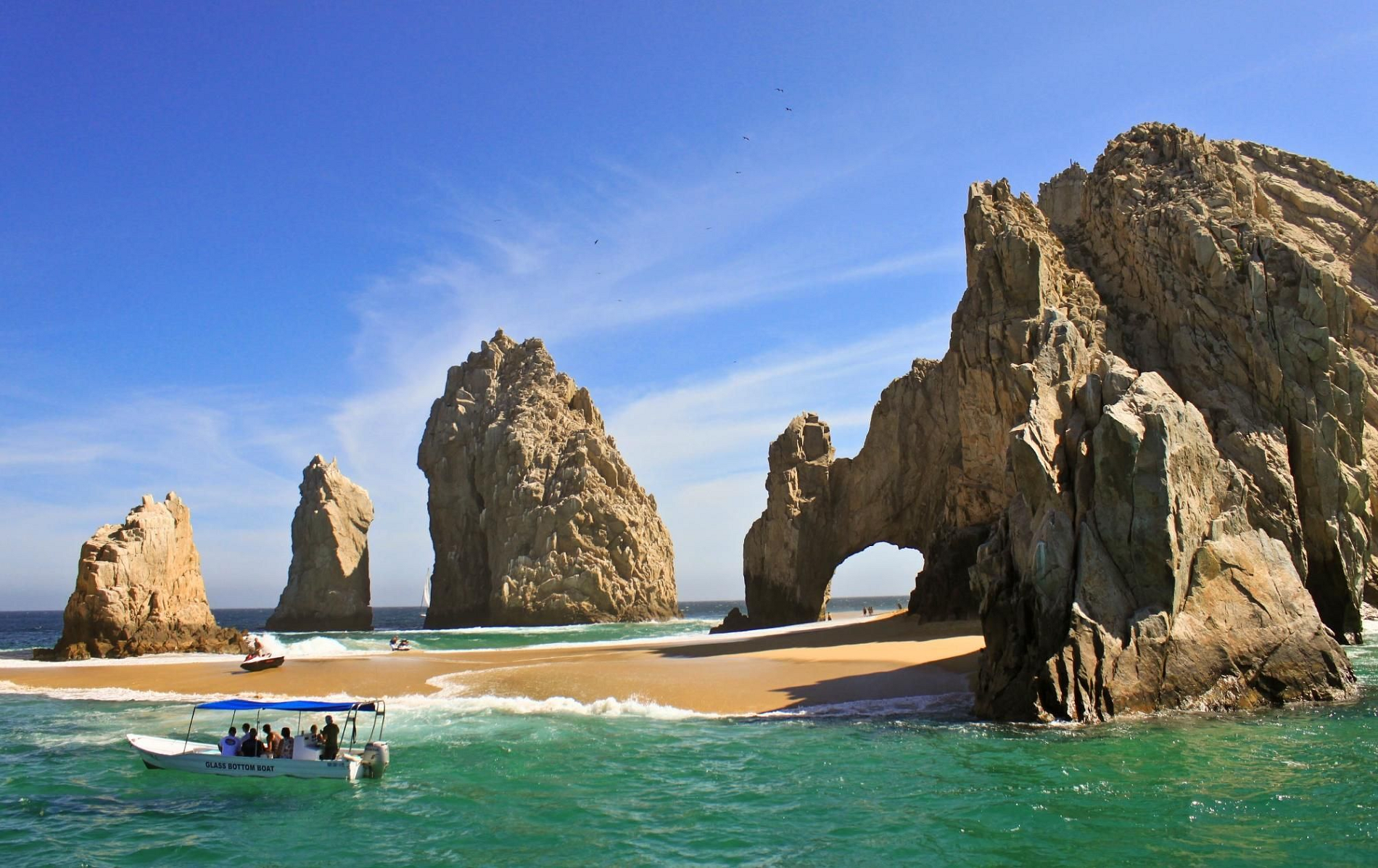
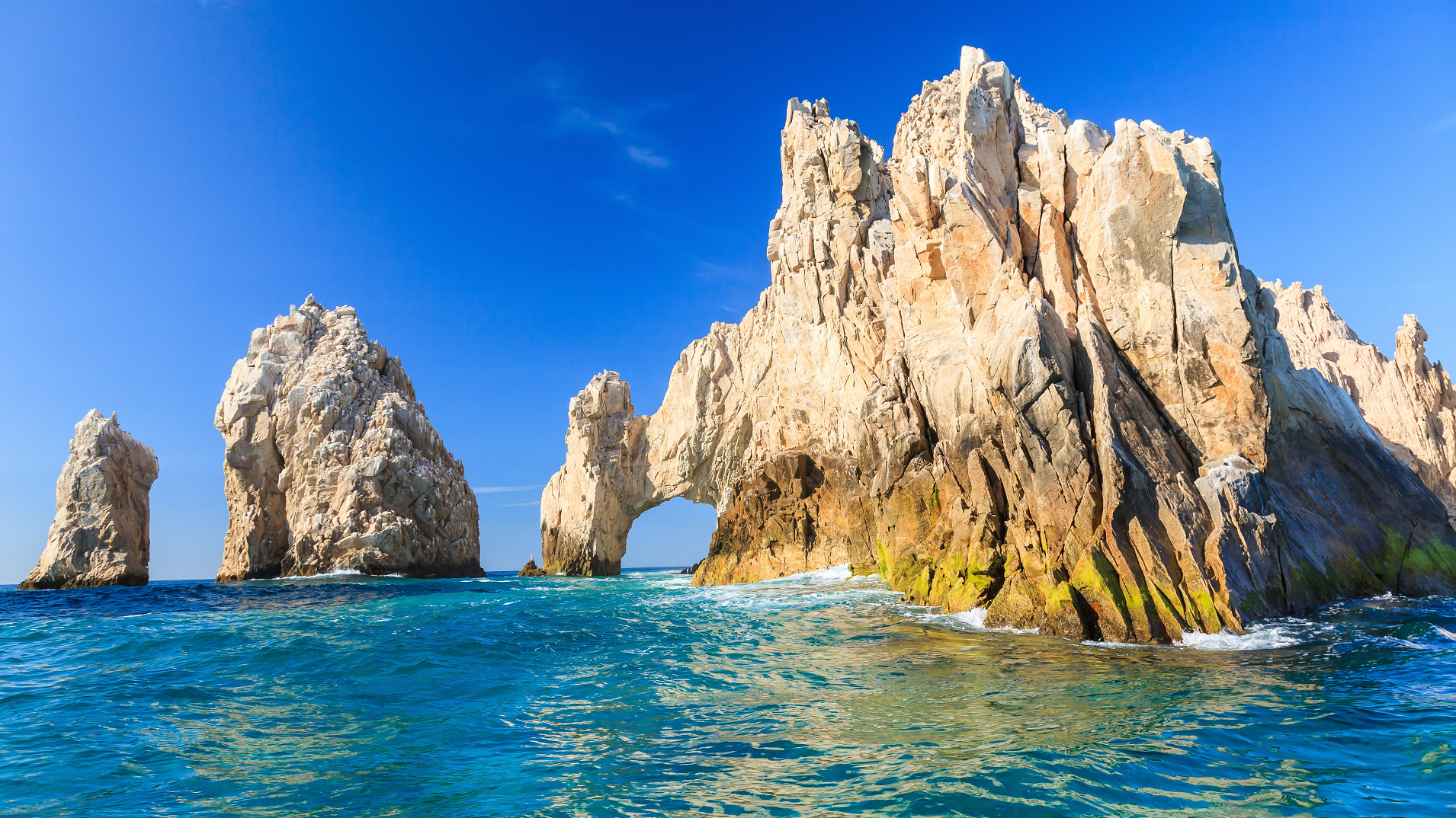
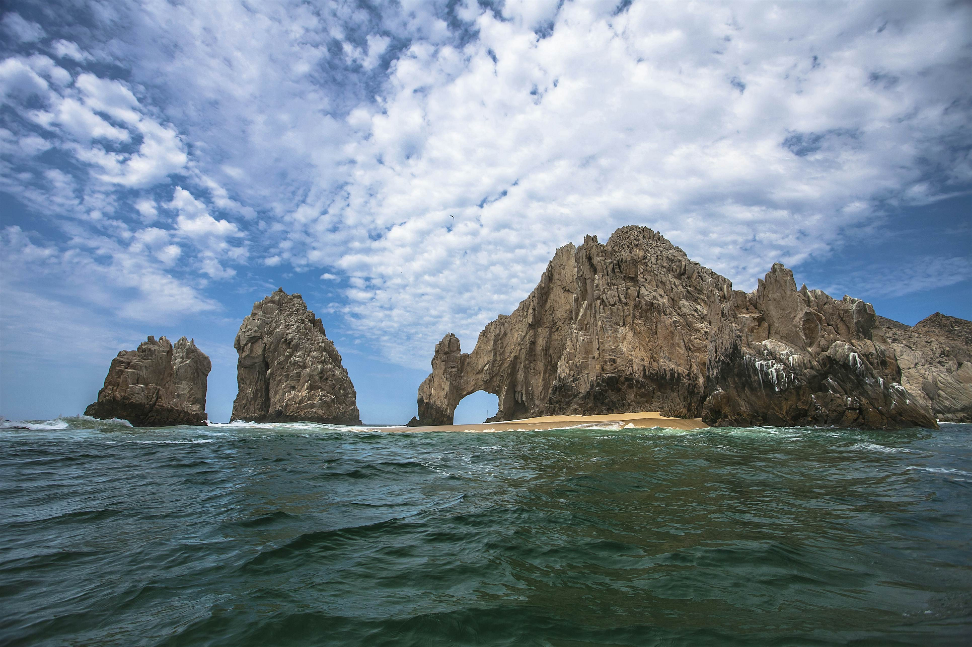
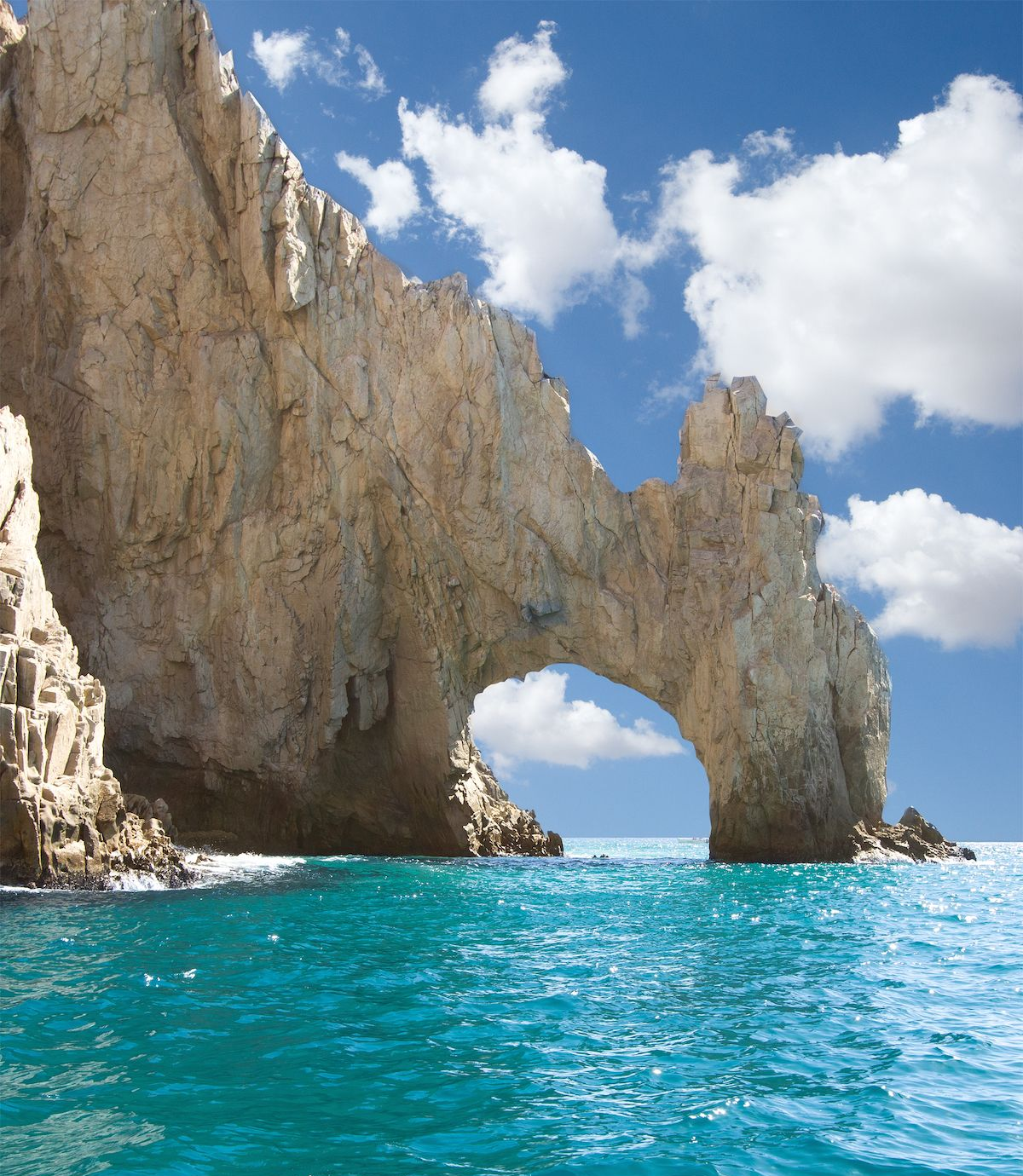
Arch of Cabo San Lucas
The arch of Cabo San Lucas is a distinctive granitic rock formation at the southern tip of Cabo San Lucas, which is itself the extreme southern end of Mexico‘s Baja California Peninsula.[1] The arch is locally known as “El Arco,” which means “the arch” in Spanish, or “Land’s End.”[2] It is here that the Pacific Ocean becomes the Gulf of California.
This area is widely used in hotel advertising in the Los Cabos Corridor. This spot is a popular gathering area for sea lions and is frequented by tourists.[3] The Arch of Cabo San Lucas is adjacent to Lovers Beach on the Sea of Cortez side and Divorce Beach on the rougher Pacific Ocean side.[2]
Access
The Arch is accessible by land or boat from the beach of the last hotel on the Pacific. Access to the arch requires climbing large rocks.[2][3][4] Entering the arch in a small watercraft can be somewhat dangerous when the sea is running. The water level can significantly go up and down. Being close to the sides of the arch is not recommended.
Geology
Basement rock in Los Cabos formed through intrusive igneous processes c. 115 million years ago, during the Cretaceous period.[5] The arch is three stories tall and was formed from natural erosion.
This article uses material from the Wikipedia article Arch of Cabo San Lucas, which is released under the Creative Commons Attribution-Share-Alike 4.0 International License (view authors).
 |  |
 |  |
 |  |
Basaseachic Falls
Basaseachic Falls (Spanish: Cascada de Basaseachi) on the Basaseachic River is the second-highest waterfall in Mexico, located in the Parque Nacional Basaseachic (Basaseachic Falls National Park) at Cañón Basaseachic in the Copper Canyon region of northwest Mexico, near Creel, Chihuahua. It is 246 meters (807 ft) tall, second in Mexico only to the Cascada de Piedra Volada (Flying Stone Falls).
Basaseachic Falls is located in the high mountains of the Sierra Madre Occidental, in the Municipality of Ocampo, 3 km (1.9 mi) from Basaseachi community and about 265 km (165 mi) west of Chihuahua.[1] It is reached via Federal Highway 16 and its surroundings make up the Basaseachic Falls National Park (Parque Nacional Cascada de Basaseachic).
The waterfall is made by two streams, Arroyo del Durazno and Arroyo de Basaseachic, which merge in the high mountains and then fall down the canyon wall. Past the falls, the stream is called Río Candameña (Candameña River), which is the namesake of the canyon it flows through, Candameña Canyon (Cañón Candameña). The Candameña River is a tributary of the Río Mayo (Mayo River).
Basaseachic Falls was considered the tallest waterfall in México until the measurement in September, 1994 of the Cascada de Piedra Volada. Both of these waterfalls are seasonal, drying up in the Spring and Autumn dry seasons.
This article uses material from the Wikipedia article Basaseachic Falls, which is released under the Creative Commons Attribution-Share-Alike 4.0 International License (view authors).
 Yampu Tours | 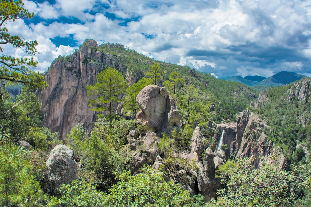 I |
Cerro Mohinora is an extinct volcano that is part of the Sierra Madre Occidental mountain range in the Mexican state of Chihuahua located in the municipality of Guadalupe y Calvo. Cerro Mohinora is the highest point in the state of Chihuahua reaching an elevation of 3,300 m (10,827 ft) above sea level. The climate of the mountain is extremely cold in the winter and temperate to semi-cold in the summer.
Geology
The mountain began to form during Paleogene geologic period characterized by intense volcanic activity in the area throwing lava and ash onto the surrounding plateau and creating the Sierra Madre Occidental. Cerro Mohinora was raised to an elevation over 3,300 m above sea level during the Pleistocene by intense tectonic activity. The mountain is mainly composed of igneous rock.
Climate
Using the Köppen climate classification the climate of the mountain is humid continental climate (Dfb). Summers are cool with temperatures rarely reaching 25 °C (77 °F) and summer lows fall below 10 °C (50 °F) regularly. There are heavy rainstorms from June to October. Winters are very cold with maximum high reaching 0 °C (32 °F) and reaching a maximum low of -31 °C (-24 °F). Winter snowstorms with high winds are common and typically over 1 meter (~3 ft) of snow per season.
Cerro Mohinora Flora and Fauna Protection Area
Cerro Mohinora Flora and Fauna Protection Area was designated in 2015. It covers an area of 91.26 km2, which includes the peak and extends to the north and east.[4]
This article uses material from the Wikipedia article Cerro Mohinora, which is released under the Creative Commons Attribution-Share-Alike 4.0 International License (view authors).
 |
