
Map of Sierra Madre de Chiapas


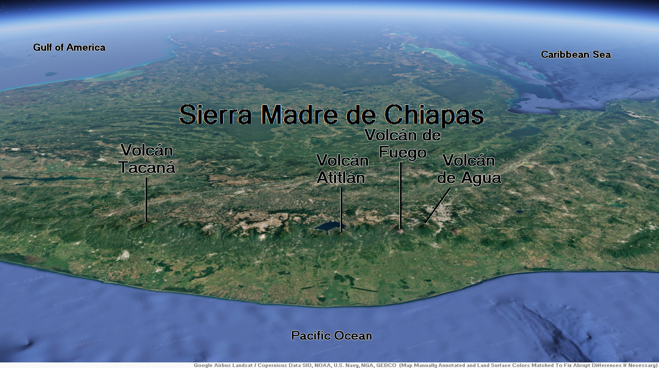
Volcan de Fuego Region


![]()
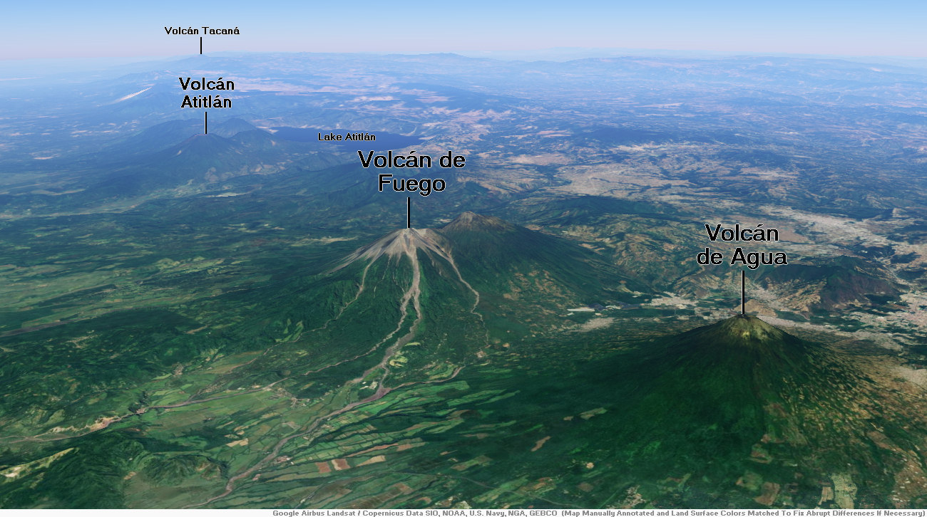
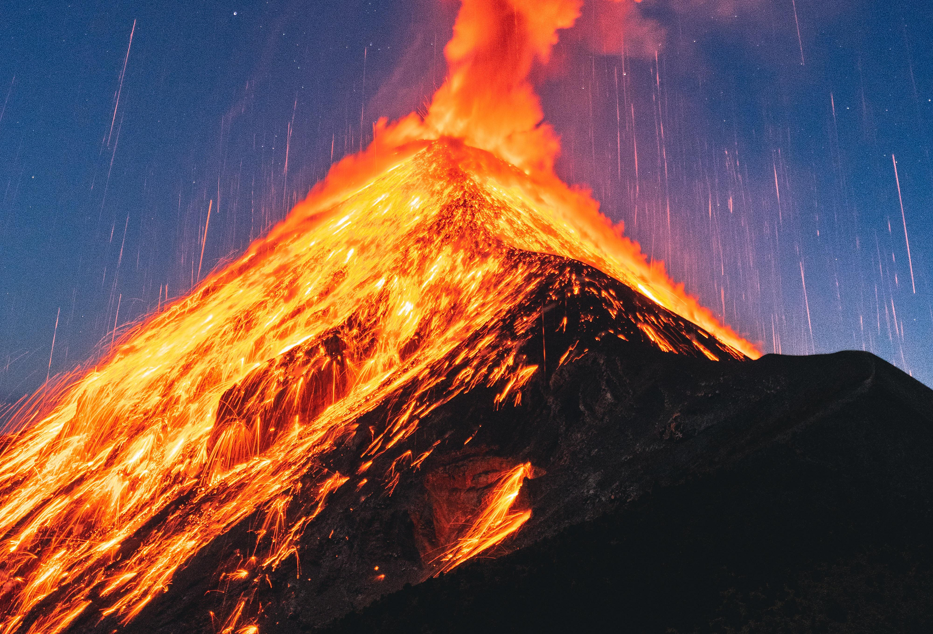
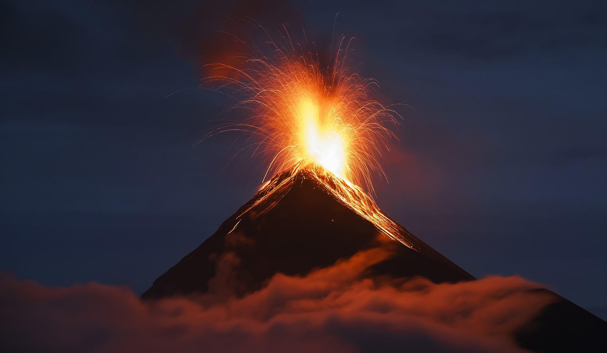
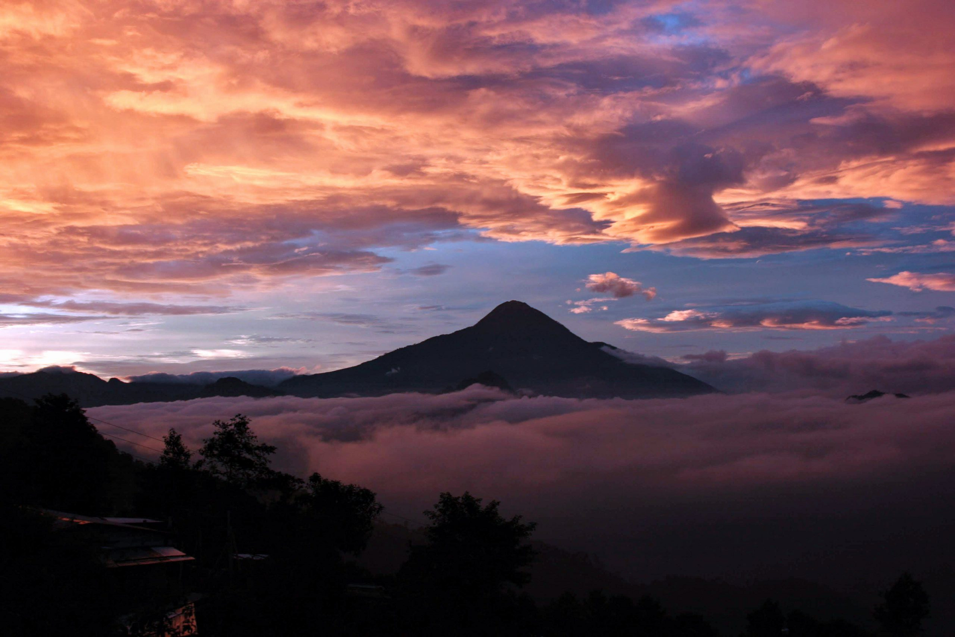
Volcán de Fuego (Spanish pronunciation: [bolˈkan de ˈfweɣo]; Spanish for “Volcano of Fire”, often shortened to Fuego) or Chi Q’aq’ (Kaqchikel for “where the fire is”) is an active stratovolcano in Guatemala, on the borders of Chimaltenango, Escuintla and Sacatepéquez departments.
Part of the mountain range of the Sierra Madre, the volcano sits about 16 kilometres (9.9 mi) west of Antigua, one of Guatemala’s most famous cities and a tourist destination.[2] It has erupted frequently, most recently in June[3][4][5] and November[6][7] 2018, 23 September 2021, 11 December 2022,[8] and 4 May 2023.[9]
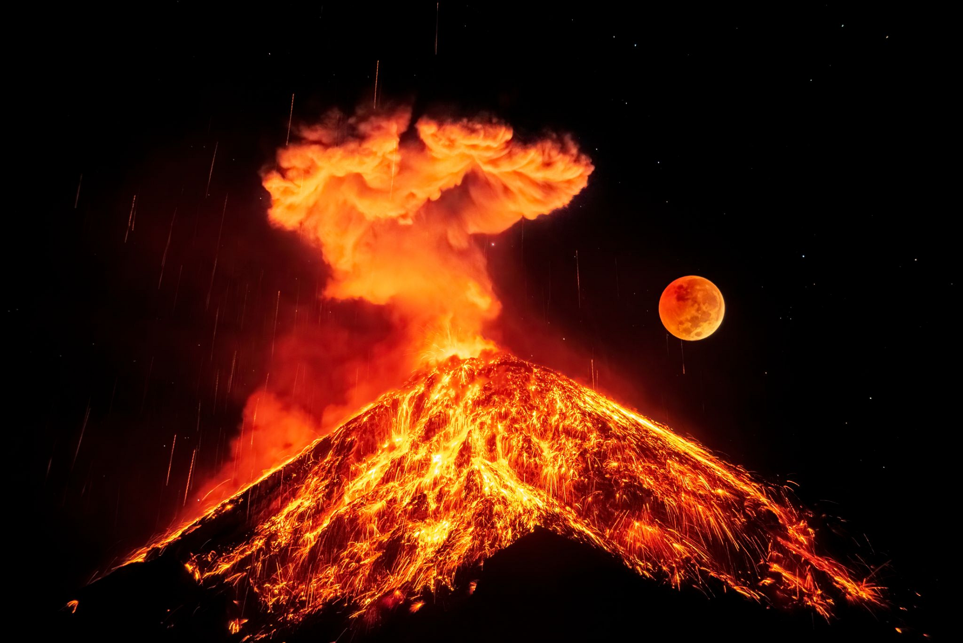
Fuego is famous for being almost constantly active at a low level. Small explosions of gas and ash occur every 15 to 20 minutes, but larger eruptions are less frequent. Andesite and basalt lava types dominate.[10][11]
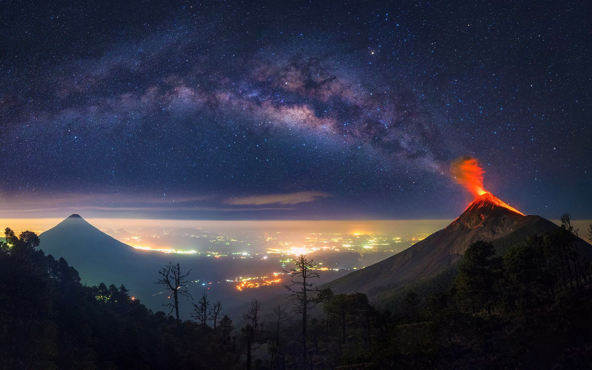
The volcano is joined with Acatenango volcano to its north and collectively the complex is known as La Horqueta. Between Fuego and Acatenango is La Meseta, a scarp marking the remains of an older volcano that collapsed around 8,500 years ago.[12] Fuego volcano started to grow after the collapse of La Meseta.[13]
Early expeditions
In 1881, French writer Eugenio Dussaussay climbed the volcano, then practically unexplored.[14] First, he needed to ask for permission to climb from the Sacatepéquez governor, who gave him a letter for the Alotenango mayor asking for his assistance with guides to help the explorer and his companion, Tadeo Trabanino.[15] They wanted to climb the central peak, unexplored at the time, but could not find a guide and had to climb to the active cone, which had a recent eruption in 1880.[16]
This article uses material from the Wikipedia article Volcán de Fuego, which is released under the Creative Commons Attribution-Share-Alike 4.0 International License (view authors).
 |  |
 I | 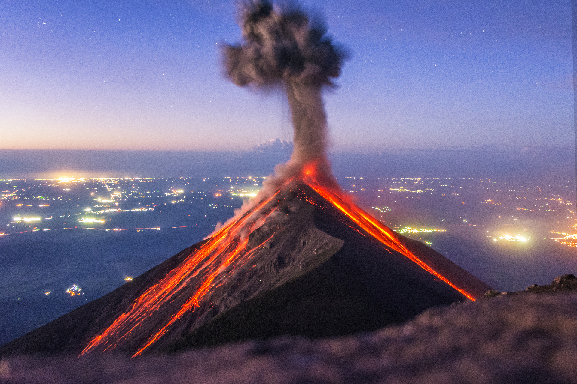 Abel Juarez (iStock) |
 Daniel Jara (iStock) | 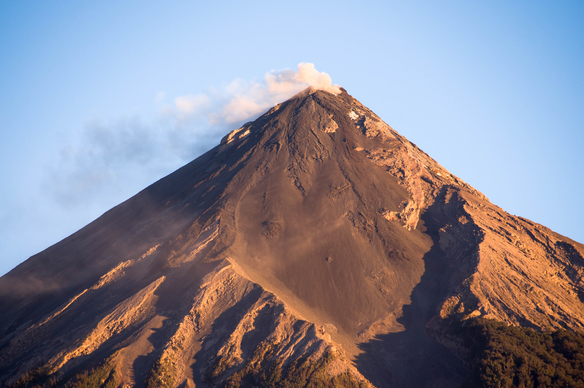 Marco Verch |
 |  |

![]()
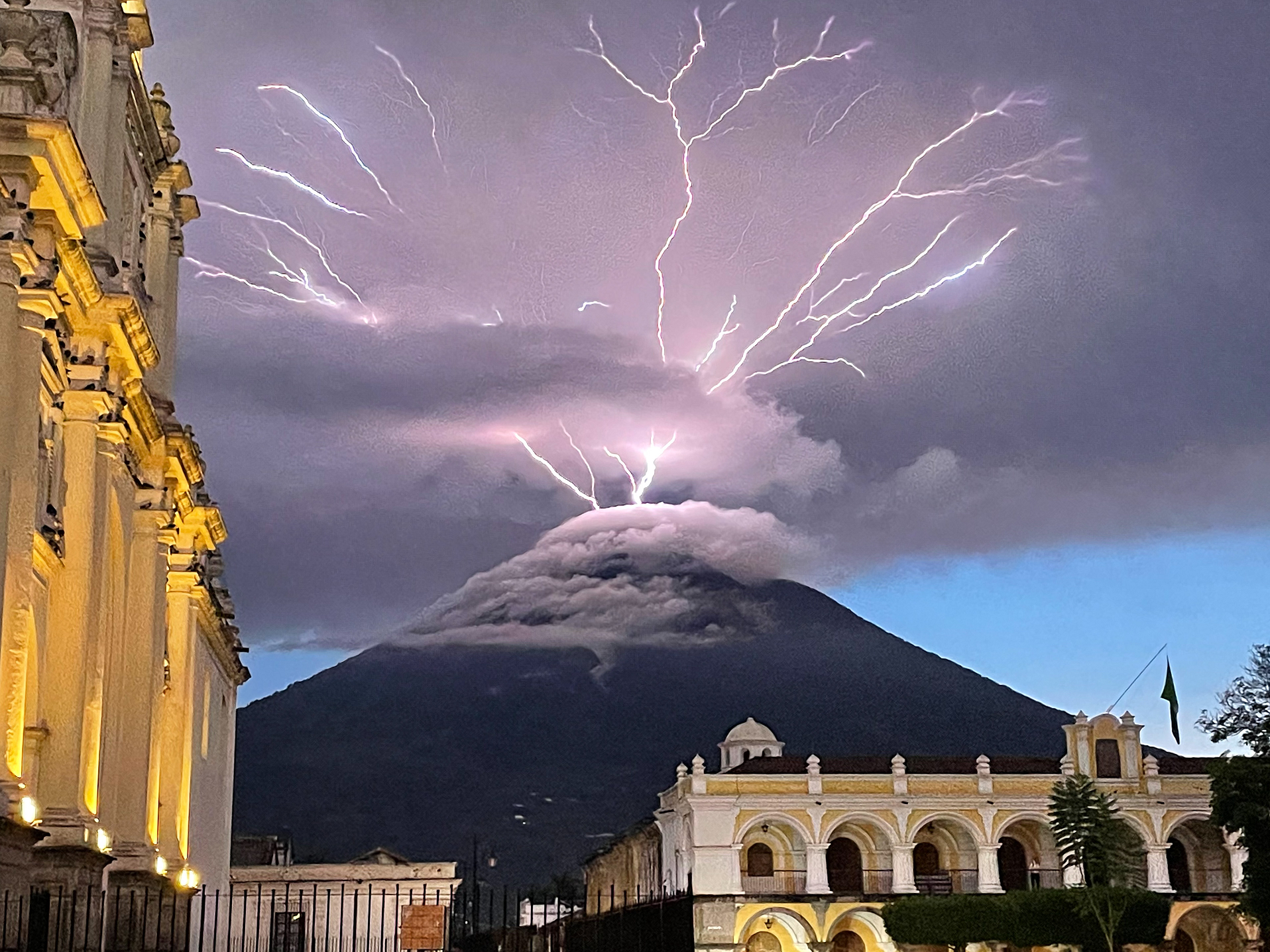
Volcán de Agua (also known as Junajpú by Maya) is an extinct stratovolcano located in the departments of Sacatepéquez and Escuintla in Guatemala. At 3,760 m (12,340 ft), Agua Volcano towers more than 3,500 m (11,500 ft) above the Pacific coastal plain to the south and 2,000 m (6,600 ft) above the Guatemalan Highlands to the north. It dominates the local landscape except when hidden by cloud cover. The volcano is within 5 to 10 km (3.1 to 6.2 mi) of the city of Antigua Guatemala and several other large towns situated on its northern apron. These towns have a combined population of nearly 100,000. It is within about 20 km (12 mi) of Escuintla (population, c. 150,000) to the south.[2] Coffee is grown on the volcano’s lower slopes.
Brief description and history
The local Kaqchikel people have always called the volcano Hunapú “place of flowers” or Jun Ajpu’ “one hunter” (The calendar date for the sacred site; a typical method for naming sacred sites in Mayan cosmovision) in current Kaqchikel orthography.[citation needed] The Spanish conquistadors also called it Hunapú until a lahar from the volcano on September 10, 1541[4] destroyed the original capital of Guatemala (now known as Ciudad Vieja) and the city was moved to Antigua Guatemala following this disaster. Among the casualties was the governor Beatriz de la Cueva.[5] As the lahar produced a destructive flood of water, this prompted the modern name “Volcán de Agua” meaning “Volcano of Water”, in contrast to the nearby “Volcán de Fuego” or “Volcano of Fire”. The Kaqchikels call Volcán de Fuego Chi Gag, which translates to “where the fire is” or Chi Q’aq’ in current Kaqchikel orthography.
The volcano was active in the late Pleistocene between 80,000 and 10,000 years ago,[2] but has not erupted since then.[1] Despite the lack of eruptive activity, the volcano can still produce debris flows and lahars that inundate nearby populated areas.[2] This was proven by the fact that on 11 September 1541, newly founded villa of Santiago de los Caballeros was ruined by a “formidable landslide that came down Volcán de Agua; the mudslide brought along heavy rocks that destroyed part of the buildings and damaged the rest”.[6] The city was destroyed and the survivors had no direction, since governor Beatriz de la Cueva died during the disaster, which took place shortly after her husband, Adelantado Pedro de Alvarado, died and she was appointed governor by the Ayuntamiento (English:City Hall).[7] Beatriz de la Cueva had been beside herself with grief and on 9 September 1541, when she had signed the Cabildo documents, she did so as “la sin ventura” (English: the unlucky one), a phrase that turned out to be prophetic.[8] In the aftermath Beatriz de la Cueva was blamed for the disaster as it was considered to be a godly punishment for her sins. Additionally her fate became a cautionary tale about giving women positions in government particularly when many qualified men were available.[9]
This article uses material from the Wikipedia article Volcán de Agua, which is released under the Creative Commons Attribution-Share-Alike 4.0 International License (view authors).
 Mario Dalma Leon (iStock) |  Librex (Wikipedia) |
![]()
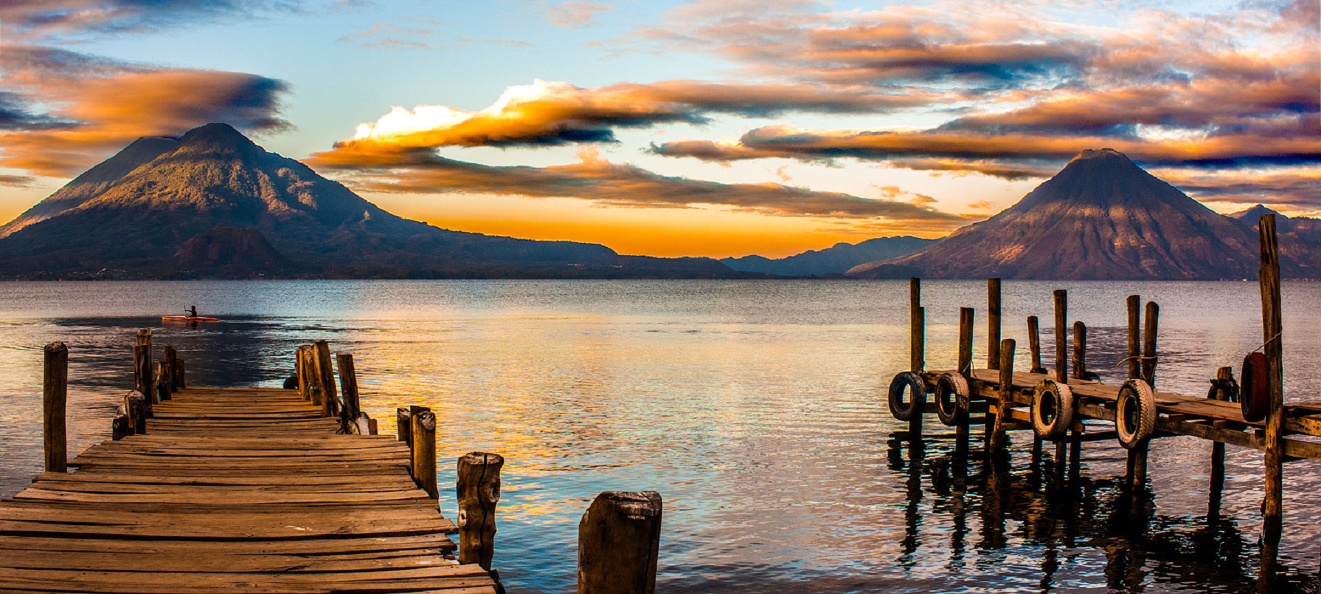
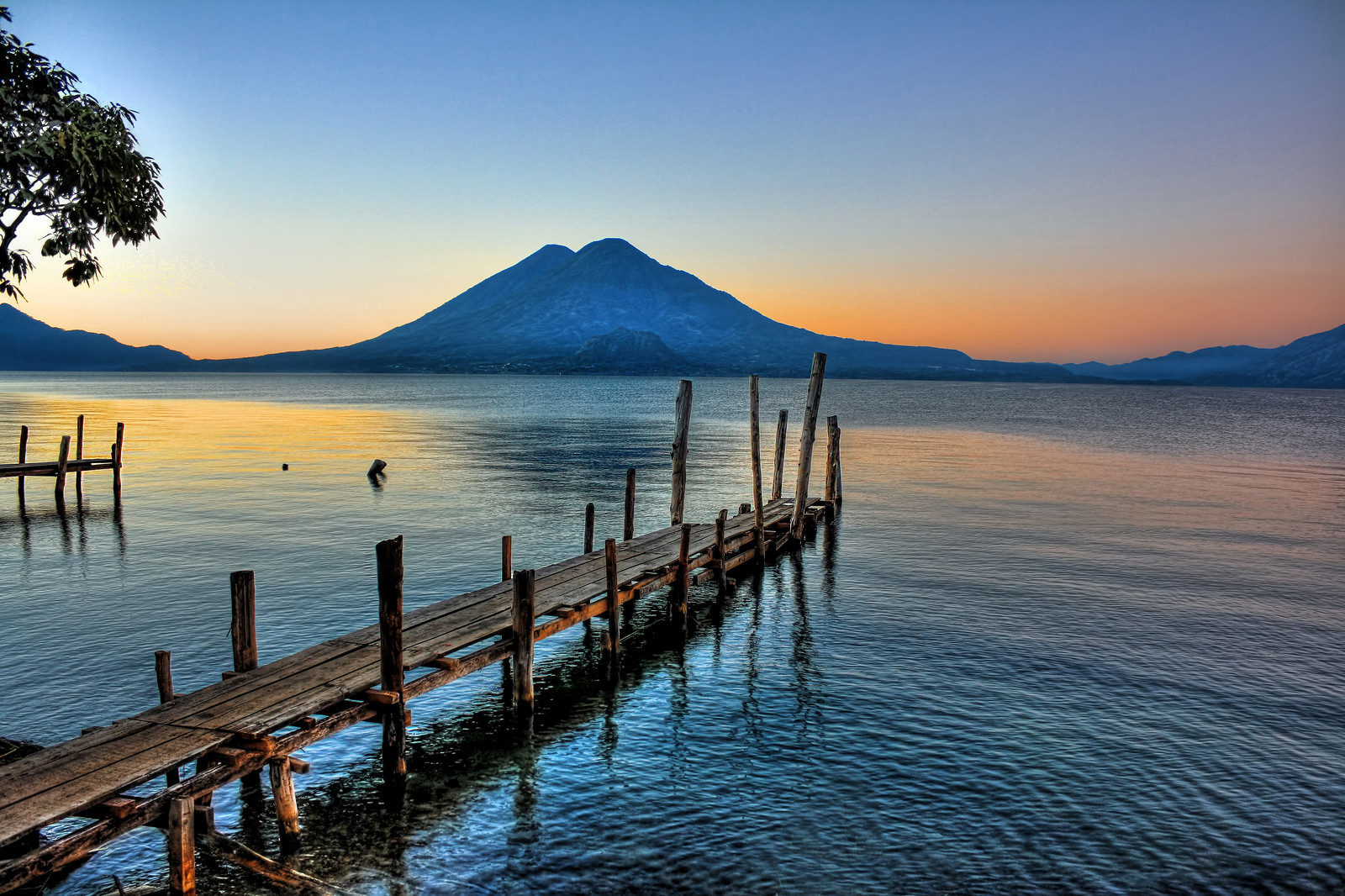
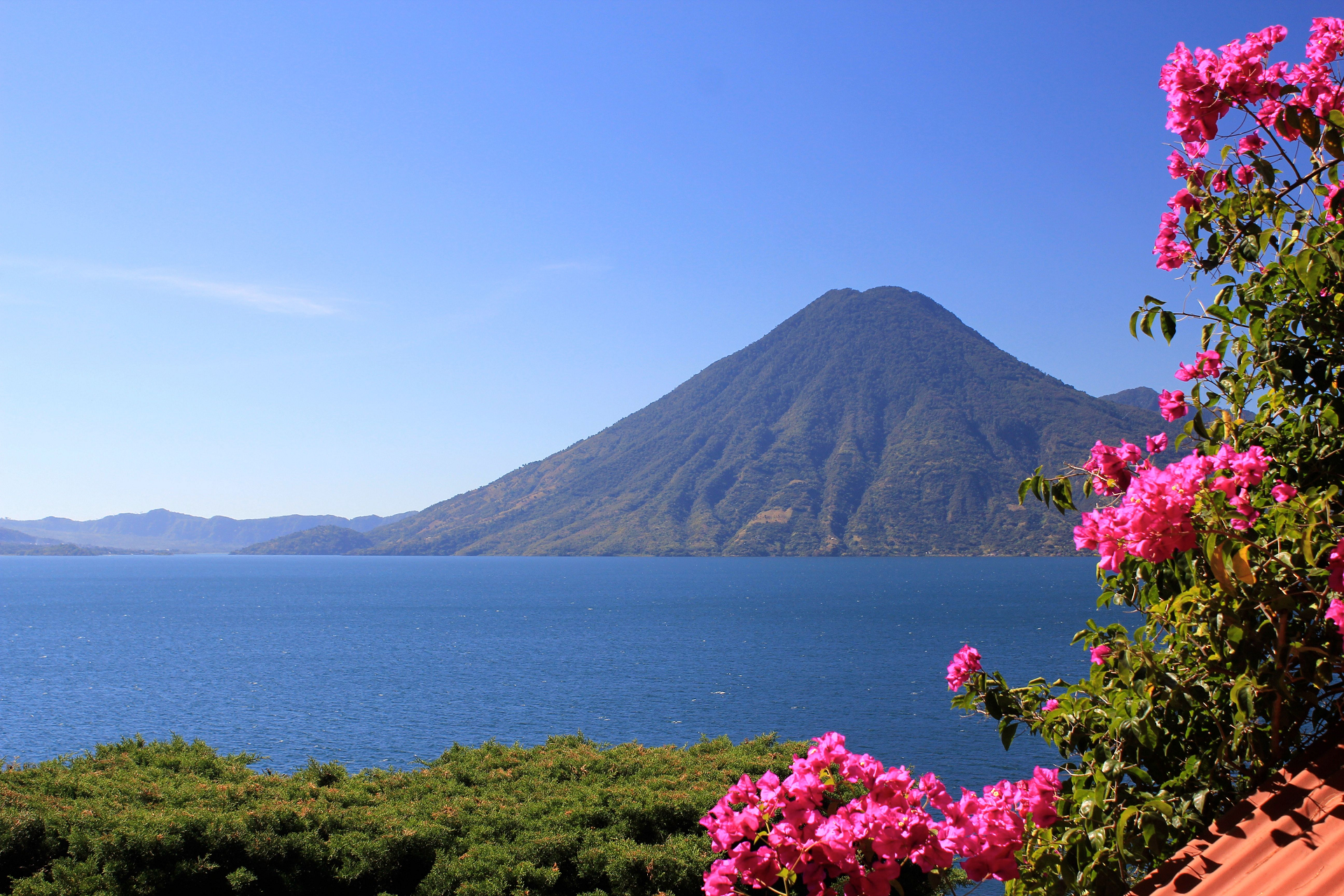
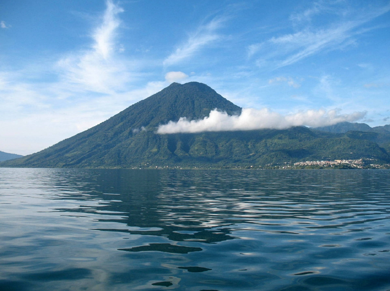
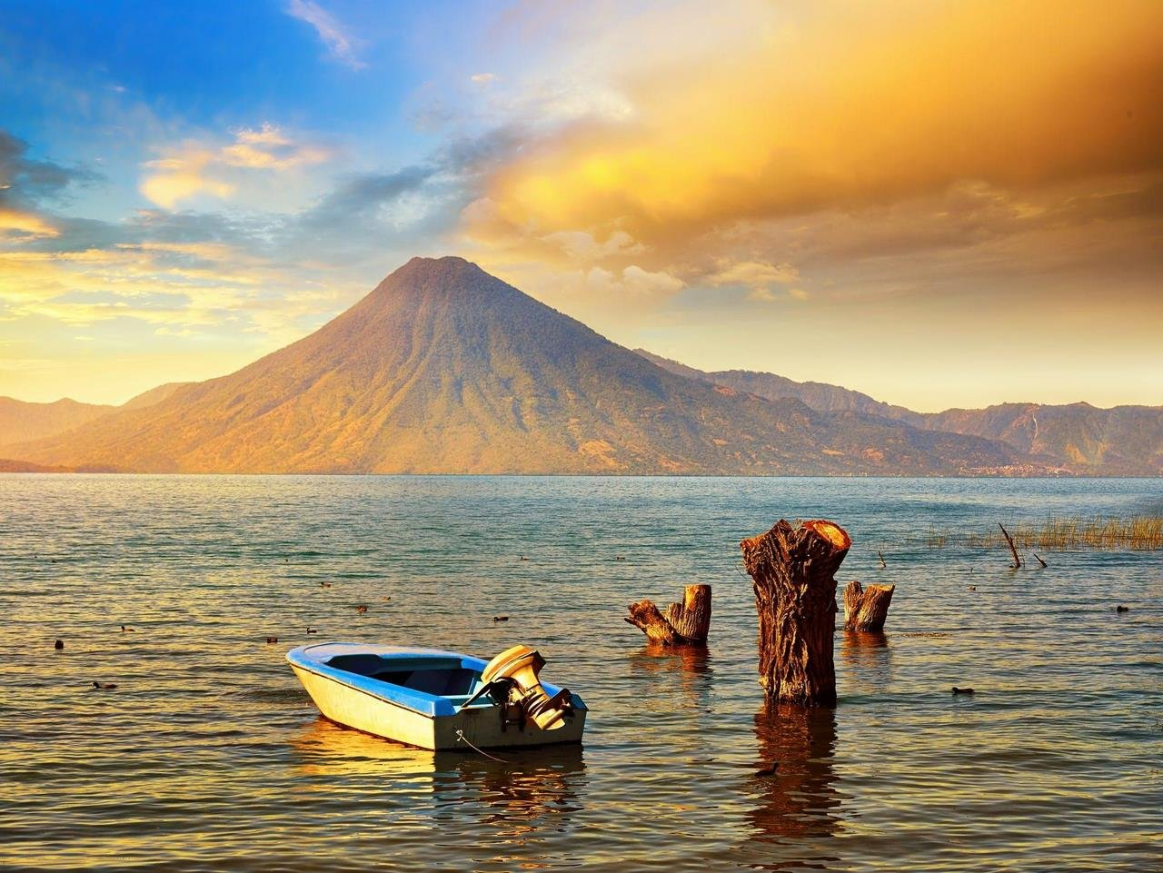
Volcán Atitlán (Spanish pronunciation: [atiˈtlan]) is a large, conical, active stratovolcano adjacent to the caldera of Lake Atitlán in the Guatemalan Highlands of the Sierra Madre de Chiapas range. It is within the Sololá Department, in southwestern Guatemala.
The volcano has been quite active historically, with more than a dozen eruptions recorded between 1469 and 1853, the date of its most recent eruption. Atitlán is part of the Central American Volcanic Arc. The arc is a chain of volcanoes stretching along Central America formed by subduction of the Cocos Plate underneath the Caribbean Plate. These volcanoes are part of the Ring of Fire around the Pacific Ocean.
Volcán Atitlán is a few miles south of Volcán Tolimán, which rises from the southern shore of Lake Atitlán. Volcán San Pedro rises above Lake Atitlán northwest of Volcán Atitlán. A long narrow bay separates Volcán Atitlán and Volcán Toliman from Volcán San Pedro.
Wildlife
Atitlán is home to two particularly rare and beautiful birds that are endemic to the cloud forests of this region. The horned guan (Oreophasis derbianus) is a Pleistocene relic of the family Cracidae that persists today only in small fragments of its previous range. Its habitat is limited to cloud forests above approximately 1,650 metres (5,410 ft). This bird is the size of a turkey and the adult male has a one-inch scarlet-colored “horn” projecting straight up from the top of its head. The Cabanis’s or azure-rumped tanager (Tangara cabanisi) is probably the most restricted-range species in the region. It occurs only at mid-elevations within the Sierra Madre del Sur of Chiapas, Mexico and western Guatemala.
This article uses material from the Wikipedia article Volcán Atitlán, which is released under the Creative Commons Attribution-Share-Alike 4.0 International License (view authors).
 I | 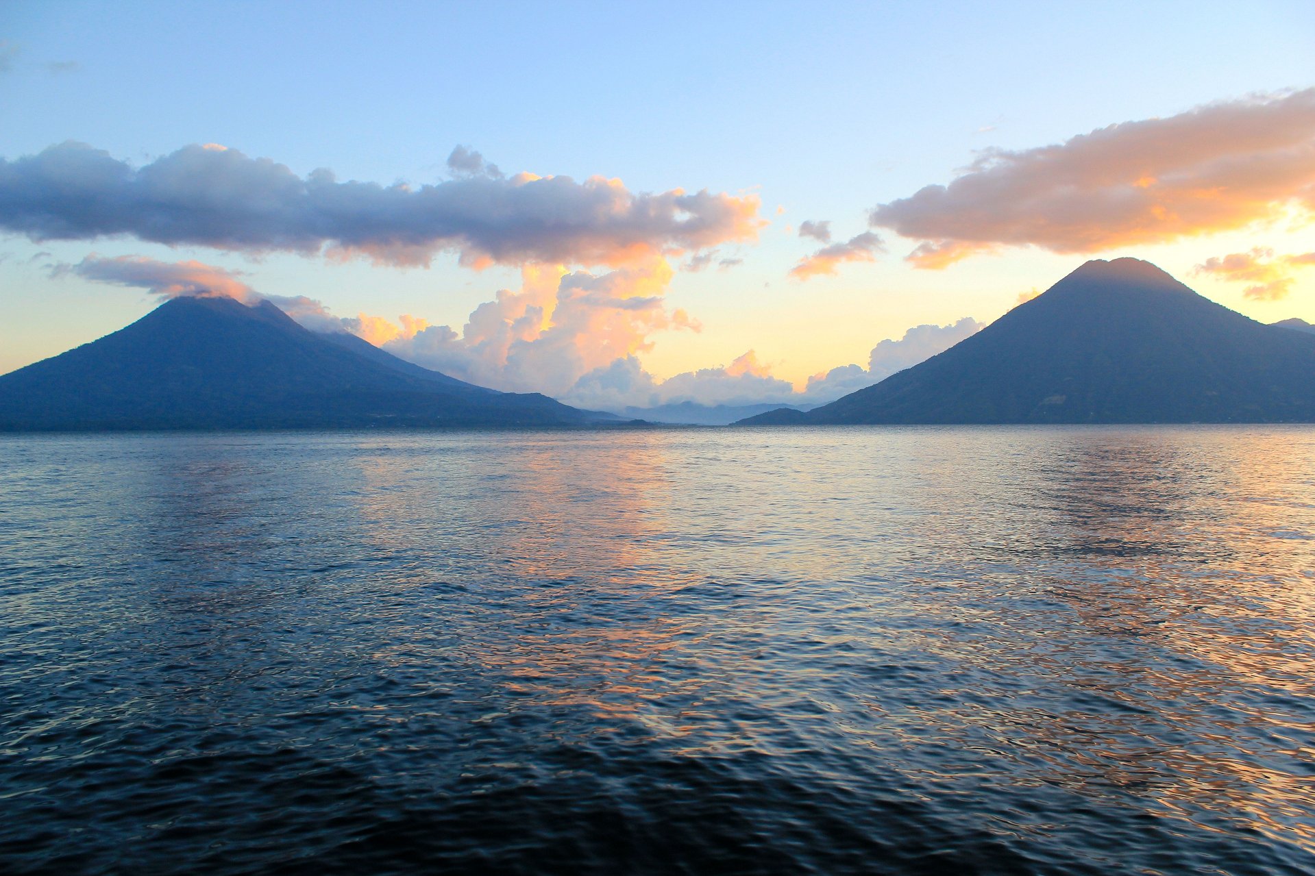 Mikeywoolf |
 Daniel Mennerich |  Daniel Mennerich (Flickr) |
 Mikeywoolf | 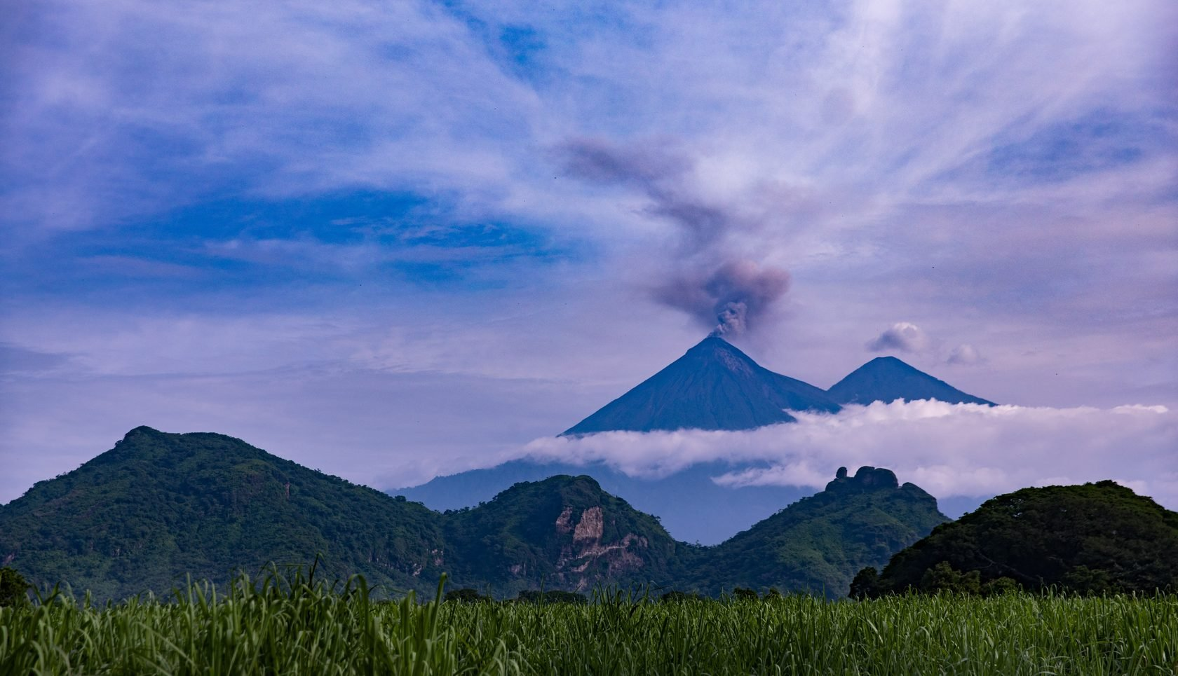 I |
 |  |
![]()
The volcano Tacaná is the second highest peak in Central America at 4,060 metres (13,320 ft), located in the Sierra Madre de Chiapas of western Guatemala and southern Mexico.[1] It is also known in Mexico as Volcán Tacina.[2]
Geography
The volcano is located within the Tacaná municipality of the San Marcos Department in Guatemala; and within the Cacahoatán and Unión Juárez Municipalities of Chiapas state in Mexico.
Its last known eruption was registered in 1986 — a small phreatic eruption in May — but it is still considered as dangerous to more than 250,000 people residing in the area.
Tacaná is the first of hundreds of volcanoes in a 1,500 km (930 mi) km row, arranged NW to SE, parallel to the Pacific Ocean coast of Central America, known as the Central America Volcanic Arc, formed by an active subduction zone along the western boundary of the Caribbean Plate.
The agricultural valley at its NNE foothills is covered with thick deposits of lahars. From its headwaters in Guatemala, the valley drains through Mexico to the Pacific Ocean. Consequently, mudflows from future eruptions could be dangerous to those in their path in both countries.[3]
Volcanology
Tacaná is a stratovolcano (composite volcano) that is surrounded by deeply dissected plutonic and metamorphic terrain. It has a 9 km (5.6 mi) wide caldera, with its elongated summit dominated by several lava domes and three large calderas breached to the south.[1]
Mild phreatic eruptions of Tacaná took place in historical times. Its most powerful known explosive activity, which included pyroclastic flows, occurred at about 70 AD (± 100 years). That large explosion has resulted in Tacaná being classified with a volcanic explosivity index of 4 by the Smithsonian National Museum of Natural History‘s Global Volcanism Program.[4]
This article uses material from the Wikipedia article Volcán Tacaná, which is released under the Creative Commons Attribution-Share-Alike 4.0 International License (view authors).
 |  |
