
Map of Rwenzori Mountains


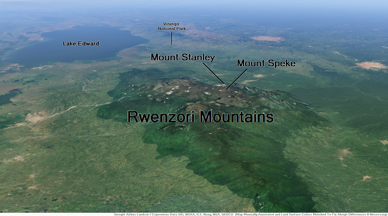
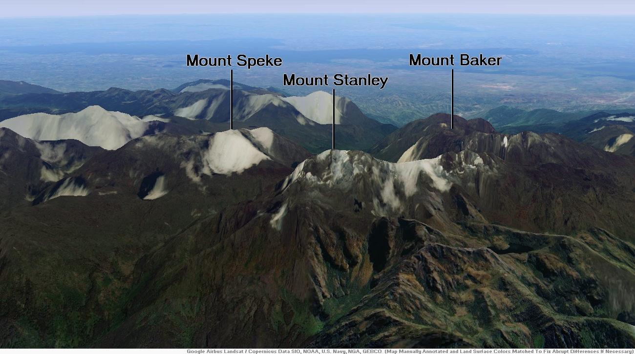
Mount Stanley Region

![]()
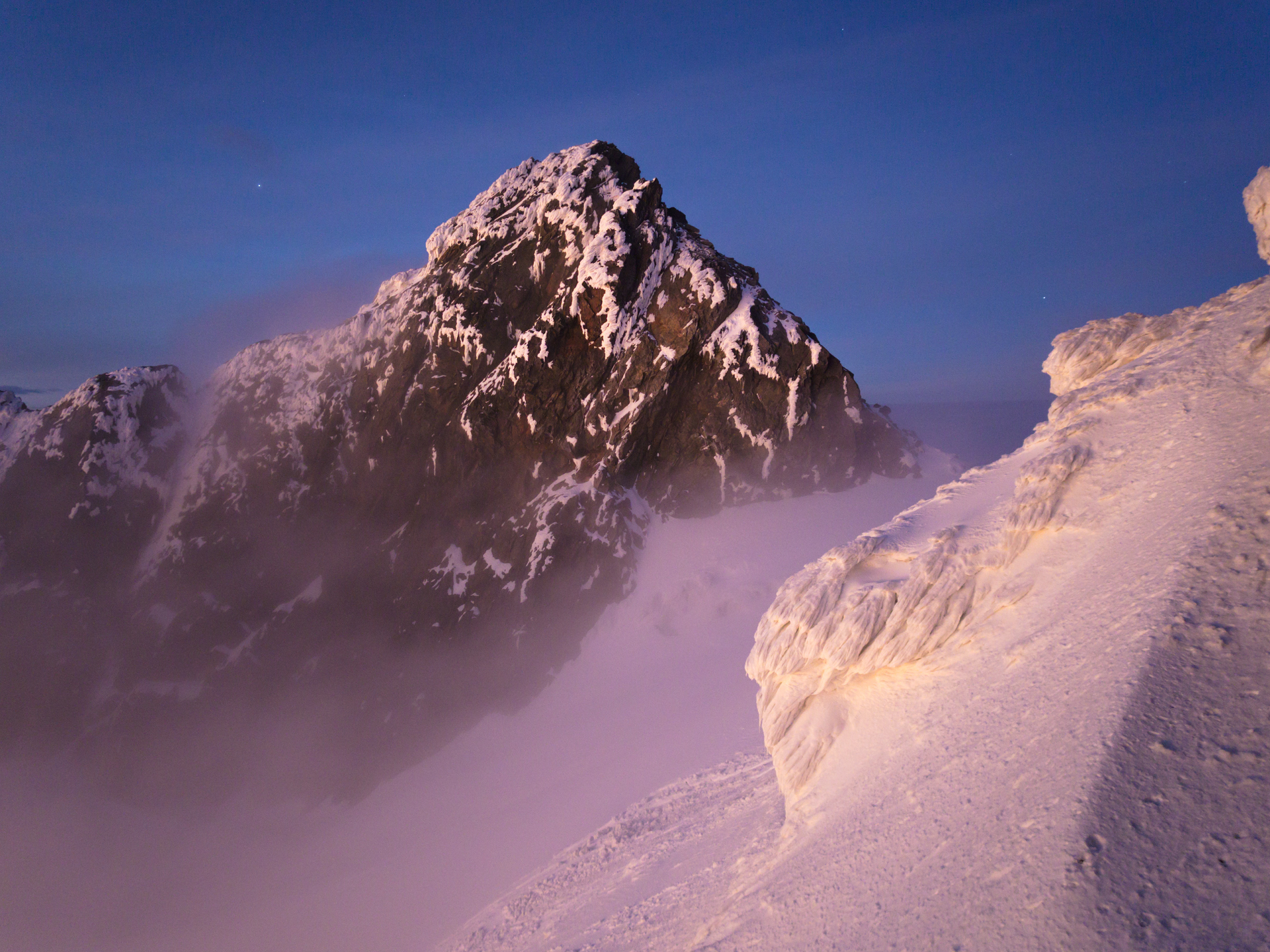
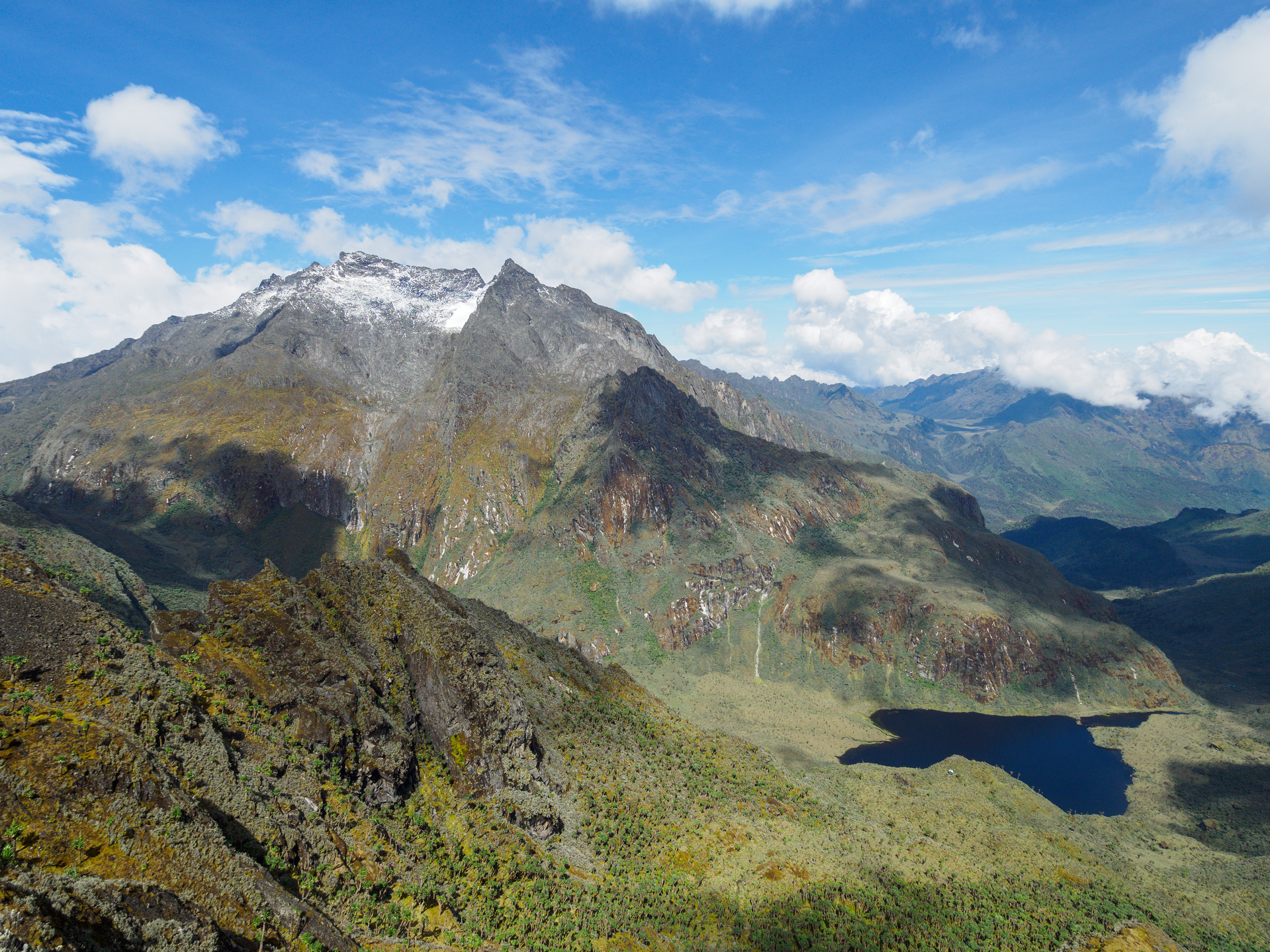
Mount Stanley or Mount Ngaliema (/əŋɡɑːˈljeɪmə/,[2] also US: /-mɑː/,[3] UK: /əŋˌɡɑːliˈeɪmə/[4]) is a mountain located in the Rwenzori range. With an elevation of 5,109 m (16,763 ft), it is the highest mountain of both the Democratic Republic of the Congo and Uganda, and the third highest[a] in Africa, after Kilimanjaro (5,895 m) and Mount Kenya (5,199 m). The peak and several other surrounding peaks are high enough to support glaciers. Mount Stanley is named for the journalist and explorer Sir Henry Morton Stanley. It is part of the Rwenzori Mountains National Park, a UNESCO World Heritage Site.[5]
Mt. Stanley consists of two twin summits and several lower peaks:
Peak………………………Meters………Feet
Margherita Peak……..5,109………16,763
Alexandra……………….5,091………16,703
Albert……………………..5,087………16,690
Savoia…………………….4,977……….16,330
Ellena……………………..4,968………16,300
Elizabeth………………..4,929………16,170
Phillip……………………..4,920………16,140
Moebius…………………4,916……….16,130
Cheptegei………………4,907……….16,099
Great Tooth……………4,603……….15,100
Expeditions
First Ascent
The first recorded ascent of Mt. Stanley was in 1906 by Luigi Amedeo, J. Petigax, C. Ollier, and J. Brocherel. Margherita Peak is named after Queen Margherita of Italy.[6] to the right side of the Isougouane valley, which leads to two stone-built refuges (Refuge du Toubkal and Refuge Les Mouflons) that are often used as base camp at 3,207 m (10,522 ft).
This article uses material from the Wikipedia article Mount Stanley, which is released under the Creative Commons Attribution-Share-Alike 4.0 International License (view authors).
 Byekwaso Blasio (Wikipedia) |  El.Sarmiento (Wikipedia) I |
 Rafał Kozubek (Wikipedia) | 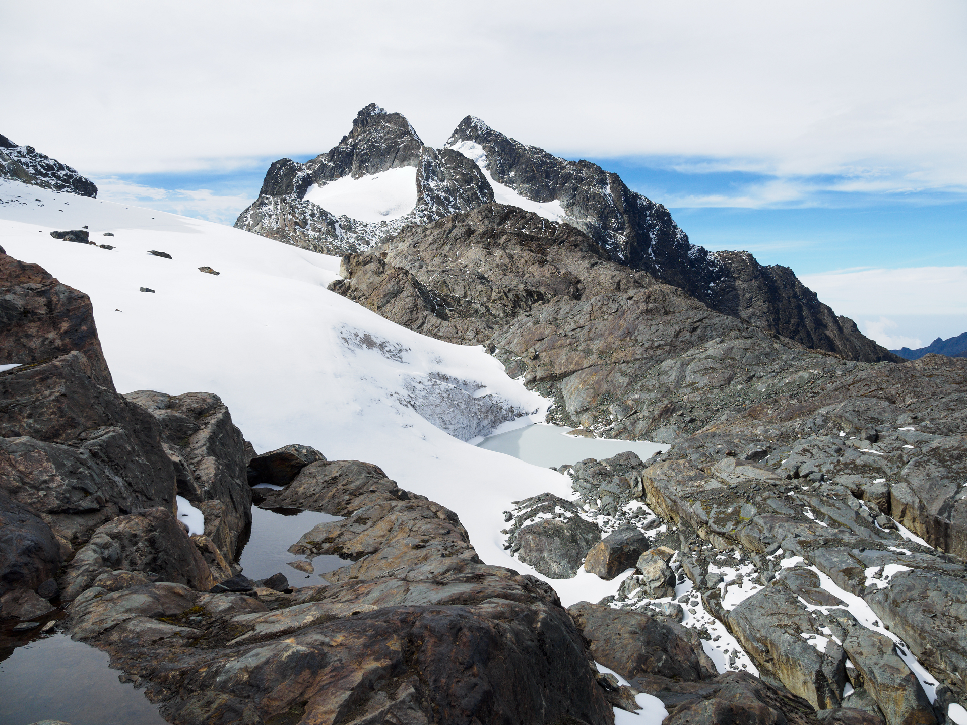 Rafał Kozubek (Wikipedia) |


![]()
Mount Speke lies in the Ruwenzori Mountains National Park in Uganda and is the second highest mountain in this range. Together with Mount Stanley and Mount Baker, it forms a triangle enclosing the upper Bujuku Valley. The nearest peak is Mount Stanley, which is 3.55 km (2.21 mi) to the south-southwest.[1] The mountains lie within an area called ‘The Mountains of the Moon’.
All mountains in this range consist of multiple jagged peaks. Mount Speke’s summits are Vittorio Emanuele 4,890 m (16,040 ft); Ensonga 4,865 m (15,961 ft); Johnston 4,834 m (15,860 ft); and Trident 4,572 m (15,000 ft).[2] The names were chosen in respect for the Italian royal family; however, the name choice had to be approved by the British Protectorate of Uganda who ruled the region at that time.
The people living on the mountains call the ‘Rwenzori’, which means ‘rain maker’ or ‘rain mountains’ in the Bakonjo language. The Baganda, who could see the mountains from far, used to call them ‘Gambaragara’, which means ‘My Eyes Pain’, a reference to the shining snow.[3] The Bakonjo had their own names for the peaks in the Rwenzori range, however, as they had never climbed them, it was difficult to clarify which peak was which. For example, they had names for the three main peaks: Kiyanja, Duwoni and Ingomwimbi. The fact is that for the Bakonjo the high Rwenzori is the home of Kitasamba, the god who resides at the high altitudes and cannot be accessed.
Early European explorers visited the region in the search for the source of the Nile. This mountain was named after John Speke. While he never climbed this peak, Speke mapped the source of the White Nile in 1862.[4] All the mountain in this region are named after similar early explorers.
When Duke of the Abruzzi climbed this summit, he climbed all the other peaks in the Rwenzori range.
Due to the large amount of rainfall Mount Speke receives, it is criss-crossed by many rivers and streams. The vegetation tends to be quite thick. There is also a variety of wildlife, including elephants, chimpanzee, monkeys, leopards and antelope.
This article uses material from the Wikipedia article Mount Speke, which is released under the Creative Commons Attribution-Share-Alike 4.0 International License (view authors).
 Rafał Kozubek (Wikipedia) | 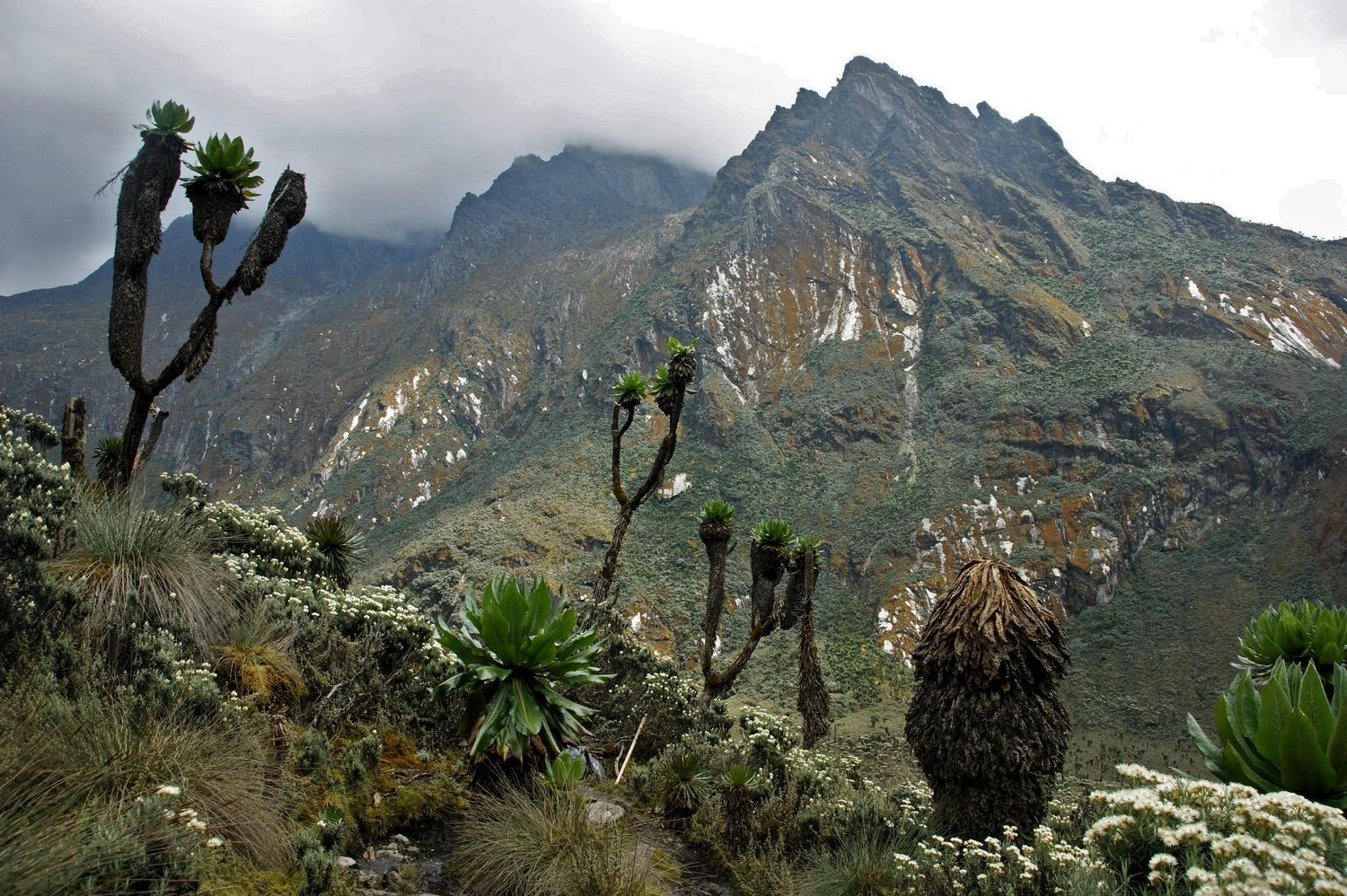 Jørn Eriksson (Flickr) I |
