
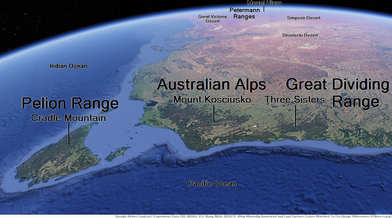
Map of Petermann Ranges


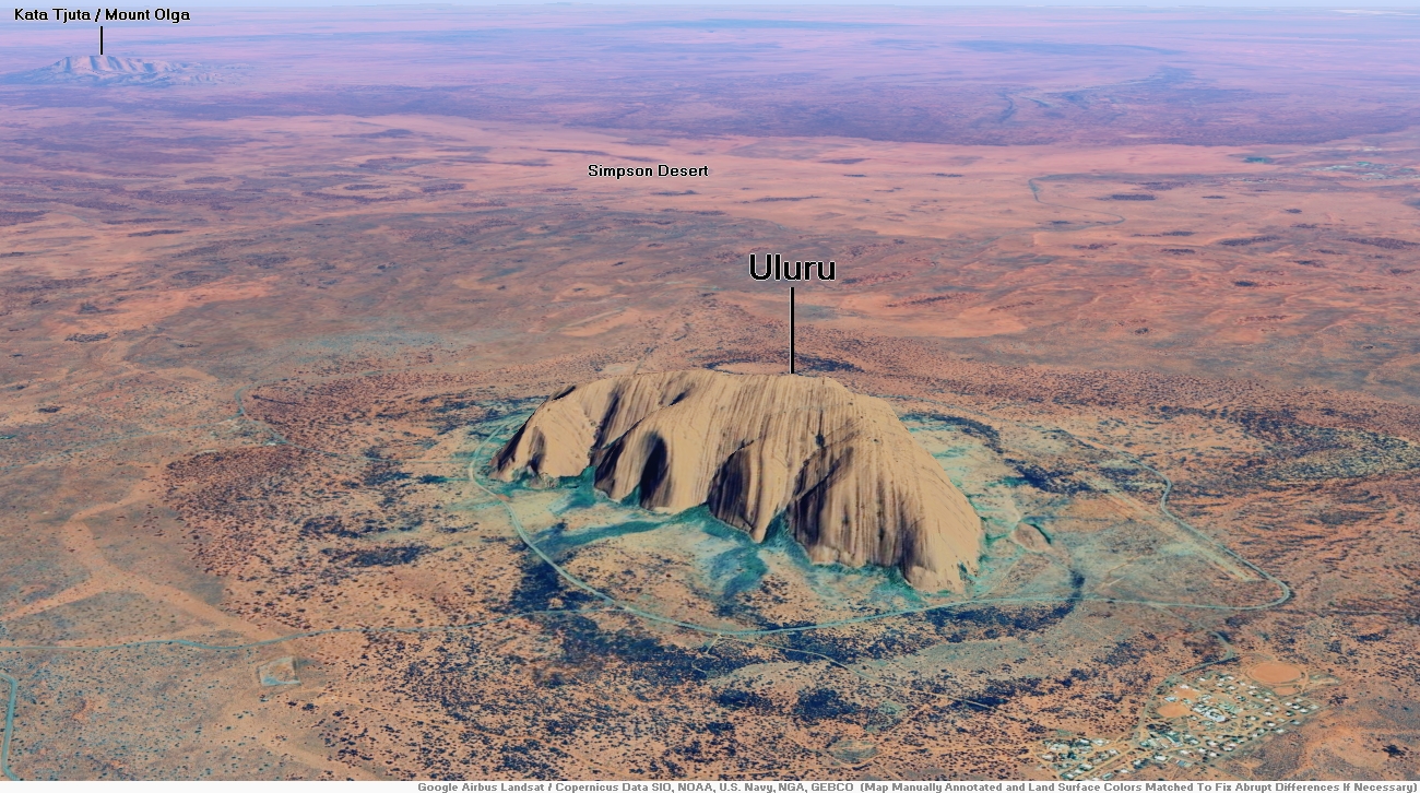
Mount Uluru Region

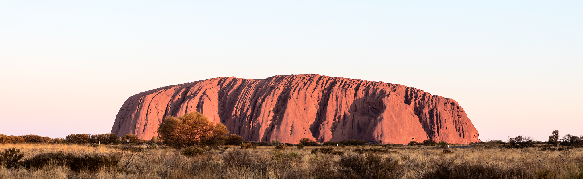
Uluru Panoramic
Dietmar Rabich (Wikipedia)
![]()
![]()
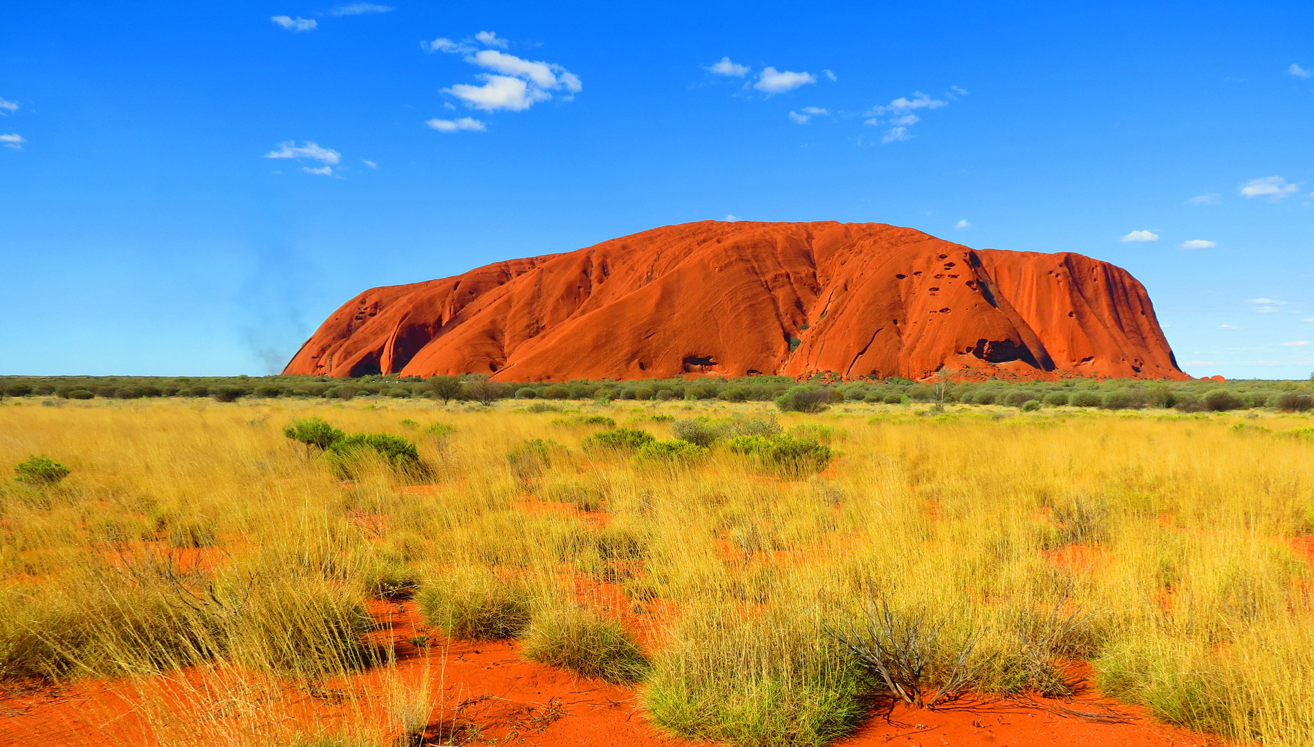
Uluru (/ˌuːləˈruː/; Pitjantjatjara: Uluṟu [ˈʊlʊɻʊ]), also known as Ayers Rock (/ˈɛərz/ AIRS) and officially gazetted as Uluru / Ayers Rock,[1] is a large sandstone monolith. It crops out near the centre of Australia in the southern part of the Northern Territory, 335 km (208 mi) south-west of Alice Springs.
Uluru is sacred to the Pitjantjatjara, the Aboriginal people of the area, known as the Aṉangu. The area around the formation is home to an abundance of springs, waterholes, rock caves and ancient paintings. Uluru is listed as a UNESCO World Heritage Site. Uluru and Kata Tjuta, also known as the Olgas, are the two major features of the Uluṟu-Kata Tjuṯa National Park.
Uluru is one of Australia’s most recognisable natural landmarks[2] and has been a popular destination for tourists since the late 1930s. It is also one of the most important indigenous sites in Australia.
Name
The local Aṉangu, the Pitjantjatjara people, call the landmark Uluṟu (Pitjantjatjara: [ʊlʊɻʊ]). This word is a proper noun, with no further particular meaning in the Pitjantjatjara dialect, although it is used as a local family name by the senior traditional owners of Uluru.[3]
On 19 July 1873, the surveyor William Gosse sighted the landmark and named it Ayers Rock in honour of the then Chief Secretary of South Australia, Sir Henry Ayers.[4]
In 1993, a dual naming policy was adopted that allowed official names that consist of both the traditional Aboriginal name (in the Pitjantjatjara, Yankunytjatjara and other local languages) and the English name. On 15 December 1993, it was renamed “Ayers Rock / Uluru” and became the first official dual-named feature in the Northern Territory. The order of the dual names was officially reversed to “Uluru / Ayers Rock” on 6 November 2002 following a request from the Regional Tourism Association in Alice Springs.[5]
Description
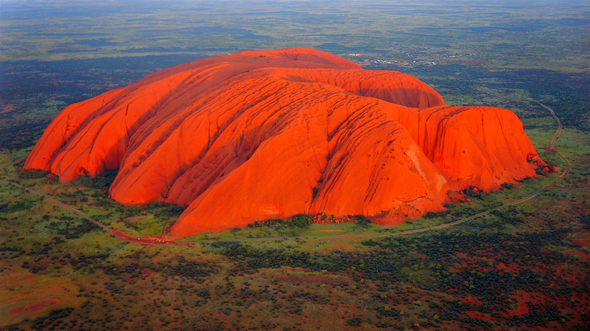
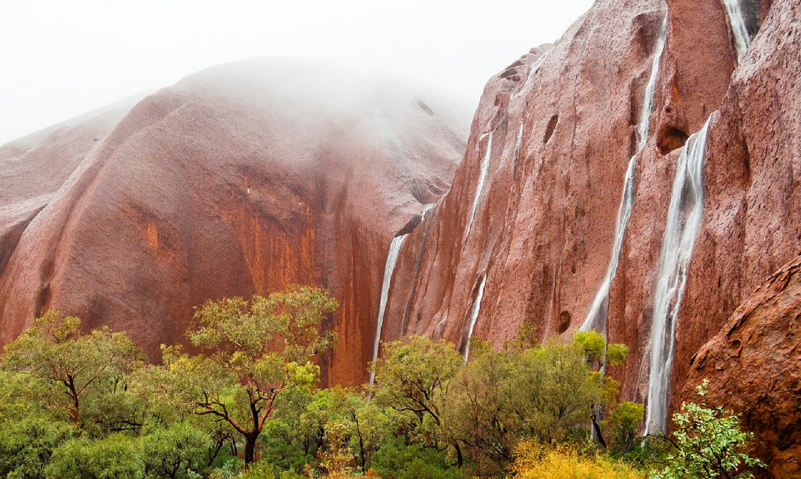
The sandstone formation stands 348 m (1,142 ft) high, rising 863 m (2,831 ft) above sea level with most of its bulk lying underground, and has a total perimeter of 9.4 km (5.8 mi).[6] Uluru is notable for appearing to change colour at different times of the day and year, most notably when it glows red at dawn and sunset. The reddish colour in the rock derives from iron oxide in the sandstone.[7]
Kata Tjuta, also called Mount Olga or the Olgas, lies 25 km (16 mi) west of Uluru. Special viewing areas with road access and parking have been constructed to give tourists the best views of both sites at dawn and dusk.
Both Uluru and the nearby Kata Tjuta formation have great cultural significance for the local Aṉangu people, the traditional inhabitants of the area, who lead walking tours to inform visitors about the bush, food, local flora and fauna, and the Aboriginal Dreamtime stories of the area.
This article uses material from the Wikipedia article Uluru, which is released under the Creative Commons Attribution-Share-Alike 4.0 International License (view authors).
 |  |
 I I | 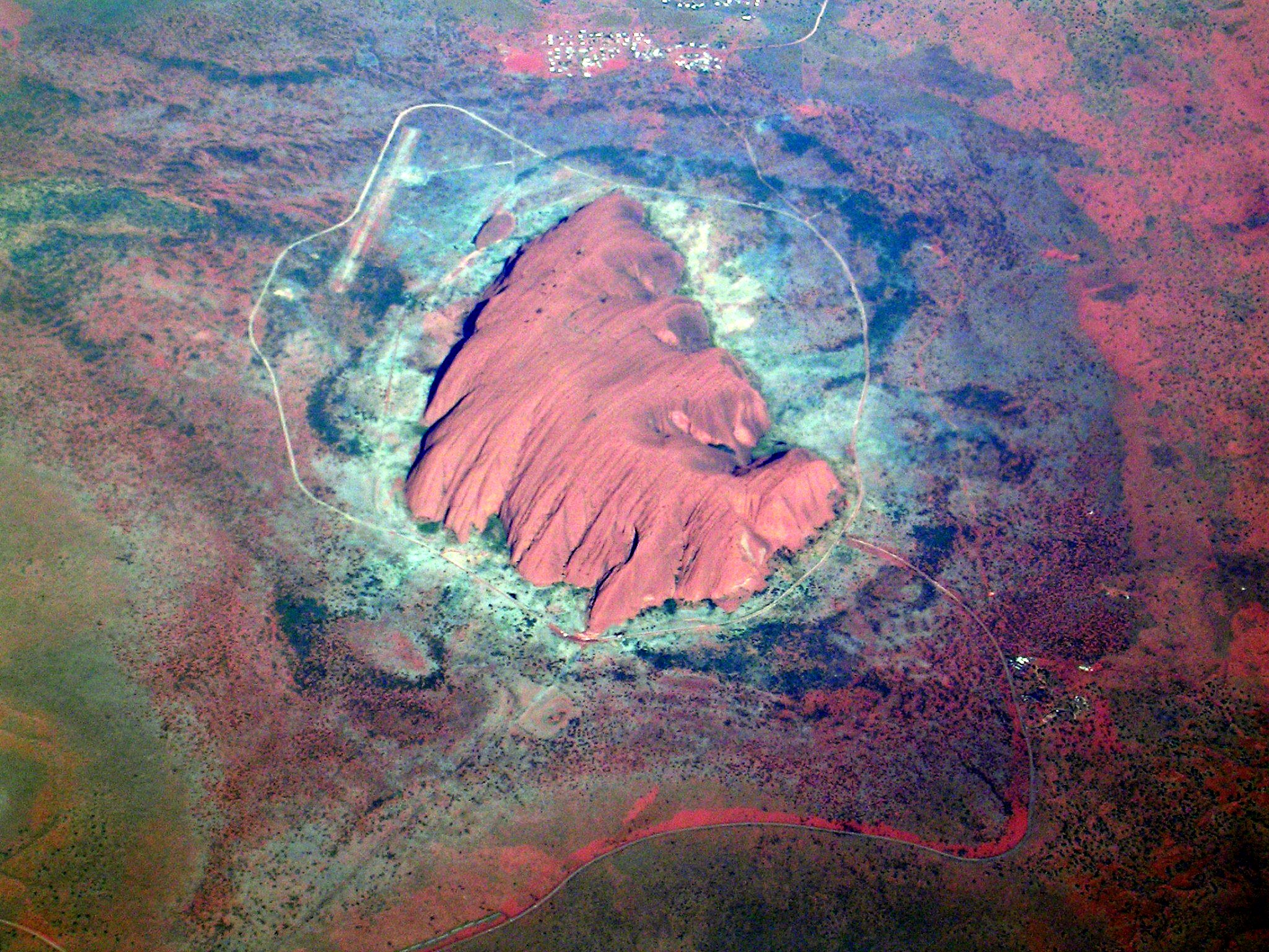 Maurus Blank (Wikipedia) |
