
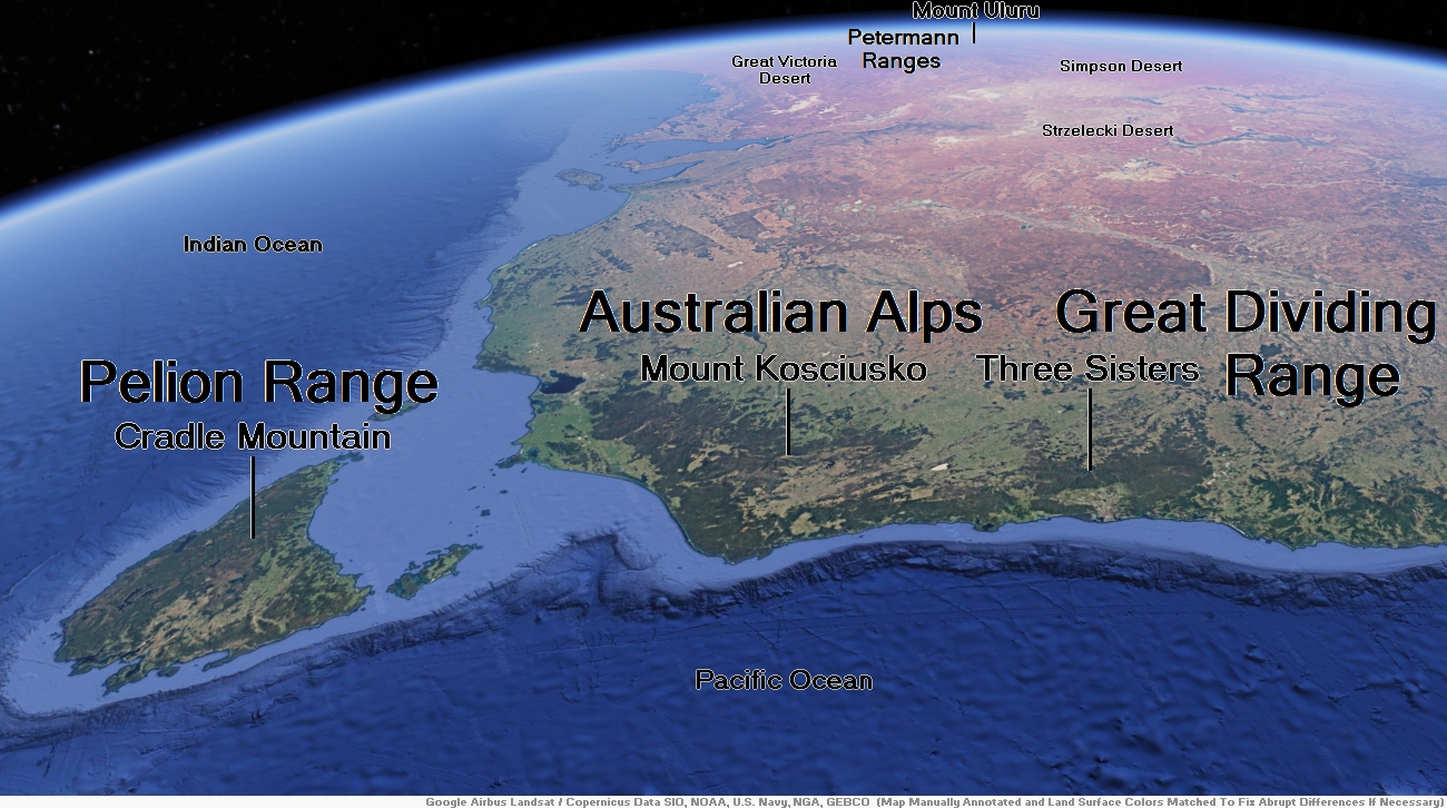
Map of Pelion Range


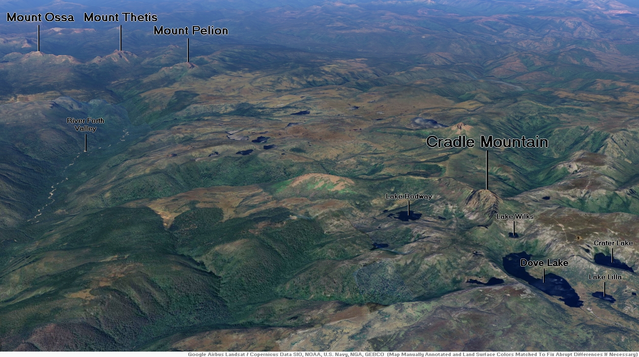
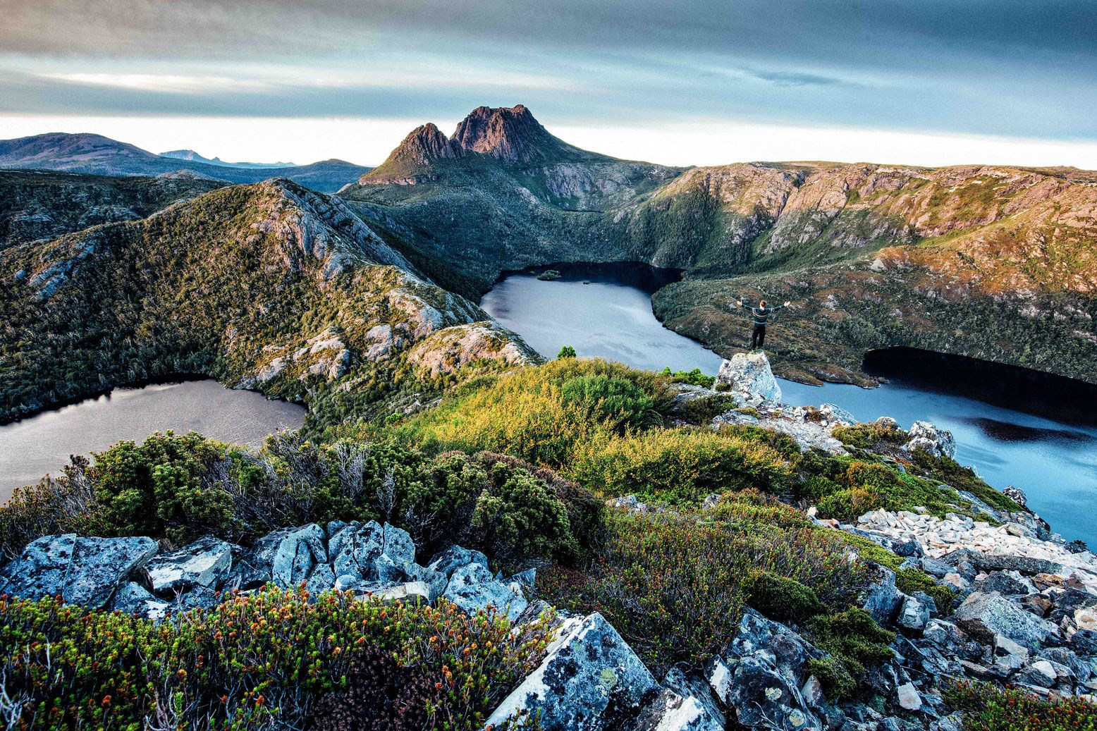
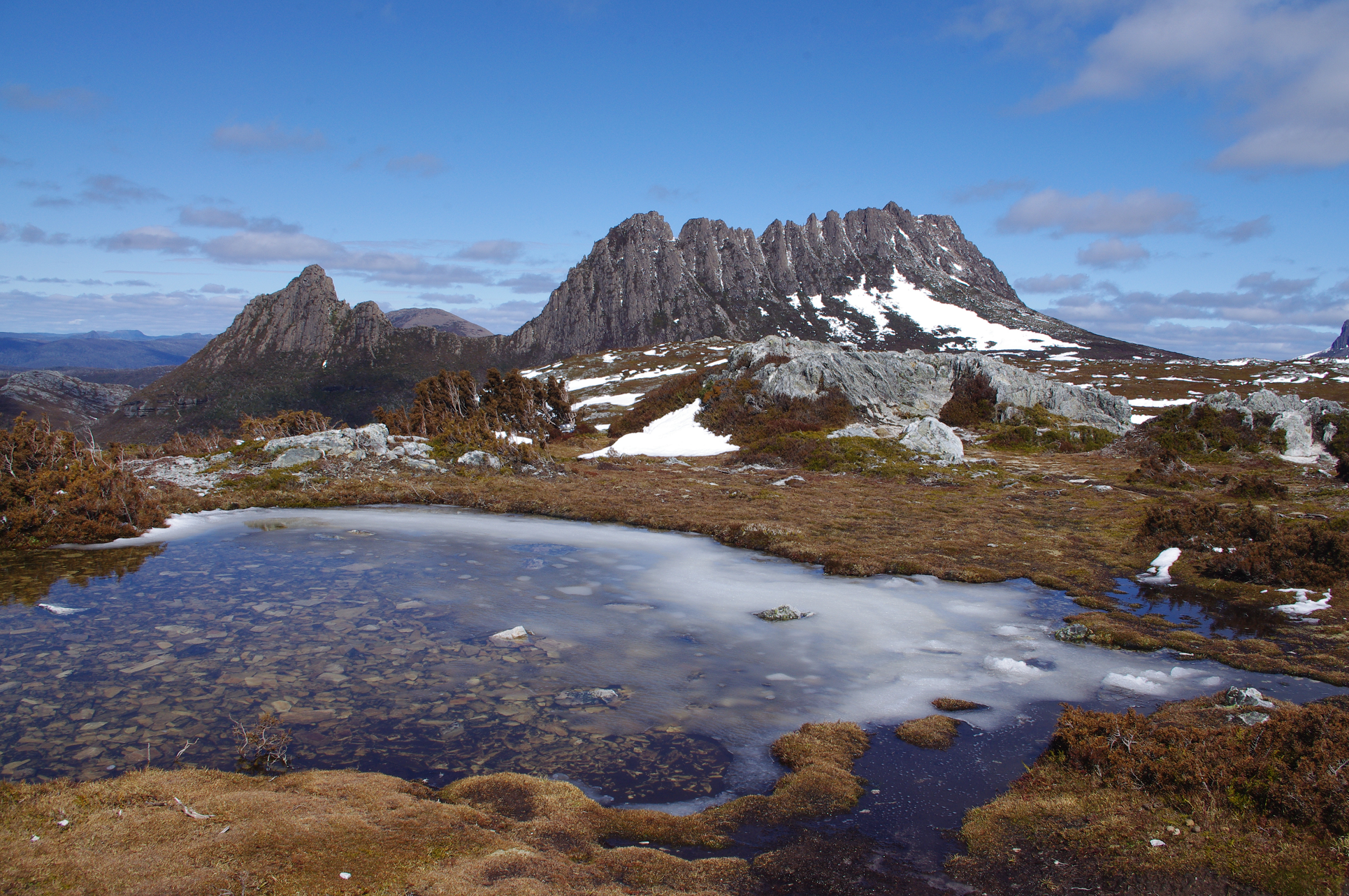
Cradle Mountain Region

![]()
![]()
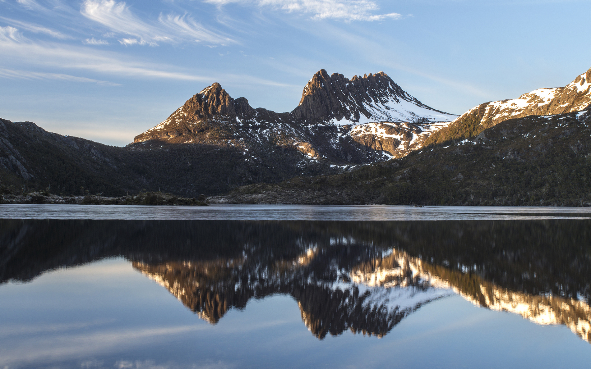
Cradle Mountain is a locality and mountain in the Central Highlands region of the Australian state of Tasmania. The mountain is situated in the Cradle Mountain-Lake St Clair National Park.
At 1,545 metres (5,069 ft) above sea level, it is the sixth-highest mountain in Tasmania.[2]
The locality of Cradle Mountain is a rural locality in the local government areas of Meander Valley, Kentish and West Coast in the Launceston and North-west and west local government regions of Tasmania. The locality is about 109 kilometres (68 mi) west of the town of Westbury. The 2016 census has a population of 66 for the state suburb of Cradle Mountain.[5] Cradle Mountain was gazetted as a locality in 1966.[6] Cradle Mountain (the mountain) occupies a small area in the north-west of the locality, which occupies the northern half of Cradle Mountain-Lake St Clair National Park.[7] Route C132 (Cradle Mountain Road / Dove Lake Road) enters from the north and runs south to Dove Lake, where it ends.[6][8]
History
Cradle Mountain sits between the Big River and Northern Tasmanian Aboriginal people. Aboriginal Tasmanians were persecuted by the European settlers upon their arrival, and the last free Aboriginals in the area were seen just south of Cradle Mountain in 1836.
Early European development
In 1827 and 1828, the first Europeans to explore and summit Cradle Mountain were Joseph Fossey and Henry Hellyer, who were surveying for the Van Diemen’s Land Company.[9]
Trappers worked in the area from the 1860s until the collapse of the fur trade in the 1950s, although hunting in the park was declared illegal after 1927. They established huts, including Du Cane and Pine Valley, and burned the land to encourage fresh growth and game.[9]
A large expanse of King Billy pines were found by James Smith in 1863, and the area was logged until the 1910s. Smith’s son continued logging the area on private (but National Park adjacent) land from 1943 to the 1972, ending after significant public protest.[9]
Cattle and sheep grazed in Cradle Valley from 1910 to 1930.
This article uses material from the Wikipedia article Cradle Mountain, which is released under the Creative Commons Attribution-Share-Alike 4.0 International License (view authors).
 I I | 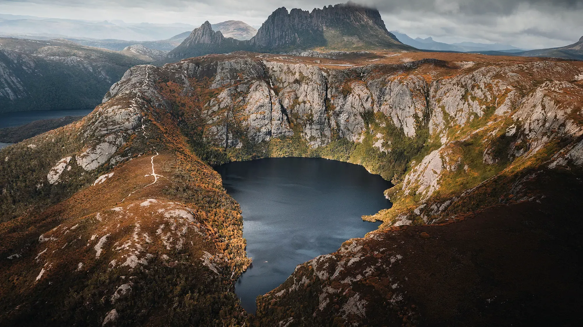 Jason Charles Hill (Discover Tasmania) |
 I | 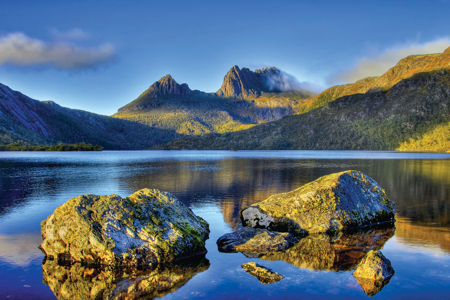 Hans Harms (iStock) |
 I I | 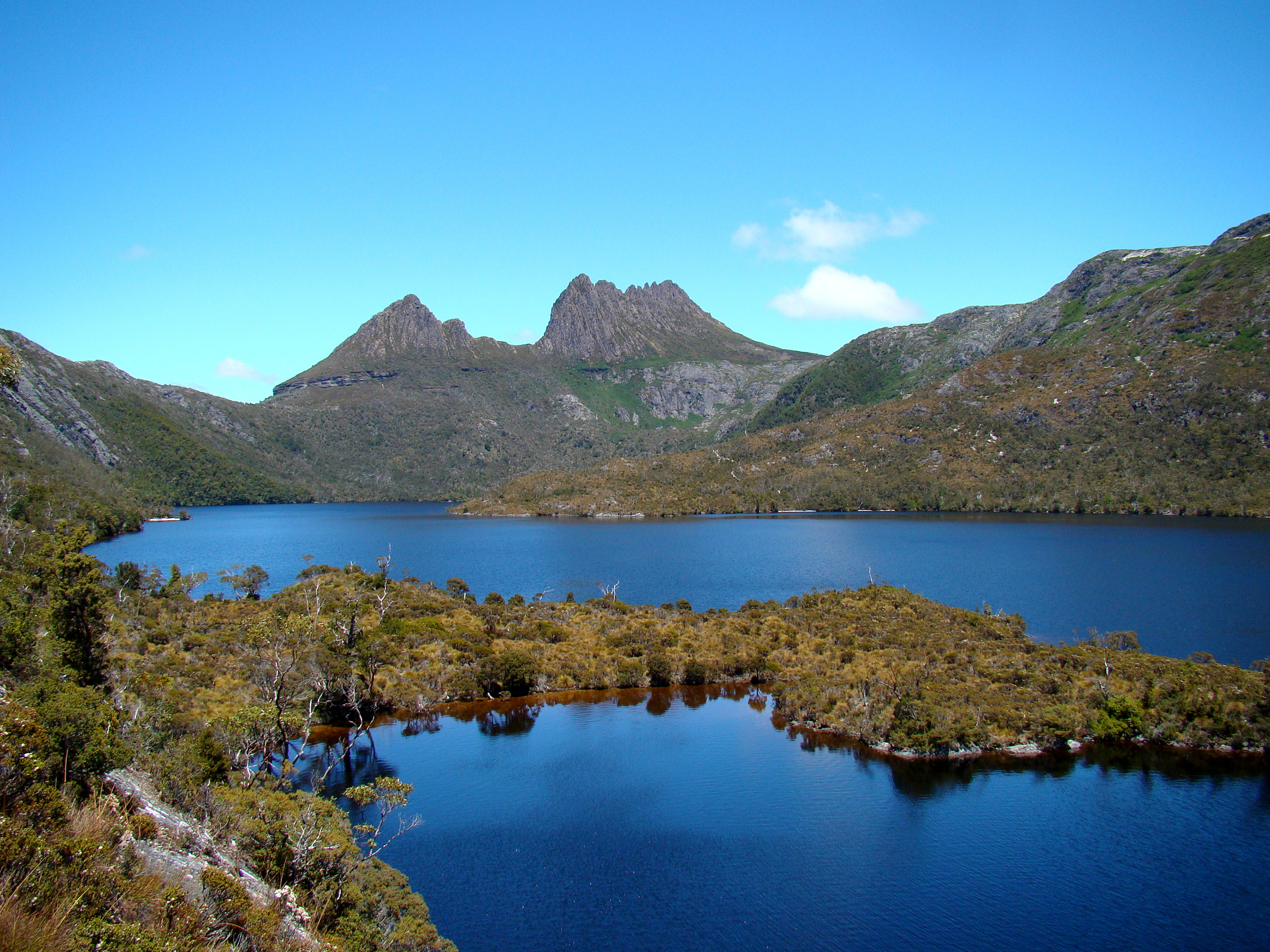 Bjørn Christian Tørrissen (Wikipedia) |
![]()
![]()
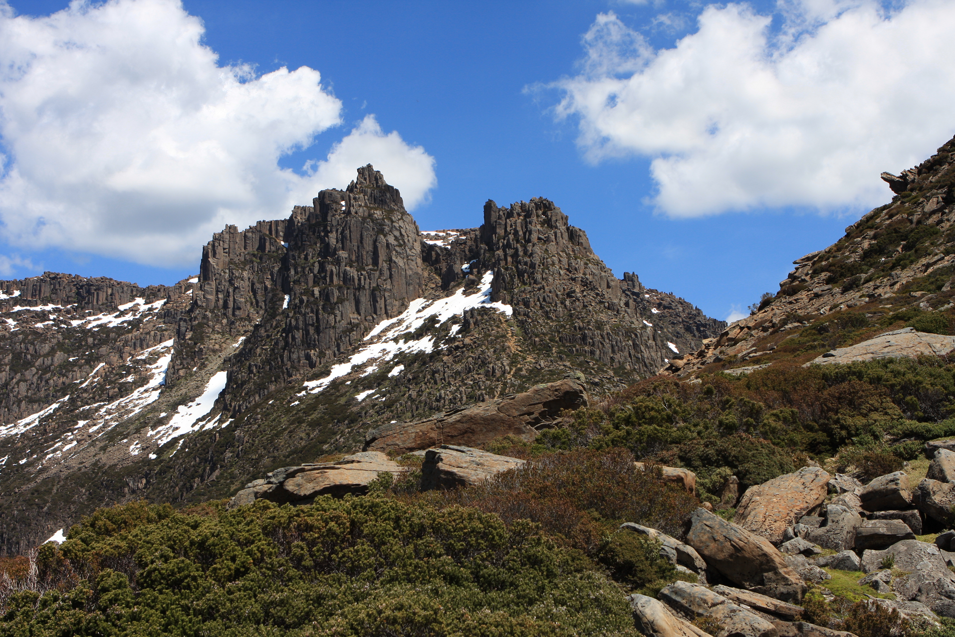
Mount Ossa is the highest mountain in Tasmania, with a summit elevation of 1,617 metres (5,305 ft) above sea level.[3] It makes up part of the Pelion Range within Cradle Mountain-Lake St Clair National Park in the Central Highlands region of Tasmania, Australia.
It was first surveyed by Europeans in the 1860s, and confirmed to be the state’s high point in 1954.
Like most peaks in the area it is capped with Jurassic dolerite.[4]
History
The Mount Ossa highland area spans the boundary between the Big River and Northern Tasmanian Aboriginal nations. Several artifacts and campsites containing various stone types and tools have been discovered around Pelion to the north, and Lake St Clair (Tasmania) to the south.[5]
It was first surveyed by Charles Gould in the 1860s and named after Mount Ossa in Greece following the theme of classical Greek names set by George Frankland, an early Tasmanian surveyor.[6][7] However, its location was marked as on what is now called Mount Nereus, and later surveyors alternatively referred to it as Parsons Hood, Mount Dundas, Mount Blackhouse or simply numbered it. For years it was thought that Cradle Mountain was the highest in Tasmania, with inexact equipment stymying attempts to closely examine the area.[8][9]
It was confirmed to be the highest mountain in Tasmania after an aerial survey in 1954.[10]
Early development
In 1892 the Mole Creek and Zeehan Mineral Prospecting and Exploration Company Ltd discovered Permian coal at the base of Mt Ossa and surrounding areas, excavating several tunnels. The seams were found to be of low quality and the tunnels were not developed, although copper mining was present in the surrounding area. A 1920s attempt to prospect for oil failed after the government warned investors away.
Mining and surveying activities led to the development of the area. Stewards Track was created from the east, and was extended and renamed the Innes Track (now Arm River Track). Old Pelion Hut formed the base of mining operations, and still stands today as a hut on the Overland Track and start point for bushwalkers climbing Mount Ossa.
Trappers worked in the area from the 1860s until the collapse of the fur trade in the 1950s, although hunting in the park was declared illegal after 1927. They established huts, some of which are still in use, and burned the land to encourage fresh growth and game.[5]
This article uses material from the Wikipedia article Mount Ossa (Tasmania), which is released under the Creative Commons Attribution-Share-Alike 4.0 International License (view authors).
 J Brew (Wikipedia) |  J Brew (Wikipedia) |
