
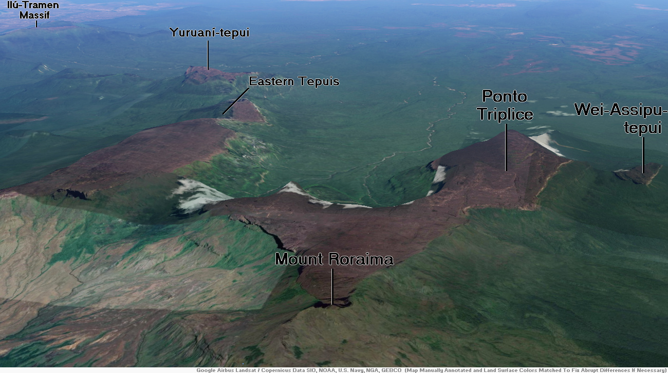
Map of Pacaraima Mountains


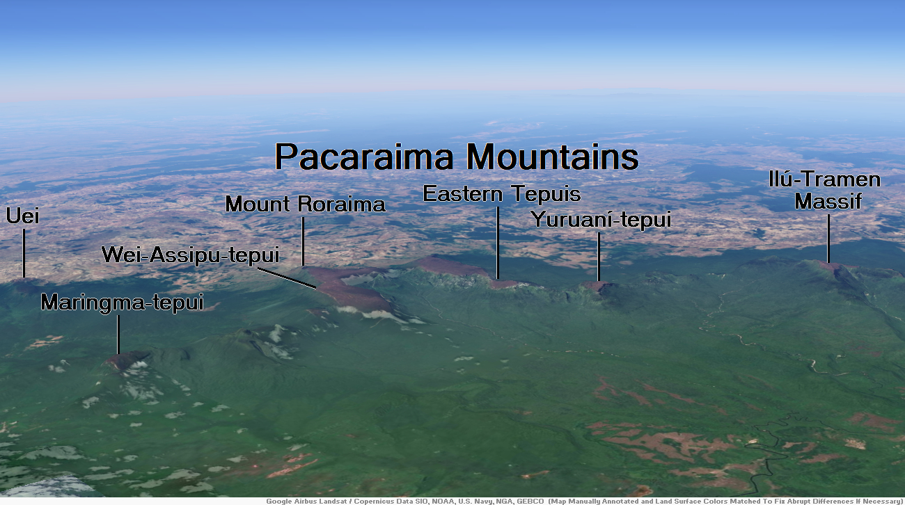
Mountain Roraima Region
![]()
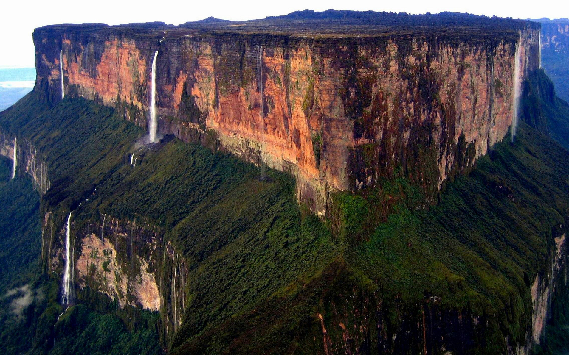
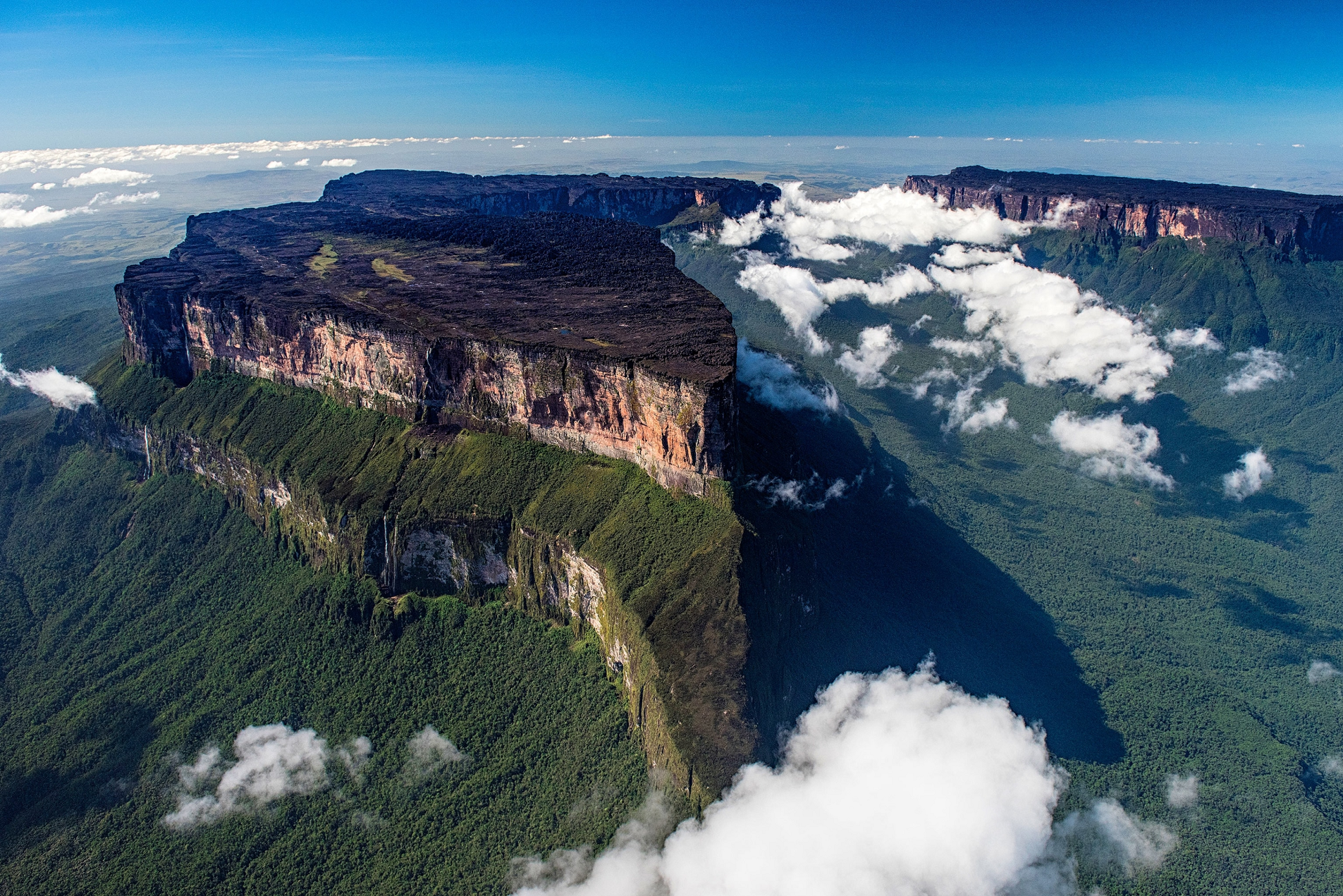
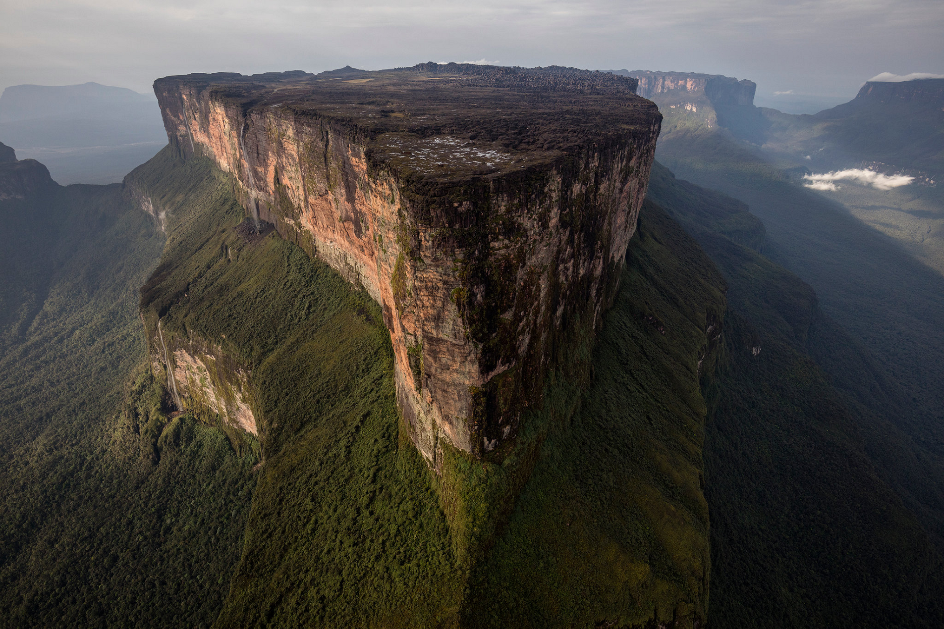
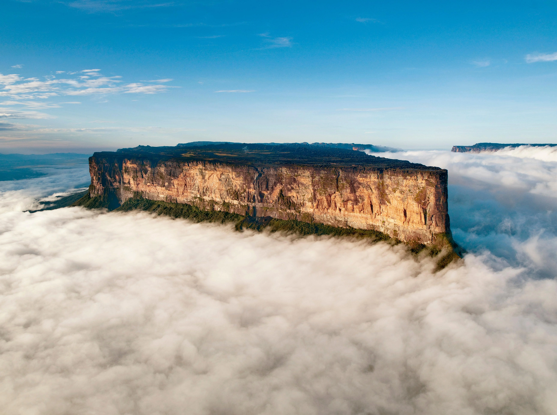
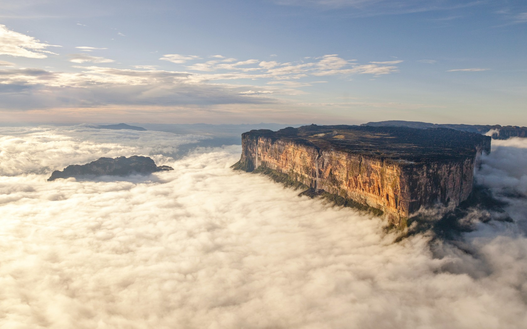
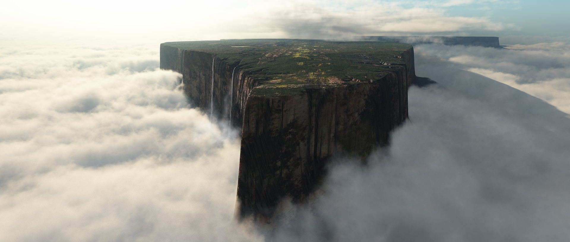
Mount Roraima (Spanish: Monte Roraima; Tepuy Roraima; Cerro Roraima; Portuguese: Monte Roraima) is the highest of the Pacaraima chain of tepuis (table-top mountain) or plateaux in South America.[4]: 156 [c] It is located at the junction of Brazil, Guyana and Venezuela. A characteristic large flat-topped mountain surrounded by cliffs 400–1,000 m (1,300–3,300 ft) high. The highest point of Mount Roraima is located on the southern edge of the cliff at an elevation of 2,810 m (9,220 ft) in Venezuela,[d] and another protrusion at an elevation of 2,772 m (9,094 ft) at the junction of the three countries in the north of the plateau is the highest point in Guyana. The name Mount Roraima came from the native Pemon people. Roroi in the Pemon language means “blue-green”, and ma means “great”.[5]
Leaching caused by intense rainfall has shaped the peculiar topography of the summit, and the geographical isolation of Mount Roraima has made it home to much endemic flora and fauna. Western exploration of Mount Roraima did not begin until the 19th century, when it was first climbed by a British expedition in 1884. Yet despite subsequent expeditions, its flora and geology remain largely unknown. The privileged setting and relatively easy access and climbing conditions on the south side of the cliffs make Mount Roraima a popular destination for hikers.[6]
Geography
Mount Roraima is located in the northern part of South America, the Pacarema Mountains in the eastern part of the Guyana Plateau, Brazil in the east accounting for 5% of its area, Guyana in the north accounting for 10%, and Venezuela in the south and west accounting for 85%.[7][8] Access to Mount Roraima from the Venezuelan side is close to the road and relatively easy; however, for both Brazil and Guyana the area is completely isolated and can only be reached by a few days of forest hikes or small local airstrip.[9][10][11]
Mount Roraima is a flat-topped mountain, typical of the Guyana Shield,[12] with an elevation of about 1,200 m (3,900 ft) in the southeast and only about 600 m (2,000 ft) in the northwest.[7] The south, southeast, east, northeast and northwest faces are all formed by straight cliffs up to about 1,000 m (3,300 ft) high. At the southern end of the mountain, part of the cliff has collapsed, forming a natural boulder.[7][13][12][14] The base of the cliff is surrounded by steep slopes to the south and east, and the north and west sides form river valleys leading to the summit.[10][13]
The top of Mount Roraima has a length of more than 10 km (6.2 mi), a maximum width of 5 km (3.1 mi), an area of about 33–50 km2 (13–19 sq mi), an elevation of more than 2,200 m (7,200 ft), and an average elevation of 2,600–2,700 m (8,500–8,900 ft).[7][15][16] The plateau is a pseudo-karst surface etched by heavy rainfall.[13] The highest point is 2,810 m (9,219 ft) above sea level, located at the southern end of the plateau and the highest point in the state of Bolívar,[7][9][16] 8.25 km (5.13 mi) north of the summit is another high point with an elevation of 2,772 m (9,100 ft), which is the highest point in Guyana.[17] In the northern part of the plateau is the landmark of the border between Brazil, Venezuela and Guyana, with an elevation of 2,734 m (8,970 ft).[18]
This article uses material from the Wikipedia article Mount Roraima, which is released under the Creative Commons Attribution-Share-Alike 4.0 International License (view authors).
 |  |
 |  |
 |  |

