
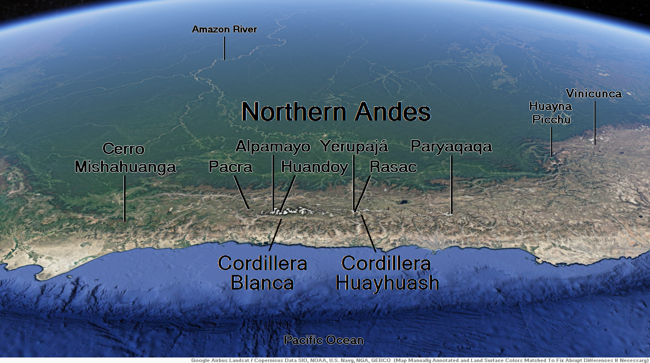
Map of Northern Andes


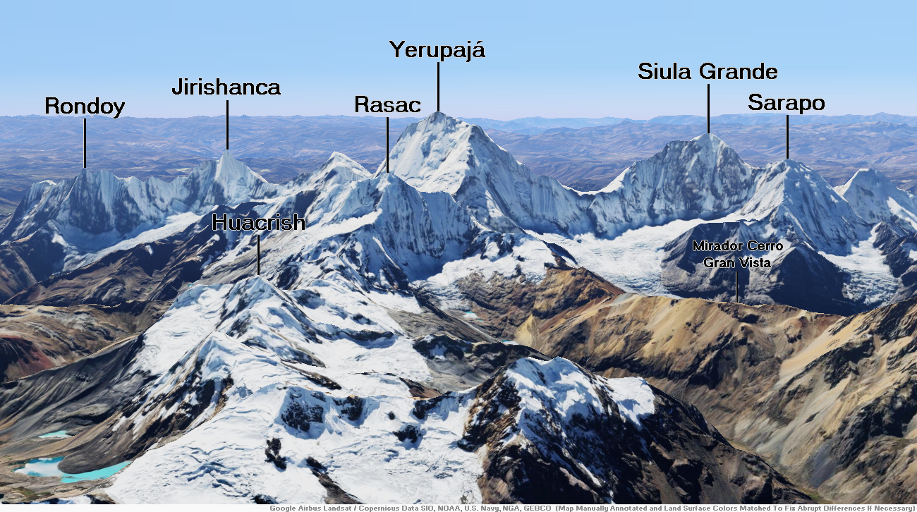
Yerupajá Region

![]()
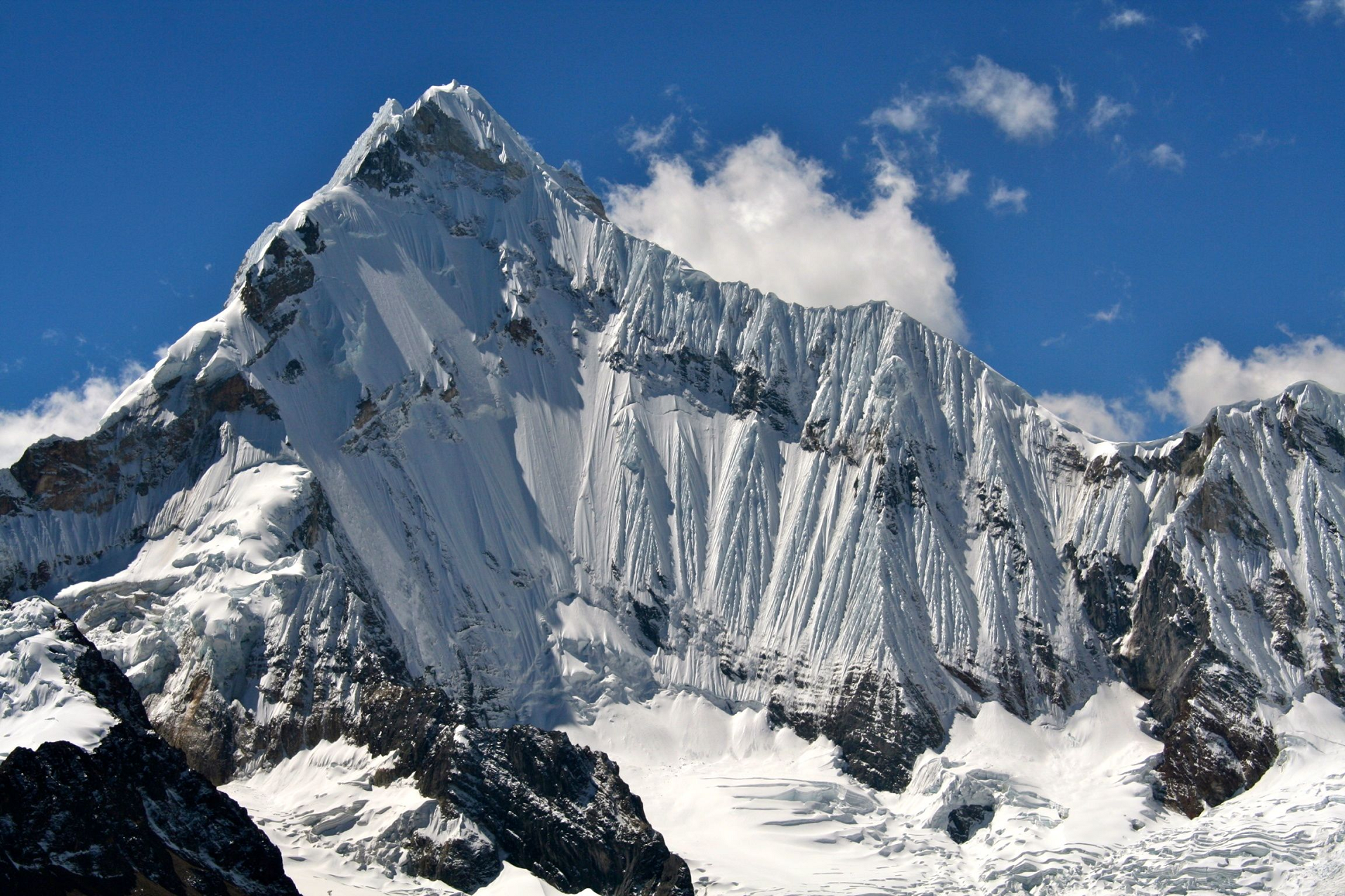
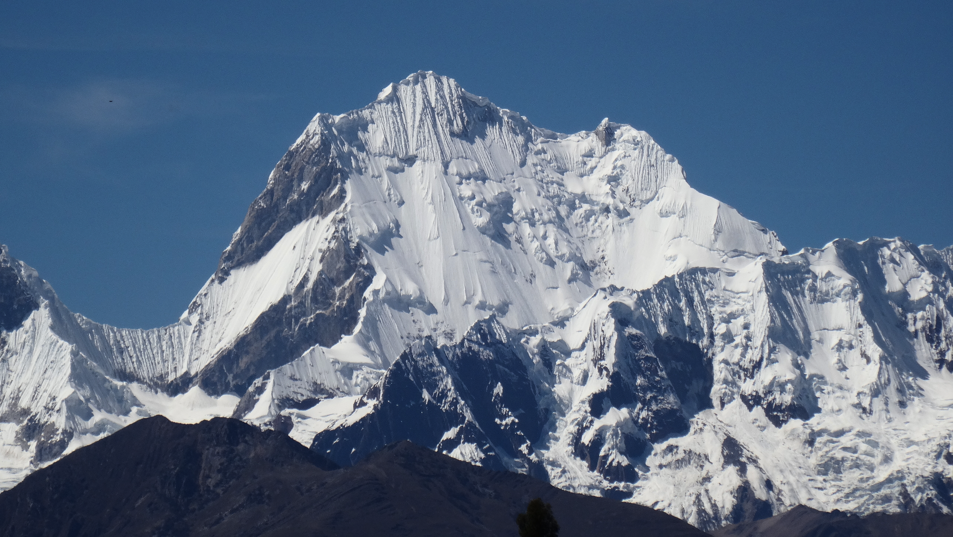
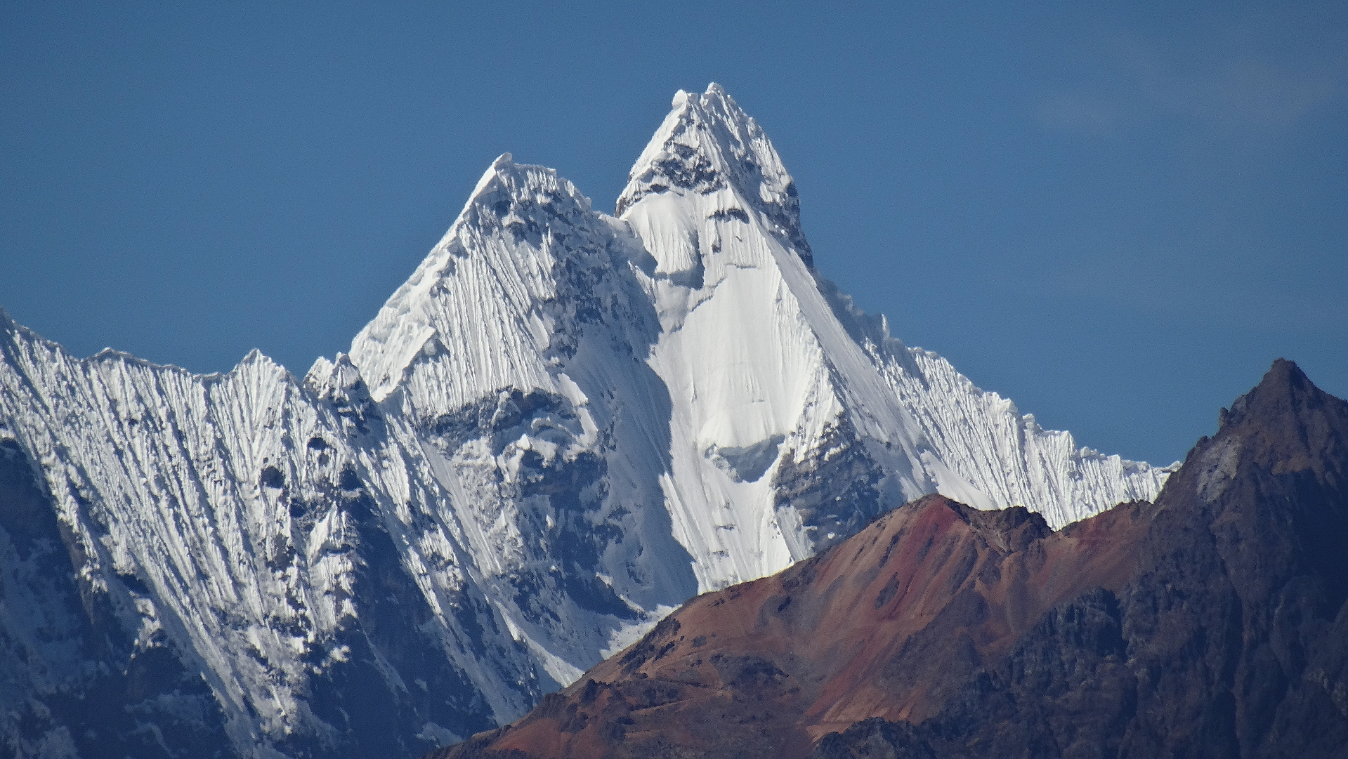
Yerupajá is a mountain of the Huayhuash mountain range in west central Peru, part of the Andes. It is located at Áncash, Bolognesi Province, Lauricocha Province. At 6,635 metres (21,768 ft) (other sources: 6,617 m (21,709 ft))[citation needed] it is the second-highest in Peru and the highest in the Huayhuash mountain range. The summit is the highest point in the Amazon River watershed, and was first reached in 1950 by Jim Maxwell and Dave Harrah, and its northern peak (Yerupajá Norte) in 1968 by the Wellingtonian Roger Bates and Graeme Dingle. Many visitors consider Yerupajá to be the most spectacular peak in South America.
There have been only a few successful ascents of the peak because it is one of the hardest Andean high peaks to climb. The most popular route is the southwest face. The approach is normally made from Huaraz southwards via Chiquián and Jahuacocha.
Notable ascents
- 1950 Southern flank of West Face First ascent of peak by David Harrah and James Maxwell.[2]
- 1966 Direct West Face 2nd ascent of peak, FA of route over 13 days by Leif Patterson and Jorge Peterek.[2]
- 1968 Northeast Face FA of route by Chris Jones and Paul Dix (summit, July 30), supported by Dean Caldwell and Roger Hart (all US).[3]
- 1969 East Face by Reinhold Messner and Peter Habeler.[4]
- 2002 Main summit solo by Santiago Quintero (July 15)[5]
Elevation
Based on the elevation provided by the available Digital elevation models, SRTM2 (6558m with voids[6]), SRTM filled with ASTER (6551m with voids[7]), TanDEM-X(6110m with voids[8]), Yerupaja is about 6635 meters above sea level.[9][1] This altitude was considered due to the lack of topographic data or even handheld GPS data.[1]
The height of the nearest key col is 4592 metres,[9] so its prominence is 2025 meters. Yerupaja is listed as range or area, based on the Dominance system [10] and its dominance is 30.6%. Its parent peak is Huascaran Sur and the topographic isolation is 148.8 kilometers.[1] This information was obtained during a research by Suzanne Imber in 2014.[11]
This article uses material from the Wikipedia article Yerupajá, which is released under the Creative Commons Attribution-Share-Alike 4.0 International License (view authors).
 Jeremyfrimer (Wikipedia) | 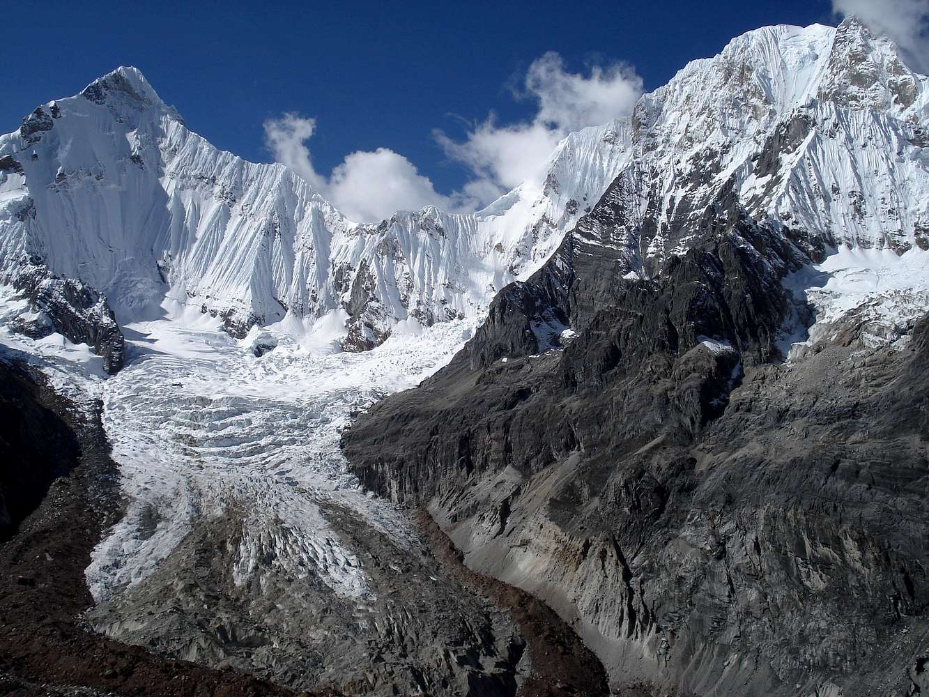 Blazin (Summit Post) |
 Waterloo1883 (Wikipedia) | 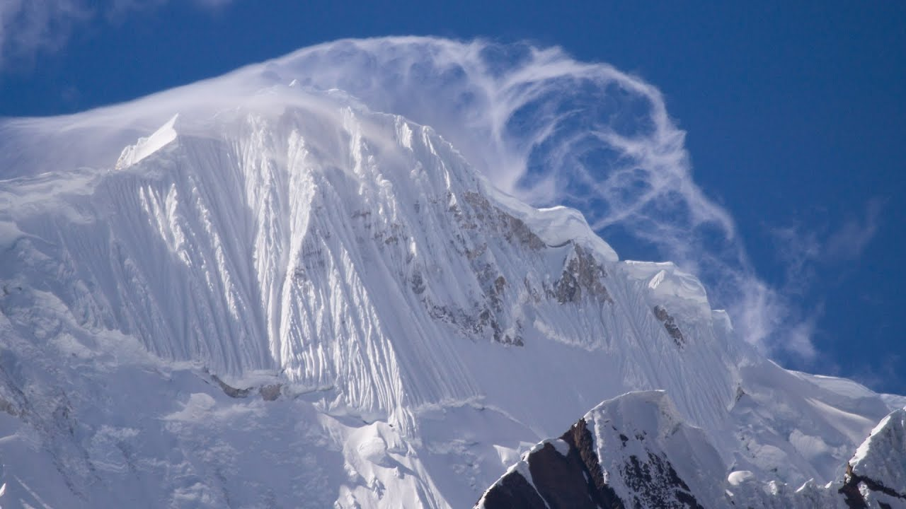 I I |

![]()
![]()
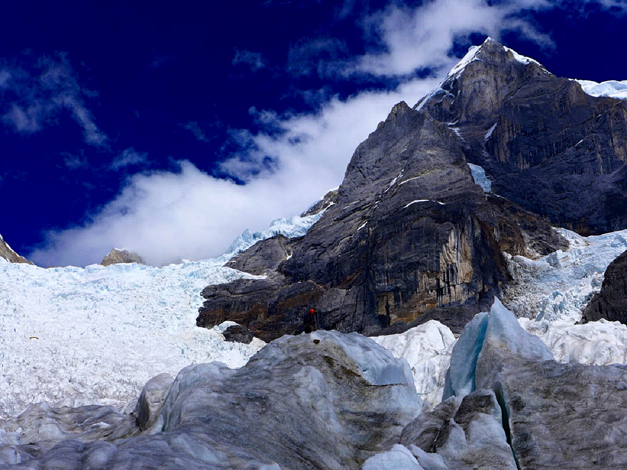
Siula Grande is a mountain in the Huayhuash mountain range in the Peruvian Andes. It is 6,344 metres (20,814 ft) high and has a subpeak, Siula Chico, 6,260 m (20,540 ft) high.[2]
Touching the Void ascent
In 1985, Siula Grande was climbed by Joe Simpson and Simon Yates. Although they ascended the West face, and thereby became the first to reach the summit by that route, they chose to descend the North Ridge, the route of the first ascent and descent in 1936. This was made almost impossible by severe weather which caused Simpson to fall and severely break his leg. All subsequent west face climbers have avoided the ridge and rappelled down the face.
Simpson and Yates’s ascent was described in Simpson’s book Touching the Void. The book was made into a film of the same title in 2003 and a play in 2018.
First ascents list
This is a partial list of first ascents by new routes made.
- 28 July 1936 North Ridge by Arnold Awerzger [de] and Erwin Schneider [de] from Austria.[3][4]
- 21 June 1966 fourth ascent, by Obster, Schulz and Manfred Sturm via the North ridge en route to Siula Chico[5]
- 1983 West Face to North ridge, after retreating from the direct West face due to rockfall hazard. 2 bivies. David Fish Fulton and Scott Flavelle
- 1985 West Face by Joe Simpson and Simon Yates[4]
- 16 June 1999 Avoiding the Touch by Mark Price and Carlos Buhler.[4] Their route followed the Yates/Simpson ascent until approximately the middle of the face, at which point they climbed a narrow, technical gully above the initial ice face and then surmounted a short wall up and left into the ice gully that led directly to the main summit (total of 24 pitches).
- 13 July 2001 “Southern Discomfort”, south face by Michel van der Spek, Jay Burbee, and Jeremy Frimer
- 17 July 2001 Noches de “Juerga”, west face[4]
- 3 July 2002 Northeast Face, Los Rapidos by Slovenes Marjan Kovač and Pavle Kozjek[6][7]
This article uses material from the Wikipedia article Siula Grande, which is released under the Creative Commons Attribution-Share-Alike 4.0 International License (view authors).
 |  Jeremyfrimer (Wikipedia) |
 Max Bonniot (American Alpine Club) | 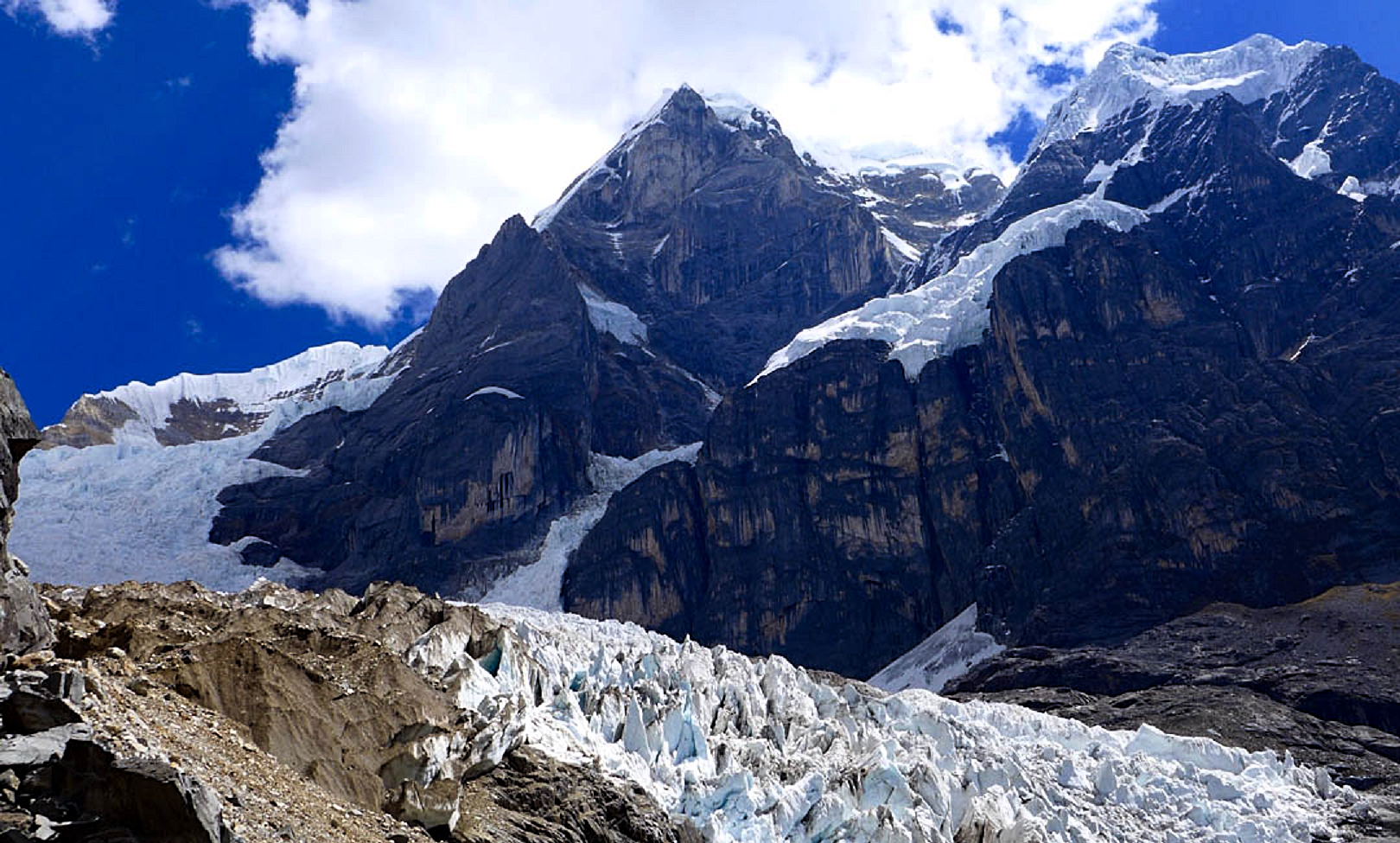 Max Bonniot (American Alpine Club) |
![]()
![]()
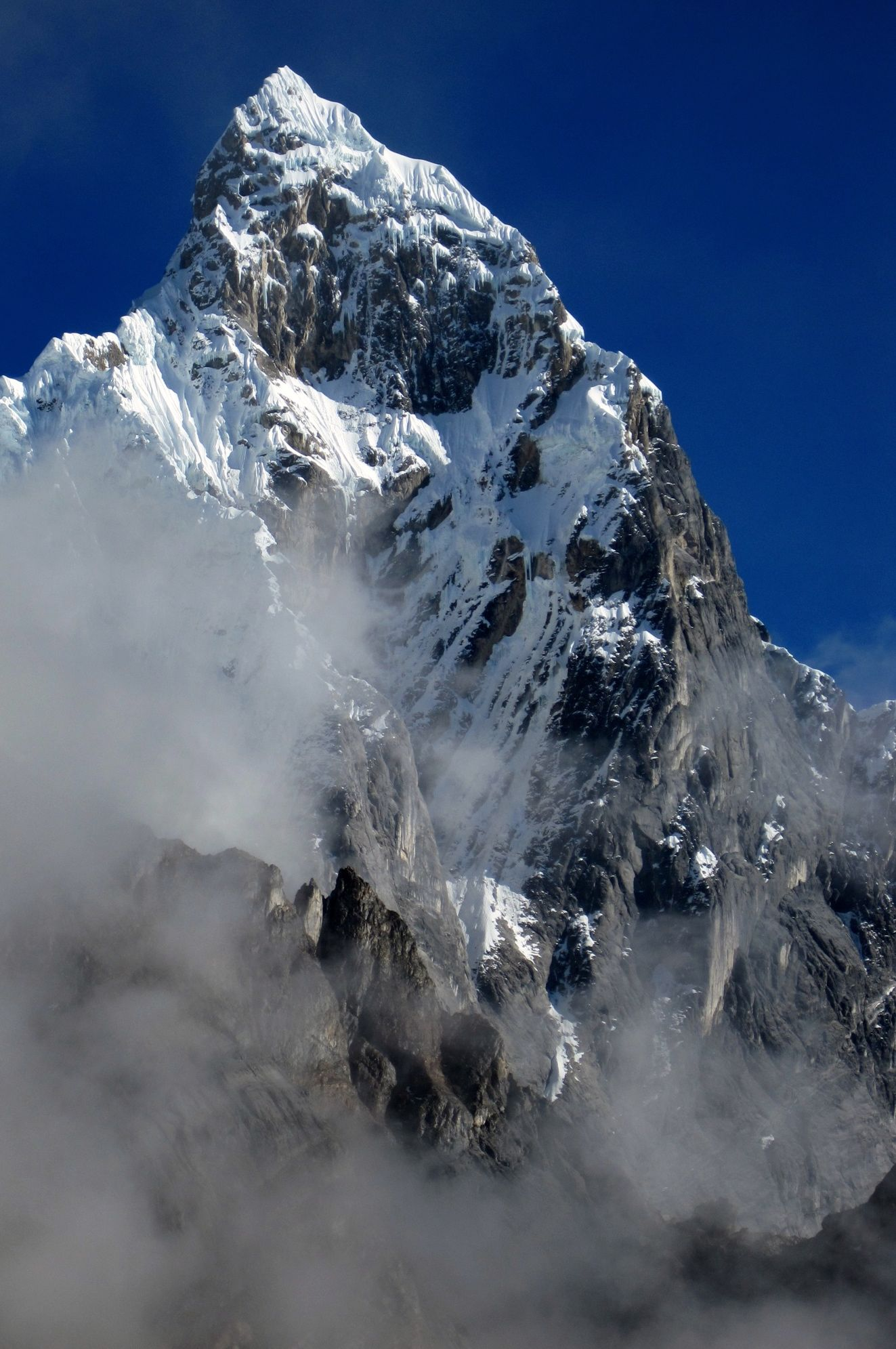
Jirishanca[4][5][6][7][8] is a 6,094-metre-high (19,993 ft)[4][5][6][7] mountain in the Huayhuash mountain range in west central Peru, part of the Andes. Other sources cite a height of 6,125 metres (20,095 ft).[8] It is the 10th highest peak in Peru and the third in the Huayhuash range (after Yerupajá and Siula Grande).[citation needed] Jirishanca translates as “hummingbird bill peak”.[6]
Ascents
The mountain is notoriously difficult and has seen very few successful ascents. The first ascent in July 1957 by the Austrian mountaineers Toni Egger [de; fr; it] and Siegfried Jungmair over the (north)east face[9] has been called “one of the boldest climbing feats ever performed in the Cordillera”.[10] Their route has only been repeated once.[11] In 1964 Gary Colliver and Glen Denny of an American expedition climbed the north ridge to the slightly lower north summit, but a traverse over the “cockscomb of ice” connecting to the main summit has so far not been attempted.[10] On July 6, 1969, an Italian team led by the 60-year-old Riccardo Cassin forged the first route through the West face.[12] On July 31, 1971 the Americans Dean Caldwell and Jon Bowlin first climbed the southwest face in two days. Leaving their expedition below, Bowlin and Caldwell forged their own route and reached the peak on August 1, and were back at base camp by August 2.[13] In 1973, a Japanese team led by Masayuki Shinohara succeeded in climbing the south east face for the first time, though it took them 49 days.[10]
Climbing
It is one of the hardest 6000 meter mountains of the Andes. The easier route to the summit is quoted TD but more difficult routes exist,[6] many on them on vertical ice and with overhanging section of mixed terrain such as the Cassin route (70° ice and a pitch rated UIAA IV+).
Elevation
The altitude of 6125 isn’t likely as other data from available digital elevation models show lower elevations: SRTM yields 6028 metres[14] and TanDEM-X 5734 metres.[15] The height of the nearest key col is 5610 meters, leading to a topographic prominence of 484 meters.[16] Jirishanca is considered a Mountain according to the Dominance System [17] and its dominance is 7.94%. Its parent peak is Yerupaja and the Topographic isolation is 3.5 kilometers.[16]
This article uses material from the Wikipedia article Jirishanca, which is released under the Creative Commons Attribution-Share-Alike 4.0 International License (view authors).
 Waterloo1883 (Wikipedia) | 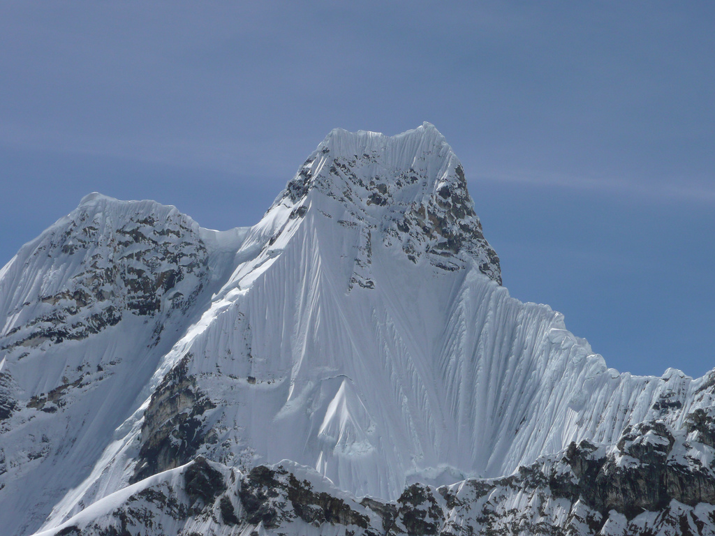 Silvio1973 (Wikipedia) |
 Jeremyfrimer (Wikipedia) | 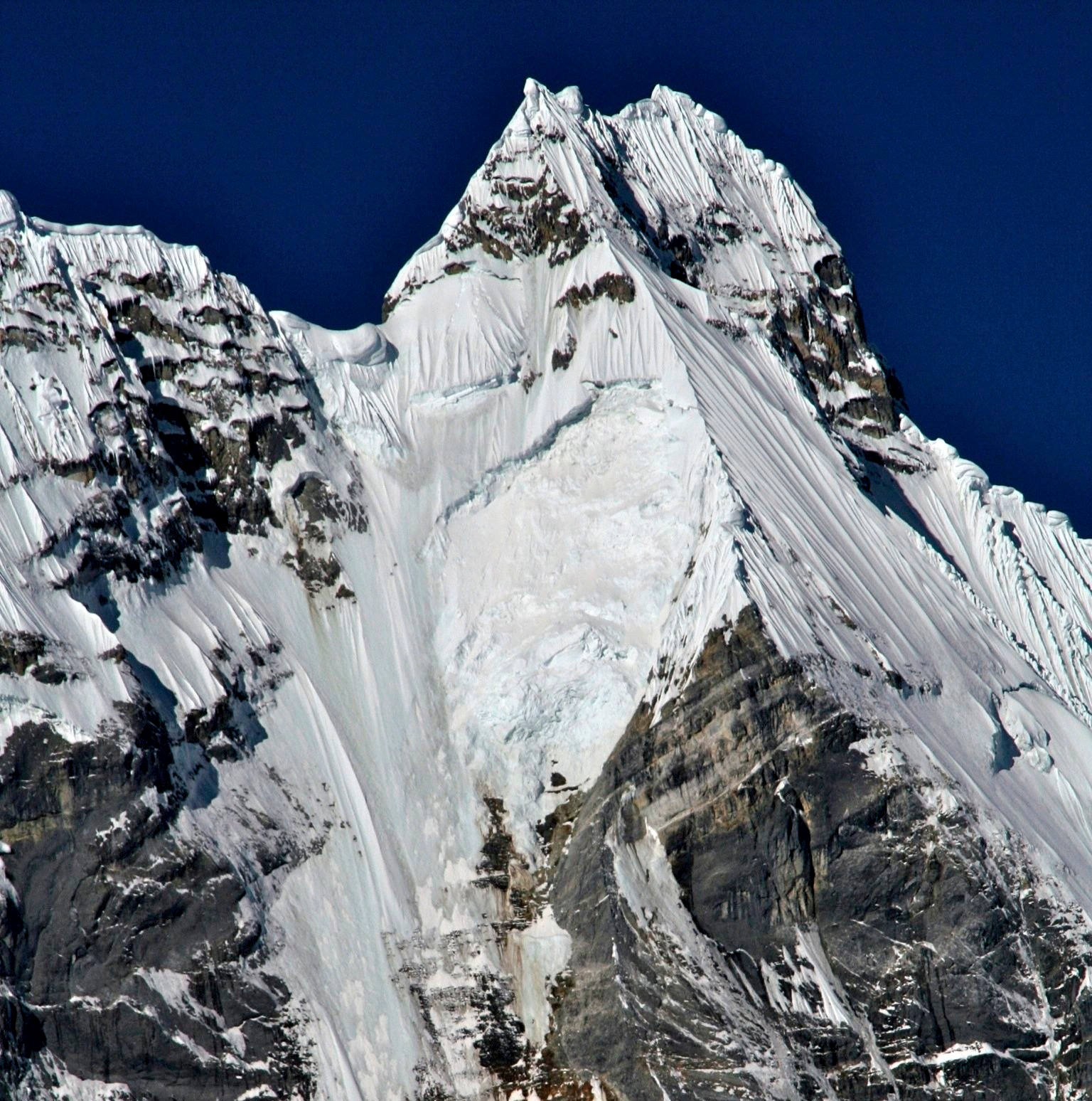 Jeremyfrimer (Wikipedia) |

![]()
Rondoy[1][2][3] (possibly from Quechua runtuy: “to hail” or “to lay an egg”)[4] is a 5,870-metre-high (19,259 ft)[1][2][3] mountain in the north of the Huayhuash mountain range in the Andes of Peru.[2][3] It is located in the Ancash Region, Bolognesi Province, Pacllón District, and in the Huánuco Region, Lauricocha Province, Queropalca District.[5] Rondoy lies north of Yerupajá and Jirishanca and southwest of Lake Mitococha.[1][2][5]
This article uses material from the Wikipedia article Rondoy, which is released under the Creative Commons Attribution-Share-Alike 4.0 International License (view authors).
 Santos (Summit Post) | 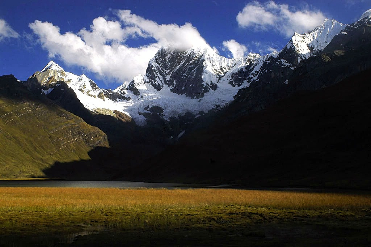 Paulo Tomaz (Wikipedia) |
![]()
![]()
Rasac[1][2][3] (possibly Quechua for toad)[3] is a mountain in the Huayhuash mountain range in west central Peru, part of the Andes.[2] It has a summit elevation of 6,017 metres (19,741 ft),[1][2][3] although other sources cite a height of 6,040 metres (19,816 ft).[4] Rasac is a long, relatively squat mountain on the western edge of the Huayhuash range, across the glacier from the tallest peak in the range, Yerupajá. Although it is a 6,000 metre mountain, Rasac’s broad profile is dwarfed by Yerupajá.
Geology
Further information: Marañón fold and thrust belt
As the rest of the Huayhuash, Rasac is made mainly of limestone, interbedded with sandstone and shale. These sediments were originally laid down on the ocean floor and have been pushed up and folded due to the convergence started about 90 million years ago when the Nazca oceanic plate started to slide under the South American continental plate. The limestone has a coarse, sharp texture and is light to dark grey in colour (although sometimes a slight bluish tint can occur). Marine fossils (bivalves and ammonites) may be found within some of the limestone beds. Some volcanic activity has also influenced the geology of the Huayhuash.
Climbing
Rasac is considered to be the easiest 6,000-metre peak in the Huayhuash range, but it is still a challenging climb. The long, snowy West Face is divided by a series of buttresses, most of which have routes in the D range according to the International French Adjectival System.[5] The Right Buttress is still unclimbed. The East Face is almost all rock, most of which seems in the condition not to be climbed. There is allegedly a snow route of moderate difficulty (considered to be the normal route and rated around AD) up a gulley on this face that looked in the summer of 2007 to be totally out of condition.
Even if Rasac is overall the most climbed peak of the Huayhuash range, it remains a mountain climbed very rarely (less than a climb per year). The mountain lies in a remote and wild setting. Expeditions willing to climb in this area have to be fully self-sufficient in case of an accident or emergency.
A traverse of the mountain begins with five pitches of rock up the east face to gain the south ridge, a long airy corniced snow and ice ridge to the summit followed by descending the north ridge and down NE face of mixed snow, rock and ice. V 5.8 AI 3–4 James Garrett, Paul Gonzales spring of 1996.
This article uses material from the Wikipedia article Rasac, which is released under the Creative Commons Attribution-Share-Alike 4.0 International License (view authors).
 Jeremyfrimer (Wikipedia) I | 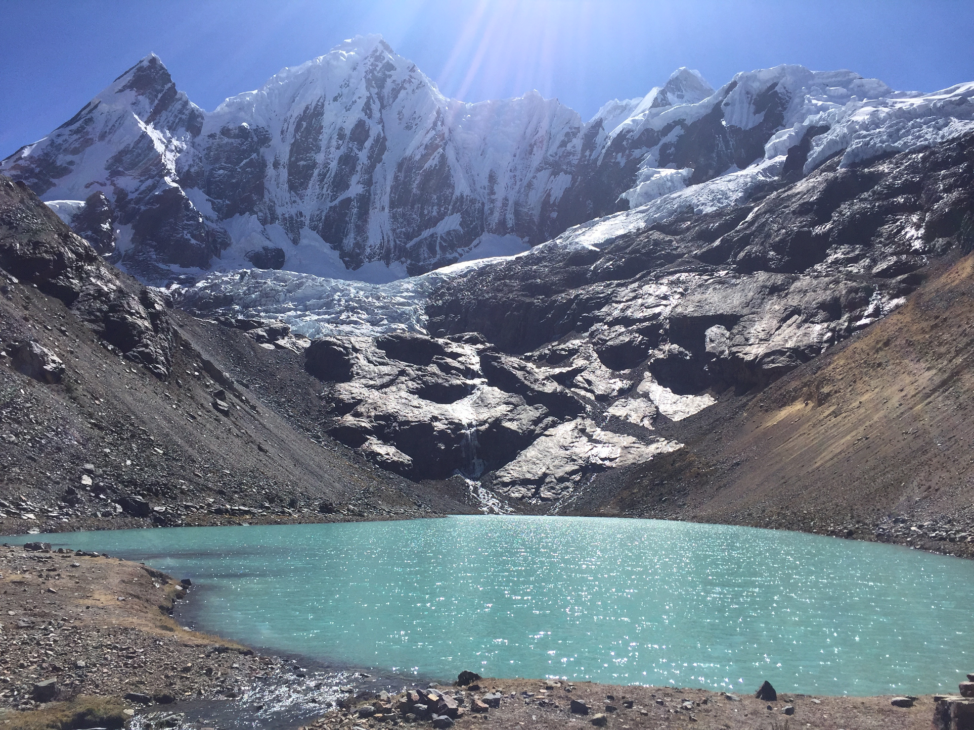 Sergio Ramirez (Wikipedia) |
![]()
![]()
Ninashanca is a mostly rocky mountain in the north of the Huayhuash mountain range in the Andes of Peru, 5,605 metres (18,389 ft) high. It is located in the Huánuco Region, Bolognesi Province, Pacllón District, and in the Lauricocha Province, Queropalca District, northwest of the lake Ninacocha.[1] It is separated from Rondoy by a col 5,000 metres (16,404 ft) high. It is a mountain very rarely climbed. Base camp can be reached from the village of Chiquian in five days of trek.
The normal route is rated D and can be climbed from Mitococha by the NE ridge, gained by a 45° snow couloir then a short rock pitch followed by the corniced ridge.
This article uses material from the Wikipedia article Ninashanca, which is released under the Creative Commons Attribution-Share-Alike 4.0 International License (view authors).
 Elvis Acevedo (Andes Handbook) | 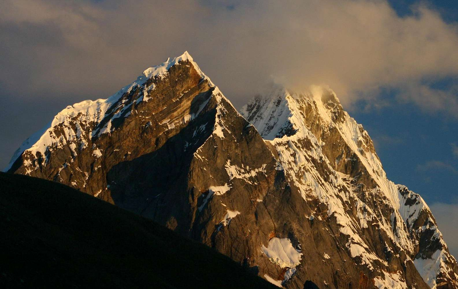 Hhsilleck (Summit Post) I |
