
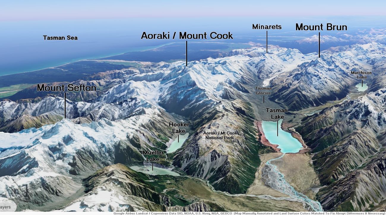
Map of Southern Alps


Aoraki / Mount Cook Region

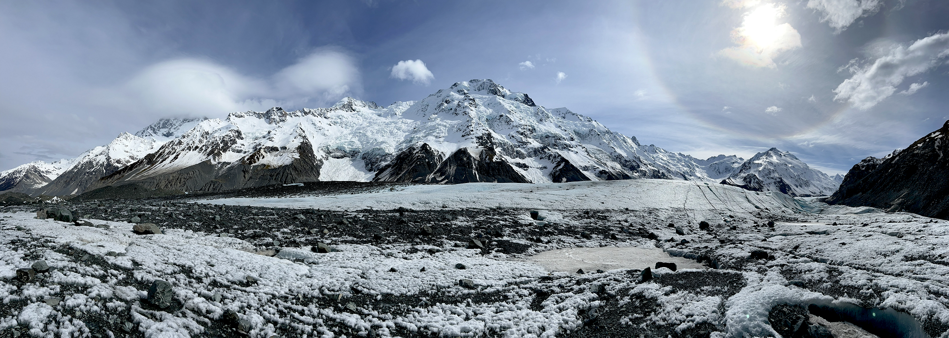
Aoraki / Mount Cook Panoramic
Chris Broyles
Sep 7, 2022 at 11:38 am
Aoraki / Mount Cook and the Hochstetter Icefall Viewed by Helicopter – 2 Min 48 Sec
![]()
![]()
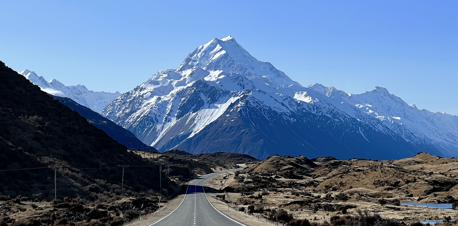
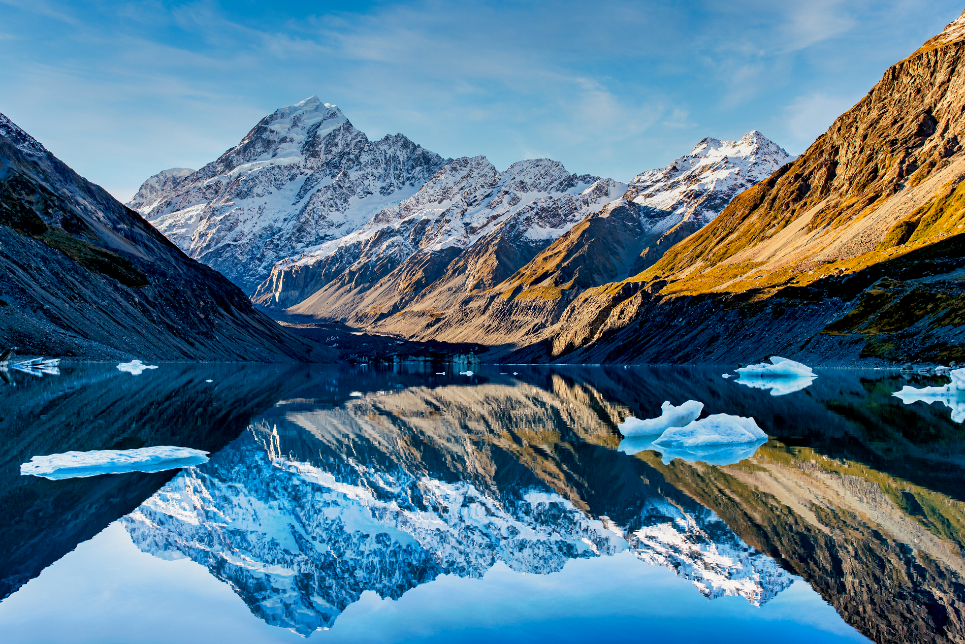
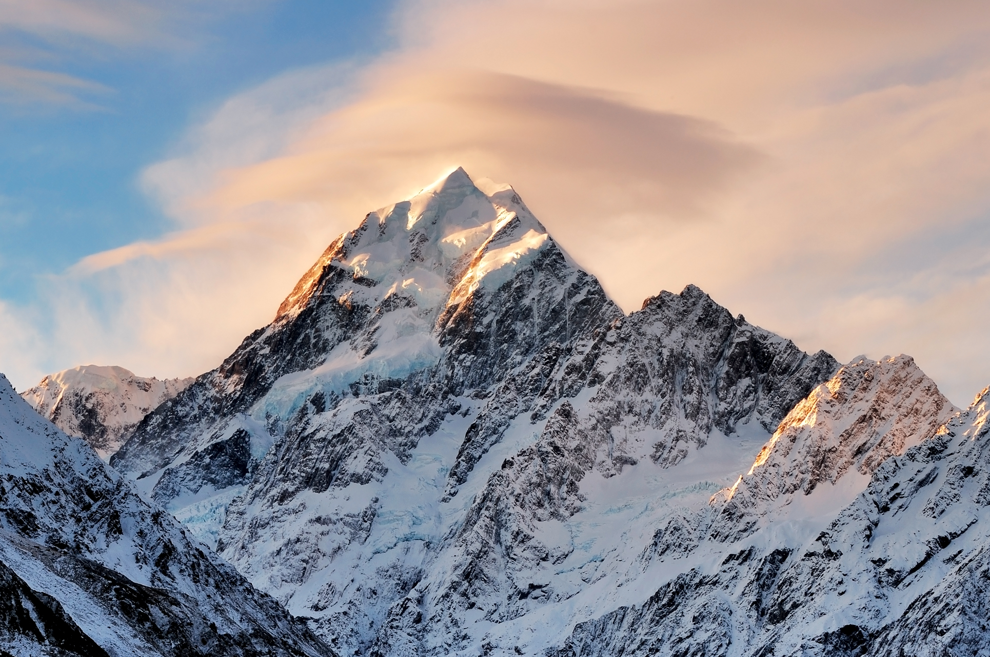
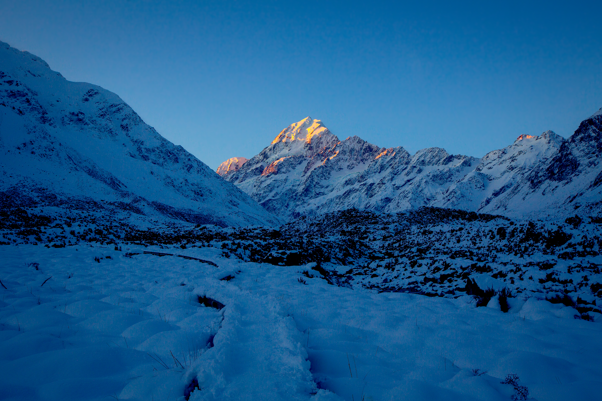
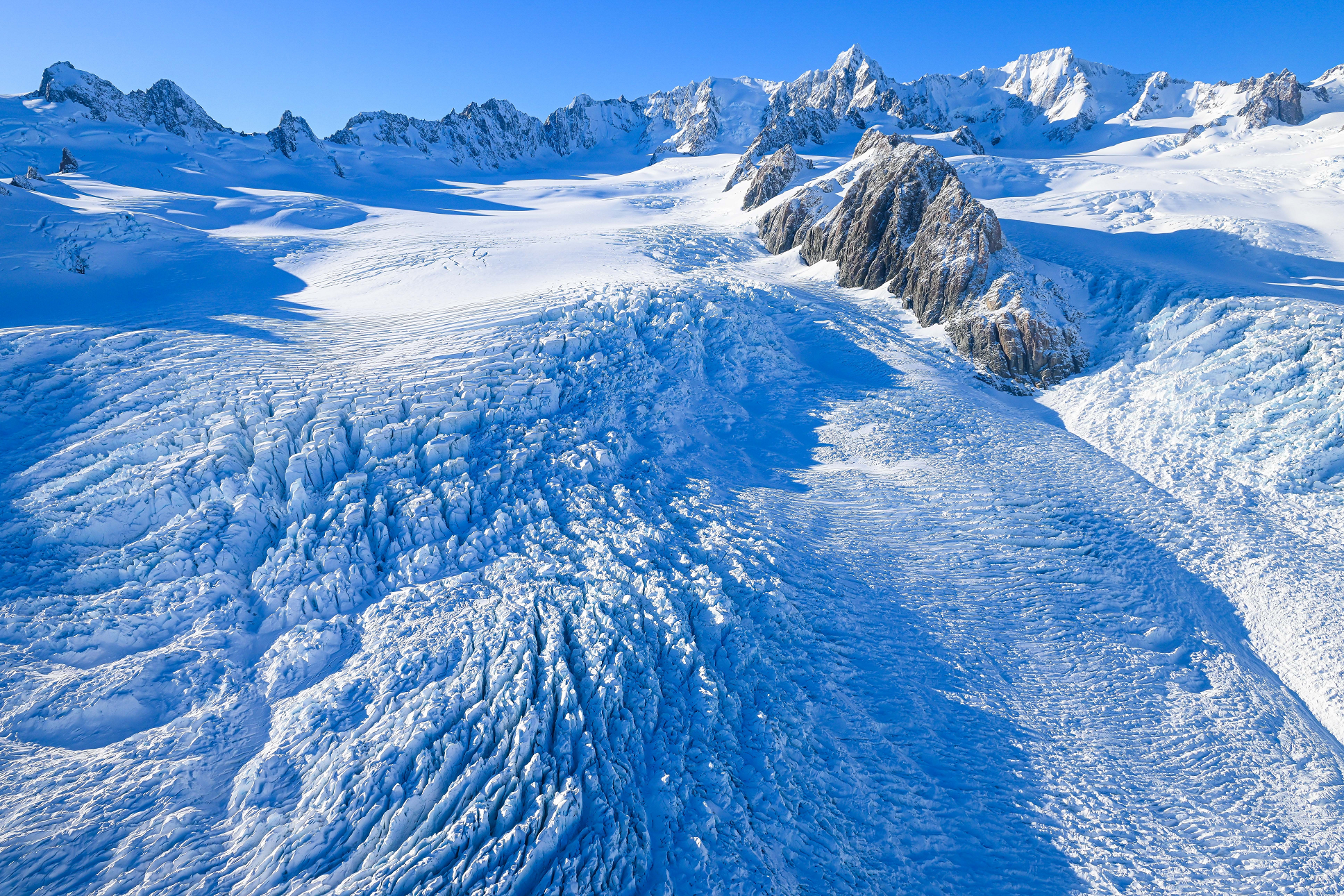
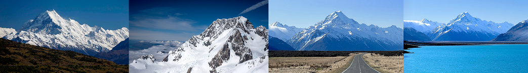
Aoraki / Mount Cook[a] is the highest mountain in New Zealand. Its height, as of 2014, is listed as 3,724 metres (12,218 feet).[2] It is situated in the Southern Alps, the mountain range that runs the length of the South Island. A popular tourist destination,[3] it is also a favourite challenge for mountain climbers. Aoraki / Mount Cook consists of three summits: from south to north, the Low Peak (3,593 m or 11,788 ft), the Middle Peak (3,717 m or 12,195 ft) and the High Peak. The summits lie slightly south and east of the main divide of the Southern Alps, with the Tasman Glacier to the east and the Hooker Glacier to the southwest.[1] Mount Cook is ranked 10th in the world by topographic isolation.[4]
Location
The mountain is in the Aoraki / Mount Cook National Park, in the Canterbury Region. The park was established in 1953 and along with Westland Tai Poutini National Park, Mount Aspiring National Park and Fiordland National Park forms one of the UNESCO World Heritage Sites. The park contains more than 140 peaks standing over 2,000 metres (6,600 ft) and 72 named glaciers, which cover 40 percent of its 700 square kilometres (170,000 acres).
The peak is located at the northern end of the Mount Cook Range, where it meets with the main spine of the Main Divide, forming a massif between the Hooker Valley to the southwest and the Tasman Valley east of the mountain. These two valleys provide the closest easily accessible view points of Aoraki / Mount Cook. A lookout point at the end of the Hooker Valley Track located only 10 kilometres (6.2 mi) from the peak has views of the entire mountainside.[5][6]
The settlement of Mount Cook Village, also referred to as “Aoraki / Mount Cook”, is a tourist centre and base camp for the mountain. It is 7 kilometres (4.3 mi) from the end of the Tasman Glacier and 15 kilometres (9.3 mi) south of Aoraki / Mount Cook’s summit.[7]
On clear days, Aoraki / Mount Cook is visible from the West Coast as far north as Greymouth, some 150 km (93 mi) away, and from most of State Highway 80 along Lake Pukaki and State Highway 6 south of Lake Pukaki. The near horizontal ridge connecting the mountain’s three summits forms a distinctive blocky shape when viewed from an eastern or western direction. Another popular view point is from Lake Matheson on the West Coast, described as the “view of views”, where on calm days, the peaks of Aoraki / Mount Cook and Mt Tasman are reflected in Lake Matheson.[8]
This article uses material from the Wikipedia article Aoraki / Mount Cook, which is released under the Creative Commons Attribution-Share-Alike 4.0 International License (view authors).
 Chris Broyles Sep 6, 2022 at 3:31 pm | 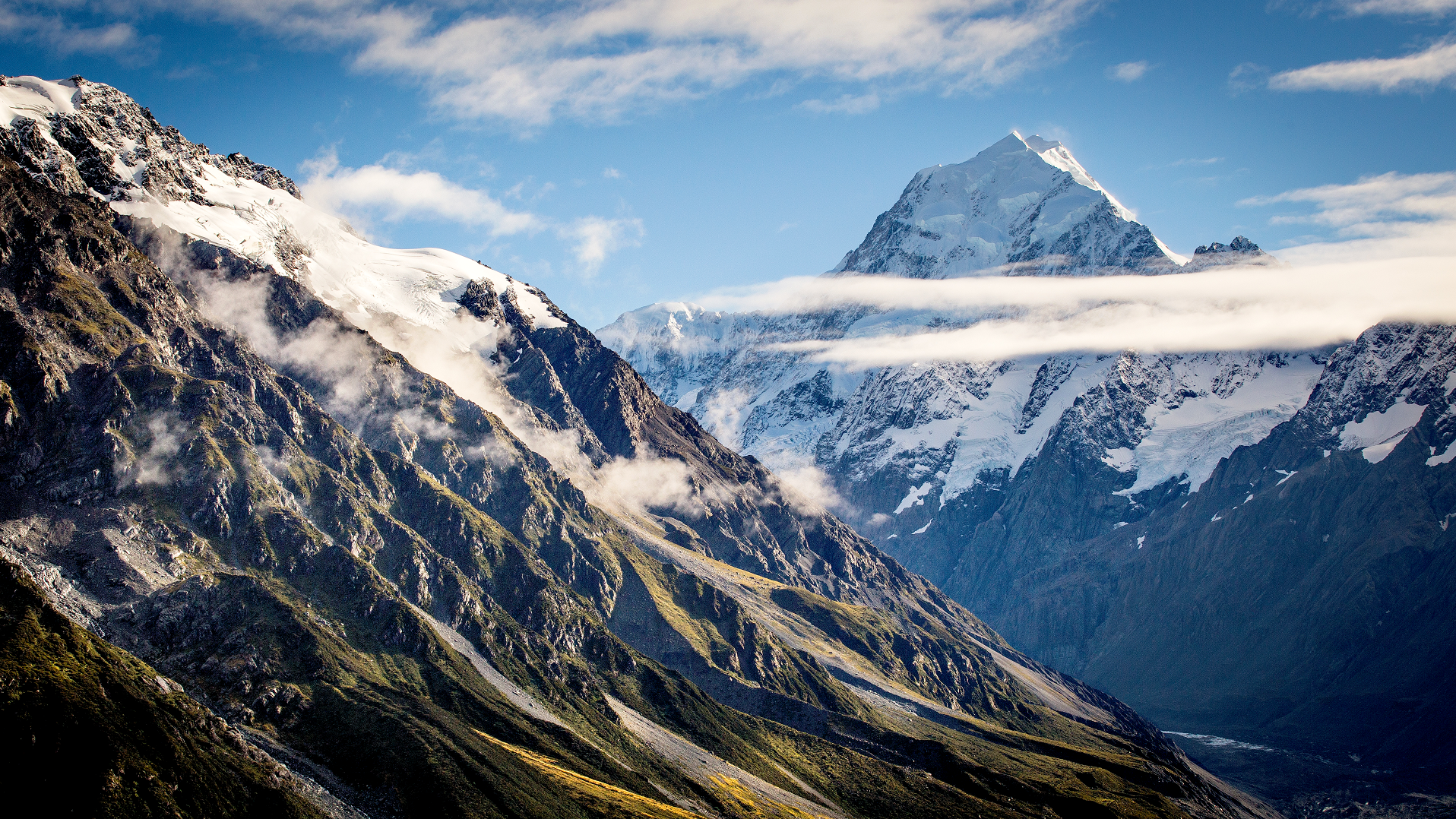 Gib (AdobeStock) I |
 S Watson (Shutterstock) |  Kritz Workroom (iStock) |
 Cn0ra (iStock) I |  Chris Broyles Sep 6, 2022 at 12:09 pm |
 Jun Yit Lai (iStock) I | 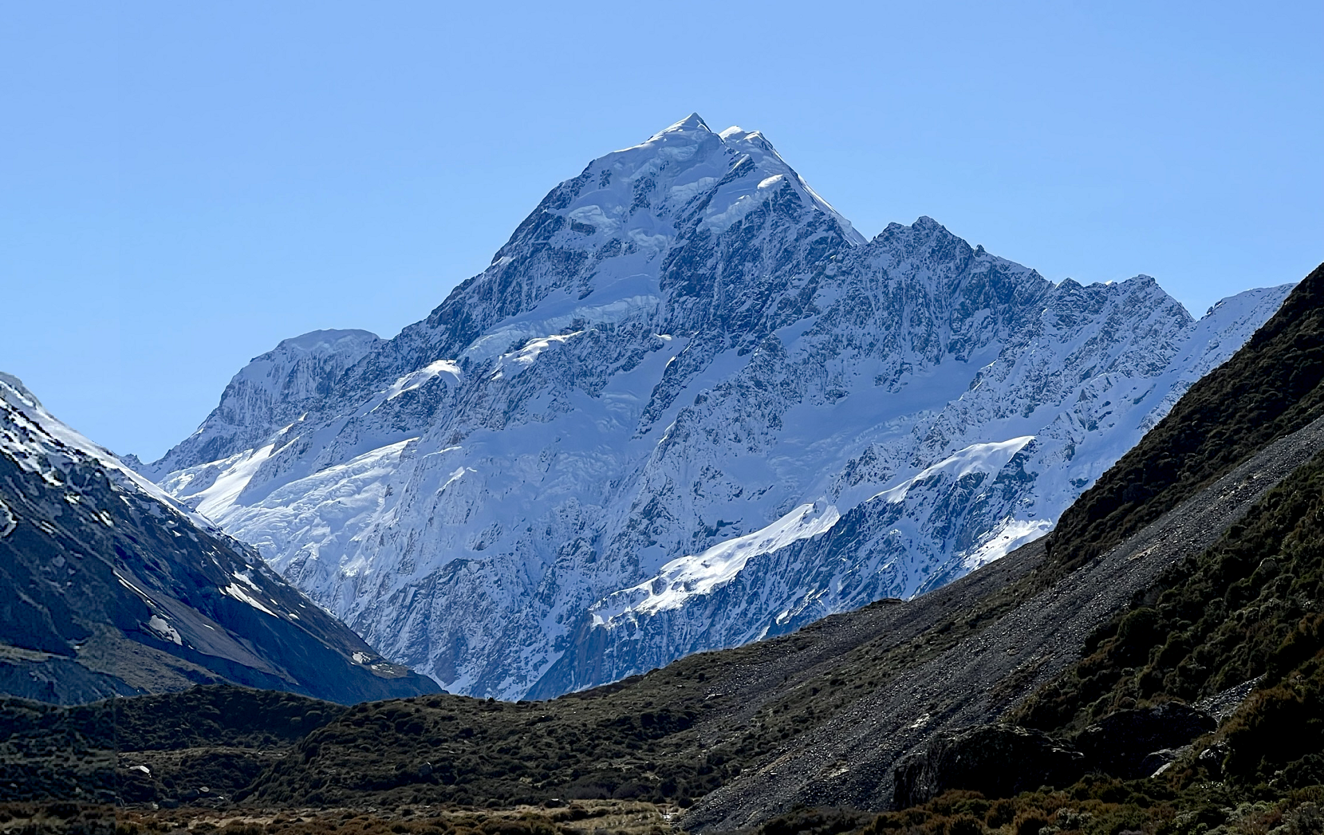 Chris Broyles Sep 6, 2022 at 11:53 am |
 SouthWesImagesAus (Shutterstock) | 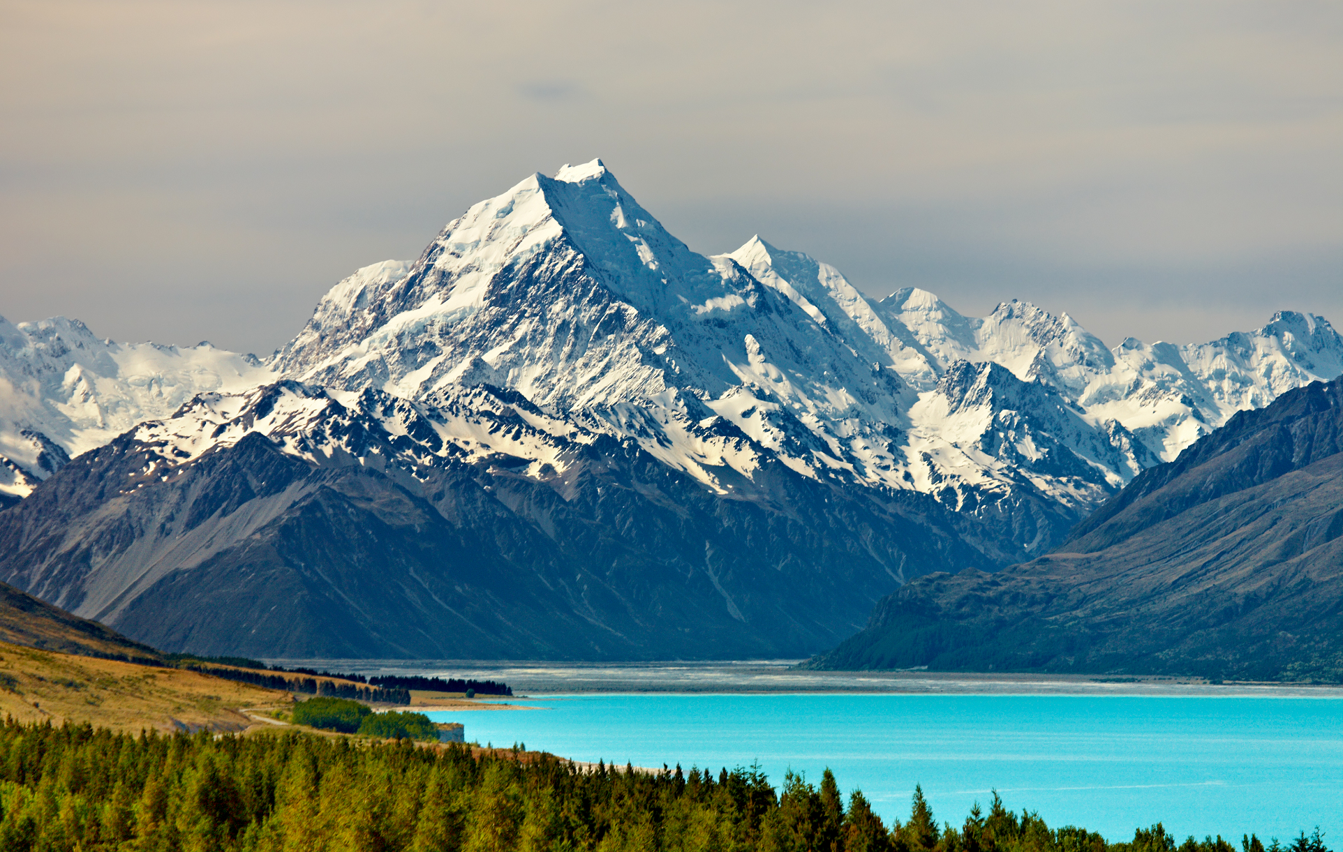 Dmitry Pichugin (Shutterstock) |
Additional Aoraki / Mount Cook Images Here
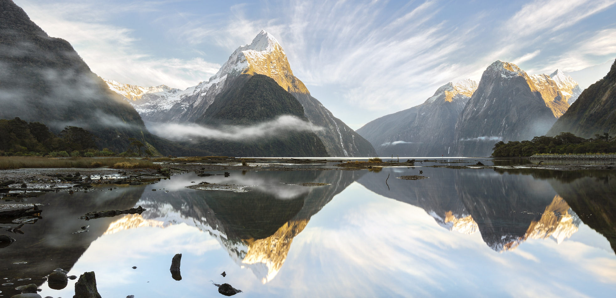
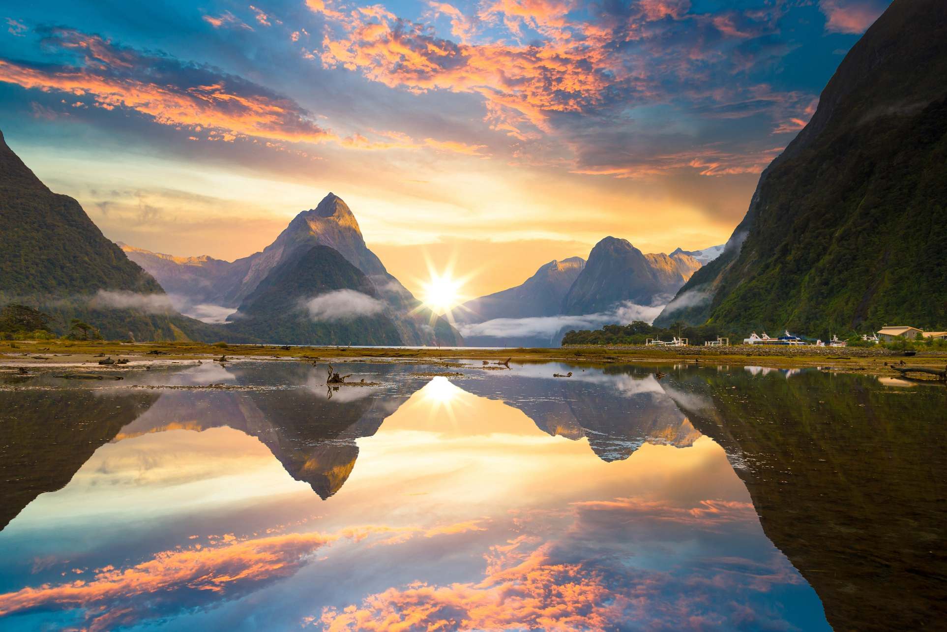
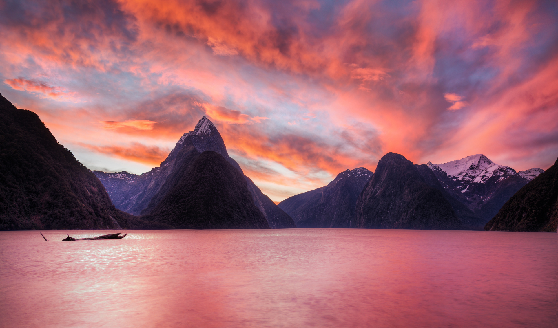
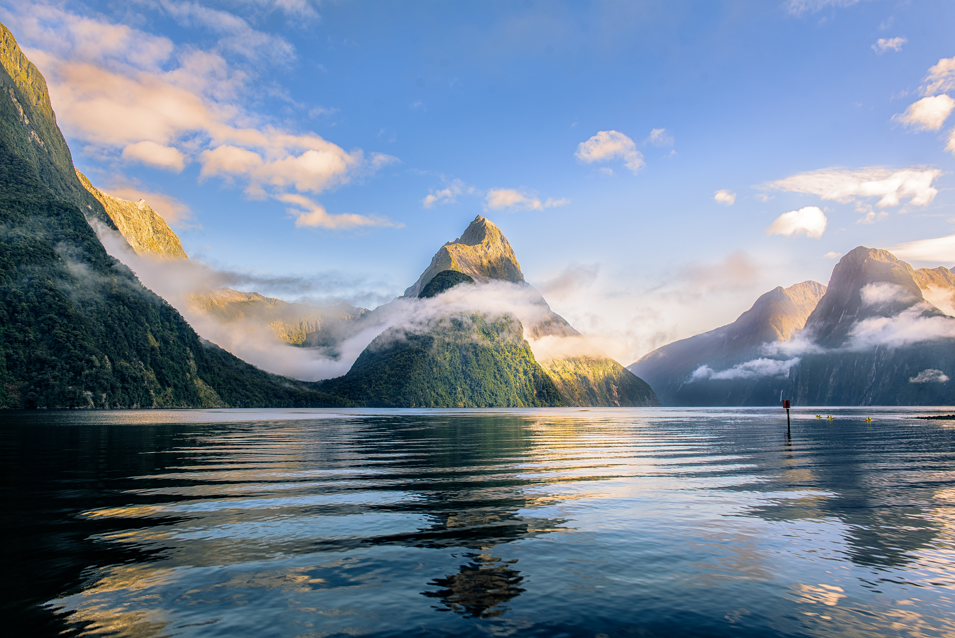
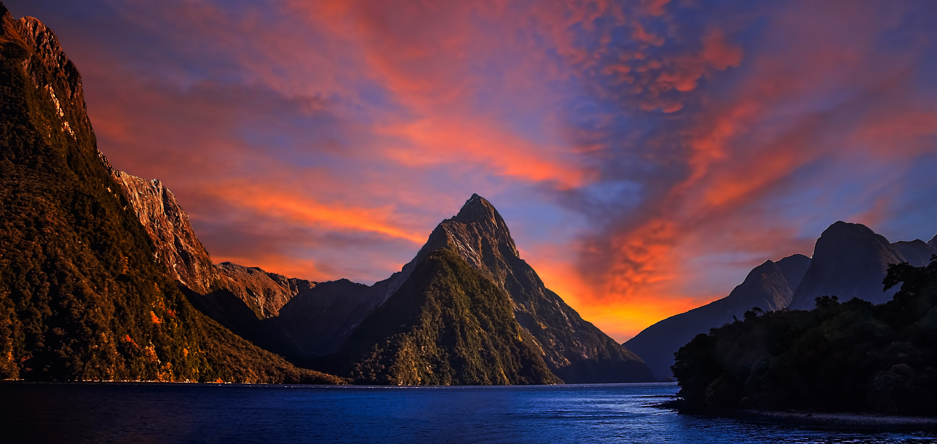
Mitre Peak Panoramic
Susan WoodImages (iStock)
![]()
![]()
Mitre Peak (Māori: Rahotu) is a mountain in the South Island of New Zealand; it is located on the shore of Milford Sound. The mountain was named by Captain John Lort Stokes of HMS Acheron, who found its shape reminiscent of the mitre headwear of Christian bishops.[2] The Māori name for the peak is Rahotu.[3]
Geography
Mitre Peak is close to the shore of Milford Sound, in the Fiordland National Park in the southwestern South Island.[4] It rises to 1,690 metres (5,560 ft) with almost sheer drops to the water. The peak is actually a closely grouped set of five peaks, although from most easily accessible viewpoints, it appears as a single point.[4] Milford Sound is part of Te Wahipounamu, a World Heritage Site as declared by UNESCO.[5] The imposing setting makes the peak a favourite object for painters.[6] A painting by Charles Decimus Barraud is held by the Sarjeant Gallery in Whanganui.[7] The only road access to Milford Sound is via State Highway 94.[8]
Climbing
Mitre Peak is difficult to reach and as a result ascent attempts are relatively infrequent.[3] The first known attempt of the peak was in 1883 by Invercargill artist Samuel Mereton, and Donald Sutherland. The pair took a boat to Sinbad Bay on 6 February and camped at the head of the valley. The next day, with little equipment, no coats and one biscuit each they climbed to the crest of the Mitre Range, from where they could see Mitre Peak over 3 km away to the east. With it being too late in the day to descend, they slept where they were overnight, before the next day abandoning the attempt to avoid an approaching storm. After a difficult descent they waited for two more days in bad weather at the head of Sinbad Gully before rowing back across Milford Sound to the hotel operated by Sunderland’s wife.[9][10]
In 1911, Jim Dennistoun walked in to Milford Sound from Lake Te Anau over McKinnon Pass, and inquired among the track porters in the hope of finding someone to climb the peak with him. None of the porters had any climbing experience, but one of them, Joe Beaglehole (1875–1962), had read Scrambles among the Alps by noted climber Edward Whymper and was thus chosen by Dennistoun to accompany him.[9]
During a sea voyage in the area with brother George in HMS Pioneer in 1909, Dennistoun had identified what he thought was a possible route but as he was not able to reconnoitre it he instead decided to take a route recommended by Donald Sutherland. After rowing across in a boat to the mouth of Sinbad Gully at the base of the peak they starting climbing at 07:30 on 13 March 1911.[11][12] Dennistoun and Beaglehole climbed via the south east-ridge through the bush until 300 metres short of the summit Beaglehole decided it was too difficult to continue and stopped. Dennistoun continued on alone up steep, smooth slabs of granite, to reach the summit at 13:15.[13]
This article uses material from the Wikipedia article Mitre Peak, which is released under the Creative Commons Attribution-Share-Alike 4.0 International License (view authors).
 I I | 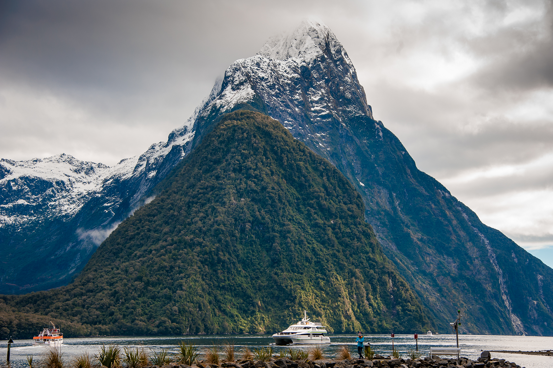 Linda Kennard (Dreamstime) |
 Trey Ratcliff (Flickr) | 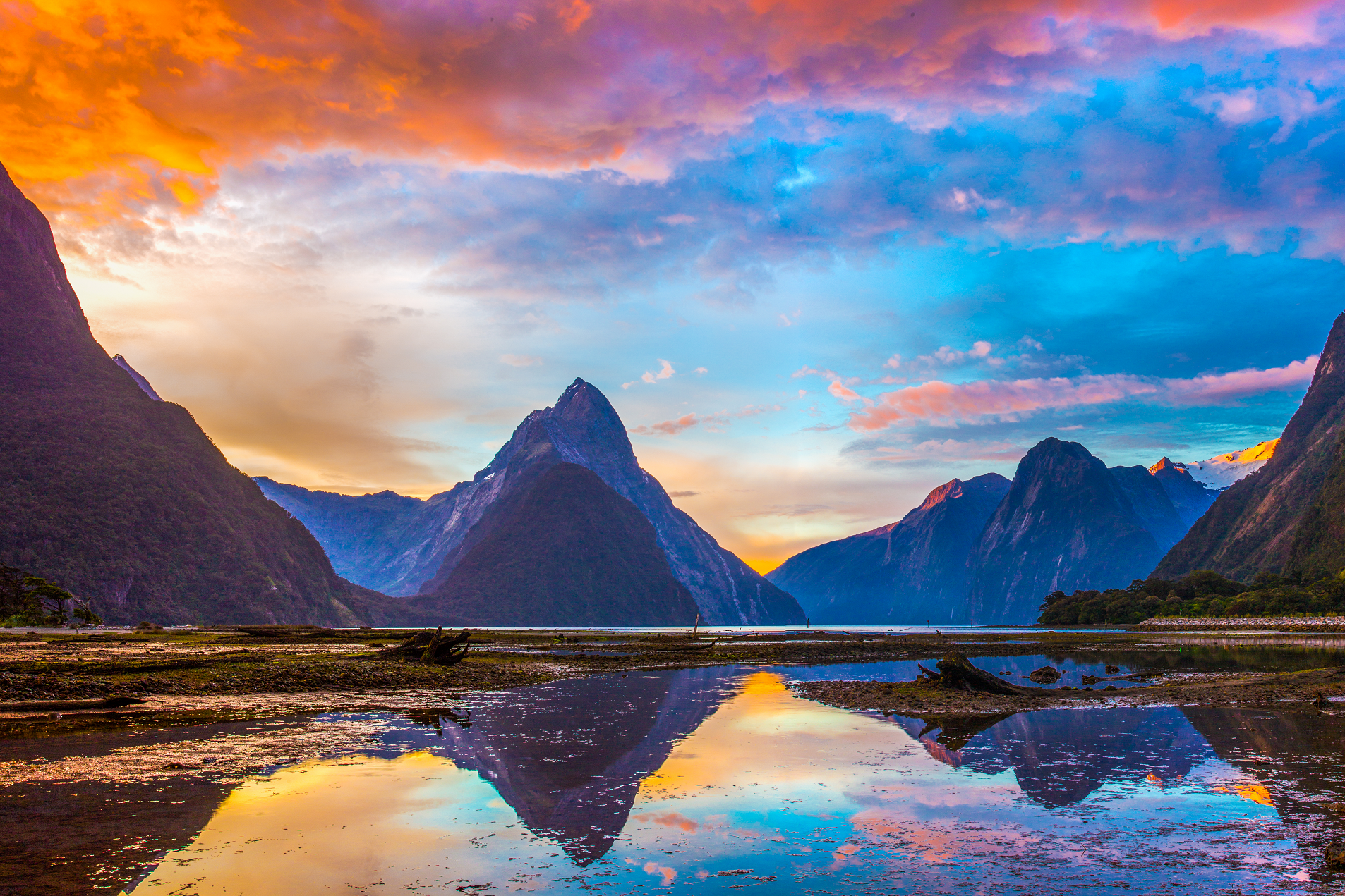 Rinus Baak (Dreamstime) |
 Natheepat Kiatpaphaphong (Dreamstime) | 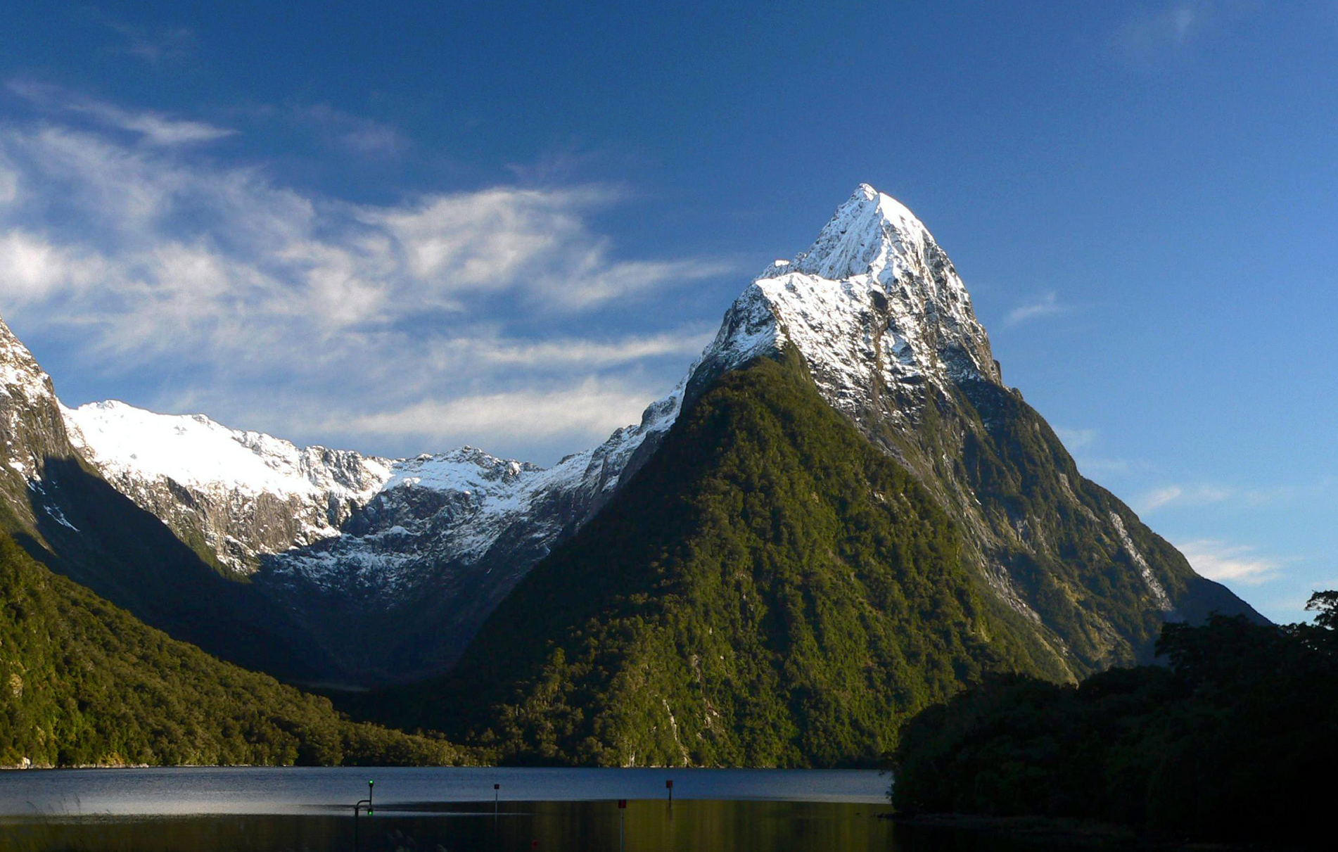 I I I |
 Paop (Dreamstime) | 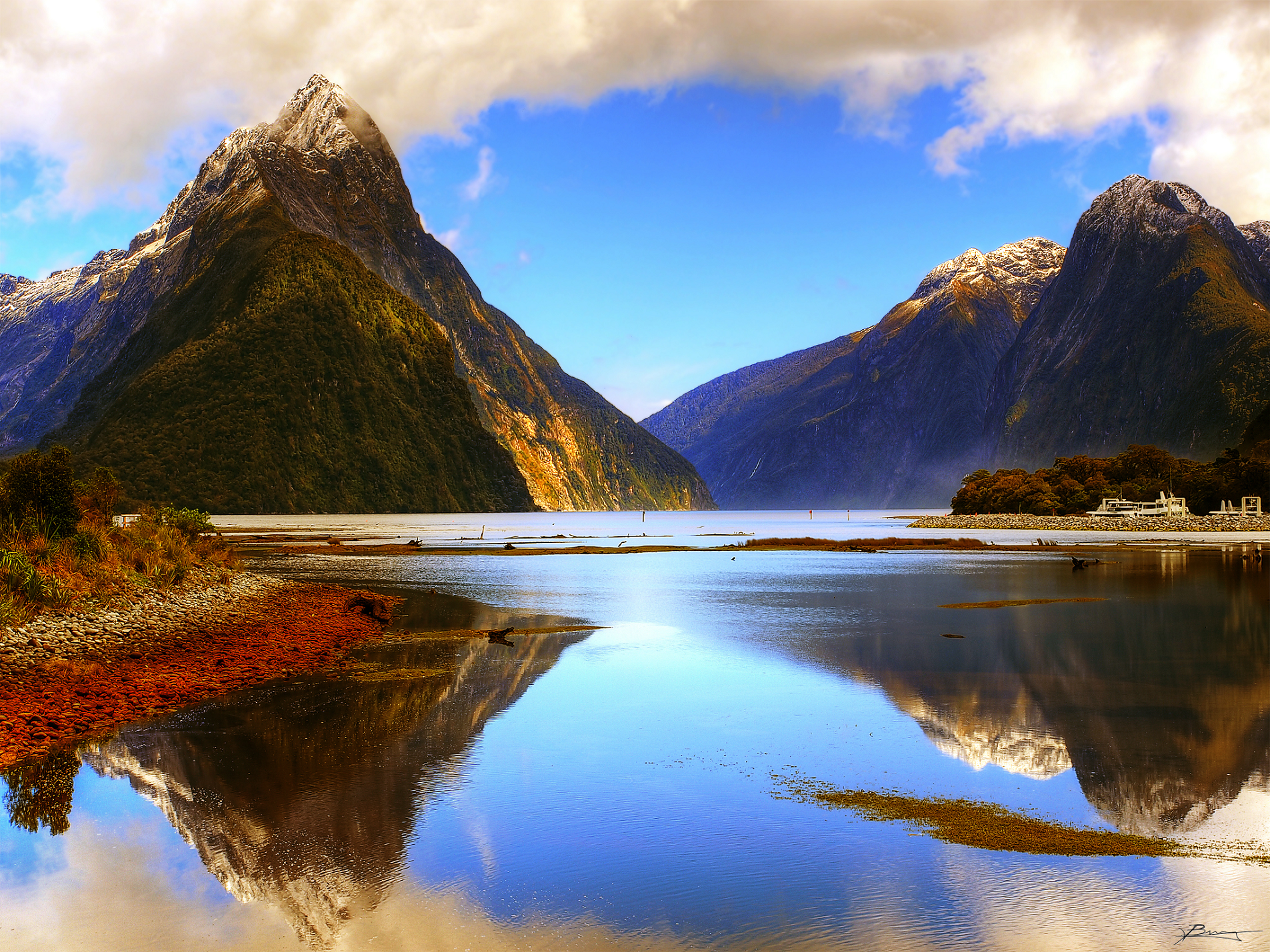 Paul Bica (Flickr) |
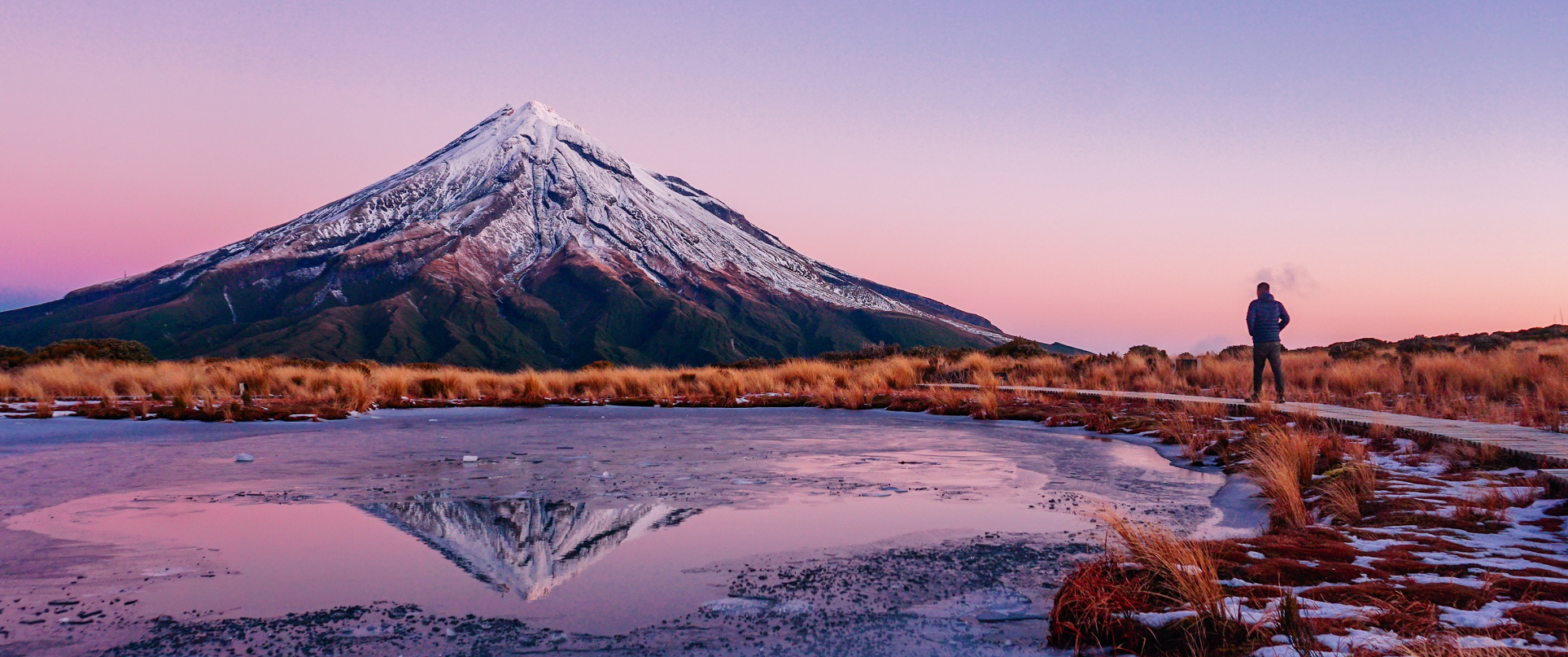
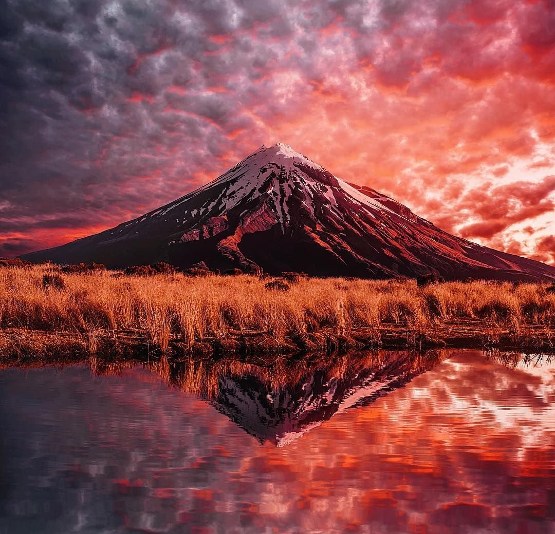
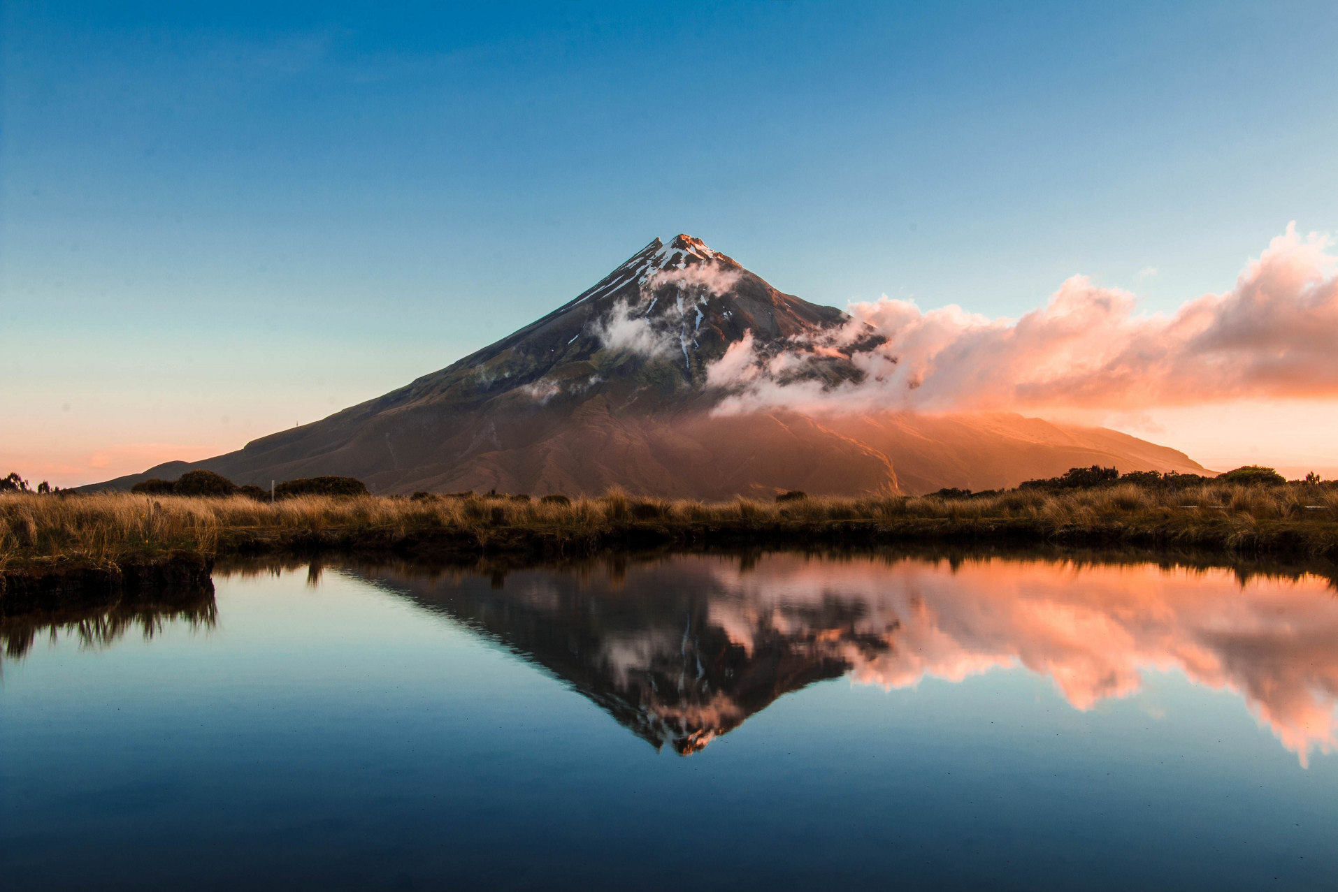
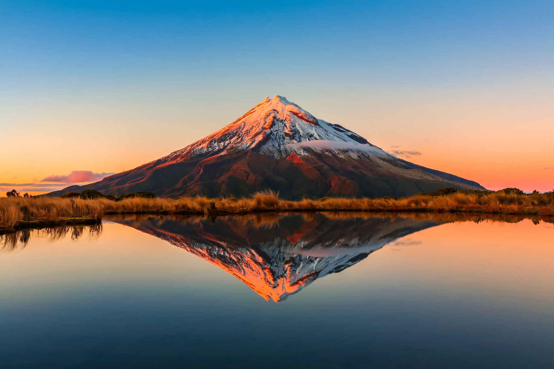
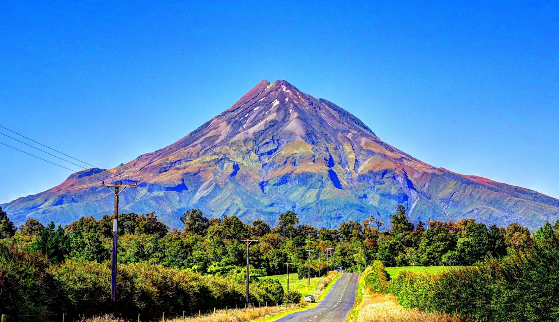
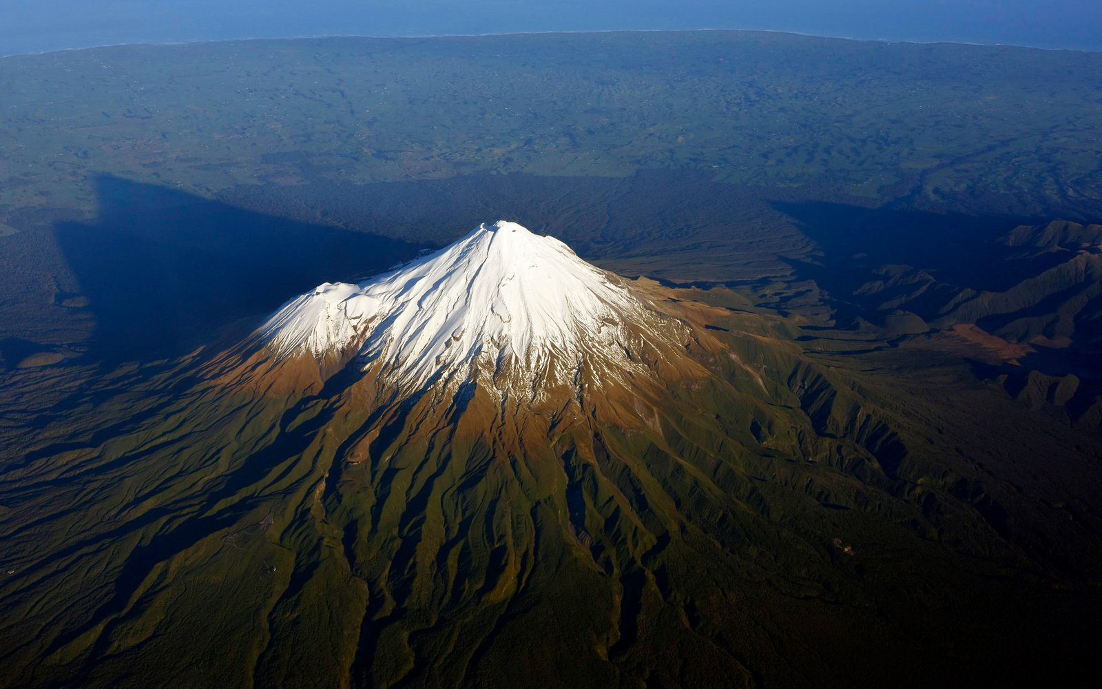
Mount Taranaki Panoramic
![]()
![]()
Mount Taranaki (Māori: Taranaki Maunga, also known as Mount Egmont) is a dormant stratovolcano and legal person in the Taranaki region on the west coast of New Zealand’s North Island.[5][6][7] At 2,518 metres (8,261 ft), it is the second highest mountain in the North Island, after Mount Ruapehu. It has a secondary cone, Fanthams Peak (Māori: Panitahi), 1,966 metres (6,450 ft), on its south side.[8]
Name
The name Taranaki is from the Māori language. The mountain was named after Rua Taranaki, the first ancestor of the iwi (tribe) called Taranaki, one of several iwi in the region.[9] The Māori word tara means mountain peak, and naki may come from ngaki, meaning “clear of vegetation.”[10] It was also named Pukehaupapa (“ice mountain”) and Pukeonaki (“hill of Naki”) by iwi who lived in the region in “ancient times”.[10][11][12]
Captain Cook named it Mount Egmont on 11 January 1770 after John Perceval, 2nd Earl of Egmont,[13] a former First Lord of the Admiralty who had supported the concept of an oceanic search for Terra Australis Incognita. Cook described it as “of a prodigious height and its top cover’d with everlasting snow,” surrounded by a “flat country … which afforded a very good aspect, being clothed with wood and verdure“.[14] When the French explorer Marc-Joseph Marion du Fresne saw the mountain on 25 March 1772 he named it Pic Mascarin. He was unaware of Cook’s earlier visit.[15]
It appeared as Mount Egmont on maps until 29 May 1986, when the name officially became “Mount Taranaki or Mount Egmont”[16] following a decision by the Minister of Lands, Koro Wētere.[17][18] The Egmont name still applies to the national park that surrounds the peak and geologists still refer to the peak as the Egmont Volcano.[19]
As part of the Treaty of Waitangi settlement with Ngā Iwi o Taranaki, a group of tribes in the region,[a] the mountain will be officially named Taranaki Maunga, and will be the first natural geographic feature with an official name in Māori, rather than English.[20][21] The settlement was initialled on 31 March 2023, and has been ratified by the iwi of Taranaki.[22][23] Some iwi in the region had referred to the mountain as Taranaki Mounga rather than Taranaki Maunga, per the local Māori dialect.[24]
Geology
Mount Taranaki is situated in the sedimentary Taranaki Basin and is part of the Taranaki Volcanic Lineament which has had a 3 cm/year (1.2 in/year) north to south migration over the last 1.75 million years.[25]: 458–9 A Wadati–Benioff zone exists at about 200 km (120 mi) depth and the volcano’s magma has the geochemical features of an arc volcano.[26]: 2 Under the volcano itself there is high heat flow with only about 10 km (6.2 mi) crustal thickness although this rapidly normalises for continental crust to 35 km (22 mi) east of the volcano and 25 km (16 mi) to the west.[26]: 2–3
This article uses material from the Wikipedia article Mount Taranaki, which is released under the Creative Commons Attribution-Share-Alike 4.0 International License (view authors).
 |  |
 I |  Dave Young (Wikipedia) |
 |  |
