
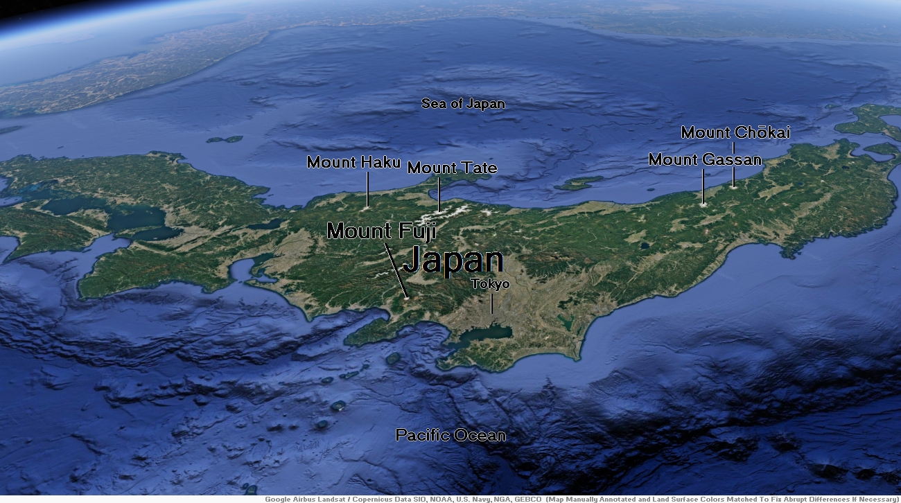
Map of Japan


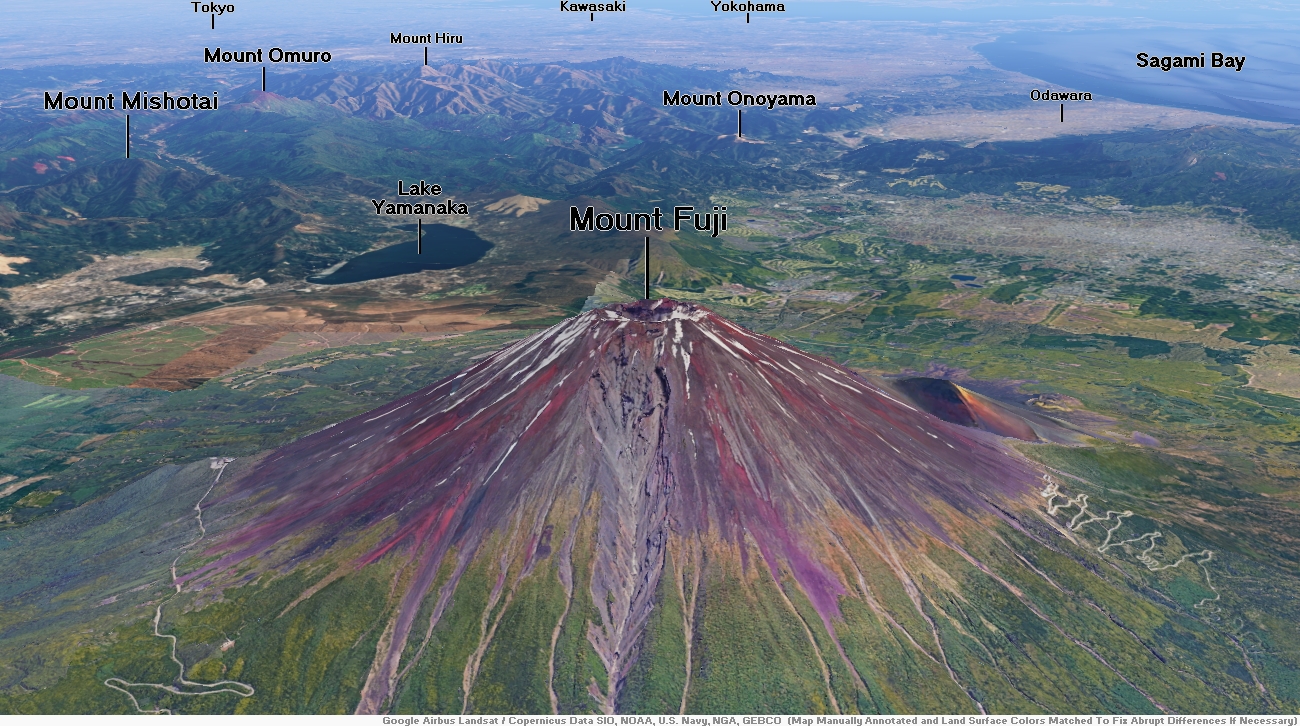
Mount Fuji Region

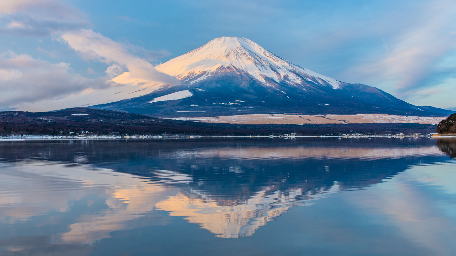
Mount Fuji Panoramic
Kanpisut (Adobe Stock)

![]()
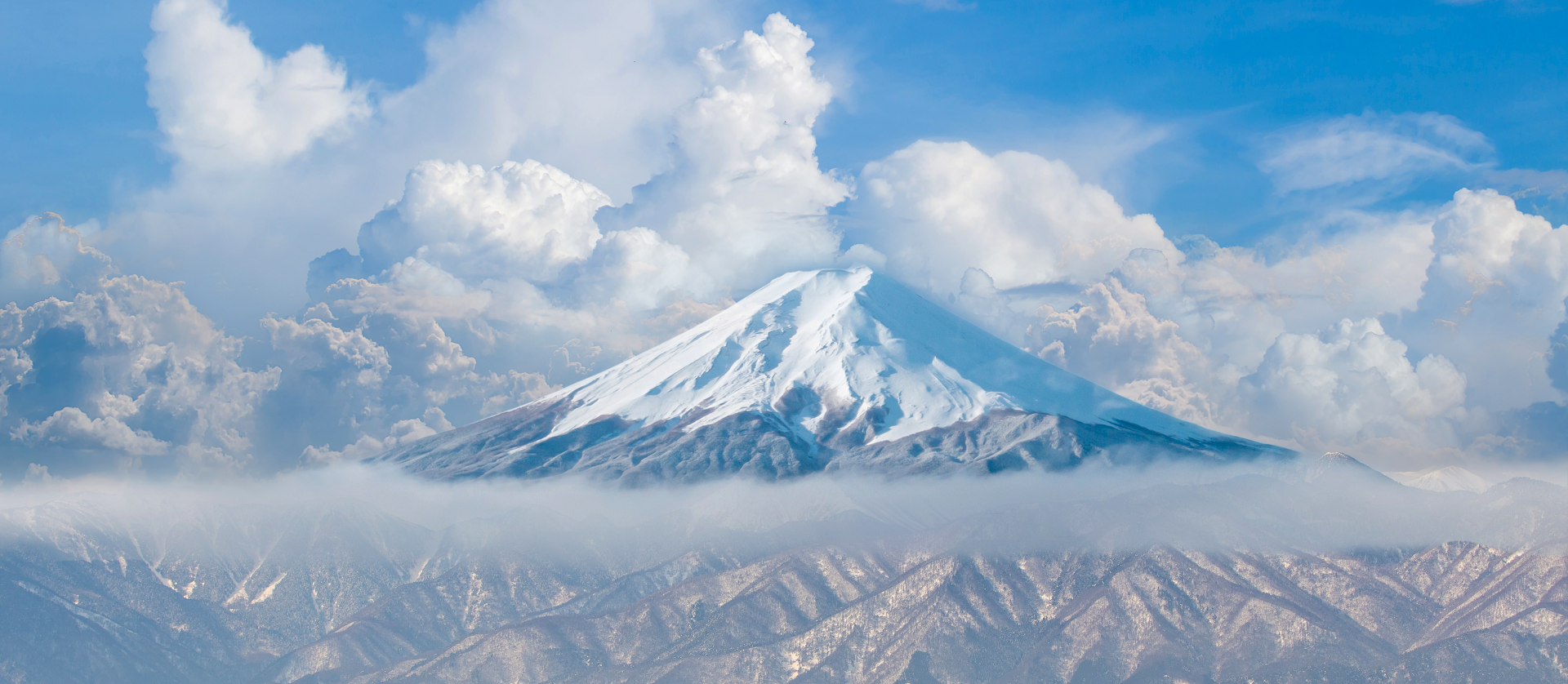
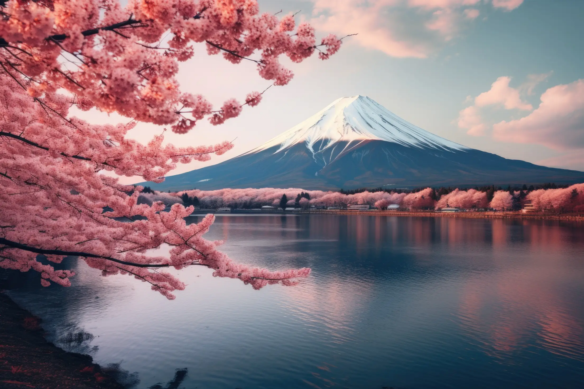
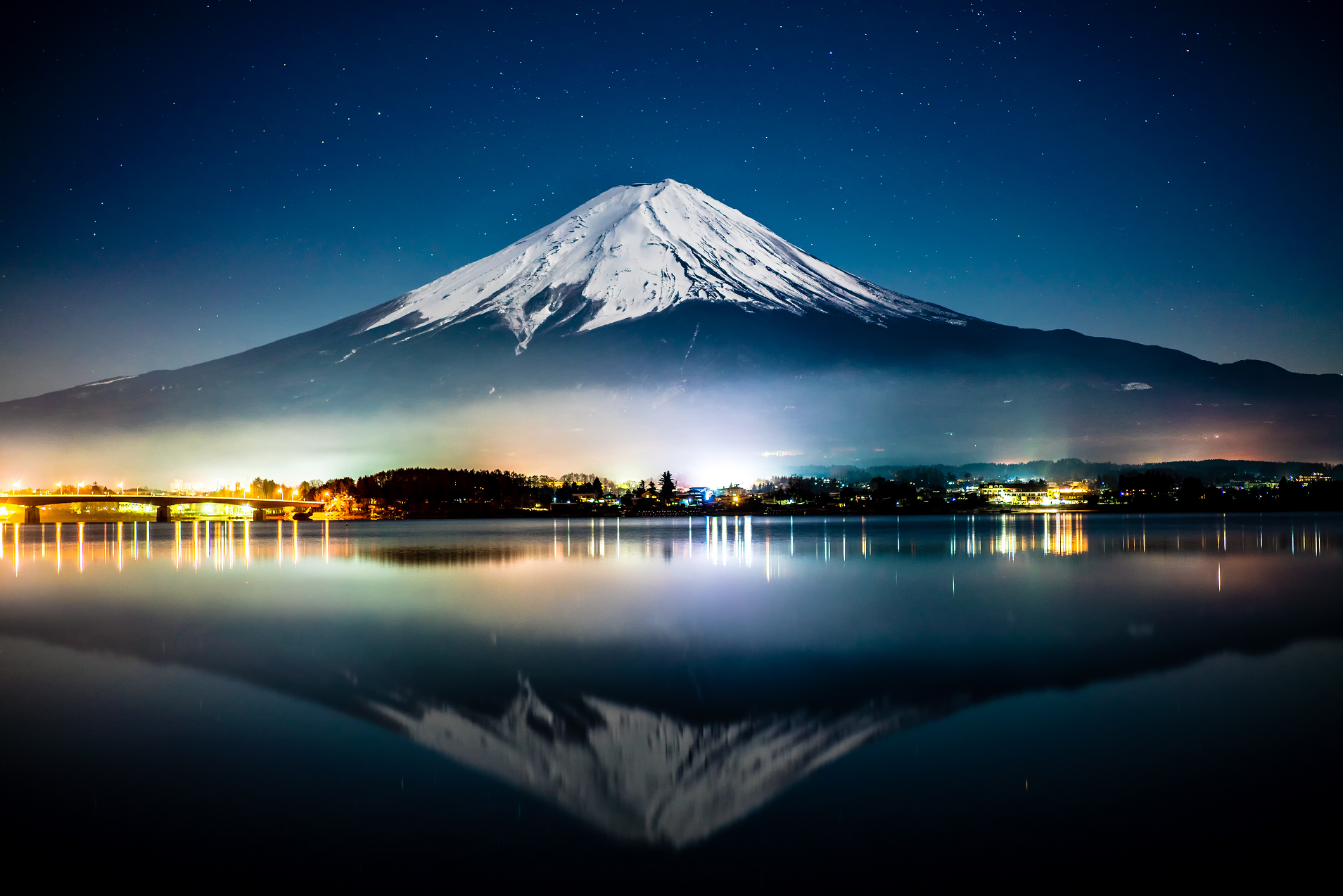
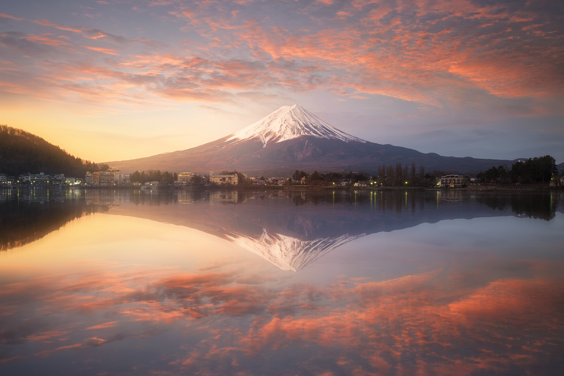
Mount Fuji (富士山, Fujisan, Japanese: [ɸɯꜜ(d)ʑisaɴ] ⓘ) is an active stratovolcano located on the Japanese island of Honshu, with a summit elevation of 3,776.24 m (12,389 ft 3 in). It is the highest mountain in Japan, the second-highest volcano located on an island in Asia (after Mount Kerinci on the Indonesian island of Sumatra), and seventh-highest peak of an island on Earth.[1] Mount Fuji last erupted from 1707 to 1708.[4][5] The mountain is located about 100 km (62 mi) southwest of Tokyo and is visible from the Japanese capital on clear days. Mount Fuji’s exceptionally symmetrical cone, which is covered in snow for about five months of the year, is commonly used as a cultural icon of Japan and is frequently depicted in art and photography, as well as visited by sightseers, hikers and mountain climbers.[6]
Mount Fuji is one of Japan’s “Three Holy Mountains” (三霊山, Sanreizan) along with Mount Tate and Mount Haku. It is a Special Place of Scenic Beauty and one of Japan’s Historic Sites.[7] It was added to the World Heritage List as a Cultural Site on June 22, 2013.[7] According to UNESCO, Mount Fuji has “inspired artists and poets and been the object of pilgrimage for centuries”. UNESCO recognizes 25 sites of cultural interest within the Mount Fuji locality. These 25 locations include the mountain and the Shinto shrine, Fujisan Hongū Sengen Taisha.[8]
Etymology
Further information: wikt:富士 § Etymology 3
The current kanji for Mount Fuji, 富 and 士, mean “wealth” or “abundant” and “man of status” respectively. However, the origins of this spelling and of the name Fuji continue to be debated.
A text of the 9th century, Tale of the Bamboo Cutter, says that the name came from “immortal” (不死, fushi, fuji) and also from the image of abundant (富, fu) soldiers (士, shi, ji)[note 1] ascending the slopes of the mountain.[9] An early folk etymology claims that Fuji came from 不二 (not + two), meaning without equal or nonpareil. Another claims that it came from 不盡 (not + to exhaust), meaning never-ending.
Hirata Atsutane, a Japanese classical scholar in the Edo period, speculated that the name is from a word meaning “a mountain standing up shapely as an ear (穗, ho) of a rice plant”. British missionary John Batchelor (1855–1944) argued that the name is from the Ainu word for “fire” (fuchi) of the fire deity Kamui Fuchi, which was denied by a Japanese linguist Kyōsuke Kindaichi on the grounds of phonetic development (sound change). It is also pointed out that huchi means an “old woman” and ape is the word for “fire”, ape huchi kamuy being the fire deity. Research on the distribution of place names that include fuji as a part also suggest the origin of the word fuji is in the Yamato language rather than Ainu. Japanese toponymist Kanji Kagami argued that the name has the same root as wisteria (藤, fuji) and rainbow (虹, niji, but with an alternative reading, fuji), and came from its “long well-shaped slope”.[10][11][12][13]
This article uses material from the Wikipedia article Mount Fuji, which is released under the Creative Commons Attribution-Share-Alike 4.0 International License (view authors).
 I | 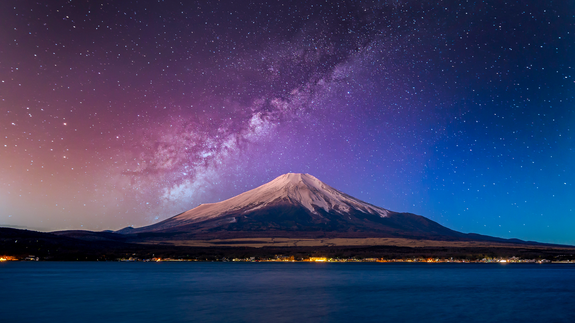 Kalyakan (Adobe Stock) |
 Trescend (Adobe Stock) | 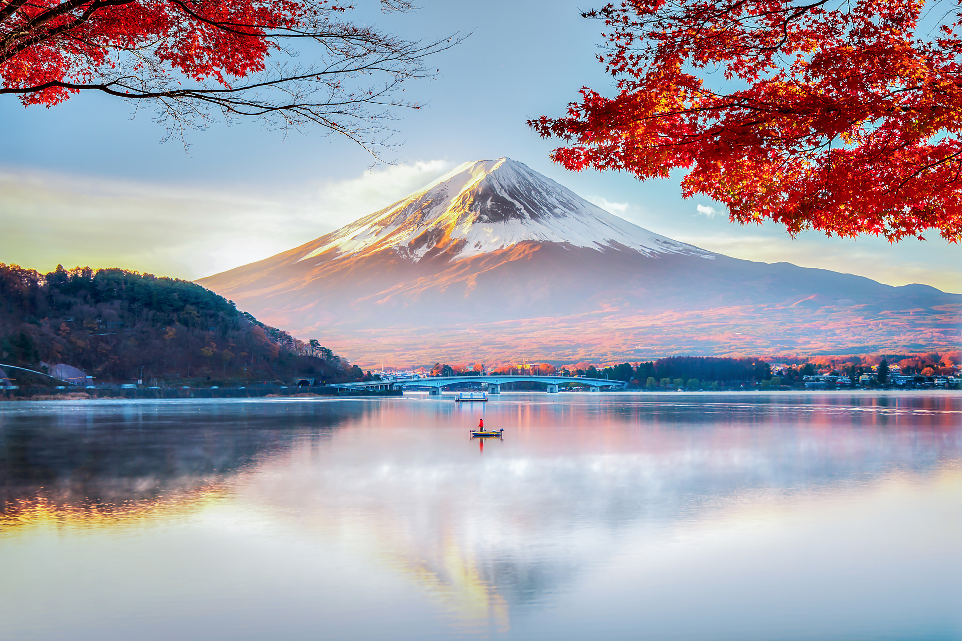 DoctorEgg (iStock) |
 Structuresxx (iStock) I | 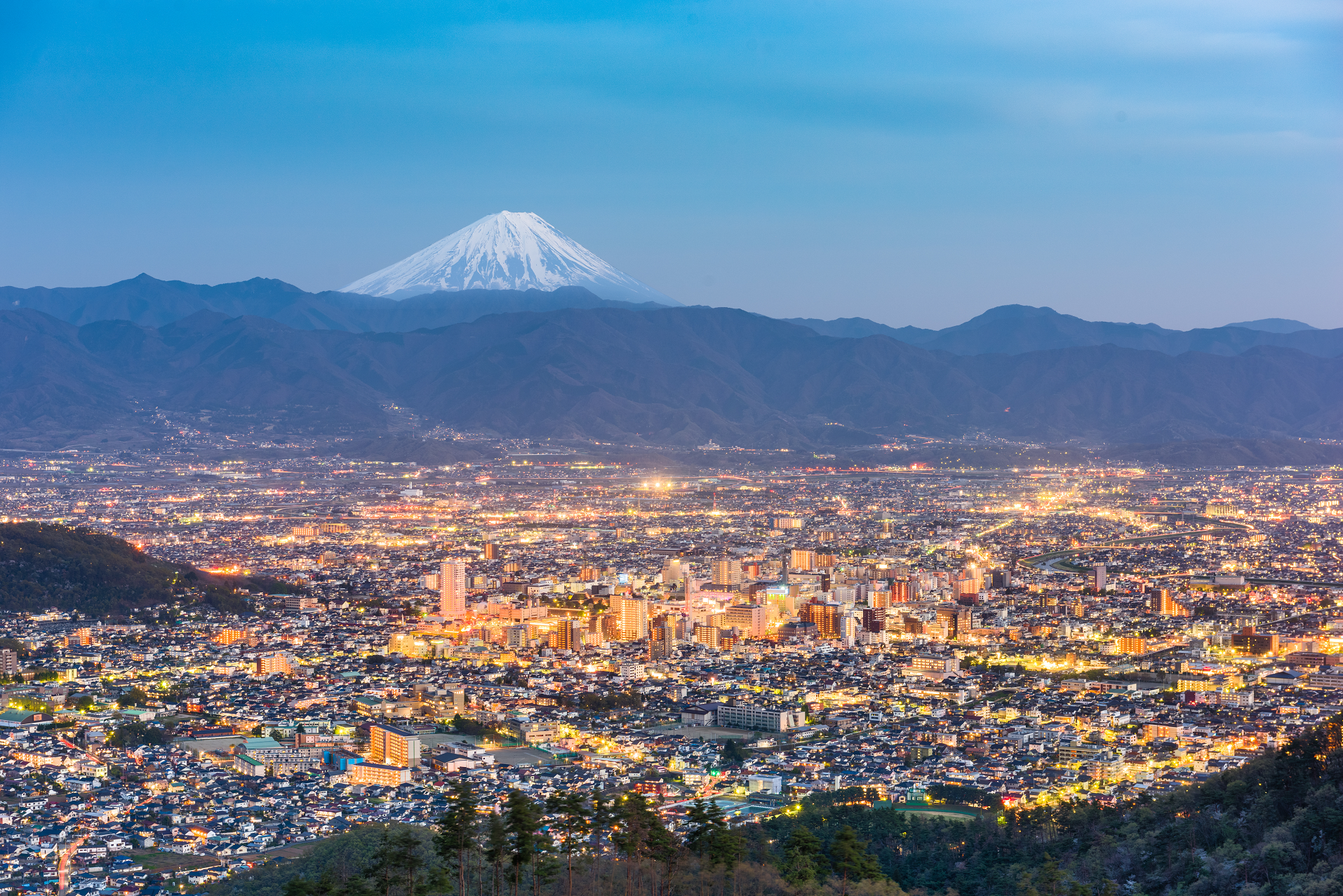 SeanPavonePhoto (Adobe Stock) |
 I | 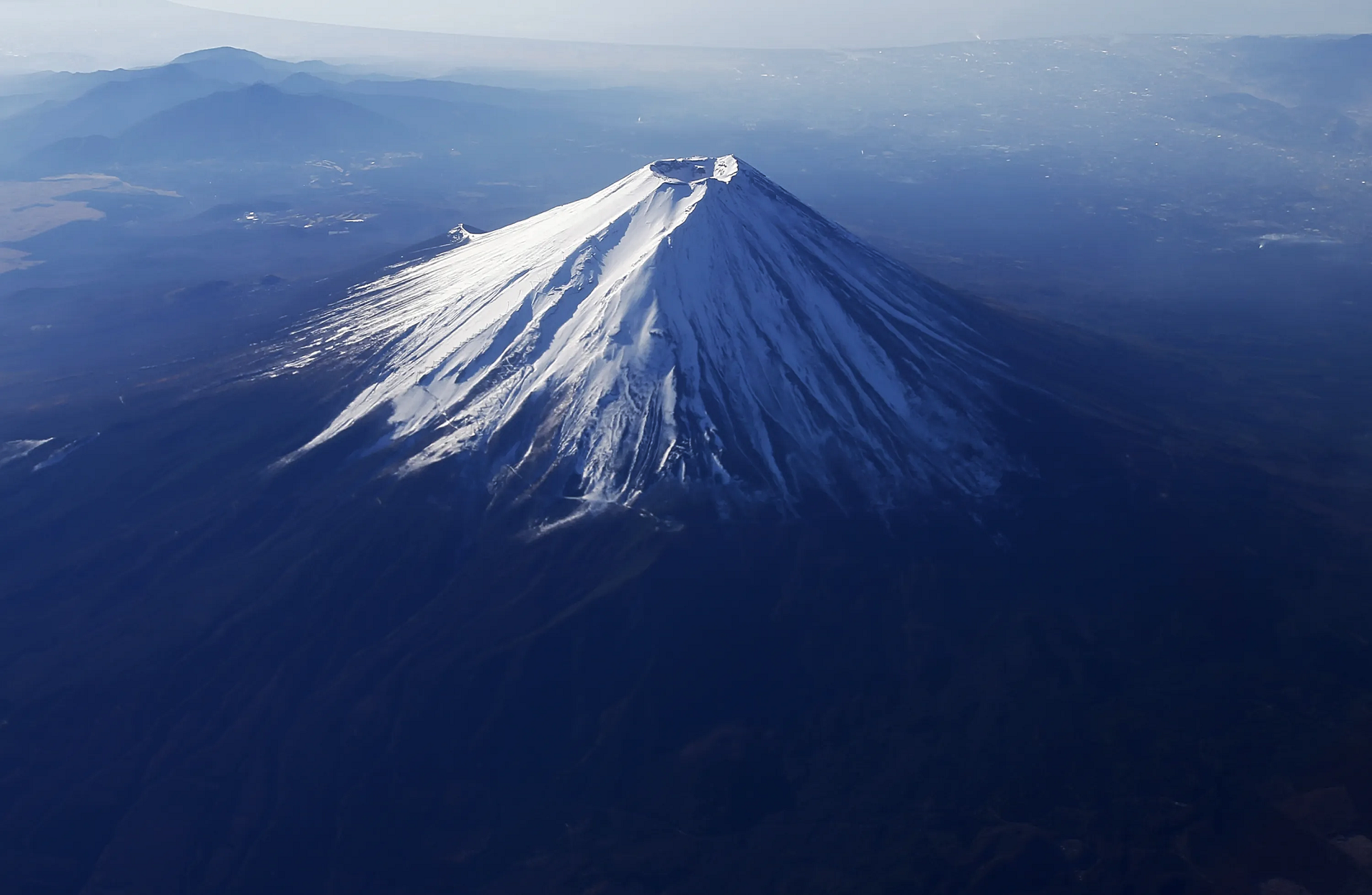 Issei Kato (Reuters) |
![]()
![]()
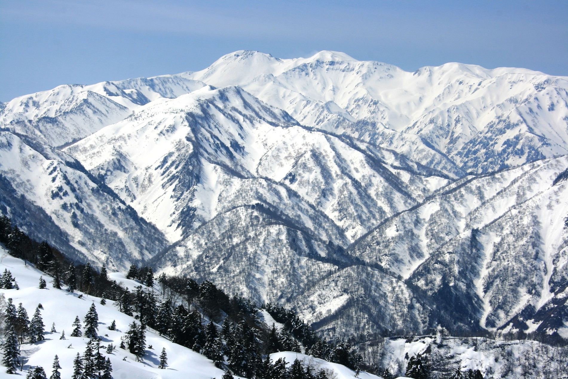
Mount Haku (白山, Haku-san; “White Mountain”), or Mount Hakusan (commonly referred to as simply Hakusan), is a dormant stratovolcano in Japan. It is located on the borders of Gifu and Ishikawa, on the island of Honshu. Mount Haku is thought[2] to have first been active 300,000 to 400,000 years ago, with the most recent eruption occurring in 1659. Along with Mount Tate and Mount Fuji, it is one of Japan’s “Three Holy Mountains” (三霊山, San-rei-zan).[3]
The mountain’s tallest peak, Gozenga-mine (御前峰), is the one that gives the mountain its height of 2,702 m (8,865 ft). Along with Ken-ga-mine (剣ヶ峰), which is 2,677 m (8,783 ft), and Ōnanji-mine (大汝峰), which is 2,648 m (8,688 ft), the three peaks are considered “Mount Haku’s Three Peaks” (白山三峰 Hakusan San-mine). Mount Bessan and Mount Sannomine are sometimes included and called “Mount Haku’s Five Peaks” (白山五峰 Hakusan go-mine).
Because it is very prominent and clearly visible from the nearby coast, even after the surrounding mountains have lost their snow, Mount Haku still appears white, which is one explanation for the mountain’s name, which means “white mountain.” It is also the westernmost mountain in Japan that is over 2,000 m (6,562 ft) in height.
History and culture
Taichō, a mountain Shugendo monk, first climbed Mount Hakusan in 717. For hundreds of years, people have come to Haku for prayers (白山信仰 Hakusan Shinkō). A branch shrine of Shirayama Hime Shrine, which served as the Ichinomiya for Kaga Province, is on the mountain. The Shirayama Hime Shrine is the main shrine (総本社, sō-honsha) of approximately 2,000 Hakusan shrines (白山神社, Hakusan jinja) in Japan. In 1980 an area of 48,000 ha was designated a UNESCO Man and the Biosphere Reserve.[4]
Nature
Mount Haku was designated as a quasi-national park in 1955. It became a national park in 1962[3] and was renamed Hakusan National Park. Because the central part of the mountain has much precipitous terrain, there are very few roads and, as a result, little human intrusion into the area. Also limiting human intrusion is the designation of the park as a Wildlife Protection Area, covering over 38,061 ha. The park stretches beyond the mountain’s borders into Toyama Prefecture.[3]
Geological Features
The area surrounding Mount Haku is one of the few in Japan that contains outcroppings from the Jurassic period of the Mesozoic era. Many of Japan’s typical examples of dinosaur fossils were found in this area. One of the major rock outcrops is in the Kuwashima area and is known as the “Kuwashima Fossil Wall” (桑島化石壁 Kuwashima Kasekikabe).
Because the mountain is a dormant volcano, it is well known for its many onsen.
This article uses material from the Wikipedia article Mount Haku, which is released under the Creative Commons Attribution-Share-Alike 4.0 International License (view authors).
 Alpsdake (Wikipedia) | 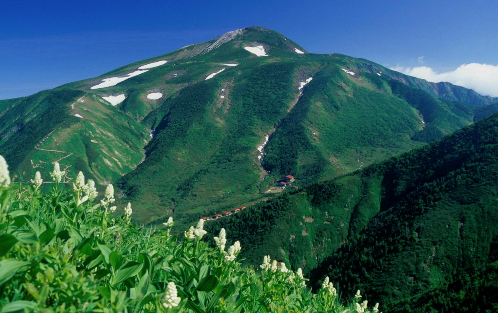 Alpsdake (Wikipedia) |
 Alpsdake (Wikipedia) | 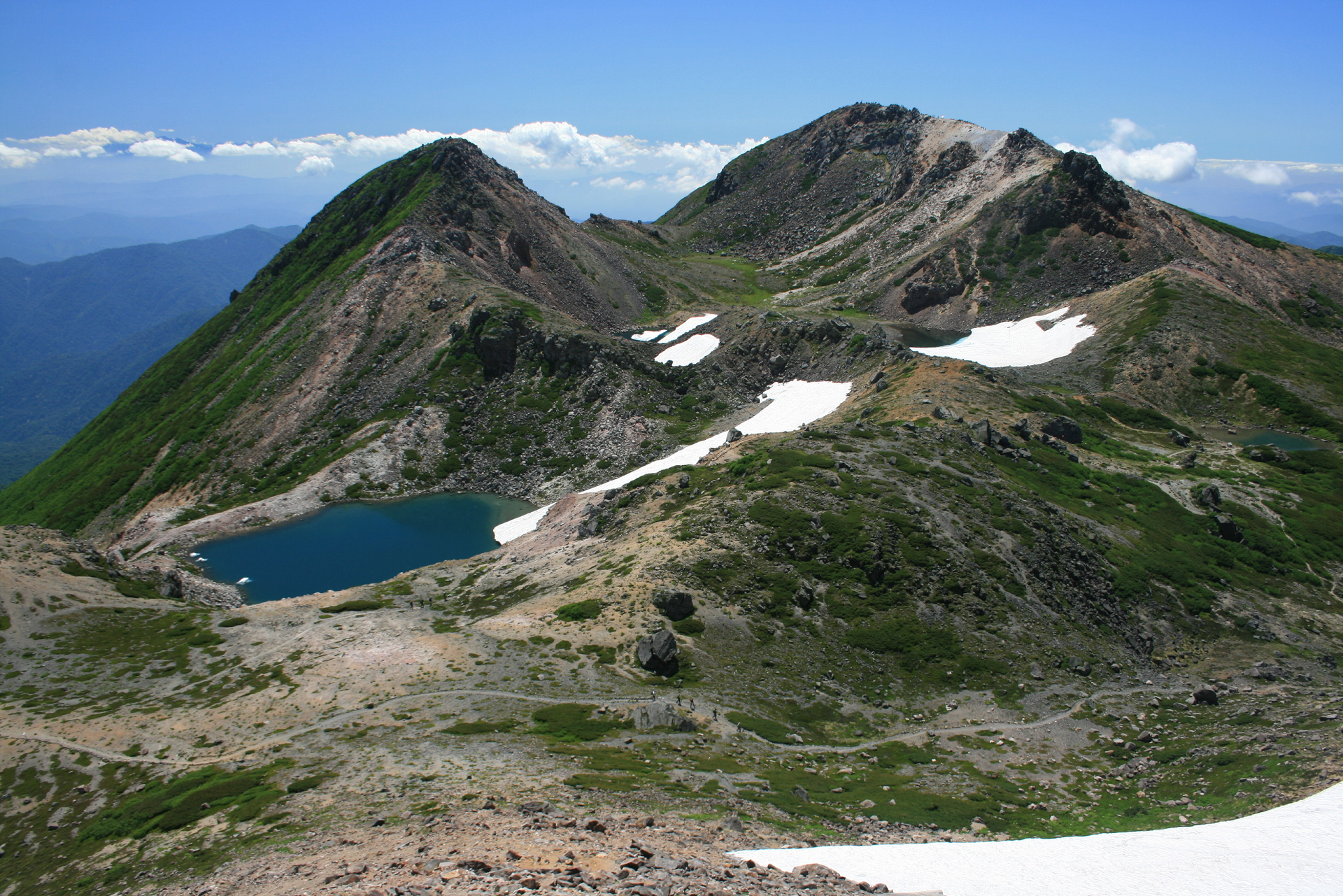 Alpsdake (Wikipedia) |
 Alpsdake (Wikipedia) | 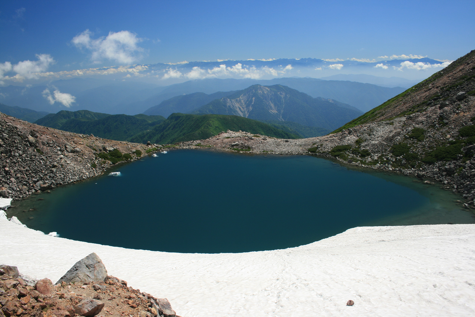 Alpsdake (Wikipedia) |
![]()
![]()
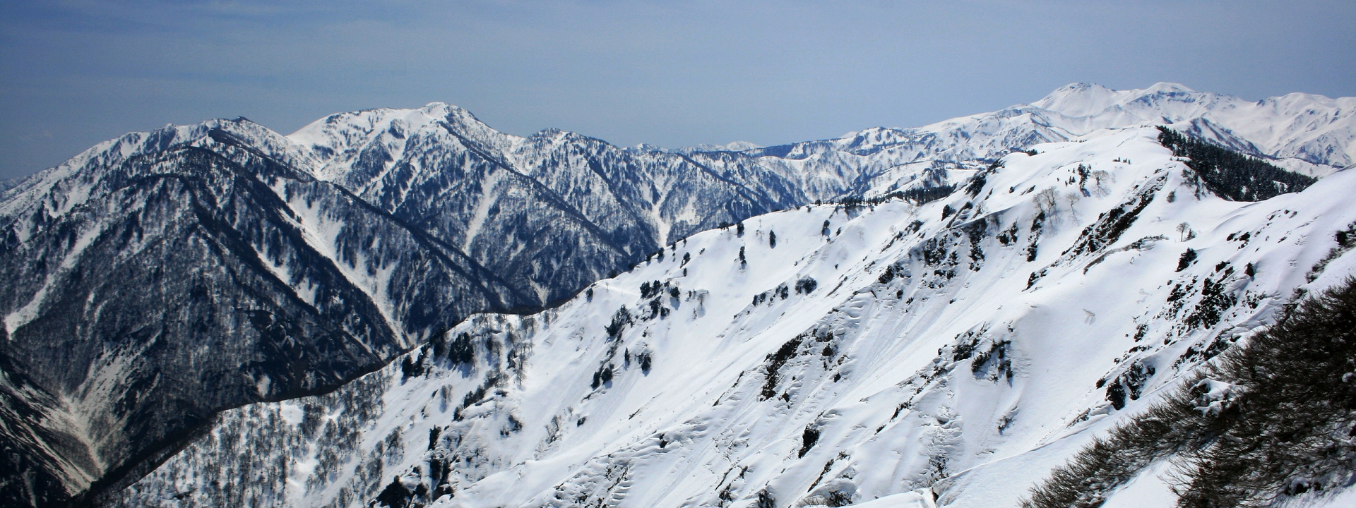
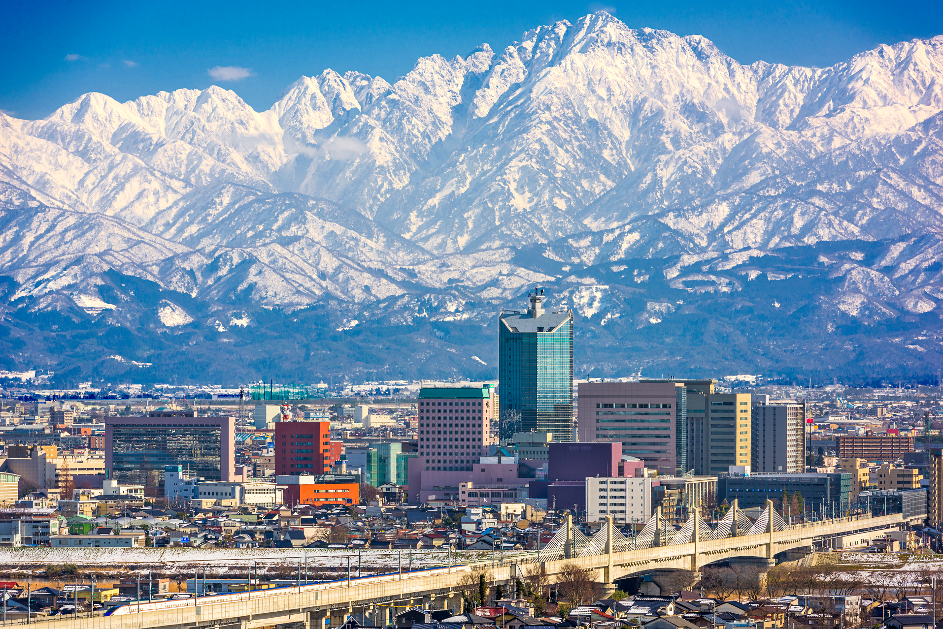
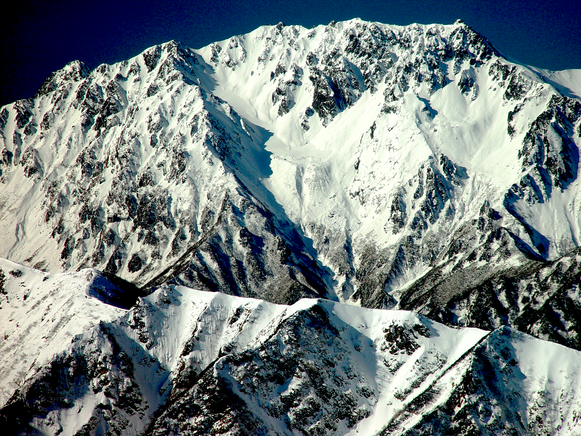
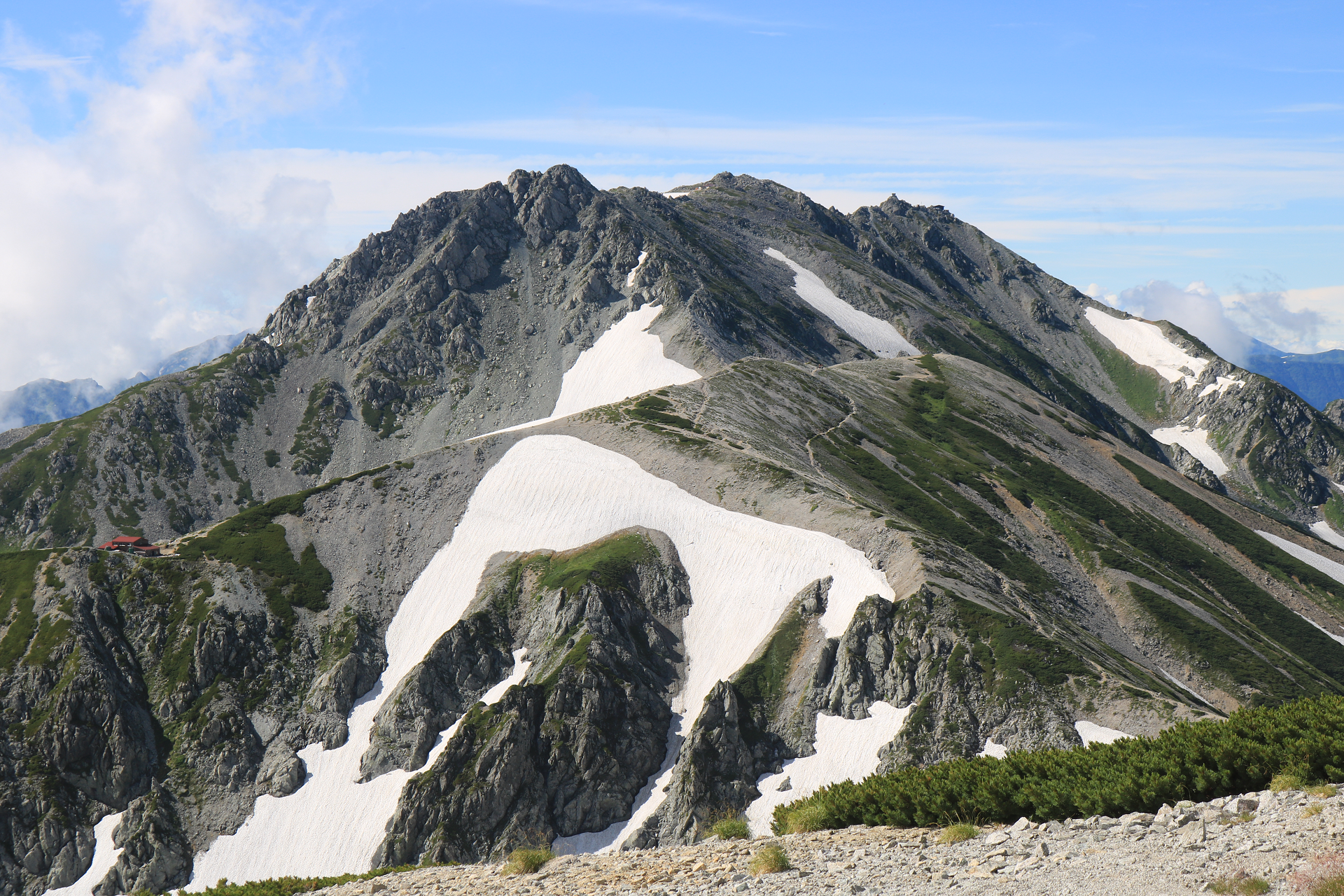
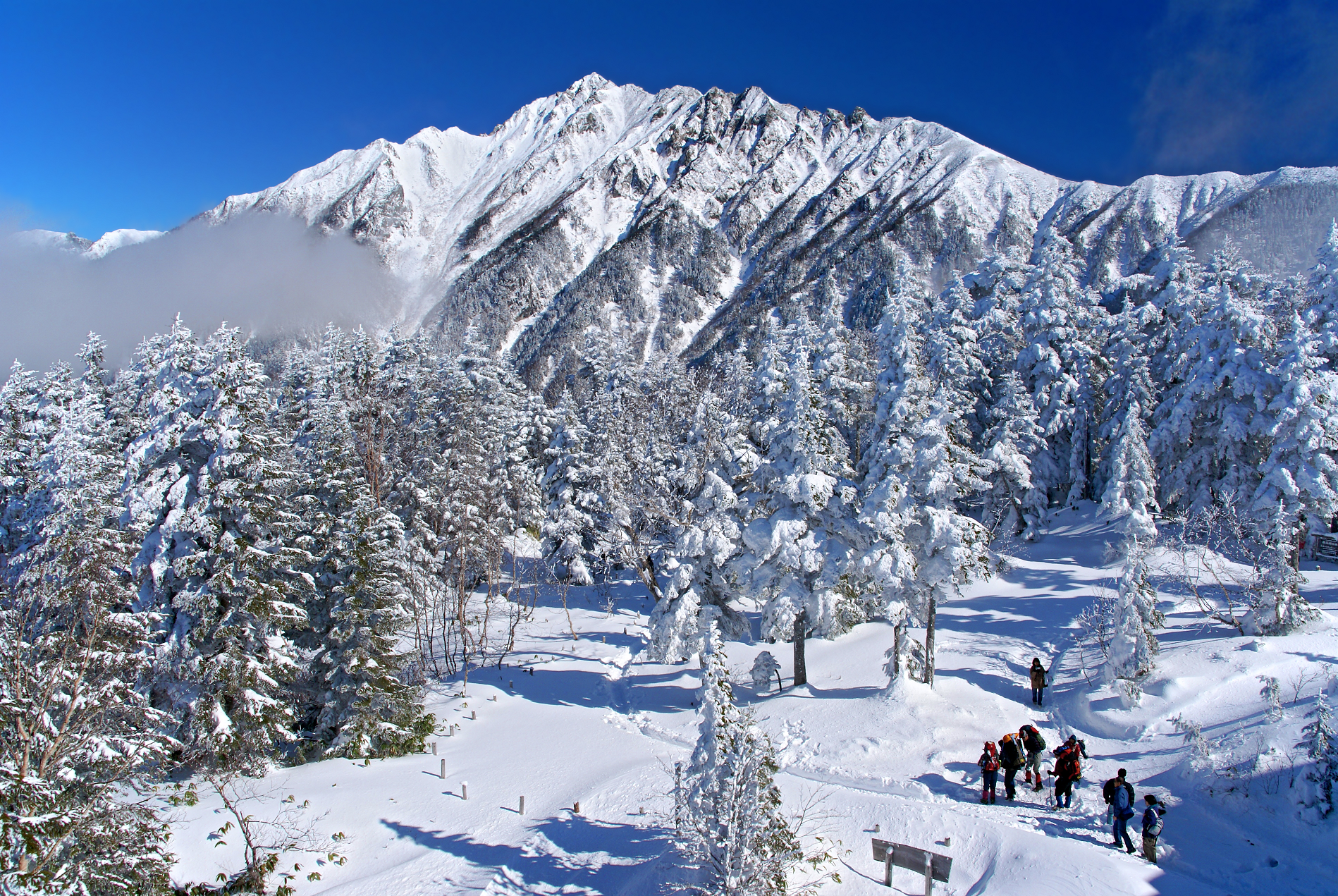
Mount Tate (立山, Tate-yama; IPA: [tateꜜjama]), also known as Tateyama, is a mountain located in the southeastern area of Toyama Prefecture, Japan. It is one of the tallest mountains in the Hida Mountains at 3,015 m (9,892 ft) and one of Japan’s Three Holy Mountains (三霊山, Sanreizan) along with Mount Fuji and Mount Haku.[2] Tateyama consists of three peaks: Ōnanjiyama (大汝山, 3,015 m), Oyama (雄山, 3,003 m), and Fuji-no-Oritate, (富士ノ折立, 2,999m)[3] which form a ridge line. Tateyama is the tallest mountain in the Tateyama Mountain Range (立山連峰, Tateyama-renpō).
The Oyama Shrine is located on Oyama Peak.[4]
Mount Tate was first climbed by Saeki no Ariyori, during Japan’s Asuka period. The area was incorporated into the Chūbu-Sangaku National Park on 4 December 1934.[5][6]
Name
The kanji name for the mountain is 立山, Tateyama in Japanese, which means “standing (立) or outstanding (顕)” and “mountain (山),” respectively. The Toyama Prefectural Government uses the name Mount Tateyama as an official translation of the Japanese mountain.
Geology
The mountain is primarily composed of granite and gneiss. However, located along the ridge and plateau, about 2 km (1.2 mi) west of the summit, there is a small andesite–dacite stratovolcano.[7] This volcano has an elevation of 2,621 m (8,599 ft) and has minor eruptions, the latest occurring in 1961.[8]
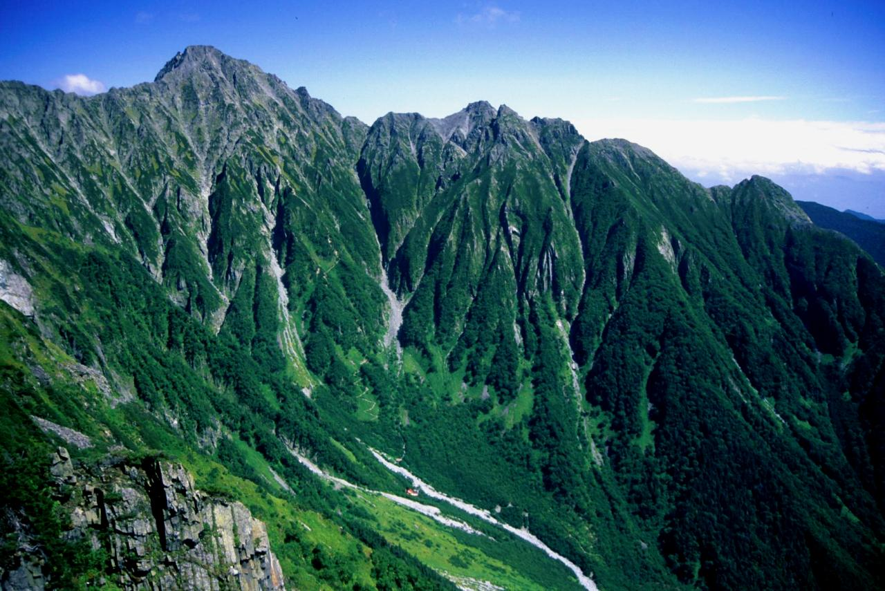
Geography Location
Tateyama is located in southeastern Toyama Prefecture. At the base of the mountain is the town of Tateyama which is accessible by train from the prefecture’s capital city, Toyama. Public transportation takes climbers and tourists as far as the Murodo Plateau Station at an elevation of 2,450 m (8,038 ft), where individuals may climb to the peak on foot. This location allows for the formation of snow and its accumulation, forming glaciers. These are the only glaciers identified in Japan so far.[9]
This article uses material from the Wikipedia article Mount Tate, which is released under the Creative Commons Attribution-Share-Alike 4.0 International License (view authors).
 Sean Pavone (iStock) | 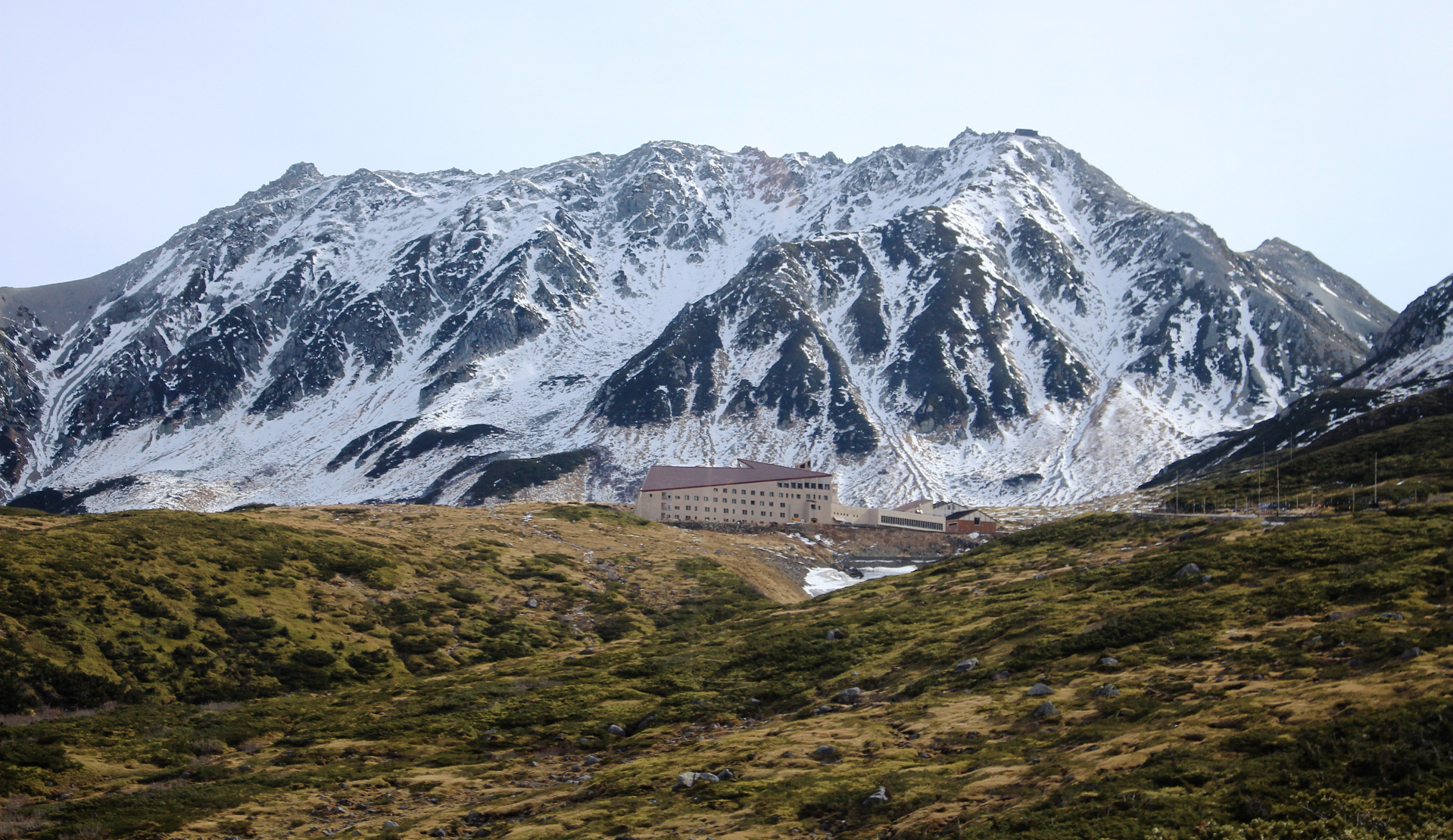 Alpsdake (Wikipedia) |
 Alpsdake (Wikipedia) | 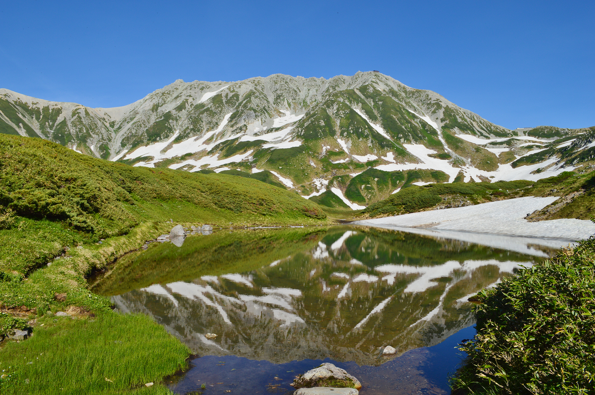 Saigen Jiro (Wikipedia) |
 Alpsdake (Wikipedia) |  Alpsdake (Wikipedia) |
![]()
![]()
Mount Hotaka (穂高岳, Hotaka-dake), also known as Mount Hotakadake, is one of the 100 Famous Japanese Mountains as coined by the media, reaching a height of 3,190 m (10,466 ft). Mount Hotaka is situated in Japan‘s Hida Mountains and all its major peaks except Mount Maehotaka, lie on the border between the cities of Matsumoto, Nagano Prefecture, and Takayama, Gifu Prefecture. This mountain is located in Chūbu-Sangaku National Park.[2]
The peaks of Okuhotaka, Karasawa, Kitahotaka, Maehotaka and Nishihotaka are called the Hotaka Mountains. The highest peak in this range, and also the tallest mountain in both Nagano and Gifu prefectures, is Mount Okuhotaka. Mount Hotaka is also referred to as the “Leader of the Northern Alps” (北アルプスの盟主, Kita-Arupusu no Meishu).
Peaks
Gamadafuji (蒲田富士, Gamadafuji) is the western peak of Karasawadake, rising 2,742 m (8,996 ft). The winter ascend route to Mount Okuhotaka passes here.
Mount Okuhotaka (奥穂高岳, Okuhotakadake) is the highest peak in the Hotaka Mountain Range and the third highest in Japan after Mount Fuji and Mount Kita. Its peak at 3,190 m (10,466 ft) is the highest in Nagano and Gifu prefectures.
Mount Karasawa (涸沢岳, Karasawa-dake) is situated on a ridge between Mount Kitahotaka and the Shirade Col (白出のコル), the location of the Hotakadake mountain cottage. The triangulation point on the top is at 3,103 m (10,180 ft) while the peak reaches 3,110 m (10,203 ft).
Mount Kitahotaka (北穂高岳, Kitahotaka-dake), at 3,106 m (10,190 ft), is the second highest of the Hotaka peaks, lying at the northern end of the range. Takidani (滝谷), on the mountain’s west face, is a well-known, prominent, rocky area of Japan. Near the summit lies the Kitahotaka Hut.
Mount Maehotaka (前穂高岳, Maehotaka-dake) is 3,090 m (10,138 ft) high and is connected to Mount Okuhotaka via the Tsuri Ridge (吊り尾根, Tsuri-one). To the north stretches the Kita Ridge (北尾根, Kita-one). To the west are rocks in direction of Okumatashiro (奥又白). The tip of the Kita Ridge is called “Byōbu no Atama” (屏風の頭, Folding Screen Head). On the northeastern face lies a sheer cliff of 1,000 m (3,281 ft).
Mount Myōjin (明神岳, Myōjin-dake), with a peak of 2,931 m (9,616 ft), lies on a mountain ridge stretching south from Mount Maehotaka. There are many climbing routes in this area.
Mount Nishihotaka (西穂高岳, Nishihotaka-dake), at 2,909 m (9,544 ft), lies on a mountain ridge running southwest from Mount Okuhotaka, near the end of the ridge. It is surrounded by many similarly rocky peaks which makes it difficult to discriminate visually.
Mount Aino (間ノ岳, Aino-dake), with a peak at 2,907 m (9,537 ft), lies on a ridge between Mount Okuhotaka and Mount Nishihotaka.
This article uses material from the Wikipedia article Mount Hotakadake, which is released under the Creative Commons Attribution-Share-Alike 4.0 International License (view authors).
 663highland (Wikipedia) | 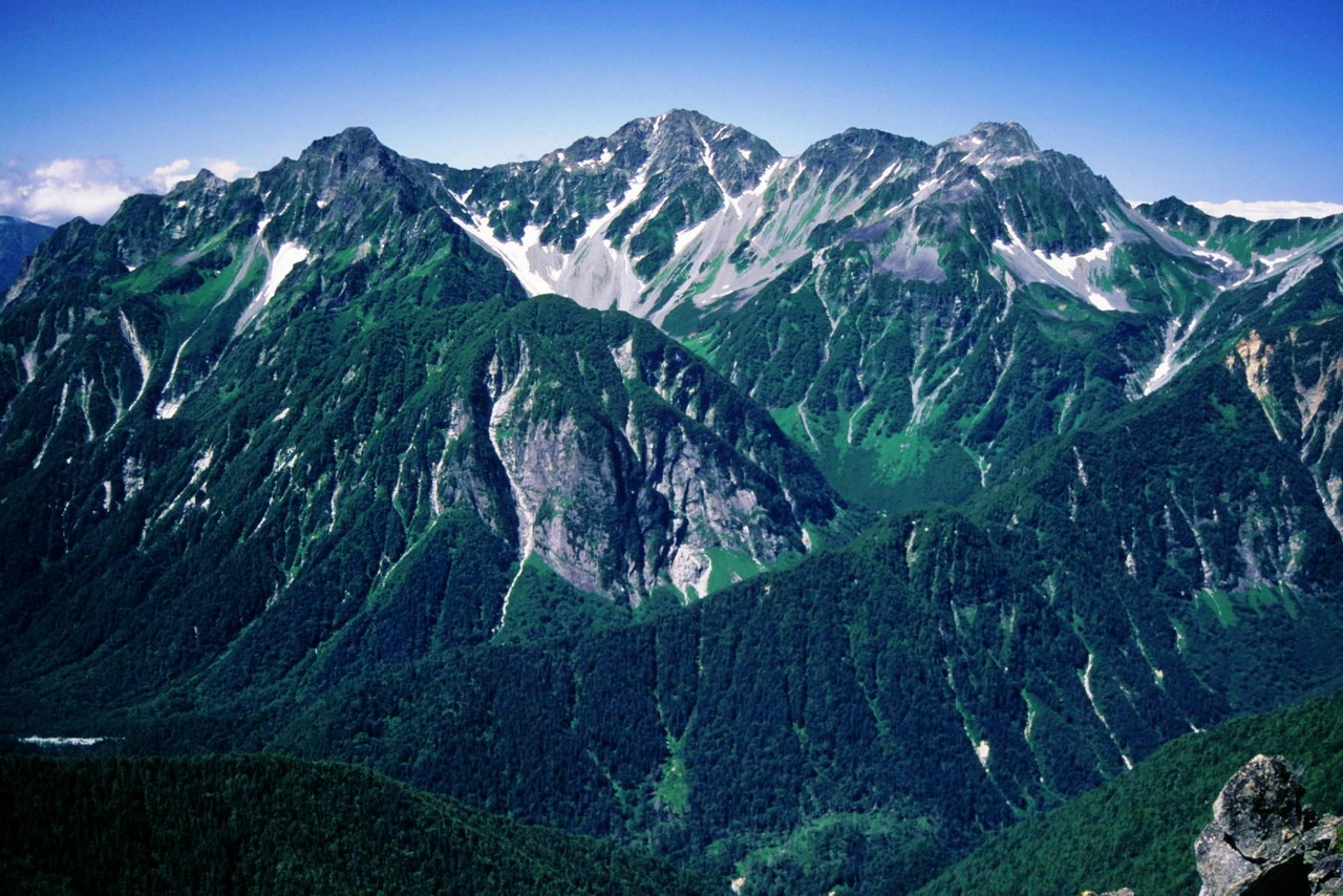 Alpsdake (Wikipedia) |
 Alpsdake (Wikipedia) | 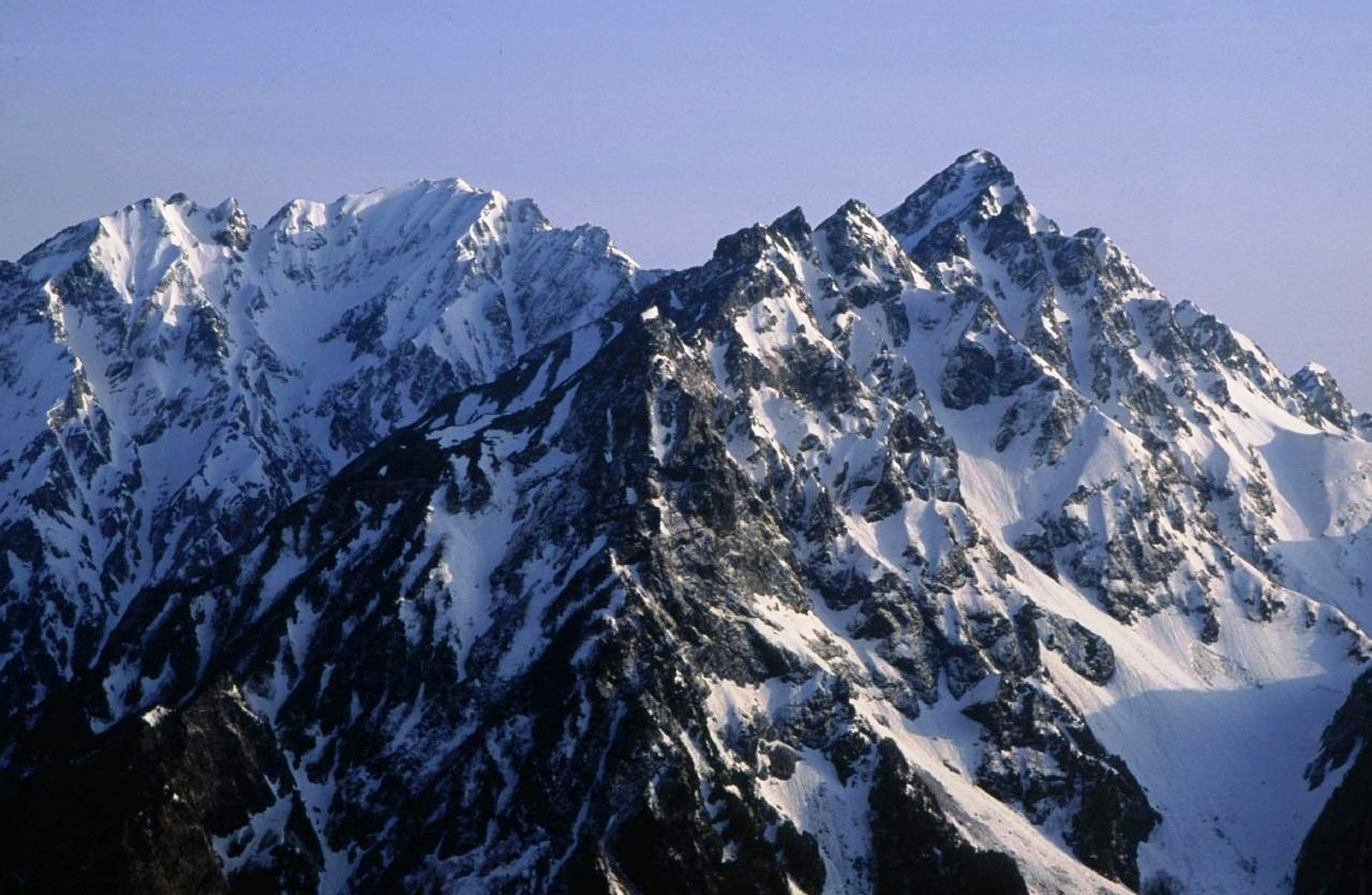 Alpsdake (Wikipedia) |
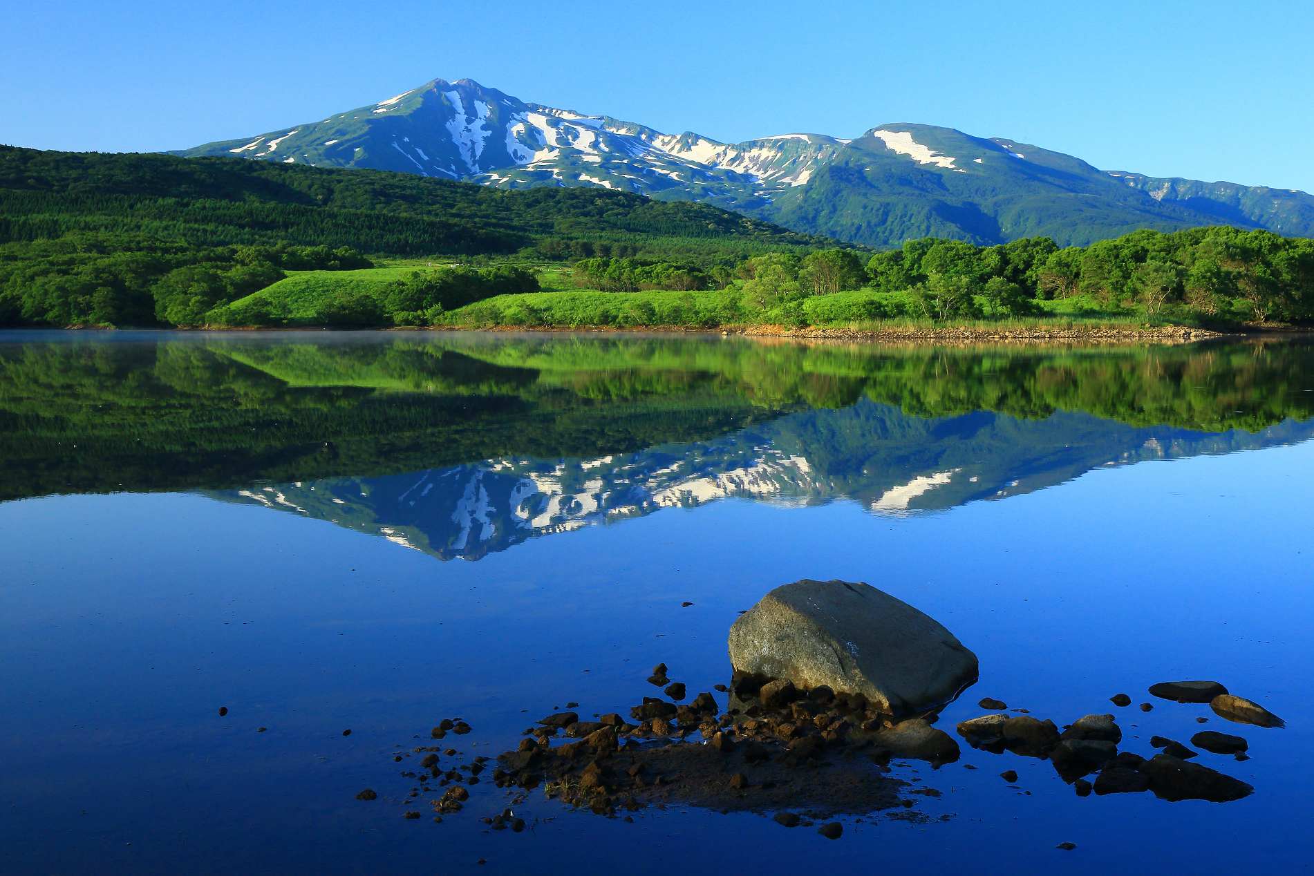
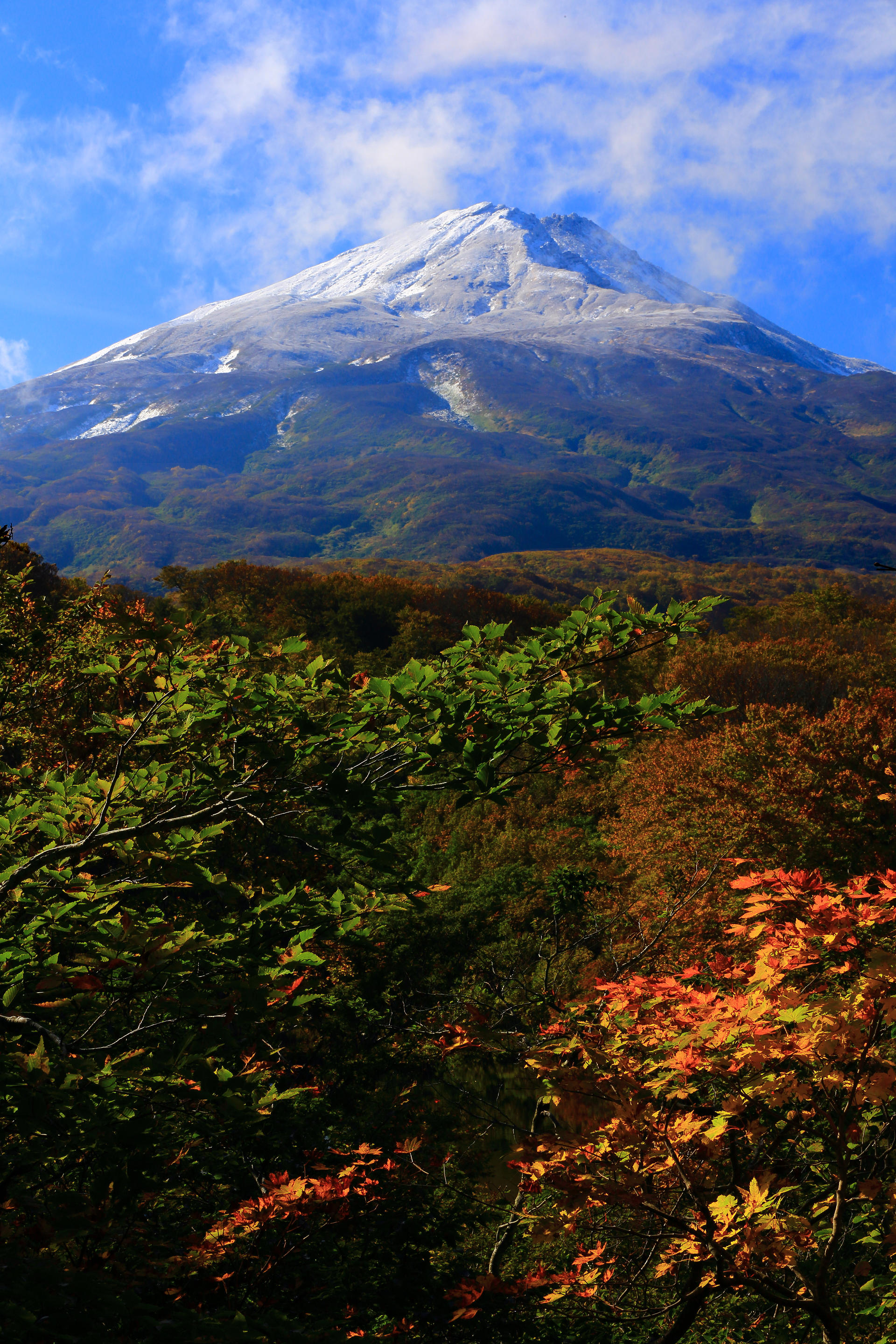
Mount Chōkai Panoramic
Nattya3714 (iStock)
![]()
![]()
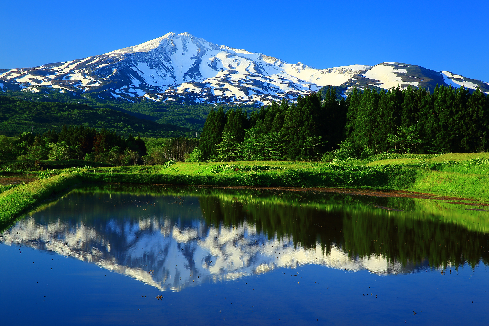
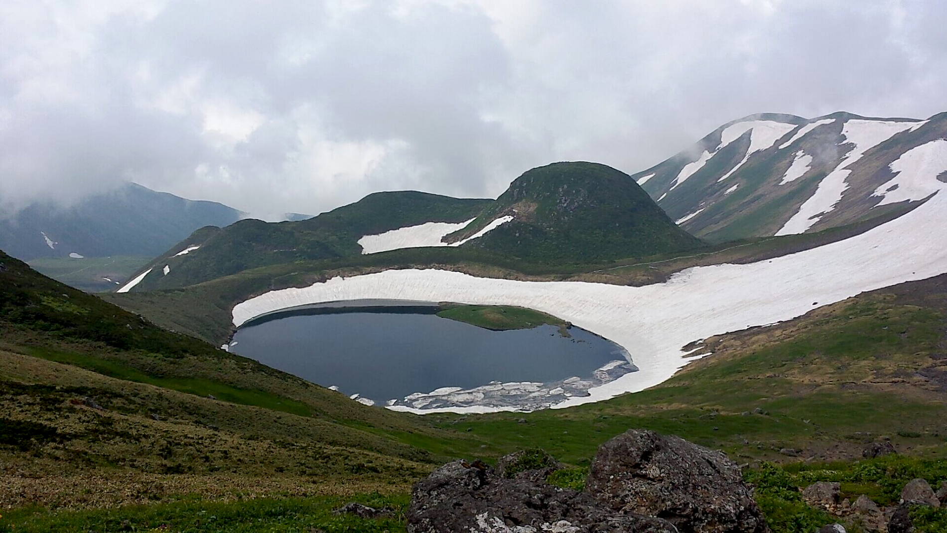
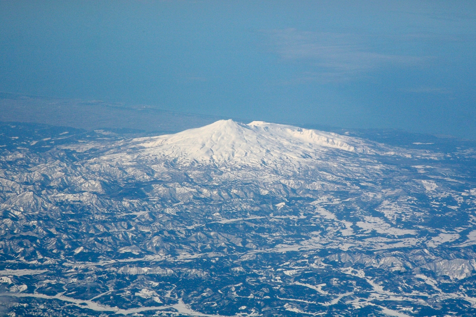
Mount Chōkai (鳥海山, Chōkai-san or Chōkai-zan) is an active volcano located on the border of Akita and Yamagata in the Tōhoku region of Japan, and is 2,236 m (7,336 ft) tall. Because of its (roughly) symmetrical shape and massive size, it is also variously known as Dewa Fuji (出羽富士), Akita Fuji (秋田富士) or Shōnai Fuji (庄内富士)[2] depending on the location of the viewer. In addition to being one of the 100 Famous Landscapes of Japan, it is also included as one of the 100 famous mountains in Japan, and famous 100 Geographical Features of Japan. It is surrounded by Chōkai Quasi-National Park. It is also a National Historic Site of Japan,[3] and is regarded as a sacred mountain by followers of the Shugendō branch of Shinto which has the shrine Chōkaisan Ōmonoimi Shrine there and is popular with hikers.
Outline
Mount Chōkai is a complex stratovolcano made of two old and new newer volcanoes, composed primarily of basalt or andesite.
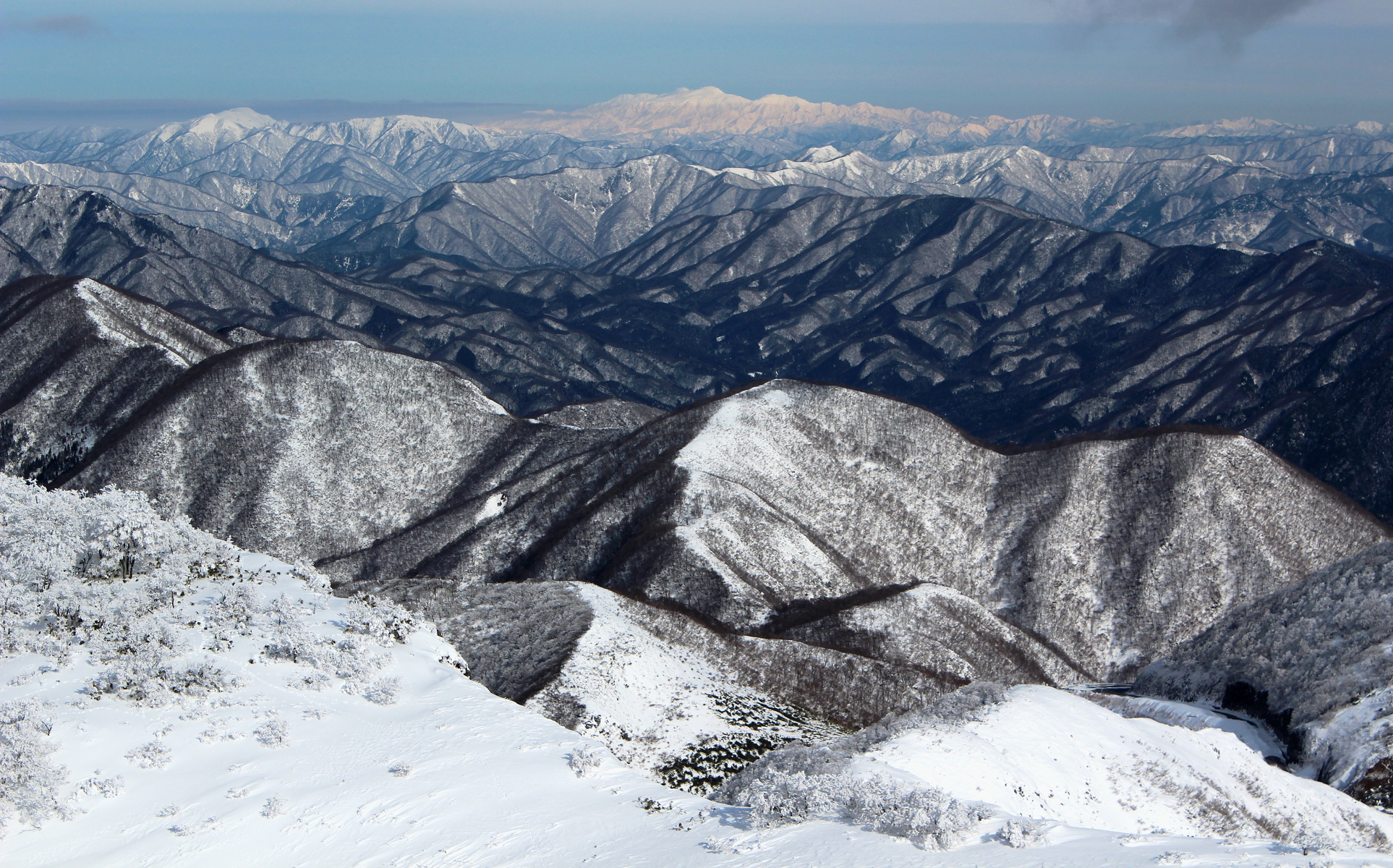
Mount Chōkai is shared by two municipalities in Akita Prefecture and four municipalities Yamagata Prefecture; however, its peak is located in Yuza, on the Yamagata side of the border. It is therefore the highest peak in Yamagata, and the second highest in the Tōhoku region after Mt. Hiuchigatake (altitude 2,356 m). The highest elevation of Mount Chōkai within Akita Prefecture has an altitude of 1,775 meters, and thus the mountain is also the highest in Akita Prefecture. From the summit, it is possible to see the Shirakami Mountains and Mount Iwaki to the north, Sado Island to the south and the Pacific Ocean to the east.
On the south side of the mountain is “Shinji Sekkei,” where snow remains in the shape of the kanji for “heart” in even in summer, and portions of the summit have perennial snow, and geological evidence of glaciation in the recent past.
Indigenous species of Mount Chōkai include the butterfly thistle and butterfly fish.
History
Mount Chōkai has been the object of mountain worship since ancient times. From the Heian period, it gradually became a training ground for Shugendō, as an avatar of Yakushi Nyorai. From the south was a pilgrimage path to the summit. In the middle of the Edo period the mountain drew many pilgrims and had 33 chapels at its base., with additional routes to its summit opened in the north. There is also a tradition that the island of Tobishima in the Sea of Japan was originally a part of the summit of Mount Chokai.
Omonoimi no Kami [ja; simple] is the God of the mountain and worshipped at Chōkaisan Ōmonoimi Shrine.
Three ships have been named after Mount Chōkai: Chōkai, an early steam gunboat, and the cruiser Japanese cruiser Chōkai (sunk in 1944), which were both in the Imperial Japanese Navy, and the JDS Chōkai, a Kongō class guided missile destroyer currently in service in the Japan Maritime Self-Defense Force.
This article uses material from the Wikipedia article Mount Chōkai, which is released under the Creative Commons Attribution-Share-Alike 4.0 International License (view authors).
 Nattya3714 (iStock) | 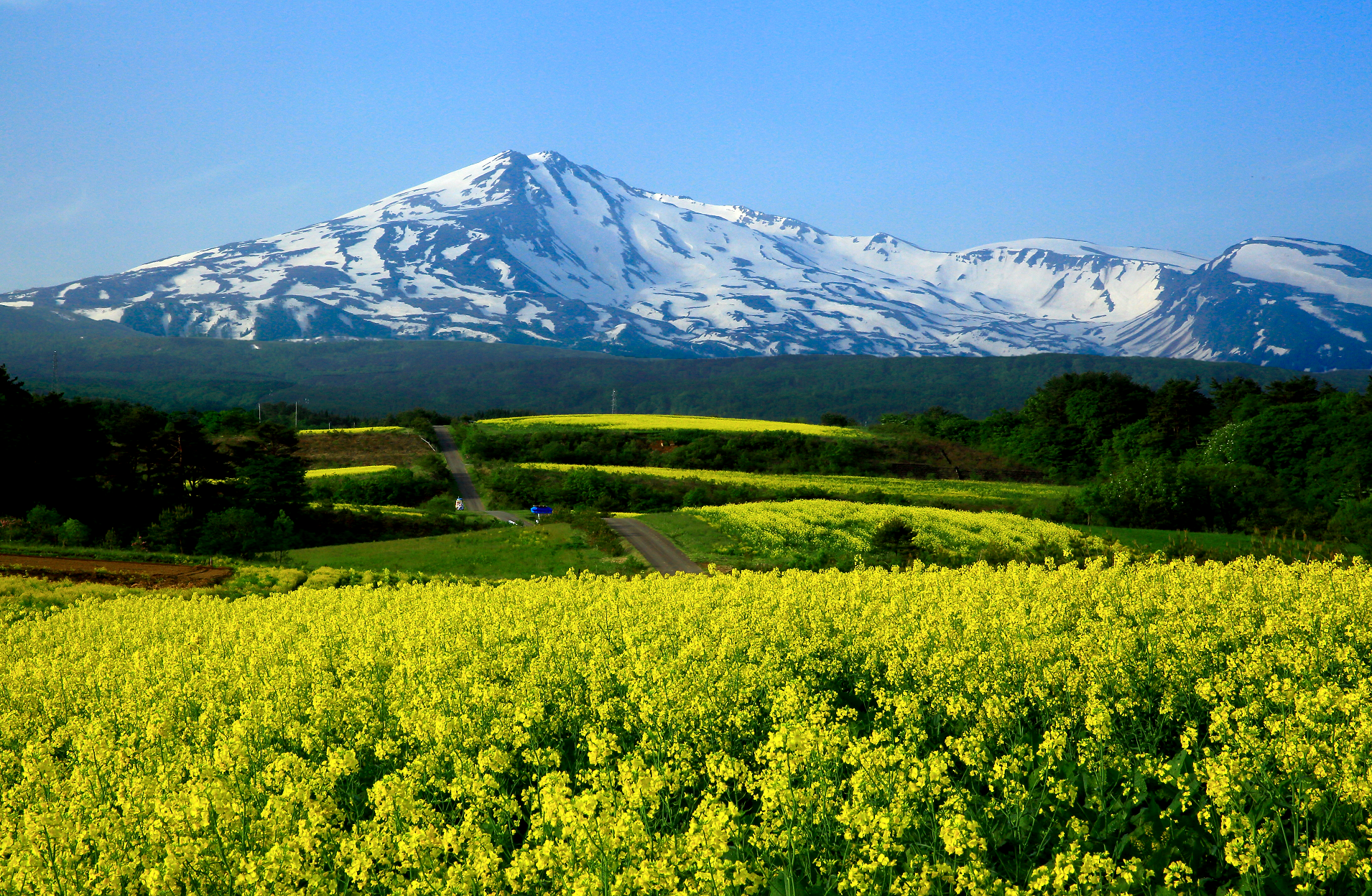 Nattya3714 (iStock) |
 Nattya3714 (iStock) | 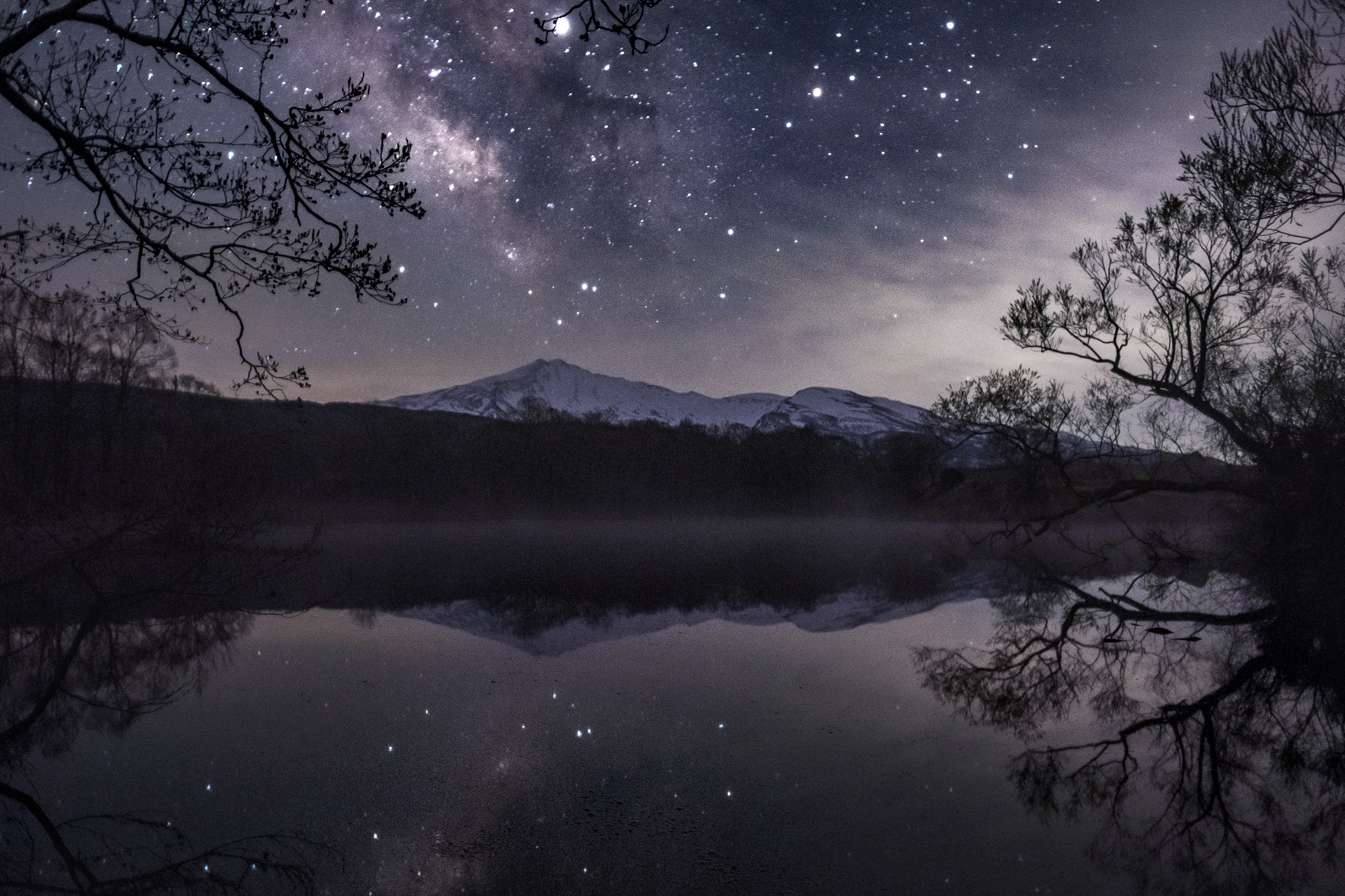 Wataru Aoki (iStock) |
 |  |
