
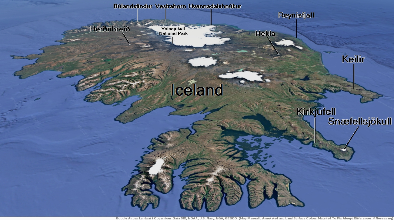
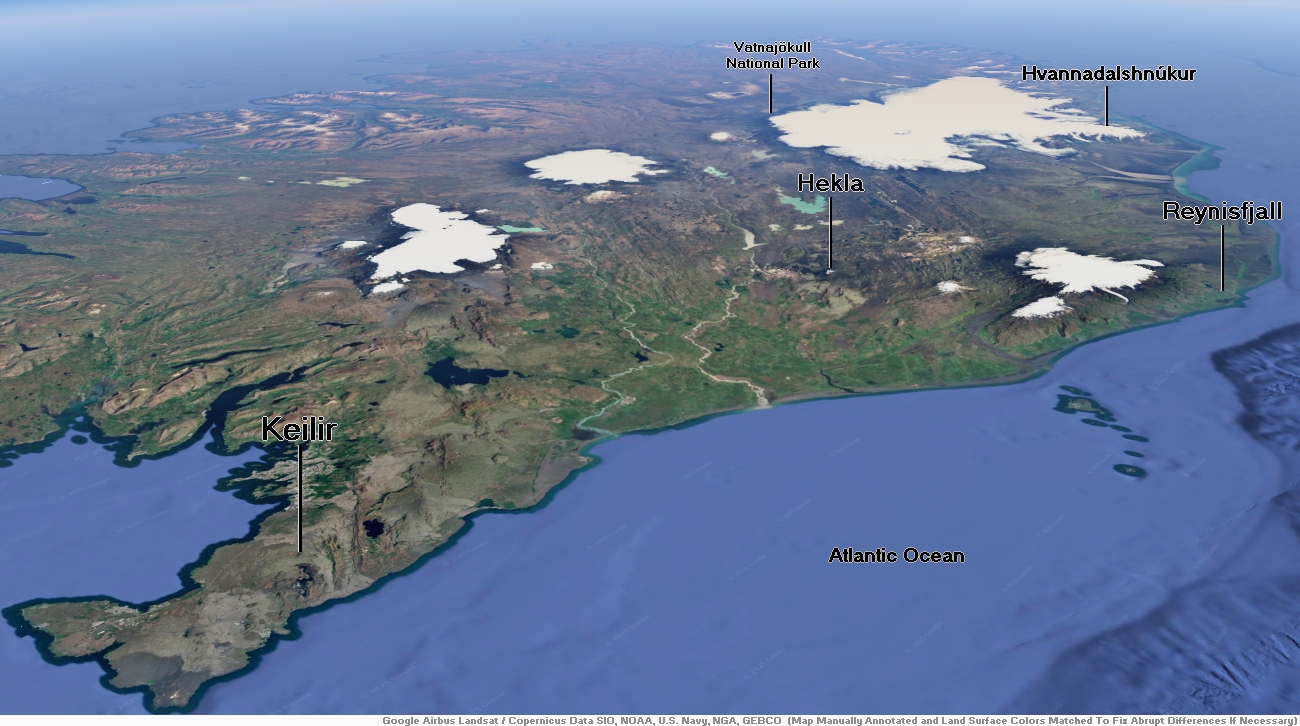
Map of Iceland
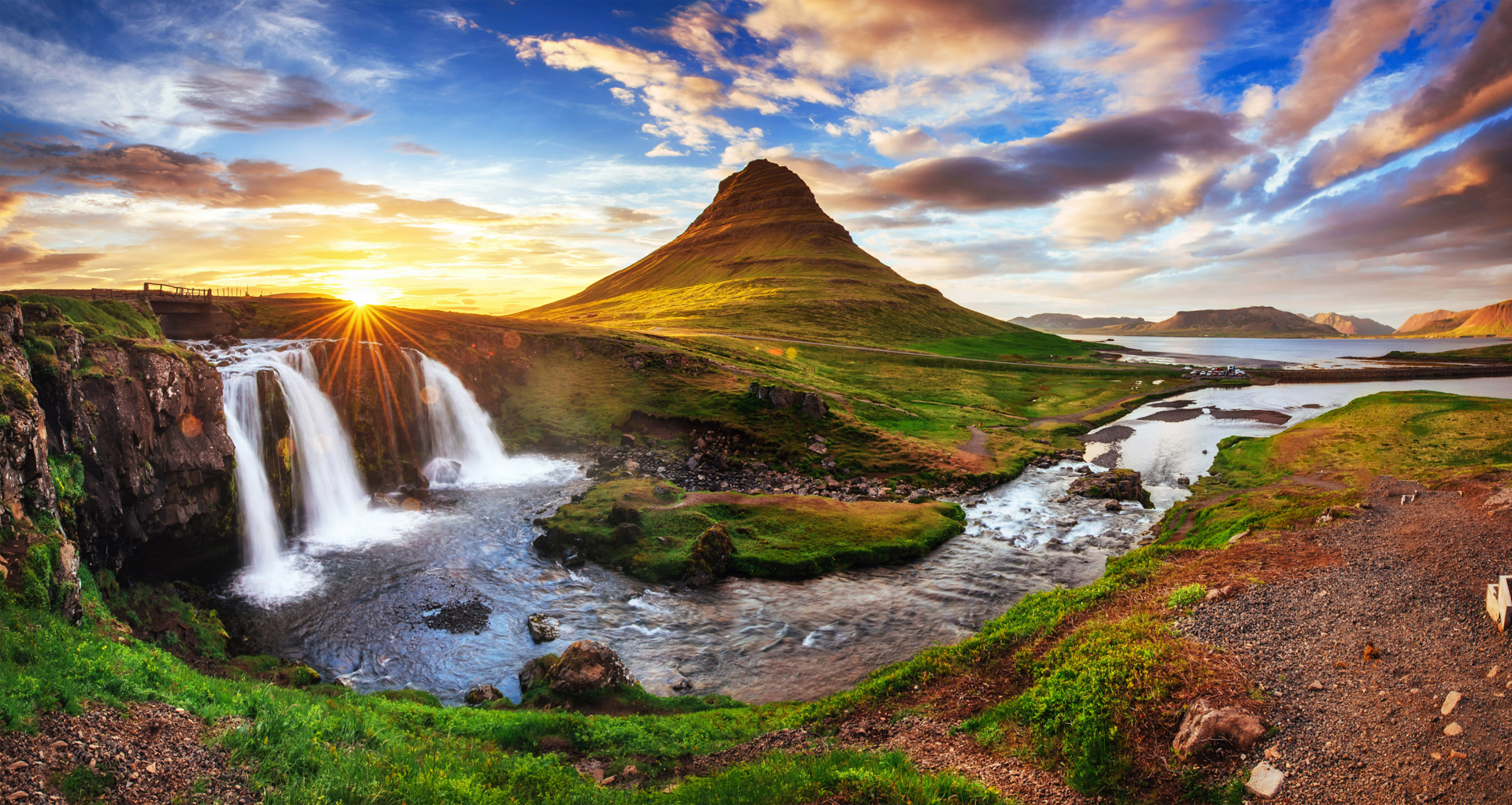
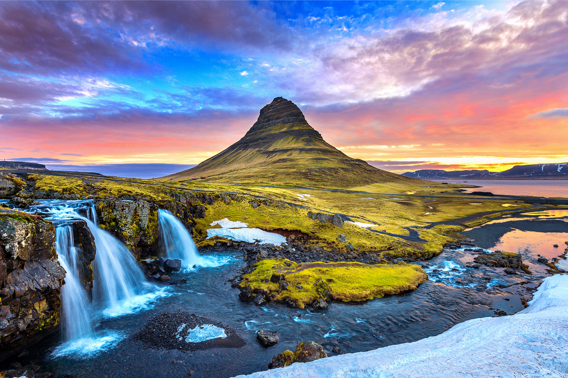
Kirkfujell Region 1

Kirkfujell Region 2

Kirkfujell Panoramic
Standret (iStock)

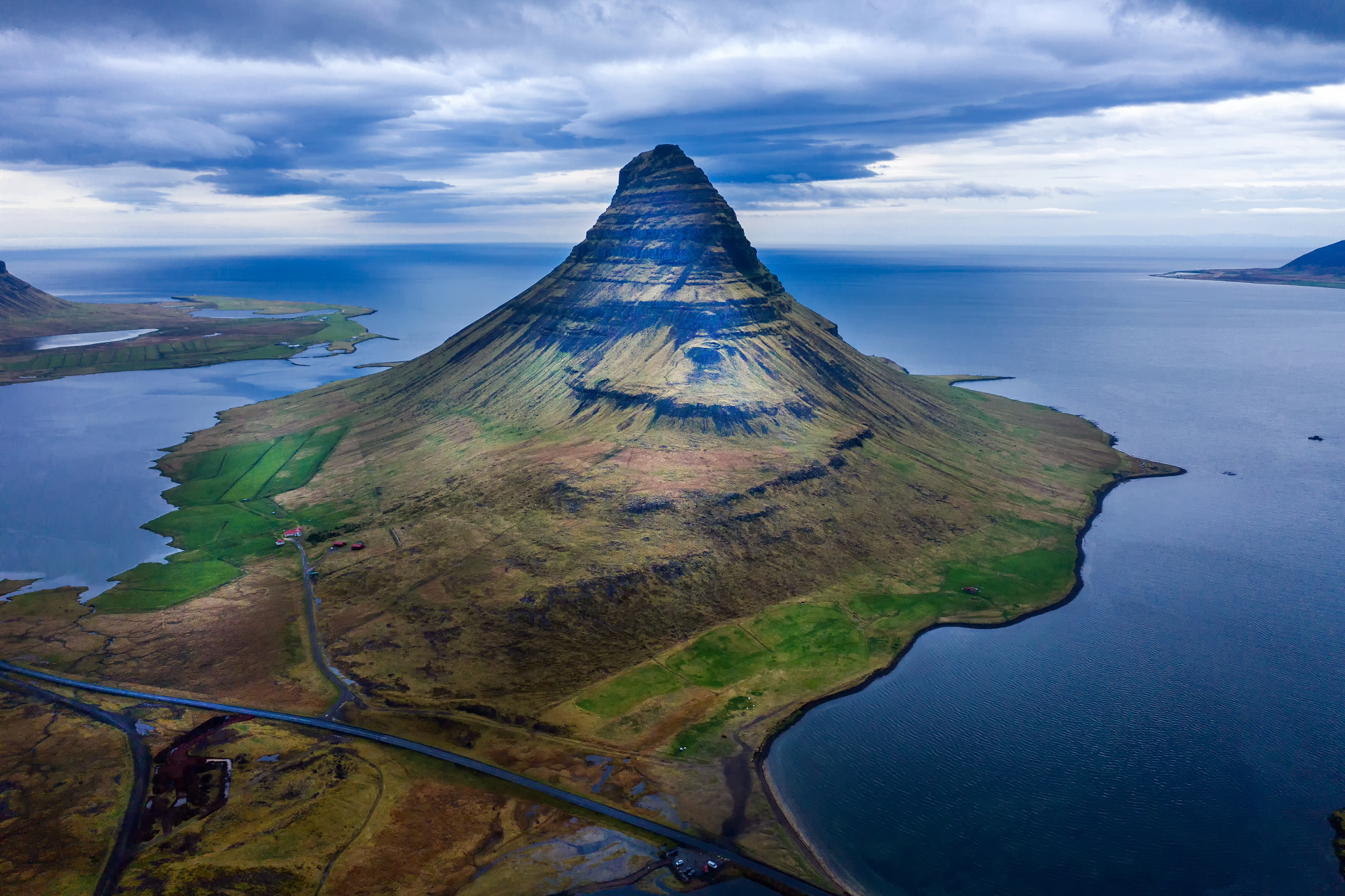
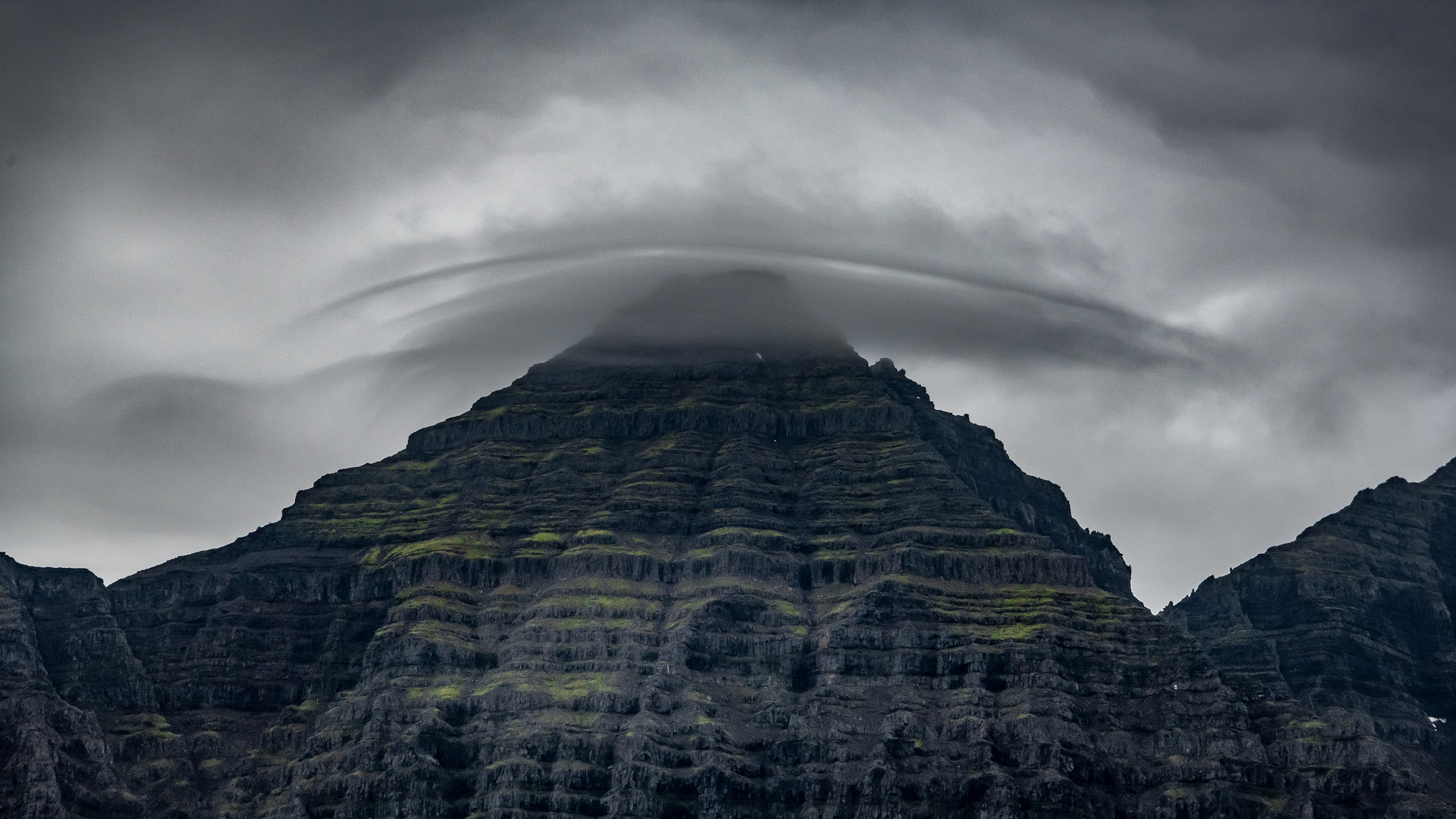
Kirkjufell (Icelandic: [ˈcʰɪr̥cʏˌfɛtl̥] ⓘ, “Church Mountain”) is a 463 m[1] high hill on the north coast of Iceland’s Snæfellsnes peninsula, near the town of Grundarfjörður. It is claimed to be the most photographed mountain in the country.[2] Kirkjufell was one of the filming locations for Game of Thrones season 6 and 7, featuring as the “arrowhead mountain” that the Hound and the company north of the Wall see when capturing a wight.
Geography
Kirkjufell contains volcanic rock but is not itself a volcano. It is a nunatak, a mountain that protruded above the glaciers surrounding it during the Ice Age, and before that was part of what was once the area’s strata. This stratum is composed of alternating layers of Pleistocene lava and sandstone, with tuff at its summit.[3]
Mountaineering
Climbing Kirkjufell is possible during the summer and fall, generally taking around three hours; however, there are steep sections that become dangerous when wet or in bad weather. The mountain has been the scene of a number of incidents, with recorded mountaineering fatalities in 1945,[4] 2017,[5] 2018,[6] and 2022.[7]
This article uses material from the Wikipedia article Kirkjufell, which is released under the Creative Commons Attribution-Share-Alike 4.0 International License (view authors).
 Yevhenii Chulovskyi (Shutterstock) | 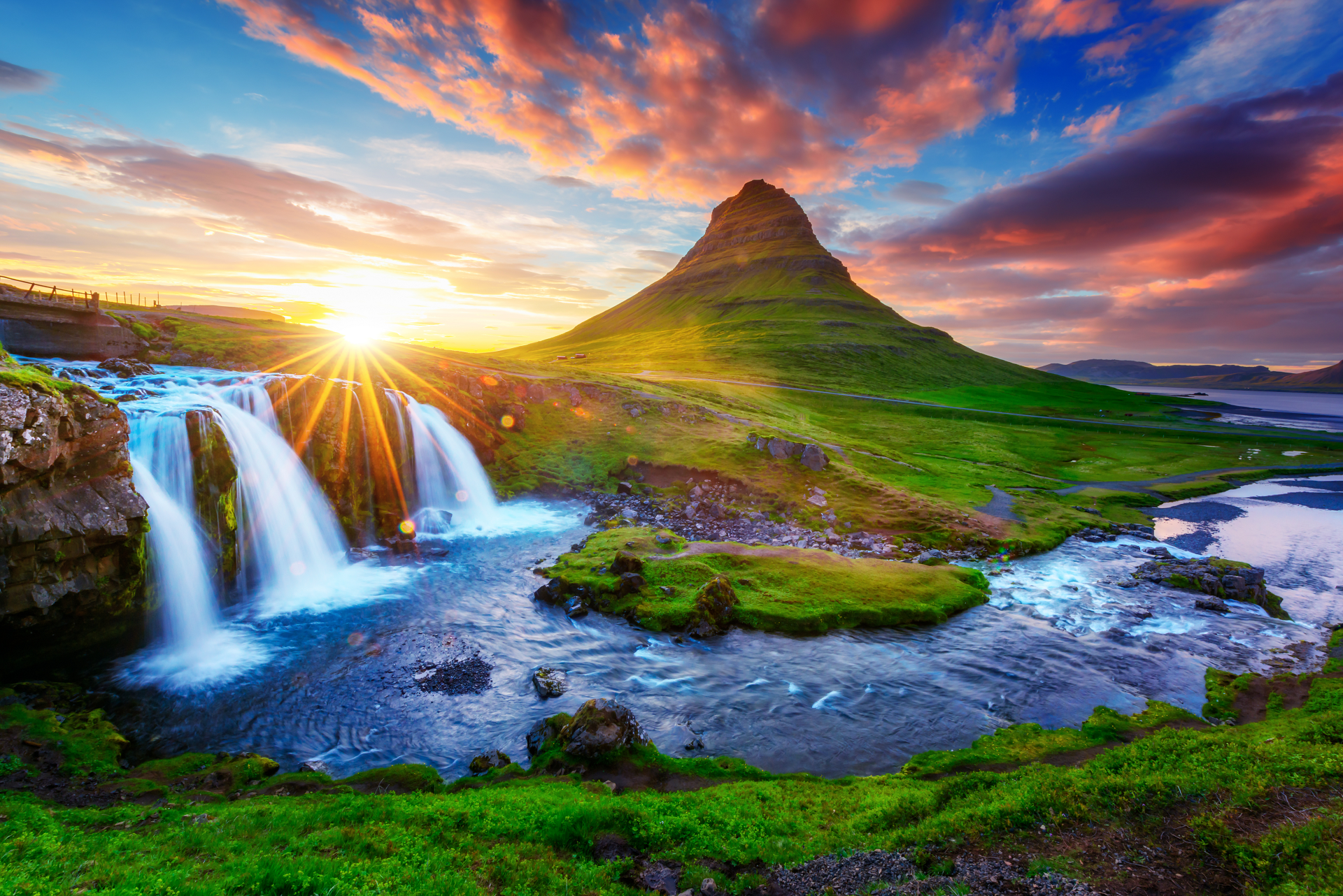 Smit (Shutterstock) I |
 Thampitakkull Jakkree (Shutterstock) |  Jenyateua (Adobe Stock) I |
 Tawatchai1990 (Adobe Stock) | 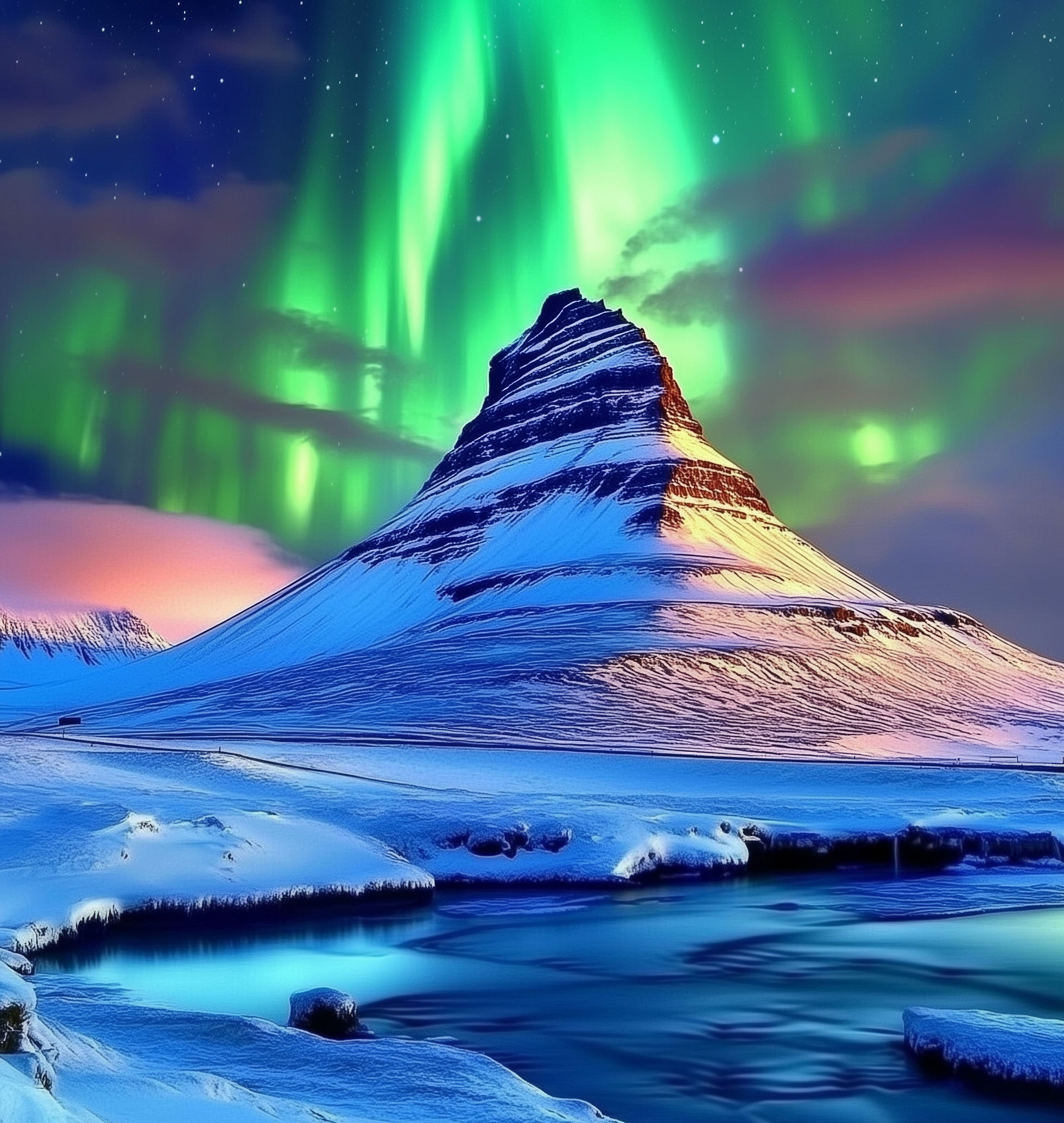 Wirestock (iStock) I |
 Salajean (Adobe Stock) I | 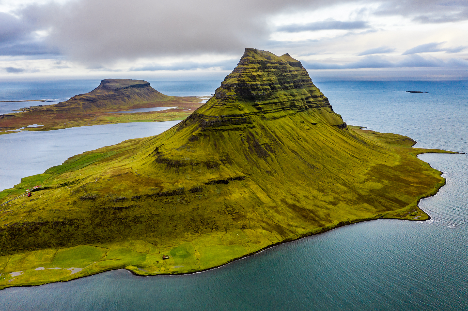 Aimeric D. Photo (Adobe Stock) |

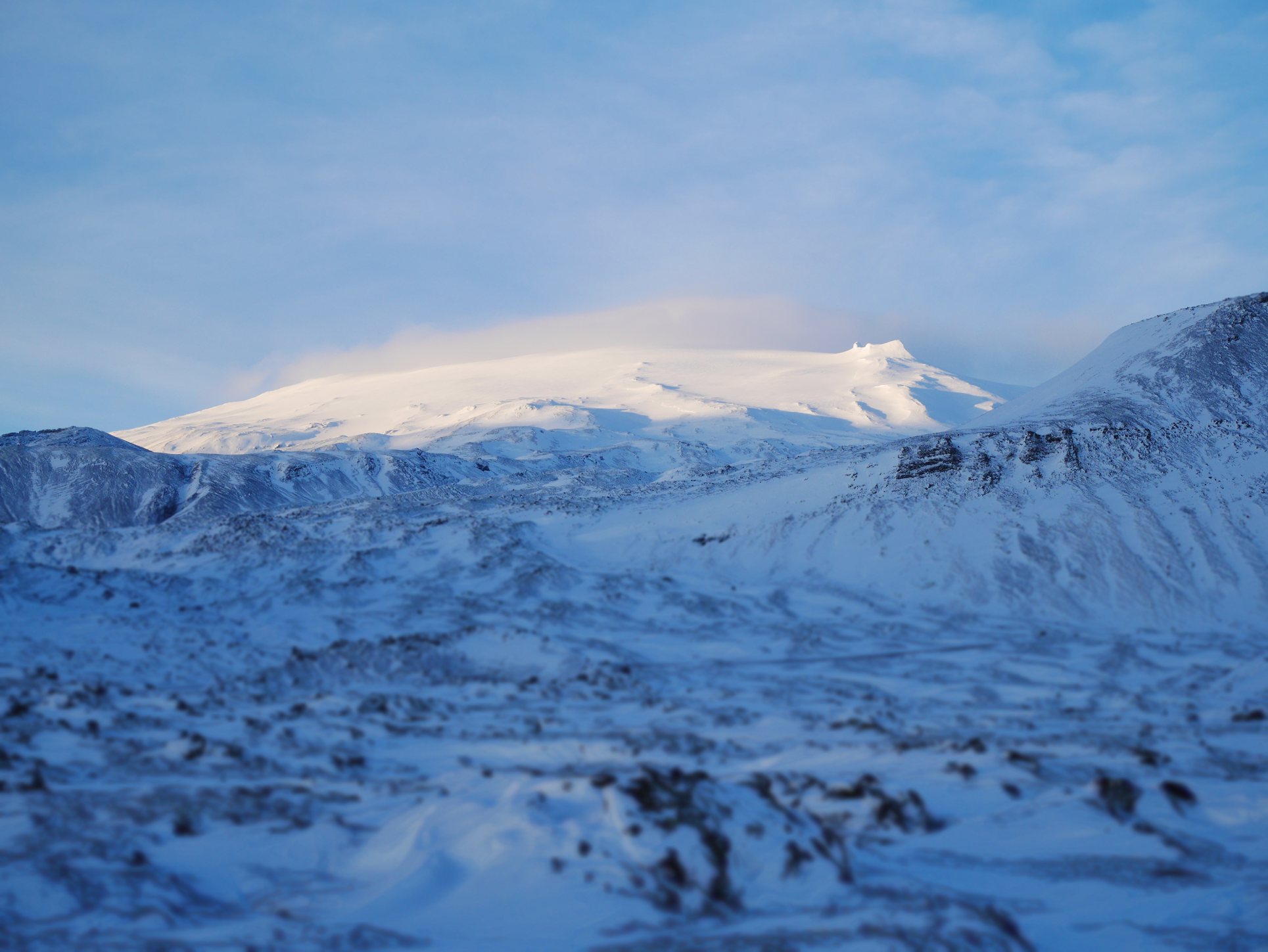
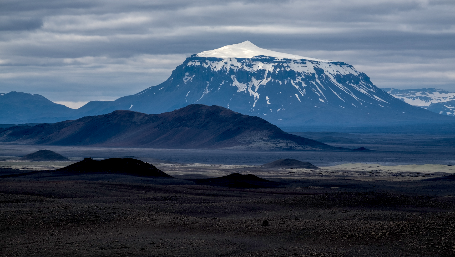
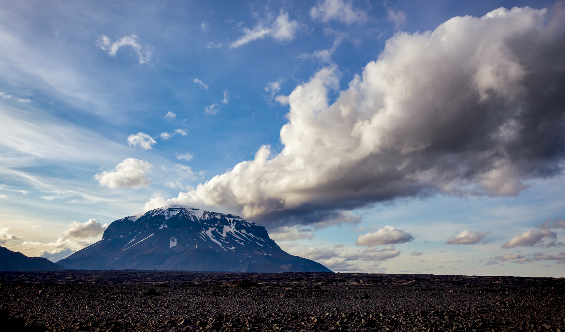
Snæfellsjökull (Icelandic pronunciation: [ˈs(t)naiːˌfɛlsˌjœːkʏtl̥] ⓘ, snow-fell glacier) is a 700,000-year-old glacier-capped stratovolcano in western Iceland.[3] It is situated on the westernmost part of the Snæfellsnes peninsula. Sometimes it may be seen from the city of Reykjavík over Faxa Bay, at a distance of 120 km (75 mi).
The mountain is one of the most famous sites of Iceland, primarily due to the novel Journey to the Center of the Earth (1864) by Jules Verne, in which the protagonists find the entrance to a passage leading to the center of the Earth on Snæfellsjökull.
The mountain is part of Snæfellsjökull National Park (Icelandic: Þjóðgarðurinn Snæfellsjökull).[4]
Snæfellsjökull was visible from an extreme distance due to an arctic mirage on 17 July 1939. Captain Robert Bartlett of the Effie M. Morrissey sighted Snæfellsjökull from a position some 536 to 560 kilometres (289–302 nmi) distant.[5]
In August 2012, the summit was ice-free for the first time in recorded history.[6] The icecap area had been 16 km2 (6.2 sq mi) in 1946,[7] 14 km2 (5.4 sq mi) in 1999 reducing to 10–11 km2 (3.9–4.2 sq mi) in 2008.[8][7]
Geology
The stratovolcano, which is the only large central volcano in its part of Iceland, has many pyroclastic cones on its flanks. Upper-flank craters produced intermediate to felsic materials. Several holocene eruptions have originated from the summit crater and have produced felsic material,[2] with pumice from the two most recent major eruptions being alkaline trachyte trending in composition close to rhyolite.[9] Lower-flank craters have produced basaltic lava flows with classic basalt composition.[9] The latest flank eruption was of 0.11 km3 (0.0264 cu mi) of basaltic material in the 4.5 km2 (1.7 sq mi) Væjuhraun lava flow and occurred shortly after the last central volcano eruption.[1] This main eruption had been explosive and originated from the summit crater.[10][11] It is dated to about 200 CE,[2][a] and was also associated with the eruption of viscous lava that covered 30 km2 (12 sq mi).[1] In all three large, perhaps up to VEI 4 plinian rhyolitic[b] eruptions have occurred during the Holocene producing tephra.[1][c] These occurred about 1800, 4000 and 8500 years ago.[1][a]
Snæfellsjökull is also associated with a fissure field that last erupted to the west forming the Væjuhraun lava flow as already mentioned.[1] To the east of Snæfellsjökull this fissure field last erupted between 5 and 8 thousand years ago.[16] This eruption formed the 18 km2 (6.9 sq mi) Búðahraun lava field from the crater Búðaklettur, south-west of Búðir.[16] This is part of the Snæfellsjökull volcanic system which in turn is part of the Snæfellsnes volcanic belt (Snæfellsnes volcanic zone).[1] This is an area of renewed intra-plate volcanism in the North American Plate,[17] with rocks no older locally than 800,000 years,[1] that overlay an extinct rift zone that produced the more than 5 million years old crustal basement tholeiitic flood basalts of the Snæfellsnes peninsula.[16]
This article uses material from the Wikipedia article Snæfellsjökull, which is released under the Creative Commons Attribution-Share-Alike 4.0 International License (view authors).
 Hopsalka (iStock) |  GOLLI |
 Snæfellsjökull 3 I | 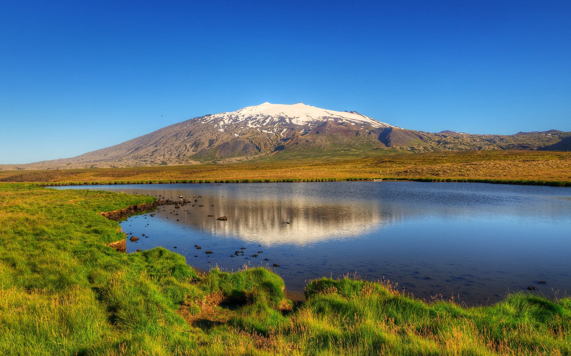 Axel Kristinsson (Wikipedia) |
Keilir Region
![]()
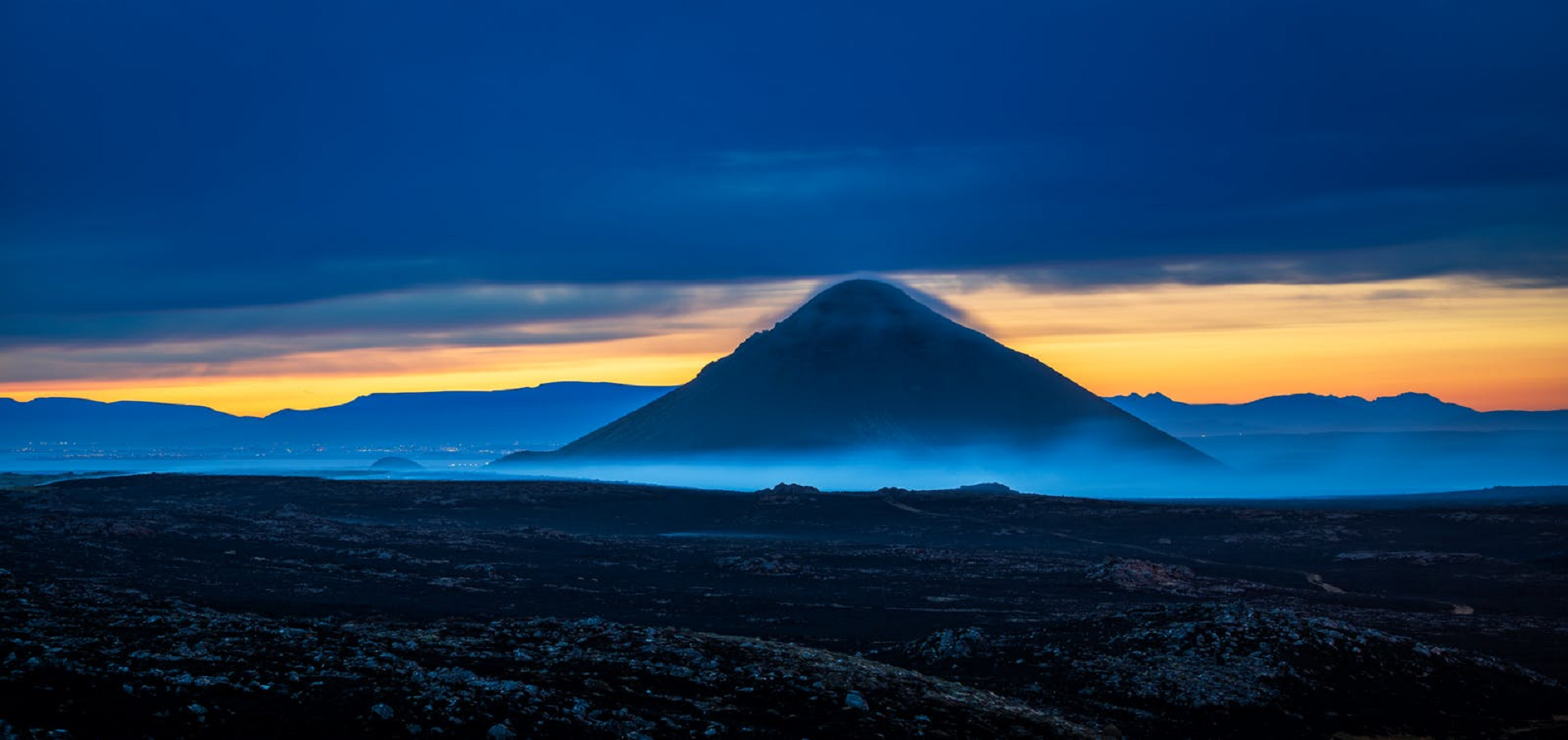
Keilir (Icelandic pronunciation: [ˈcʰeiːlɪr̥]; 378 m asl) is a Pleistocene subglacial mound or perhaps a conical tuya[3] on Reykjanes Peninsula in Iceland.[4] Basal area is 0.773 km2, summit area 0.004 km2, basal width 0.99 km, summit width 0.07 km, volume 0.0362 km3.[3]
It is located within the area of Krýsuvík volcanic system[5] and Reykjanesfólkvangur. It is about 17 miles southwest of the capital city Reykjavík.
In March 2021 the mountain began to emit earthquakes followed by a fissure lava eruption further southwest at Fagradalsfjall.
Formation
Keilir was formed during a subglacial fissure eruption which concentrated in the end at one vent.[6] Except the cone, also some small subglacially formed hills to the north are results of this eruption.[7][6]
Eruptions under the Weichselian glaciers on Reykjanes Peninsula
When stratigraphy is considered in detail, it tells about the different parts of this eruption: The eruption thawed the glacier ice and formed a subglacial lake in which the volcano continued to develop. The water very soon touched the magma within the vent and caused explosive activity. Tephra set down in layers into the subglacial lake. With time, the tephra built up a hill and small elongated mountain over the vent(s). When such an eruption is continued over a longer time span, the water in the end does not reach the vent(s) any more and lava begins to flow.[6]
In the top region of Keilir, there is a small cap of lava (area of lava cap 0,020 km2[3]) which could mean that the volcanic mountain is a tuya (the lava being from subaerial eruptions at the end of the eruption series)[3] or perhaps just represents a volcanic plug (the lava cooled and plugged up the vent).[6]
Ice thickness and more exact time of eruption in the case of Keilir are not known, just that it took place during the Pleistocene (Weichselian).[6]
Comparison to an Antarctic subglacial tuff cone
Smellie and other scientists newly discovered a similar monogenetic subglacial tuff cone within the ice of Antarctica and could determine the thickness of ice which covered the vent during eruption. The Antarctic cone did lie under a polar ice sheet and not a temperate glacier as was the case with Keilir. Additionally, the Antarctic cone is much older (around 640 000 years), whereas Keilir is up to 100 000 years old. And the tuff cone from Victoria Land, Antarctica, is placed next to known granitic plutonic complexes and seems to be a parasitic cone of a stratovolcano, whereas Keilir is located adjacent to presently active volcanic systems and looks as if it were placed on top of the shield volcano Þráinskjöldur, though the last one is younger than the subglacial formation. Interestingly,[editorializing] similar tectonics, rift zones, are behind both expressions of volcanism: the West Antarctic Rift System on the one hand,[8] and in the case of Keilir the Reykjanes Rift as part of the rift zones crossing Iceland. Also similar are their rocks – mafic lapilli tuff (in Icelandic: móberg).[8][9]
This article uses material from the Wikipedia article Keilir, which is released under the Creative Commons Attribution-Share-Alike 4.0 International License (view authors).
 I |  Solon bjorn (iStock) |
![]()
![]()
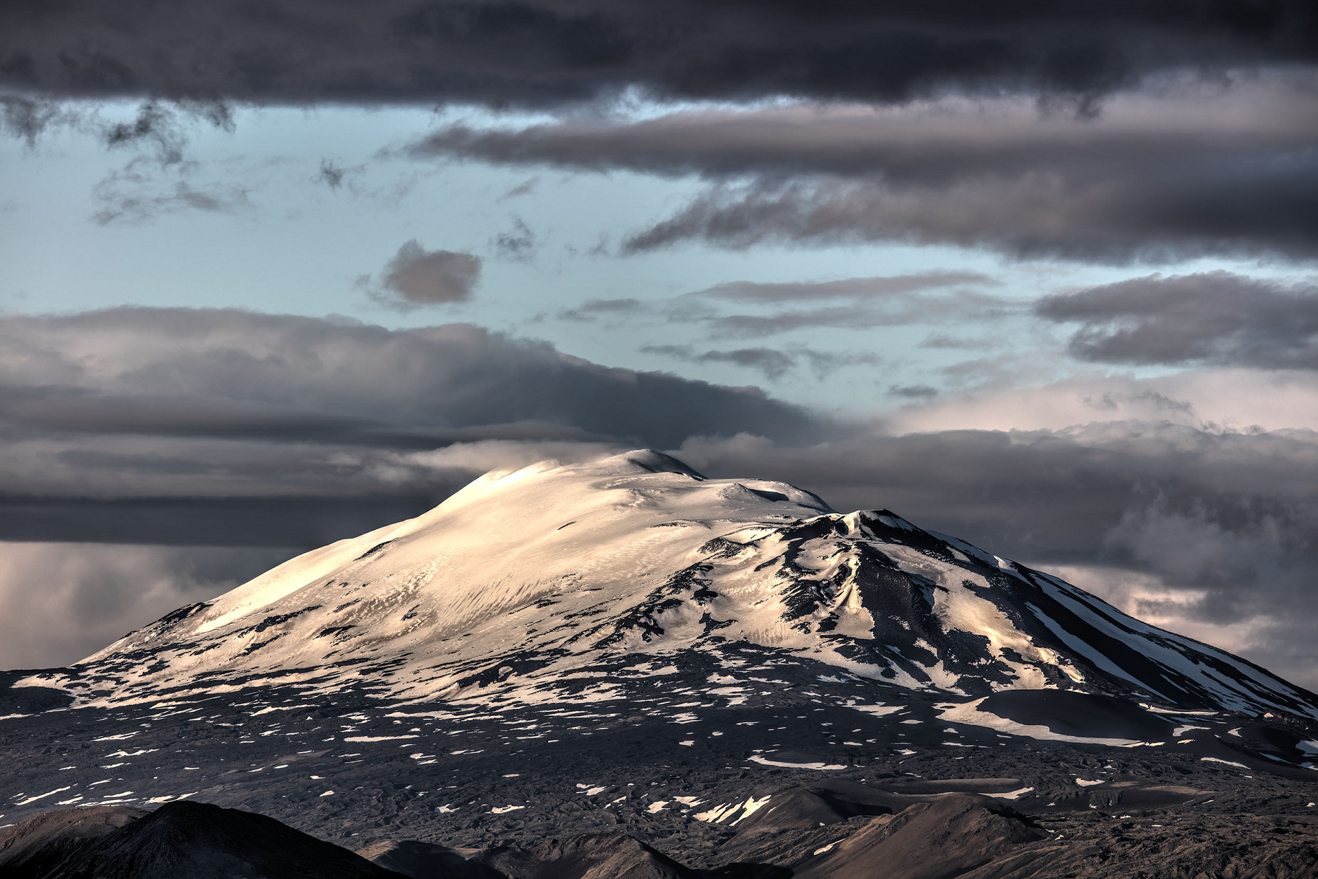
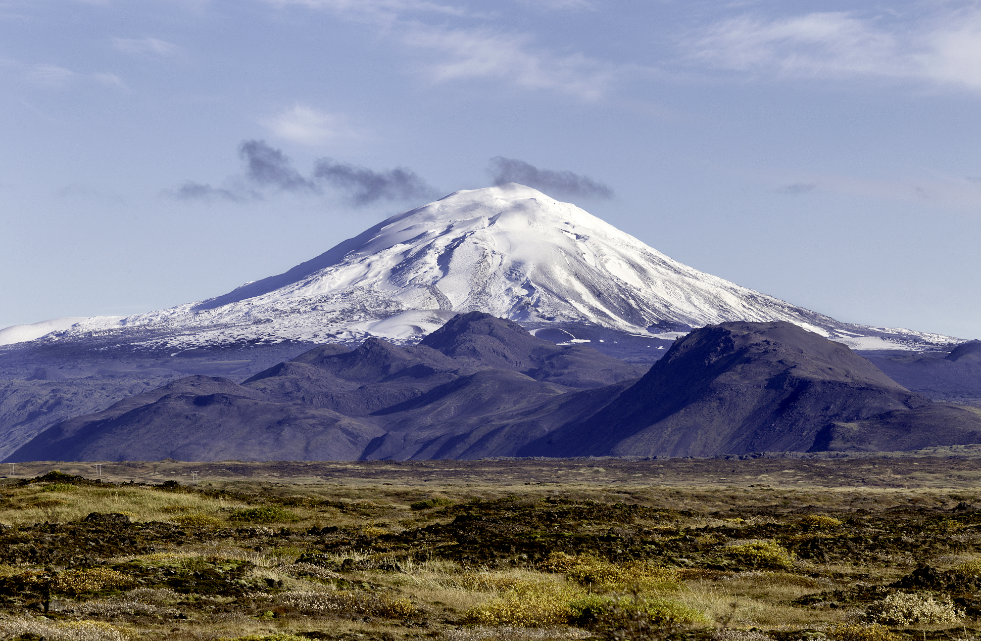
Hekla (Icelandic pronunciation: [ˈhɛhkla] ⓘ), or Hecla,[2][3] is an active stratovolcano in the south of Iceland with a height of 1,491 m (4,892 ft). Hekla is one of Iceland’s most active volcanoes; over 20 eruptions have occurred in and around the volcano since the year 1210.[4] During the Middle Ages, the Icelandic Norse called the volcano the “Gateway to Hell” and the idea spread over much of Europe.
The volcano’s frequent large and often initially explosive eruptions have covered much of Iceland with tephra, and these layers can be used to date eruptions of Iceland’s other volcanoes. Approximately 10% of the tephra created in Iceland in the last thousand years has come from Hekla, amounting to 5 km3 (1.2 cu mi). Cumulatively, the volcano has produced one of the largest volumes of lava of any in the world in the last millennium, around 8 km3 (1.9 cu mi).
Etymology
In Icelandic Hekla is the word for a short hooded cloak, which may relate to the frequent cloud cover on the summit. An early Latin source refers to the mountain as Mons Casule.[5]
Reputation
After the eruption of 1104, stories, probably spread deliberately through Europe by Cistercian monks, told that Hekla was the gateway to Hell.[6]
A poem by the monk Benedeit from c. 1120 about the voyages of Saint Brendan mentions Hekla as the prison of Judas.
In the Flatey Book Annal it was recorded that during the 1341 eruption, people saw large and small birds flying in the mountain’s fire which were taken to be souls.[8] In the 16th century Caspar Peucer wrote that the Gates of Hell could be found in “the bottomless abyss of Hekla Fell”. The belief that Hekla was the gate to Hell persisted until the 19th century.[7] There is still a legend that witches gather on Hekla during Easter.[9]
Geography
Hekla is part of a volcanic ridge, 40 km (25 mi) long. The most active part of this ridge, a fissure about 5.5 km (3.4 mi) long named Heklugjá [ˈhɛhklʏˌcauː], is considered to be within Hekla proper. Hekla looks rather like an overturned boat, with its keel being a series of craters, two of which are generally the most active.[10][11]
This article uses material from the Wikipedia article Hekla, which is released under the Creative Commons Attribution-Share-Alike 4.0 International License (view authors).
 Peter Coughlan (Flickr) I | 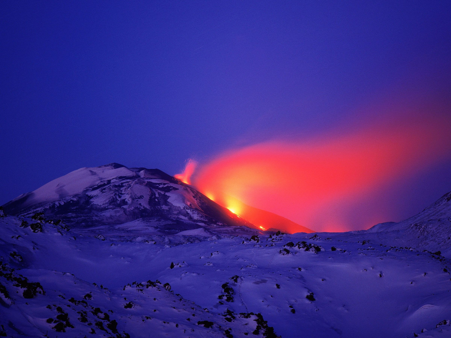 I I |
 Sumos (iStock) I | 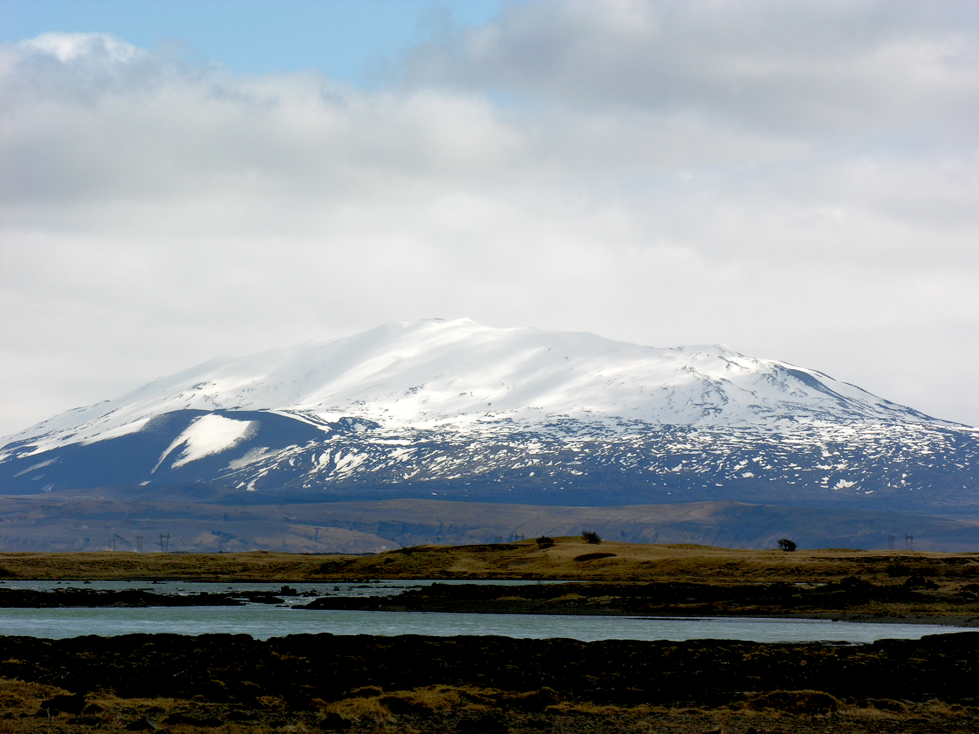 Hansueli Krapf (Wikipedia) |

![]()
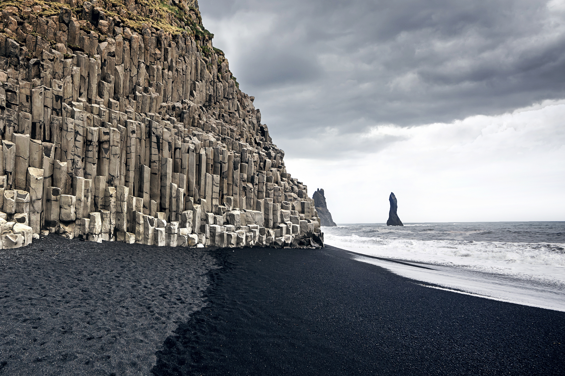
The Reynisfjall is an approximately 340-metre-high mountain in the municipality of MÃ3rdalur in the far south of Iceland.
Its outlets in the form of cliffs reach directly to the famous black coast of VÃ3k à MÃ3rdal. Due to its proximity to the rock interior (Reynisdrangar), which is located in the bay, it is considered a popular viewpoint among photographers and tourists and at the same time as a rallying point for ornithologists who study the behaviour of various animals from the family of petrels. Like most other mountains in this region, Reynisfjall has a very sparse vegetation, which is characterized mainly by grasses, lichens and isolated bush growth. The ascent is via several hairpin bends ; from its peak, the HjörleifshöfÃ3i mountain can be recognized in the east direction in good weather conditions. On the dome there is a transmission mast, which provides the buildings in the surrounding area with radio and telephone network, as well as internet reception.[ 1]
This article uses material from the Wikipedia article Reynisfjall, which is released under the Creative Commons Attribution-Share-Alike 4.0 International License (view authors).
 Duha127 (iStock) I | 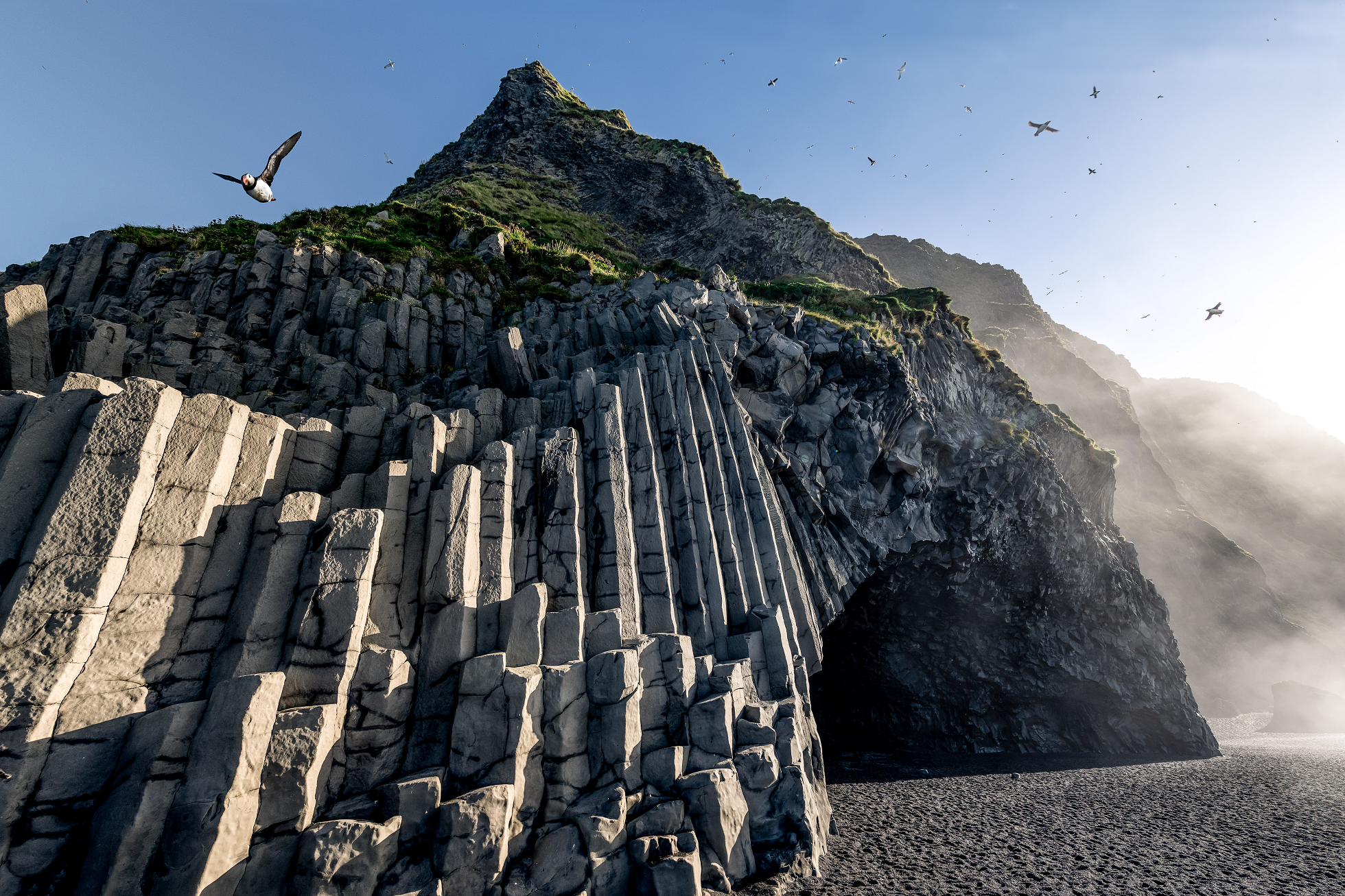 Bernd Thaller (Wikipedia) |
 Sasha64f (iStock) I | 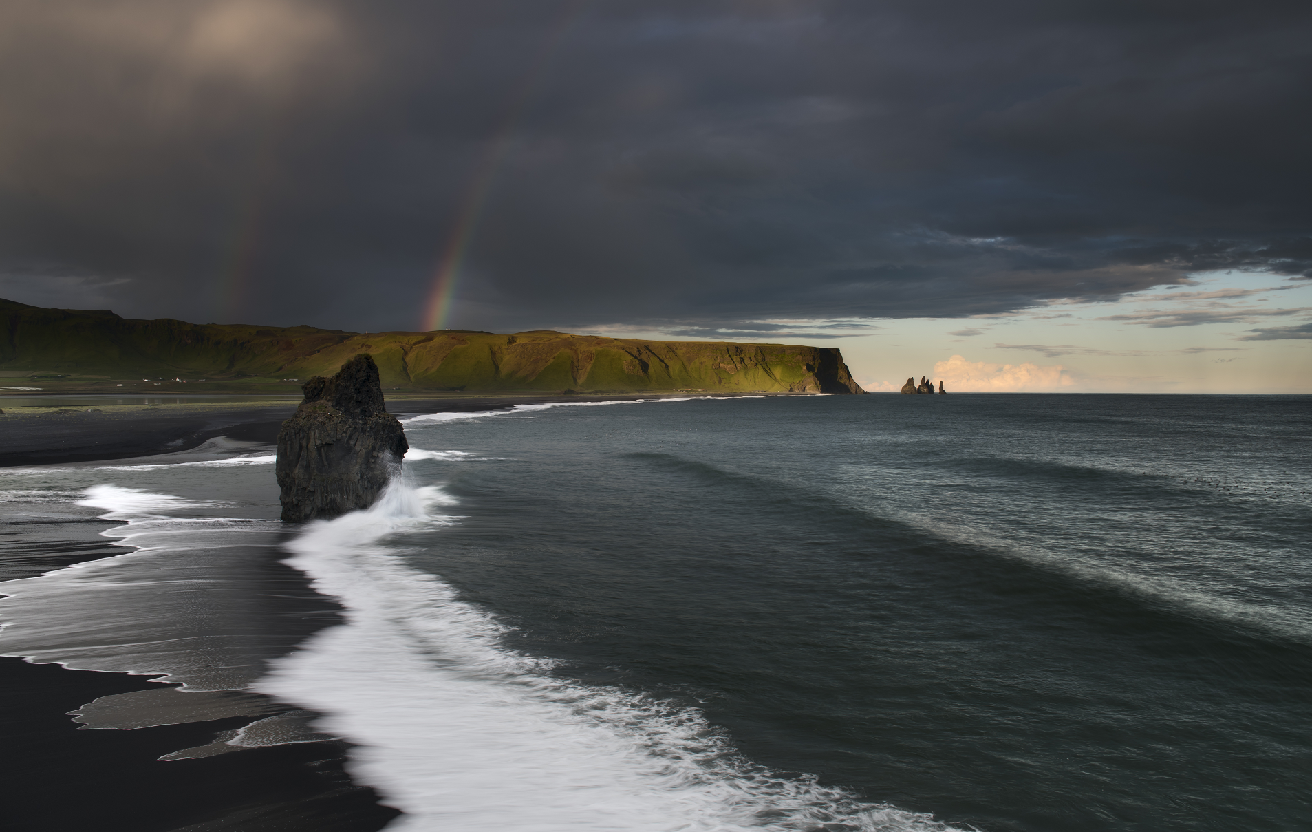 KonstantinMaslak (iStock) |
 I | 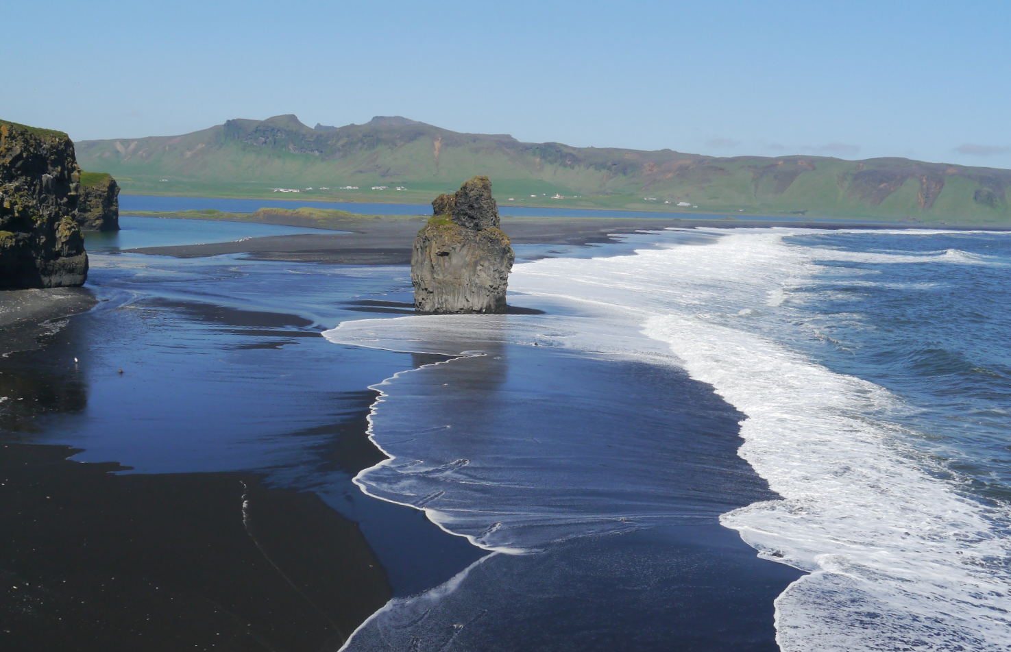 Zairon (Wikipedia) |
Hvannadalshnúkur Region

![]()
![]()
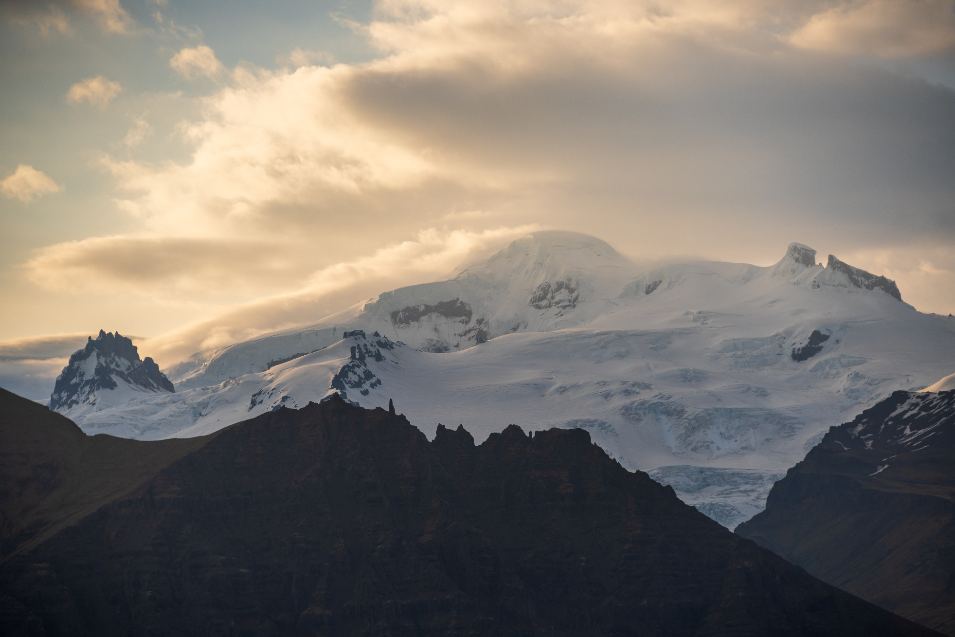
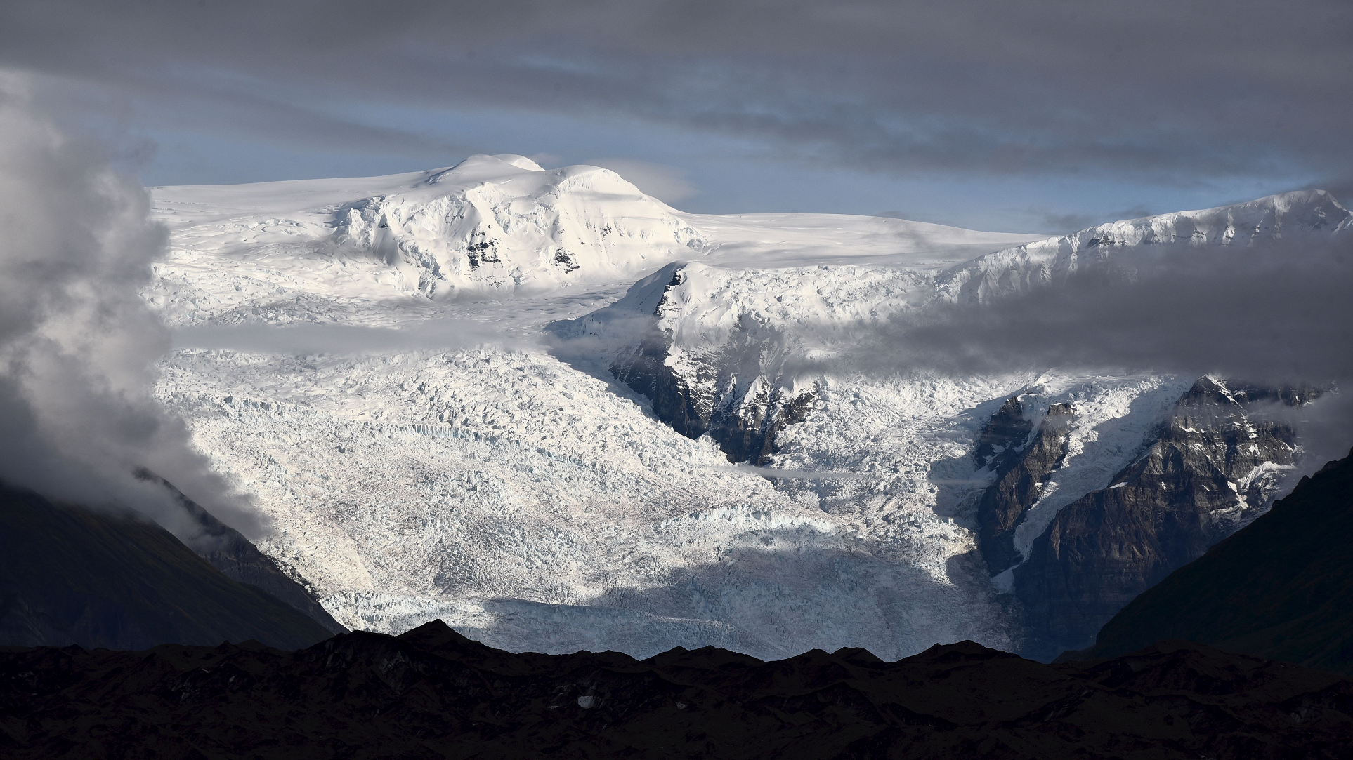
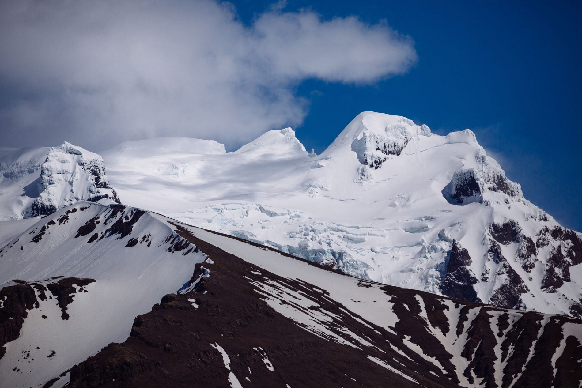
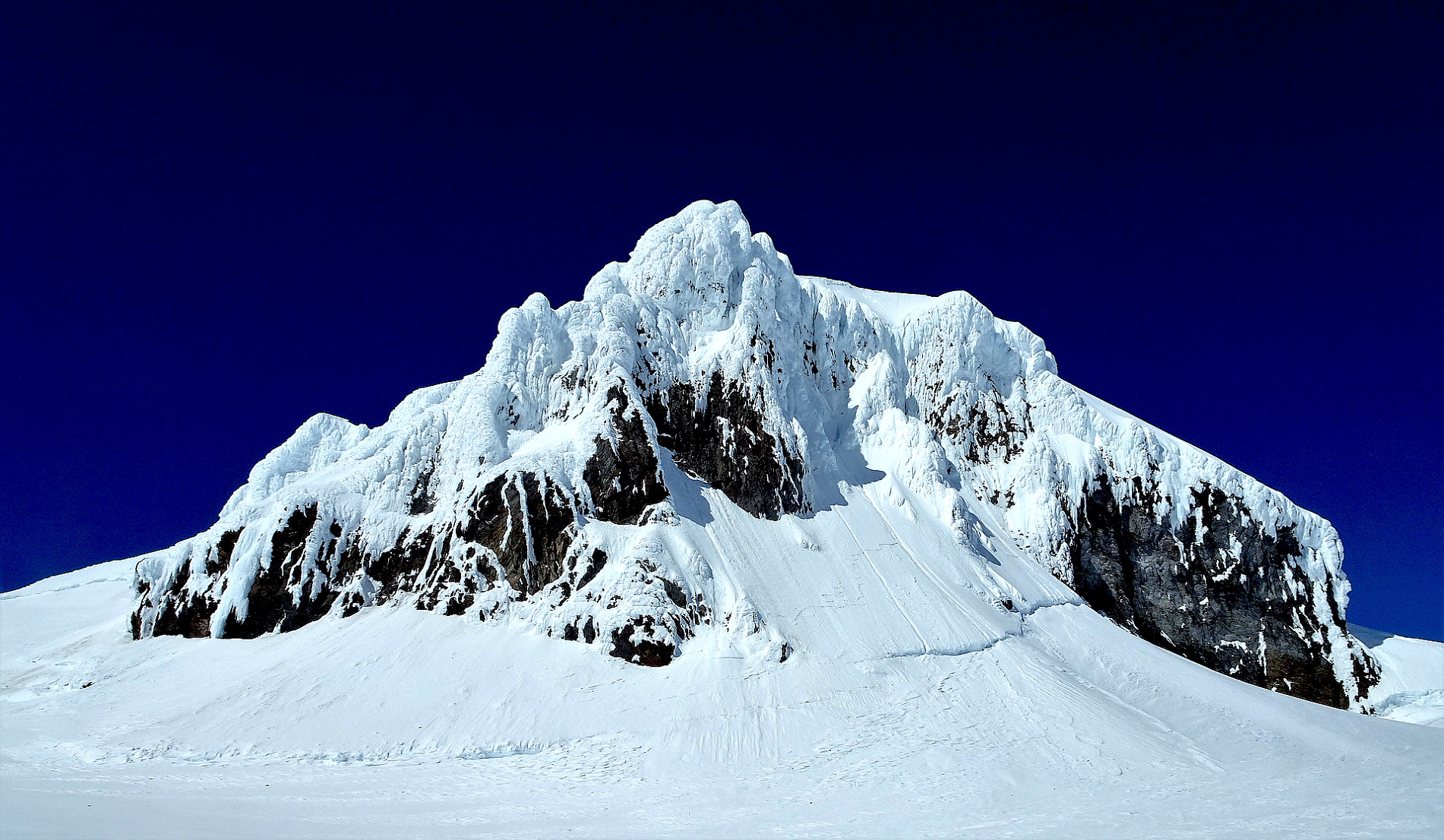
Hvannadalshnjúkur (pronounced [ˈkʰvanːaˌtalsˌn̥juːkʏr̥, ˈxʷa-]) or Hvannadalshnúkur[a] Icelandic pronunciation: [-ˌn̥uːkʏr̥] ⓘ is a pyramidal peak on the northwestern rim of the summit crater of the Öræfajökull volcano in Vatnajökull National Park, Iceland. Its summit is the highest point and the only Ultra-prominent peak in the country.
Geography
An official measurement in August 2005 established the height of the mountain as 2,109.6 metres (6,921 ft 3 in).[5] Earlier surveys had measured a height of 2,119 m or 6,952 ft.[1] The peak is part of the Vatnajökull National Park.
This article uses material from the Wikipedia article Hvannadalshnjúkur, which is released under the Creative Commons Attribution-Share-Alike 4.0 International License (view authors).
 Zrfphoto (iStock) | 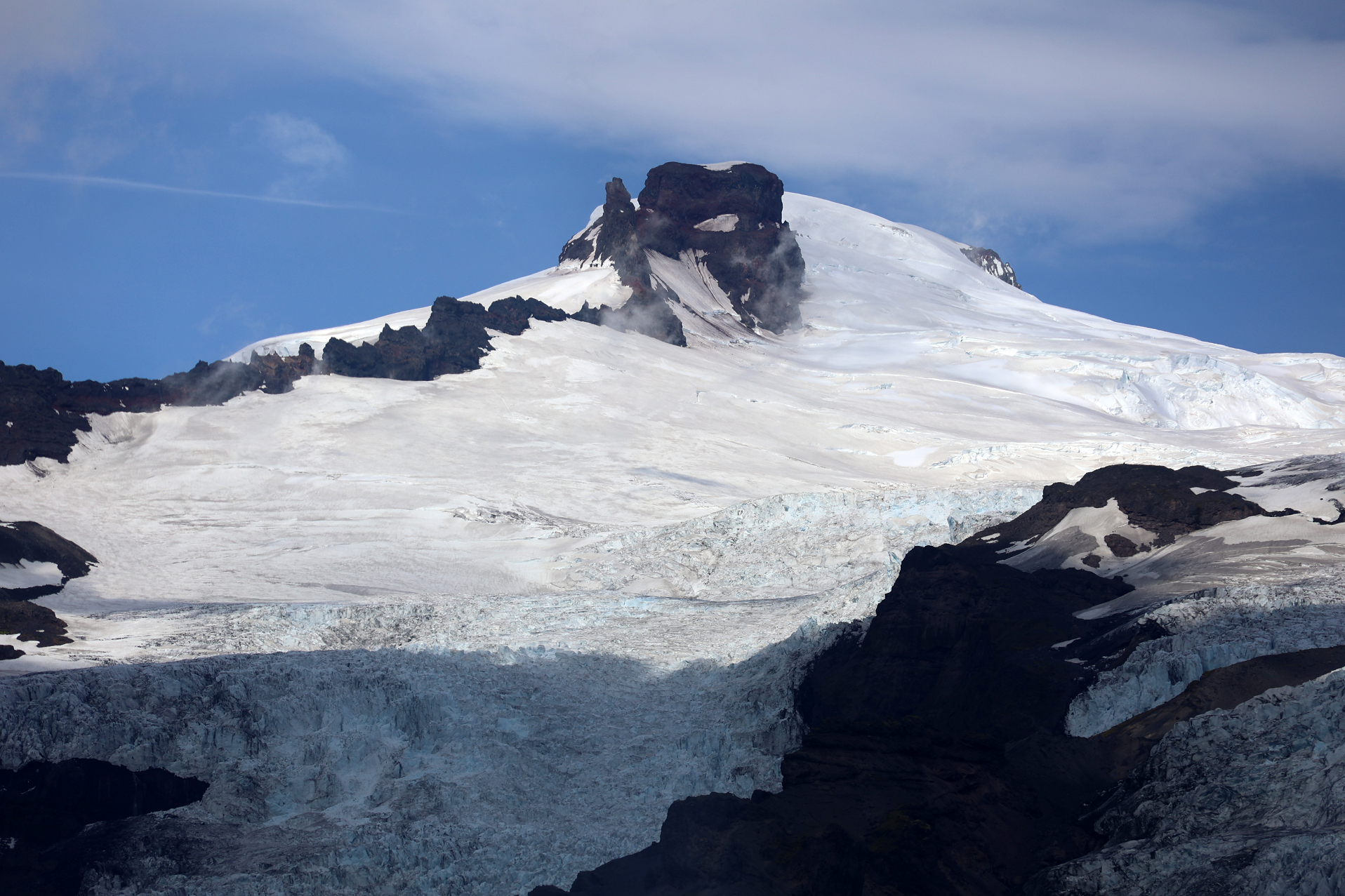 Vipersniper (iStock) |
 Wirestock (iStock) | 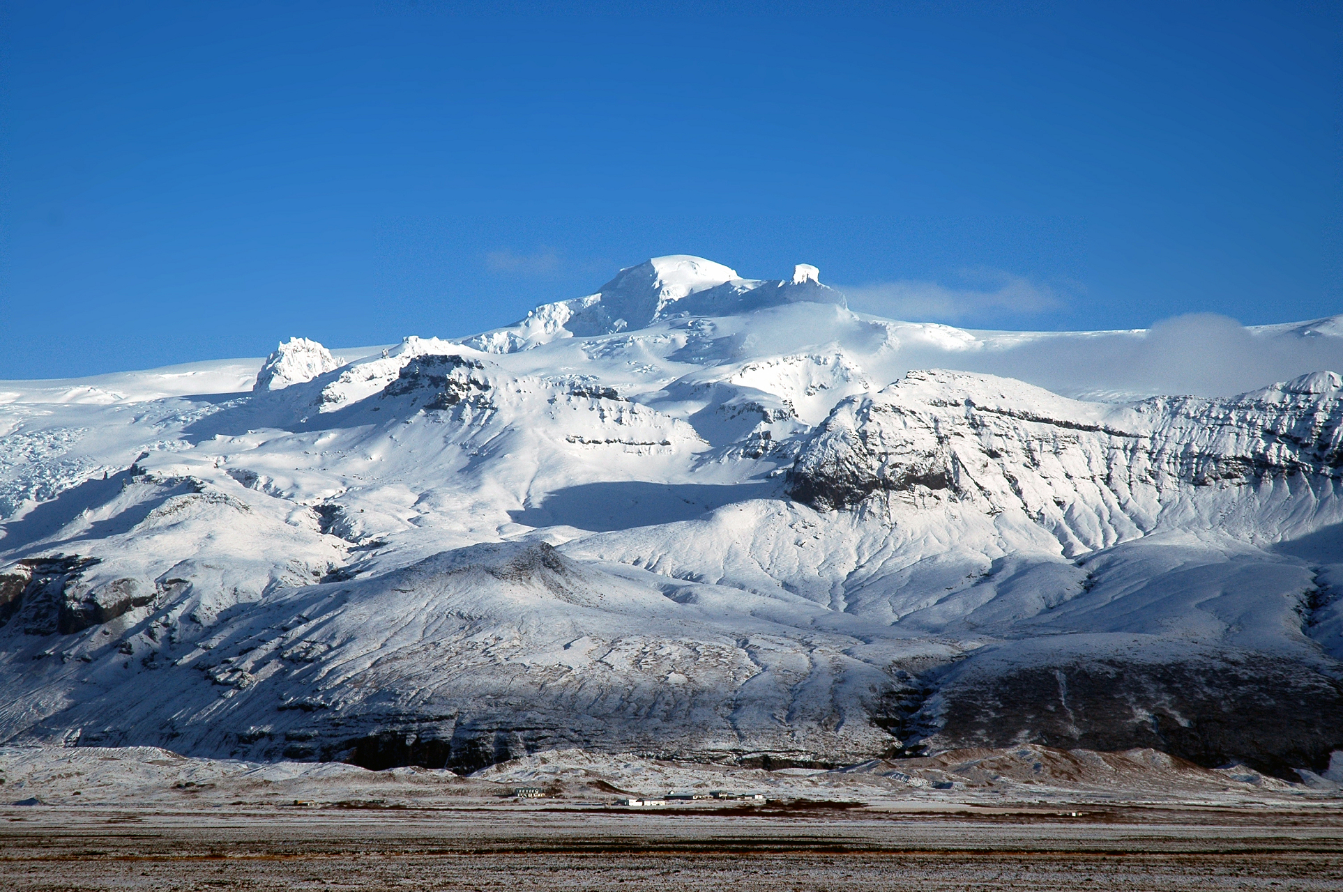 Grasp1 (Wikipedia) |
 |  |
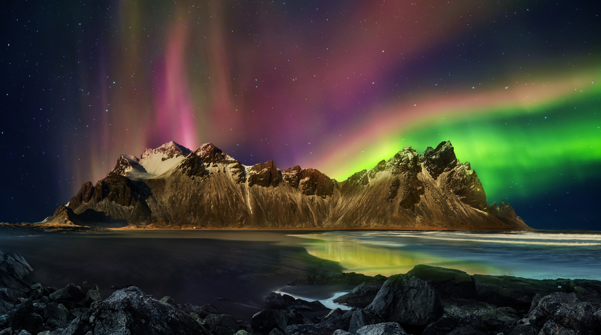
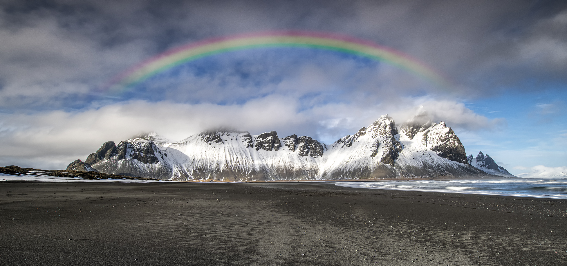
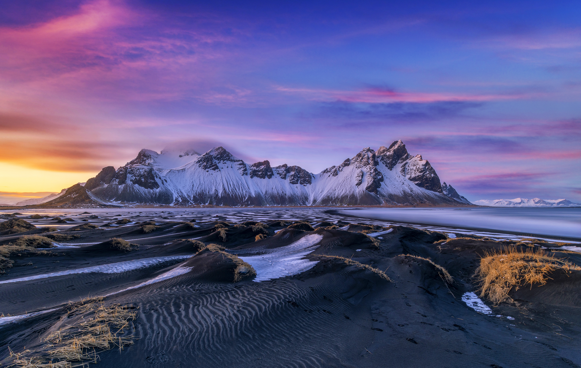
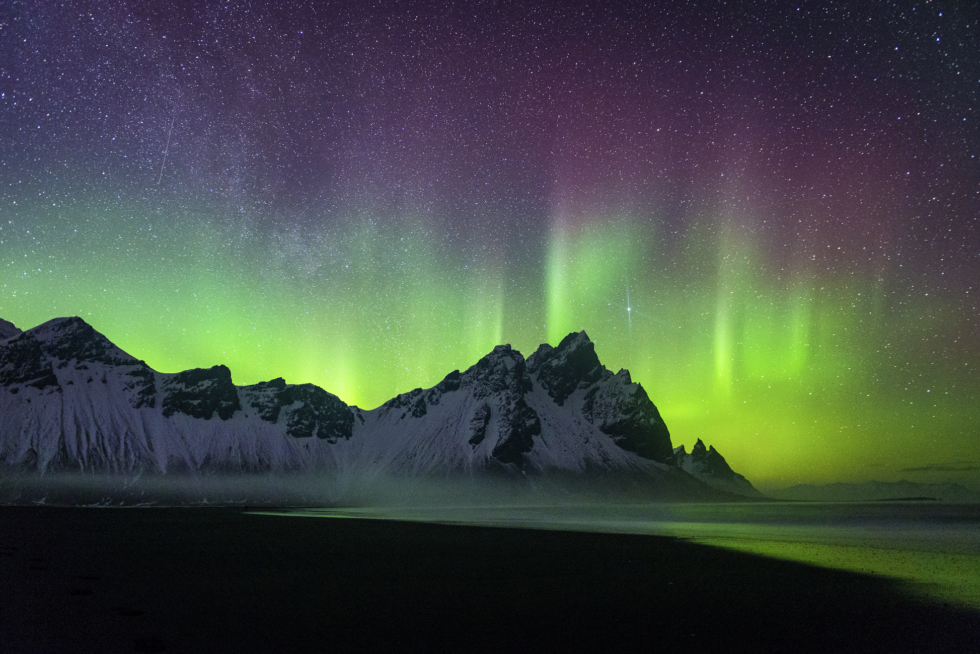
Vestrahorn Panoramic
Jag_cz (iStock)
![]()
![]()
Vestrahorn or Horn (454 m) is a mountain in Southeast Iceland on the headland between Skarðsfjörður and Papafjörður. The mountain stands between Hornsvík and Papóss on the open sea about 10 km east of Höfn in Hornafjörður. It is one of the few mountains in Iceland that are made of gabbro. Gabbro has sometimes been called hornblende in a joking manner, because it is found at Vestrahorn and Eystrahorn.
A very difficult hiking trail lies between the mountain and the shore at Vestrahorn. At the foot of the mountain and on the shore there are many gabbro boulders, the largest of which are the size of a five-story apartment building.
West of Vestrahorn, Stokksnes extends into the sea. There was a NATO observation post there until 2000. There are many seals on the skerries outside the shore at Stokksnes.
Vestrahorn belongs to the mountains outside Skarðsdalur, which are listed as a natural heritage site. It is a beautiful mountain range with a variety of rock types, and both granophyre and gabbro are found in Vesturhorn.
Geography
It was once thought that the gabbro in Vestrahorn was the oldest rock in Iceland. It has since been discovered that the gabbro is an intrusion into older basalt. To the east of Vestrahorn are basalt layers, mainly made of tholeiite, which is the oldest rock at Hornafjörður, about 8 million years old. Within the basalt lie intrusion layers and large intrusion nodules of gabbro and granophyre, a medium-grained and coarse-grained deep rock. The coarse-grained deep rock is an intrusion and younger than the tholeiite basalt that surrounds it. The gabbro-granophyre is about 6.6 million years old.
Historical events at Vestrahorn Vestrahorn is on the border of the settlement of the settlers Þorsteinn Legg and Hrollaug Rögnvaldsson. Hrolllaugur was the son of the Earl of Mæri in Norway and the brother of Gönga-Hrólfr. He first arrived in the harbor in Reykjavík but found his ships washed ashore at Vestrahorn and settled there. On March 6, 1873, several French schooners ran aground at Vestrahorn in severe weather.
A picture of Vestrahorn is on a stamp from 1991. The artist is Þröstur Haraldsson.
This article uses material from the Wikipedia article Vestrahorn, which is released under the Creative Commons Attribution-Share-Alike 4.0 International License (view authors).
 Piotr Krzeslak (iStock) | 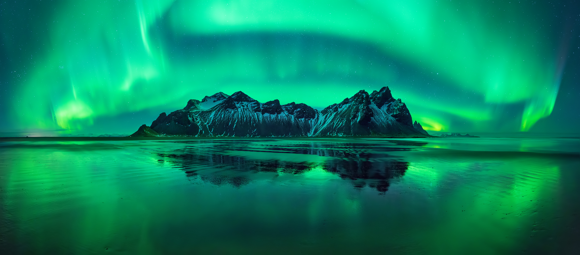 Jwen_Stroop (iStock) |
 Piotr Krzeslak (iStock) | 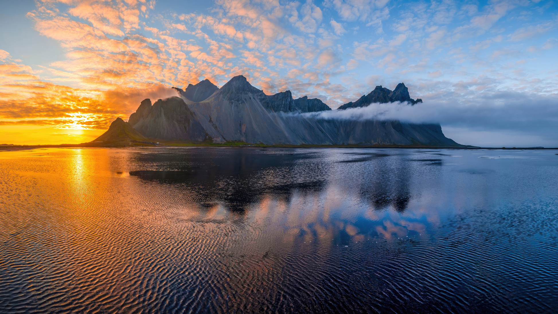 I |
 Piotr Krzeslak (iStock) | 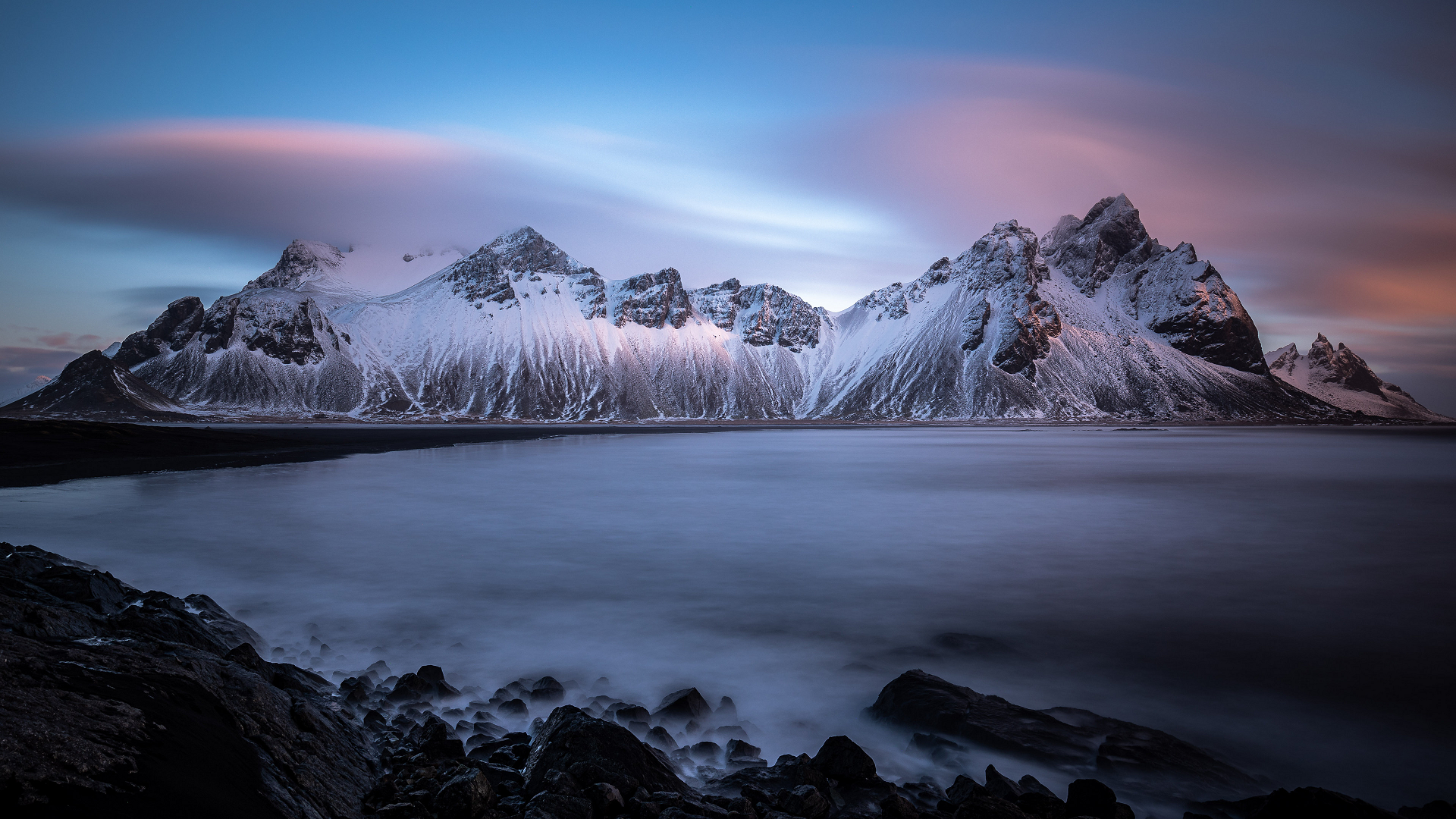 I |
![]()
Búlandstindur (Icelandic pronunciation: [ˈpuːˌlan(t)sˌtʰɪntʏr̥] ⓘ) is a mountain in Eastern Iceland between the bays Berufjörður and Hamarsfjörður. Mt. Búlandstindur is 1,069 metres (3,507 ft) above sea level. It is a pyramid-shaped stack of basaltic strata. The villages around this mountain are famous for fishing.[1]
This article uses material from the Wikipedia article Búlandstindur, which is released under the Creative Commons Attribution-Share-Alike 4.0 International License (view authors).
 I |  Distress Bark (Wikipedia) |
 |  |
![]()
![]()
Herðubreið (Icelandic pronunciation: [ˈhɛrðʏˌpreiːθ] ⓘ, broad-shouldered)[3] is a tuya in the northern part of Vatnajökull National Park, Iceland. It is situated in the Highlands of Iceland at the east side of the Ódáðahraun ([ˈouːˌtauːðaˌr̥œyːn]) desert and close to Askja volcano. The desert is a large lava field originating from eruptions of Trölladyngja and other shield volcanoes in the area. Herðubreið was formed beneath the ice sheet that covered Iceland during the last glacial period.
Overview
This distinctive mountain has been known by its present name since at least 1300.[4] Due to the mountain’s steep and unstable sides, the first definite ascent was in 1908 by Hans Reck and Sigurður Sumarliðason, despite centuries of knowledge of its existence.[2] [a] The mountain is often referred to as “The Queen of Icelandic Mountains” by Icelanders due to its beautiful shape.[7] It was voted in 2002 “Iceland’s favourite mountain”.[3]
Near the mountain lies an oasis called Herðubreiðarlindir [ˈhɛrðʏˌpreiːðarˌlɪntɪr̥] with a campground and hiking trails. In former times, outcasts who had been excluded from Icelandic society because of crimes they had committed lived in the Ódáðahraun and accessed the oasis. One such outlaw was Fjalla-Eyvindur, who lived there during the winter of 1774–1775.[8]
In 2019, Herðubreið became a part of Vatnajökull National Park.[9]
Geology
Herðubreið is a basaltic central subglacial volcano that formed during the last ice age under ice at least as thick as its current prominence of about 800 m (2,600 ft).[10]: 3–4 It is usually described as a composite volcano which is the same as a stratovolcano.[1][11] It is separate from the present potentially active fissure swarms and central volcanoes nearby and is believed to be inactive. Its original magma reservoirs are believed to have been at 9–11 km (5.6–6.8 mi), and 15–18 km (9.3–11.2 mi) below the surface.[10]: 21 There is in the upper crust, between 2 and 8 km (1.2 and 5.0 mi) deep, a 10 km (6.2 mi) broad belt of shallow seismicity extending from 30 km (19 mi) to the south of Herðubreið to the mountain itself due to plate boundary spreading.[12]: 2 There is also deeper activity likely to be related to magmatic movements but perhaps this is related to the shallow volcano-tectonic seismic activity at the active Askja volcano nearby.[12]: 3 Herðubreið is a classic tuya and was quickly recognised as such after the landform was described firstly as a subglacial volcanic construct in 1947.
The eruption sequence likely started before the glaciation of the last ice age south of Herðubreið in the ridge area called Herdubreidartögl with olivine tholeiite basalt being erupted. Glaciation resulted in pressure on the magma reservoir that initially may have switched off further eruptive activity.[10]: 4 In due course a second stage in the southern part of Herðubreið melted the ice with initial olivine tholeiite lava deposition under a lake that was followed by underwater hyaloclastite mass flow deposits.
This article uses material from the Wikipedia article Herðubreið, which is released under the Creative Commons Attribution-Share-Alike 4.0 International License (view authors).
 |  |
