
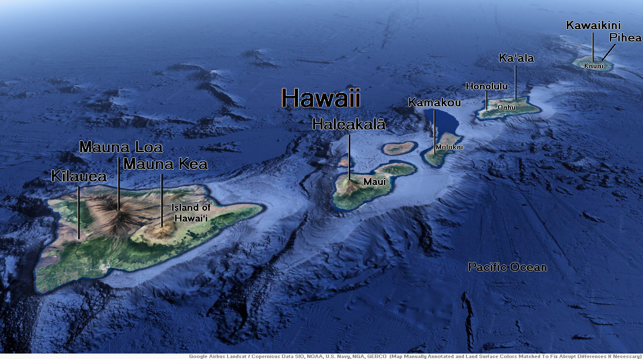
Map of Hawaii


Mauna Kea Region 1
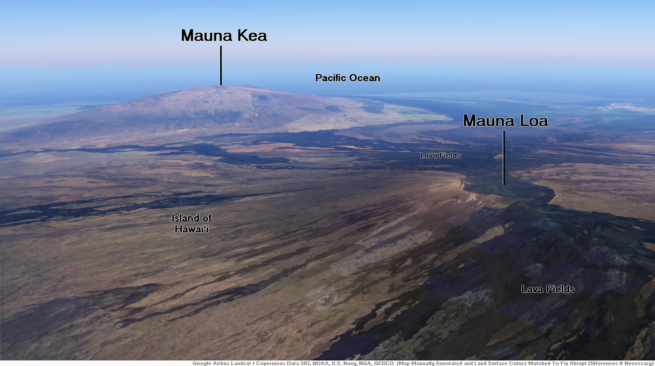
Mauna Kea Region 2


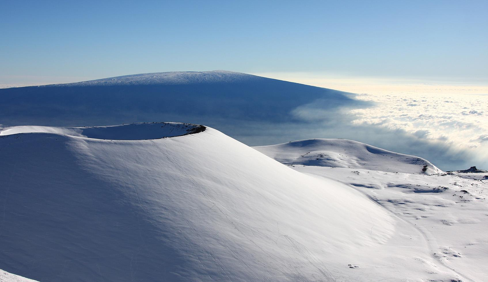
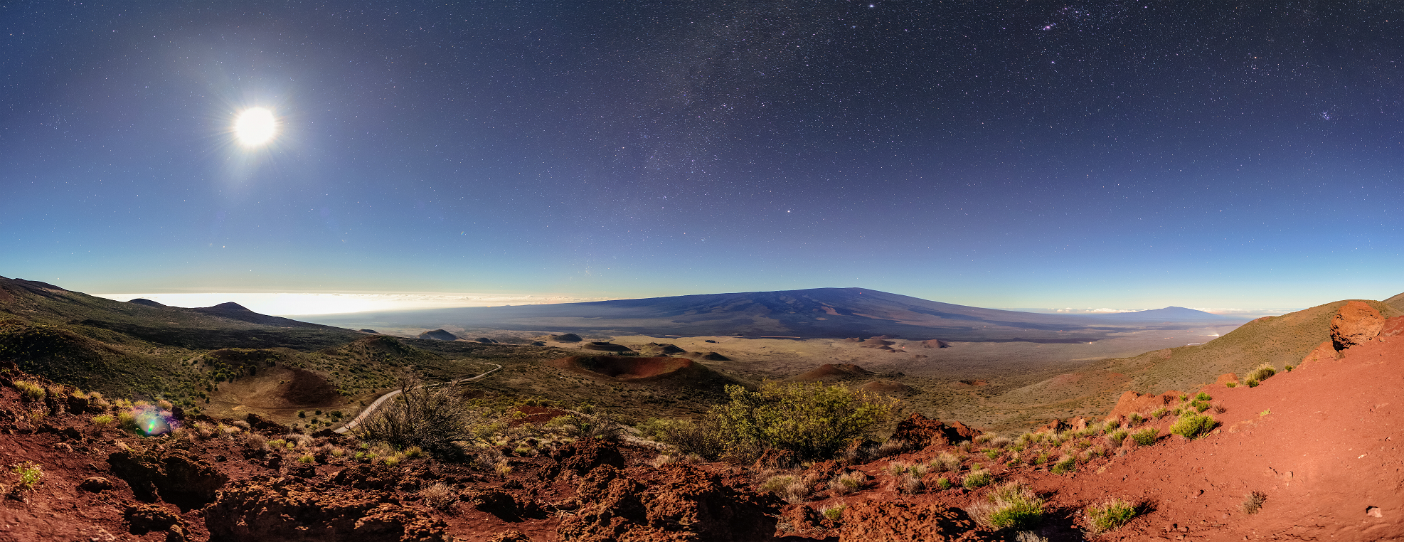
Mauna Kea (/ˌmɔːnə ˈkeɪə, ˌmaʊnə -/,[6] Hawaiian: [ˈmɐwnə ˈkɛjə]; abbreviation for Mauna a Wākea)[7] is a dormant shield volcano on the island of Hawaiʻi.[8] Its peak is 4,207.3 m (13,803 ft) above sea level, making it the highest point in Hawaii and the island with the second highest high point, behind New Guinea, the world’s largest tropical island with multiple peaks that are higher. The peak is about 38 m (125 ft) higher than Mauna Loa, its more massive neighbor. Mauna Kea is unusually topographically prominent for its height: its prominence from sea level is fifteenth in the world among mountains, at 4,207.3 m (13,803 ft); its prominence from under the ocean is 9,330 m (30,610 ft), rivaled only by Mount Everest. This dry prominence is greater than Everest’s height above sea level of 8,848.86 m (29,032 ft), and some authorities have labeled Mauna Kea the tallest mountain in the world, from its underwater base.[a] Mauna Kea is ranked 8th by topographic isolation.[citation needed]
It is about one million years old and thus passed the most active shield stage of life hundreds of thousands of years ago. In its current post-shield state, its lava is more viscous, resulting in a steeper profile. Late volcanism has also given it a much rougher appearance than its neighboring volcanoes due to construction of cinder cones, decentralization of its rift zones, glaciation on its peak, and weathering by the prevailing trade winds. Mauna Kea last erupted 6,000 to 4,000 years ago and is now thought to be dormant.
In Hawaiian religion, the peaks of the island of Hawaiʻi are sacred. An ancient law allowed only high-ranking aliʻi to visit its peak. Ancient Hawaiians living on the slopes of Mauna Kea relied on its extensive forests for food, and quarried the dense volcano-glacial basalts on its flanks for tool production. When Europeans arrived in the late 18th century, settlers introduced cattle, sheep, and game animals, many of which became feral and began to damage the volcano’s ecological balance. Mauna Kea can be ecologically divided into three sections: an alpine climate at its summit, a Sophora chrysophylla–Myoporum sandwicense (or māmane–naio) forest on its flanks, and an Acacia koa–Metrosideros polymorpha (or koa–ʻōhiʻa) forest, now mostly cleared by the former sugar industry, at its base. In recent years, concern over the vulnerability of the native species has led to court cases that have forced the Hawaiʻi Department of Land and Natural Resources to work towards eradicating all feral species on the volcano.
With its high elevation, dry environment, and stable airflow, Mauna Kea’s summit is one of the best sites in the world for astronomical observation. Since the creation of an access road in 1964, thirteen telescopes funded by eleven countries have been constructed at the summit. The Mauna Kea Observatories are used for scientific research across the electromagnetic spectrum and comprise the largest such facility in the world. Their construction on a landscape considered sacred by Native Hawaiians continues to be a topic of debate to this day.
This article uses material from the Wikipedia article Mauna Kea, which is released under the Creative Commons Attribution-Share-Alike 4.0 International License (view authors).
 |  |
 I I | 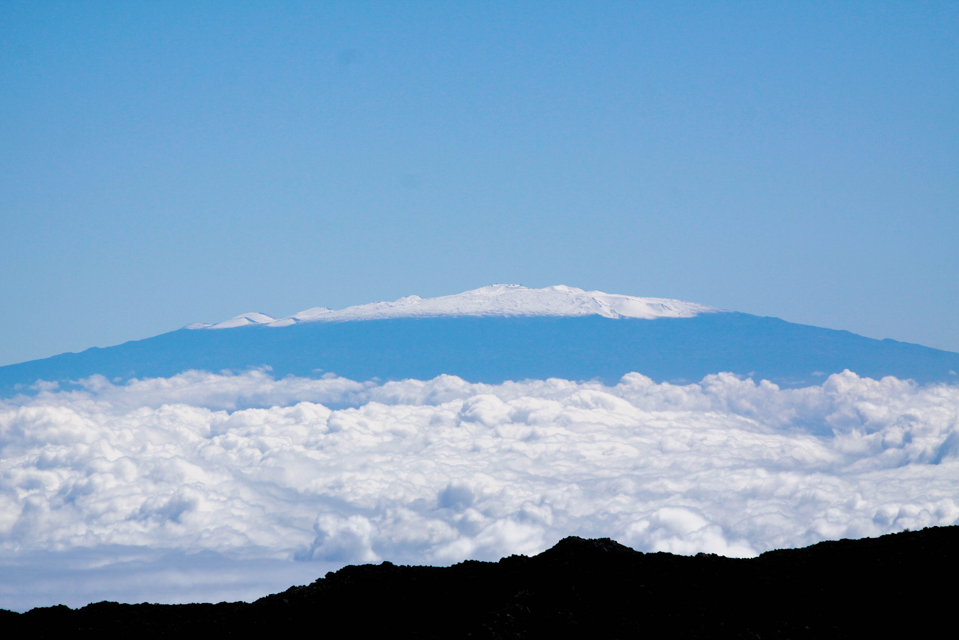 Aiden Relkoff (Wikipedia) |
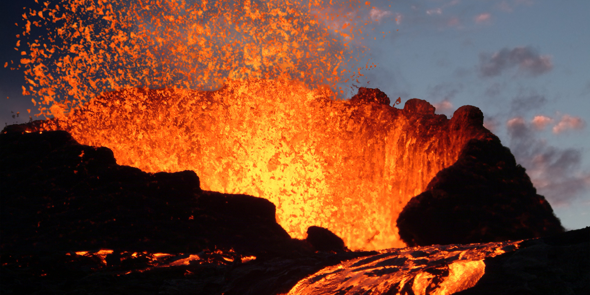
Mauna Loa (/ˌmɔːnə ˈloʊ.ə, ˌmaʊnə -/, Hawaiian: [ˈmɐwnə ˈlowə]; lit. ’Long Mountain’[1]) is one of five volcanoes that form the Island of Hawaii in the U.S. state of Hawaii in the Pacific Ocean. Mauna Loa is Earth’s largest active volcano[1] by both mass and volume. It was historically considered to be the largest volcano on Earth until Tamu Massif was discovered to be larger.[4] Mauna Loa is a shield volcano with relatively gentle slopes, and a volume estimated at 18,000 cubic miles (75,000 km3),[5] although its peak is about 125 feet (38 m) lower than that of its neighbor, Mauna Kea.[6] Lava eruptions from Mauna Loa are silica-poor and very fluid, and tend to be non-explosive.
Mauna Loa has likely been erupting for at least 700,000 years, and may have emerged above sea level about 400,000 years ago. Some dated rocks are 470,000 years old.[7] The volcano’s magma comes from the Hawaii hotspot, which has been responsible for the creation of the Hawaiian Island chain over tens of millions of years. The slow drift of the Pacific Plate will eventually carry Mauna Loa away from the hotspot within 500,000 to one million years from now, at which point it will become extinct.
Mauna Loa’s most recent eruption began on November 27, 2022, and ended on December 13, 2022. It was the first eruption since 1984.[8][9] No recent eruptions of the volcano have caused fatalities, but eruptions in 1926 and 1950 destroyed villages, and the city of Hilo is partly built on lava flows from the late 19th century.
Because of the potential hazards it poses to population centers, Mauna Loa is part of the Decade Volcanoes program, which encourages studies of the world’s most dangerous volcanoes. Mauna Loa has been monitored intensively by the Hawaiian Volcano Observatory since 1912. Observations of the atmosphere are undertaken at the Mauna Loa Observatory, and of the Sun at the Mauna Loa Solar Observatory, both located near the mountain’s summit. Hawaii Volcanoes National Park covers the summit and portions of the southeastern and southwestern flanks of the volcano, and also incorporates Kīlauea, a separate volcano.
This article uses material from the Wikipedia article Mauna Loa, which is released under the Creative Commons Attribution-Share-Alike 4.0 International License (view authors).
 I |  U.S. Geological Survey |
 |  |
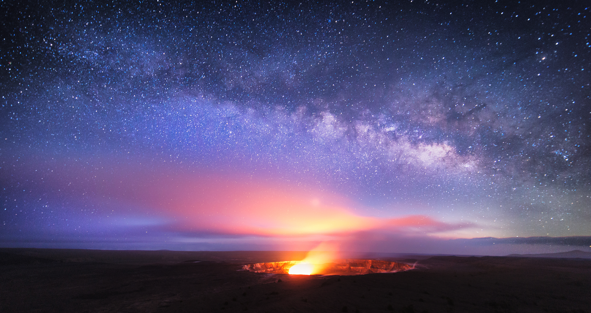
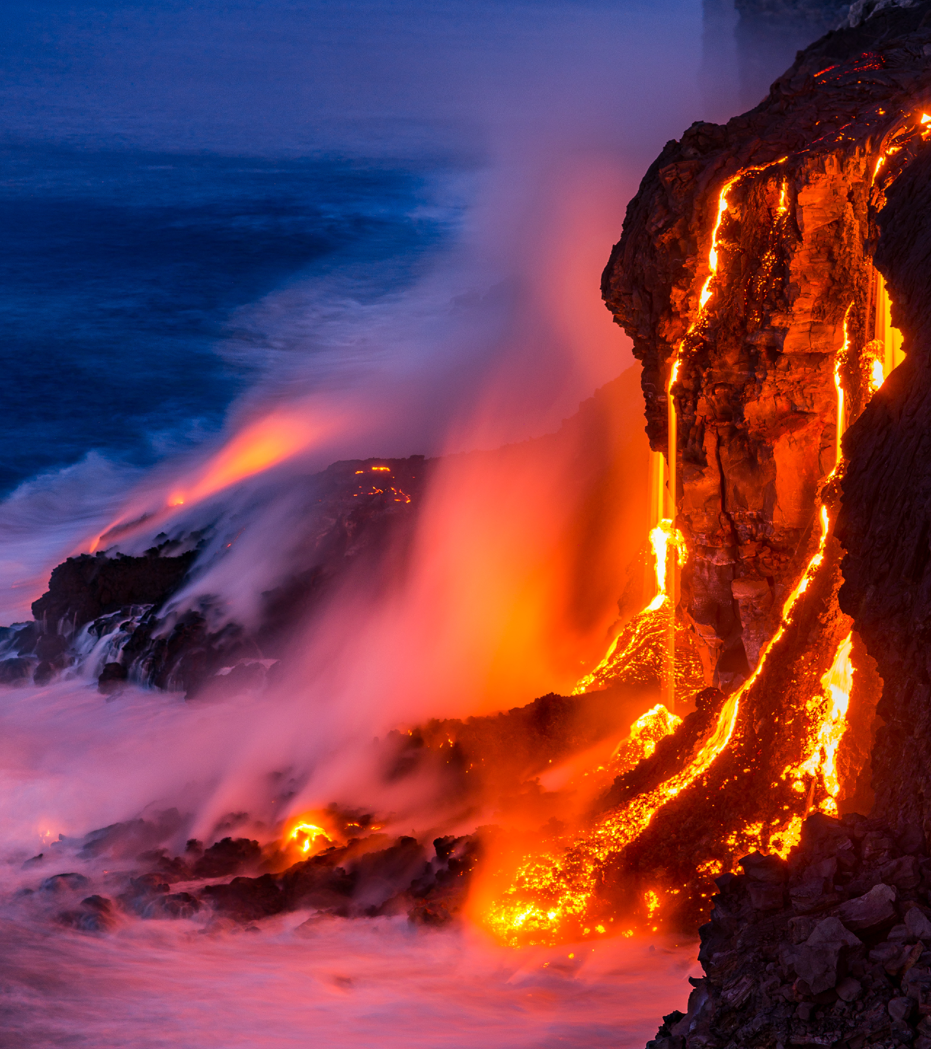
Kīlauea (US: /ˌkɪləˈweɪə/ ⓘ KIL-ə-WAY-ə, Hawaiian: [kiːlɐwˈwɛjə]) is an active shield volcano in the Hawaiian Islands. It is located along the southeastern shore of Hawaii Island. The volcano is between 210,000 and 280,000 years old and grew above sea level about 100,000 years ago. Since the islands were settled, it has been the most active of the five volcanoes that together form the island and among the most active volcanoes on Earth. The most recent eruption began in December 2024.
Kīlauea is the second-youngest product of the Hawaiian hotspot and the current eruptive center of the Hawaiian–Emperor seamount chain. Because it lacks topographic prominence and its activities historically coincided with those of Mauna Loa, Kīlauea was once thought to be a satellite of its much larger neighbor. Kīlauea has a large, fairly recently formed caldera at its summit and two active rift zones, one extending 125 km (78 mi) east and the other 35 km (22 mi) west. An active fault of unknown depth moves vertically an average of 2 to 20 mm (0.1 to 0.8 in) per year.
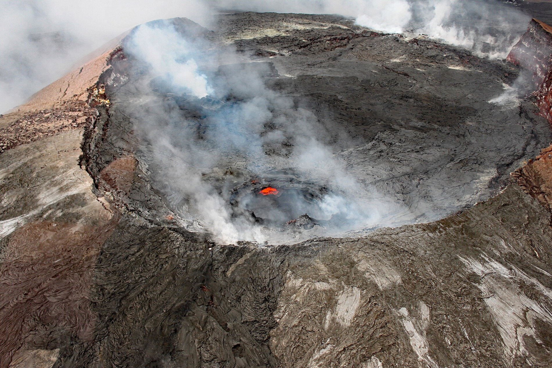
Between 2008 and 2018, Halemaʻumaʻu, a pit crater located within Kīlauea’s summit caldera, hosted an active lava lake. Kīlauea erupted nearly continuously from vents on its eastern rift zone between January 1983 and April 2018, causing major property damage, including the destruction in 1990 of the towns of Kalapana and Kaimū along with the community’s renowned black sand beach.
Beginning in May 2018, activity shifted further downrift from the summit to the lower Puna district, during which lava erupted from two dozen vents with eruptive fountains that sent rivers of lava into the ocean in three places. The eruption destroyed Hawaii’s largest natural freshwater lake, covered substantial portions of Leilani Estates and Lanipuna Gardens, and destroyed the communities of Kapoho, Vacationland Hawaii, and most of the Kapoho Beach Lots.[4][5] The County of Hawaii reported that 716 dwellings were destroyed.[6] Concurrent with the activity downrift in lower Puna, the lava lake within Halemaʻumaʻu drained and a series of explosive collapse events occurred at the volcano’s summit, with at least one explosion emitting ash 30,000 feet (9,100 m) into the air. This activity prompted a months-long closure of the Kīlauea section of Hawaii Volcanoes National Park.[7] The eruption ended in September 2018.[6] Since 2020, several eruptions have occurred within the enlarged caldera left by the 2018 collapse events as well as along the volcano’s southwest and east rift zones.
This article uses material from the Wikipedia article Kīlauea, which is released under the Creative Commons Attribution-Share-Alike 4.0 International License (view authors).
 Valentin M Armianu (iStock) | 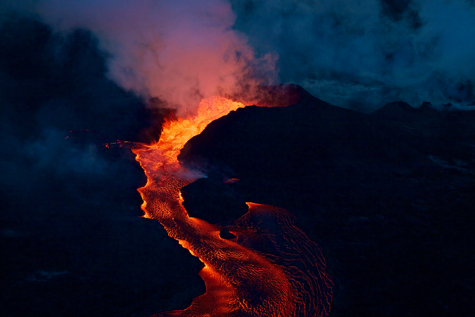 U.S. Geological Survey (Wikipedia) |
 Jim Wiltschko (iStock) | 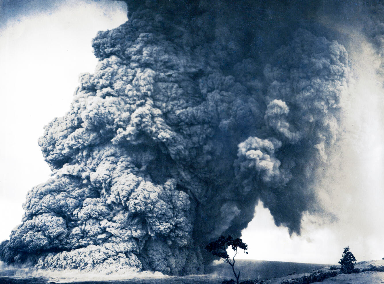 Maehara, K (Wikipedia) |
 Tommygbeatty (Pixabay) | 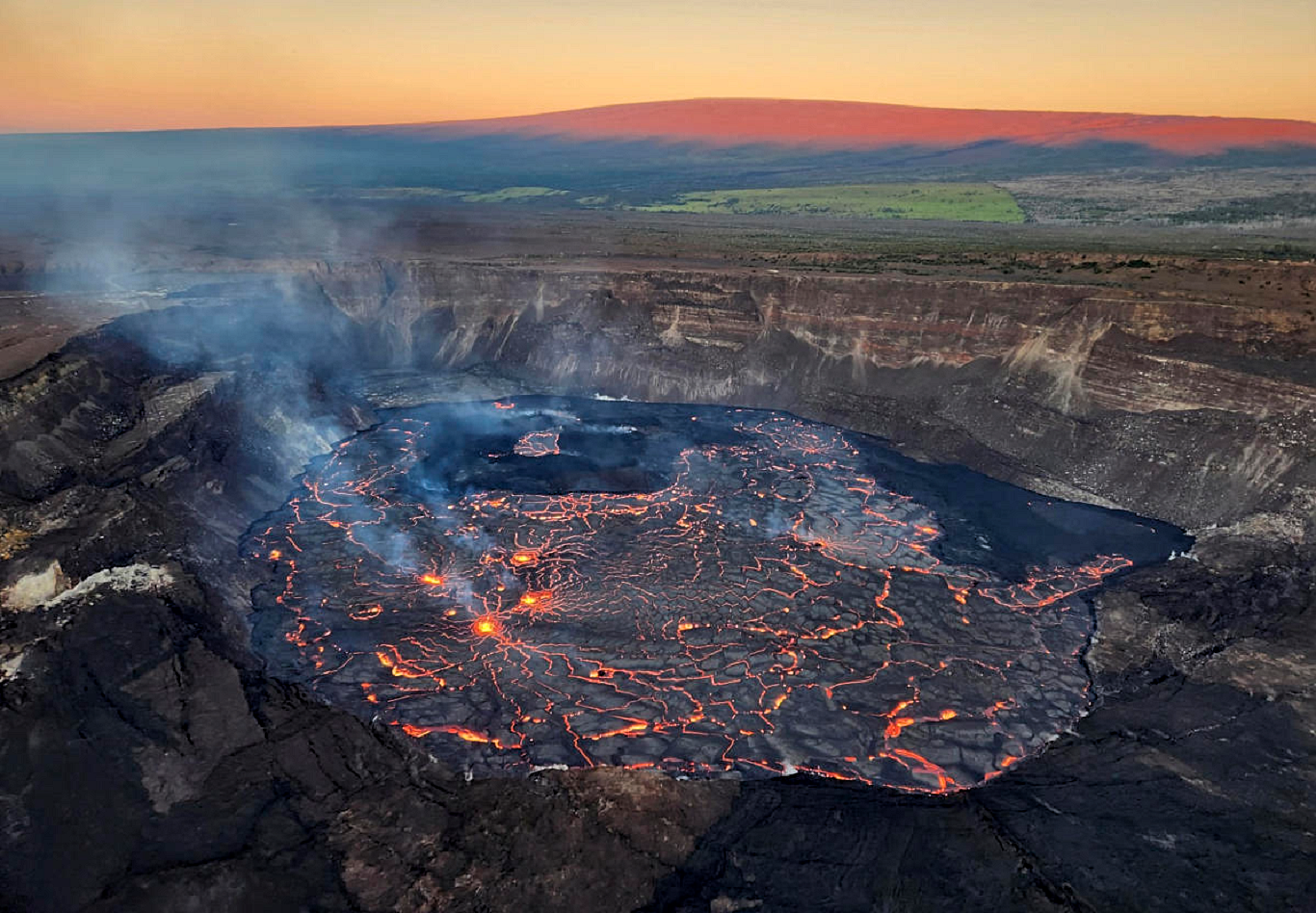 U.S. Geological Survey |
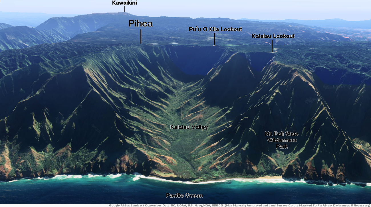
Kawaikini Region
![]()
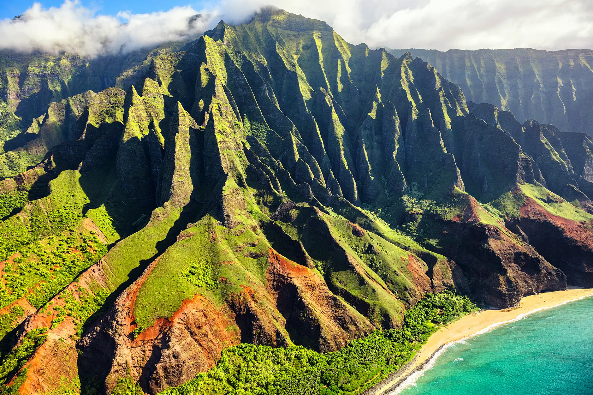
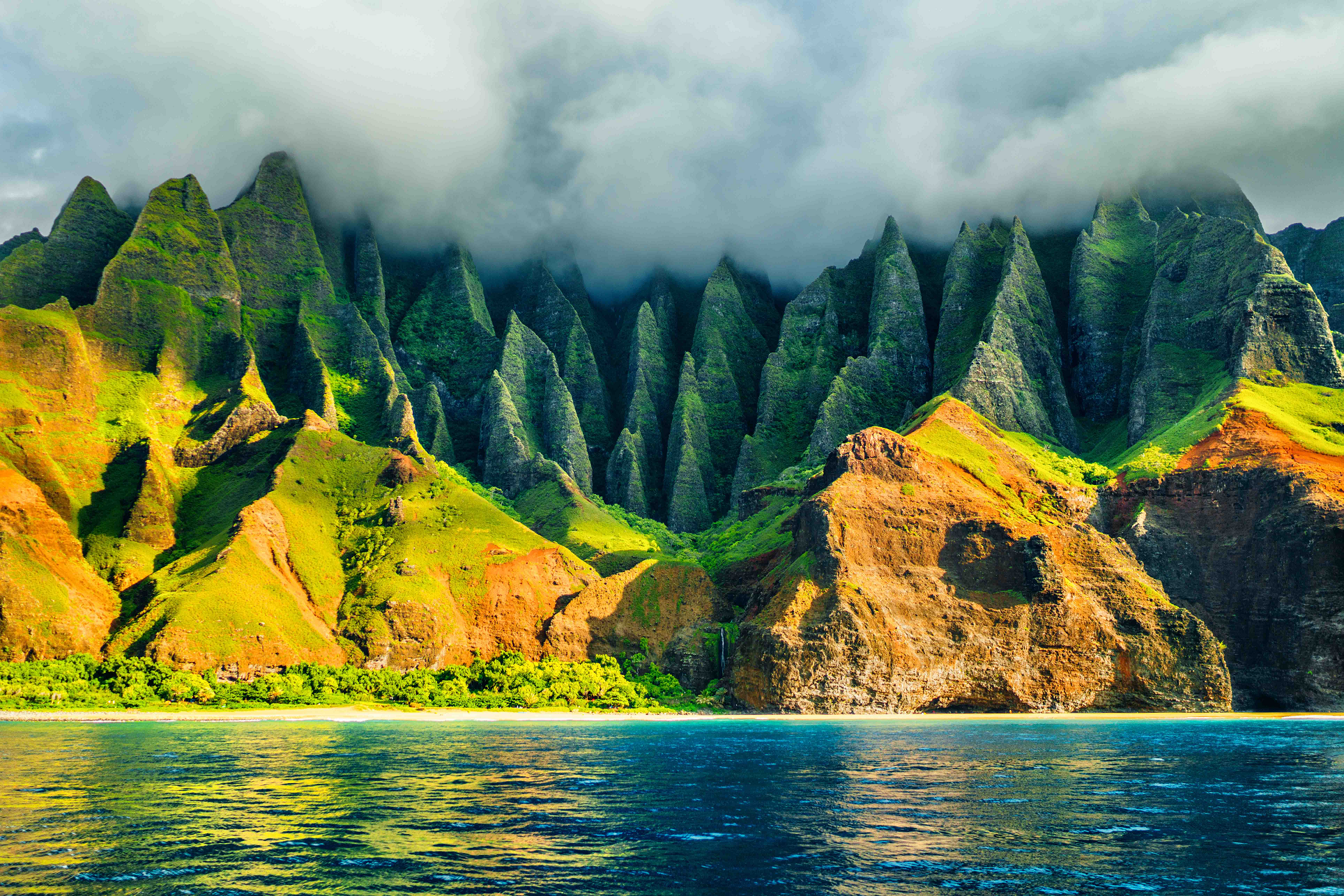
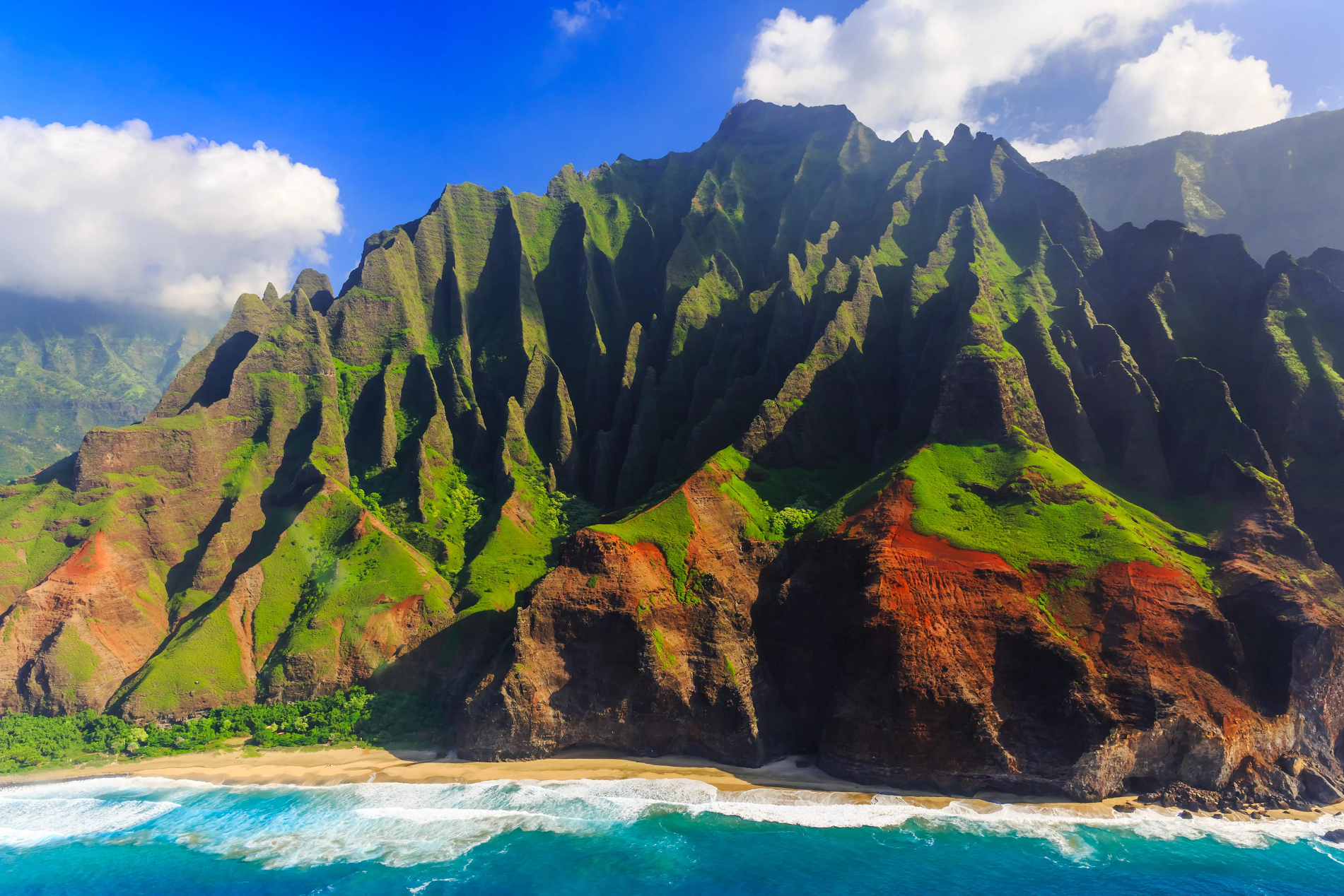
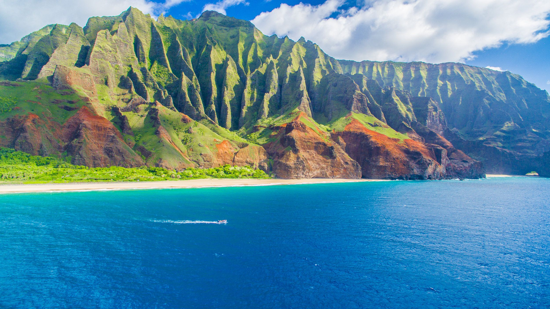
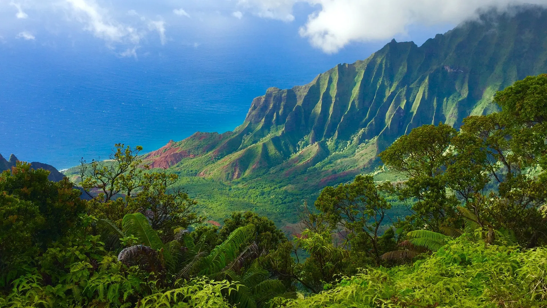
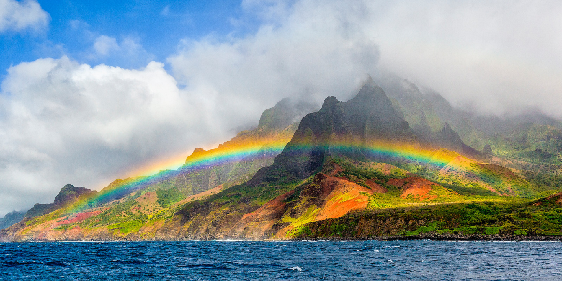
Kalalau Valley
The Kalalau Valley is located on the northwest side of the island of Kauai in the state of Hawaii. The valley is located in the Nā Pali Coast State Park and houses the Kalalau Beach. The Nā Pali Coast is rugged and is inaccessible to automobiles. The only legal ways to access the valley are by kayak or by hiking the Kalalau Trail.
The valley is surrounded by cliffs more than 2,000 feet (610 m) high. This valley’s bottom is broad and relatively flat, with an accessible region about 2 miles (3.2 km) long and 0.5 miles (0.80 km) wide. The abundant sun and rain provides an ideal environment for flora and fauna. Many Native Hawaiians lived in the valley into the 20th century, farming taro from a vast complex of terraced fields. Today, its designation as a state park forbids anyone from residing there.
Access to Kalalau Valley
Since the Nā Pali Coast is too steep for any motorized vehicles, all access to the valley is by boat or foot, except for emergency helicopter landings. Kayaks are a popular way of visiting the valley, although sea conditions can make this dangerous during the winter. Hiking and trail running the Kalalau Trail are also popular, but the trail is about 11 miles (18 km) long, quite strenuous for those not in good shape, and can be dangerous at parts for inexperienced people.
Access to the Kalalau Valley is controlled. A limited number of permits are sold for camping in Kalalau Valley every year by the Hawaii Department of Land and Natural Resources (DLNR), although parking for campers is no longer allowed at the trail head. Instead, parking is now an exclusive privilege for day users of Ha’ena State Park, where the Kalalau Trail head is located, and permitted Kalalau campers are provided no overnight parking whatsoever. Anyone wishing to hike or run beyond Hanakāpīʻai valley must have a permit for staying in Kalalau Valley overnight, even if their intention is to return the same day. A total of sixty overnight permits are issued for each night. Permits must generally be sought as early as 6 months in advance of travel.
This article uses material from the Wikipedia article Kalalau Valley, which is released under the Creative Commons Attribution-Share-Alike 4.0 International License (view authors).
 |  |
 SCStock (iStock) I | 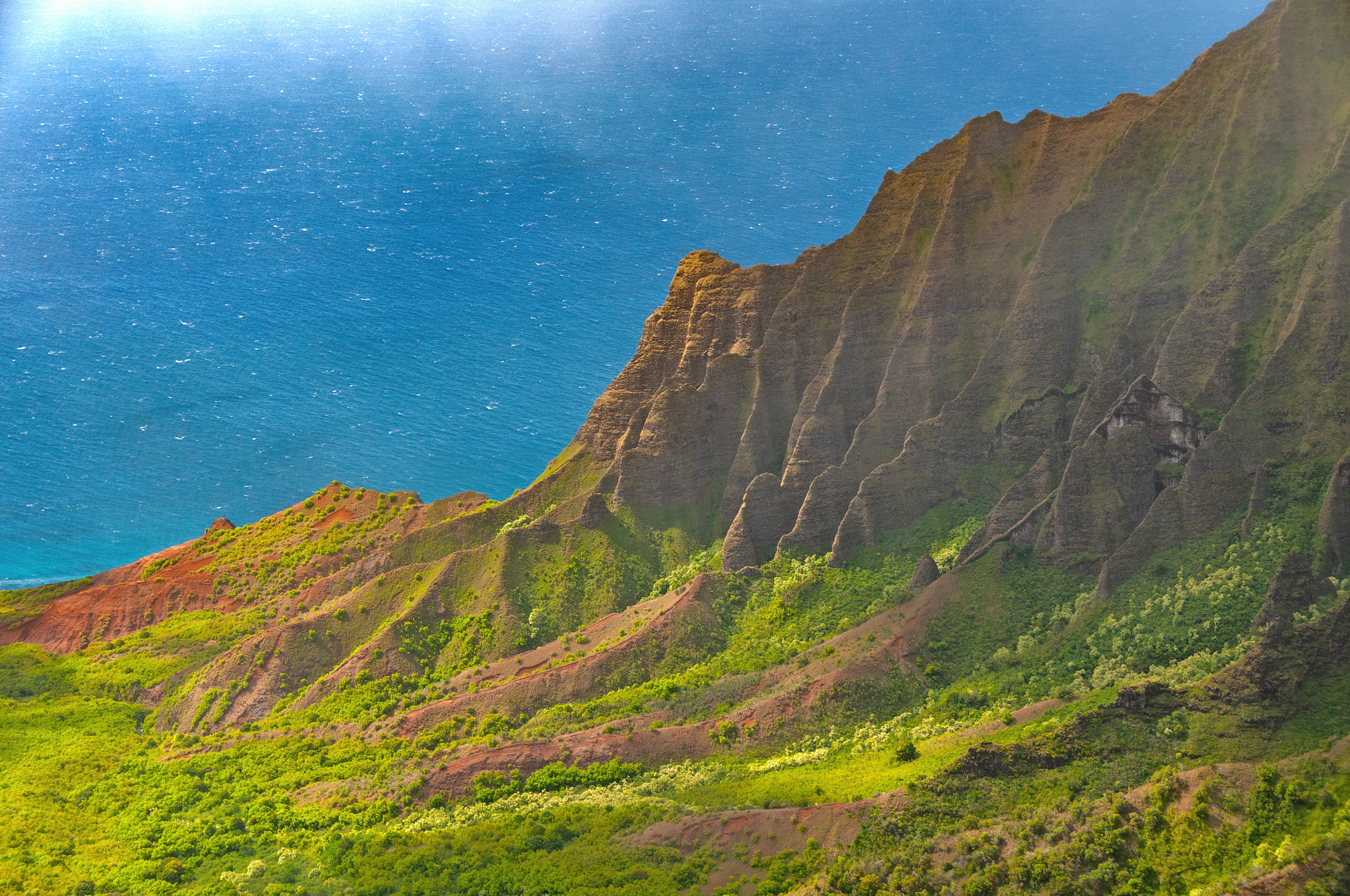 Steven Prorak (Dreamstime) |
 |  |
 |  |
![]()
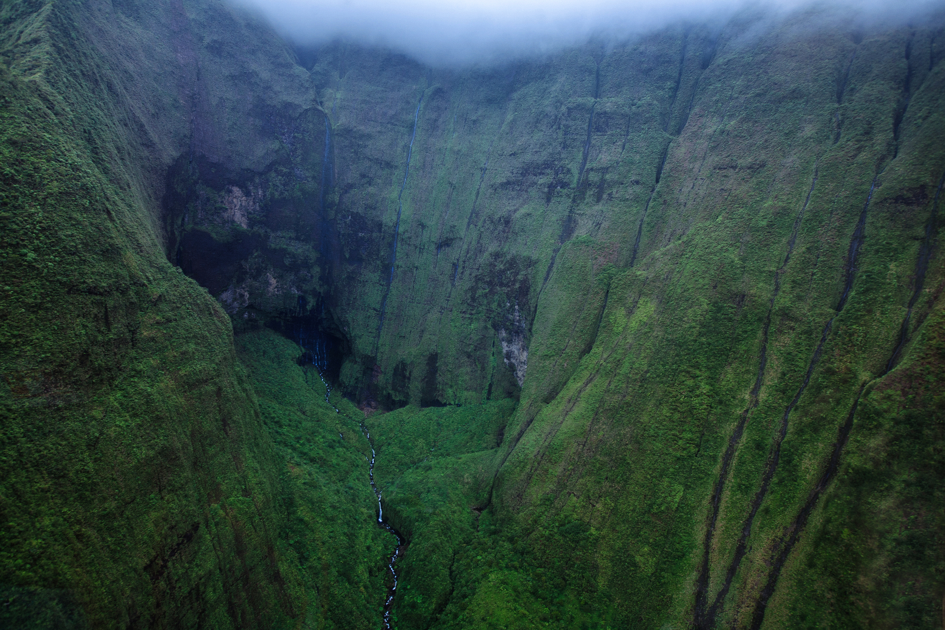
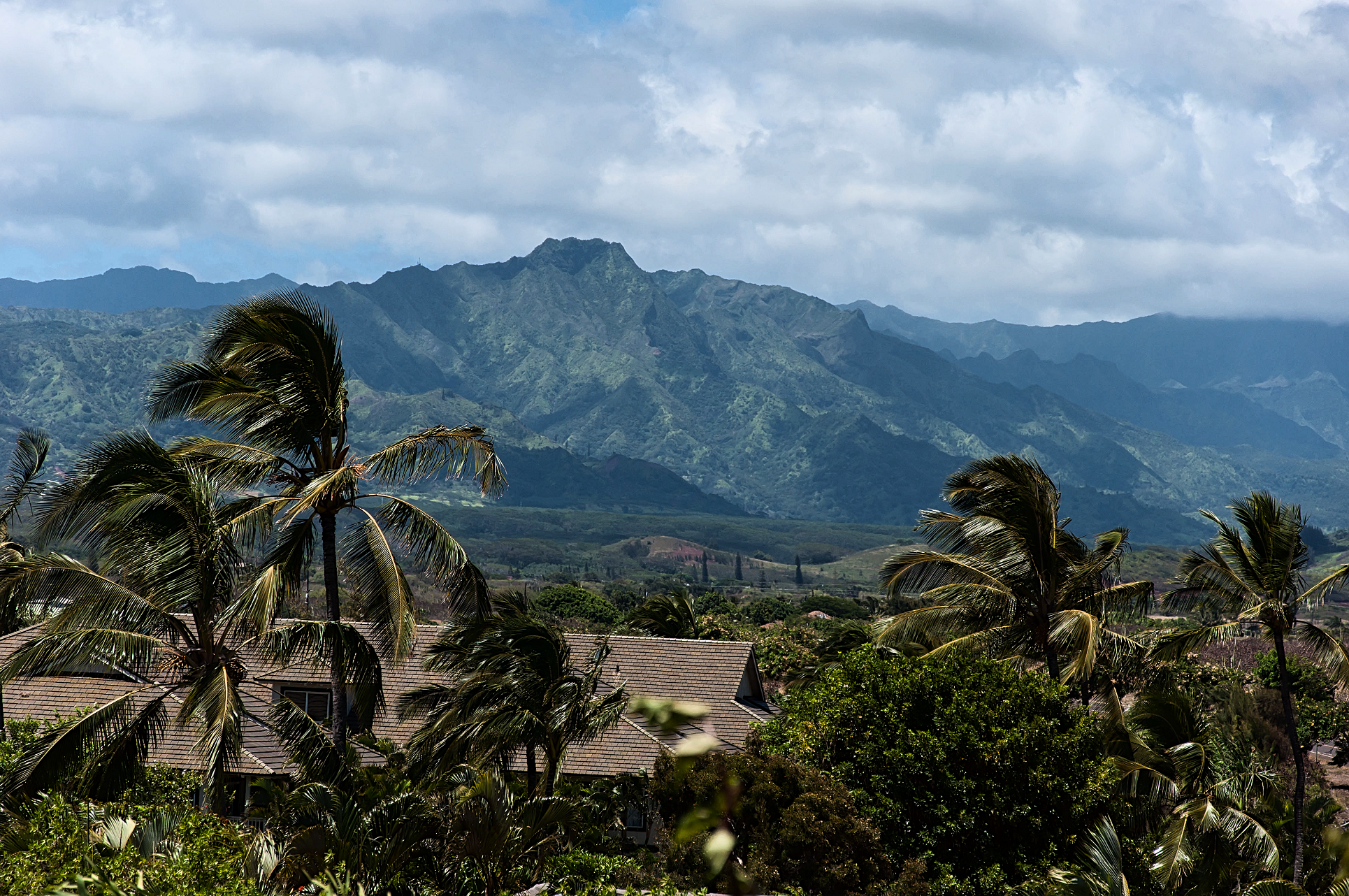
Kawaikini is a shield volcano on the Hawaiian Island of Kauai and in Kauai County and measures 5,243 feet (1,598 m) in elevation.[2] It is the summit of the island’s inactive central shield volcano, Mount Waialeale.[3] Other peaks on Kauai include: Waialeale (5,148 feet), Namolokama Mountain (4,421 feet), Kalalau Lookout (4,120 feet), Keanapuka Mountain (4,120 feet), Haupu (2,297 feet) and Nounou (1,241 feet).[4]
Description
A rain gauge placed on the nearby Waialeale lake records daily rainfall[5] and regularly lands Kauai’s peaks on the National Climatic Data Center’s list of places averaging the highest annual rainfall.[6] This high rainfall makes reaching the summit difficult on most days.
The rain is not the only barrier to reaching Kawaikini. The Alakai Wilderness Preserve is located to the west and its miles of dense, swampy forest limit access to the summit. To the north, east, and south, Kawaikini is protected by steep, wet cliffs.[7]
Etymology
Ka wai kini literally translates to “the multitudinous water” in the Hawaiian language, referring to the island’s high rainfall.[8]
This article uses material from the Wikipedia article Kawaikini, which is released under the Creative Commons Attribution-Share-Alike 4.0 International License (view authors).
 Tommy Song (Dreamstime) | 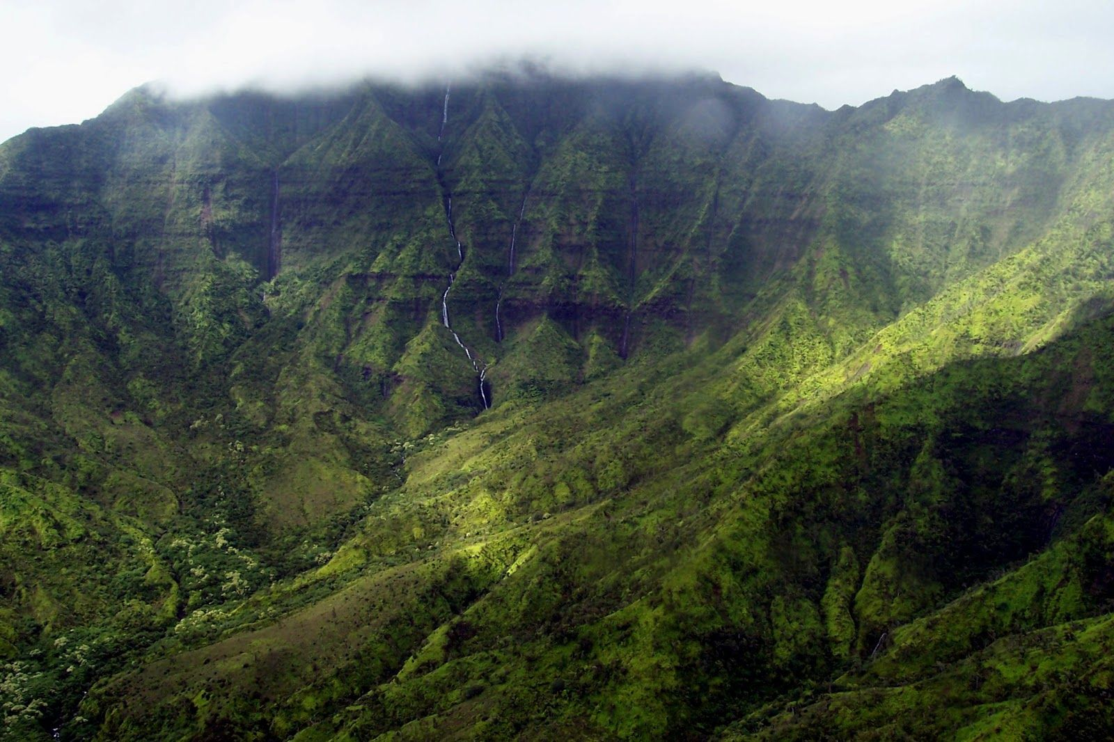 I I |
 Bradhoc (Wikipedia) | 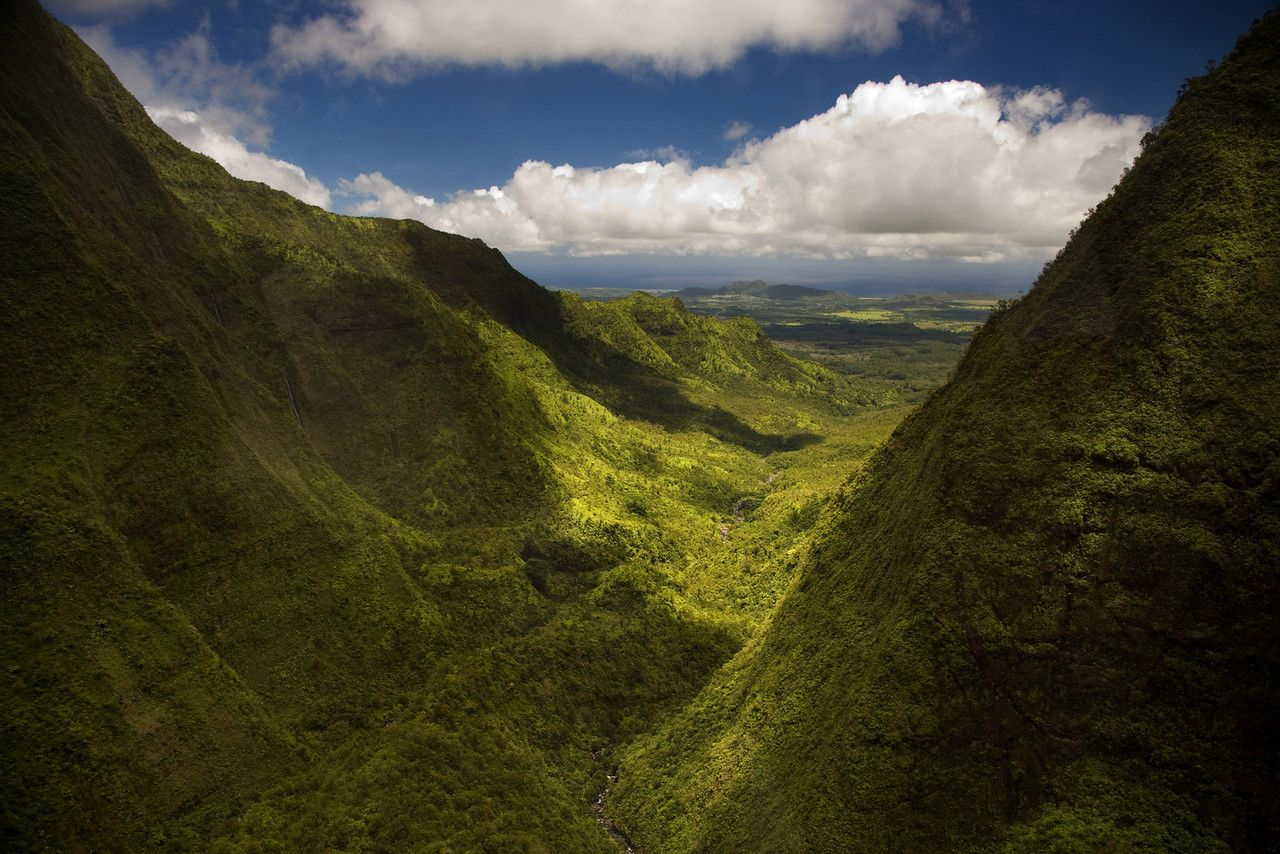 I |
 I | 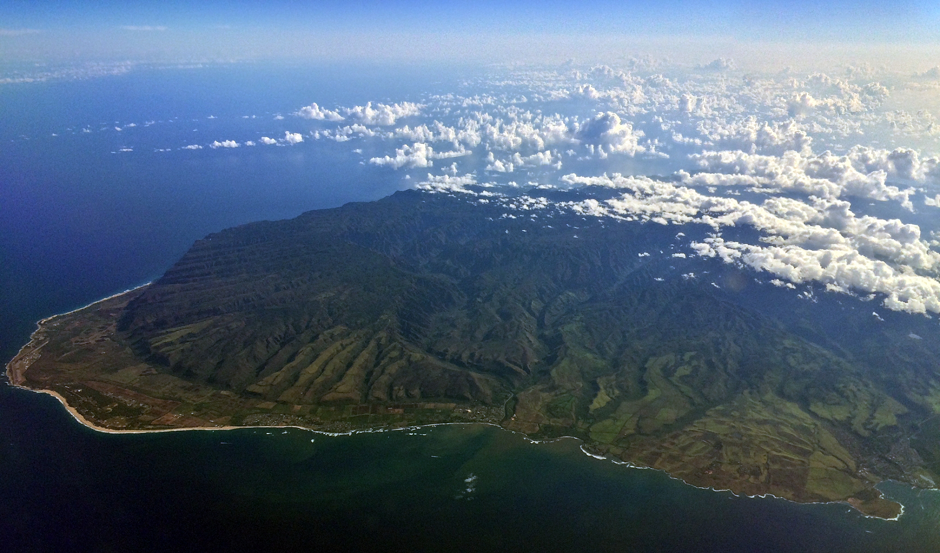 Ivtorov (Wikipedia) |
