
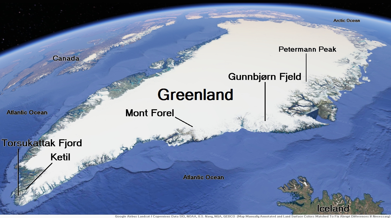
Map of Greenland


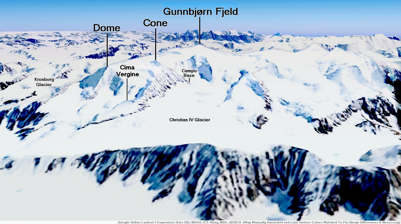
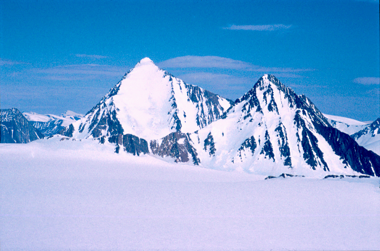
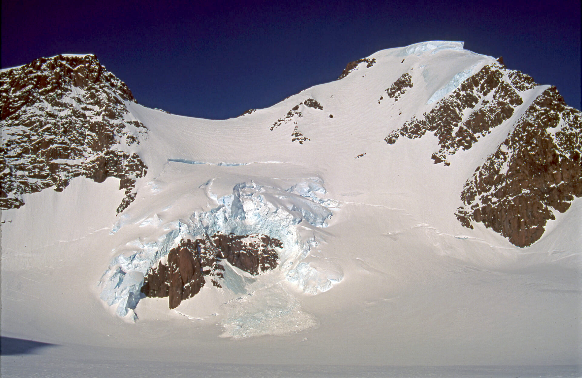
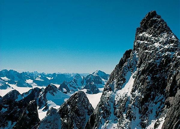
Gunnbjørn Fjeld


![]()
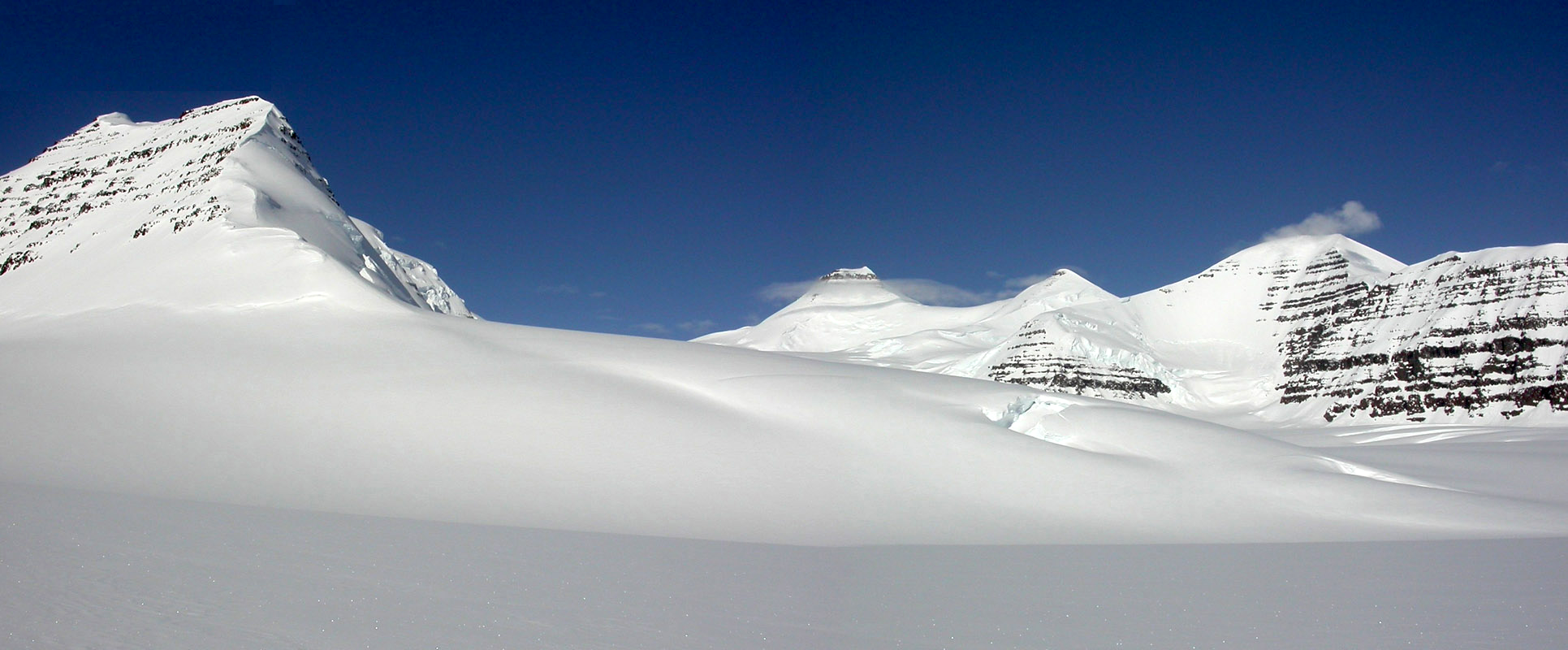
Gunnbjørn Fjeld is the highest mountain in Greenland, Denmark, north of the Arctic Circle, and it is the highest peak in North America east of the Mississippi River. It is a nunatak, a rocky peak protruding through glacial ice. Gunnbjørn Fjeld is ranked 9th by topographic isolation.
Geography
Gunnbjørn Fjeld is located in the Watkins Range, an area of nunataks on the east coast, which contains several other summits above 3,500 metres.[1] Its height is often given as 3,700 metres (12,139 ft), although figures vary slightly.
This is higher than Snæfellsjökull, 530.2 kilometers away on the west coast of Snæfellsnes on Iceland.[2]
Normal straight light rays do not allow one to simultaneously see Gunnbjørn Fjeld and Snæfellsjökull. However, arctic mirages allow seeing long distances by refracting (bending) the light. This effect is caused by a thermal density gradient in the atmosphere. It has been suggested that mutual visibility may exist under hillingar effect or Arctic mirage conditions.[3]
History
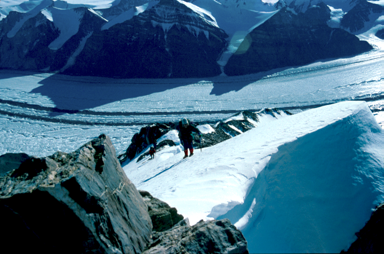
Gunnbjørn Fjeld was first climbed on 16 August 1935 by Augustine Courtauld, Jack Longland, Ebbe Munck and Lawrence Wager. It is named after Gunnbjörn Ulfsson, the first European to have sighted Greenland.
The peak rises in an uninhabited part of the eastern coast of Greenland. The mountain is climbed infrequently due to its remote location. Access is often done with helicopter or ski-equipped plane (normally from Iceland).
This article uses material from the Wikipedia article Gunnbjørn Fjeld, which is released under the Creative Commons Attribution-Share-Alike 4.0 International License (view authors).
 Arnt Flatmo I | 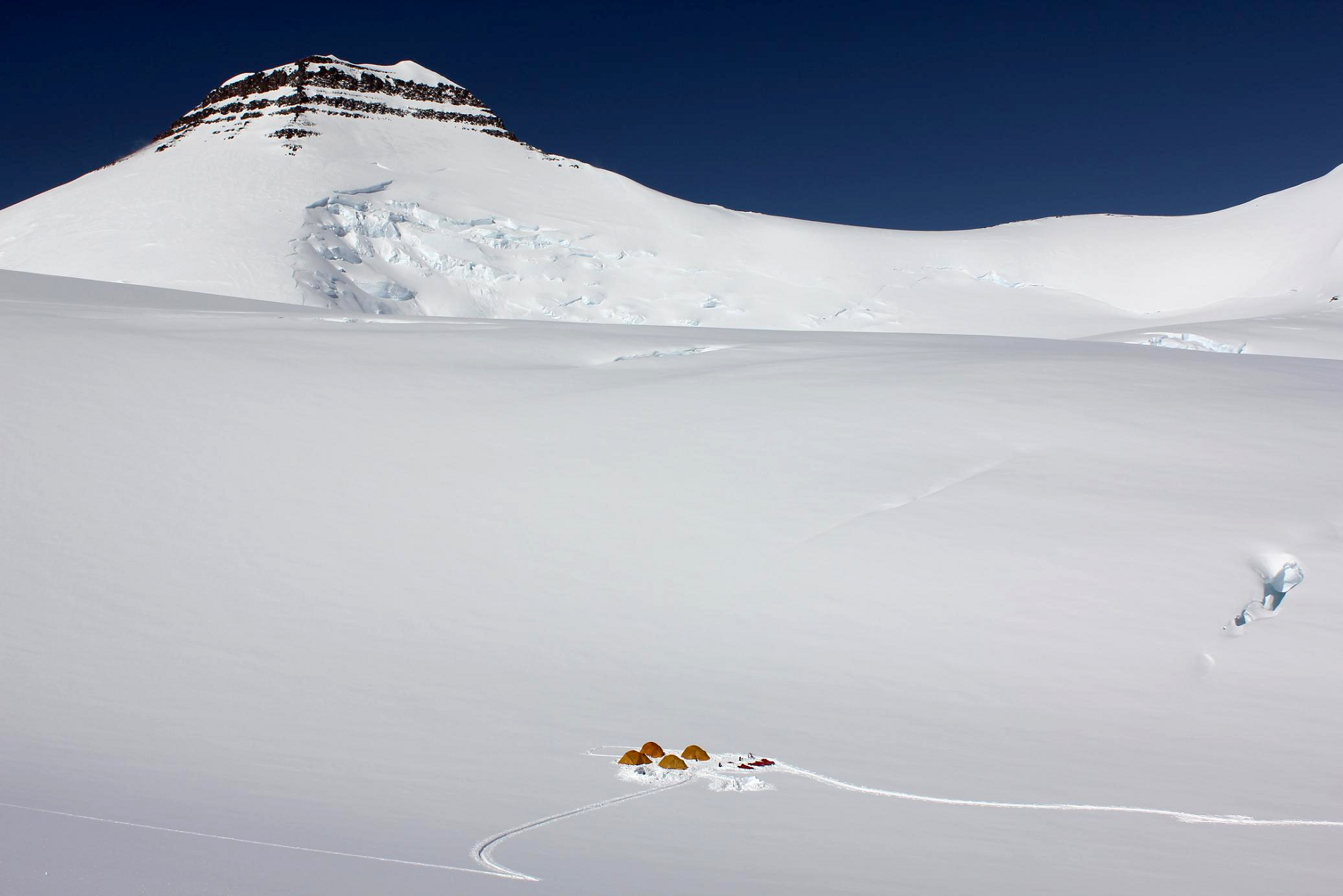 Maxim Bouev (Wikipedia) |
 |  |
 I |  I |
![]()
![]()
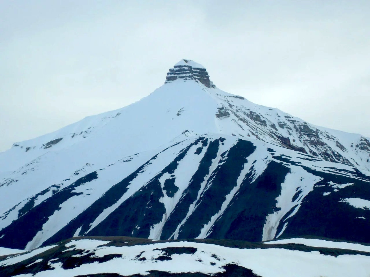
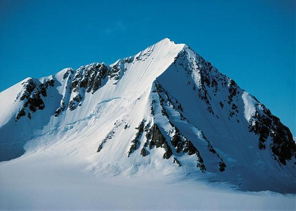
Petermann Peak,[3] (Danish: Petermann Bjerg),[4] also known as Petermann Fjeld, Petermanns Topp and Petermann Point[2] is a mountain in King Christian X Land, Northeast Greenland. Administratively it is part of the Northeast Greenland National Park zone.
The area around Petermann Peak is uninhabited. This mountain is located in the high Arctic zone, where Polar climate prevails. The average annual temperature in the area is −16 °C. The warmest month is June, when the average temperature rises to −2 °C, and the coldest is January, with −22 °C.[5]
Geography
Petermann Peak rises to a height of 2,943 metres (9,656 ft) on a nunatak located the northern side of the Nordenskiöld Glacier, in western Fraenkel Land in the inner Kaiser Franz Joseph Fjord. It has a magnificent appearance, dominating the surrounding landscape. The Gregory Glacier flows from its northeastern side into the Knækdalen valley.[6] The Kalifbjerg (2667 m), Kerberus (c. 2500 m), Gog (c. 2600 m) and Magog (c. 2400 m) peaks are located to the north of Petermann Peak. Initially believed to be the highest peak in Greenland, this mountain is one of the most renowned summits in northeastern Greenland together with Payer Peak located nearby.
The Petermann Peak is marked as a 2,940-metre-high (9,646 ft) peak in the Defense Mapping Agency Greenland Navigation charts[7] and as a 2,790-metre-high (9,154 ft) mountain in other sources.[8]
Historical Background
Petermann Peak was first seen in August 1870 by Julius Payer and Ralph Copeland when they climbed Payer Peak. It was named Petermanns Spitze by Carl Koldewey during the Second German North Polar Expedition he led while first surveying and partially exploring Kaiser Franz Joseph Fjord in 1869–70. The peak was named after German geographer August Heinrich Petermann (1822–78) who was a great supporter of the expedition.[2] In 1899 A.G. Nathorst mistook a lower peak in the vicinity, now named Nathorst Tinde, for Petermann Bjerg. At the turn of the century Petermann Peak was assumed to be the highest peak in all Greenland.[9]
The first ascent of the peak was made on 15 August 1929 by the Cambridge Expedition to East Greenland led by Scottish polar explorer James Wordie (1890–1962).[3] the second ascent by John Haller and Wolfgang Diehl on 9 August 1951.[10]
This article uses material from the Wikipedia article Petermann Peak, which is released under the Creative Commons Attribution-Share-Alike 4.0 International License (view authors).
 Iain Smart | 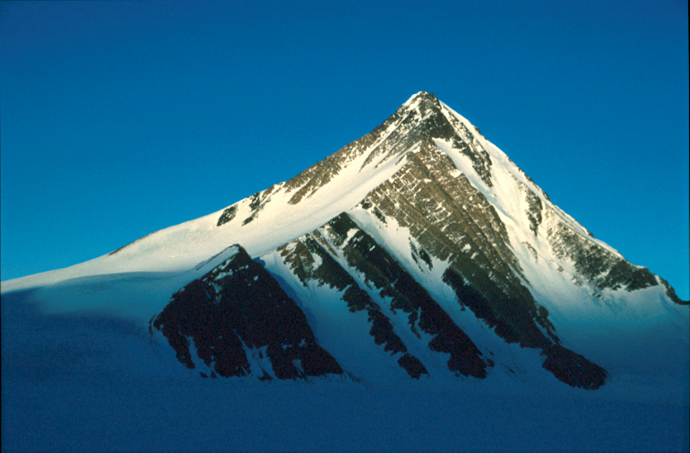 Petter Bjørstad |
 Iain Smart | 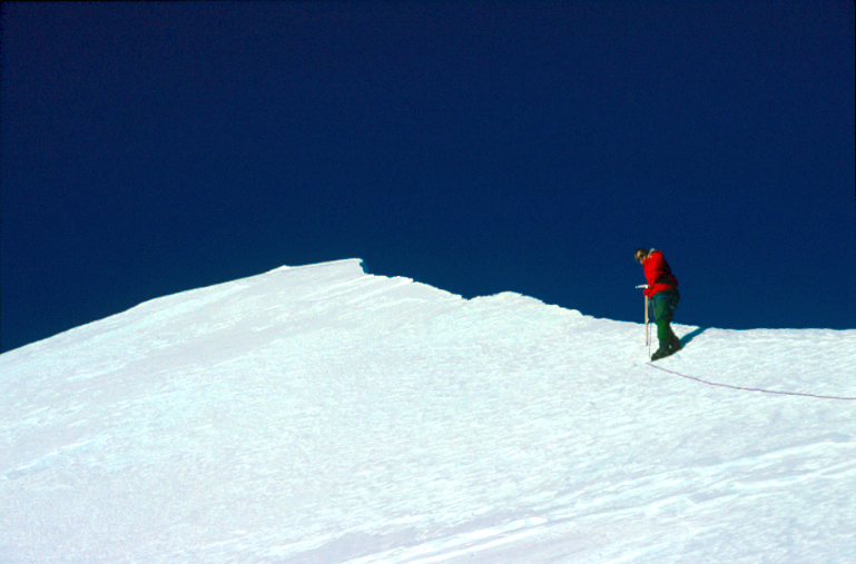 Iain Smart |
![]()
![]()
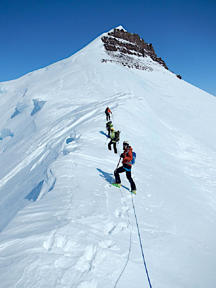
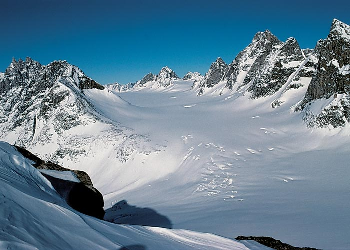
Mont Forel is a mountain in King Christian IX Land, Sermersooq Municipality, Greenland. It is part of the Schweizerland range, also known as ‘Schweizerland Alps’.[1]
This peak is located in a popular climbing destination, together with the Watkins Range to the northeast and the Stauning Alps further north.[2]
History
The mountain was named in 1912 by Swiss geophysicist and Arctic explorer Alfred de Quervain[3] after his Greenland icecap crossing from Godhavn (Qeqertarsuaq) on the west, to Sermilik Fjord on the eastern side.[4]
Mont Forel was first climbed by a Swiss expedition of the Akademischer Alpen-Club of Zürich led by André Roch in 1938.[5][6]
Geography
Mont Forel is the highest peak outside of the area of the Watkins Range, where the highest mountain, Gunnbjørn Fjeld, rises. It is located just north of the Arctic Circle in the Schweizerland Alps, north of Sermilik, near Ammassalik Island. Its elevation is 3,383 metres (11,099 ft) and there is an ice dome at the top of the mountain.[7] The Crown Prince Frederick Range stretches northeastwards to the northeast of Mont Forel.[8]
This article uses material from the Wikipedia article Mont Forel, which is released under the Creative Commons Attribution-Share-Alike 4.0 International License (view authors).
 |  |
 |  |
 I | 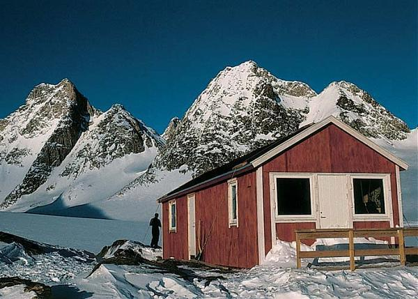 I |
Torsukattak Fjord
![]()

![]()
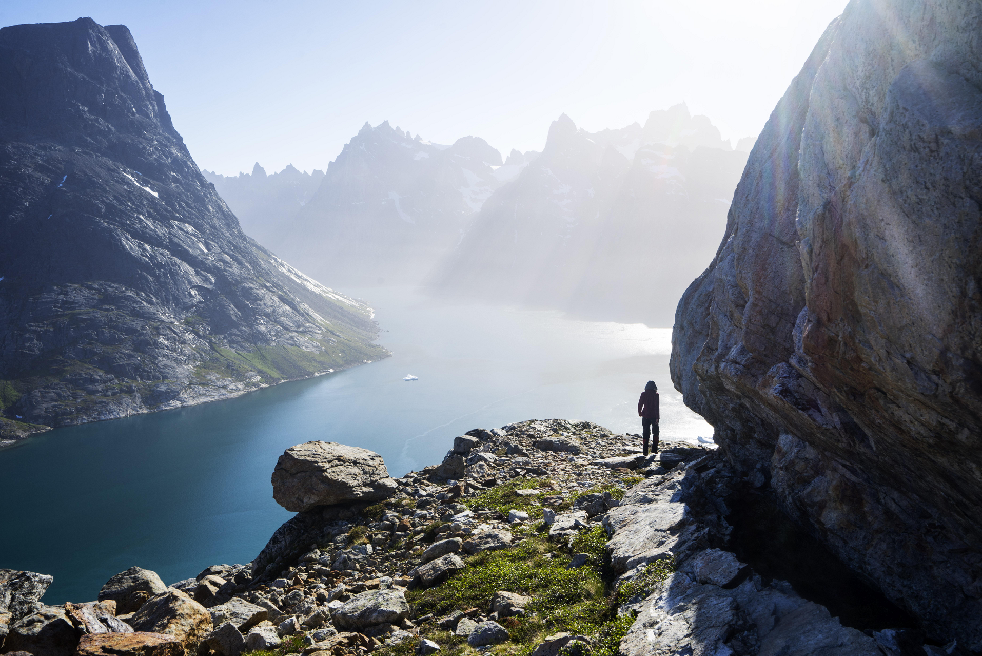
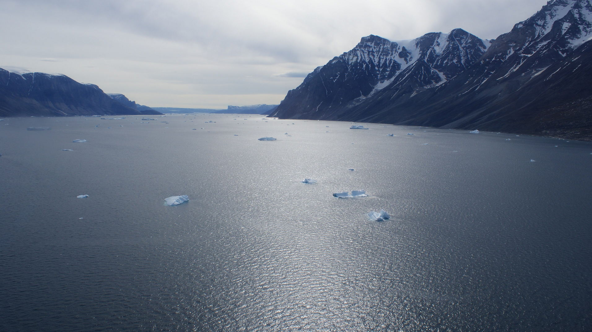
Torsukattak is a fjord in far southern Greenland. Administratively it is part of the Kujalleq municipality.
Geography
Torsukattak Fjord is located to the southwest of Prince Christian Sound near the Cape Farewell Archipelago. The fjord is oriented in a roughly north–south direction and in the south it opens into the Labrador Sea of the North Atlantic Ocean. It separates large Pamialluk Island in the east from the mainland to the west of the fjord. Stordalen Havn is located at the bend 20 km into the fjord where it bends to the east for 7 km and connects with the Qoornoq Strait and the Ilua Fjord of the Prince Christian Sound system.[1]
The islands of Sullat and Nunarsuaq —the latter rising to a height of 939 m— lie at the mouth of the fjord. There are further smaller islands near them.[2]
This article uses material from the Wikipedia article Torsukattak Fjord, which is released under the Creative Commons Attribution-Share-Alike 4.0 International License (view authors).
 |  |
 Bergauf (Summit Post) I I |  Christianblog (Wikipedia) I |
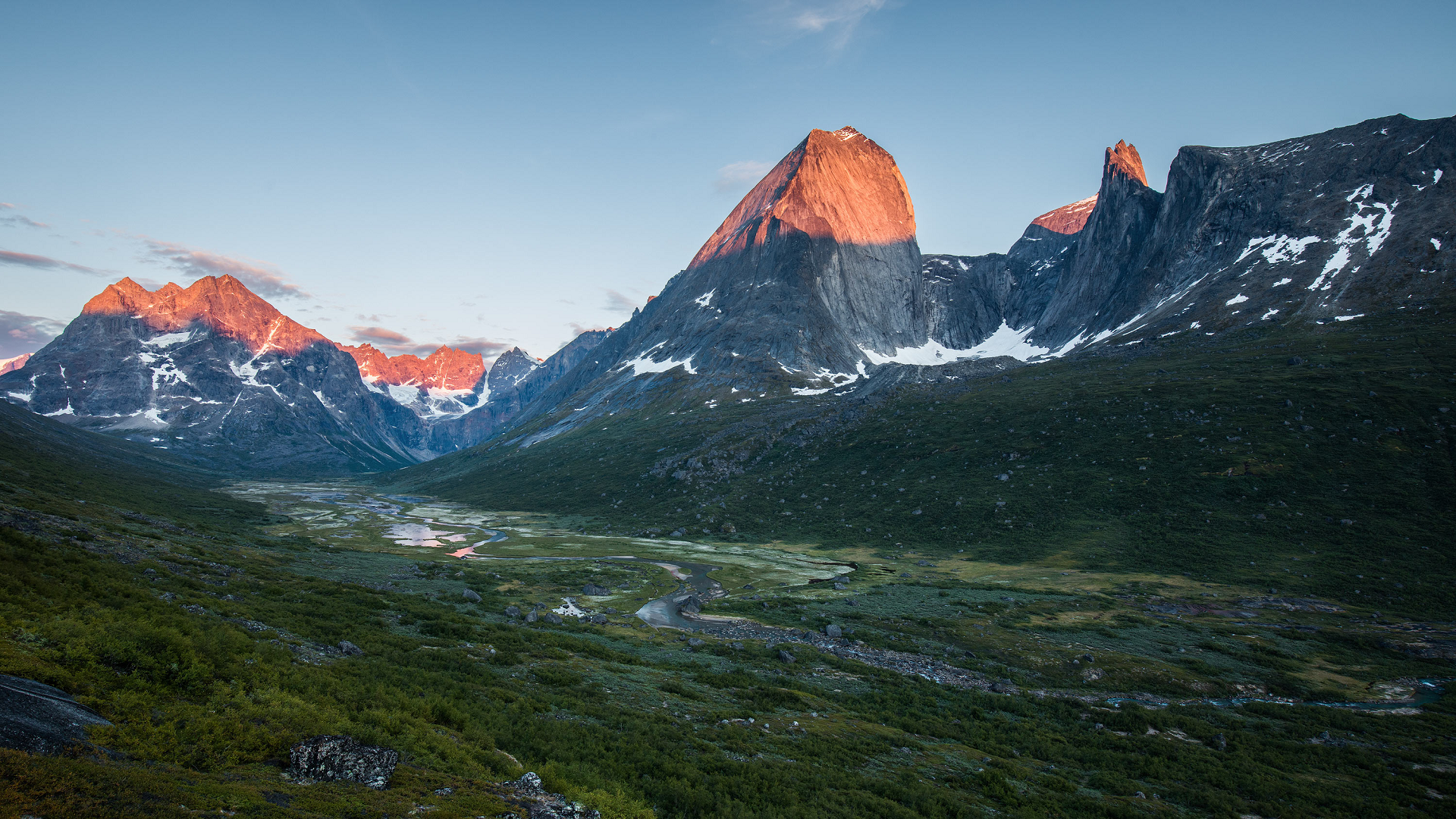
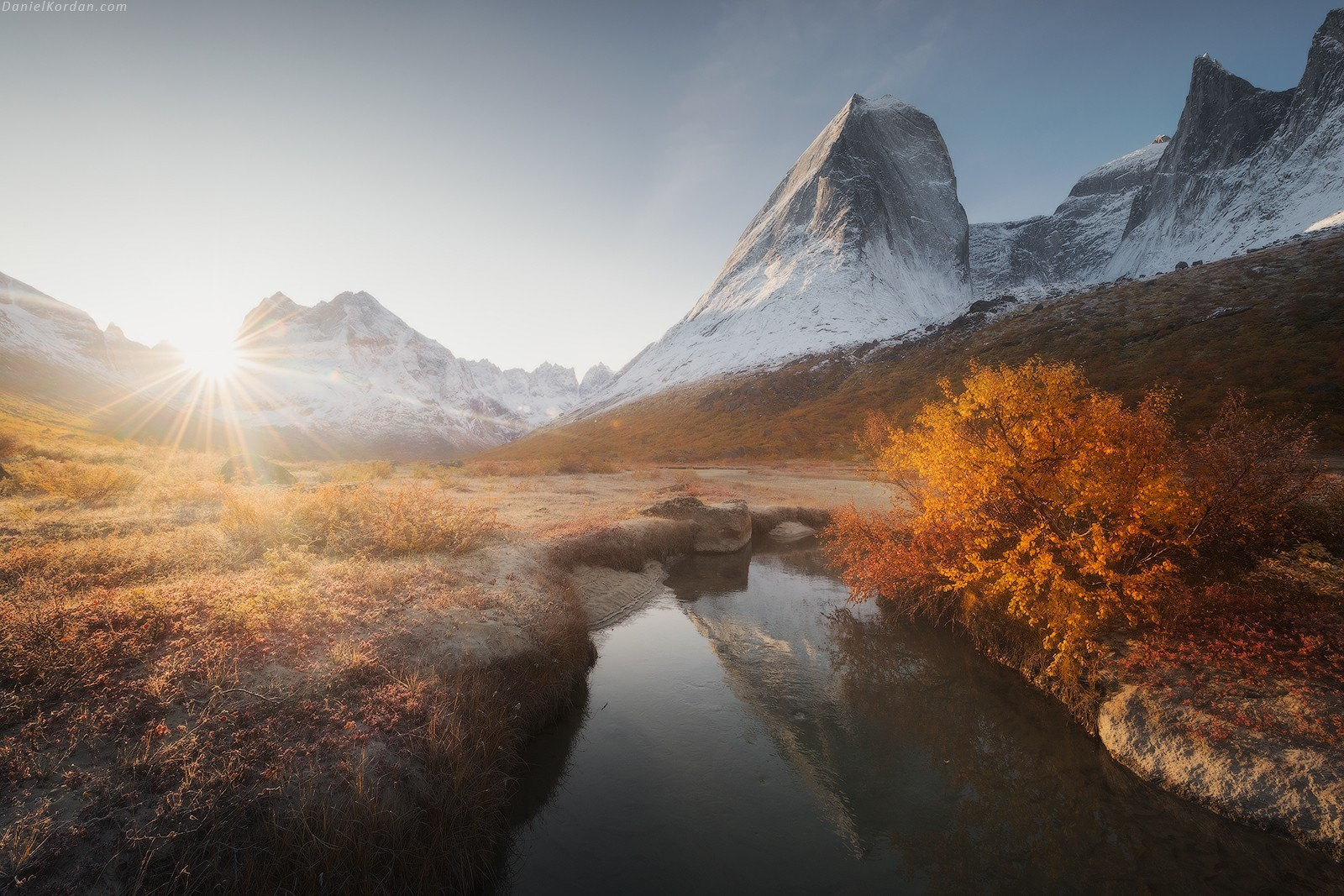
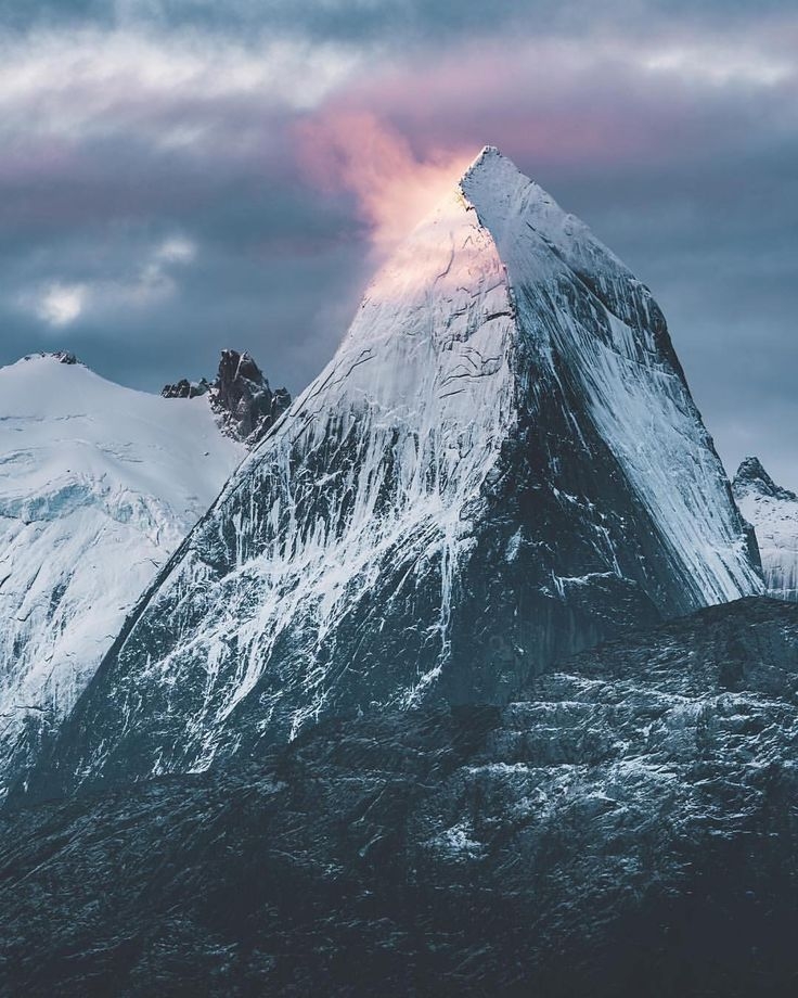
Ketil Region
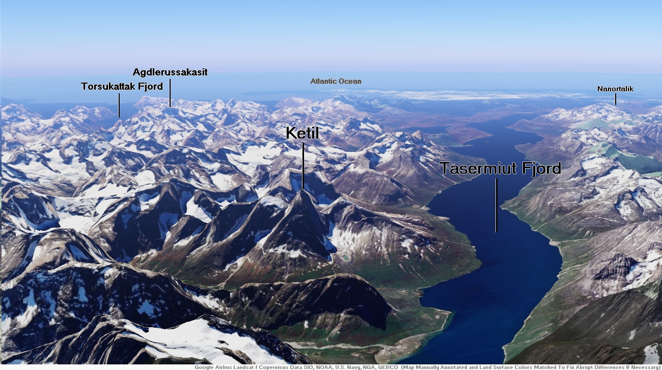
Ketil Panoramic
![]()
![]()
The Ketil (Greenlandic: Uiluit Qaqqaa, meaning “Shell Mountain”) is a 2,010 m–high mountain in southern Greenland, in the Kujalleq municipality.[2]
Ketil’s granite walls are similar to Tiningnertok‘s (Apostelen Tommelfinger), another massive peak in the east coast.[3]
Geography
Together with Nalumasortoq and Ulamertorsuaq, Ketil is part of the group of three massive largely unglaciated rocky mountains rising in the peninsula of the mainland which forms the eastern side of the Tasermiut Fjord.[4]
In the same manner as its slightly lower neighbour Ulamertorsuaq, Ketil has become popular among mountain climbers owing to its higher than 1000 m sheer western granite wall. It is considered one of the most challenging Big Walls on Earth.[3]
This mountain is marked as a 2,003-metre-high (6,572 ft) peak in some sources.[5]
This article uses material from the Wikipedia article Ketil (mountain), which is released under the Creative Commons Attribution-Share-Alike 4.0 International License (view authors).
 Daniel Kordan | 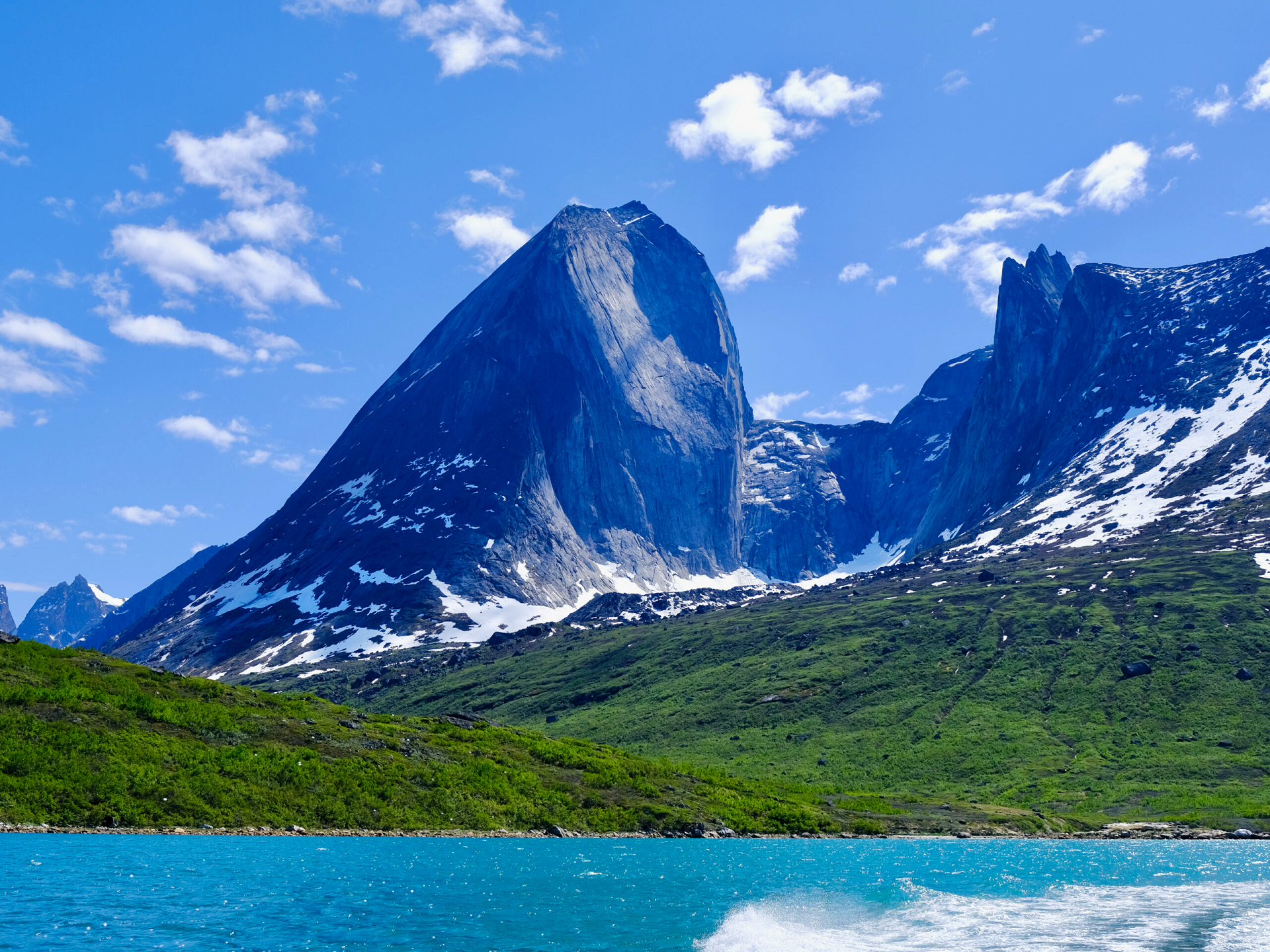 Sarah WoodallI |
 I | 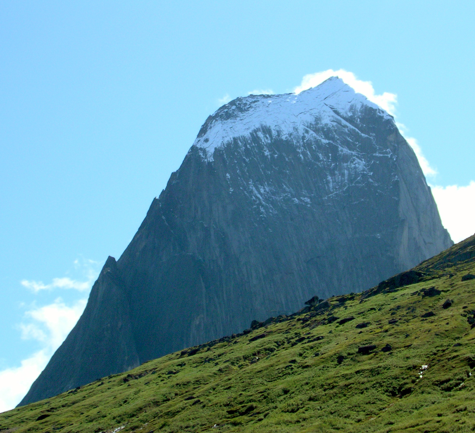 Svickova (Wikipedia) |

![]()
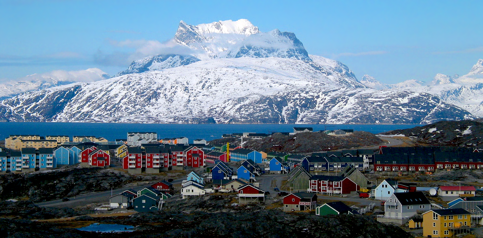
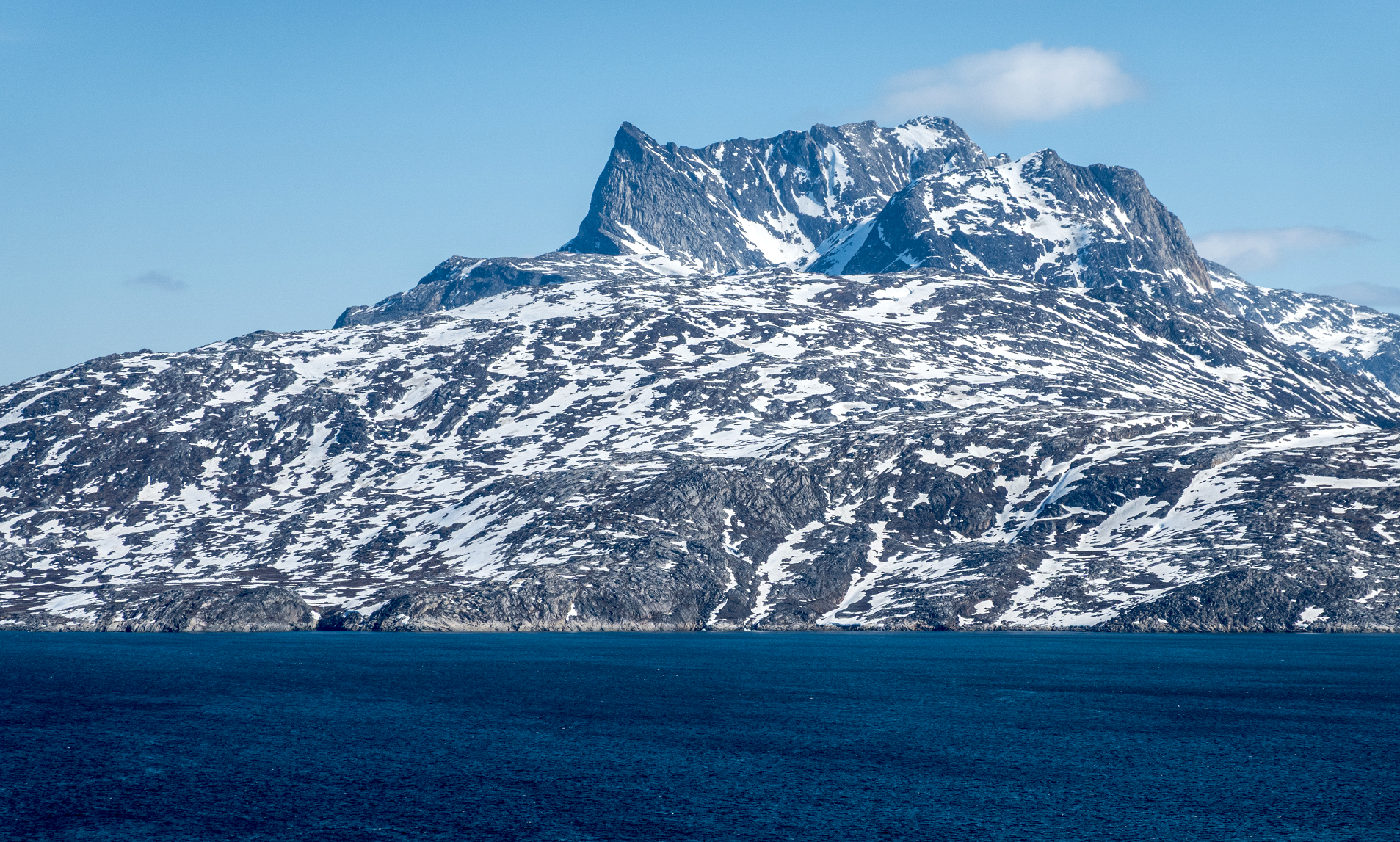
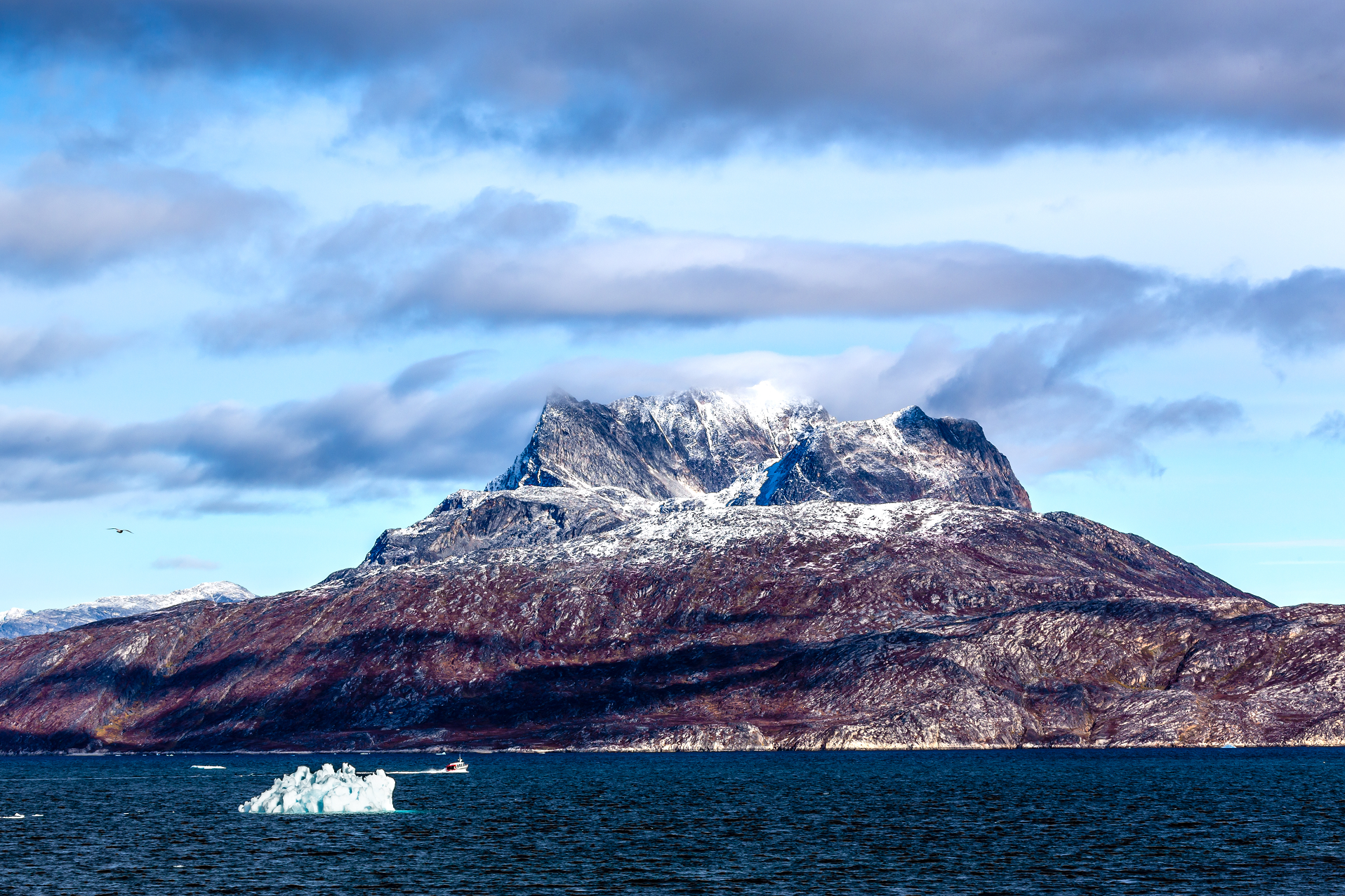
Sermitsiaq (Danish: Sadelø) (English: Saddle) is a 1,210-metre-tall (3,970 ft) Greenlandic mountain in the district of Nuuk in the Kommuneqarfik Sermersooq.
Location
The mountain is located in the center of its namesake island and 15 km north-east of Nuuk, the capital of Greenland, in the Nuup Kangerlua (Danish: Godthåbsfjorden). Its summit is crowned by a sharp west–east ridge, from which three summit points emerge. These resemble a saddle, which gave the mountain and the island its Danish name. While its south side is shaped by steep rock formations, its north side is covered with glaciers. It also harbors a waterfall which is a tourist attraction.
Due to its distinctive shape the mountain is Nuuk’s most prominent landmark, incorporated into its flag and coat of arms. The Sermitsiaq, one of two national newspapers in Greenland, is named after the mountain.
This article uses material from the Wikipedia article Sermitsiaq (mountain), which is released under the Creative Commons Attribution-Share-Alike 4.0 International License (view authors).
 Oliver Schauf (Wikipedia)I | 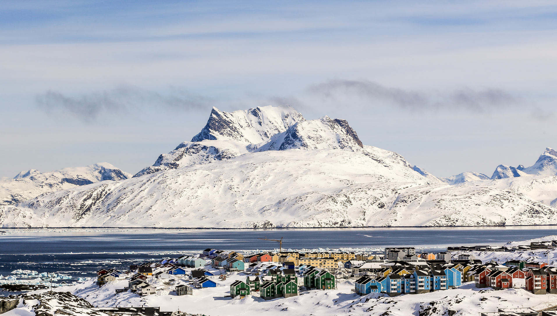 Vadim_Nefedov (iStock) I |
 BackyardProduction (iStock) | 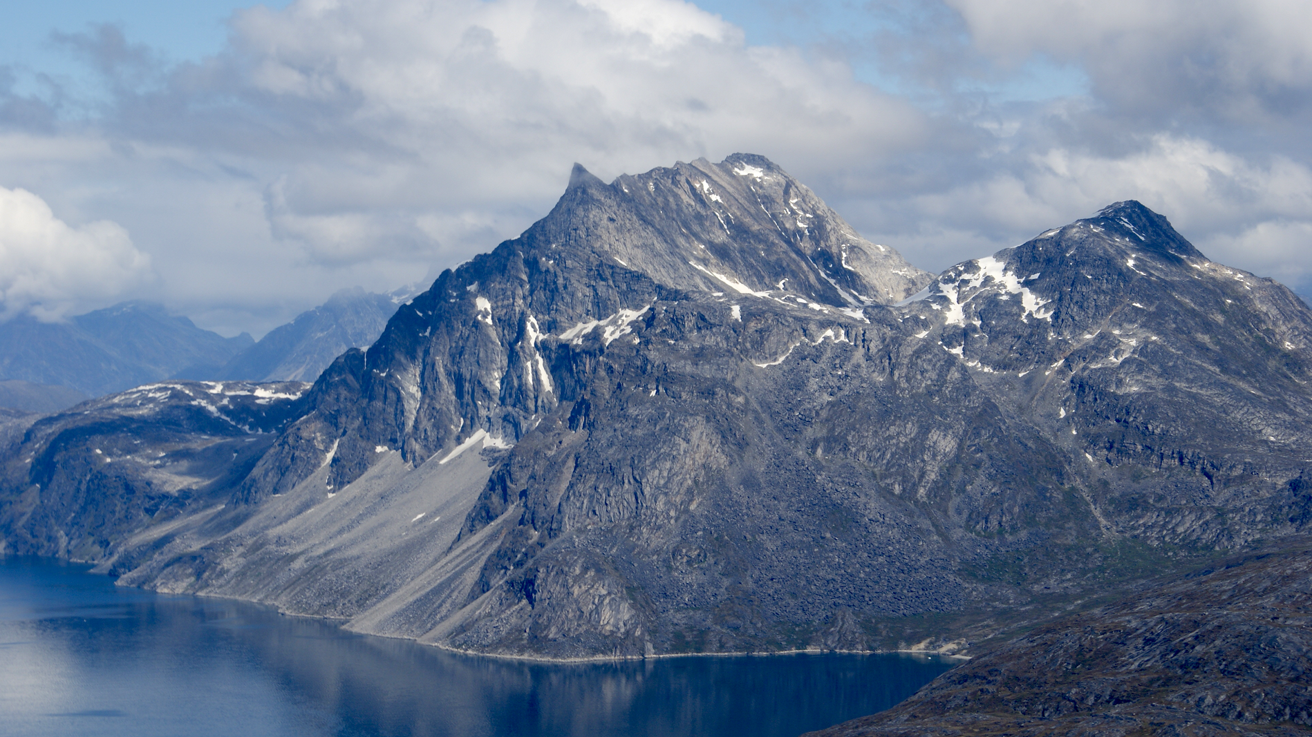 Algkalv (Wikipedia) I |
 Vadim_Nefedov (iStock) |  Vadim_Nefedov (iStock) |
