
Map of Eje Volcanico Transversal


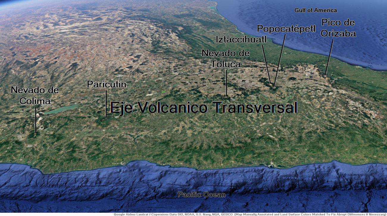
Popocatépetl Region


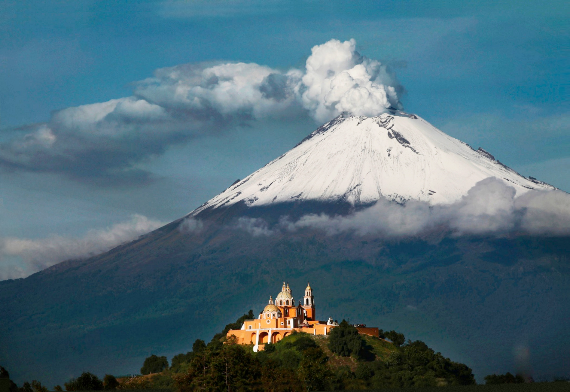
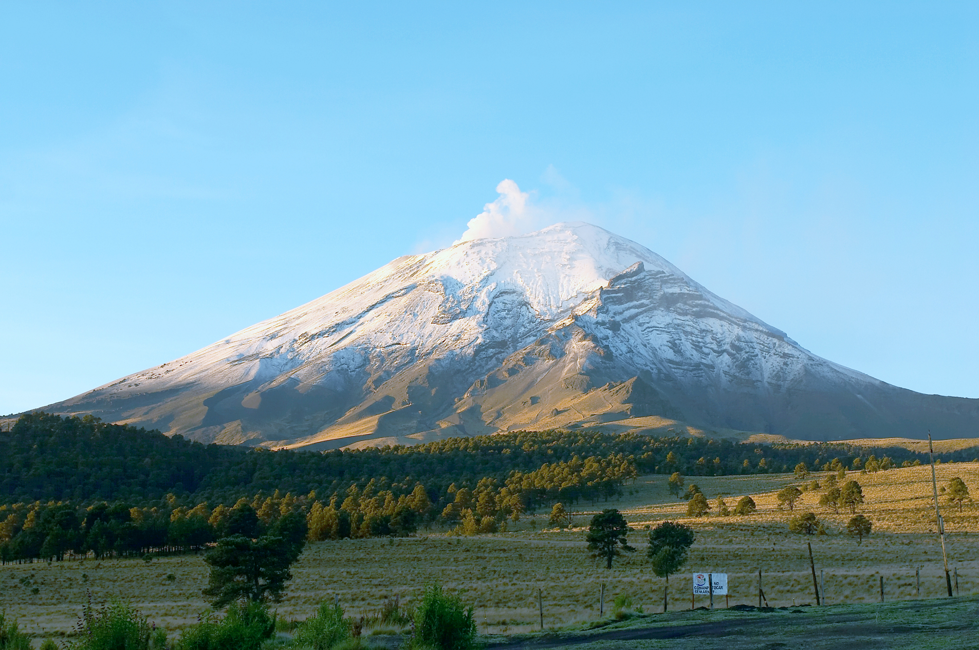
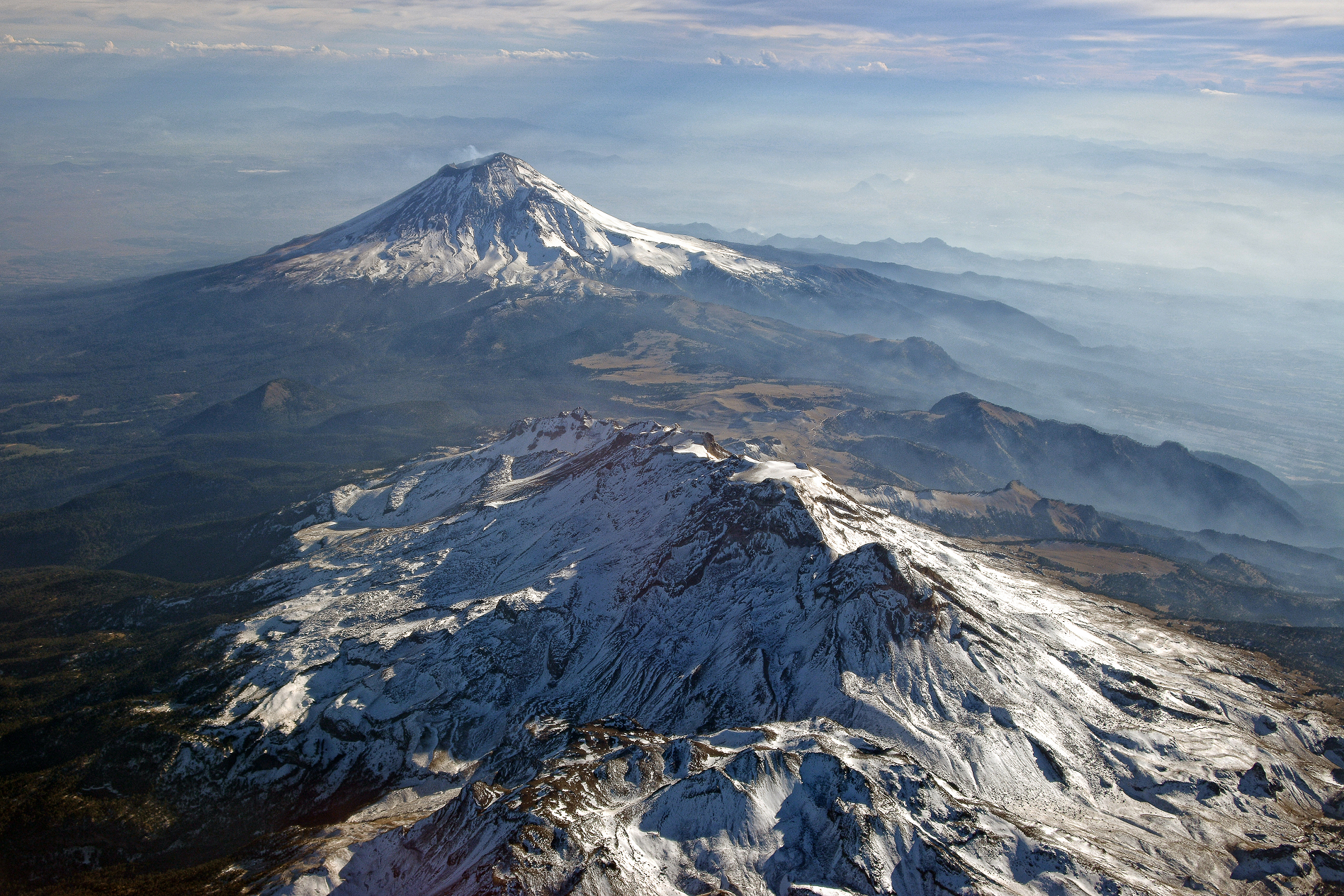
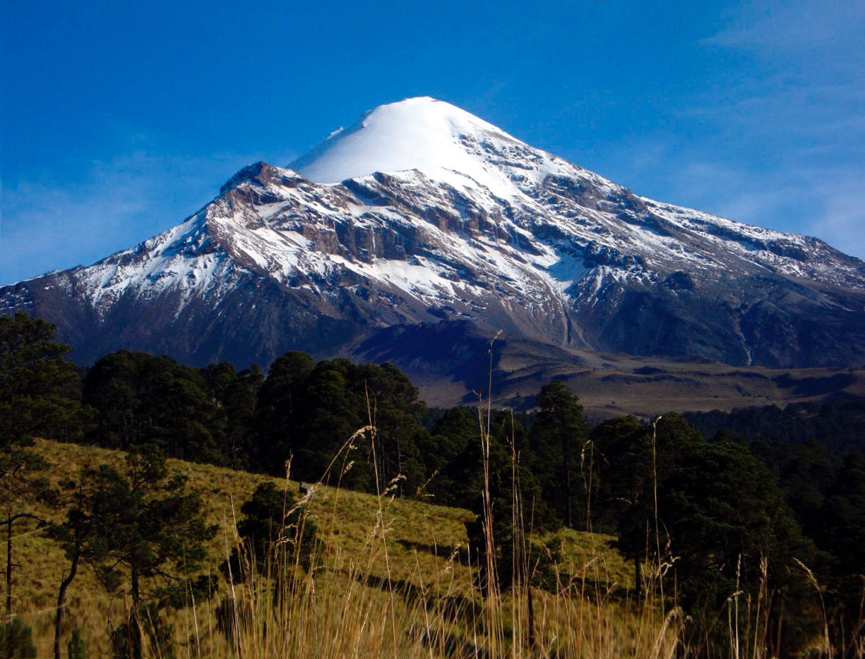
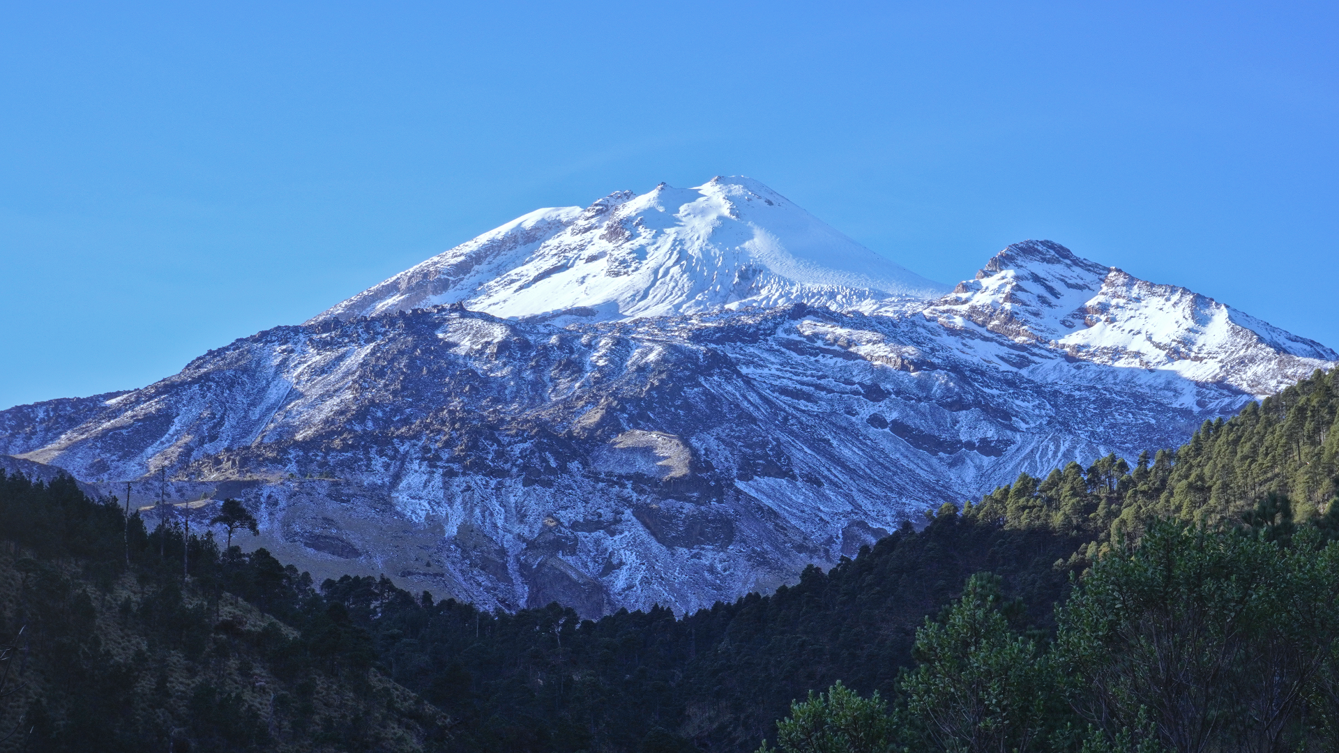
Popocatépetl (UK: /ˌpɒpəˈkætəpɛtəl, ˌpɒpəkætəˈpɛtəl/ POP-ə-KAT-ə-pet-əl, -kat-ə-PET-əl, US: /ˌpoʊp-/ POHP-, Spanish: [popokaˈtepetl] ⓘ; Nahuatl languages: Popōcatepētl [popoːkaˈtepeːt͡ɬ] ⓘ) is an active stratovolcano located in the states of Puebla, Morelos, and Mexico in central Mexico. It lies in the eastern half of the Trans-Mexican Volcanic Belt. At 5,393 m (17,694 ft)[1] it is the second highest peak in Mexico, after Citlaltépetl (Pico de Orizaba) at 5,636 m (18,491 ft).
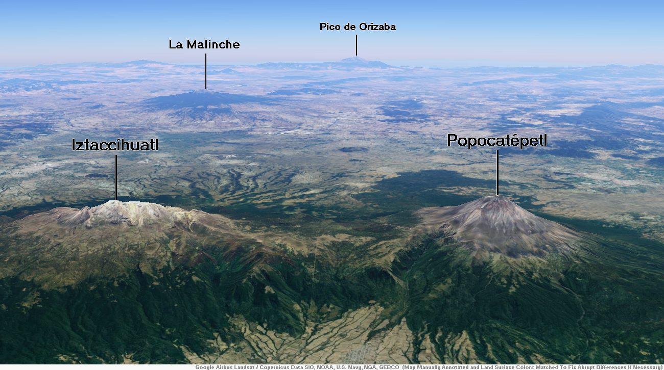
It is linked to the twin volcano of Iztaccihuatl to the north by the high saddle known as the “Paso de Cortés“.[5] Izta-Popo Zoquiapan National Park, wherein the two volcanoes are located, is named after them.[6][7]
Popocatépetl is 70 km (43 mi) southeast of Mexico City, from where it can be seen regularly, depending on atmospheric conditions. Until recently, the volcano was one of three tall peaks in Mexico to contain glaciers,[8] the others being Iztaccihuatl and Pico de Orizaba. In the 1990s, the glaciers such as Glaciar Norte (North Glacier) greatly decreased in size, partly due to warmer temperatures but largely due to increased volcanic activity.[9] By early 2001, Popocatépetl’s glaciers were gone; ice remained on the volcano, but no longer displayed the characteristic features of glaciers such as crevasses.[10][11][12]
Lava erupting from Popocatépetl has historically been predominantly andesitic, but it has also erupted large volumes of dacite.[13] Magma produced in the current cycle of activity tends to be a mixture of the two with the andesites being rich in magnesium.[14]
Name
The name Popocatépetl comes from the Nahuatl words popōca (Nahuatl pronunciation: [poˈpoːka]) “it smokes” and tepētl [ˈtepeːt͡ɬ] “mountain”, meaning Smoking Mountain. The volcano is also referred to by Mexicans as El Popo affectionately, or to shorten the full name. The alternate nickname Don Goyo comes from the mountain’s association in the lore of the region with San Gregorio, “Goyo” being a nickname-like short form of Gregorio. The name was extended by those who lived in Santiago Xalitzina, a small community 12 km (7.5 mi) from the volcano. Legend says that many years ago, a villager met an old man on the slopes of the mountain, who introduced himself as Gregorio Chino Popocatépetl. Gregorio was a personification of the spirit of the volcano, and communicates with the locals to warn them if an eruption is about to happen. Thus, every March 12, the day of San Gregorio, the locals bring flowers and food to the volcano to celebrate the saint.[15][16]
This article uses material from the Wikipedia article Popocatépetl, which is released under the Creative Commons Attribution-Share-Alike 4.0 International License (view authors).
 I | 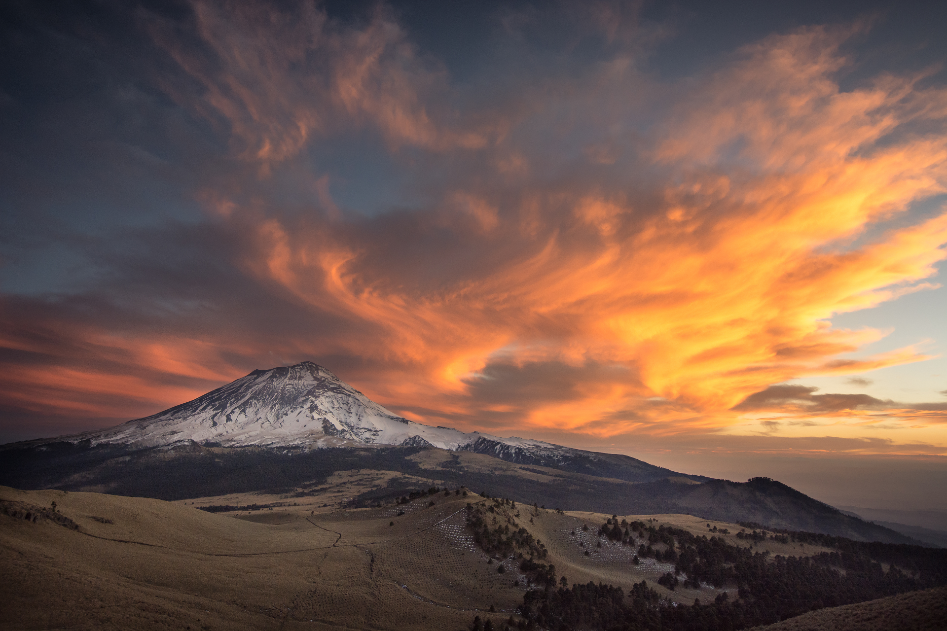 Atonaltzin (iStock) |
 I I | 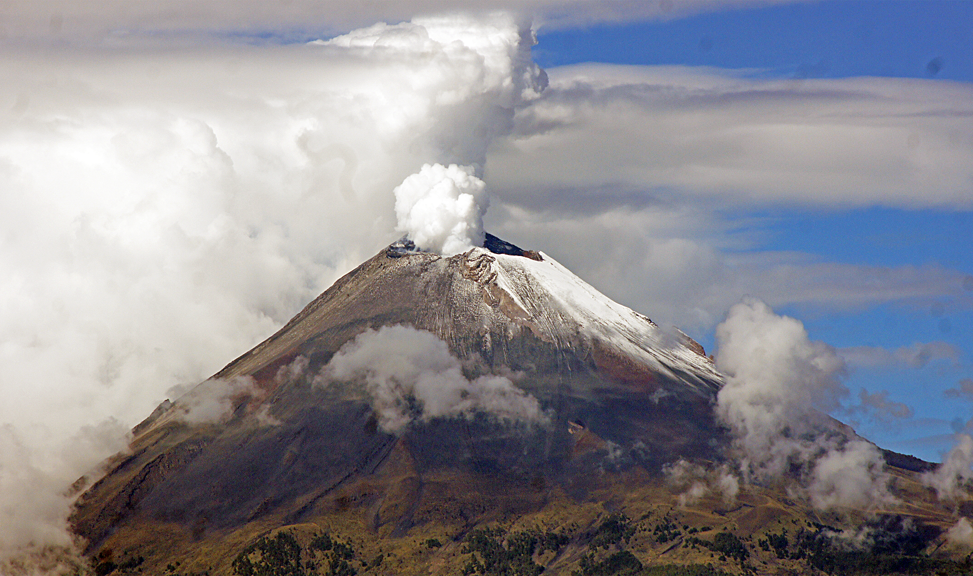 Eduardo Cabanas (iStock) |
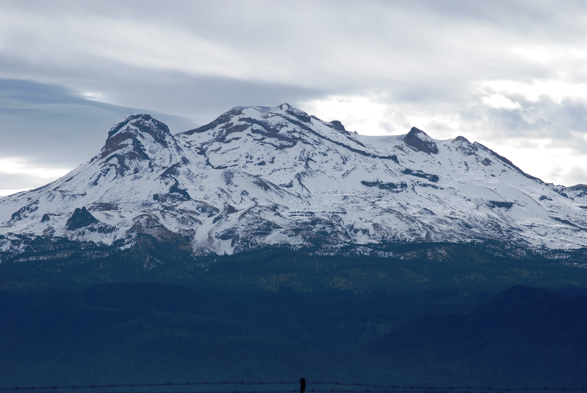
Iztaccíhuatl or Ixtaccíhuatl (both forms also spelled without the accent) (Nahuatl pronunciation: [istakˈsiwat͡ɬ] ⓘ or, as spelled with the x, [iʃtakˈsiwat͡ɬ]) is a 5,230 m (17,160 ft)[1] dormant volcanic mountain in Mexico located on the border between the State of Mexico and Puebla within Izta-Popo Zoquiapan National Park. It is the nation’s third highest, after Pico de Orizaba at 5,636 m (18,491 ft), and Popocatépetl at 5,426 m (17,802 ft).
The name “Iztaccíhuatl” is Nahuatl for “White (like salt) woman”, reflecting the four individual snow-capped peaks which depict the head, chest, knees and feet of a sleeping female when seen from east or west. Iztaccíhuatl is to the north of its twin Popocatépetl, to which it is connected by the high altitude Paso de Cortés. Depending on atmospheric conditions Iztaccíhuatl is visible much of the year from Mexico City some 70 km (43 mi) to the northwest. The first recorded ascent was made in 1889, though archaeological evidence suggests the Mexica and previous cultures climbed it previously. It is the lowest peak containing permanent snow and glaciers in Mexico.
Geology
The summit ridge of the massive 450 km3 (110 cu mi) volcano is a series of overlapping cones constructed along a NNW-SSE line to the south of the Pleistocene Llano Grande caldera. There have been andesitic and dacitic Pleistocene and Holocene eruptions from vents at or near the summit. Areas near the El Pecho summit vent are covered in flows and tuff beds post-dating glaciation, approximately 11,000 years ago. The most recent vents are at El Pecho and a depression at 5,100 m (16,700 ft) along the summit ridge midway between El Pecho and Los Pies.[1]
This article uses material from the Wikipedia article Iztaccihuatl, which is released under the Creative Commons Attribution-Share-Alike 4.0 International License (view authors).
 Zaharov (iStock) I | 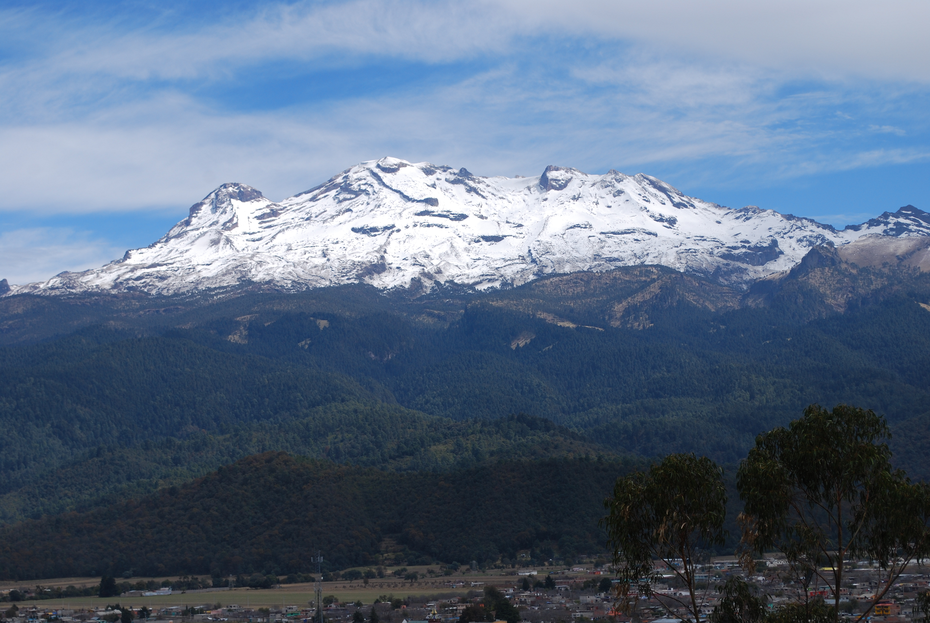 Jakub Hejtmánek (Wikipedia) |
 Alejandro Linares Garcia (Wikipedia) I | 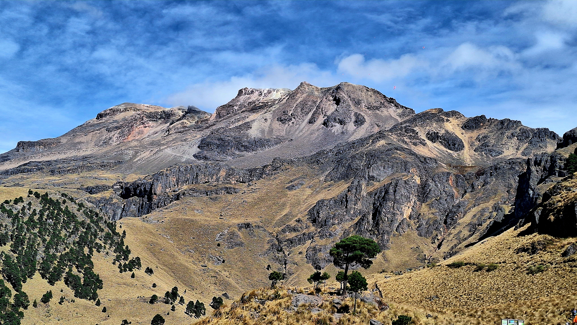 Michel Ismael Figueroa Padilla (iStock) |
Pico de Orizaba, also known as Citlaltépetl (from Nahuatl citlal(in) = star, and tepētl = mountain), is an active volcano, the highest mountain in Mexico[1] and third highest in North America, after Denali of United States and Mount Logan of Canada. Pico de Orizaba is also the highest volcano in North America. It rises 5,636 metres (18,491 ft) above sea level in the eastern end of the Trans-Mexican Volcanic Belt, on the border between the states of Veracruz and Puebla.[1] The volcano is currently dormant but not extinct, with the last eruption taking place during the 19th century. It is the second most prominent volcanic peak in the world after Mount Kilimanjaro. Pico de Orizaba is ranked 16th by topographic isolation.
Toponymy
Pico de Orizaba overlooks the valley and city of Orizaba, from which it gets its Spanish name, i.e., Orizaba’s peak. During the colonial era, the volcano was also known as Cerro de San Andrés due to the nearby settlement of San Andrés Chalchicomula at its base.[citation needed]
Its Náhuatl name, Citlaltépetl, comes from citlalli (star) and tepētl (mountain) and thus means “Star Mountain”. This name is thought to be based on the fact that the snow-covered peak can be seen year round for hundreds of kilometers throughout the region.[citation needed] This name is not, however, used by Náhuatl speakers of the Orizaba area, who instead call it Istaktepetl (Iztactépetl in the traditional orthography for Classical Nahuatl), meaning ‘White Mountain’.
A third name, Poyauhtecatl, which means “the one that colours or illuminates”, has also been recorded. This name was given by the Tlaxcaltecs in memory of their lost country.[4]
Topography
The peak of Citlaltépetl rises dramatically to an elevation of 5,636 m (18,491 ft) above sea level; it has a topographic prominence of 4,922 m (16,148 ft). Regionally dominant, Pico de Orizaba is the highest peak in Mexico and the highest volcano in North America; it is also the third highest peak in North America after Denali and Mount Logan. Orizaba is ranked 7th in the world in topographic prominence. It is the second most prominent volcanic peak in the world after Africa’s Mount Kilimanjaro, and the volcano is ranked 16th in the world for topographic isolation. About 110 km (68 mi) to the west of the port of Veracruz, its peak is visible to ships approaching the port in the Gulf of Mexico, and at dawn rays of sunlight strike the Pico while Veracruz still lies in shadow. The topography of Pico de Orizaba is asymmetrical from the center of the crater; the eastern face is the steepest side of the volcano and the northwestern face the most gradual side. The gradual slopes of the northwestern face of the volcano allow for the presence of large glaciers and provide the most traveled route for hikers traveling to the summit.
This article uses material from the Wikipedia article Pico de Orizaba, which is released under the Creative Commons Attribution-Share-Alike 4.0 International License (view authors).
 I | 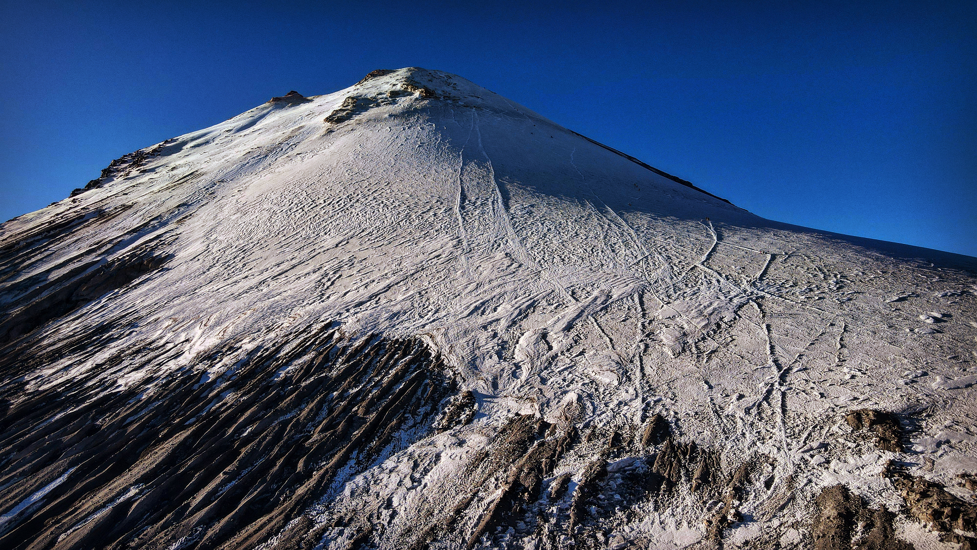 Jano de la Fuente (iStock) |
 Laura Jacome Cessa (iStock) | 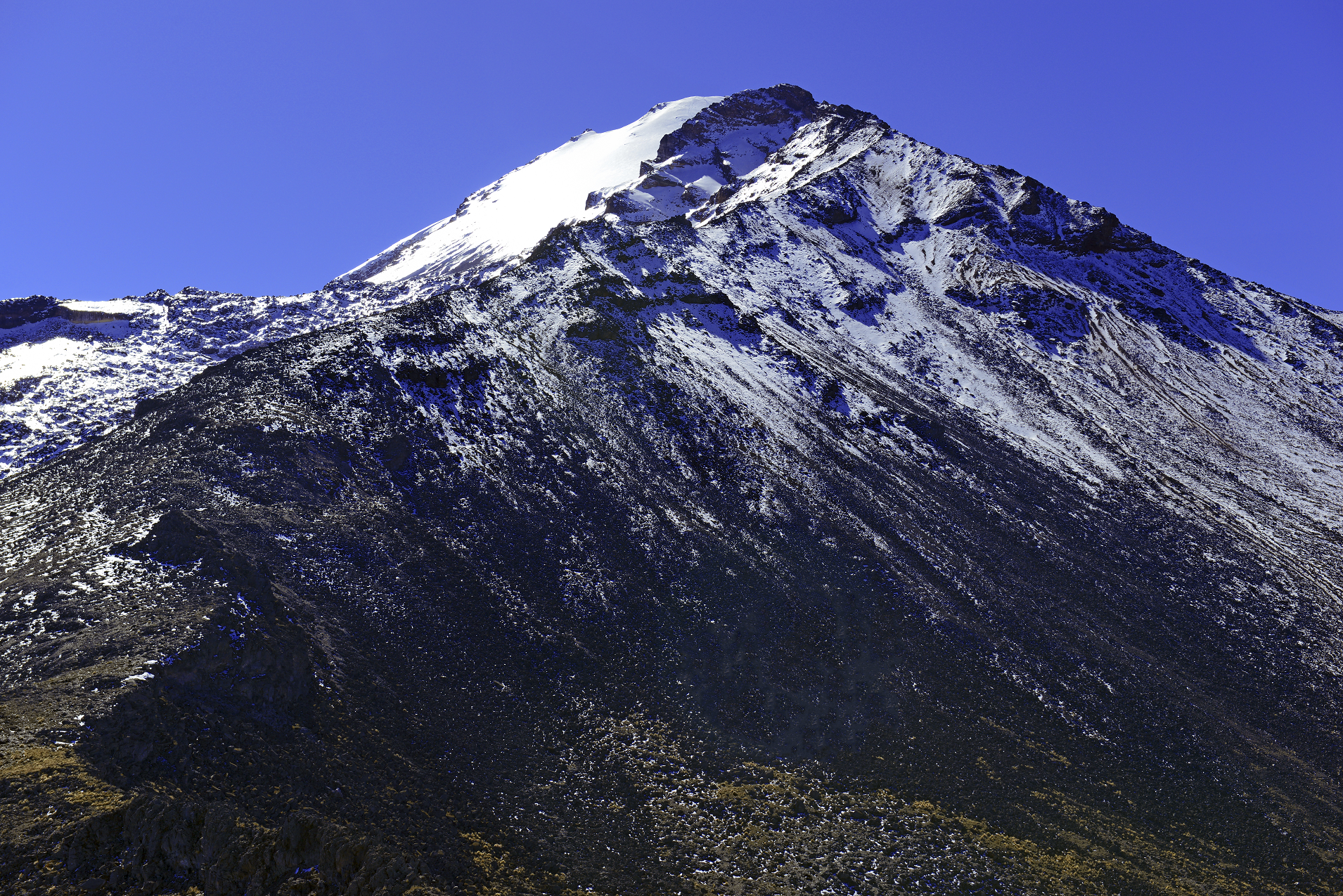 4robertcicchetti (iStock) I |
