
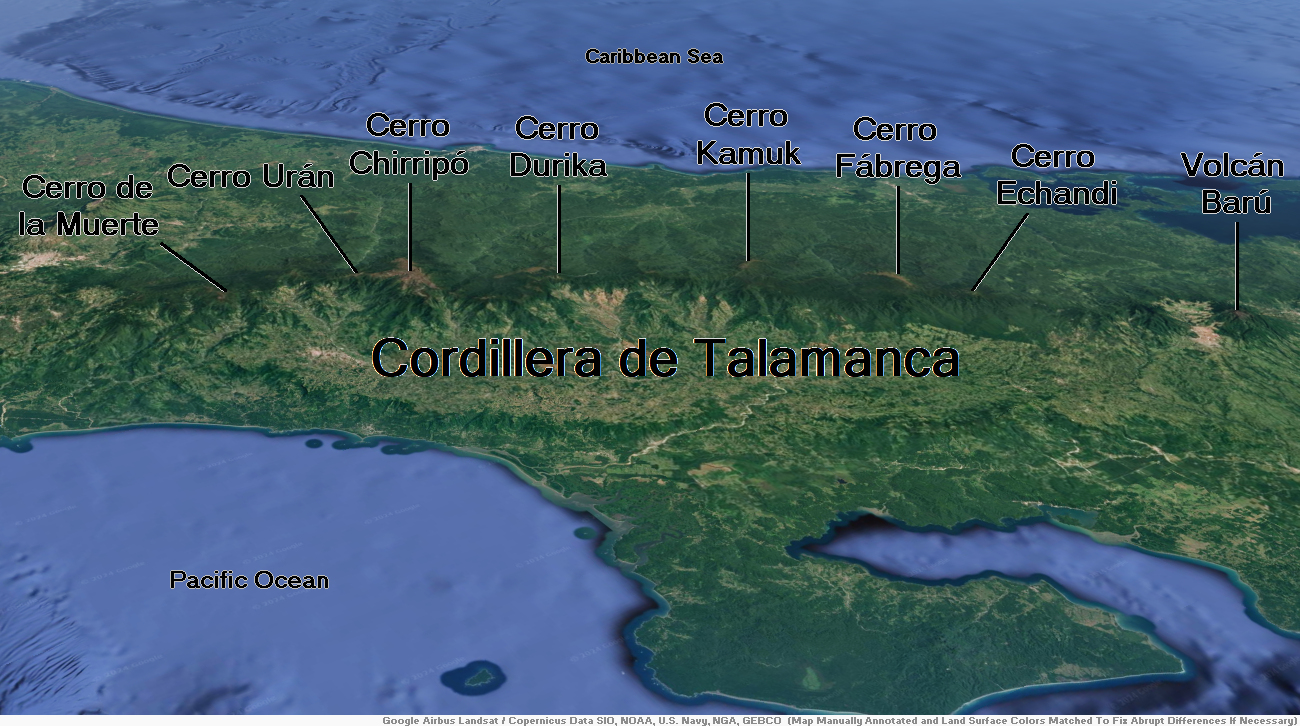
Map of Cordillera de Talamanca


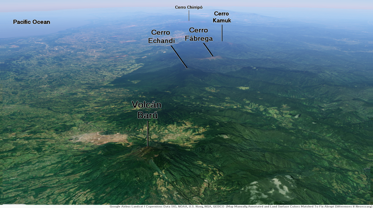
Volcán Barú Region

![]()
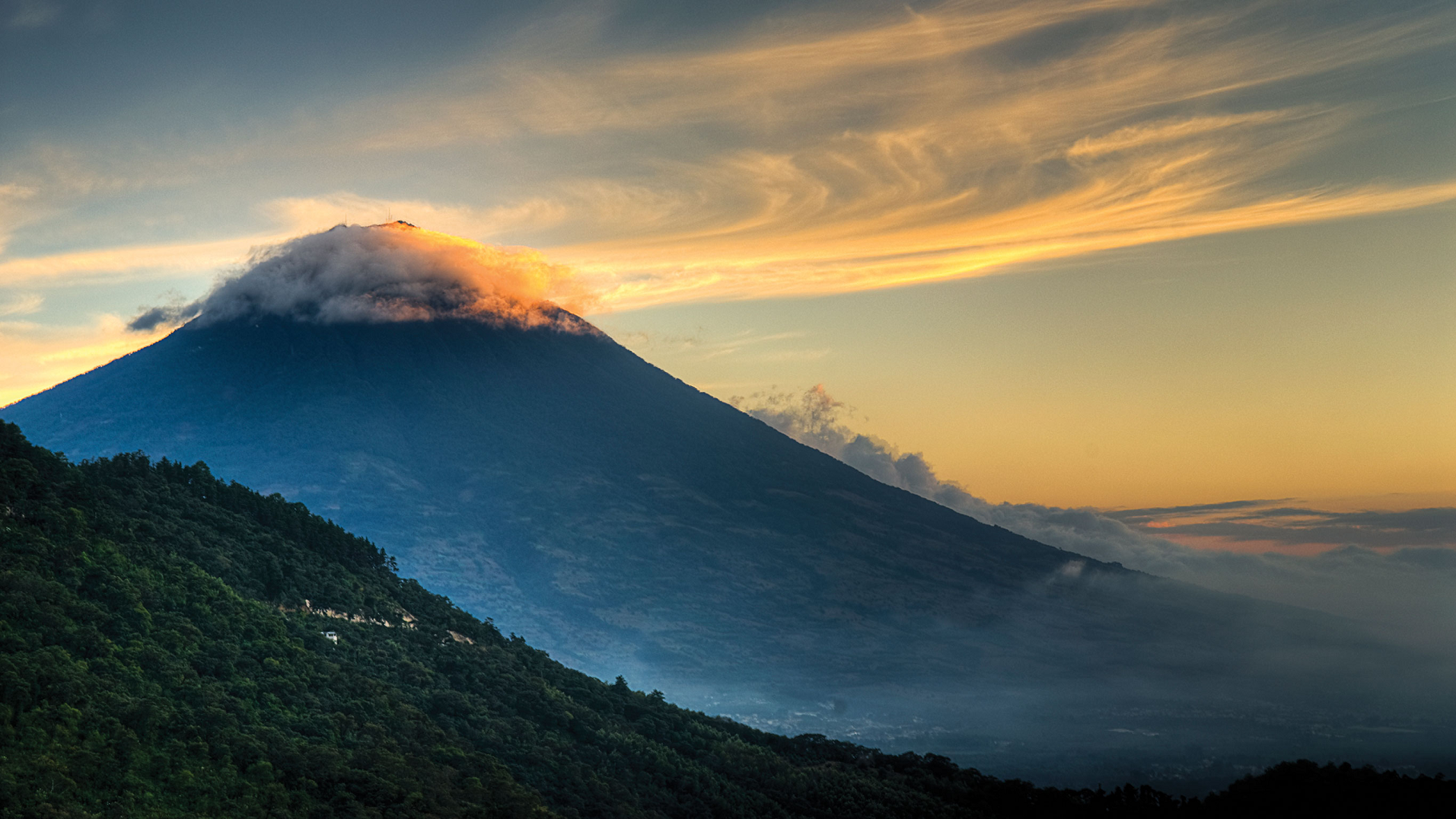
The Volcán Barú (also Volcán de Chiriquí[1]) is an active stratovolcano and the tallest mountain in Panama, at 3,475 metres (11,401 ft) high. It lies about 35 km (22 mi) off the border of Costa Rica. It is also the twelfth highest peak in Central America.[3]
Due to its height and the narrowness of the isthmus of Panama, it is possible (though relatively rare) to see both the Pacific Ocean and Caribbean Sea from Volcán Barú’s peak on a clear day.[citation needed]
Geography
The small town of Volcán at the base of Volcán Barú sits on the remnants of a huge lahar that appears to have breached the caldera. A small river has eroded the lahar exposing an ancient forest below dated to about 1000 years old.[citation needed]
Volcán Barú is surrounded by a fertile area of cool highlands drained by the Chiriquí Viejo and Caldera Rivers. The towns of Volcán and Cerro Punta can be found on its western side, while Boquete is on the eastern flank.
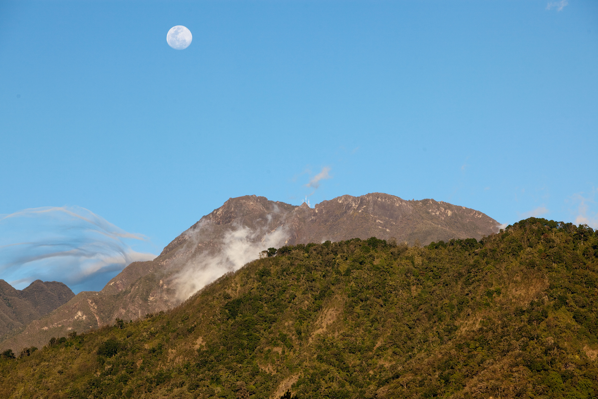
The occasional fall of hail or ice pellets has been reported on the summit, where the minimum temperature can be below 0 °C (32 °F) and the formation of frost is frequent during the dry season. The peak is host to a large installation of broadcast towers.
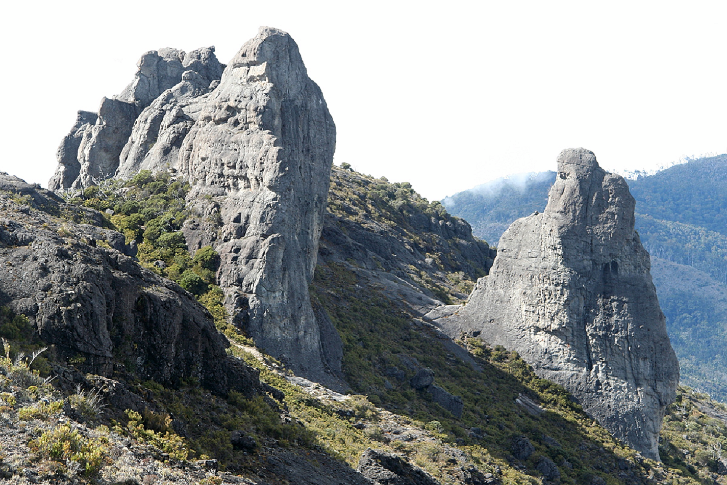
Description
De Boer et al.[4] were the first to show that El Barú volcano is active and part of the extension of the Central American Volcanic Arc in Panama. Further detailed work on the geochemistry of the lavas from El Barú and other volcanoes in Panama was completed by Defant et al.[5] They substantiated, based on geochemistry, that the lavas were derived by subduction (calc-alkaline). Radiometric dates also showed that the volcanism falls into two groups that range from 20 million years to recent. They also showed that the youngest volcanism consists primarily of adakites (partial melts from the subducted slab) whereas the older volcanism is normal calc-alkaline lavas.
This article uses material from the Wikipedia article Volcán Barú, which is released under the Creative Commons Attribution-Share-Alike 4.0 International License (view authors).
 I |  NTCo (iStock) |
 Sachagriffin (Wikipedia) | 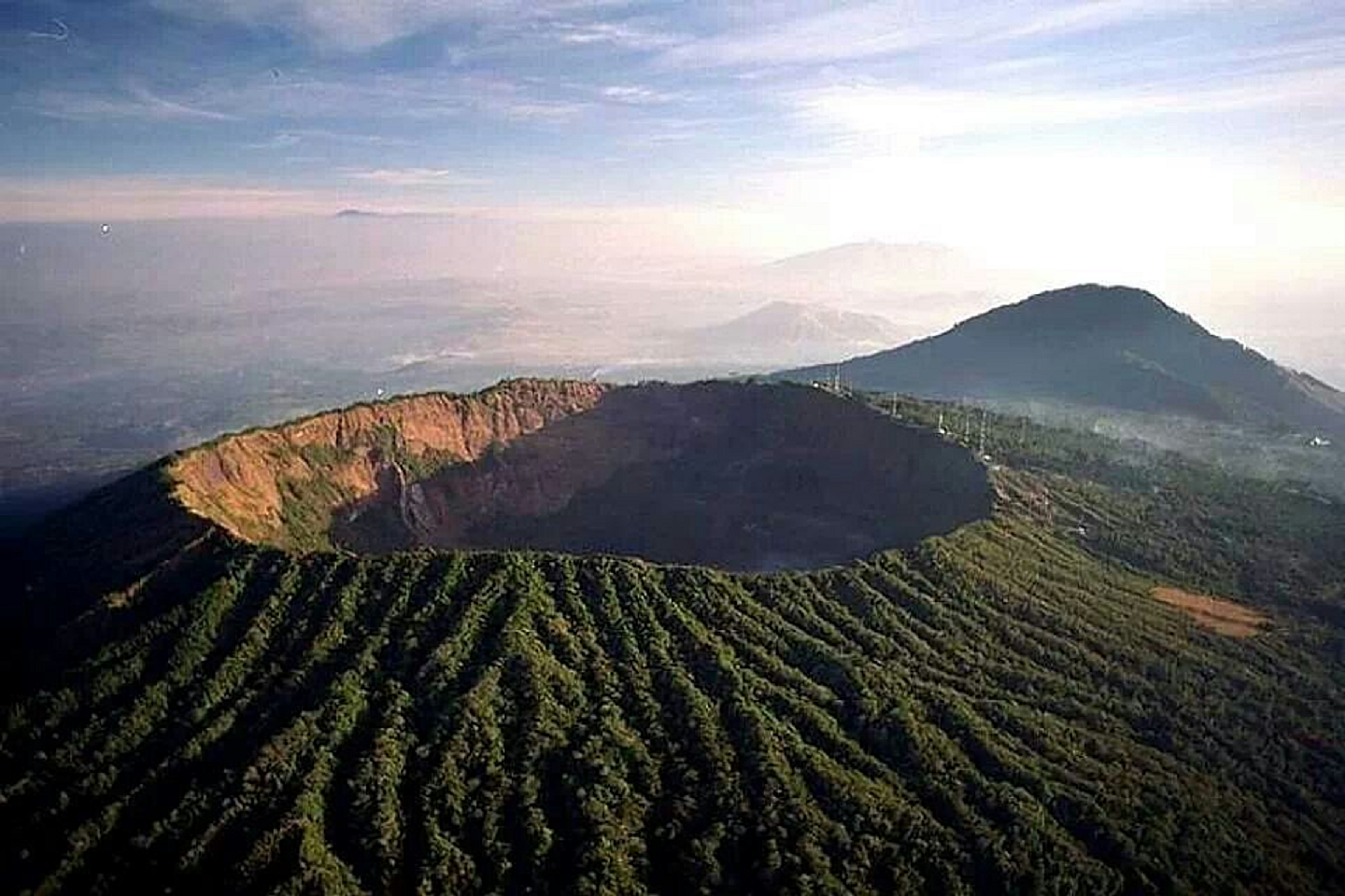 I |
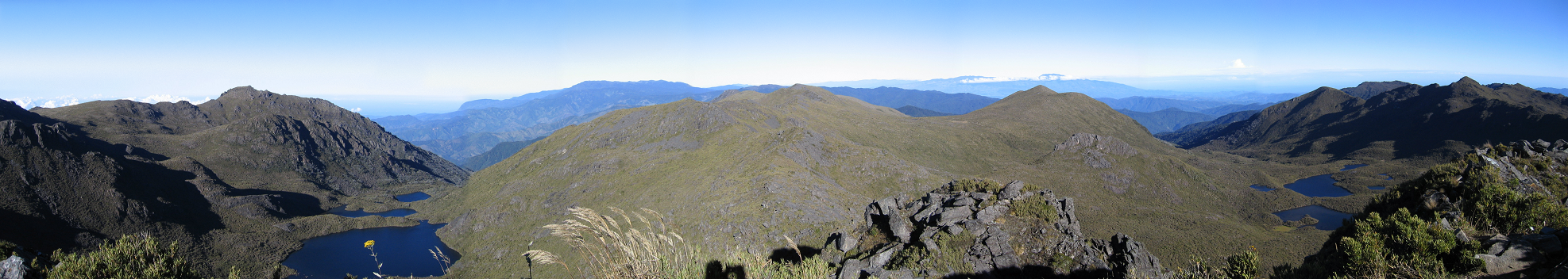
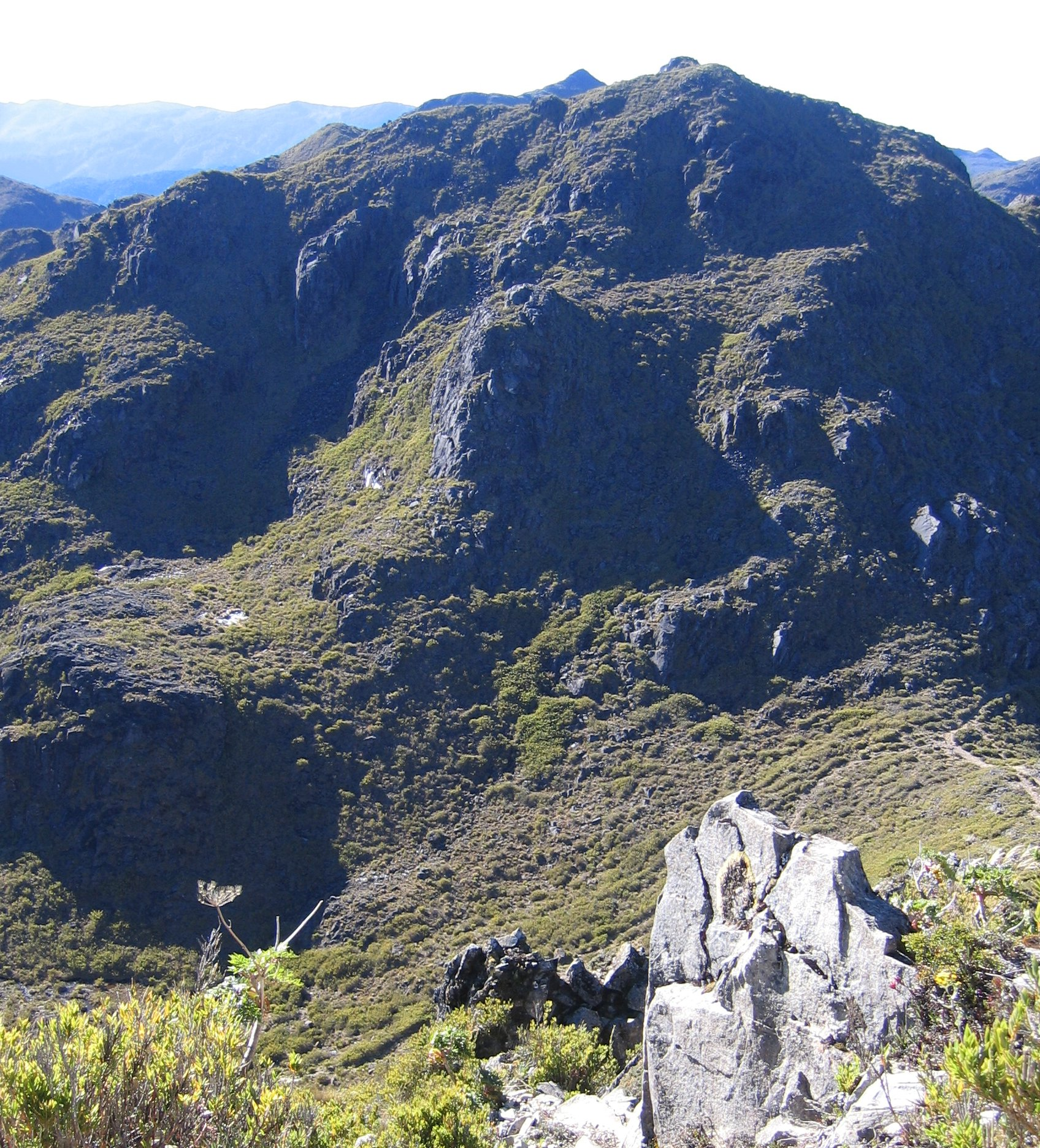
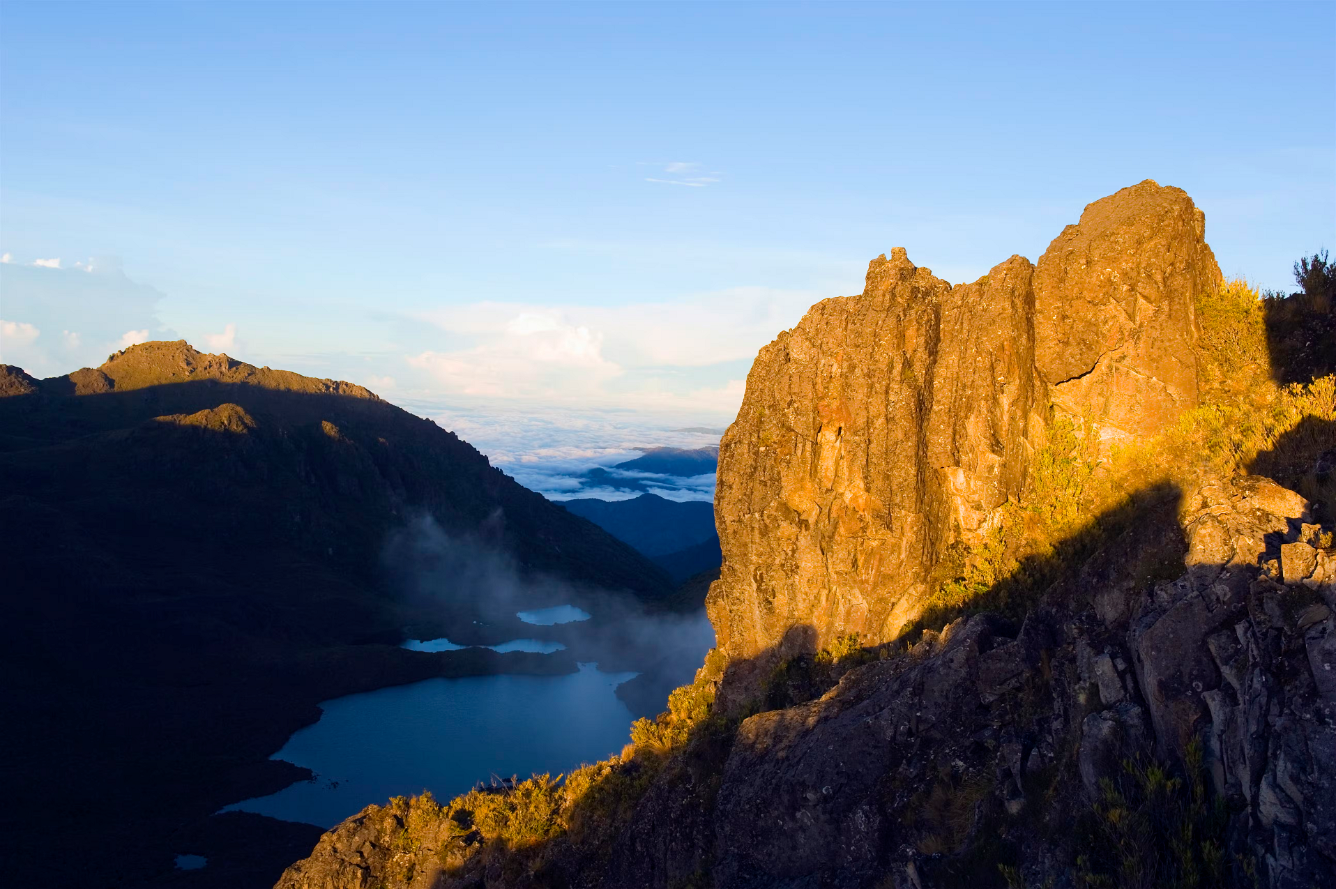
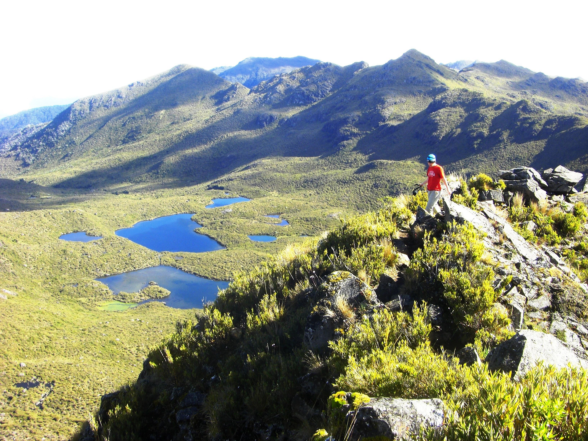
Cerro Chirripó Panoramic

![]()
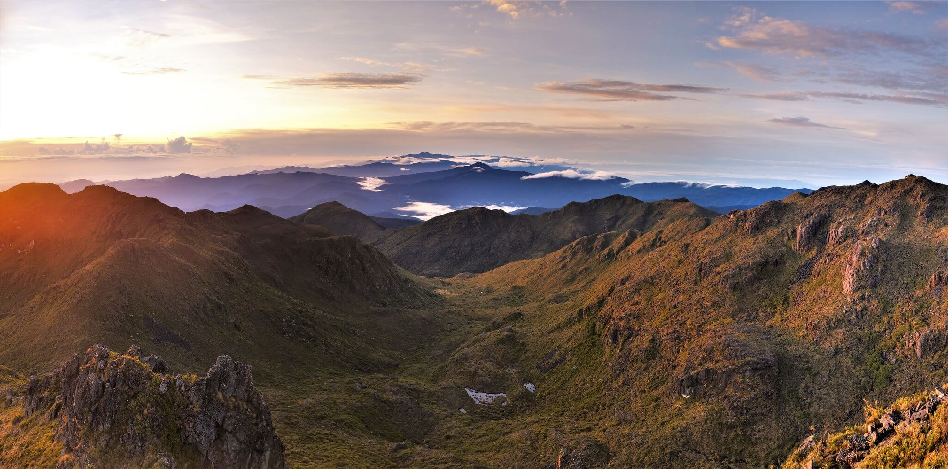
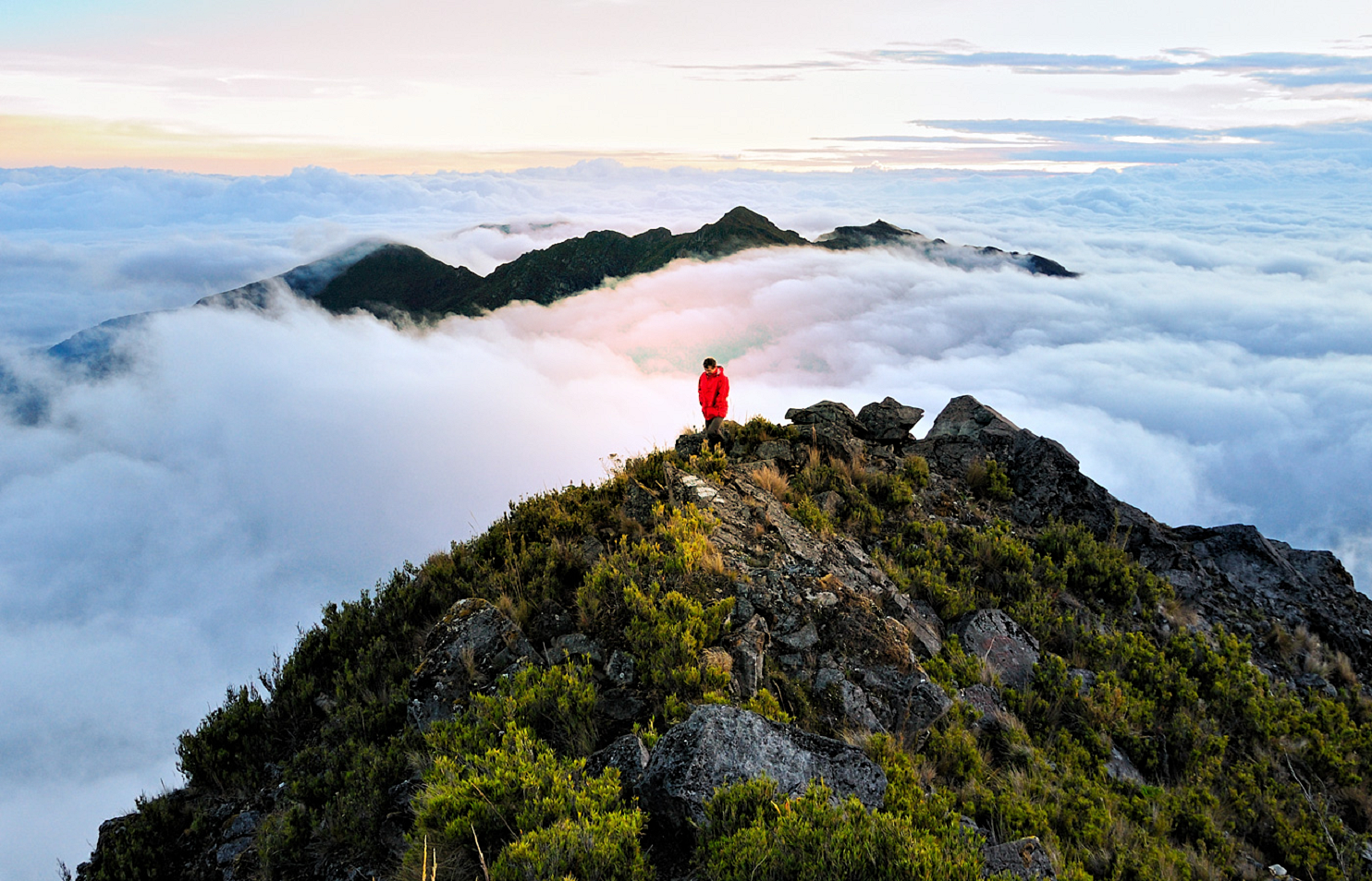
Cerro Chirripó is the highest mountain in Costa Rica, with an elevation of 3,821 meters (12,536 feet). It is part of the Cordillera de Talamanca, and the range’s highest point. It is located in Chirripó National Park and is noted for its ecological wealth. The mountain was named “Chirripo”, meaning “land of eternal waters”, by indigenous Costa Ricans because there are many lakes and streams around the mountain.[2] The high peaks in Chirripó National Park and La Amistad International Park host important areas of Talamancan montane forest and Costa Rican Páramo with high endemism and extremely high biodiversity. The peaks of these mountains constitute sky islands for many species of plants and animals. Snow has not fallen on the peak in the past 100 years or so, according to the University of Costa Rica, but hail is sometimes reported.
The great height of Mount Chirripó relative to its surroundings is also evidenced by its particularly high topographic prominence of 3,727 m (12,228 ft),[1] which makes it the 37th most prominent peak in the world. On clear days it is possible to see across the country from the Pacific Ocean to the Caribbean Sea.[3]
Climbing Mount Chirripó is possible by obtaining a permit from the National Park office in San Gerardo de Rivas. From the trailhead, the summit can be reached via a 19.5-kilometer (12.1 mile) hike.[4]
Geography
Chirripó is the 37th most prominent peak in the world. The most abundant ecosystem in the mountains is the páramo, extending across almost all the mountains. It also has a large number of lakes on the top, this is because during the ice age it was covered with snow, but when the ice melted these unique glacial lakes were formed.
Climate
Temperatures on Mount Chirripo during the day can range between 4 and 18 °C (39 and 64 °F), and at night they can drop from 1 and −3 °C (34 and 27 °F). The coldest temperature ever documented in Costa Rica was recorded here (−9 °C (16 °F)).
History
The earliest known civilization to inhabit the area of Chirripó was the indigenous Cabécar people. In 1904, Agustín Blessing Presinger became the first known European to climb the peak.
This article uses material from the Wikipedia article Cerro Chirripó, which is released under the Creative Commons Attribution-Share-Alike 4.0 International License (view authors).
 Travicted Photography (Flickr) | 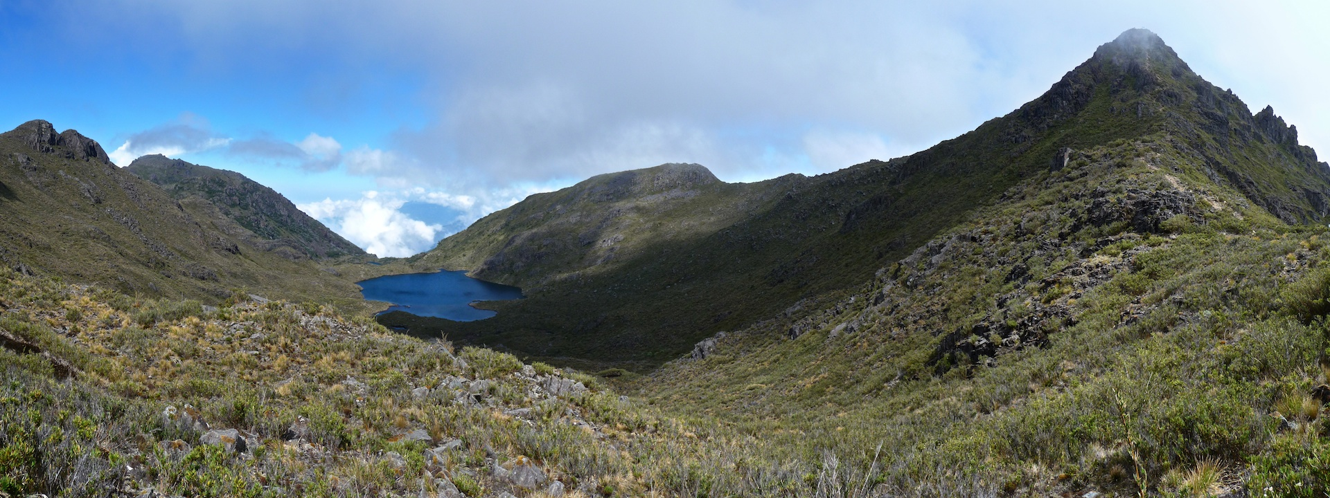 Monty VanderBilt (Flickr) I |
 Peter Andersen (Wikipedia) | 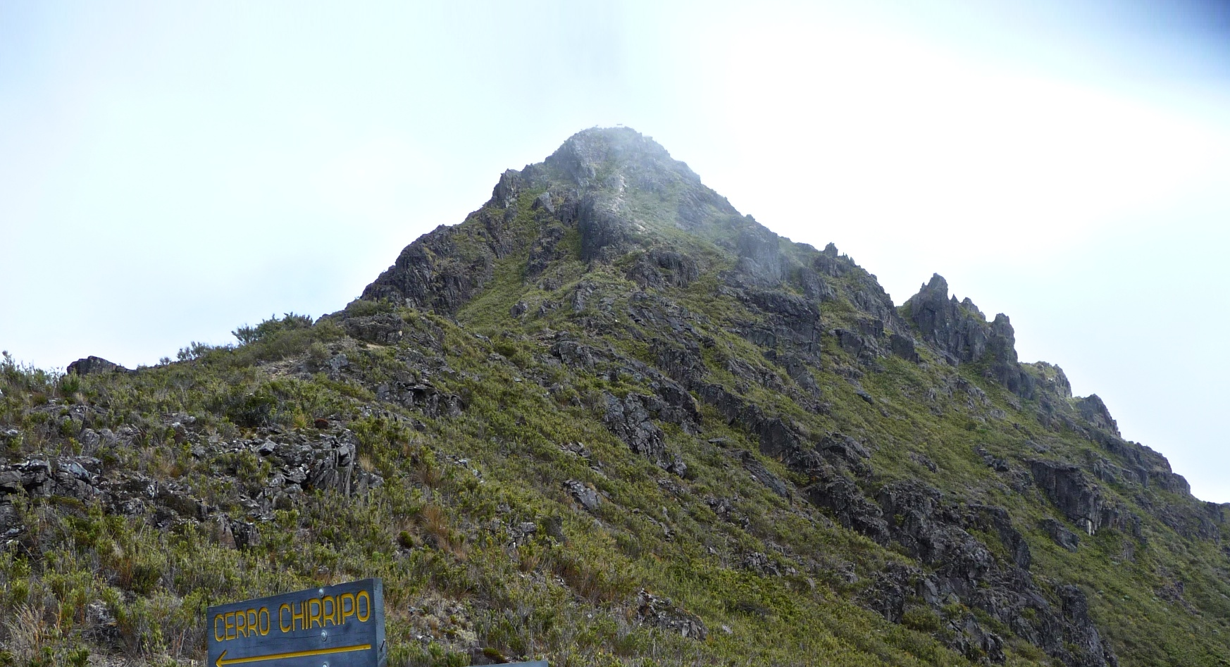 |
 |  |
 |  |
![]()
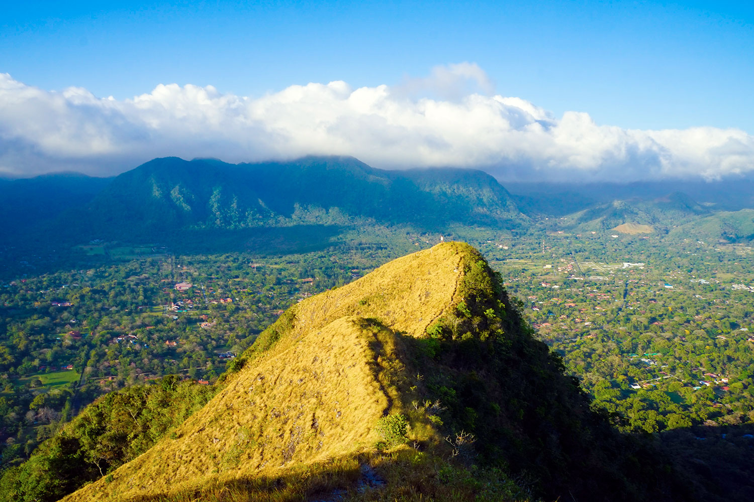
El Valle is a stratovolcano in central Panama and is the easternmost volcano along the Central American Volcanic Arc which has been formed by the subduction of the Nazca Plate below Central America. Some time prior to 200,000 years ago, the volcano underwent a huge eruption event that caused the top of the volcano to collapse into the empty magma chamber below forming a large caldera. Several lava domes have developed inside the caldera since the collapse—forming Cerro Pajita, Cerro Gaital and Cerro Caracoral peaks. Prior to research in the early 1990s, it was thought that no active volcanism existed within Panama. But radioactive dates from El Valle show that the volcano last erupted as recently as 200,000 years ago.[1]
Work by de Boer et al.[2] and Defant et al.[3][4] of other volcanoes within Panama have shown that there are two episodes of volcanism—young (< 2.5 million years ago) and old (> 4.5 million years ago) groups. The young volcanism consists of adakites (slab melts) whereas the older volcanism appears to be normal calc-alkaline volcanism.
This article uses material from the Wikipedia article El Valle (volcano), which is released under the Creative Commons Attribution-Share-Alike 4.0 International License (view authors).
 |  |
