
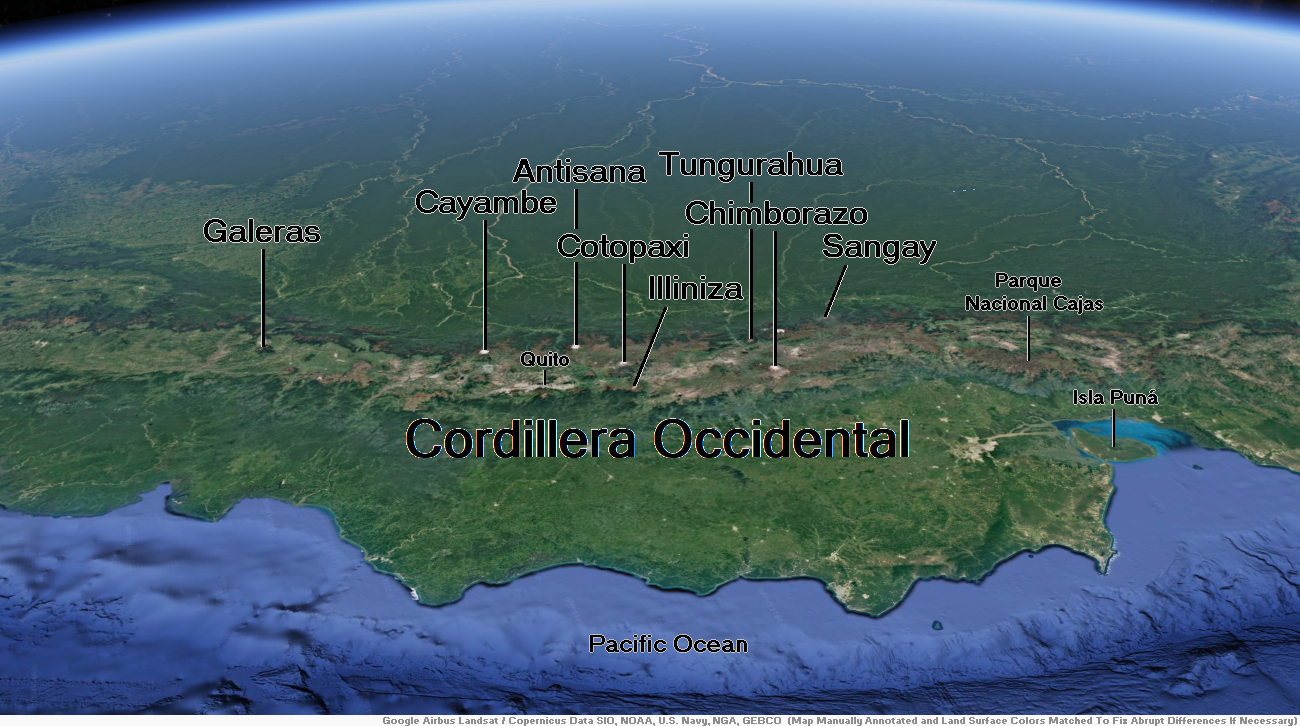
Map of Cordillera Occidental


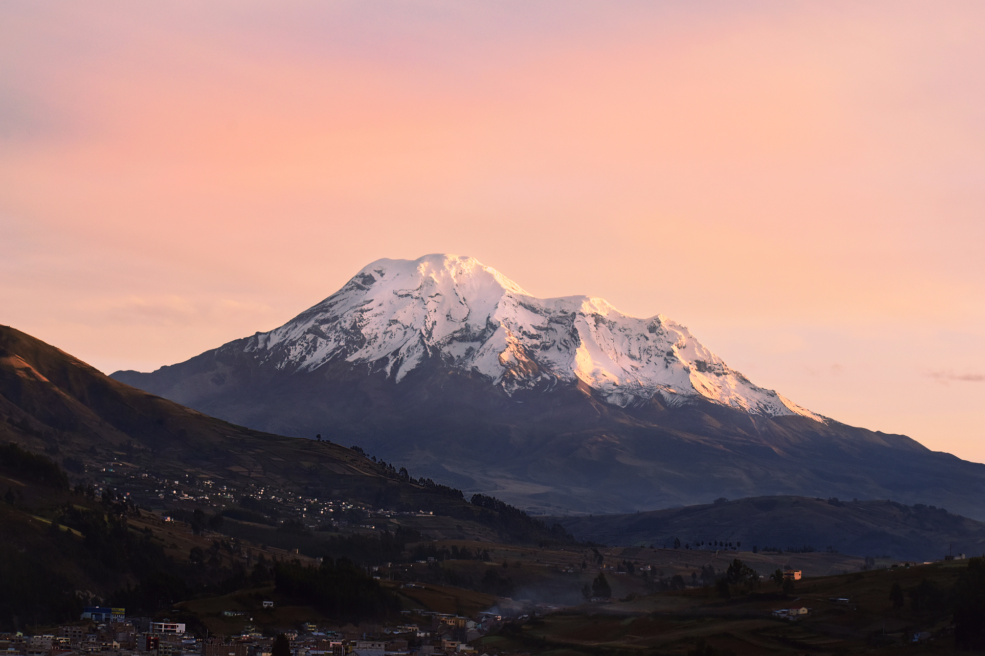
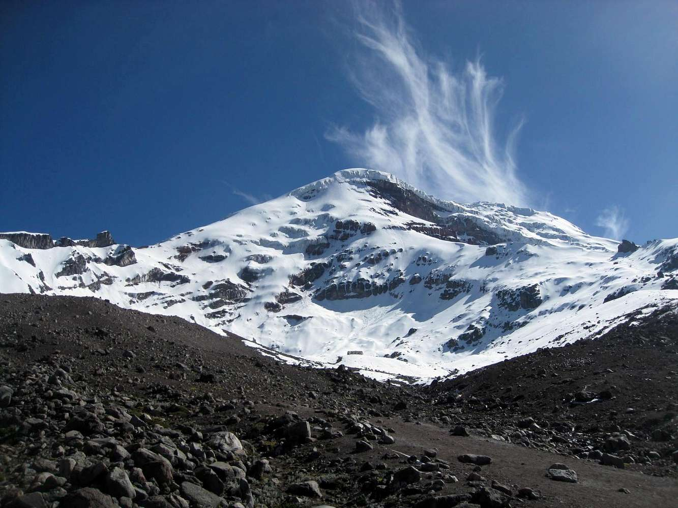
Chimborazo Region


![]()
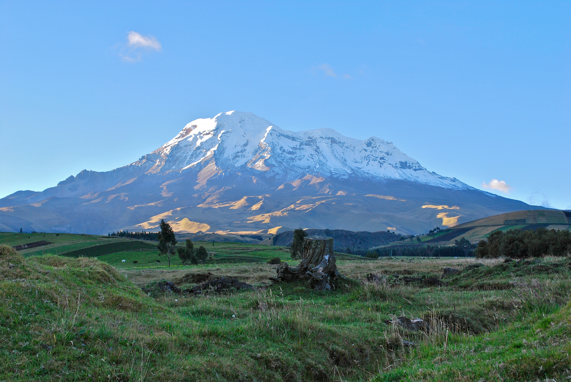
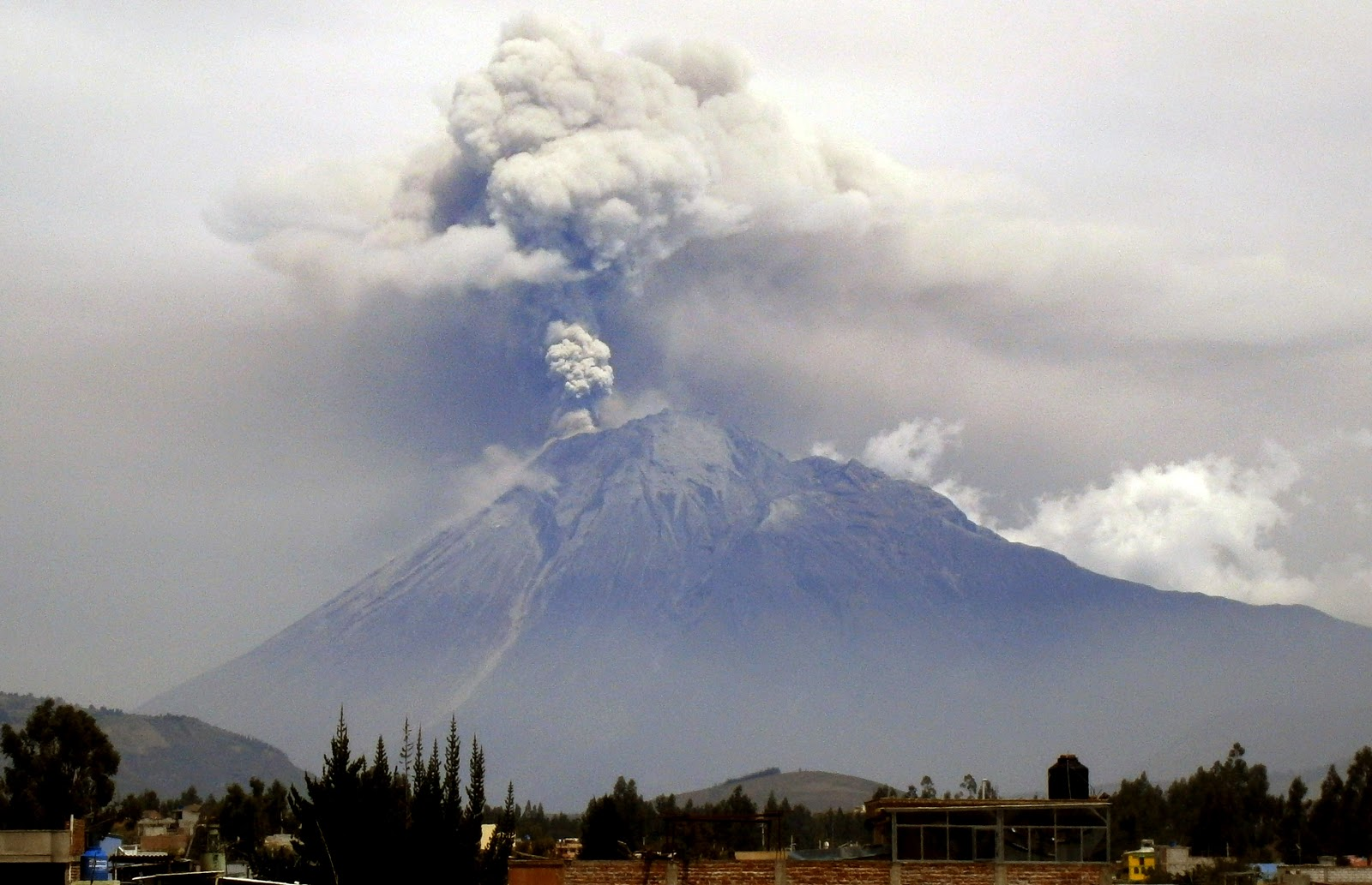
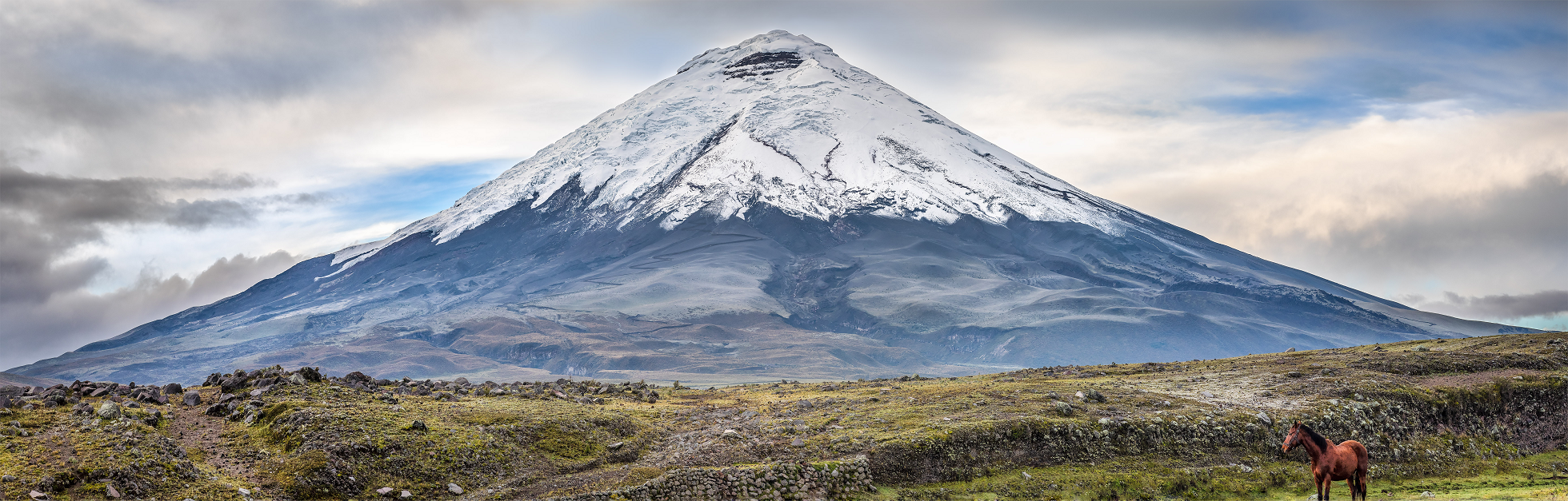
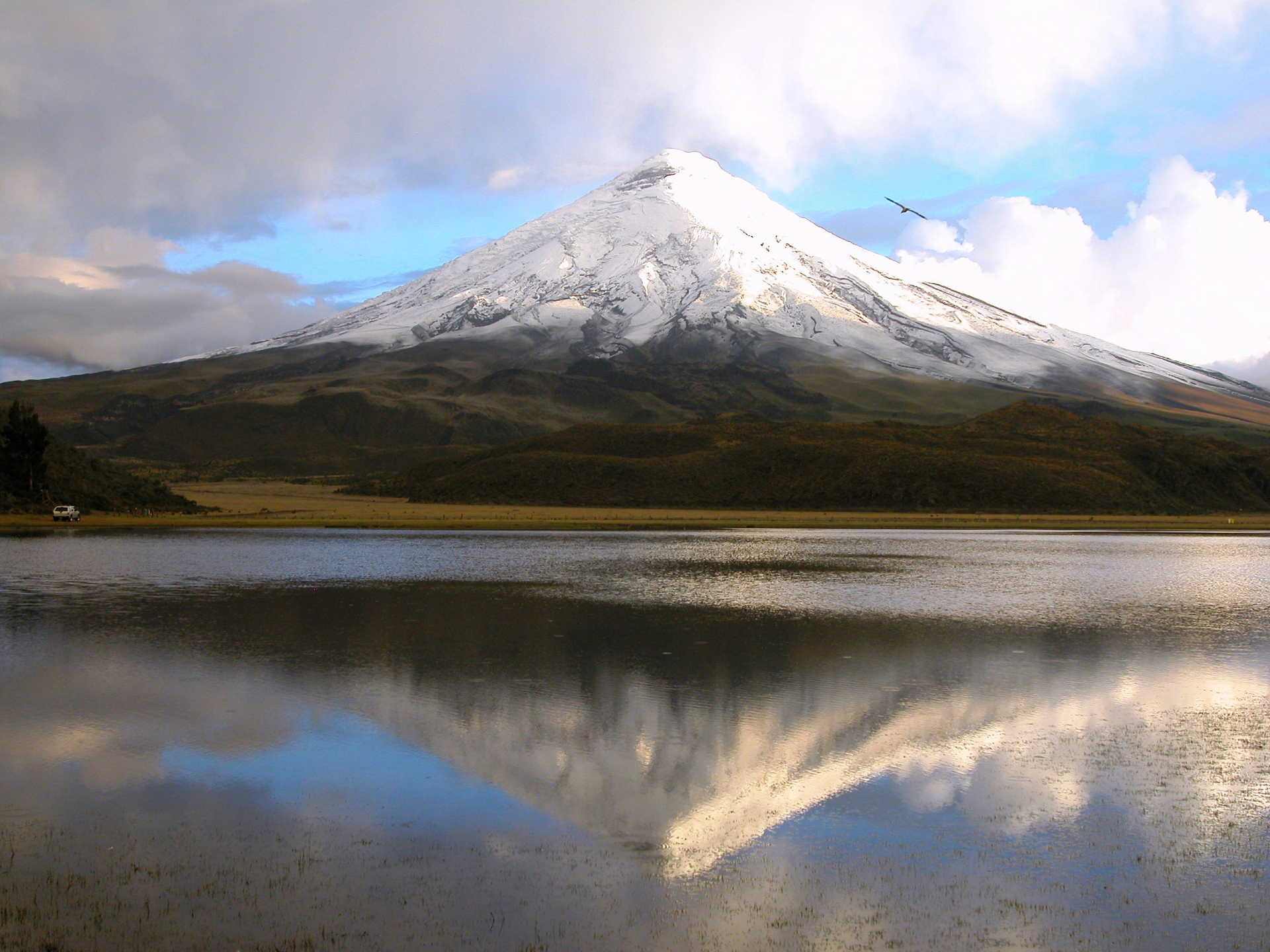
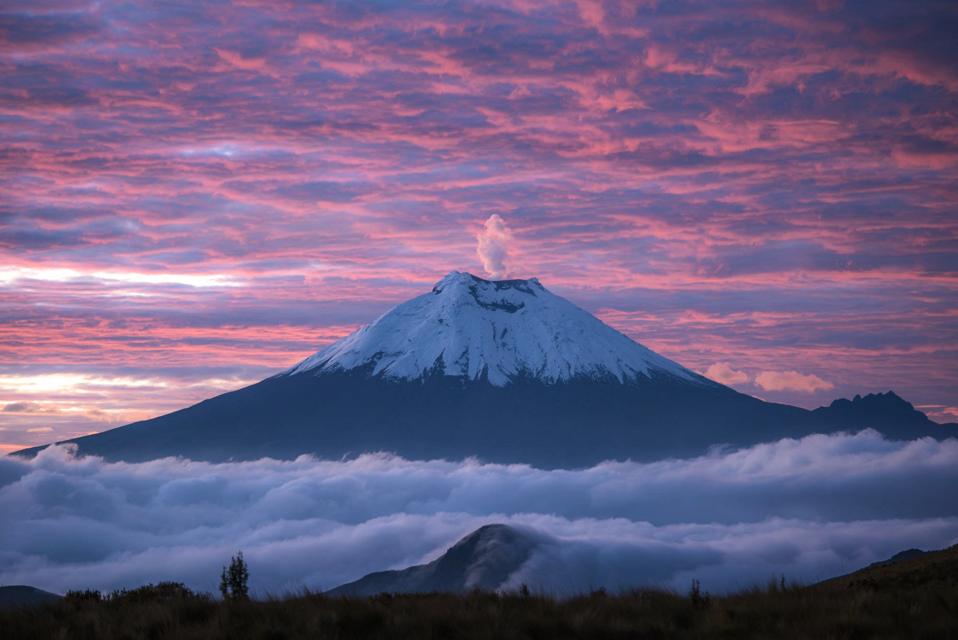
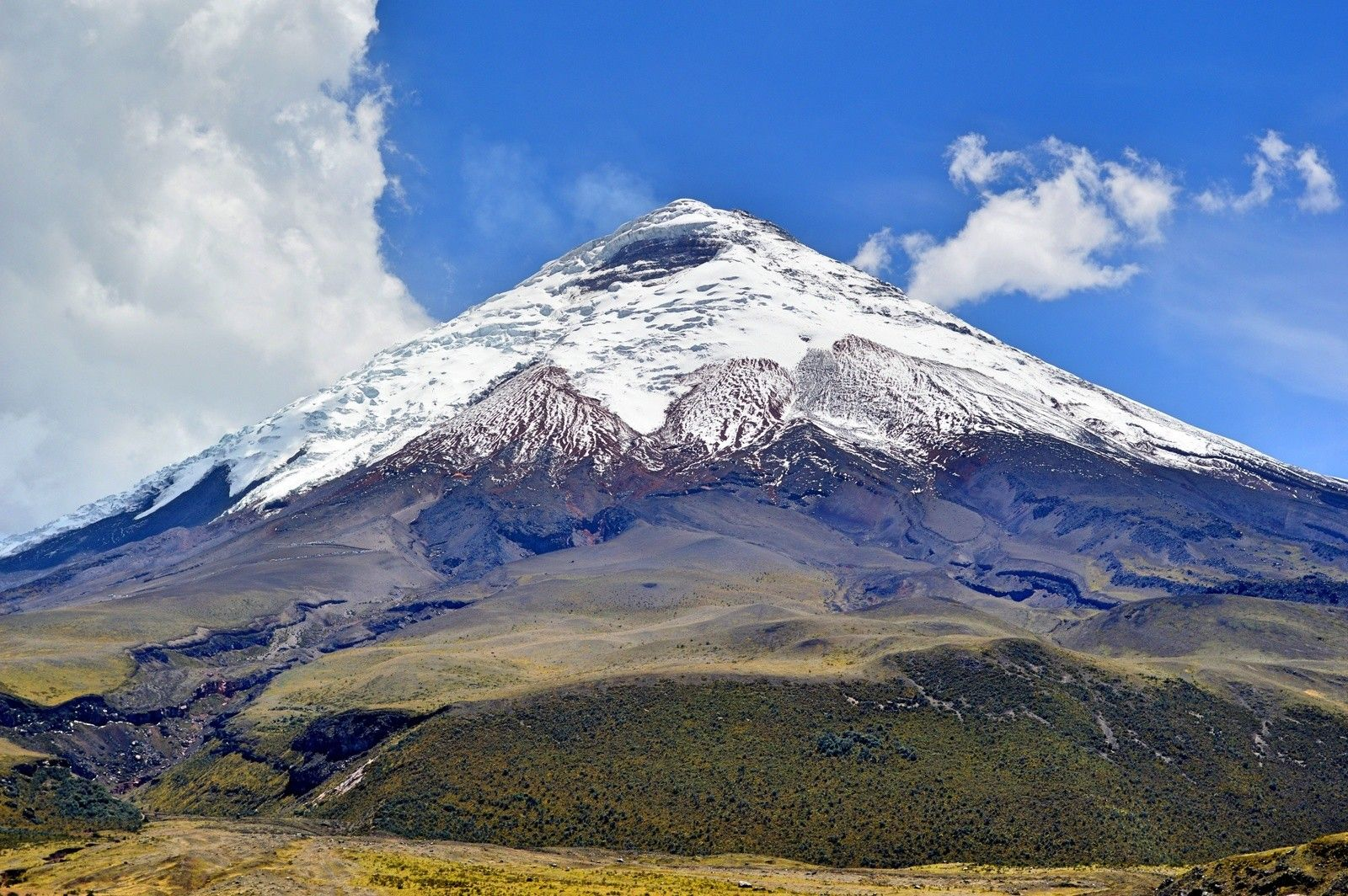
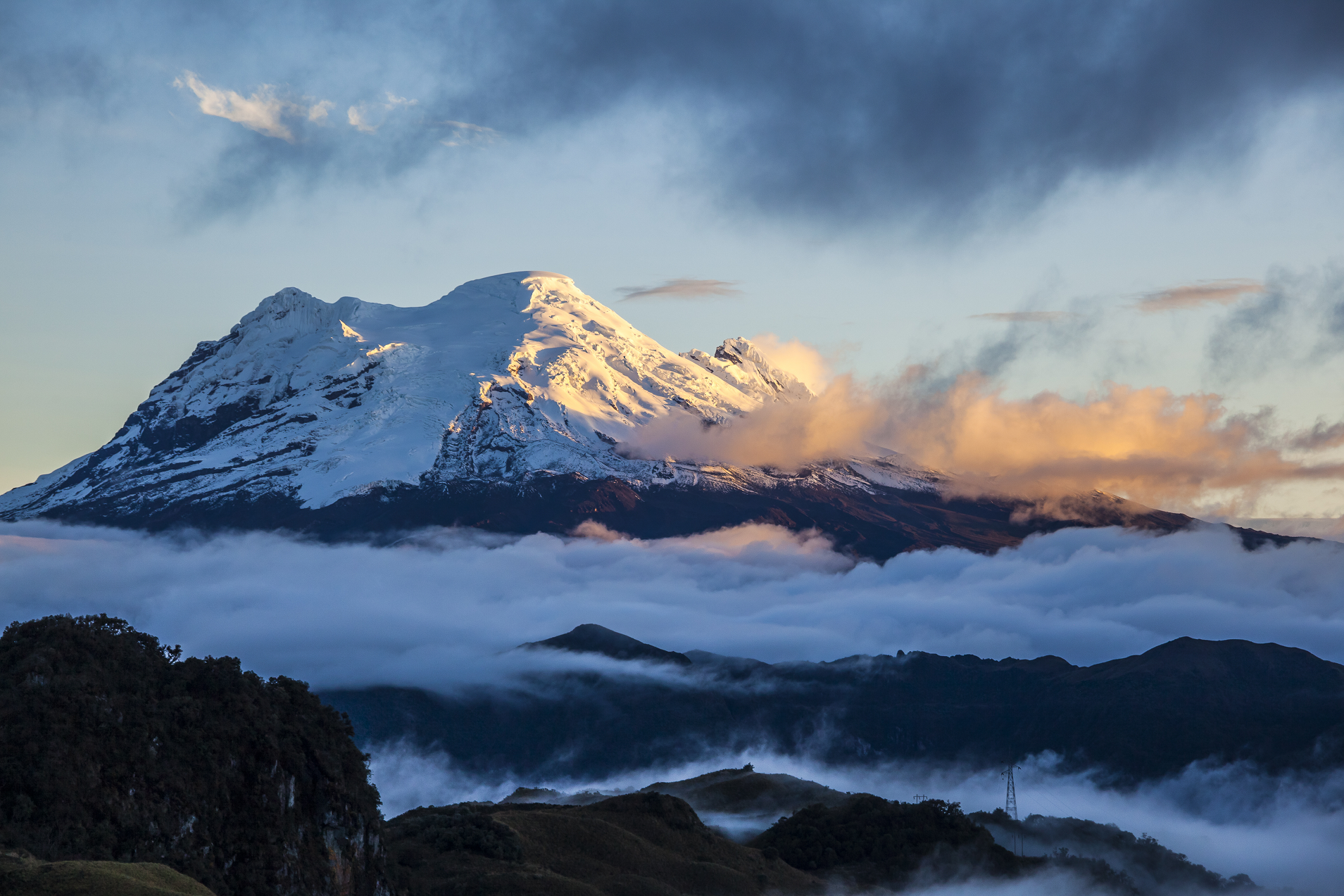
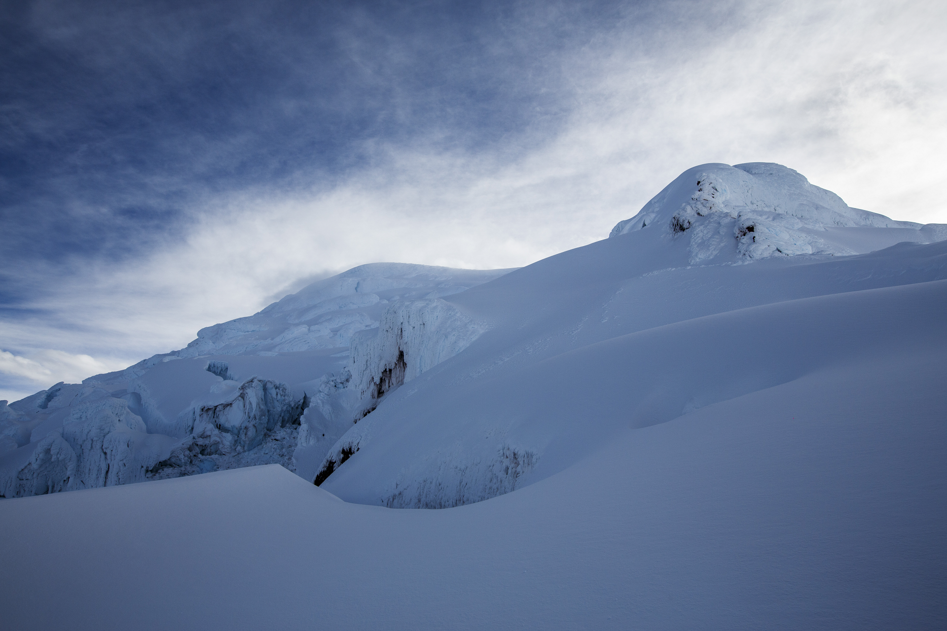
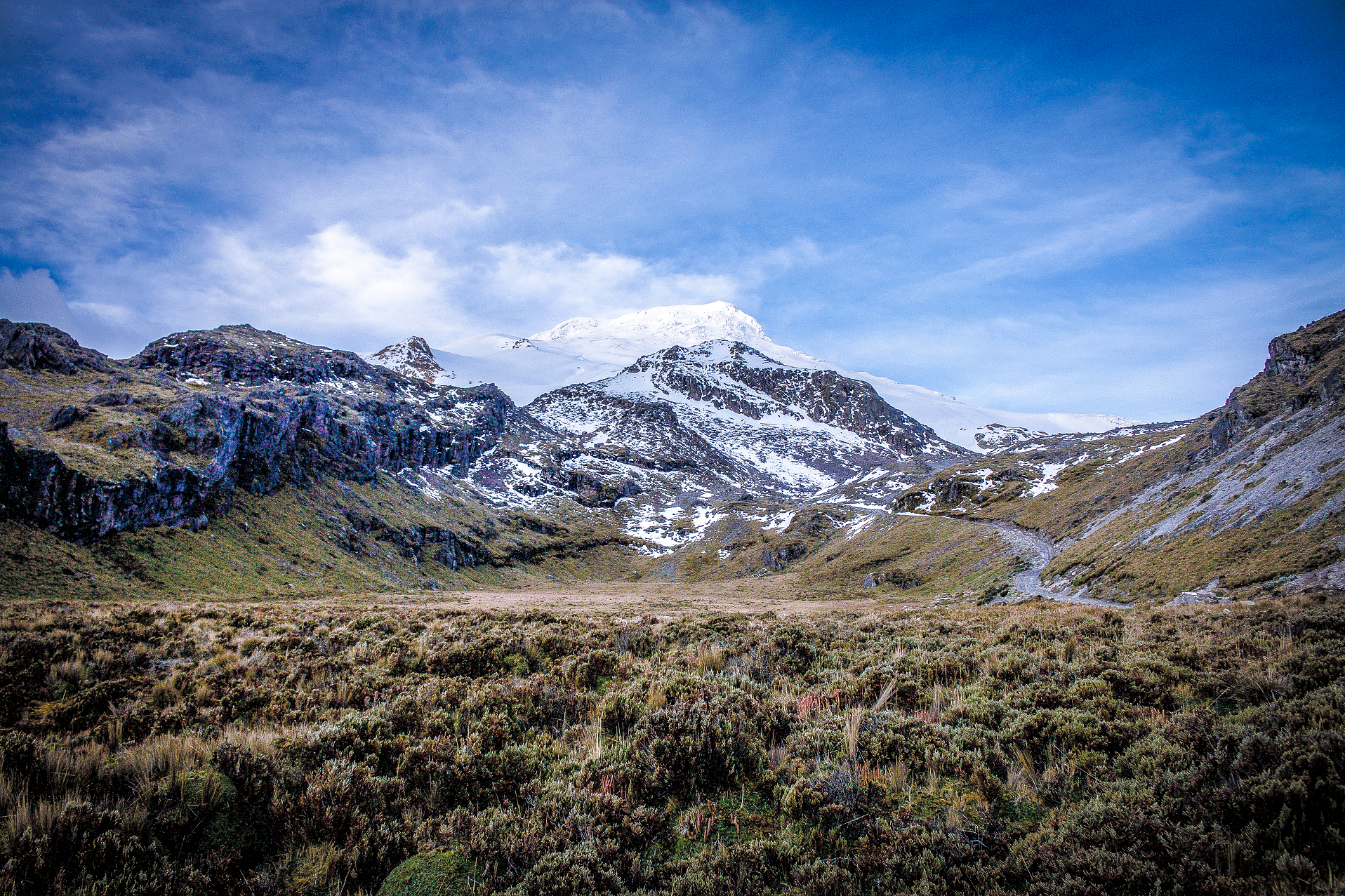
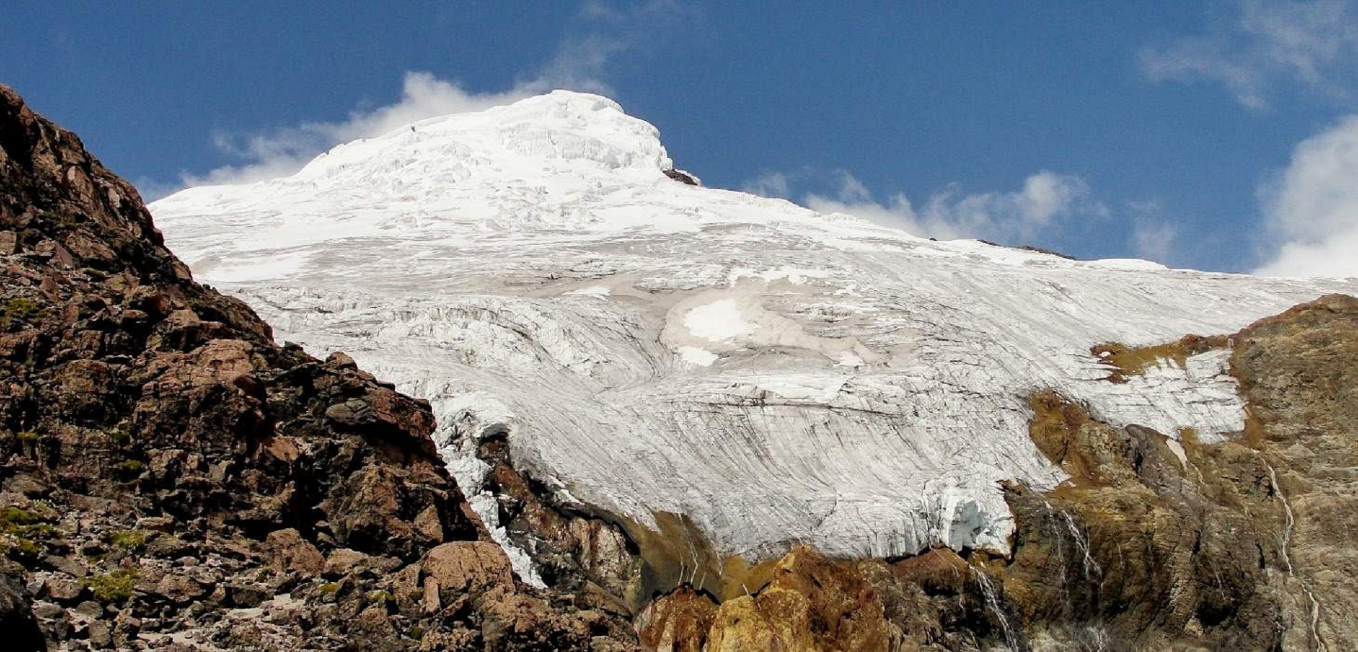
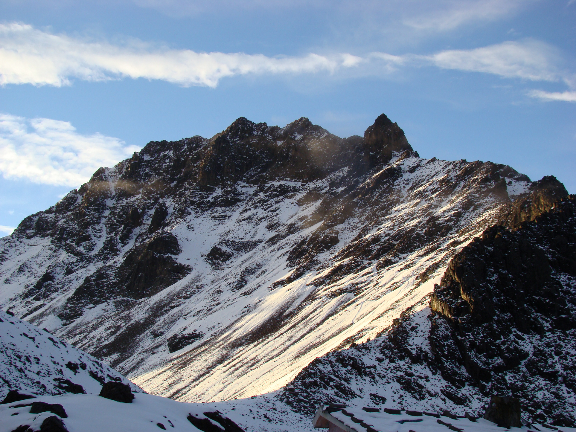
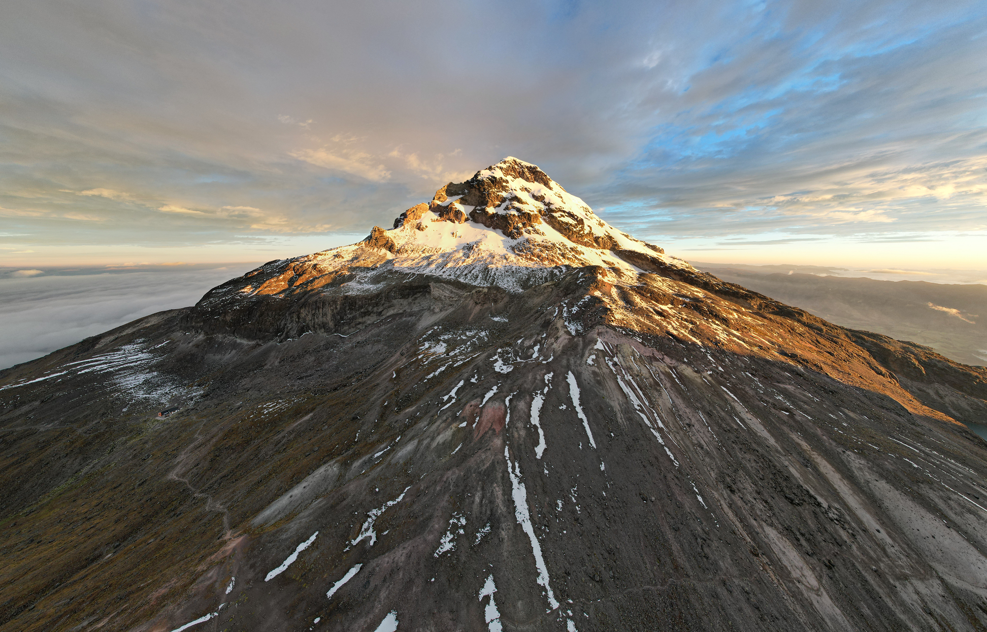
Chimborazo (Spanish pronunciation: [tʃimboˈɾaso] ⓘ) is a stratovolcano situated in Ecuador in the Cordillera Occidental range of the Andes. Its last known eruption is believed to have occurred around AD 550.[4] Although not the tallest mountain in the Andes or on Earth relative to sea level, its summit is the farthest point on Earth’s surface from the Earth’s center due to its location along the planet’s equatorial bulge.[5] Chimborazo’s height from sea level is 6,263 m (20,548 ft), well below that of Mount Everest at 8,849 m (29,031 ft).
Chimborazo is the highest mountain in Ecuador and the 39th-highest peak in the entire Andes. It is a popular destination for mountaineering due to its challenging climbing routes, which involve traversing snow, ice, and rocky terrain.
Etymology
Several theories regarding the origin of the name Chimborazo exist. In many dialects of Quechua, “chimba” means “on the other side” as in “on the other side of the river” or “on the opposite bank”. Other dialects pronounce this word “chimpa”. Also, “razu” means “ice” or “snow”. Local Quichua speakers say that Chimborazo is a Hispanicized pronunciation of “chimbarazu”, meaning “the snow on the other side”.[6] Another theory suggests it is a combination of the Cayapa Schingbu for Women and the Colorado/Quichua Razo for Ice/Snow resulting in Women of Ice. According to another, Chimbo is Jívaro for Throne of Master/God resulting in Icethrone of God. The locals also used to call the mountain Urcurazu, with the Quichua Urcu for Mountain resulting in Mountain of Ice.[7] In local indigenous mysticism, Chimborazo represents Taita (Father) whereas neighbouring Tungurahua is seen as Mama, and Guagua (Child) for Pichincha hence Taita Chimborazo, Mama Tungurahua and Guagua Pichincha.
Geography Location
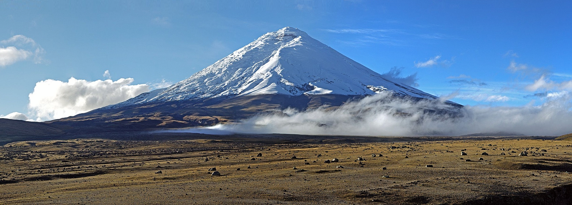
Chimborazo is in the Chimborazo Province of Ecuador, 150 km (93 mi) south-southwest of the city of Quito, Ecuador. It is a neighbor to 5,018 m (16,463 ft) high Carihuairazo, another inactive stratovolcano. Chimborazo’s summit rises 2,500 m (8,202 ft) above the surrounding highlands (~3,500 to 4,000 m (11,483 to 13,123 ft)) with a ≈20 km (12 mi) wide base.
Under clear conditions, the summit of Chimborazo can be seen from the coastal city Guayaquil, nearly 140 km (87 mi) away. The nearest cities are Riobamba (~30 km to the southeast), Ambato (~30 km to the northeast) and Guaranda (~25 km to the southwest). Chimborazo is surrounded by the Reserva de Producción Faunistica Chimborazo, which forms a protected ecosystem to preserve the habitat for the Andes native camelids of vicuña, llama and alpaca.
This article uses material from the Wikipedia article Chimborazo, which is released under the Creative Commons Attribution-Share-Alike 4.0 International License (view authors).
 EyeEm Mobile GmbH (iStock) |  Ecuadorplanet (iStock) I |
 Astrobassman (Summit Post) | 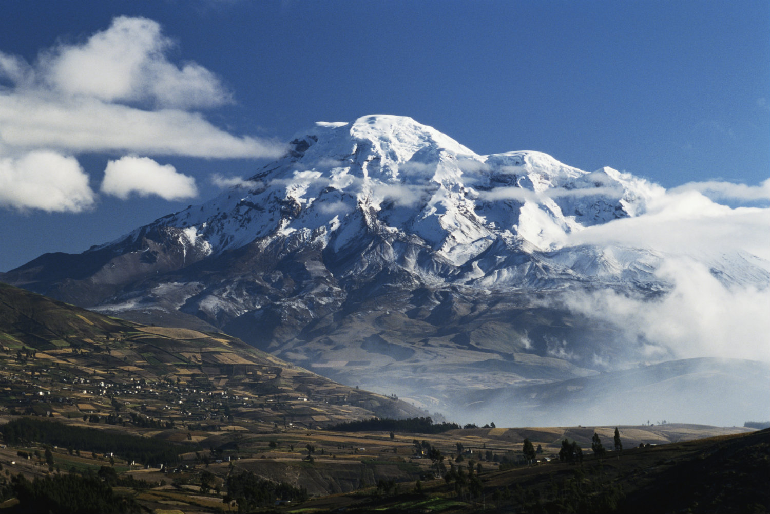 I I |
 David Torres Costales (Wikipedia) | 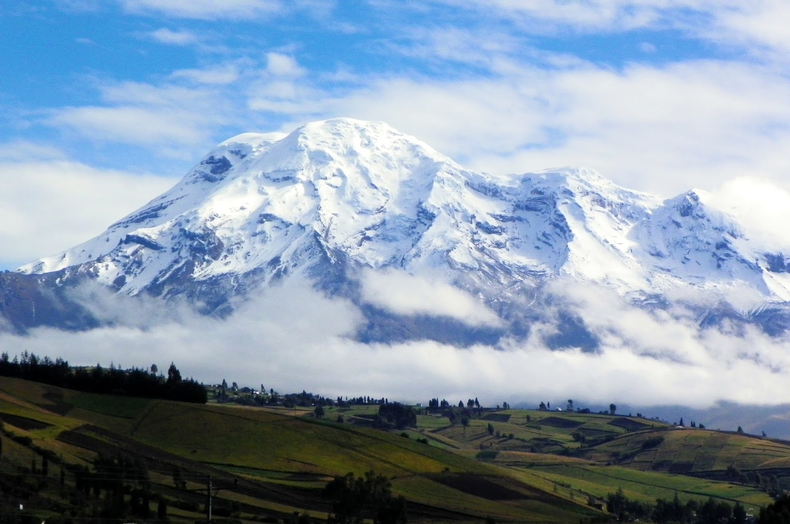 I I |

![]()
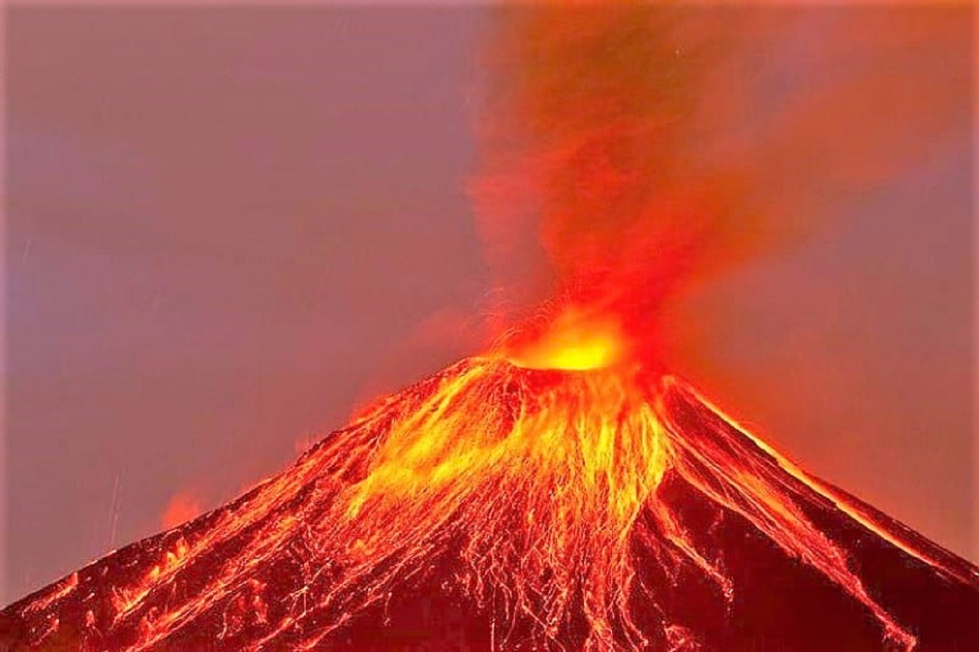
Tungurahua (/tʊŋɡʊˈrɑːwə/; from Quichua tunguri (throat) and rahua (fire), “Throat of Fire”)[5] is an active stratovolcano located in the Cordillera Oriental of Ecuador. The volcano gives its name to the province of Tungurahua. Volcanic activity restarted on August 19, 1999,[6] and is ongoing as of 2023, with several eruptive episodes since then, the most recent lasting from February 26 to March 16, 2016.[7]
Etymology
According to one theory the name Tungurahua is a combination of the Quichua tunguri (throat) and rahua (fire) meaning “Throat of Fire”.[5] According to another theory it is based on the Quichua uraua for crater.[8] Tungurahua is also known as “The Black Giant” (Gigante Negro in spanish),[9] and in local indigenous mythology it is referred to as Mama Tungurahua (“Mother Tungurahua”).[10]
Geography and geology
Location
Tungurahua 5,023 metres (16,480 ft) is located in the Cordillera Oriental of the Andes of central Ecuador, 140 kilometres (87 mi) south of the capital Quito. Nearby notable mountains are Chimborazo (6,263 metres (20,548 ft)) and El Altar (5,319 metres (17,451 ft)). It rises above the small thermal springs town of Baños de Agua Santa (1,800 metres (5,900 ft)) which is located at its foot 8 kilometres (5.0 mi) to the north. Other nearby towns are Ambato (30 kilometres (19 mi) to the northwest) and Riobamba (30 kilometres (19 mi) to the southwest). Tungurahua is part of the Sangay National Park.
Glacier
With its elevation of 5,023 metres (16,480 ft), Tungurahua just over tops the snow line (about 4,900 metres (16,100 ft)). Tungurahua’s top is snow-covered and did feature a small summit glacier which melted away after the increase of volcanic activity in 1999.
Volcanism
Today’s volcanic edifice (Tungurahua III) is constructed inside its predecessor’s (Tungurahua II) caldera which collapsed about 3000 (±90) years ago. The original edifice (Tungurahua I) collapsed at the end of the Late Pleistocene.[11]
This article uses material from the Wikipedia article Tungurahua, which is released under the Creative Commons Attribution-Share-Alike 4.0 International License (view authors).
 I I | 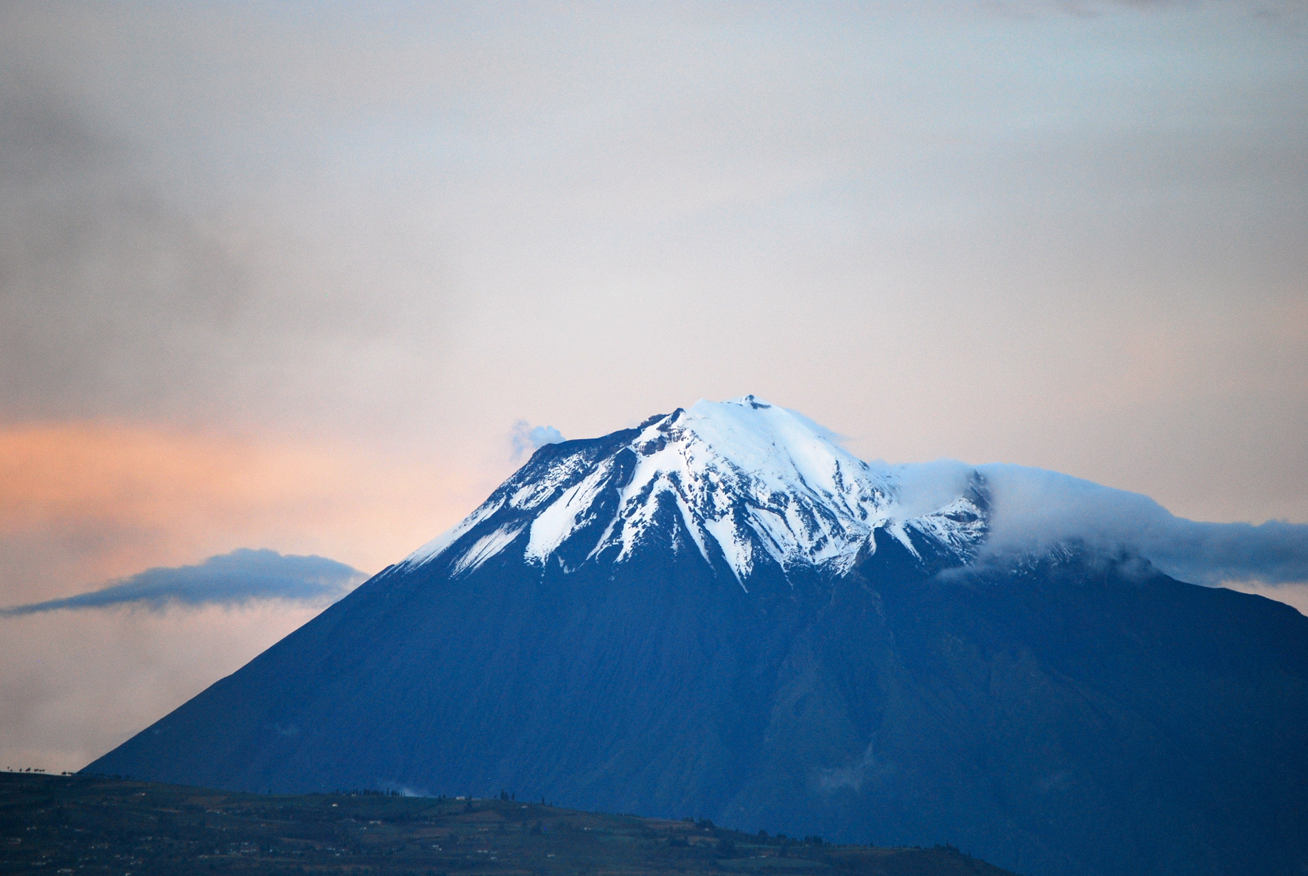 David Torres Costales (Wikipedia) |
 |  |
Cotopaxi Panoramic
Simon Matzinger (Wikipedia)

![]()
Cotopaxi (Spanish pronunciation: [kotoˈpaksi]) is an active stratovolcano in the Andes Mountains, located near Latacunga city of Cotopaxi Province, about 50 km (31 mi) south of Quito, and 31 km (19 mi) northeast of the city of Latacunga, Ecuador.[1] It is the second highest summit in Ecuador (after Chimborazo), reaching a height of 5,897 m (19,347 ft). Cotopaxi is among the highest active volcanoes in the world.
Cotopaxi is known to have erupted 87 times, resulting in the creation of numerous valleys formed by lahars (mudflows) around the volcano.[2] An ongoing eruption began on 21 October 2022.[3]
At the end of February 2023, the Geophysical Institute of Ecuador reported that Cotopaxi had produced around 8,000 earthquakes since October 21, 2022, amounting to 1,600 events per month.[4]
Description
On a clear day, Cotopaxi is clearly visible on the skyline from Latacunga and Quito.[5] It is part of the chain of volcanoes around the Pacific Plate known as the Pacific Ring of Fire. It has an almost symmetrical cone that rises from a highland plain of about 3,800 m (12,470 ft), with a width at its base of about 23 km (14 mi).[6] It has one of the few equatorial glaciers in the world, which starts at the height of 5,000 m (16,400 ft). At its summit, Cotopaxi has an 800 m × 550 m (2,620 ft × 1,800 ft) wide crater which is 250 m (820 ft) deep. The crater consists of two concentric crater rims, the outer one being partly free of snow and irregular in shape. The crater interior is covered with ice cornices and rather flat. The highest point is on the outer rim of the crater on the north side.
History Name
According to locals who speak Quechua, coto means ‘neck’ and paxi means ‘moon’ (Quechua q’oto ‘throat’ + Aymara phakhsi ‘moon’).[7][8] This refers to the crater of Cotopaxi that looks like a crescent moon. The mountain was honored as a sacred mountain by local Andean people, even before the Inca invasion in the 15th century. It was worshiped as rain sender, which served as the guarantor of the land’s fertility, and at the same time its summit was revered as a place where gods lived.
This article uses material from the Wikipedia article Cotopaxi, which is released under the Creative Commons Attribution-Share-Alike 4.0 International License (view authors).
 I | 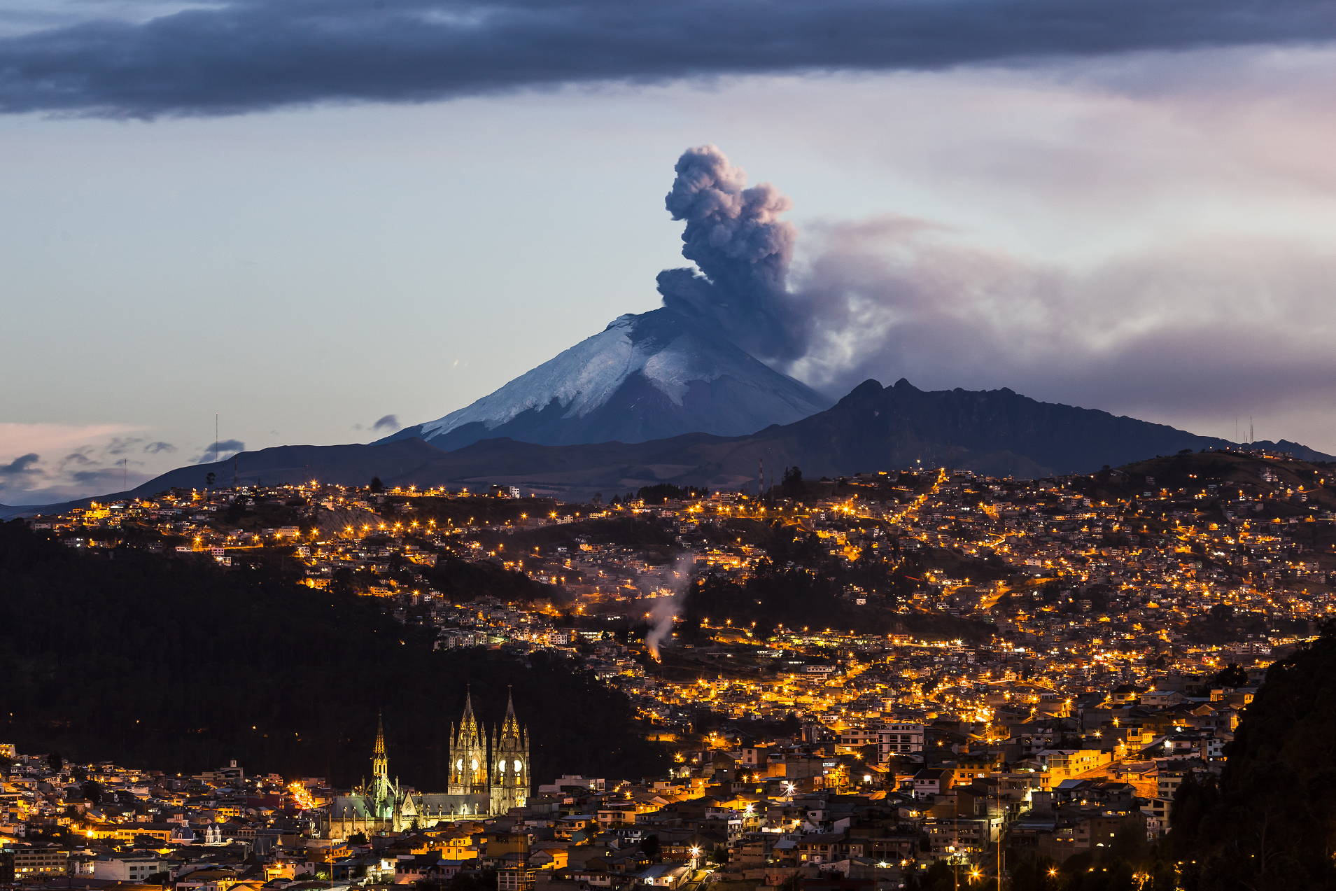 PatricioHidalgoP (iStock) |
 Ernesto (Overlandtheamericas) | 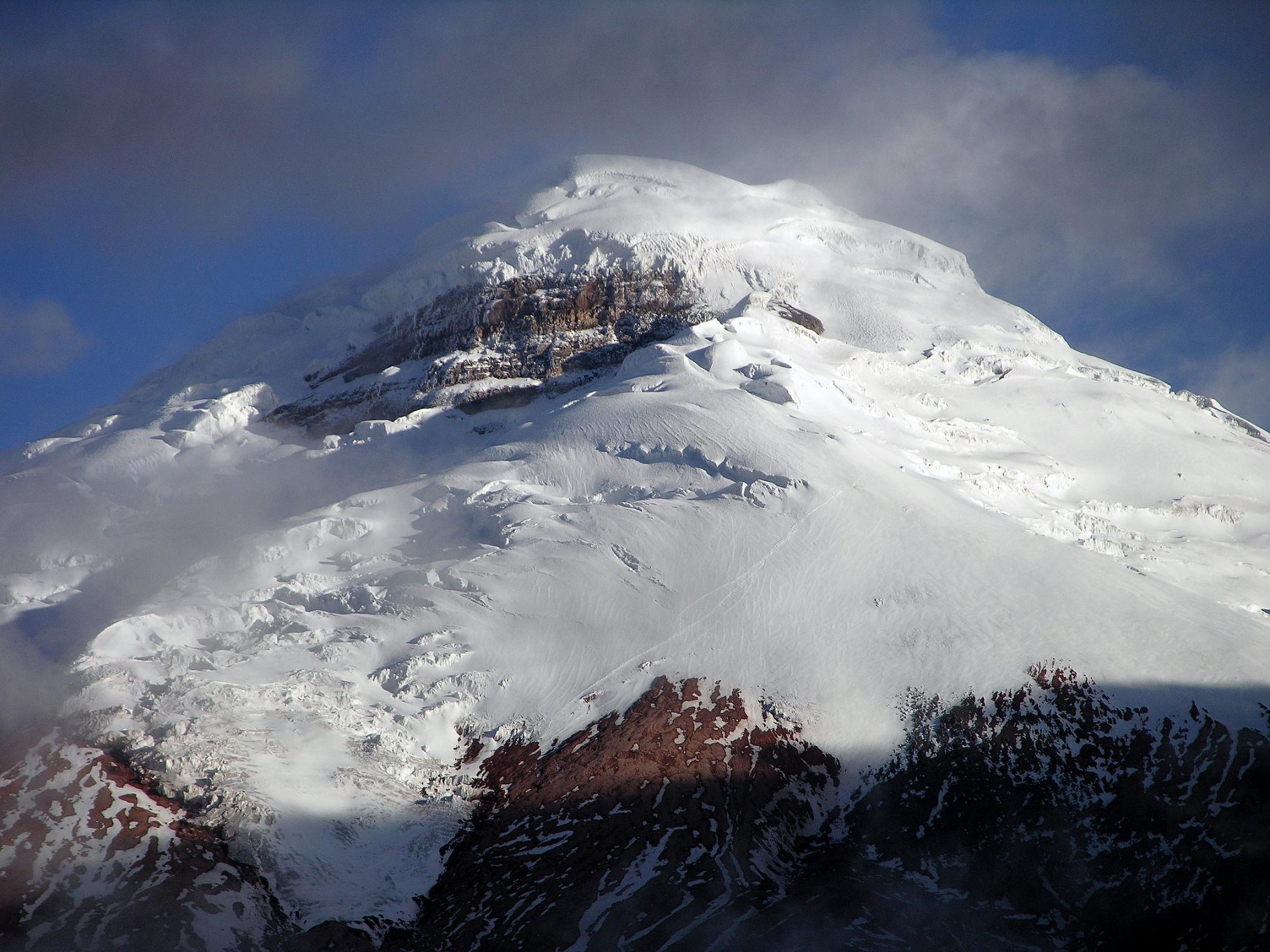 Jerome Ryan I |
 Marktucan (iStock) | 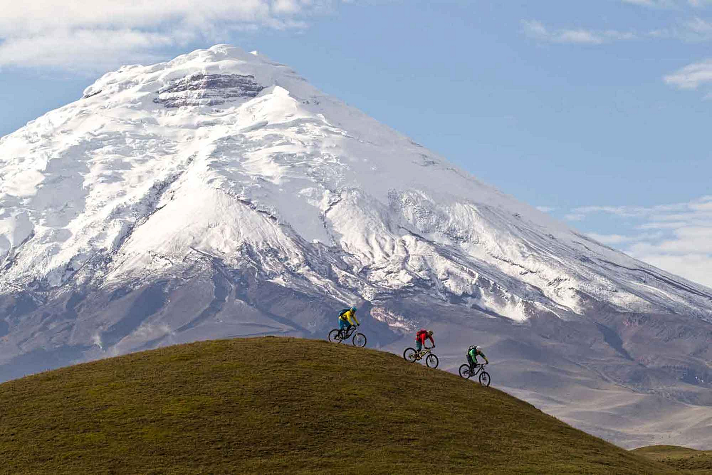 I |
 |  |
![]()
![]()
Antisana is a stratovolcano of the northern Andes, in Ecuador. It is the fourth highest volcano in Ecuador, at 5,753 metres (18,875 ft), and is located 50 kilometres (31 mi) SE of the capital city of Quito.
Antisana presents one of the most challenging technical climbs in the Ecuadorian Andes.[citation needed] Next to the Pichincha, Cotopaxi, Tungurahua and Chimborazo, the Antisana belongs to the five volcanic mountains that the Prussian-born explorer Alexander von Humboldt tried to climb in 1802 during his American journey.[3]
This article uses material from the Wikipedia article Antisana, which is released under the Creative Commons Attribution-Share-Alike 4.0 International License (view authors).
 PatricioHidalgoP (iStock) | 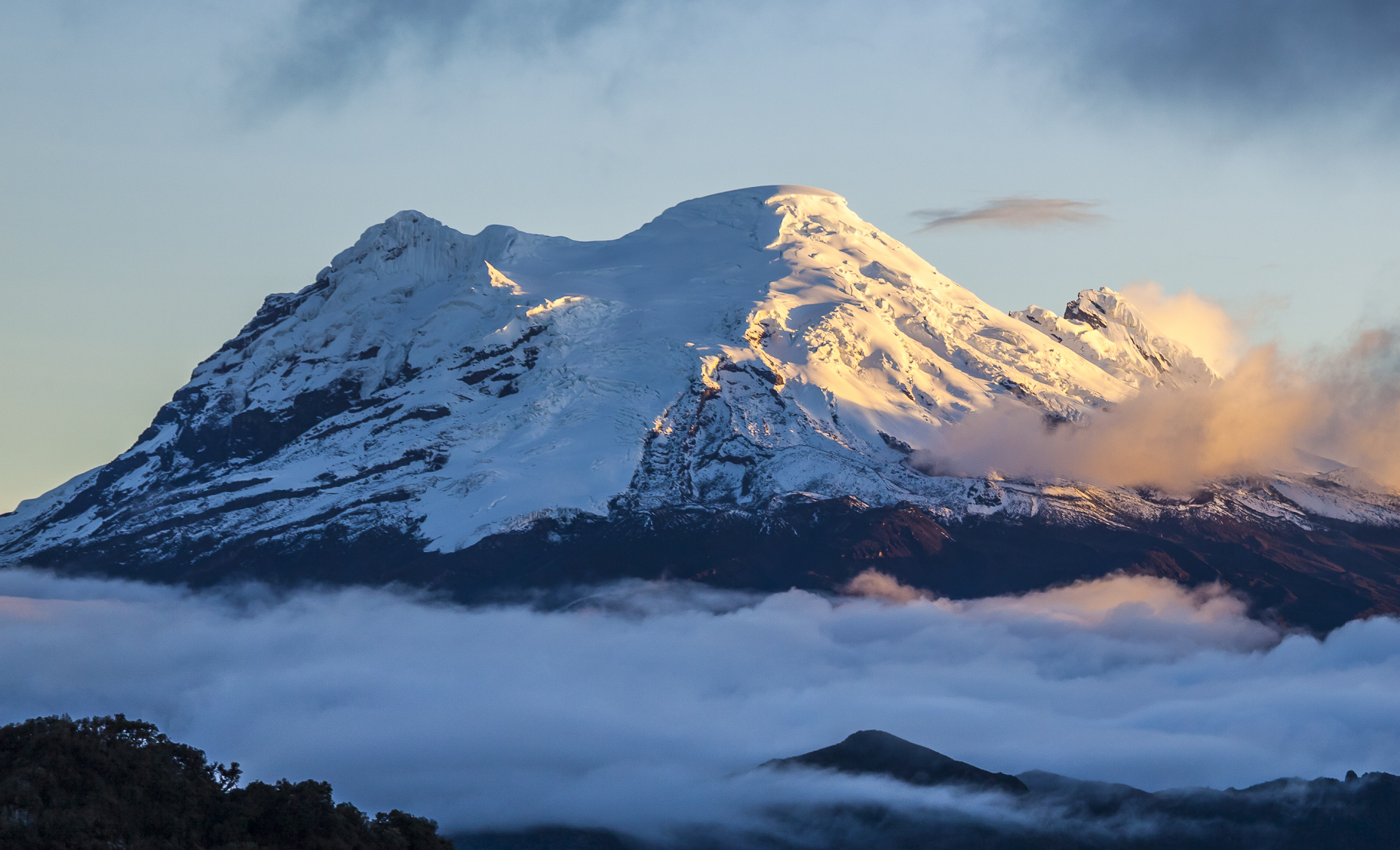 PatricioHidalgoP (iStock) |
 Cavan Images (iStock) | 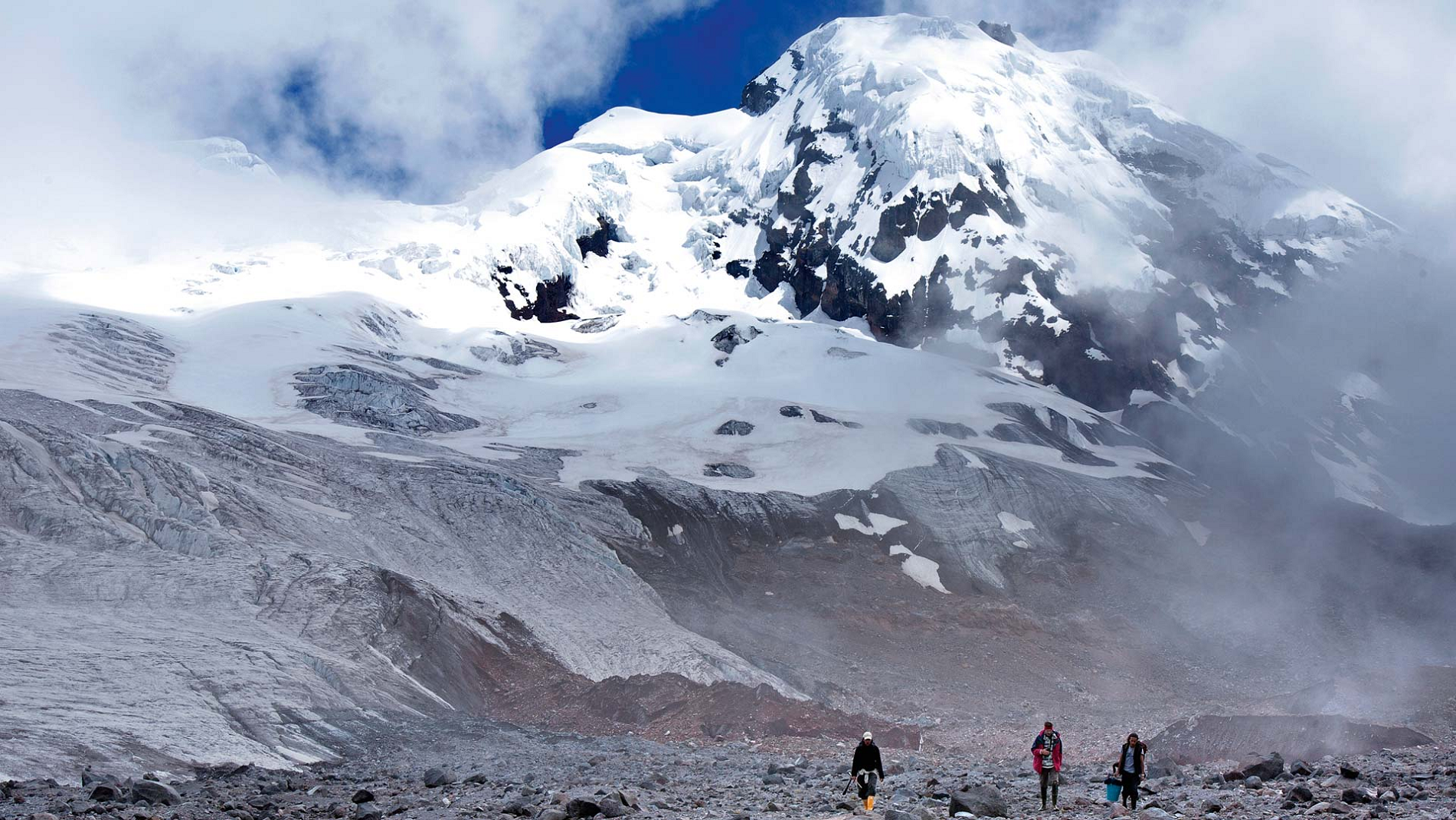 Ilán Greenfield (Nan Magazine) |

![]()
Cayambe or Volcán Cayambe is a volcano in Ecuador, in the Cordillera Central, a range of the Ecuadorian Andes. It is located in Pichincha Province, some 70 km (43 mi) northeast of Quito. It is the third-highest mountain in Ecuador, at an elevation of 5,790 m (18,996 ft) above sea level.[2]
Cayambe, which has a permanent snow cap, is a Holocene compound volcano which last erupted in March 1786.[1] At 4,690 metres (15,387 ft), its south slope is the highest point in the world crossed by the Equator, and the only point on the Equator with snow cover. The ice cap covers an area of about 22 km2 (8 sq mi) and there are glaciers on the eastern flank descending to about 4,400 m (14,400 ft), whereas those on the drier western flank reach about 4,700 m (15,400 ft).[2] The volcano and most of its slopes are within the Cayambe Coca Ecological Reserve.[3]
Cayambe was first climbed by British adventurer Edward Whymper and his two Italian guides and companions Jean-Antoine Carrel and Louis Carrel in 1880.[4] They made first ascents of most of the volcanoes in Ecuador. Cayambe remains a favorite of mountaineers today. The main route runs through a much-fissured terrain of moderate inclination, and only in its final part does the slope increase to 45°. There is a formidable bergschrund to cross at about 5,500 m (18,000 ft). On the final stages, there are many cracks and seracs to be overcome, and there are extensive views from the summit.[5]
Cayambe was considered especially beautiful by Alexander von Humboldt, whose writings in turn inspired Frederic Edwin Church to paint the peak, setting the stage for his painting The Heart of the Andes.[6]
Cayambe’s peak is the point of Earth‘s surface farthest from its axis; thus, it rotates the fastest as Earth spins.[7]
This article uses material from the Wikipedia article Cayambe which is released under the Creative Commons Attribution-Share-Alike 4.0 International License (view authors).
 Diegoandrade (Wikipedia) | 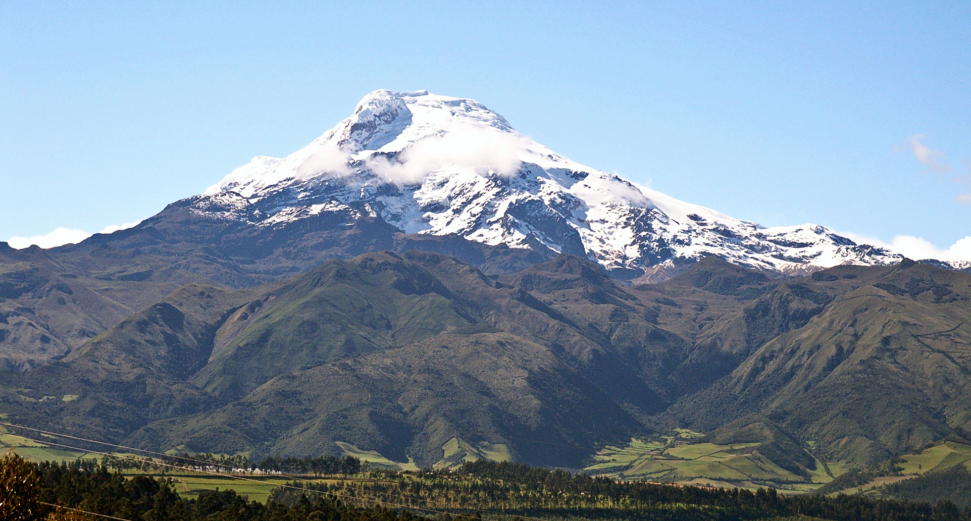 Kryptonit (Wikipedia) I |
 I I | 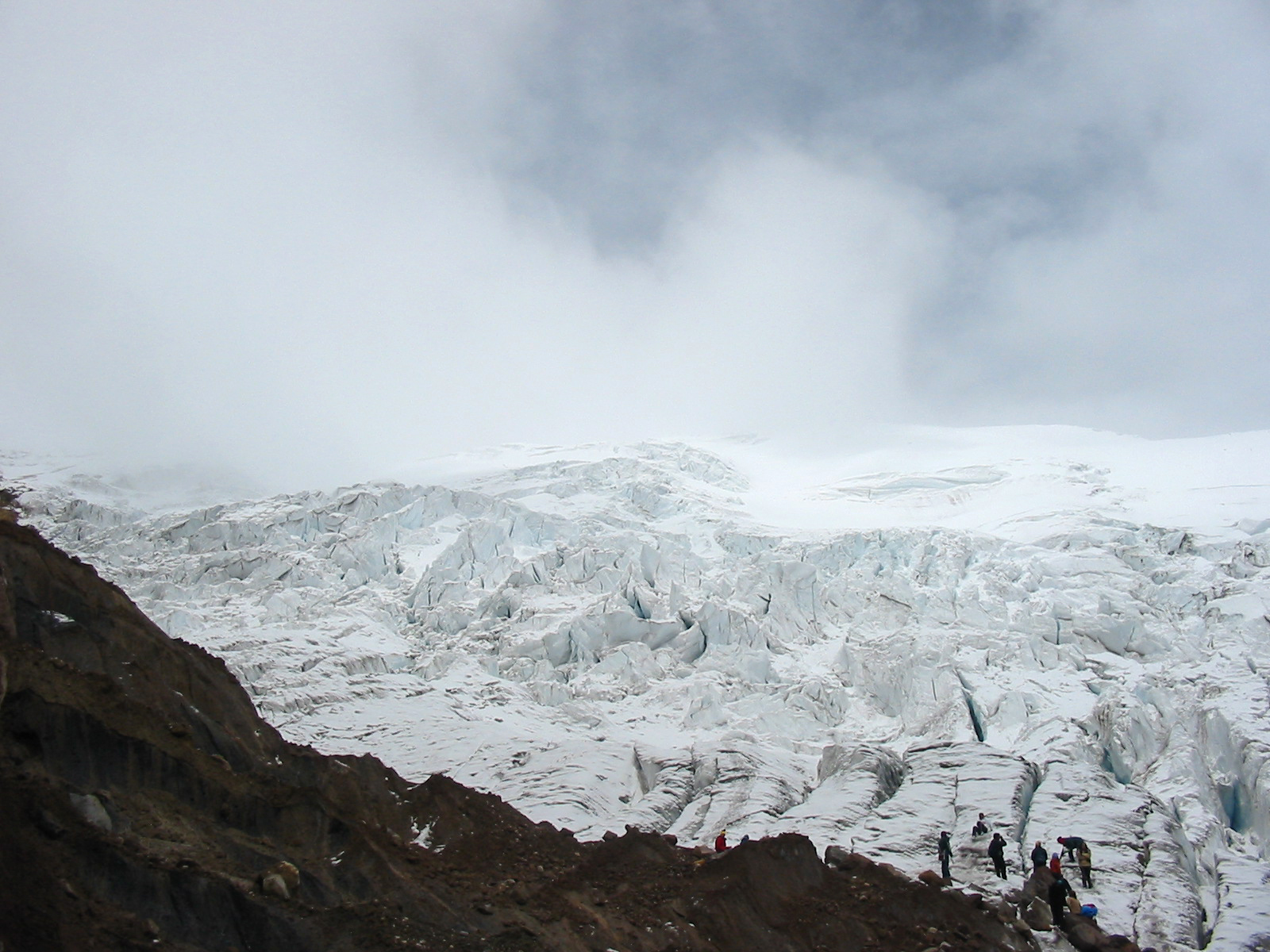 Martin Iturbide Wikipedia |
![]()
![]()
The Illinizas are a pair of volcanic mountains that are located in the north of Latacunga, Cotopaxi, Ecuador. They are located in the Illinizas Ecological Reserve (Spanish: Reserva Ecológica Los Illinizas). These twin mountains are separated by a saddle that is about a kilometer long. The peaks are among the highest in Ecuador, with Illiniza Sur standing slightly taller than Illiniza Norte, its northern counterpart, at 5245 metres and 5126 metres respectively.[4]
Most guidebooks (for example, Lonely Planet Ecuador, Ecuador: A Climbing Guide) spell the mountain with only one “l” as in Iliniza. The name Illinizas is derived from the Kunza words for “masculine hill.”[5]
Whilst Illiniza Sur (the southern peak) is a more difficult climb due to its glacial nature, Illiniza Norte requires some climbing expertise,[6] and may be climbed as a trekking peak. A guide is still recommended, however, as the path becomes hard to navigate as it approaches the summit.
There is a rustic refuge located between the north and south peaks. It can be reached in one hour by car from El Chaupi, followed by a three-hour climb. The refuge has gas stoves, pots and pans and bunk beds. It is necessary to bring warm sleeping bags and food, but water is available to be boiled.
The Englishman Edward Whymper tried and failed twice to make the first ascent of Iliniza Sur. It was climbed for the first time in 1880 by his two Italian guides Jean-Antoine Carrel and Louis Carrel. The first ascent of Iliniza Norte was made in 1912 by the Ecuadorians Nicolás Martínez and Alejandro Villavicencio.[3]
This article uses material from the Wikipedia article Illiniza, which is released under the Creative Commons Attribution-Share-Alike 4.0 International License (view authors).
 Diegoandrade (Wikipedia) | 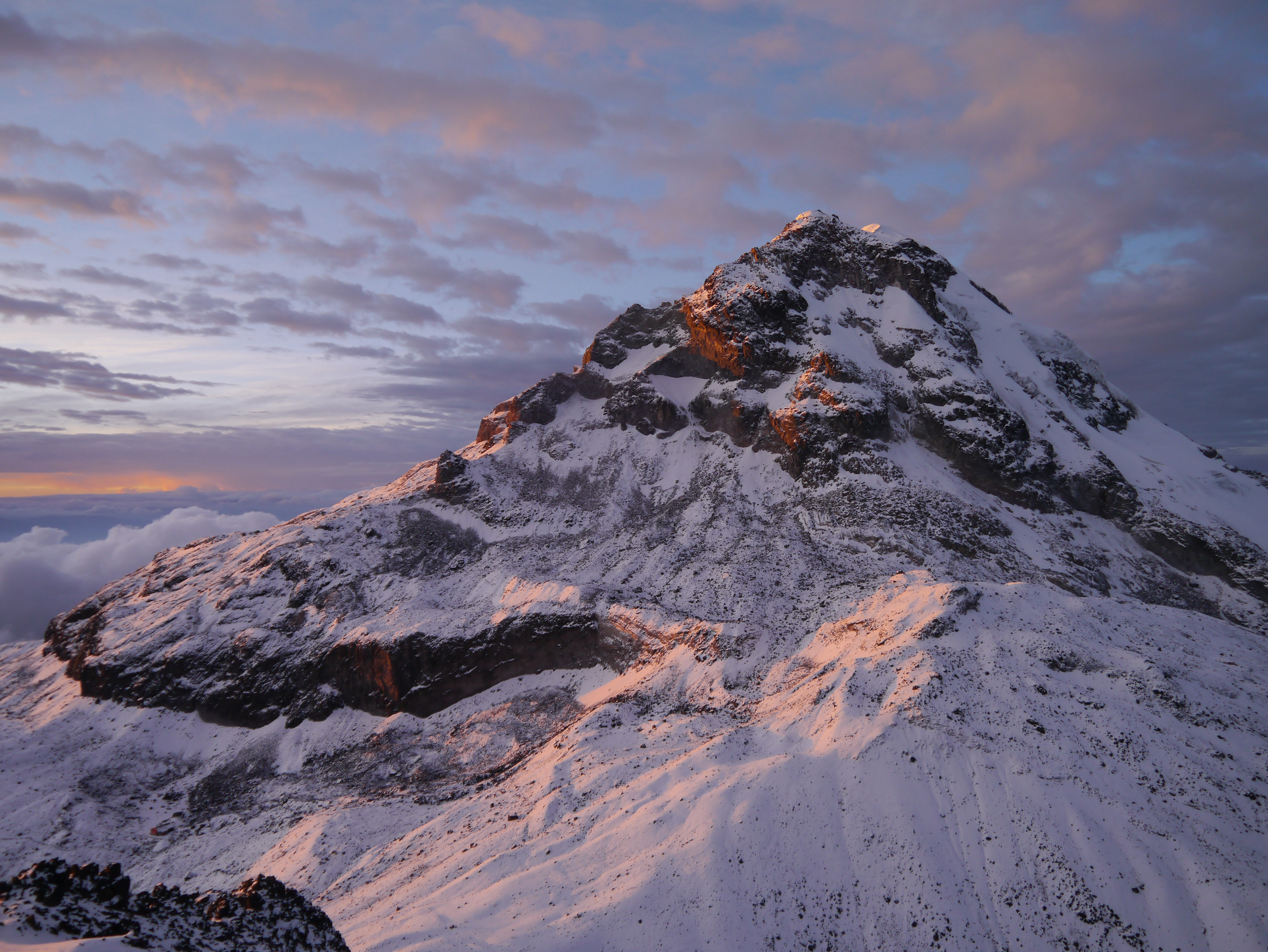 M M-Wikipedia I |
 Friedrich Kircher (Wikipedia) | 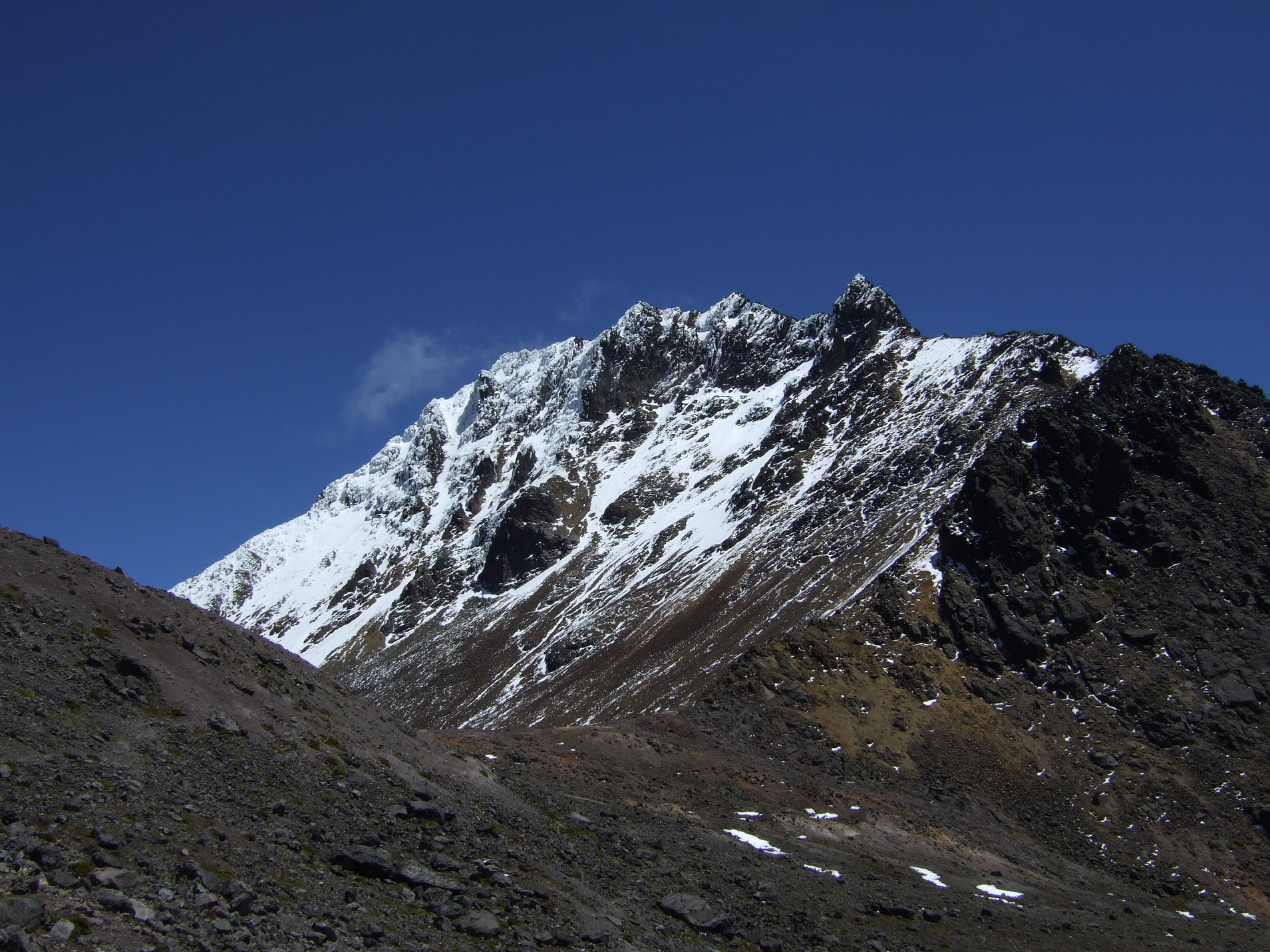 Lion Hirth (Wikipedia) I |
![]()
![]()
 Diegoandrade (Wikipedia) | 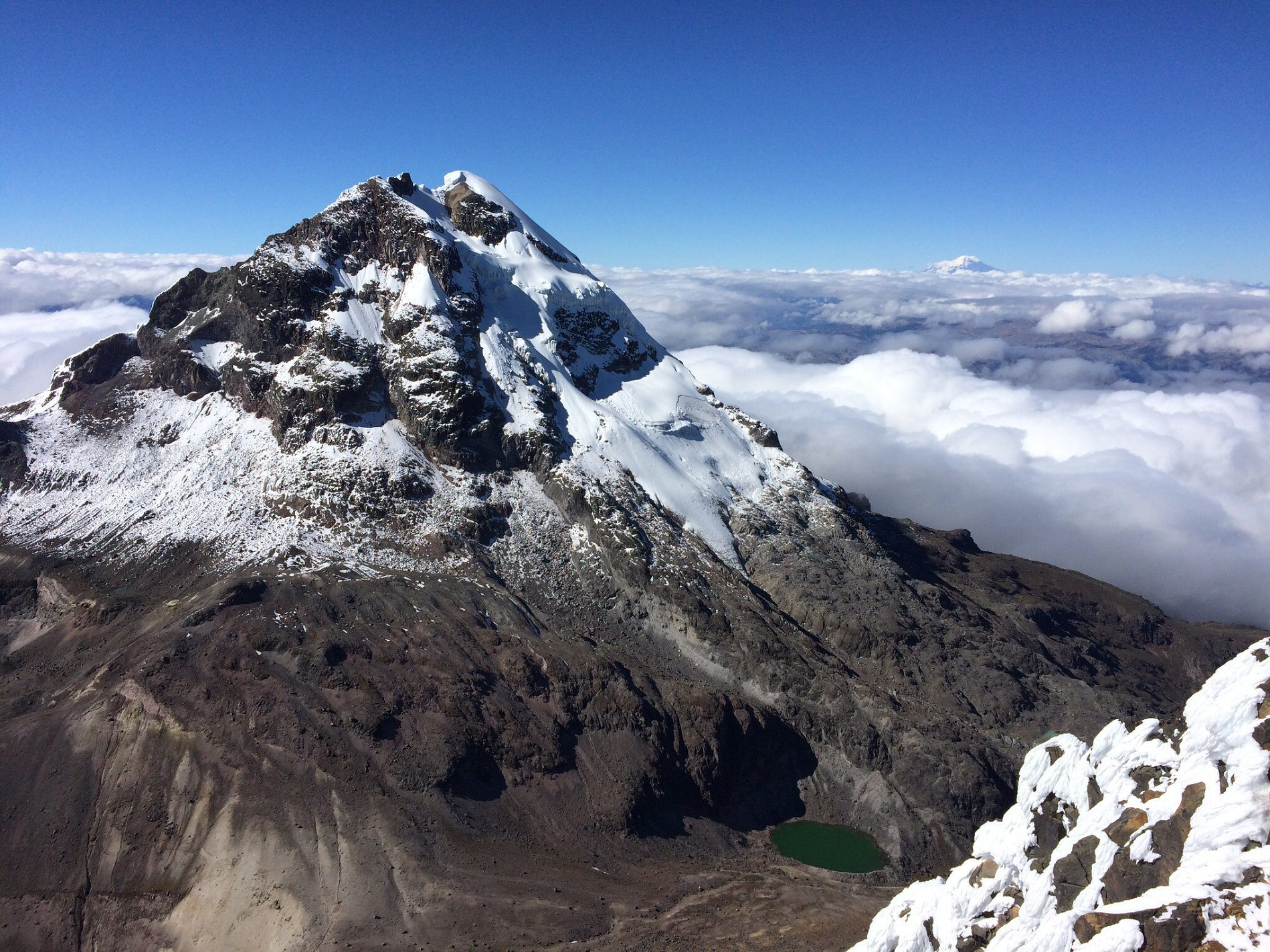 I I |
![]()
![]()
Pichincha is a stratovolcano in Ecuador. The capital Quito wraps around its eastern slopes.
The two highest peaks of the mountain are Wawa Pichincha (Kichwa wawa child, baby / small,[3] Spanish spelling Guagua Pichincha) (4,784 metres (15,696 ft)) and Ruku Pichincha (Kichwa ruku old person,[3] Spanish Rucu Pichincha) (4,698 metres (15,413 ft)). The active caldera is in Wawa Pichincha on the western side of the mountain.[4]
Description
Both peaks are visible from the city of Quito and both are popular acclimatization climbs. Wawa Pichincha is usually accessed from the village of Lloa outside of Quito. Ruku is typically accessed from the TelefériQo on the western side of Quito.
In October 1999, the volcano erupted and covered the city with several inches of ash. Before that, the last major eruptions were in 1553[5] and in 1660, when about 30 cm (12 in) of ash fell on the city. The province in which it is located was named for the mountain. This is also the case for many of the other provinces in Ecuador (including Cotopaxi, Chimborazo, and Imbabura).
Geography and geology
Dracula vampira, a type of orchid, can be found on the volcano, at an altitude of between 1,900–2,200 m (6,200–7,200 ft) above sea level.[6][7]
Eruptions
In 1660, Pichincha underwent a Plinian eruption,[8] spreading ash over 1,000 kilometres (621 mi), with over 30 centimetres (12 in) of ash falling on Quito.[1]
The most recent significant eruption began in August 1998.[1] On March 12, 2000, a phreatic eruption killed two volcanologists who were working on the lava dome.[9]
This article uses material from the Wikipedia article Pichincha (volcano), which is released under the Creative Commons Attribution-Share-Alike 4.0 International License (view authors).
 Annom (Wikipedia) |  Timwryan (Wikipedia) |
 Jeremy Scott Foster (travelfreak.com) | 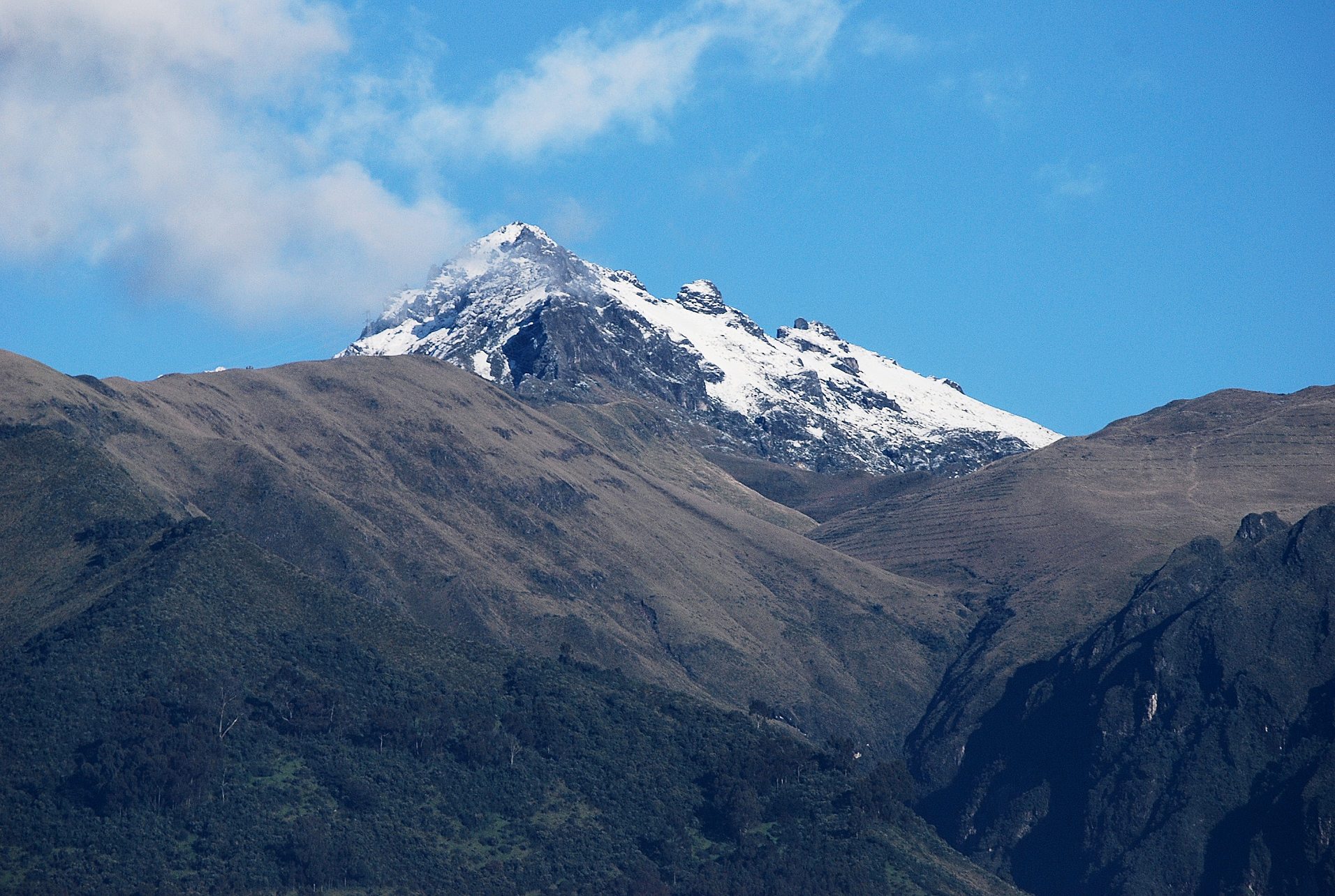 I I |
![]()
![]()
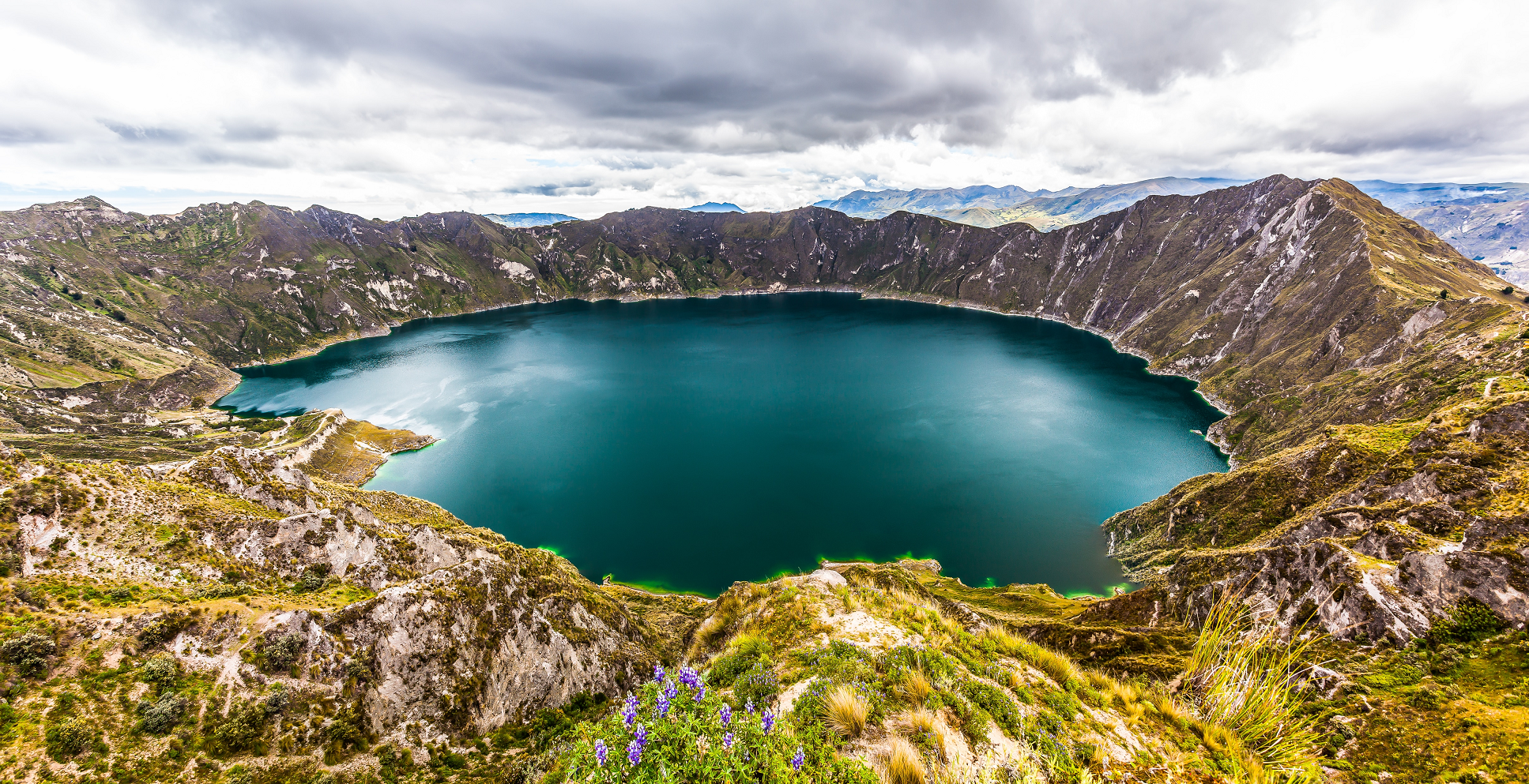
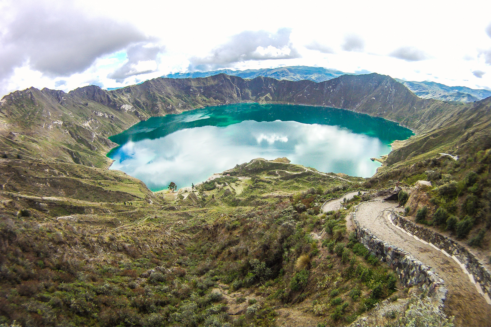
Quilotoa (Spanish pronunciation: [kiloˈto.a]) is a water-filled crater lake and the most western volcano in the Ecuadorian Andes. The 3-kilometre (2 mi)-wide caldera was formed by the collapse of this dacite volcano following a catastrophic VEI-6 eruption about 800 years ago, which produced pyroclastic flows and lahars that reached the Pacific Ocean, and spread an airborne deposit of volcanic ash throughout the northern Andes.[1] This last eruption followed a dormancy period of 14,000 years and is known as the 1280 Plinian eruption.[2] The fourth (of seven) eruptive phase was phreatomagmatic, indicating that a Crater lake was already present at that time.[3] The caldera has since accumulated a 250-metre-deep (820 ft) crater lake, which has a greenish color as a result of dissolved minerals. Fumaroles are found on the lake floor and hot springs occur on the eastern flank of the volcano.[1]
Quilotoa is a site of growing popularity. The route to the “summit” (the small town of Quilotoa) is generally traveled by hired truck or bus from the town of Zumbahua 17 kilometres (11 mi) to the South, or more commonly by bus from Latacunga. Visitors have to pay two US dollars each to enter Quilotoa. There are a number of simple hostels in the immediate area offering services such as mules and guides. Activities include a four to five-hour hike around the caldera (whose diameter is just over 3 kilometres (2 mi)). The caldera rim is highly irregular and reaches its maximum elevations 3,810 metres (12,500 ft) to the N, 3,894 metres (12,776 ft) to the NW and 3,915 metres (12,844 ft) to the SE, at three lava domes. The 10-kilometre (6 mi) hike is sandy and steep in places and can be quite taxing, particularly if there is fog.
It is a half-hour hike down from the viewpoint (and 1- to 2-hour hike back up the 280-metre (919 ft) vertical ascent), and very basic lodging down in its bowl. Camping is permitted at the bottom of the crater, but there is no potable water (except half-litre bottles sold at the hostel)[4]
The lake surface is located at 3,500 metres (11,483 ft) asl. The total volume of water stored in Lake Quilotoa is 0.35 cubic kilometres (0.084 cu mi). According to local inhabitants, the lake level has been slowly declining over the last 10 years. Travertine deposits occur along the shore up to 10 metres (33 ft) above the lake level (in the year 2000).[3]
The village of Quilotoa and the associated crater is also a popular destination within the Quilotoa Loop and is a common starting point for the “Quilotoa Traverse”, a multi-day village to village hiking route.
This article uses material from the Wikipedia article Quilotoa, which is released under the Creative Commons Attribution-Share-Alike 4.0 International License (view authors).
 |  |
 Annom (Wikipedia) |  I |
![]()
![]()
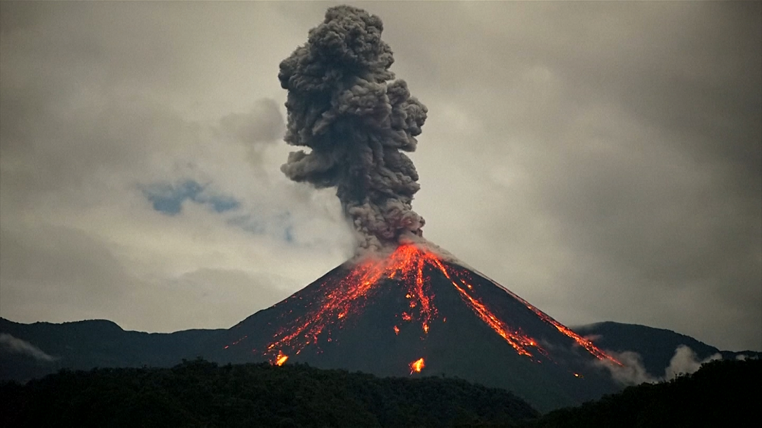
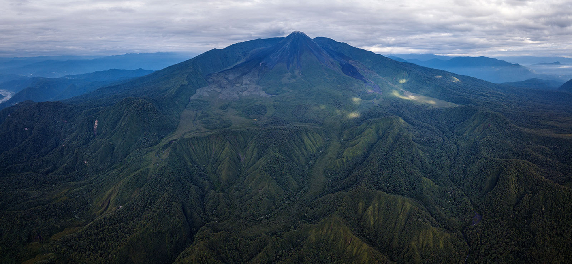
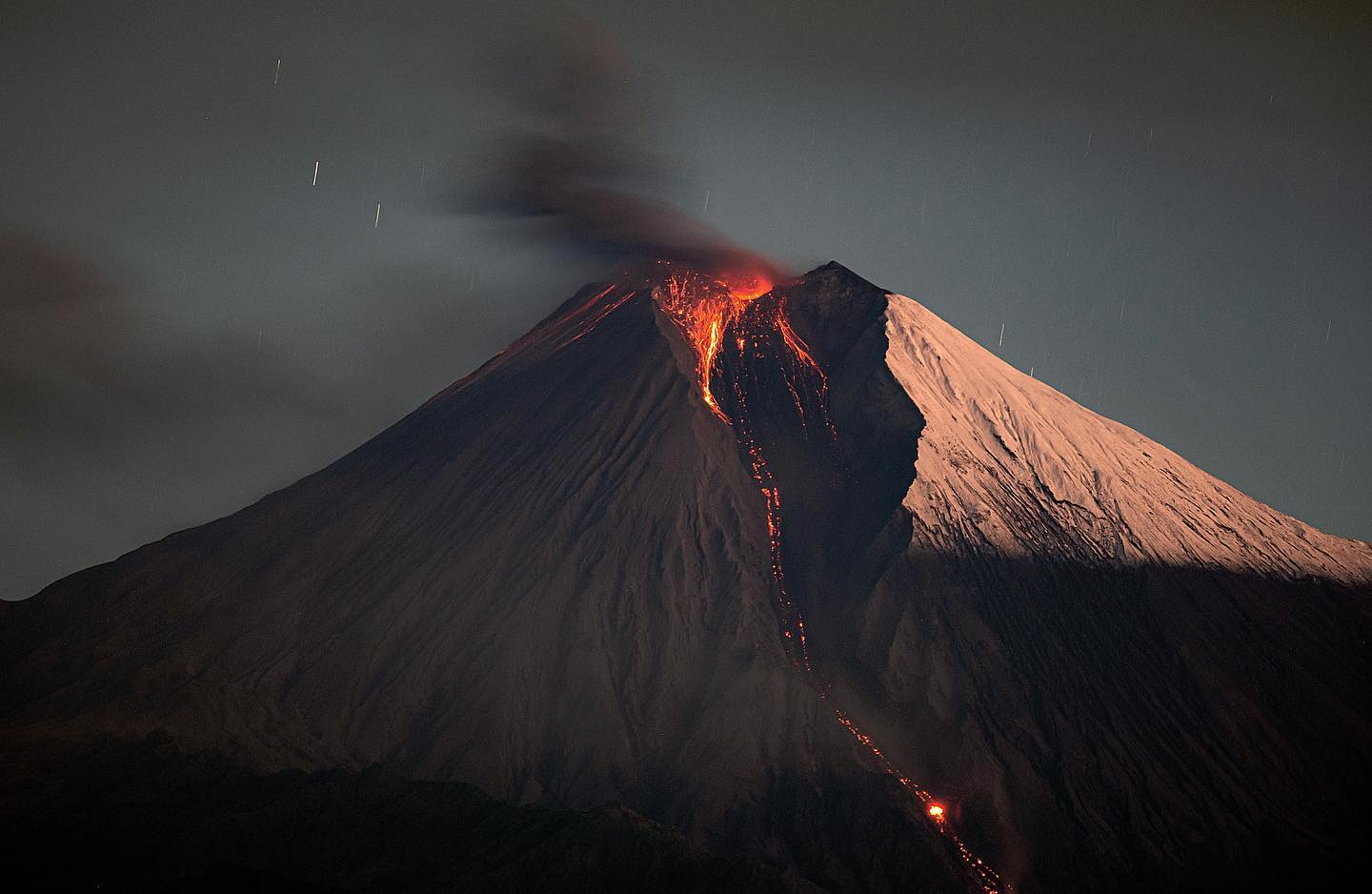
Reventador is an active stratovolcano which lies in the eastern Andes of Ecuador. It lies in a remote area of the national park of the same name, which is Spanish for “exploder”. Since 1541, it has erupted over 25 times, although its isolated location means that many of its eruptions have gone unreported.
The largest historical eruption occurred in 2002.[3] During that eruption, the plume from the volcano reached a height of 17 kilometres (11 mi) and pyroclastic flows proceeded to 7 kilometres (4.3 mi) from the cone. On March 30, 2007, the mountain ejected ash to a height of about 3.2 kilometres (2.0 mi). No injuries or damage were reported.[4] Its most recent eruption began on 27 July 2008,[3] and it has remained in continuing eruption status (intermittent eruptive events without a break of 3 months or more) as of 15 October 2021.[5]
Reventador is part of a chain of volcanoes in the Cordillera Real, much further east than the main volcanic axis of the region. The volcano rises above the jungles of the western Amazon basin and the flanks are densely clad in forests. The volcano has a caldera that is 4 km (2.5 mi) across; there is a wide gap in the caldera wall to the east, formed by a collapse of the structure. There is an unvegetated stratovolcano rising about 1,300 m (4,265 ft) from inside the caldera, and this is the main seat of current volcanic activity. The lavas are andesitic.[6]
Reventador is one of the most active volcanoes in Ecuador. In 2020, there were near daily emissions of clouds of ash rising one or two kilometres into the air, occasional crater incandescence, and frequent avalanches of incandescent blocks.[4]
This article uses material from the Wikipedia article Reventador, which is released under the Creative Commons Attribution-Share-Alike 4.0 International License (view authors).
 I I | 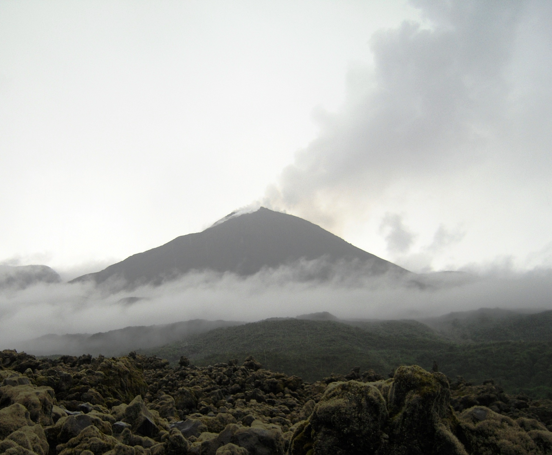 Don Valentino (Wikipedia) |
 M. Rietze | 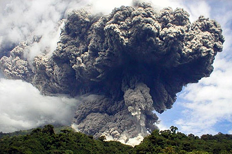 I |

![]()
Sangay (also known as Macas, Sanagay, or Sangai)[8] is an active stratovolcano in central Ecuador. It exhibits mostly strombolian activity. Geologically, Sangay marks the southern boundary of the Northern Volcanic Zone, and its position straddling two major pieces of crust accounts for its high level of activity. Sangay’s approximately 500,000-year-old history is one of instability; two previous versions of the mountain were destroyed in massive flank collapses, evidence of which still litters its surroundings today.
Due to its remoteness, Sangay hosts a significant biological community with fauna such as the mountain tapir, giant otter, Andean cock-of-the-rock and king vulture. Since 1979, its ecological community has been protected as part of the Sangay National Park. Although climbing the mountain is hampered by its remoteness, poor weather conditions, river flooding, and the danger of falling ejecta, the volcano is regularly climbed, a feat first achieved by Robert T. Moore in 1929.
History
Folklore sourced from native people in the region compared Sangay to a lighthouse surrounded by a sea, which represented the dense jungle. The density of the jungle caused people to lose their way, but seeing ash and steam emissions from the volcano would help orient travelers along their way. Scientists have interpreted folklore like this as evidence of frequent and long-lasting eruptive activity at Sangay.[9]
In January 2024, archaeologists announced the discovery of archaeological sites on the east side of the volcano known as the Upano Valley sites. It is estimated that this cluster of urban settlements were inhabited between about 500 BCE to sometime between 300 and 600 CE. Altogether the cities may have reached a population between 15,000 and 100,000 people. They were surrounded by agricultural fields that archaeologist Stéphen Rostain speculates may have been particularly productive because their proximity to Sangay.[10][11]
Seventeen additional archaeological sites had been located prior to the 2024 announcement including potential monuments. An estimated 30,000 people lived in the region before Spanish occupation began in 1534. The Spanish prospected for gold on and around the volcano through the 16th and 17th Centuries and settled the area but expeditions undertaken in the 19th Century noted no inhabitants nearby. Modern development of the eastern side of the volcano began in the early 20th Century.[12]
The volcano and lands surrounding it were placed in a National Wildlife Reserve by the Ecuadorian government in 1975. This became Sangay National Park in 1979, which was expanded in 1992. The United Nations added it to their list of World Heritage Sites in 1983. From 1992 to 2005, poaching and human development led the UN to consider the site as being endangered but removed this status in 2005.[12]
This article uses material from the Wikipedia article Sangay, which is released under the Creative Commons Attribution-Share-Alike 4.0 International License (view authors).
 Eqphos-fotografia (IGEPN) | 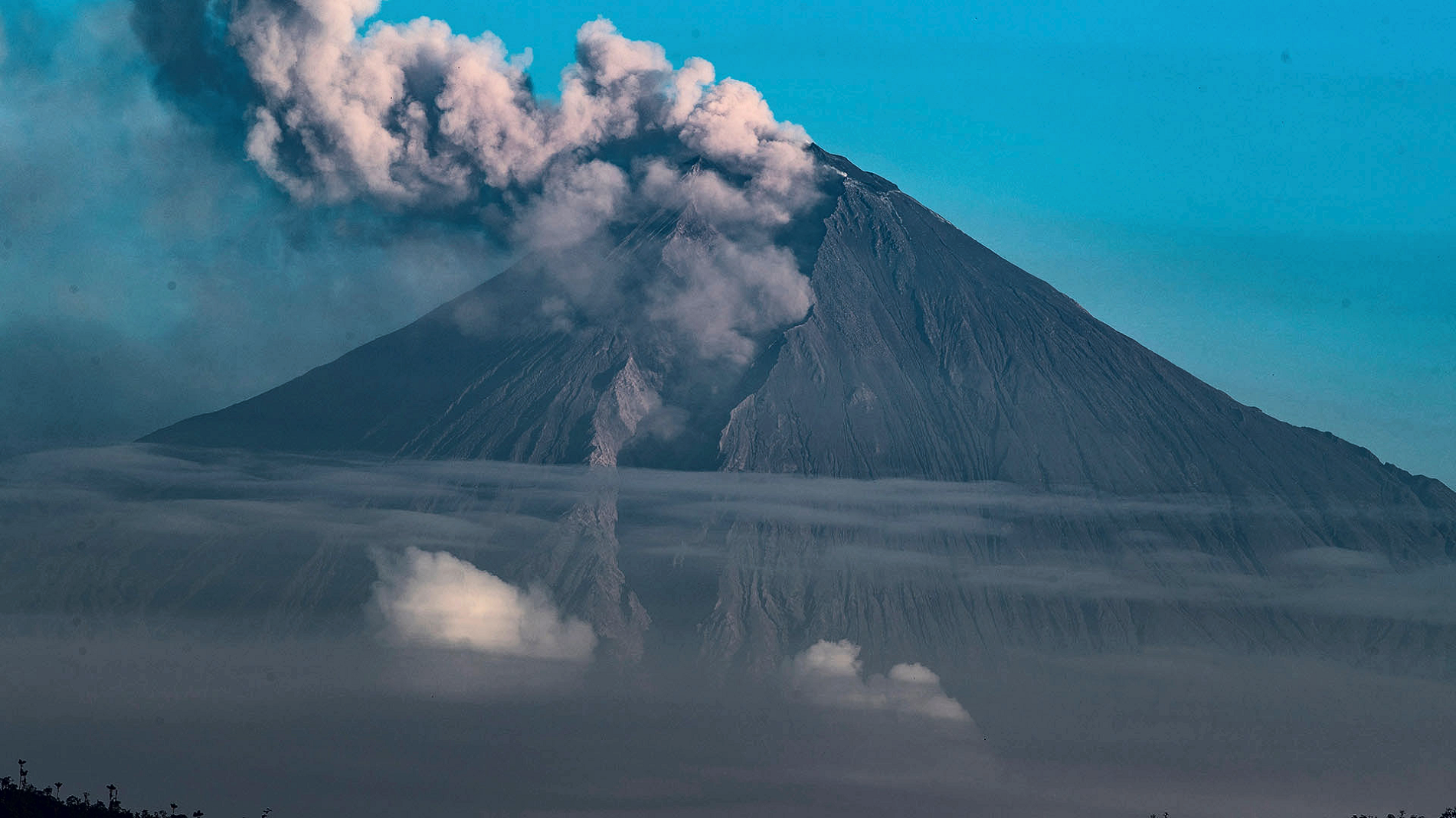 I I |
 I I | 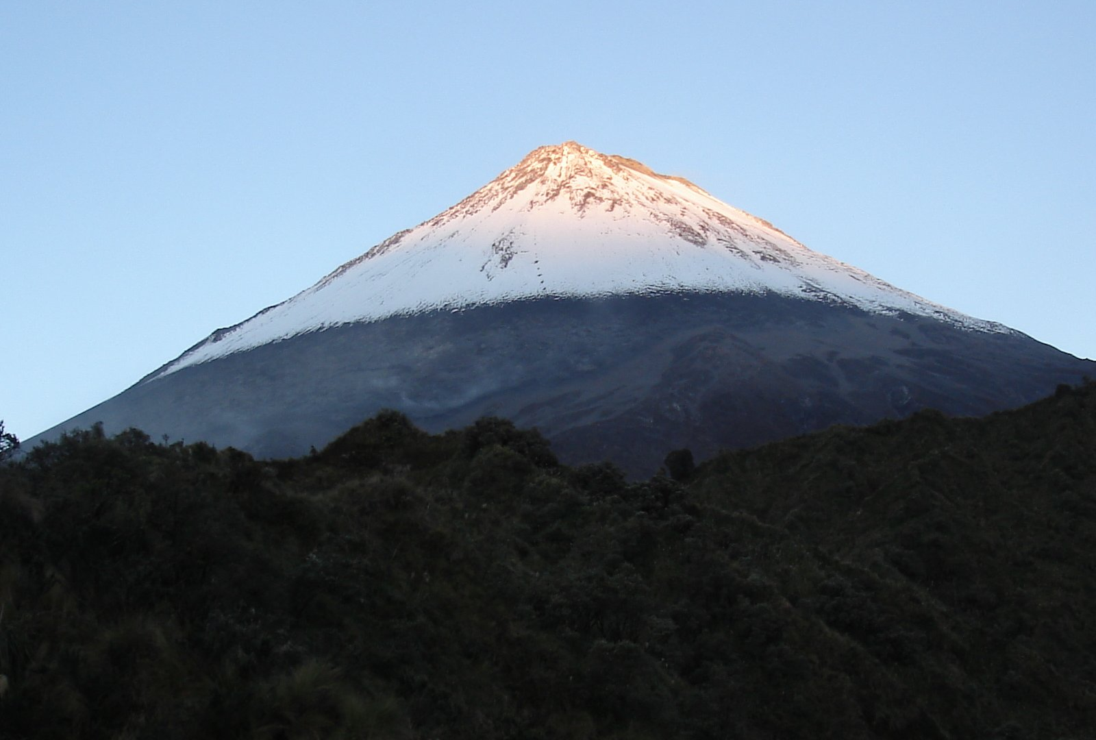 Albert Backer (Wikipedia) |
