
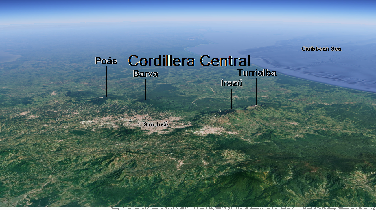
Map of Cordillera Central


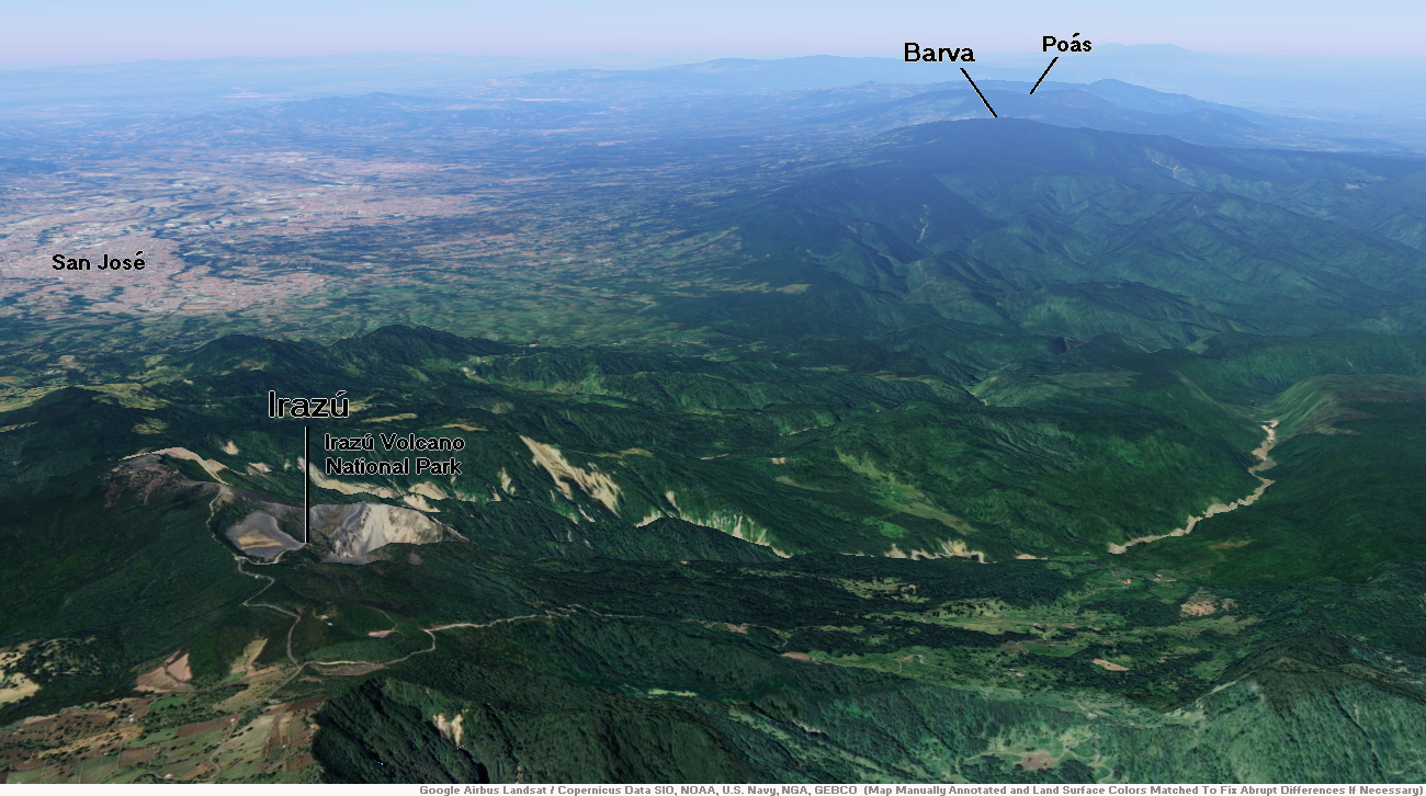
Irazú Region
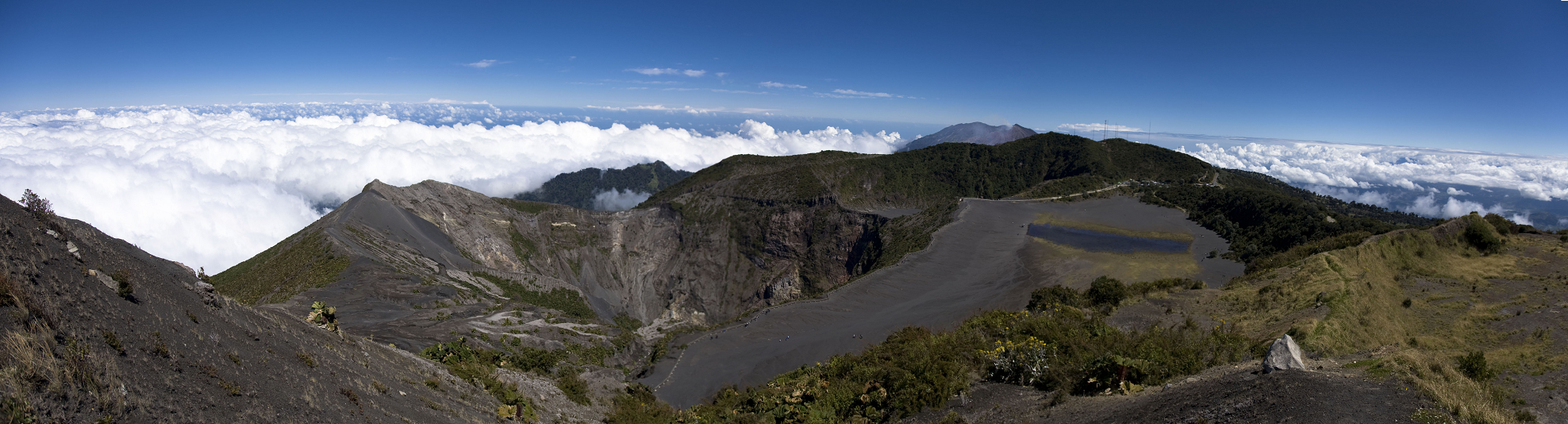
Irazú Panoramic
Rafael Golan (Wikipedia)

![]()
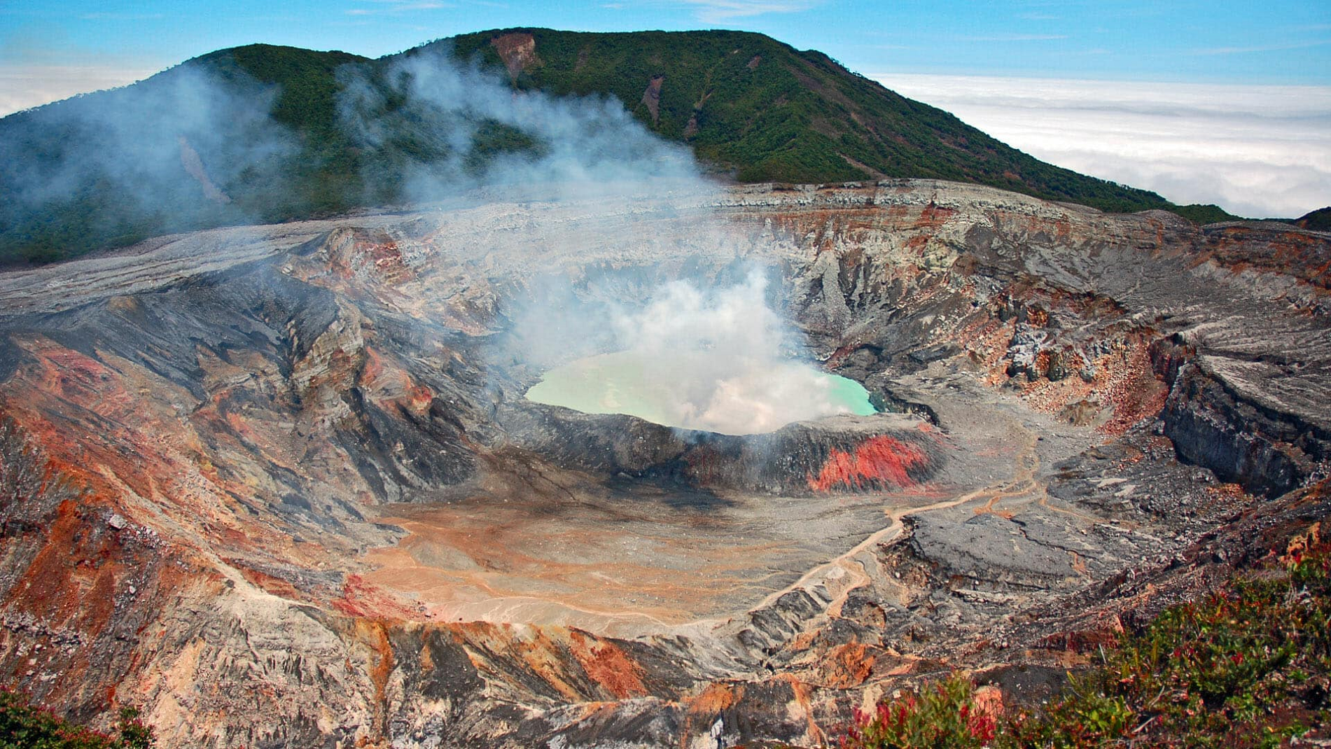
The Irazú Volcano (Spanish: Volcán Irazú) is an active volcano in Costa Rica, situated in the Cordillera Central close to the city of Cartago.
The name might have come from either the combination of “ara” (point) and “tzu” (thunder)[clarification needed] or a corruption of Iztarú, which was the name of an indigenous village on the flanks of the volcano. In Costa Rica it is known by the name of “El Coloso” (the Colossus) due to the catastrophes that it has unleashed in the past.
The volcano’s summit has several craters, one of which contains Diego de la Haya, a green crater lake of variable depth. At 11,260 feet (3,432 m), the Irazú Volcano is the highest active volcano in Costa Rica.[2] It is thus a popular tourist spot. It is easily visited from San José, the Costa Rican capital, with a road leading right up to the summit craters and a weekly bus service to the top. The summit of the volcano also houses a few television transmitters for television stations in San José.
From the top it is possible to see both the Atlantic and Pacific oceans on a clear day.[3] However, such clear days are rare, and the volcano’s summit is usually cloud-covered.
The volcano is contained within the Irazú Volcano National Park, which spreads across 5,705 acres (2,300 ha). The national park contains both primary and secondary montane forests and is home to armadillos, owls, rabbits, foxes, woodpeckers, and hummingbirds.[4]
Geology
The Irazú volcano is a complex volcanic shield. It is the highest active volcano in Costa Rica, and has an area of 500 km2 (190 sq mi). It has an irregular subconic shape, and temperatures at its summit vary between 3 and 17 °C (37 and 63 °F), with a record low of −3 °C(26.6 °F) [5] and a record high of 23.2 °C(73.4 °F).[6] Irazu volcano is a stratovolcano with a summit elevation of 3,432 metres (11,260 ft). Its five craters are easily differentiated.[1] The most important ones, because of their activity, are The Main Crater and the Diego de la Haya crater. The Main Crater is almost circular, has very inclined walls and it measures 1,050 metres (3,440 ft) in diameter and 300 metres (980 ft) deep. The Diego de la Haya crater is 600 metres (2,000 ft) in diameter and 100 metres (330 ft) deep. Other craters are Playa Hermosa, La Laguna, and El Piroclastico.[7]
This article uses material from the Wikipedia article Irazú Volcano, which is released under the Creative Commons Attribution-Share-Alike 4.0 International License (view authors).
 I | 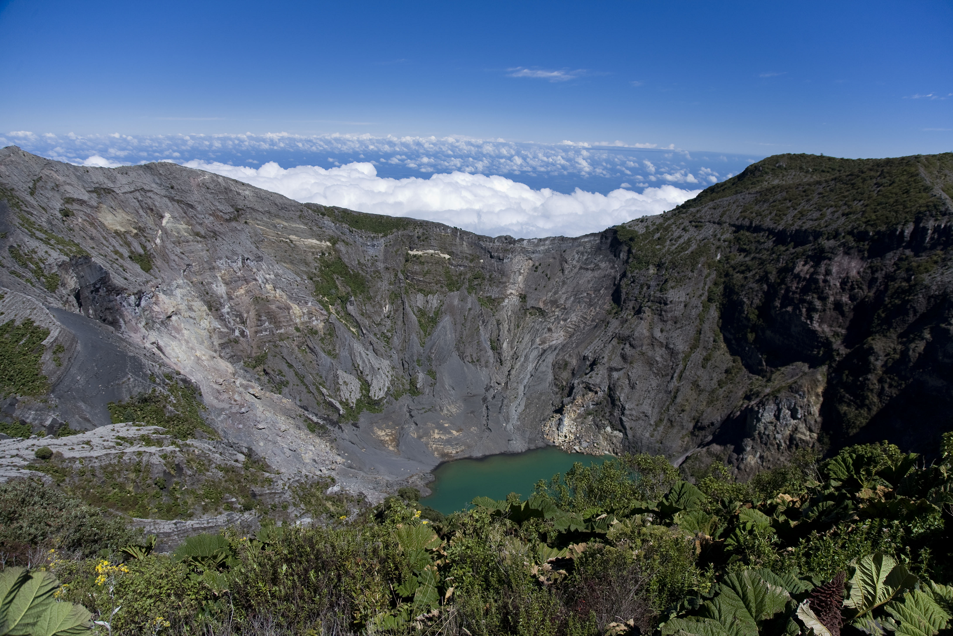 Rafael Golan (Wikipedia) |
![]()
The Poás Volcano (Spanish: Volcán Poás), is an active 2,697-metre (8,848 ft) stratovolcano in central Costa Rica and is located within Poas Volcano National Park. It has erupted 40 times since 1828, with a strong eruption on April 2017—causing the evacuation of visitors and residents.[2] The volcano and surrounding park were closed for nearly 17 months, with a 2.5 kilometer safety perimeter established around the erupting crater.[3] On September 1, 2018, the park was reopened to the public only with limited access to the crater observation area. They have started to require a reservation on the National Park Website before visitation. Adjacent trails to Lake Botos, and the museum at the visitor center remained closed. The volcano erupted briefly twice in September 2019.[4]
Crater lakes
There are two crater lakes near the summit. The northern lake is known as the Laguna Caliente (“hot lagoon”) and is located at a height of 2,300 m in a crater approximately 0.3 km wide and 30 m deep. It is one of the world’s most acidic lakes. The acidity varies after rain and changes in volcanic activity, sometimes reaching a pH of almost 0. The bottom of this lake is covered with a layer of liquid sulfur.[5] Acidity, lake temperature fluctuations, and a complex, toxic sulfur and iron chemistry (conjectured to be like conditions on early Earth and Mars) limits aquatic life to a specially-adapted Acidiphilium bacteria.[6] Above ground, acid gases create acid rain and acid fog, causing damage to surrounding ecosystems and often irritation of eyes and lungs.
Lake Botos, the southern lake, fills an inactive crater, with the latest eruption in 7500 BC. It is cold and clear, and is surrounded by a cloud forest within the National Park boundaries.
Eruptive history
On May 17, 1953, an eruption occurred that started a cycle and lasted until 1956. At least two people were reported missing in this incident.[7]
Poás was near the epicenter of a 6.1-magnitude earthquake in January 2009 that killed at least forty people and affected Fraijanes, Vara Blanca, Cinchona (the most affected area), the capital San José, and the Central Valley region of Costa Rica. There was also an eruptive activity in 2009 involving minor phreatic eruptions and landslides within the northern active crater. Poás eruptions often include geyser-like ejections of crater-lake water.
On February 25, 2014, a webcam from the Volcanological and Seismological Observatory of Costa Rica (OVSICORI) captured the moment a dark cloud exploded about 1,000 feet in the air from a massive crater of the Poás Volcano. This volcano remains active today.[8][9] Poás is one of the 9 volcanoes currently monitored by the Deep Earth Carbon Degassing Project. The project is collecting data on the carbon dioxide and sulfur dioxide emission rates from subaerial volcanoes.[10]
This article uses material from the Wikipedia article Poás Volcano, which is released under the Creative Commons Attribution-Share-Alike 4.0 International License (view authors).
 I I | 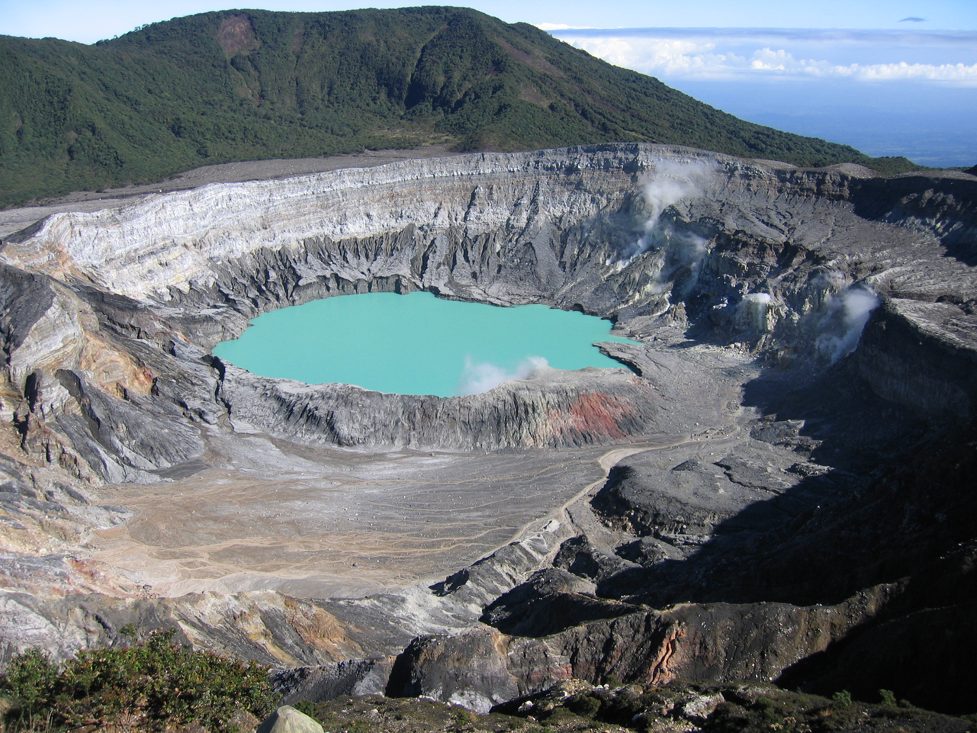 Peter Andersen (Wikipedia) |
![]()
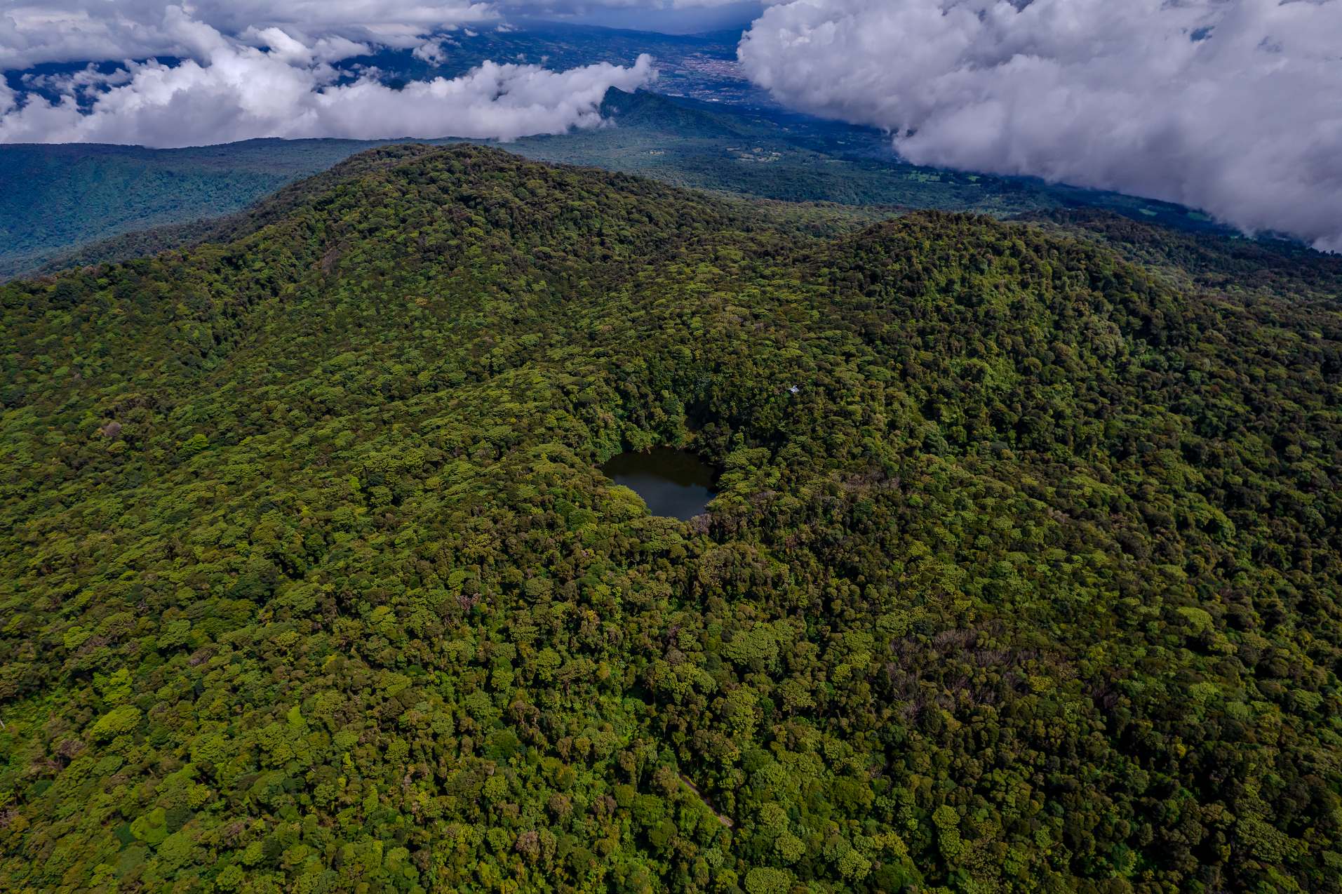
Barva Volcano is an andesitic stratovolcano complex in central Costa Rica, 22 km north of San José, in Heredia Province. On the eastern side of the mountain is a lake in what was the volcanic crater, called “Laguna de Barva”, and on the western side it has three hills on the top which are called “Las Tres Marías”.[1] It is located in the small agricultural community of Sacramento.
Barva has several eruptive centres at its summit and many parasitic cones on its flanks. Its three principal summits visible from the Central Valley give it the common local name of Las Tres Marías (The Three Marys).
Four pyroclastic cones are present within the 2 x 3 km caldera at the central and northwestern part of the summit. The southwestern peak contains four cones, one of which has a crater lake.[1]
The last confirmed eruptive activity at Barva Volcano has been dated to 8,050 years ago. There were reports of eruptions in the 1760s and in 1867, but investigations at the summit did not find evidence to confirm the reports.[1]
This article uses material from the Wikipedia article Barva Volcano, which is released under the Creative Commons Attribution-Share-Alike 4.0 International License (view authors).
 Gianfranco Vivi (iStock) | 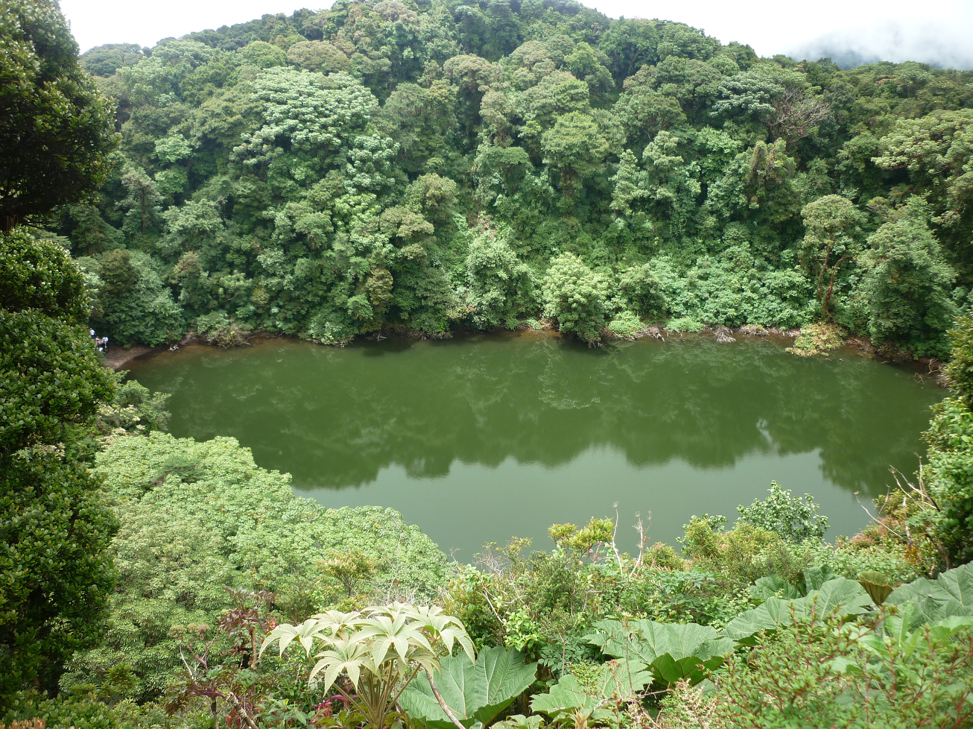 MadriCR (Wikipedia) |
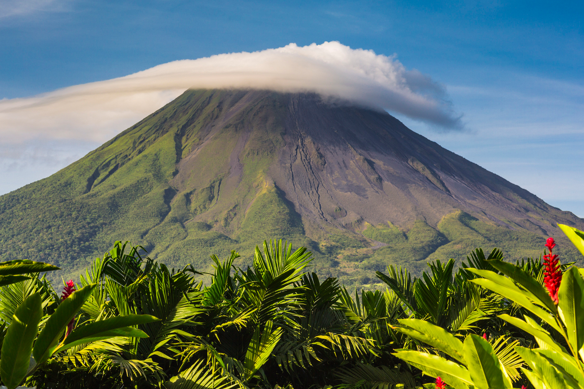
Arenal Panoramic
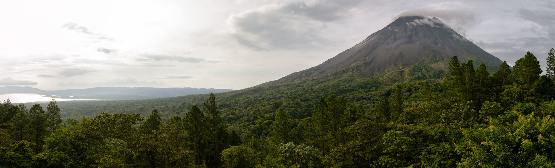
Christophe Meneboeuf (Wikipedia)
![]()
![]()
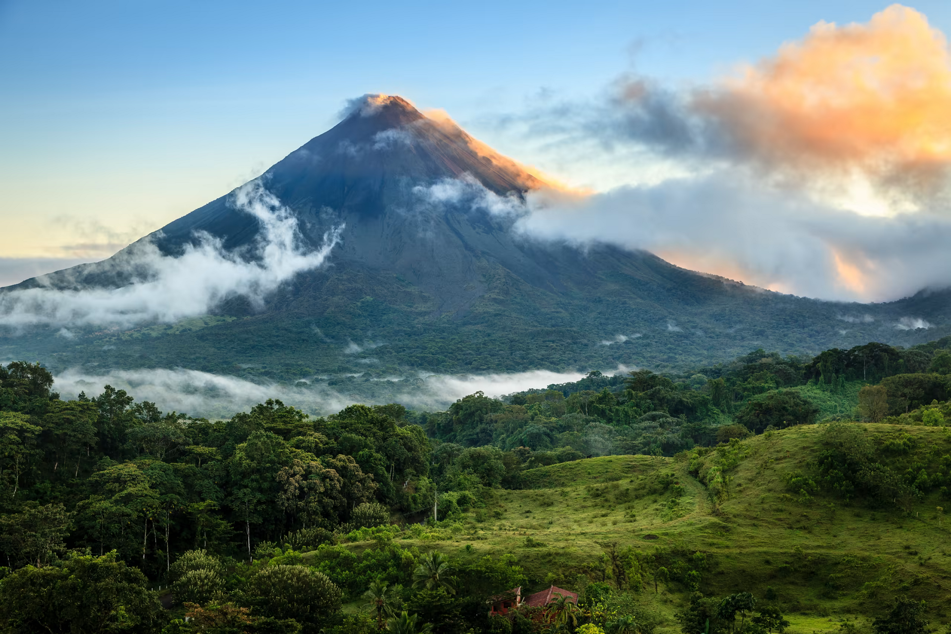
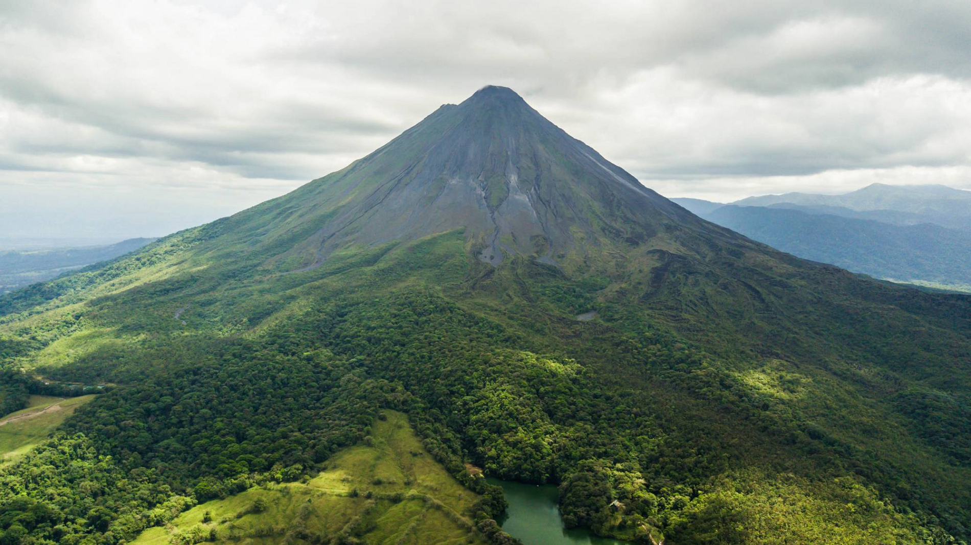
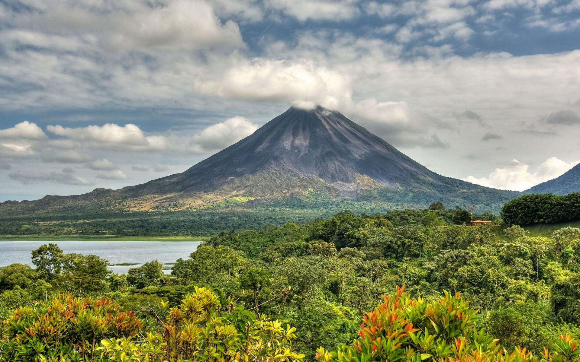
Arenal Volcano (Spanish: Volcán Arenal) is an active andesitic stratovolcano in north-western Costa Rica around 90 km (56 mi) northwest of San José, in the province of Alajuela, canton of San Carlos, and district of La Fortuna. The Arenal volcano measures at least 1,633 metres (5,358 ft) high.[2] It is conically shaped with a crater 140 metres (460 ft) in diameter. Geologically, Arenal is considered a young volcano and it is estimated to be less than 7,500 years old.[1] It is also known as “Pan de Azúcar”, “Canaste”, “Volcan Costa Rica”, “Volcan Río Frío” or “Guatusos Peak”.[1]
The volcano was dormant for hundreds of years and exhibited 2 craters at its summit, with minor fumaroles activity, covered by dense vegetation. In 1968 it erupted unexpectedly, destroying the small town of Tabacón. Due to the eruption three more craters were created on the western flanks but only one of them exists today. Arenal’s eruption from 1968 to 2010 is the tenth longest duration volcanic eruption on Earth since 1750.[3] Since 2010, Arenal has been dormant.[4]
Geographic setting and description
Arenal is one of seven historically active Costa Rican volcanoes along with Poás, Irazú, Miravalles, Orosí, Rincón de la Vieja complex, and Turrialba. It was Costa Rica’s most active volcano until 2010, and one of the ten most active volcanoes in the world. It has been studied by seismologists for many years. The volcano is located at the center of Arenal Volcano National Park in the northern zone of the country, 15 kilometres (9.3 mi) southwest of the La Fortuna district in San Carlos (canton), Costa Rica.[5]
Arenal Volcano area is an important watershed for the Arenal Lake Reservoir. The reservoir’s water is used for hydroelectric power. It is also connected to the national system.[6]
Arenal has several eruptive vents.[7] Chato is a dormant stratovolcanic cone. It is believed that Chato first erupted 38,000 years ago during the Pleistocene period and last erupted about 3,500 years ago.[1] Chatito is a lava dome with an elevation of 1,100 metres (3,609 ft). Espina is another lava dome.[1]
This article uses material from the Wikipedia article Arenal Volcano, which is released under the Creative Commons Attribution-Share-Alike 4.0 International License (view authors).
 |  |
 |  |
