
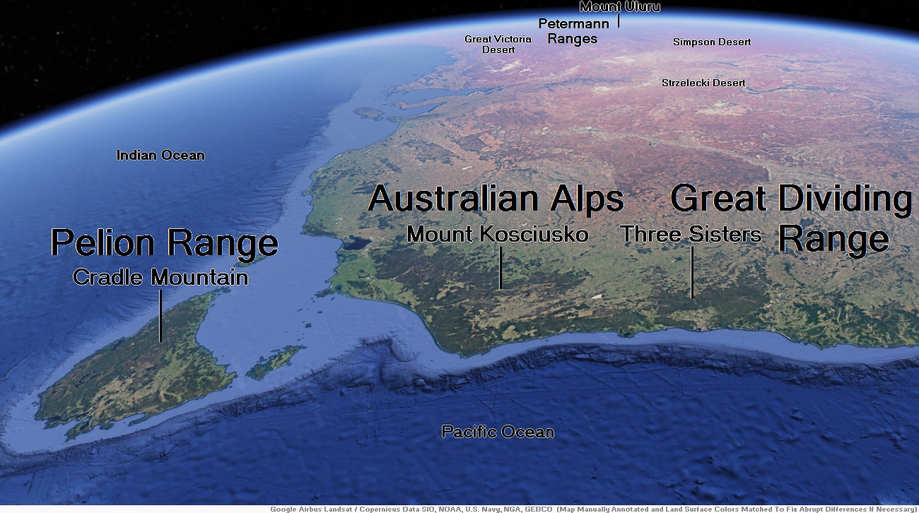
Map of Australian Alps


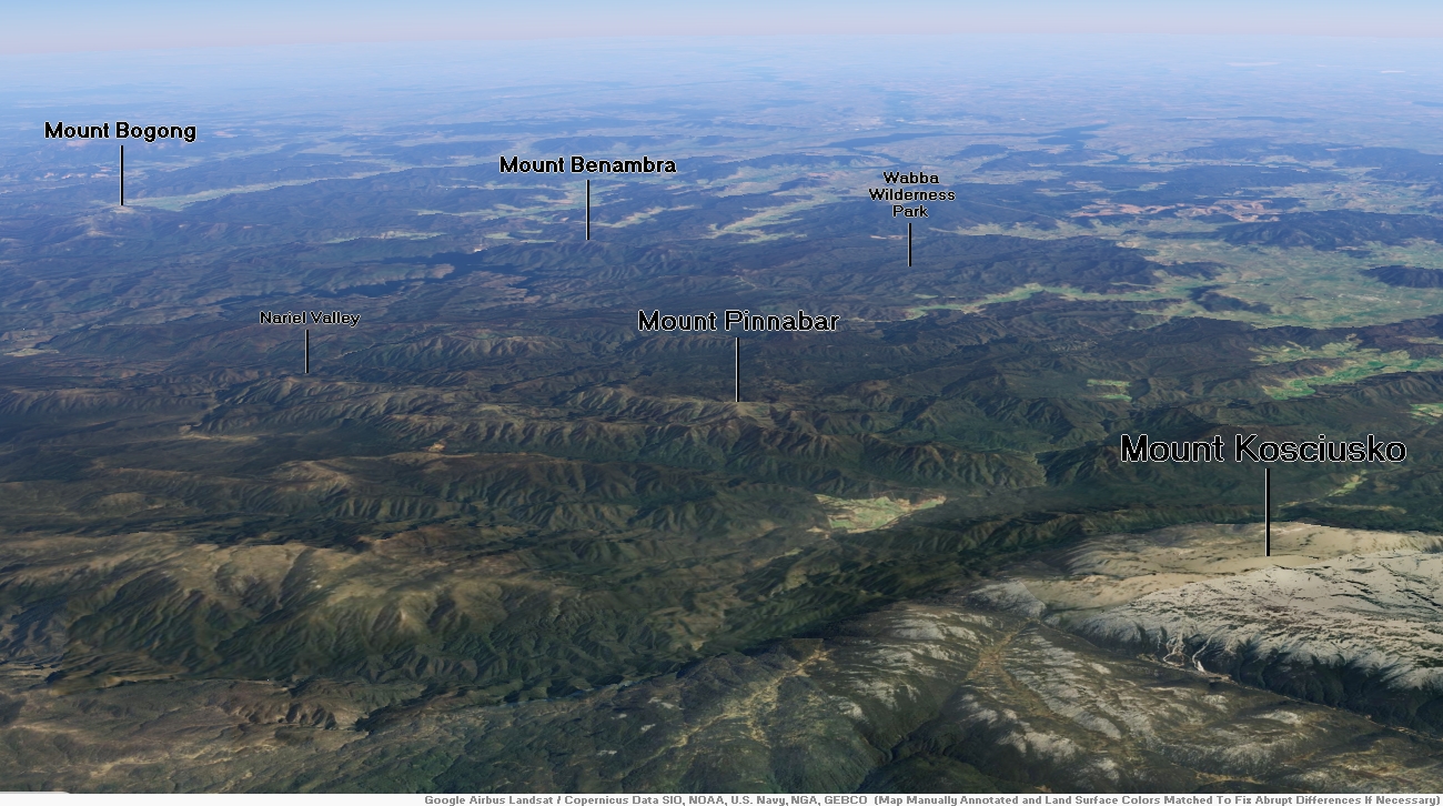
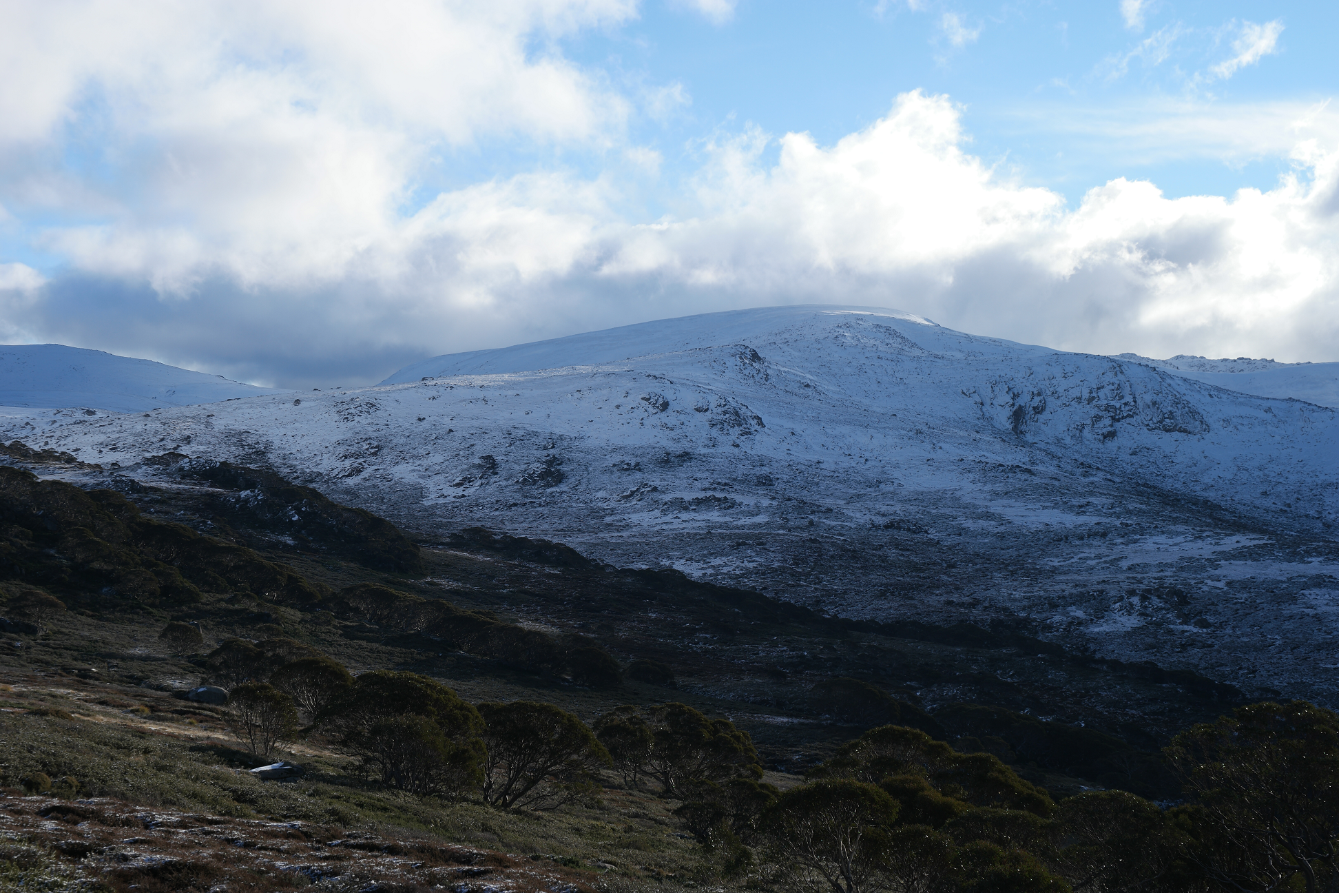
Mount Kosciusko Region

![]()
![]()
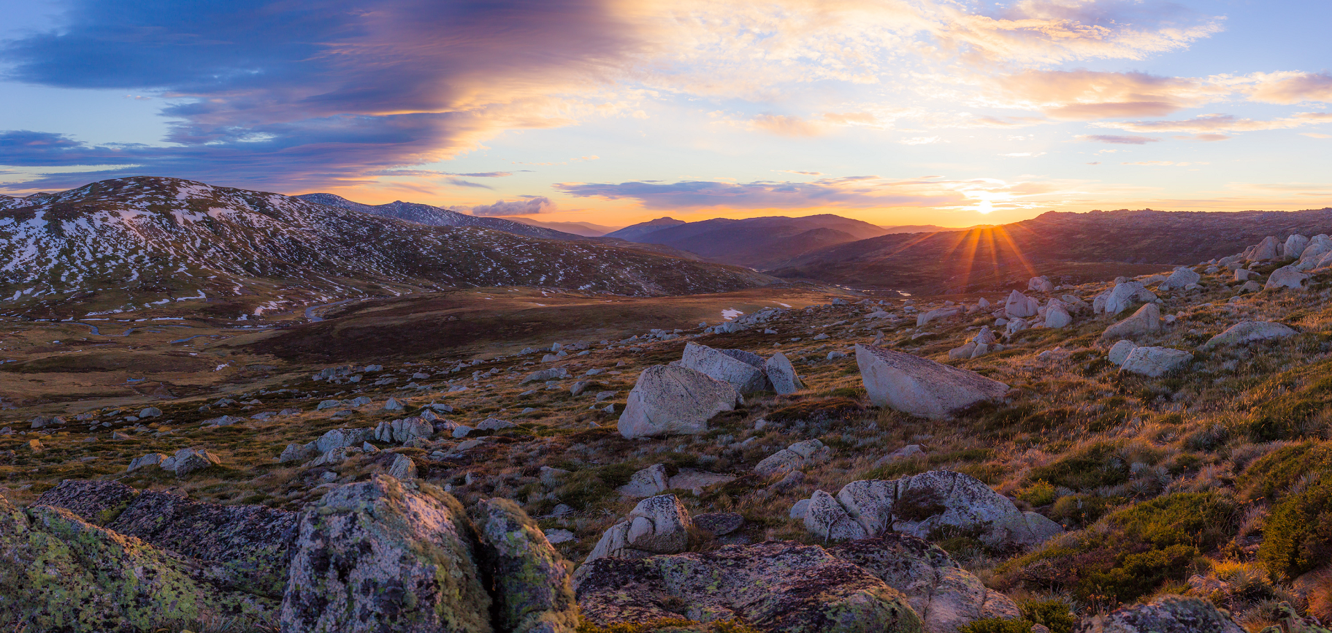
Mount Kosciuszko (/ˌkɒziˈʌskoʊ/ KOZ-ee-USK-oh;[4] (Polish pronunciation: [kɔɕˈt͡ɕuʂ.kɔ] kosh-CHOOSH-koh) Ngarigo: Kunama Namadgi)[5][6] is mainland Australia’s highest mountain, at 2,228 metres (7,310 ft) above sea level. It is located on the Main Range of the Snowy Mountains in Kosciuszko National Park, part of the Australian Alps National Parks and Reserves, in New South Wales, Australia, and is located west of Crackenback and close to Jindabyne, near the border with Victoria. Mount Kosciuszko is ranked 35th by topographic isolation.
Etymology and charting
The mountain was named by the Polish explorer Paweł (Paul) Edmund Strzelecki in 1840, in honour of Polish freedom fighter General Tadeusz Kościuszko,[note 1] because of its perceived resemblance to the Kościuszko Mound in Kraków, Poland.[7]
An exploration party led by Strzelecki and James Macarthur beside him with Indigenous guides Charlie Tarra and Jackey set off on what is called Strzelecki’s Southern expedition. Macarthur was seeking new pastures. Strzelecki wanted to investigate the climate, geology, paleontology and geography of NSW and to publish his findings.[8] This included identifying Australia’s highest summit, which Strzelecki reached on 12 March 1840.[9][10]
The approach was made from Geehi Valley. After climbing Hannel’s Spur, the peak now named Mount Townsend was reached. Here Strzelecki used his instruments to make observations. Mt Townsend is Australia’s second highest mountain, adjacent to and almost the same height as Mt Kosciuszko, and Strzelecki saw that the neighbouring peak was slightly higher. In the presence of Macarthur he named the higher summit Mount Kosciusko after the famous Polish-Lithuanian military leader who died in 1817. As it was late, Macarthur decided to return to camp and Strzelecki alone climbed the Kosciuszko summit.
Based on Strzelecki’s records, Australia’s highest summit was mapped. A cartographical mistake made in an edition of Victorian maps transposed Mount Kosciusko to the position of the present Mount Townsend. Later editions of the map continued to show the original location.[11] NSW maps did not make this mistake.[citation needed]
The Victorian error created confusion. In 1885, Austrian explorer Robert von Lendenfeld, guided by James M. Spencer,[12] a local pastoralist, aided by a map containing the transposition error, reached Mount Townsend believing it was Mount Kosciusko. According to Spencer, the local Aboriginals called Mount Kosciusko Tar-gan-gil. Like Strzelecki, Lendenfeld also observed that the neighbouring peak was higher. He named it Mount Townsend to honour the surveyor who in 1846 traversed the peak.
Lendenfeld claimed he had identified and reached the highest peak of the continent. The NSW Department of Mines discovered Lendenfeld’s mistake and assigned the name Mount Townsend to the second-highest mountain of the range. Lendenfeld’s announcement created further confusion. When Lendenfeld’s mistake was corrected, a popular legend was created that the established names of the two mountains were swapped rather than re-educate the populace of the name of the highest mountain.[13]
This article uses material from the Wikipedia article Mount Kosciuszko, which is released under the Creative Commons Attribution-Share-Alike 4.0 International License (view authors).
 Li.silvia (Wikipedia) | 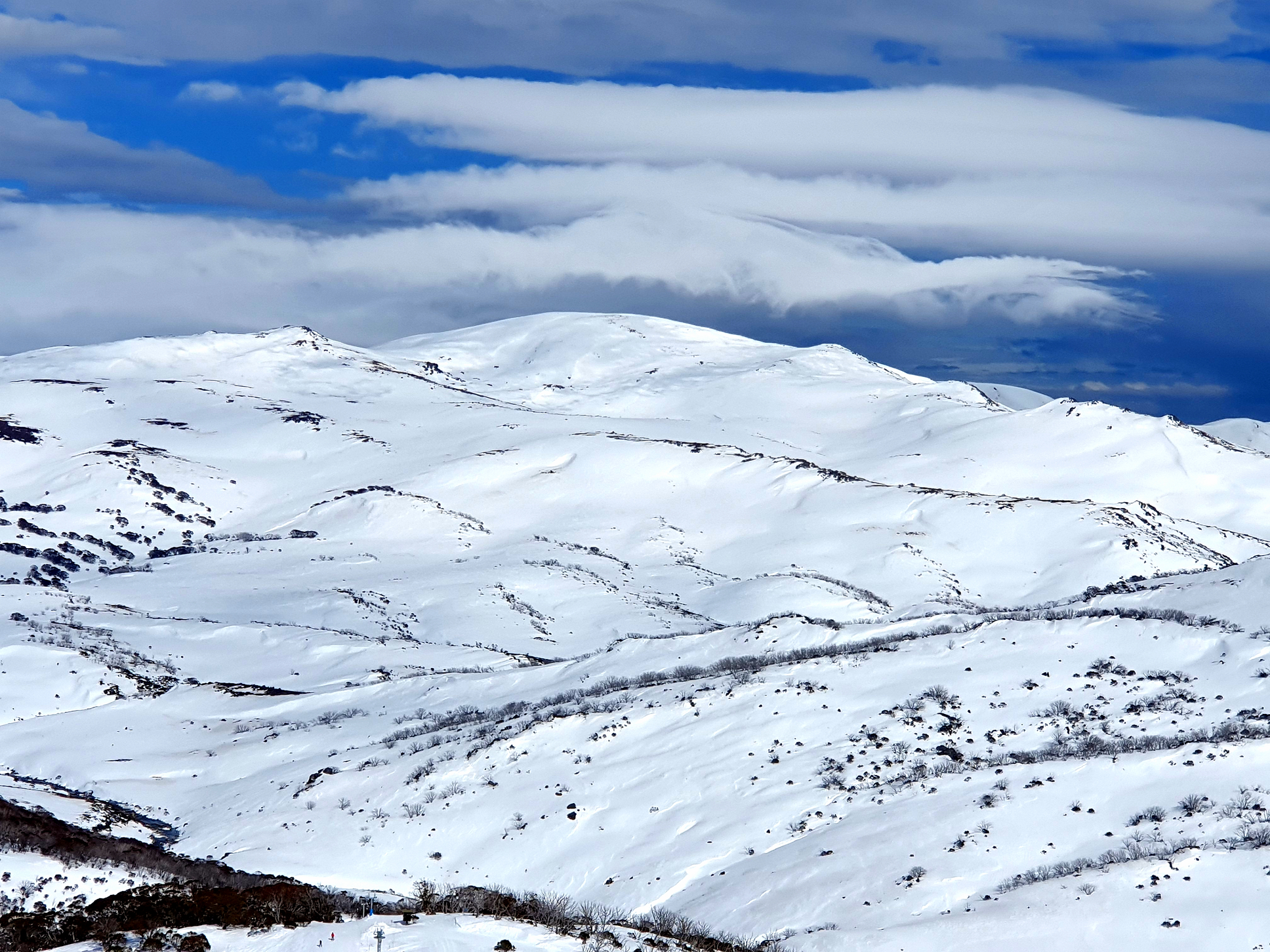 Martinjohnbudden (Wikipedia) |
 Dhx1 (Wikipedia) |  Dhx1 (Wikipedia) I |

![]()
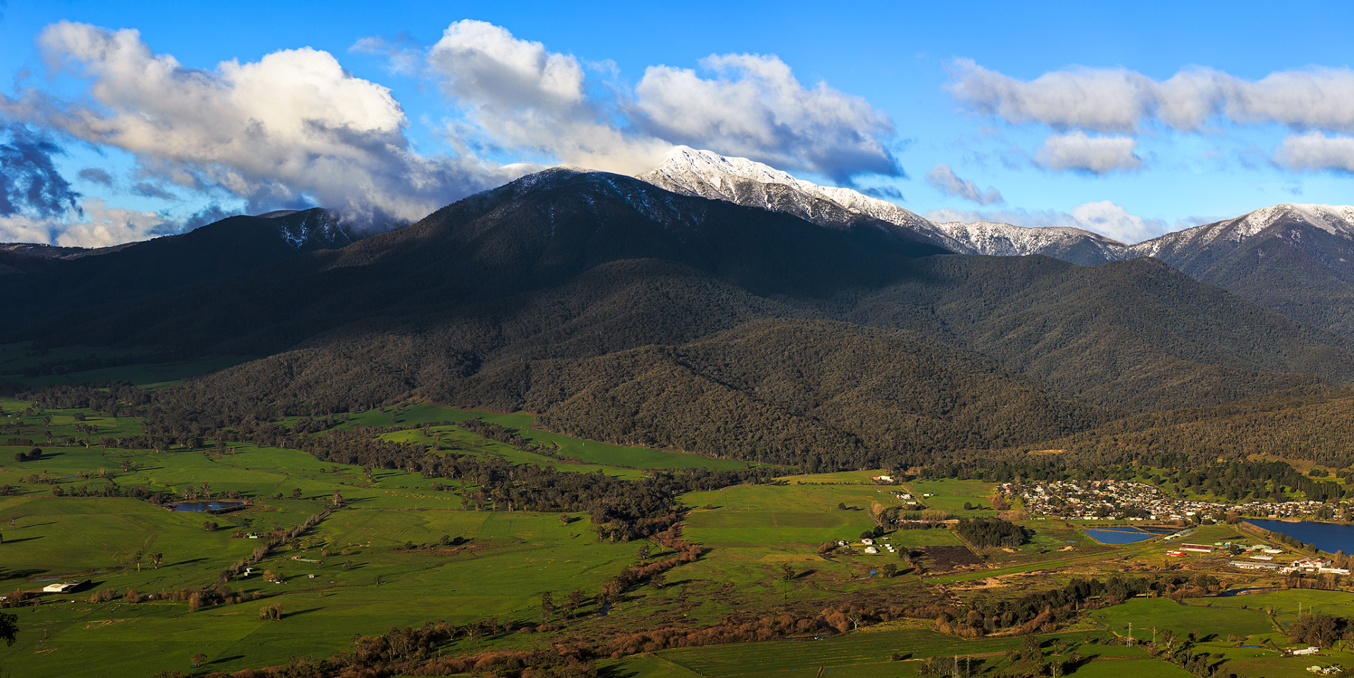
Mount Bogong, /ˈboʊɡɒŋ/ located in the Alpine National Park and part of the Victorian Alps of the Great Dividing Range, is the highest mountain in Victoria, Australia, at 1,986 metres (6,516 ft) above sea level.[3][5]
The Big River separates the massif of the mountain from the Bogong High Plains to the south. From the nearby town of Mount Beauty to its summit, Mount Bogong rises more than 1,600 metres (5,200 ft),[citation needed] thus making it one of the highest peaks in Australia not only in terms of its elevation above sea level, but also in terms of actual base-to-summit prominence.[citation needed]
Mount Bogong is a popular backcountry skiing mountain through winter but only has snow for the mid winter-spring months. It is around 30 kilometres (19 mi) by road and walking track or 12 kilometres (7.5 mi) direct to Mount Beauty. Falls Creek and Mount Hotham ski resorts are also nearby. Camping is relatively safe below the treeline but the summit ridgeline is very exposed.
Emergency shelter is also available at Bivouac Hut on the Staircase Spur, and at Cleve Cole, above Camp Creek on the broad ridge to the south of the summit, and Michell’s Hut on the Eskdale Spur.
Etymology
In the Australian Aboriginal Waywurru and Dhudhuroa languages, the mountain is named Warkwoolowler, meaning the mountain where Aboriginal people collected the boo.gong fly.[1] Additionally, in the Dhudhuroa language the word Bugung means the brown moth, referring to Agrotis infusa.
Flora and fauna
The lower slopes of Mount Bogong are covered with tall forests of Alpine Ash (Eucalyptus delegatensis) to an altitude of about 1,300 metres (4,300 ft). From 1,300 metres (4,300 ft) to 1,800 metres (5,900 ft), woodland and open woodland of Snow Gum (Eucalyptus pauciflora) dominate, and above 1,800 metres (5,900 ft), the vegetation consists of alpine shrubland, grassland and herbfield.
Animals that live on Mount Bogong have all found some way to adapt to the environment which is very harsh. For example, bogong moths gregariously aestivate in caves throughout the mountain to avoid desiccation.[6] Other animals that live on Mount Bogong include the pygmy possum, smoky mouse, broad toothed rat, powerful owl, spotted tree frog and she-oak skink.
Much of the mountain, especially the northern side, was badly burnt in the 2003 Eastern Victorian alpine bushfires.
This article uses material from the Wikipedia article Mount Bogong, which is released under the Creative Commons Attribution-Share-Alike 4.0 International License (view authors).
 Joe Ritson (Wikipedia) | 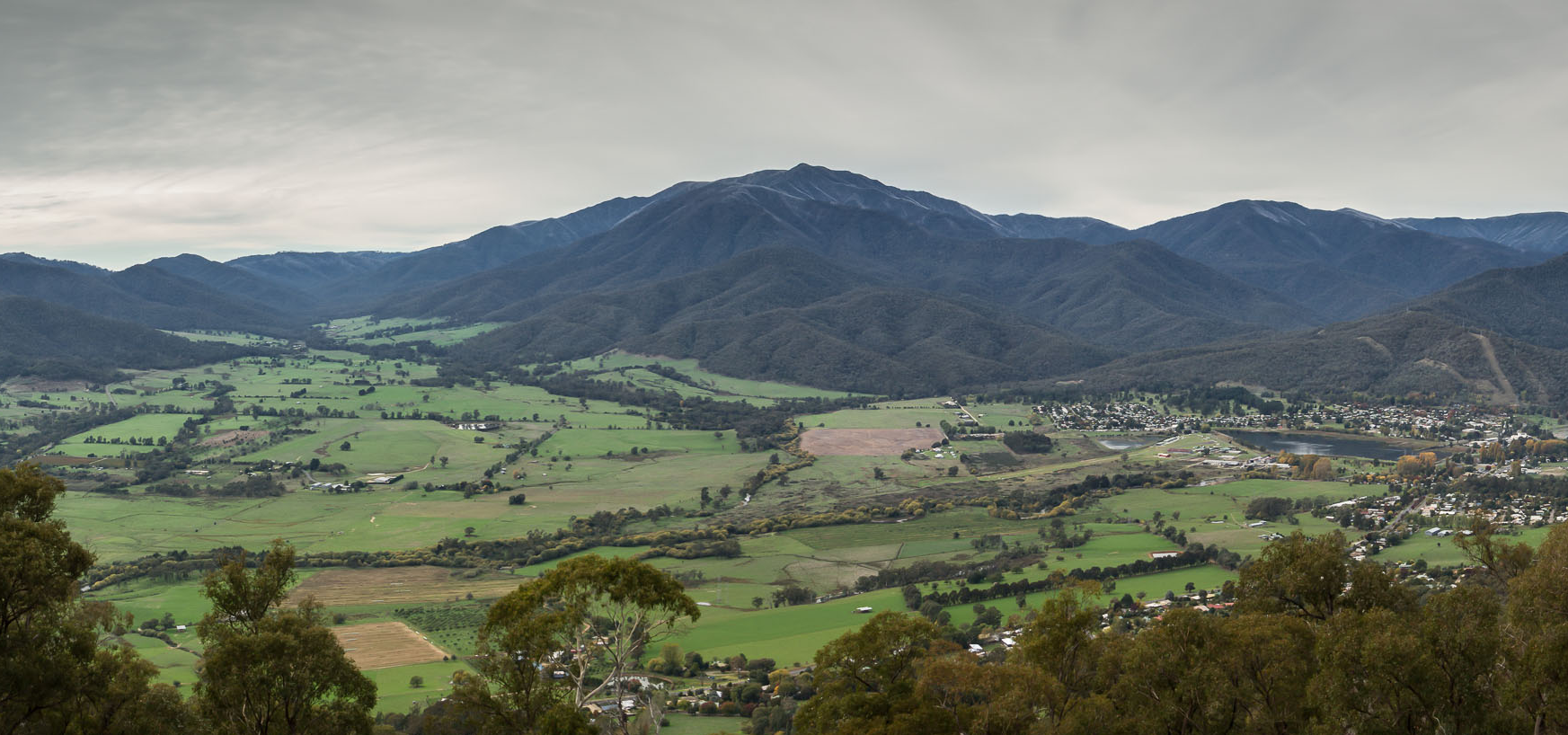 Stephen Edmonds (Wikipedia) |
