
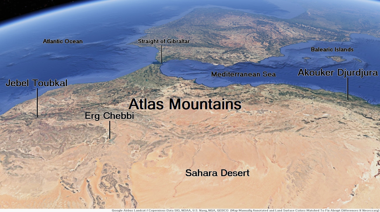
Map of Atlas Mountains


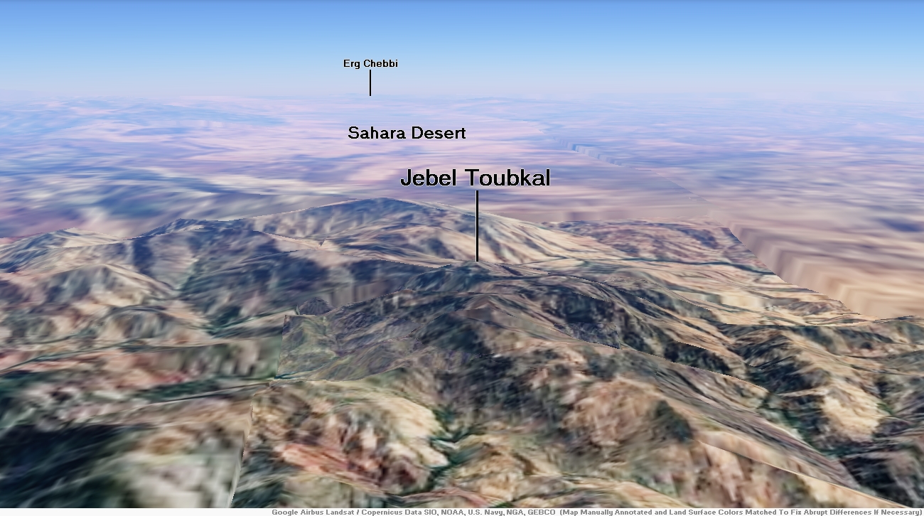
Jebel Toubkal Region
![]()
Toubkal (Arabic: توبقال, romanized: tūbqāl, pronounced [tuːbqaːl]), also Jbel Toubkal or Jebel Toubkal, is a mountain in southwestern Morocco, located in the Toubkal National Park. At 4,167 m (13,671 ft), it is the highest peak in Morocco, the Atlas Mountains, North Africa and the Arab world. Located 63 km (39 mi) south of the city of Marrakesh, and visible from it, Toubkal is an ultra prominent peak, the highest for over 2,000 km (1,200 mi). Toubkal is ranked 27th by topographic isolation.
Geography
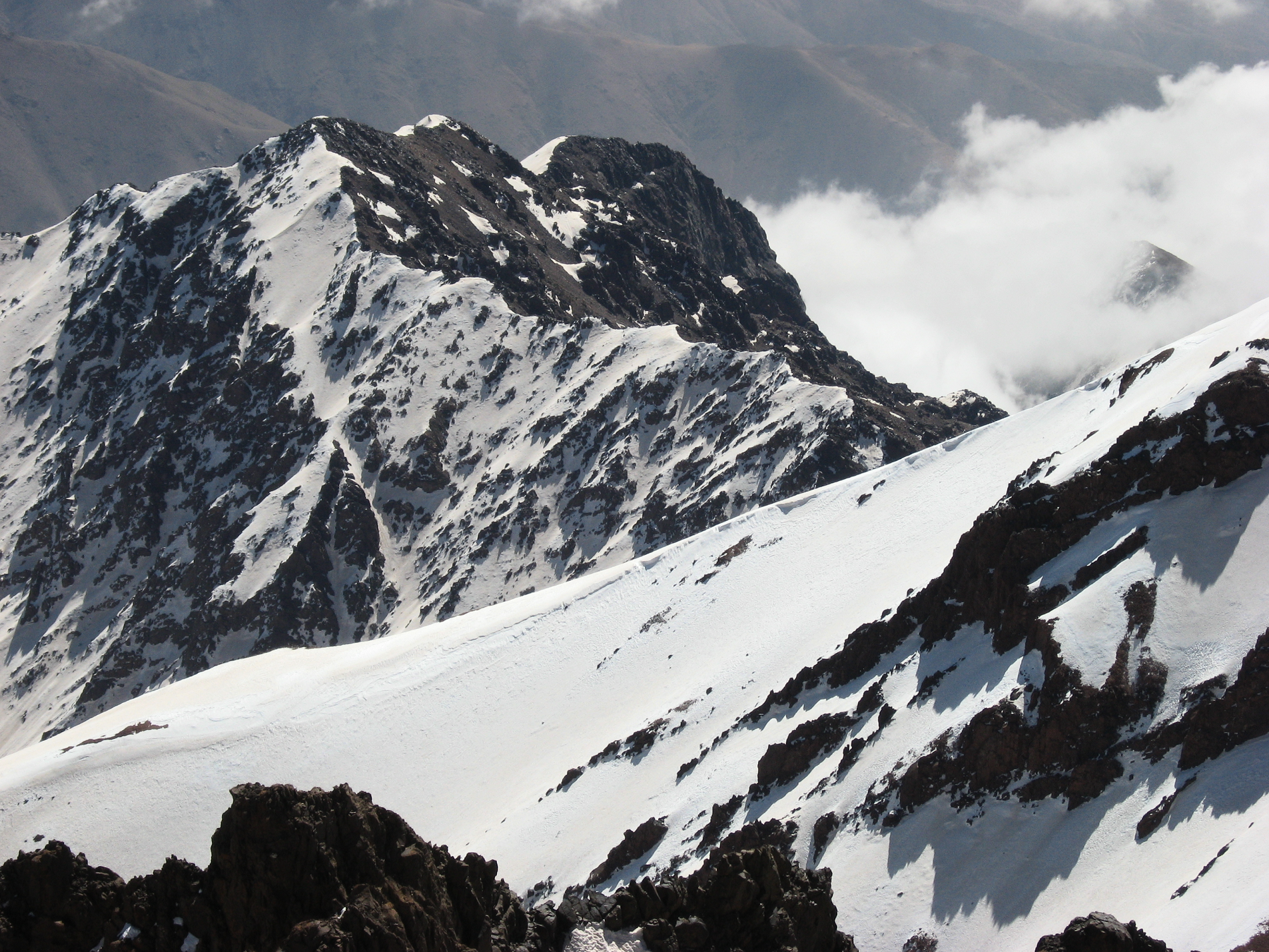
Although much of the High Atlas consists of sedimentary rocks, the Toubkal massif is an area of volcanic rocks which have weathered into alpine crests, cut by deep, narrow valleys. To the south, the mountain drops steeply down for 1,800 metres (5,906 ft) to a small lake called Lac d’Ifni. To the west, the mountain’s edge is marked by a pass, the Tizi n’Ouanoums at 3,664 metres (12,021 ft). From this pass, the mountain’s W-S-W ridge rises up to Toubkal West, which forms a shoulder at 4,020 metres (13,189 ft) before continuing to the summit at 4,167 metres (13,671 ft).[4]
The north and western sides of Toubkal drain down to the Mizane Valley, which has the passes of both Tizi n’Ouanoums and Tizi n’Ouagane at its head. Two hanging valleys on the western side of the mountain – the Ikhibi Nord and Ikhibi South provide ready access for trekkers and climbers to reach Toubkal’s summit. At one time the northern valley provided the normal route of ascent, but the construction of a mountain hut by the French Alpine Club below Ikhibi Sud now encourages trekkers to ascend via the southern route instead.[4]
Access
Toubkal is popular with trekkers and ski mountaineers, but less so with climbers, despite its ease of access and sunny climate.[4] Trekkers usually approach the mountain from Marrakesh via the road-end village of Imlil. Qualified guides can be hired, as well as porters, to carry equipment and food supplies higher into the mountains. It is a moderate hike and navigation is not a problem.
The normal route starts with a walk to the village of Aroumd. Beyond Aroumd, a floodplain is crossed and the route follows the left slope of the valley southwards. The valley bends to the east to the tiny settlement of Sidi Chamharouch, which has grown around a Muslim shrine. At Sidi Chamharouch, the path leads over the stream and runs steeply uphill to the right side of the Isougouane valley, which leads to two stone-built refuges (Refuge du Toubkal and Refuge Les Mouflons) that are often used as base camp at 3,207 m (10,522 ft).
This article uses material from the Wikipedia article Toubkal, which is released under the Creative Commons Attribution-Share-Alike 4.0 International License (view authors).
 Mark Horrell (Flickr) | 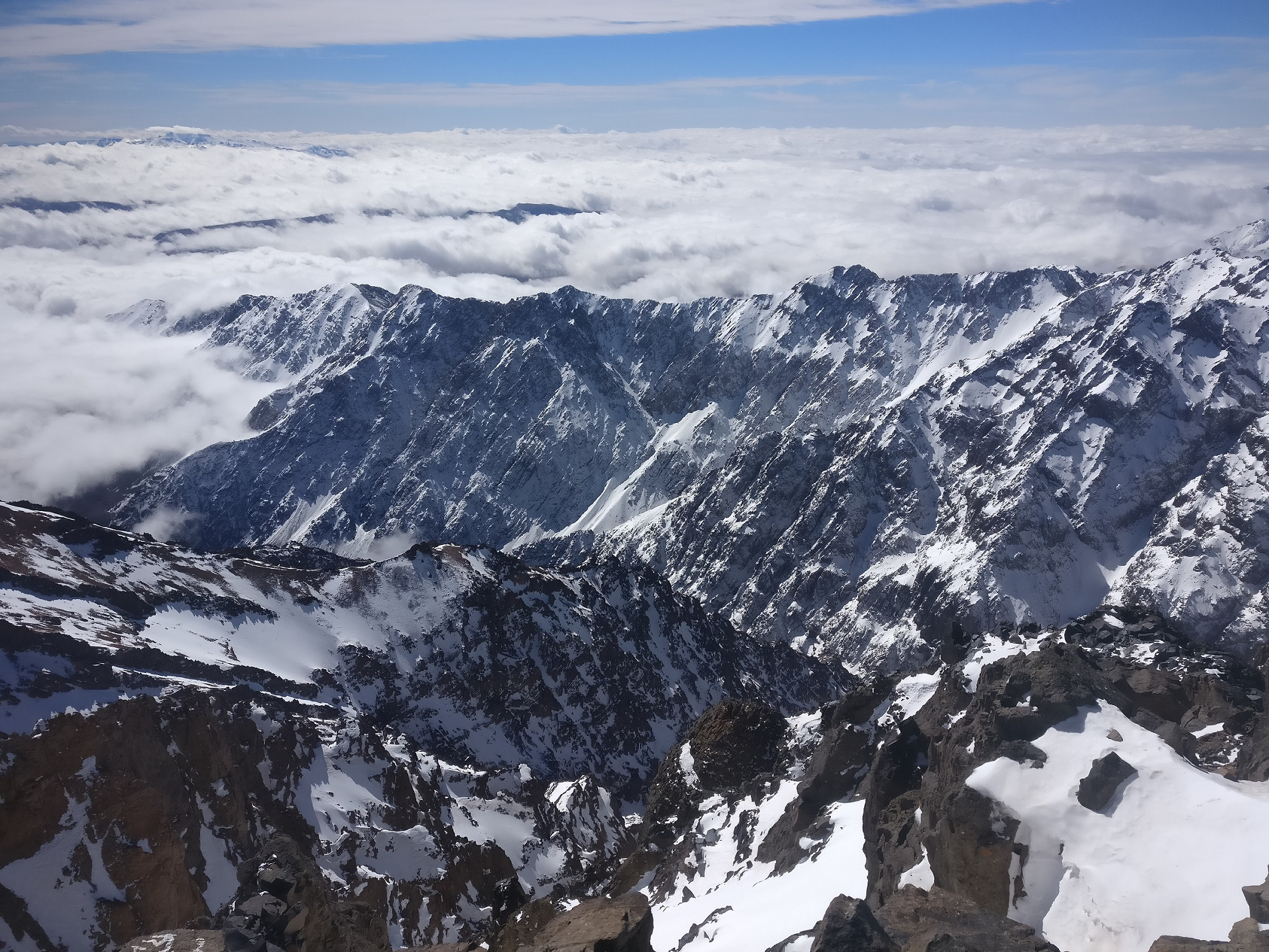 I |
 Notcreative123 (Wikipedia) |  SimonKing74 (Wikipedia) I |


![]()
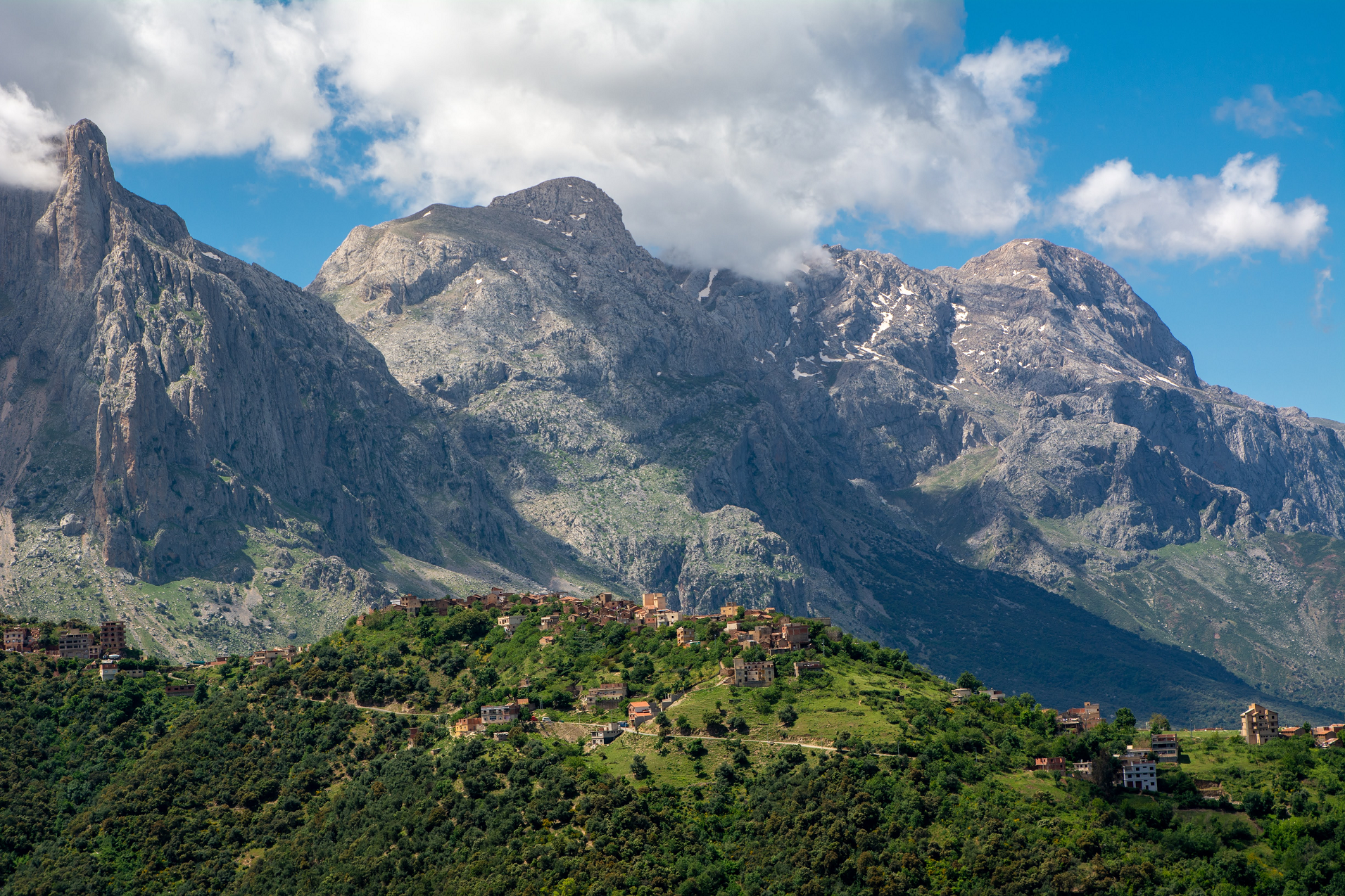
Djurdjura
The Djurdjura (Berber: Adrar n Jerjer[1], Arabic: جبال جرجرة, romanized: Jabal Jurjura) is a mountain range of the Tell Atlas, part of the Atlas Mountain System. It is located in Kabylie, Algeria.
Geography
The Djurdjura is a massif made up of two differentiated ranges, one in the north with the Haïzer and Akouker subranges and the other in the south. Its highest point, Lalla Khedidja known in Kabylian as Tamgut Aâlayen, has an elevation of 2,308 metres (7,572 ft) and it is located in the southern range. Other notable summits are the 2,305 m high Ich n’Timedouine (أكارو تيمدواي), a peak located in the central area of the massif, highest point of the Akouker subrange.
Adrar n’Hayzer (أدرار نن هيدزر), the highest point of the Haïzer subrange, is a 2,164 m tall summit rising above Bouira and the high valley of Oued Dhous. The Thaletat is a 1,638 m high rocky mountain with a very original shape located in Tizi Ouzou Province.
Other notable features of the Djurdjura range are the 1,750 m high Tirourda Pass (تيروردا) mountain pass at the eastern end and the Kweryet (كويرت), a 1500 m high mountain that rises to the north of the massif. This mountain gave its name to an ancient commune, Douar N’Kweryet, a commune that gathered certain villages of the Ouacifs (At Wasif) and the Ouadhia (Iwadhiyen).
History
The range had been known to the ancient Romans as Mons Ferratus, the Iron Mountains. Famous mediaeval explorer Ibn Batuta went to Béjaïa across this mountain range. He was heading towards Tunis with a caravan on his Hajj journey and traveled to Béjaïa from Mitidja, a plain near Algiers.[2]
Resorts and protected areas
The Djurdjura National Park is a protected area within the range.[3]
This mountain range also has a ski resort (أكابور مركز تيكجدة) at Tikjda with places such as the Point De Vue Du Djurdjura, as well as the Gouffre de l’Akouker. The resort is located at a height of 1,478 m.[4]
This article uses material from the Wikipedia article Djurdjura, which is released under the Creative Commons Attribution-Share-Alike 4.0 International License (view authors).
 Farid Ait Chaalal (Wikipedia) |

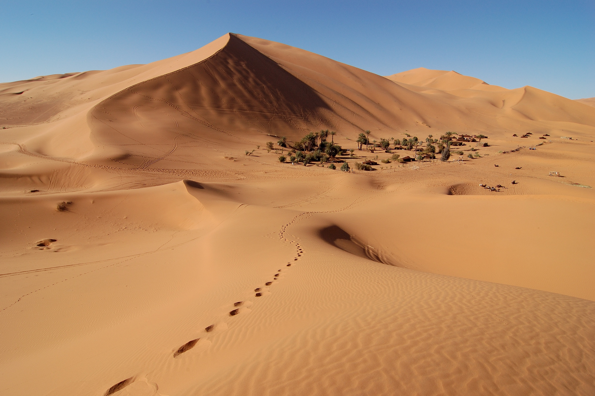
![]()
Erg Chebbi (Arabic: عرق الشبي) is one of Morocco‘s several ergs – large seas of dunes formed by wind-blown sand. It is located on the far western edge of the Sahara Desert.[1] There are several other ergs in Morocco, such as Erg Chigaga near M’hamid.
Description
In places, the dunes of Erg Chebbi rise to 150 meters from the surrounding hamada (rocky desert) and altogether span an area of approximately 28 kilometers from north to south and 5–7 kilometers from east to west lining the Algerian border.[2]
The nearest sizable town is Erfoud, about 60 kilometers further north. One other city is Rissani, around 40 kilometers from Merzouga. Rissani was the site of a kingdom known as Sijilmassa, which became prosperous from the 8th to the 14th century due to its control of the caravan routes.
Although rainfall is not very common, in 2006 flooding adjacent to the dunes destroyed many buildings and killed three people.
Tourism
Merzouga, the local tourist center, is located on the western lee of the dunes, together with hotels and auberges running north-south along the dunes. Many companies offer camel trips into the dunes, taking tourists on overnight trips to permanent campsites on the outer sections of the erg. Erg Chebbi’s proximity to the tourist center has led to the erg sometimes being referred to as the “dunes of Merzouga”.[3]
During the warmest part of the year, some Moroccans come to Erg Chebbi to be buried neck-deep in the hot sand for a few minutes at a time. This is considered to be a treatment for rheumatism.
This article uses material from the Wikipedia article Erg Chebbi, which is released under the Creative Commons Attribution-Share-Alike 4.0 International License (view authors).
 Bjørn Christian Tørrissen (Wikipedia) |  Bjørn Christian Tørrissen (Wikipedia) |
 Rosino (Wikipedia) | 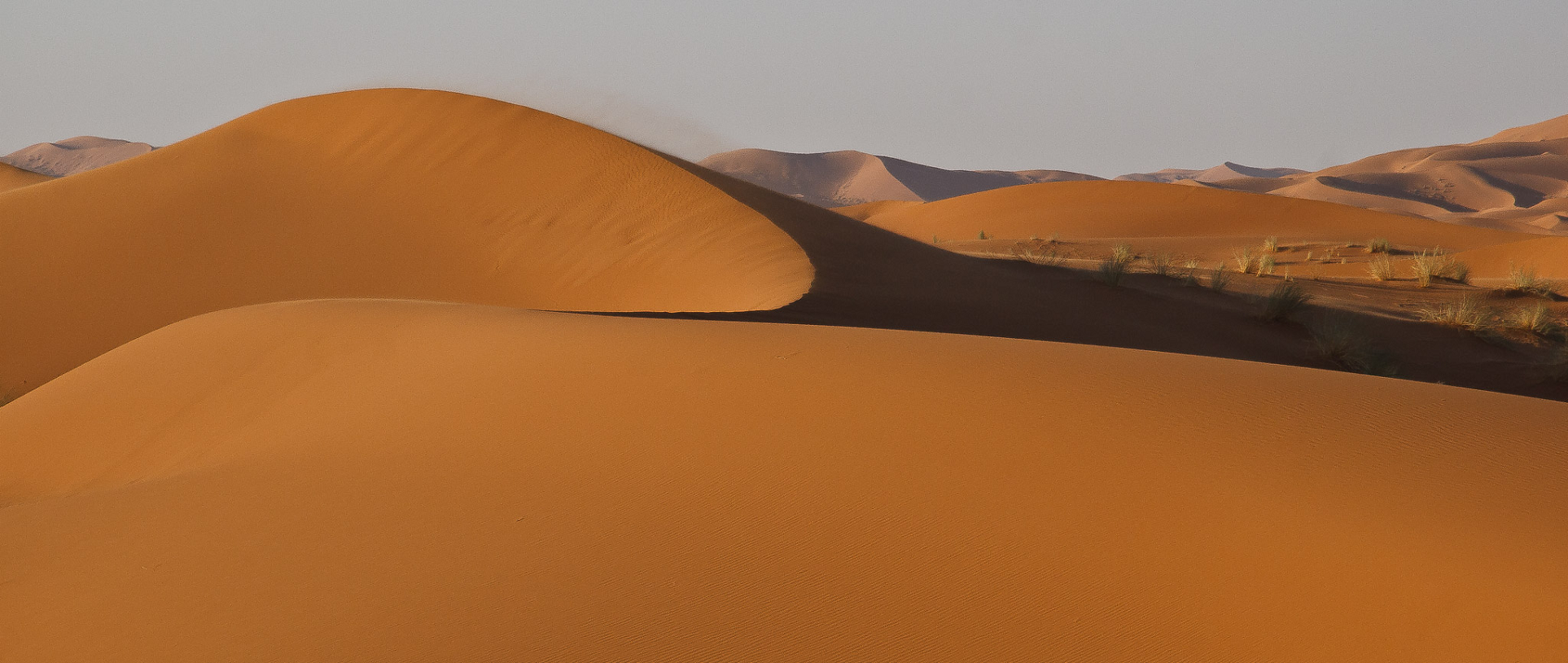 Mike Prince (Wikipedia) |
