
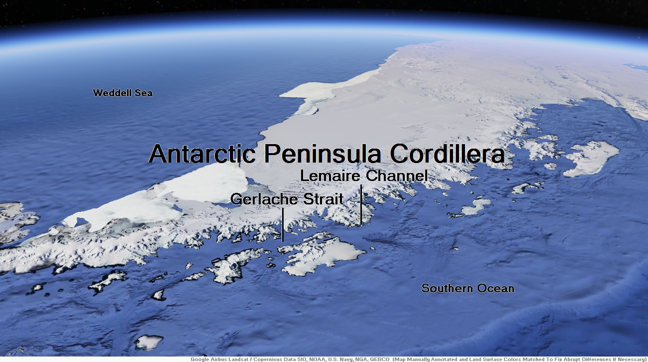
Map of Antarctic Peninsula


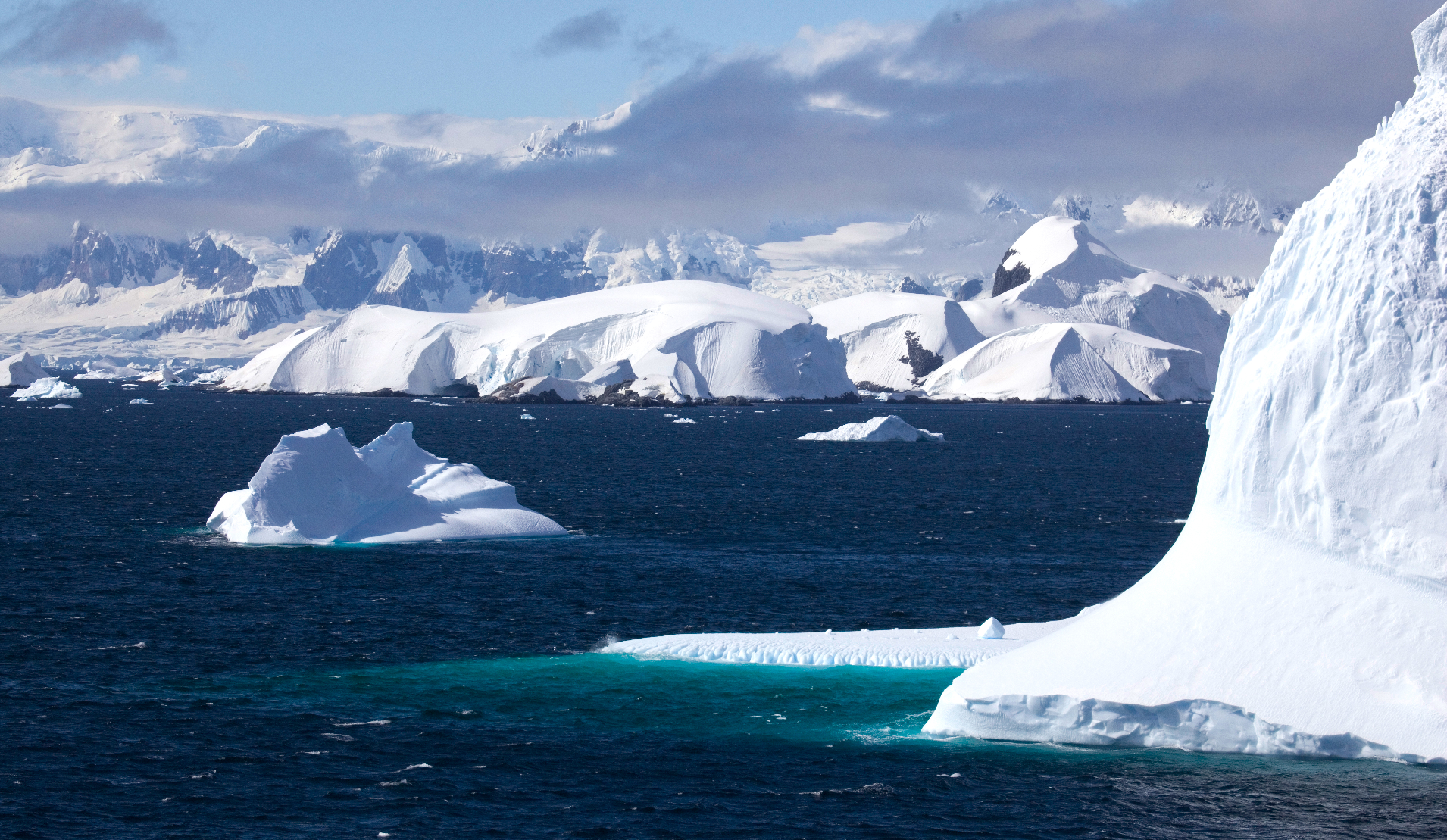
Antarctica Peninsula Panoramic
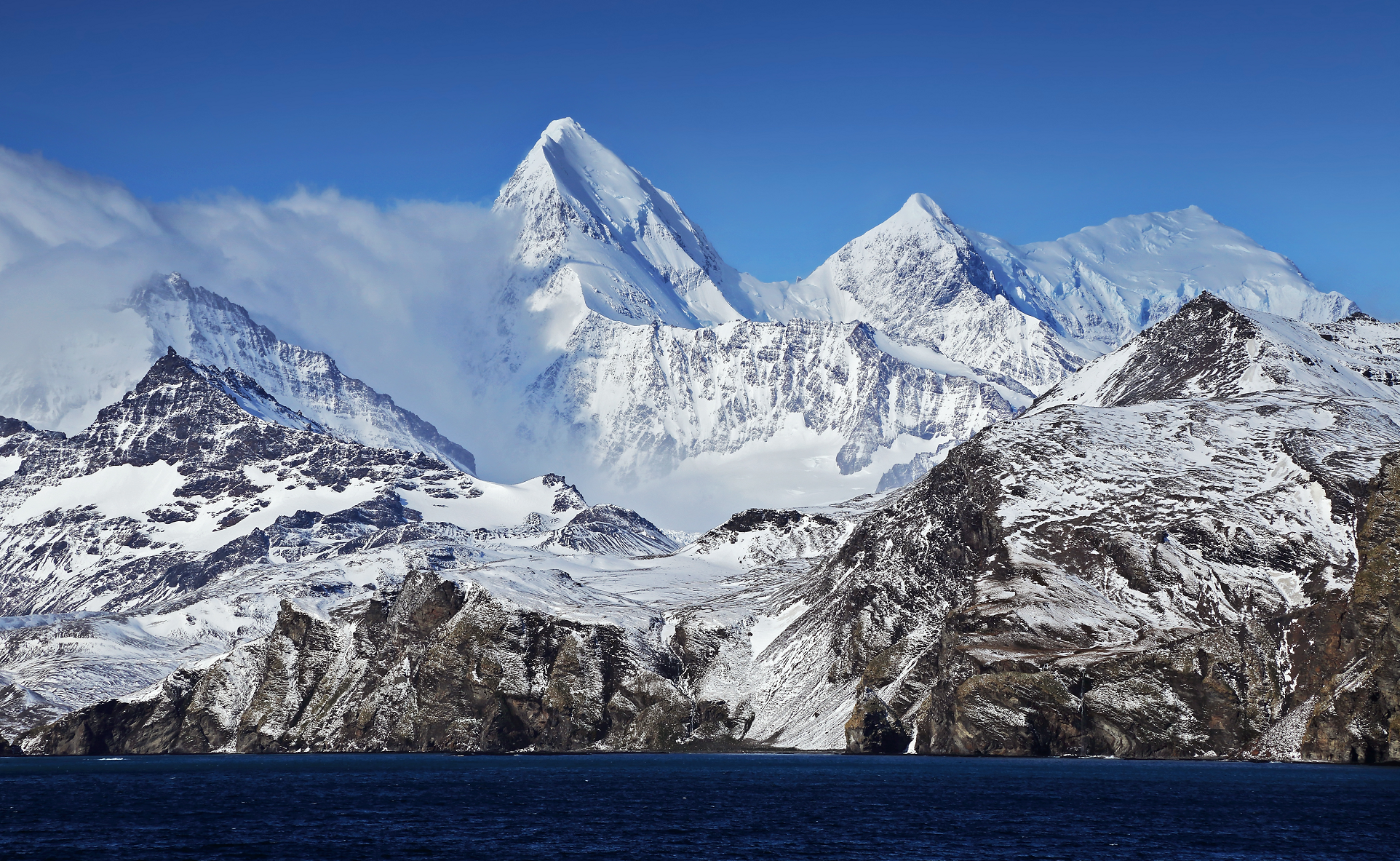
ChrisOgden1 (iStock)
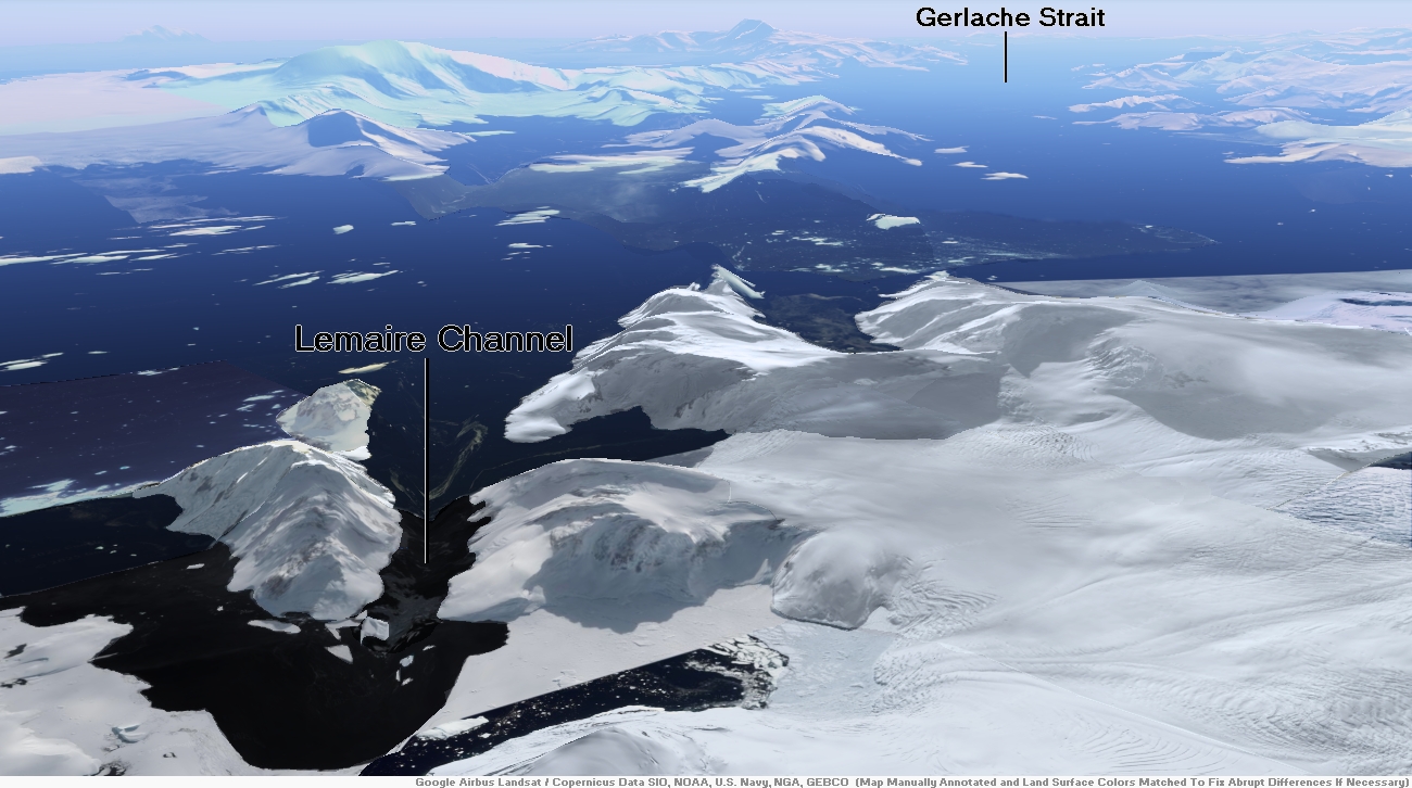
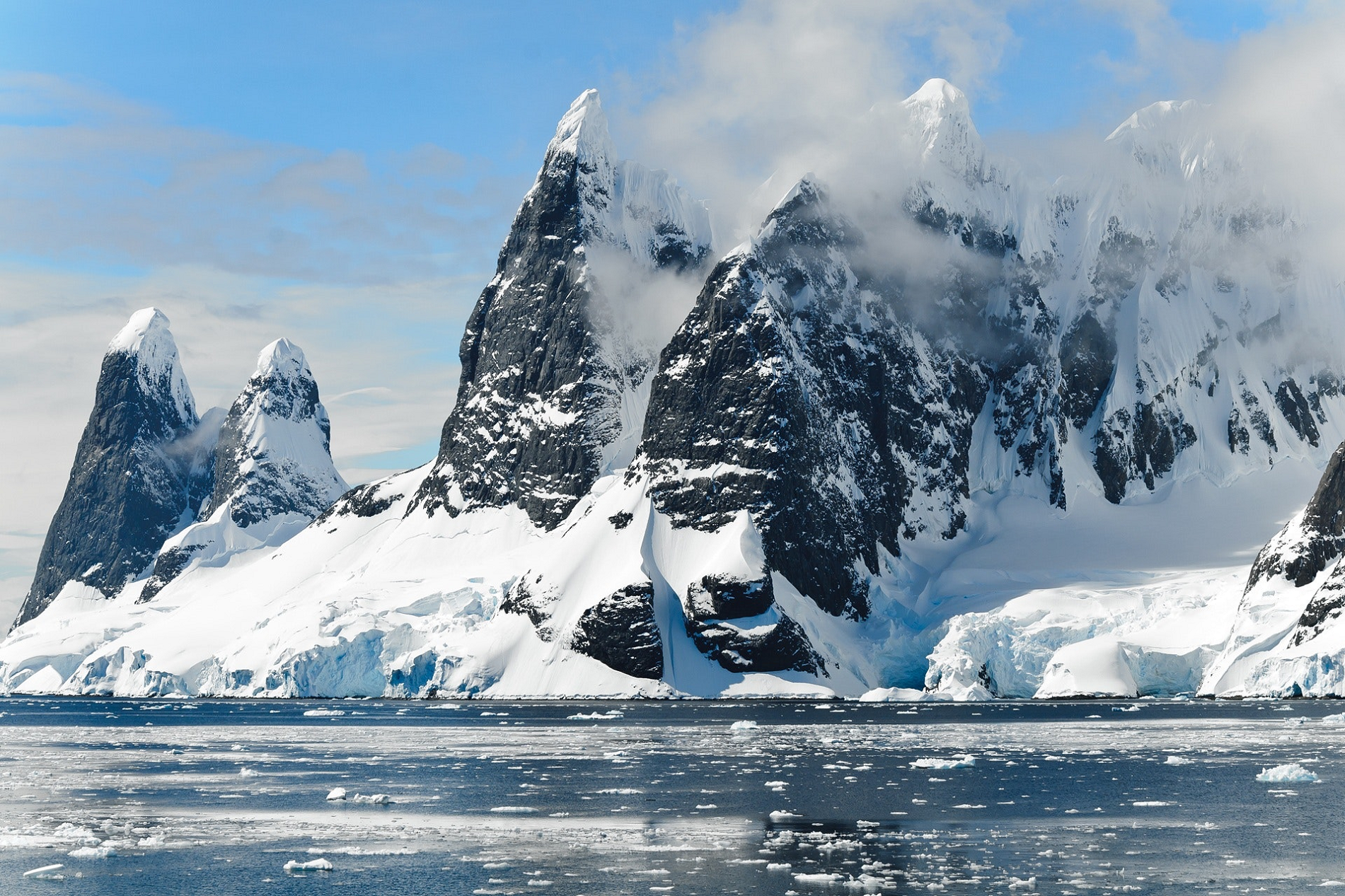
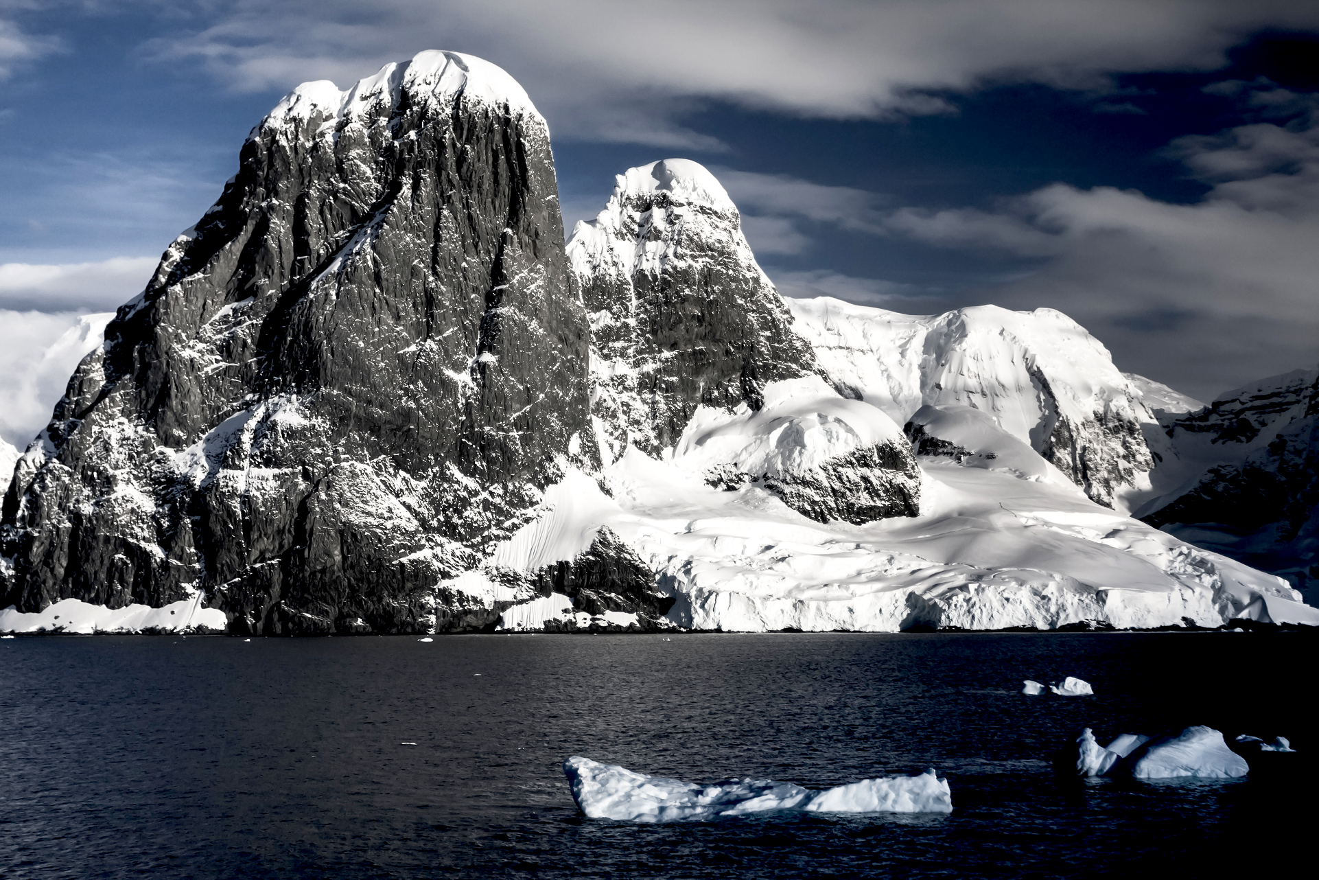
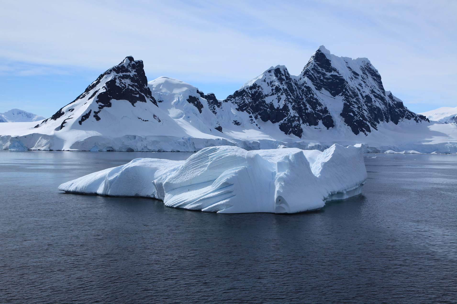
Lemaire Channel Region
Lemaire Channel Panoramic
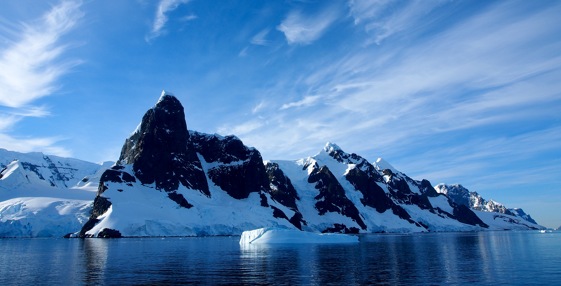
Andreas (Flickr)
![]()
![]()
Lemaire Channel is a strait off Antarctica, between Kyiv Peninsula in the mainland’s Graham Land and Booth Island. Nicknamed “Kodak Gap” by some, it is one of the top tourist destinations in Antarctica; steep cliffs hem in the iceberg-filled passage, which is 11 km (6.8 mi) long and just 600 metres (2,000 ft) wide at its narrowest point.
It was first seen by the German expedition of 1873-74, but not traversed until December 1898, when the Belgica of the Belgian Antarctic Expedition passed through. Expedition leader Adrien de Gerlache named it for Charles Lemaire (1863-1925), a Belgian explorer of the Congo.
The channel has since become a standard part of the itinerary for cruising in Antarctica; not only is it scenic, but the protected waters are usually as still as a lake, a rare occurrence in the storm-wracked southern seas, and the north-south traverse delivers vessels close to Petermann Island for landings. The principal difficulty is that icebergs may fill the channel, especially in early season, obliging a ship to backtrack and go around the outside of Booth Island to reach Petermann.
Features
Features of the southeast coast of the channel include, from north to south, False Cape Renard, Humphries Heights, Loubat Point, Deloncle Bay, Hotine Glacier, Glandaz Point, Una Peaks, Mount Cloos, Cape Cloos, Leay Glacier, Mount Scott (Antarctica), Duseberg Buttress (Copernix annotated satellite view).
This article uses material from the Wikipedia article Lemaire Channel, which is released under the Creative Commons Attribution-Share-Alike 4.0 International License (view authors).
 Goinyk Production (Shutterstock) |  I I |
 Αναστασία Πορτνά (Wikipedia) |  AnneHunecke (iStock) I |
 Goinyk (iStock) | 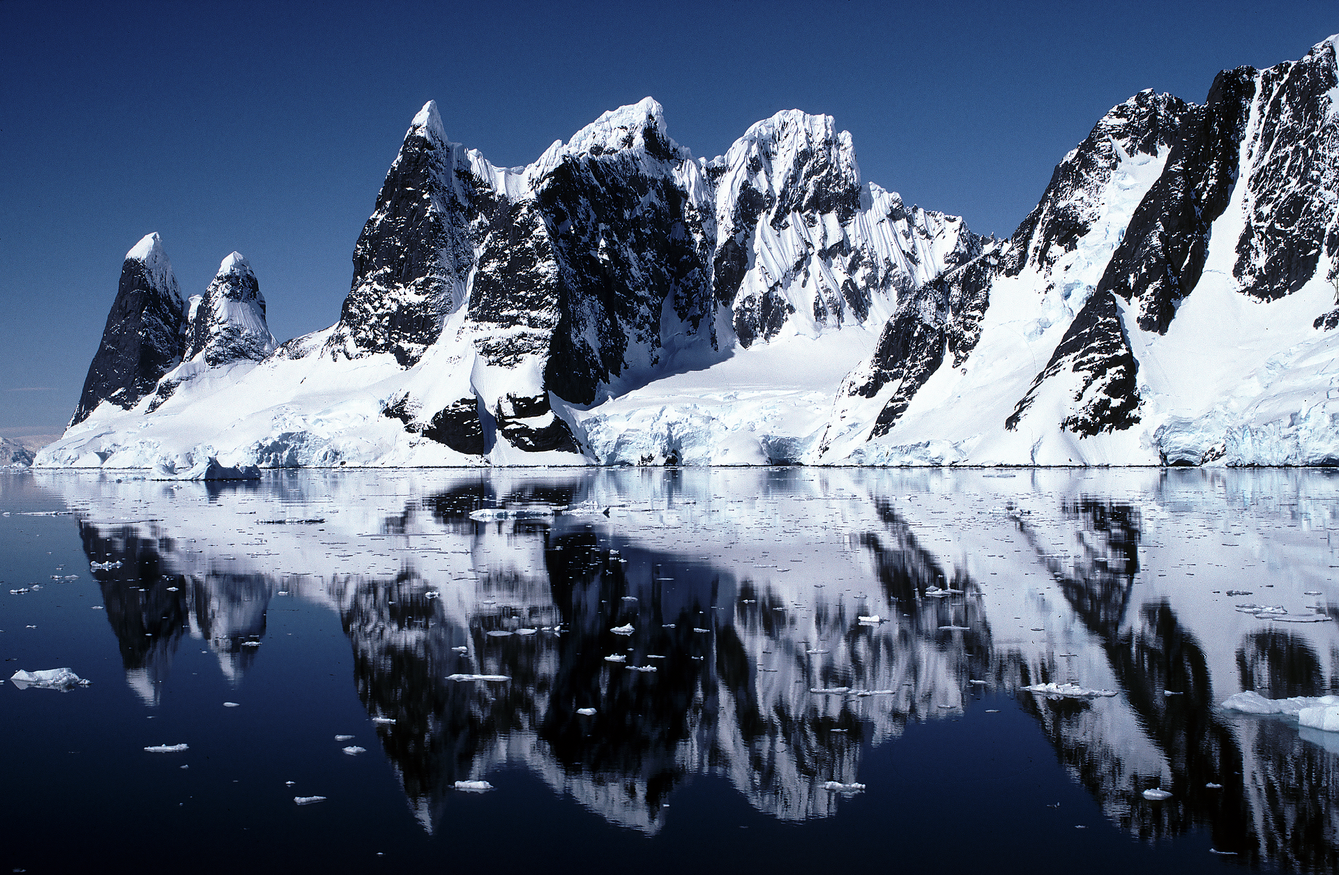 The_Crofter (iStock) |
 Christian Horz (iStock) |  I |

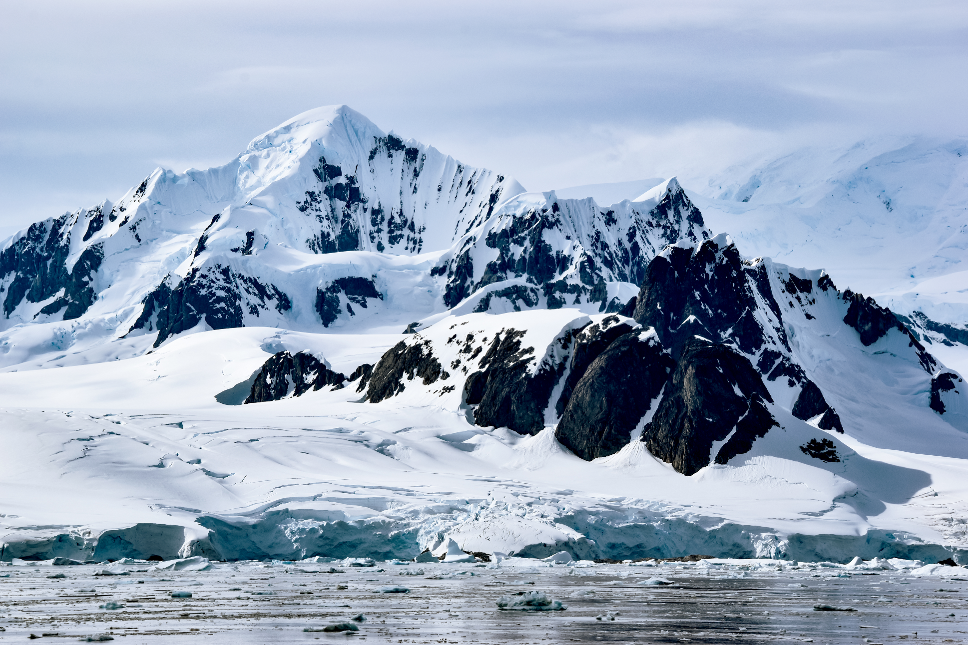
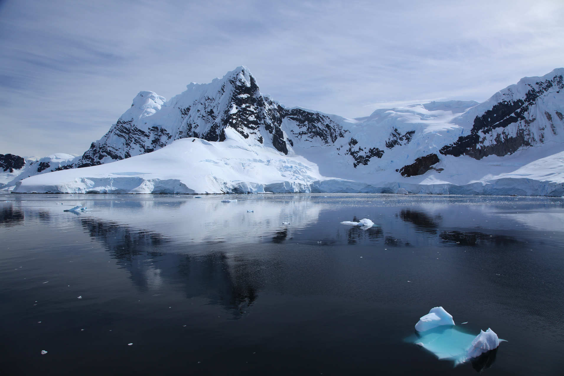
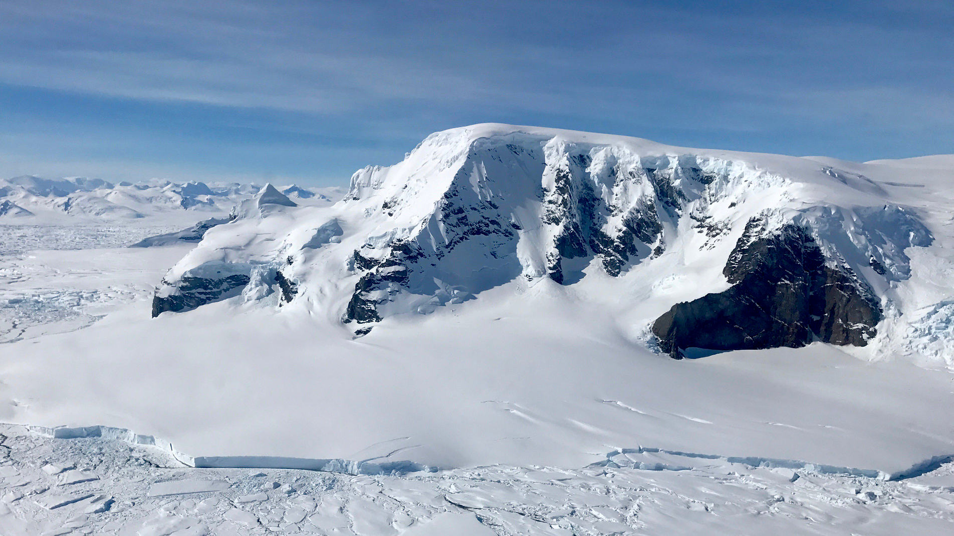
Gerlache Strait Panoramic
Andreas (Flickr)
![]()
![]()
Gerlache Strait or de Gerlache Strait or Détroit de la Belgica is a channel/strait separating the Palmer Archipelago from the Antarctic Peninsula. The Belgian Antarctic Expedition, under Lt. Adrien de Gerlache, explored the strait in January and February 1898, naming it for the expedition ship Belgica.[1] The name was later changed to honor the commander himself.
On the expedition in the Gerlache Strait, biologist Emil Racoviță made several discoveries, including a flightless midge fly that was later formally named Belgica antarctica by the Belgian entomologist Jean-Charles Jacobs.[1]
The Gerlache Strait has spiky blue icebergs, and is widely considered a great spot for whale-watching.
Geology
Four tectonic blocks are identifiable in the Gerlache Strait area, bounded by two systems of Tertiary strike-slip faults. The longitudinal faults include the SW-NE trending Neumayer Fault that extends from Peltier Channel across Wiencke Island, and then onwards most likely as the Gerlache Fault. The SW-NE trending Fournier Fault parallels the Gerlache Fault and divides Anvers Island. The transverse faults trend E-W and SE-NW across Wiencke Island and Brabant Island, and include the Schollaert Channel faults. The Danco Coast Block extends from Cape Willems to Wilhelmina Bay. The Brabant Island Block encompasses the southern portion of that island. The Neumayer Channel Block is bound by the Neumayer Fault and the Fournier Fault. The Anvers-Melchior Islands Block includes northwest Anvers Island and its offshore islands Melchior Islands.[2]
Gerlache Straight can be viewed from Spigot Peak.[3]
History
In 1934, polar explorer Lincoln Ellsworth reported in the New York Times that a heavy snowstorm and ice made it necessary to change his plan for going from De Gerlache Strait out to sea and south to Adelaide Island.[4] In 1979, four American adventurers survived a two-month expedition to Antarctica. The Washington Post reported that the most dangerous part of their journey was a their crossing of the Gerlache Straight on a raft.[5]
The writer Dianne Ackerman said she went to Gerlache Strait in the 1990s in order to find inspiration for writing prose.[6]
In 2002, Lynne Cox became the first person to swim a mile in the near-freezing Antarctic Ocean.[7] She did the swim in Gerlache Strait.[7] In 2021, a couple on a ship in the Gerlache Straight captured footage of a gentoo penguin narrowly escaping a few hungry killer whales.[8]
This article uses material from the Wikipedia article Gerlache Strait, which is released under the Creative Commons Attribution-Share-Alike 4.0 International License (view authors).
 Liam Quinn (Wikipedia) | 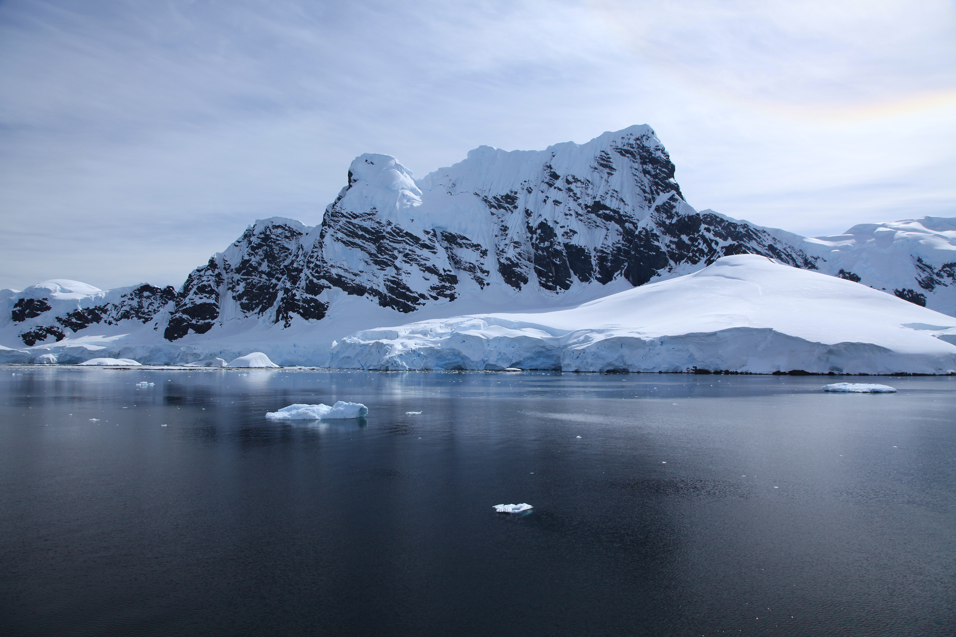 Liam Quinn (Flickr) |
 Liam Quinn (Flickr) | 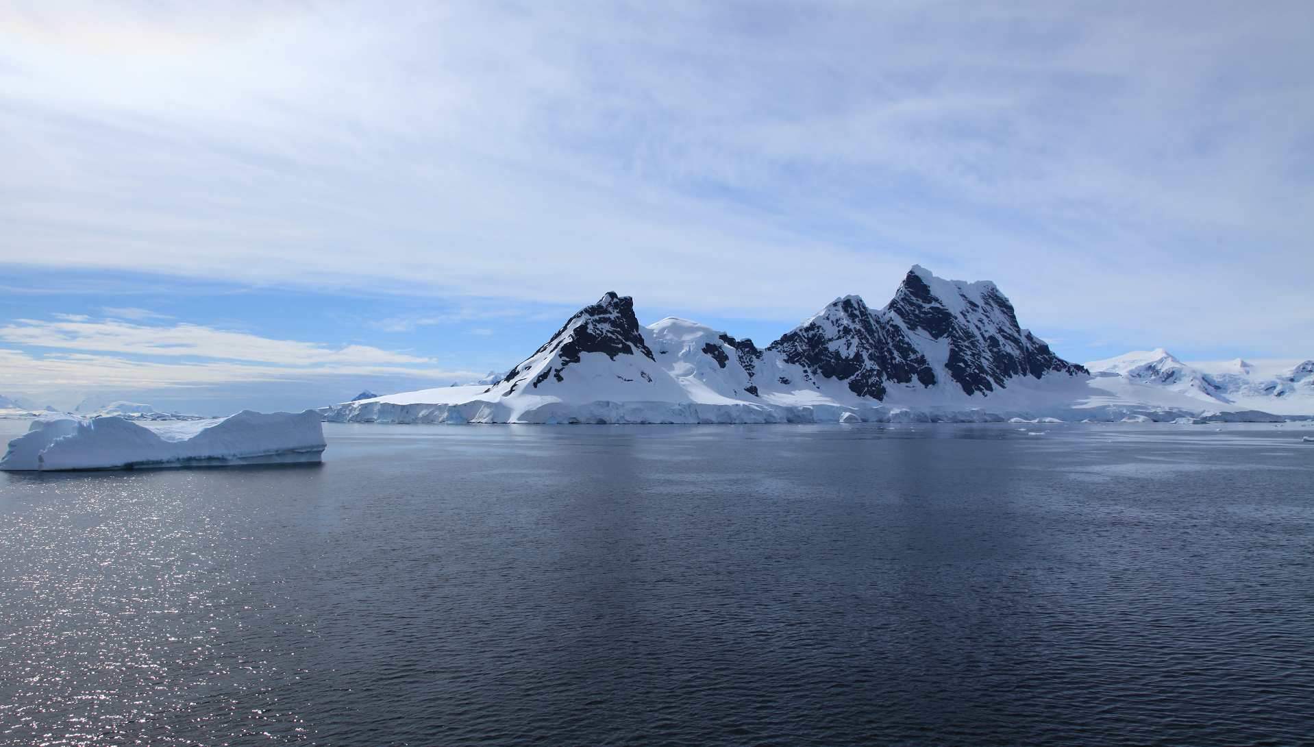 Liam Quinn (Flickr) |
![]()
![]()
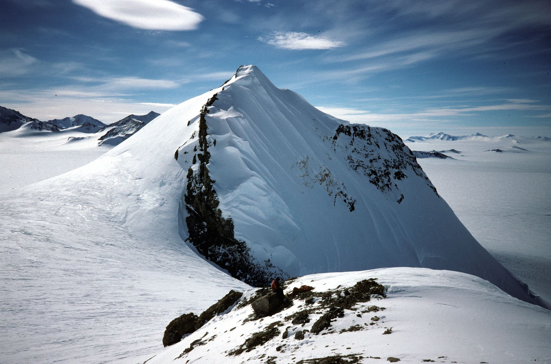
Mount Jackson (Mount Andrew Jackson and Mount Ernest Gruening) is a mountain that dominates the upland of the southern part of the Antarctic Peninsula. It is located in Palmer Land, part of the British Antarctic Territory (with unrecognised claims by Chile and Argentina). With an elevation of 3,184 metres (10,446 ft), Mount Jackson was once thought to be the highest mountain in the Antarctic Peninsula and the British Antarctic Territory, before the true height of Mount Hope (Eternity Range) was measured.[3] Discovered by members of the United States Antarctic Service, 1939–41, it was named for Andrew Jackson, the seventh President of the United States. The first ascent of Mount Jackson was made by a team led by John Crabbe Cunningham of the British Antarctic Survey (BAS) in 1964. Mount Jackson’s geology was studied in 1972 as part of the Palmer Island investigations by a team of geologists.
Topography
Mount Jackson and the Welch Mountains demarcate the central Black Coast, which is dissected by many inlets and is bounded on the west by Dyer Plateau of central Palmer Land. The two mountains rise above the ice shelf with reliefs of about 1,200–1,500 metres (3,900–4,900 ft) towards the east. They are interconnected by icefall zones forming a plateau with steep snow slopes. Mount Jackson rises from its southeast flanks, displaying a steeple summit, whilst the north flank is occupied by a vast cirque. Supraglacial moraines on the mountain’s east side measure between 1–5 kilometres (0.62–3.11 mi) in length and display boulders at their distal ends.
History
The first topographic mapping of Mount Jackson was carried out in November 1940 by a sledge party of the United States Antarctic Service (USAS). The ground survey was facilitated by aerial photographs and aerial observations. The height was estimated at 4,200 metres (13,800 ft), and the mountain was named Mount Ernest Gruening after the Governor of the Alaska Territory at that time, Ernest Gruening.[7] USAS later renamed it Mount Jackson for the seventh President of the United States.[7] President Jackson signed the bill into law authorizing the United States Exploring Expedition of 1838–42. The expedition, led by Lt. Charles Wilkes, included exploration and surveying of the Pacific Ocean and surrounding lands, including Antarctica.[5]
In November 1947, a Falkland Islands Dependencies Survey ground party based at Stonington Island observed Mount Jackson and estimated its height at 3,050 metres (10,010 ft), considerably lower and more accurate than the first estimate in 1940.[7] After the Falkland Islands Dependencies Survey was renamed the British Antarctic Survey in 1962, a series of depots were developed, including one at Mount Jackson.[8] BAS members were successful in making many first ascents of the mountains of the Antarctic Peninsula, and John Cunningham, who served at the BAS base at Adelaide Island, was the first to climb Mount Jackson. Traveling by dog sled for 640 kilometres (400 mi),[9] his team reached the summit on 23 November 1964.[7][6][10]
A precise height of the summit was determined by a BAS survey party who ascended the peak during the austral summer of 1996–97.[1]
This article uses material from the Wikipedia article Mount Jackson (Antarctica), which is released under the Creative Commons Attribution-Share-Alike 4.0 International License (view authors).
 Euphro (Flickr) |
![]()
![]()
Mount Balfour (69°19′00″S 67°13′00″W) is a bastion-like rocky mountain, 1,010 metres (3,310 ft) high, which lies at the mouth of Fleming Glacier, close to the junction with the Wordie Ice Shelf on the west side of the Antarctic Peninsula. First roughly surveyed in 1936 by the British Graham Land Expedition under Rymill, and resurveyed by the Falkland Islands Dependencies Survey in 1948. It was named for Henry Balfour, President of the Royal Geographical Society from 1936 to 1938.
This article uses material from the Wikipedia article Mount Balfour (Antarctica), which is released under the Creative Commons Attribution-Share-Alike 4.0 International License (view authors).
 Joe MacGregor (NASA) |
