
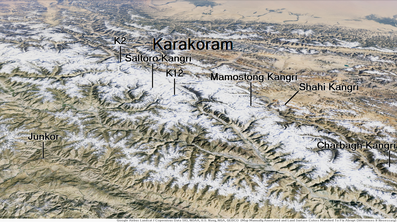
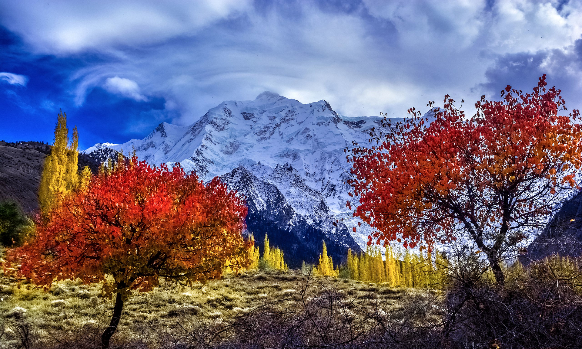
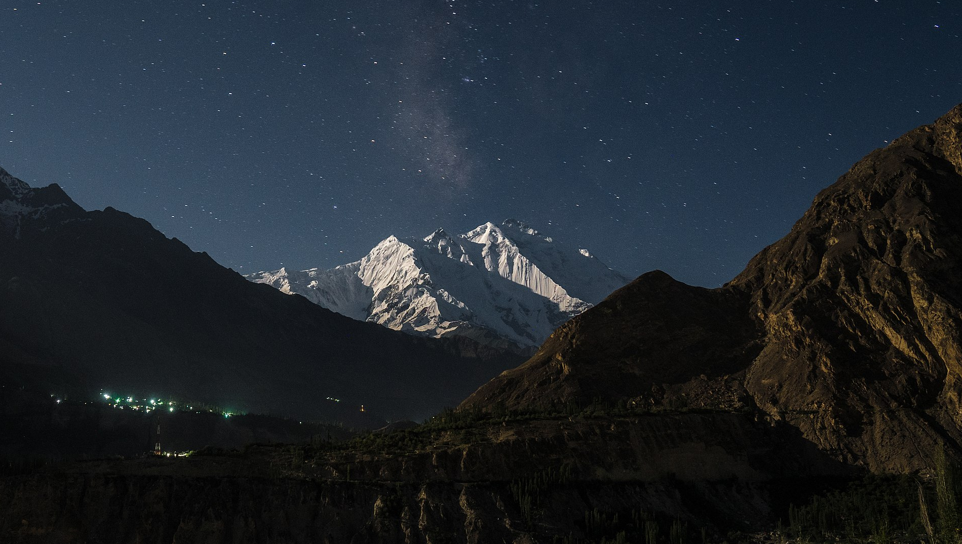
Map of Karakoram
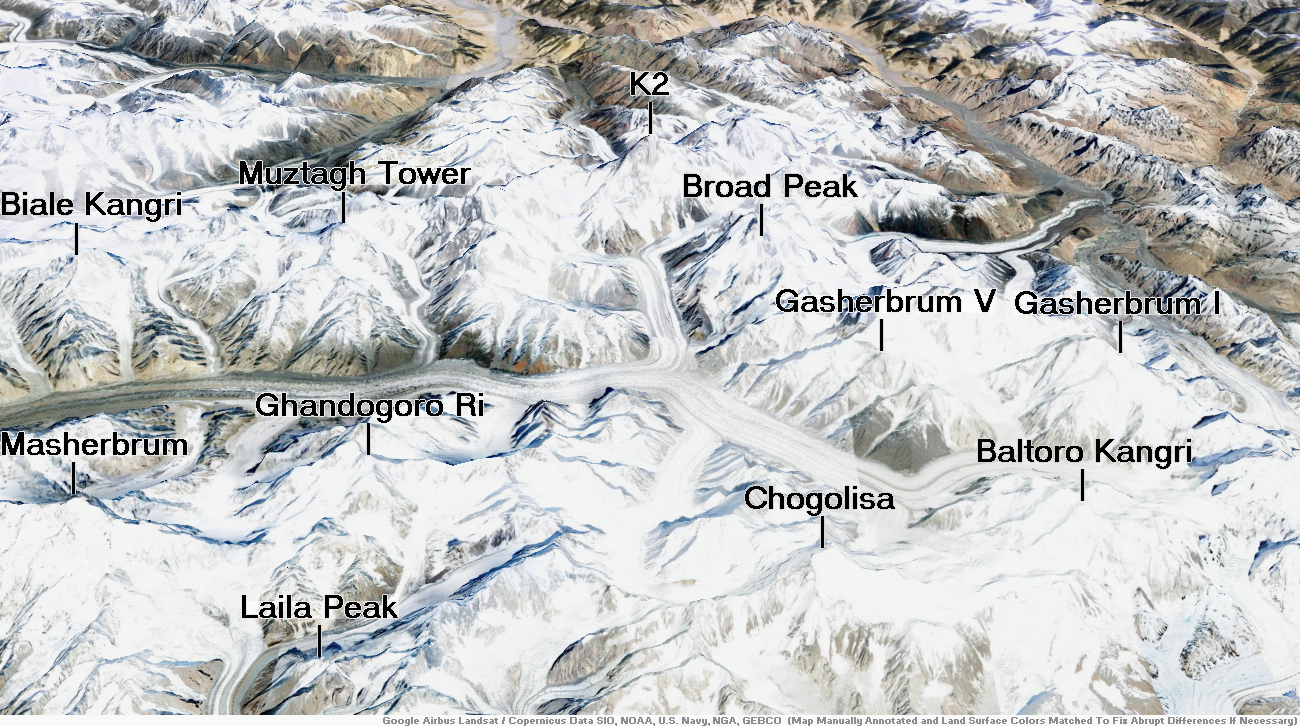
K2 Region
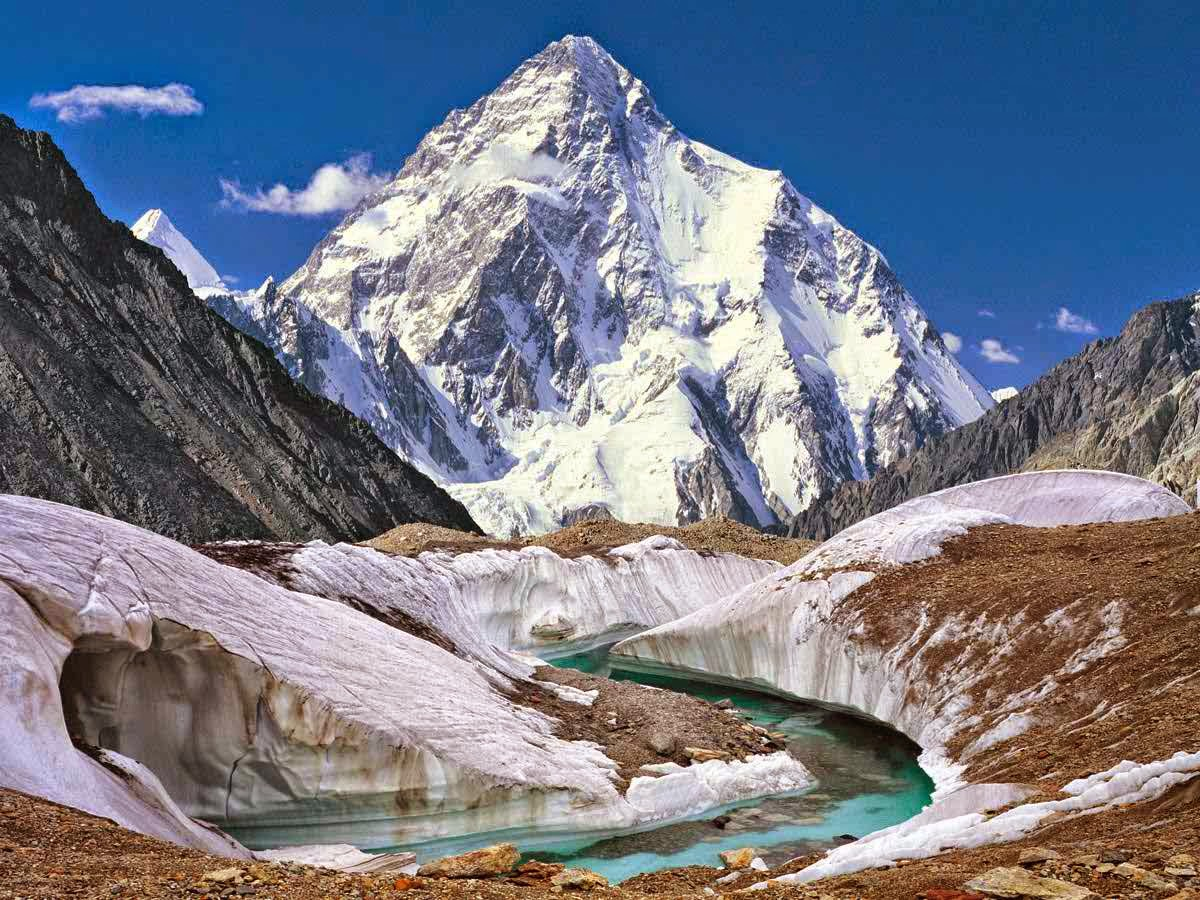
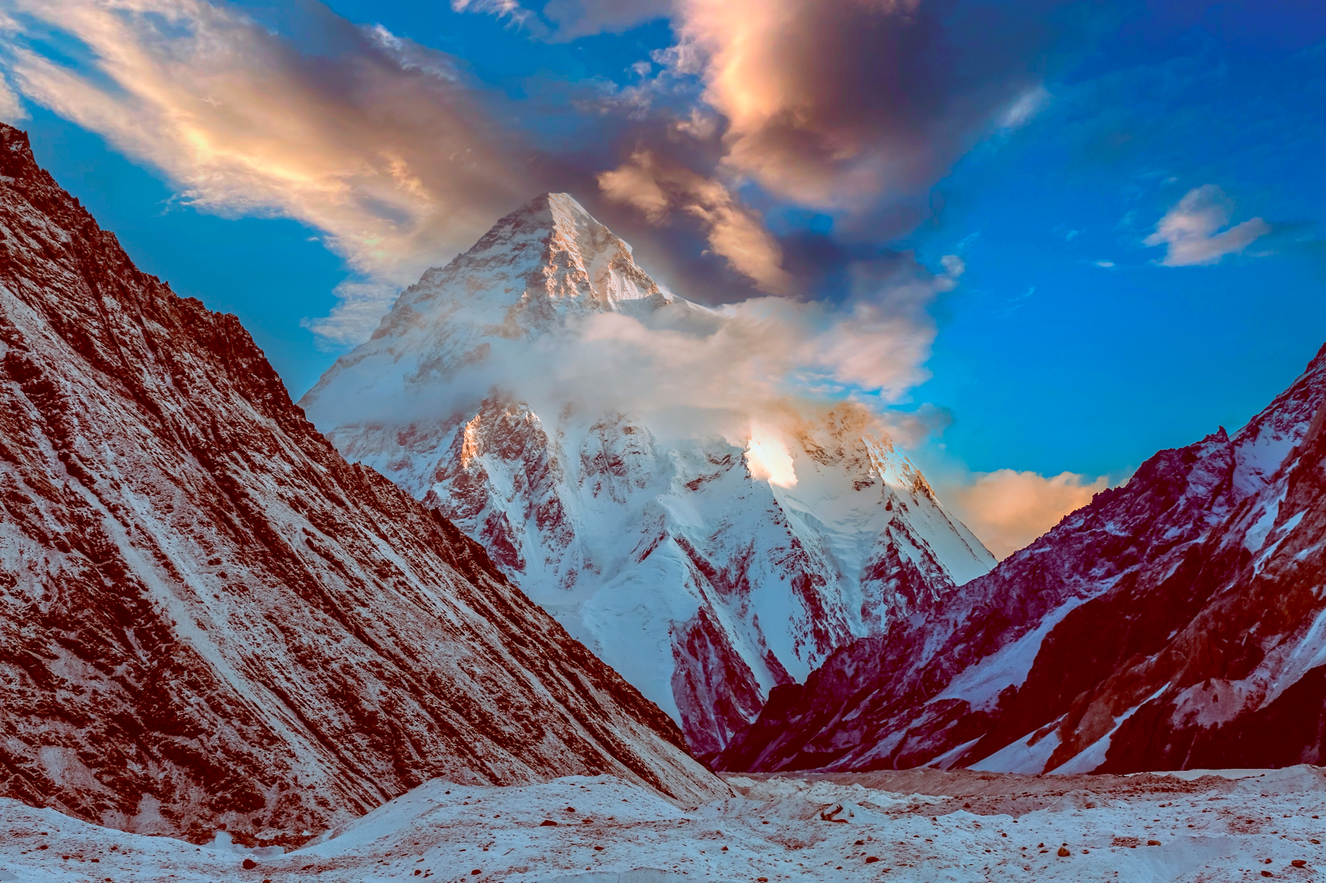
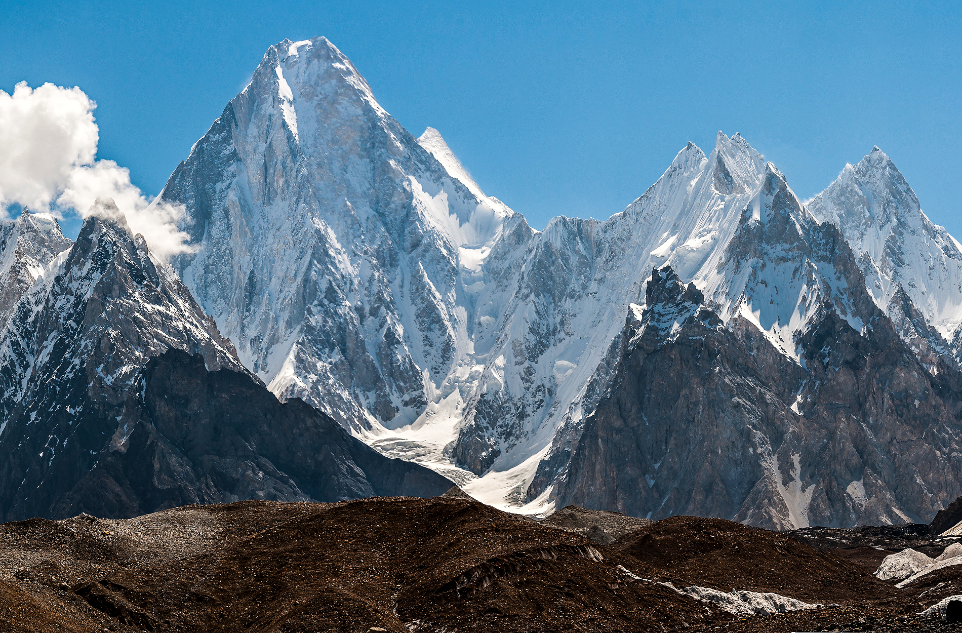
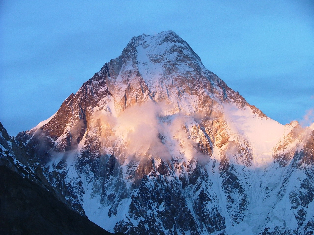
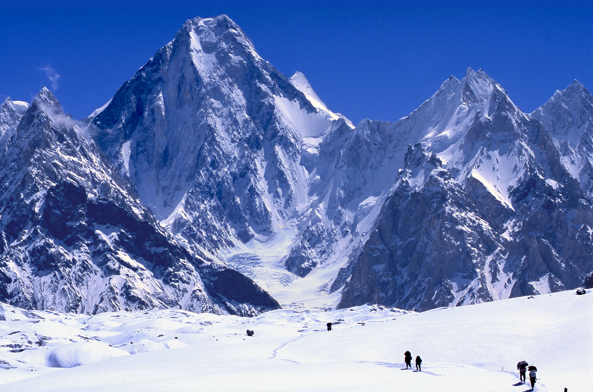
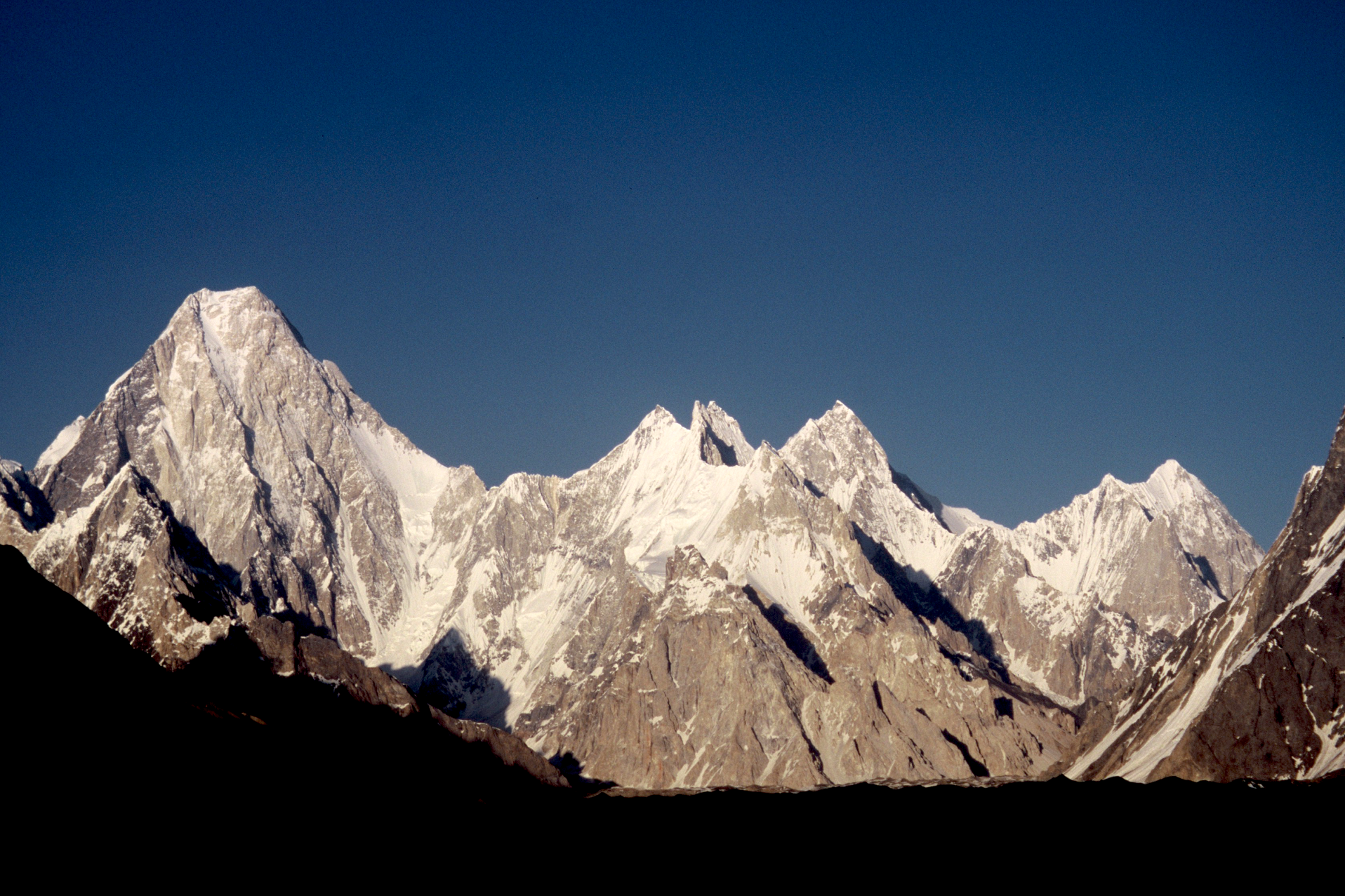
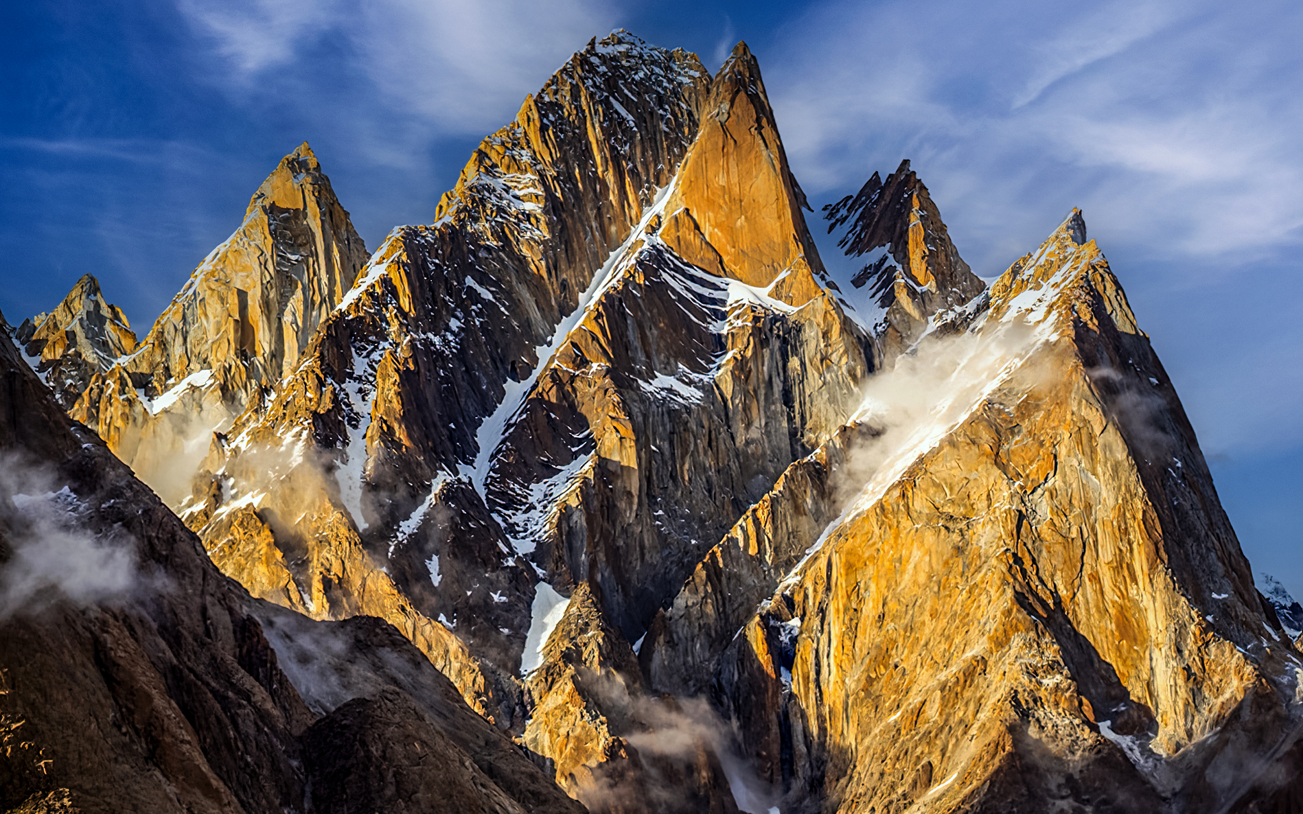
K2 Panoramic 1 and 2
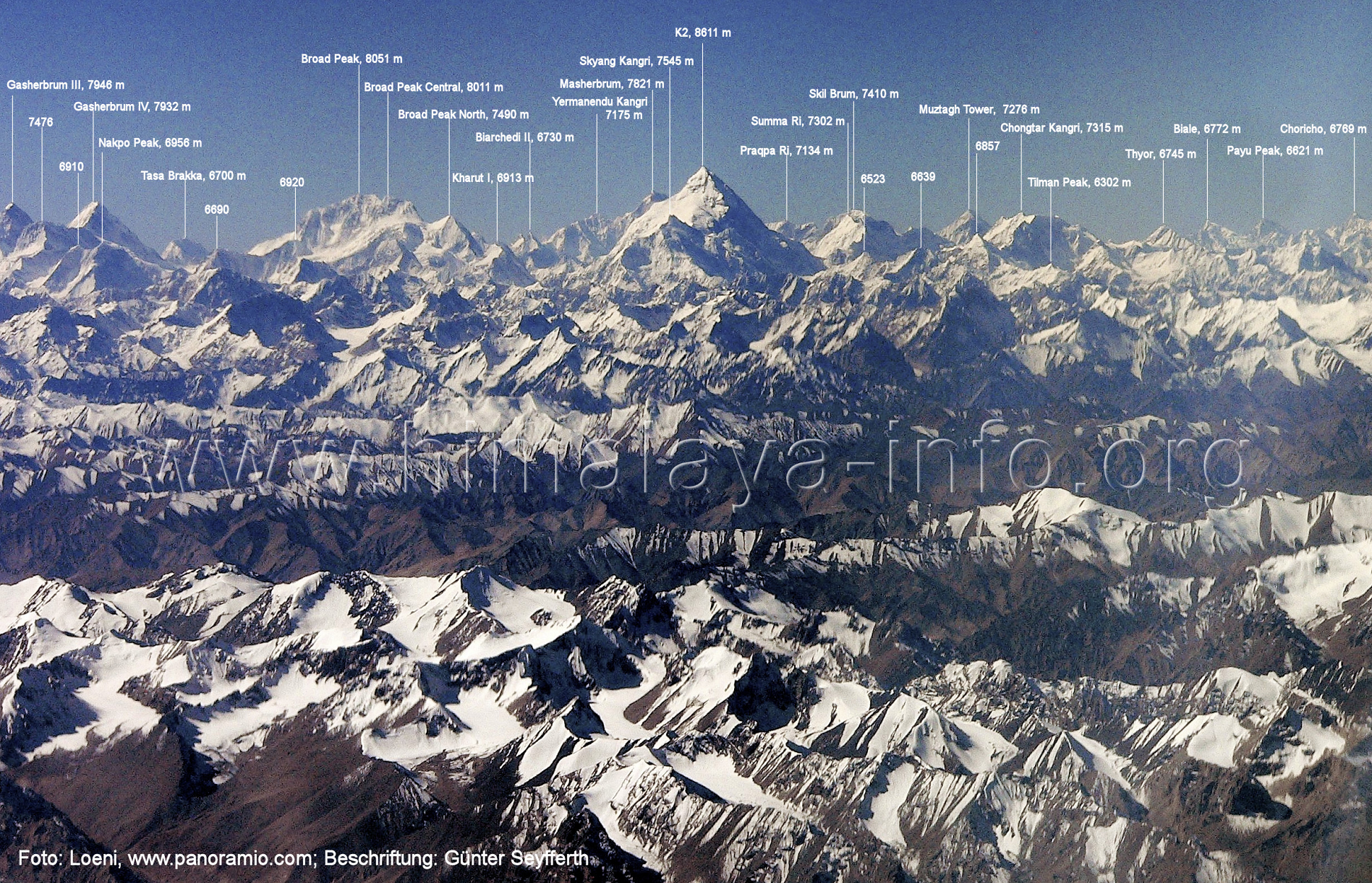 Loeni (Panoramio.com) | 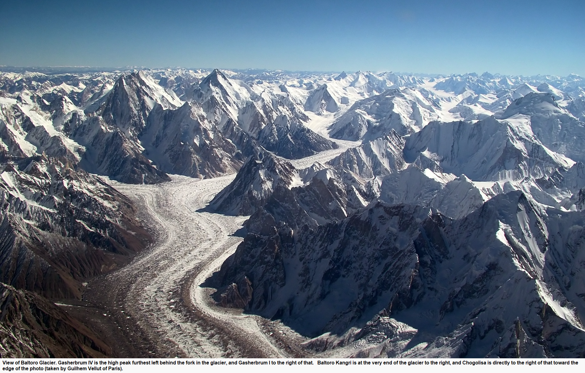 Guilhem Vellut |
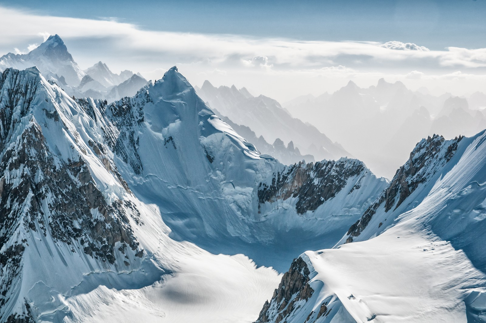
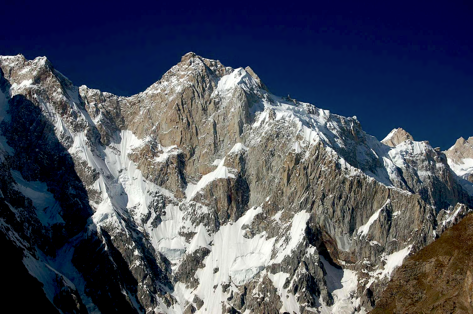
K2 Panoramic 3
 |

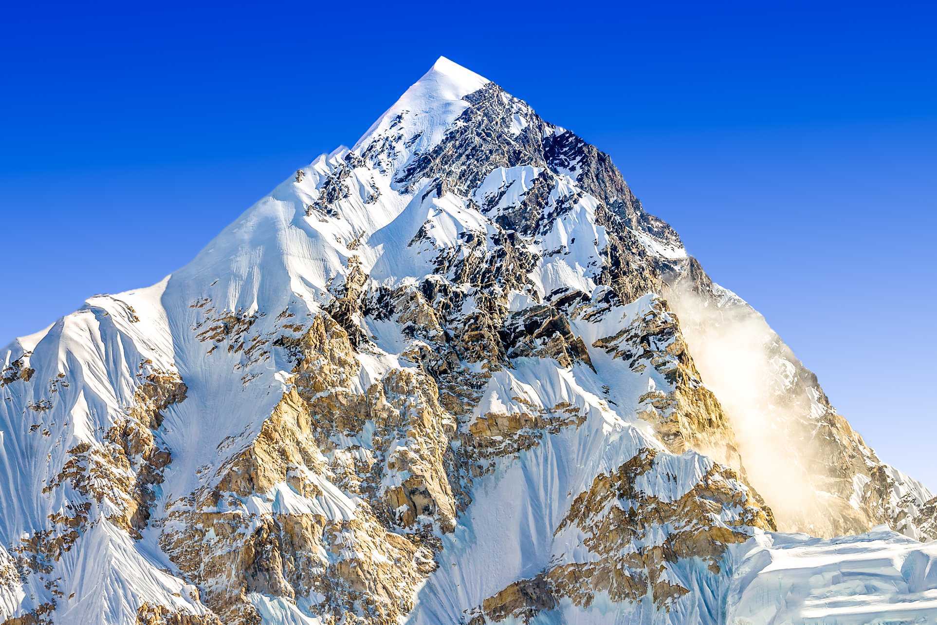
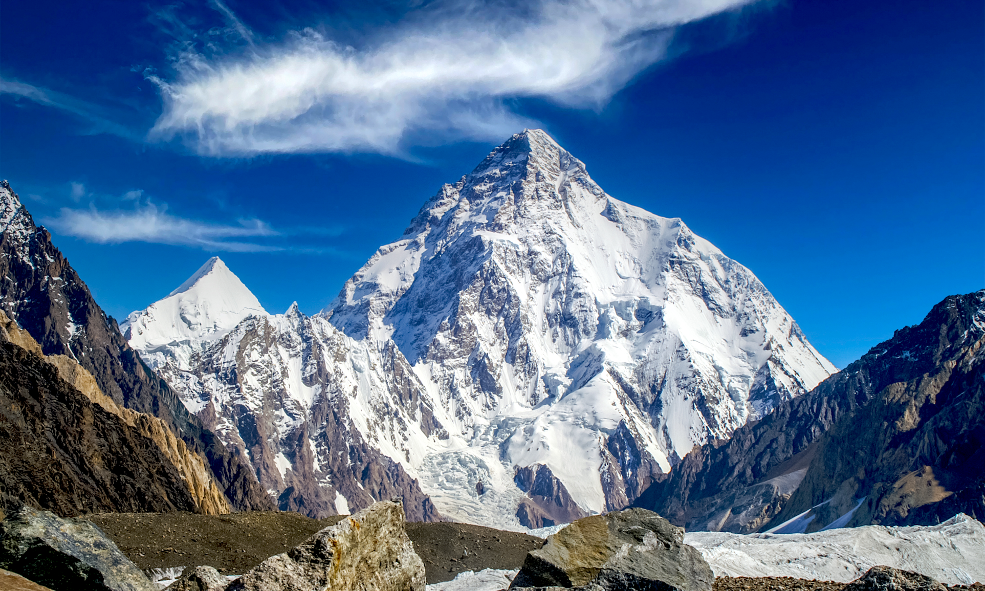
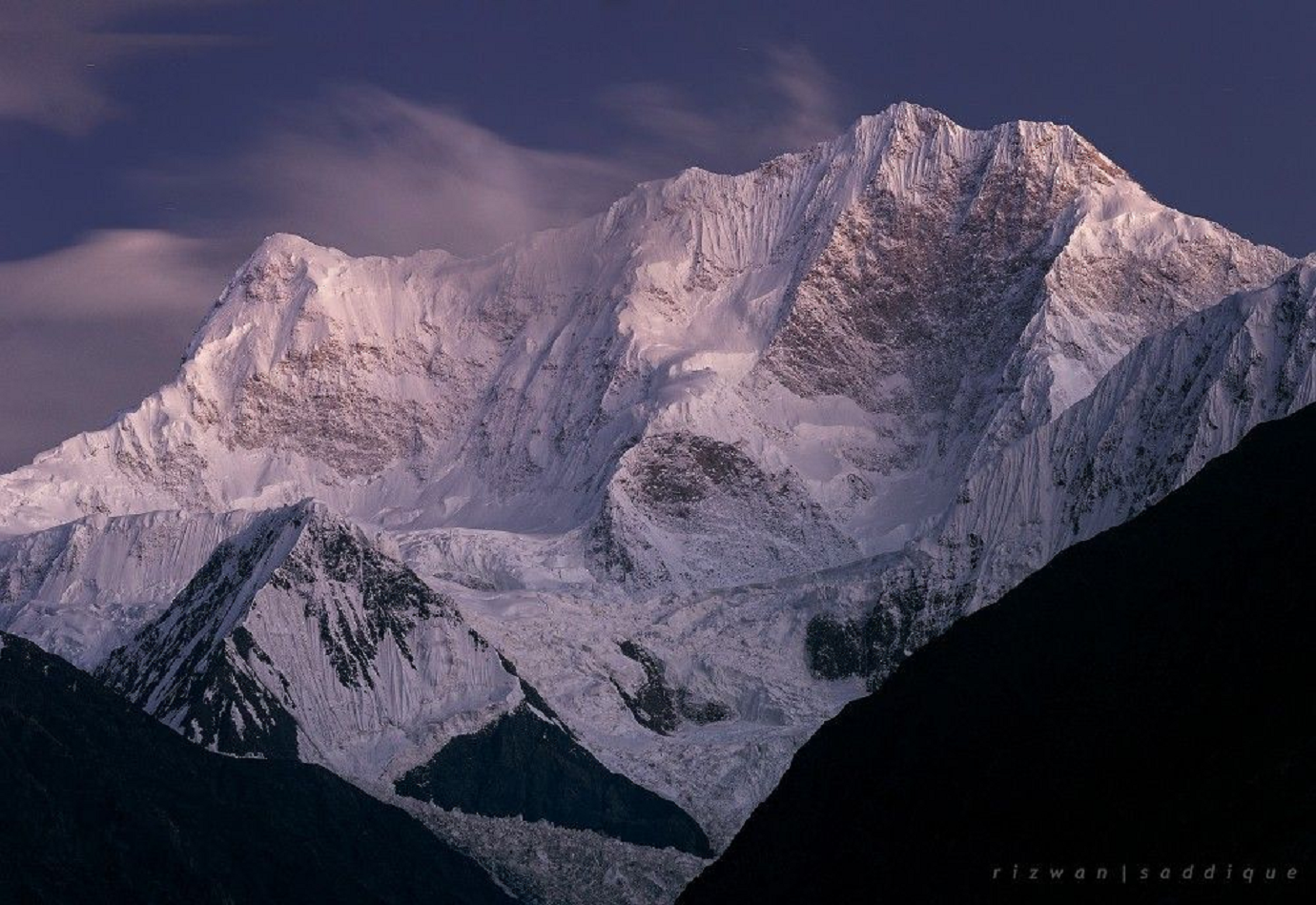
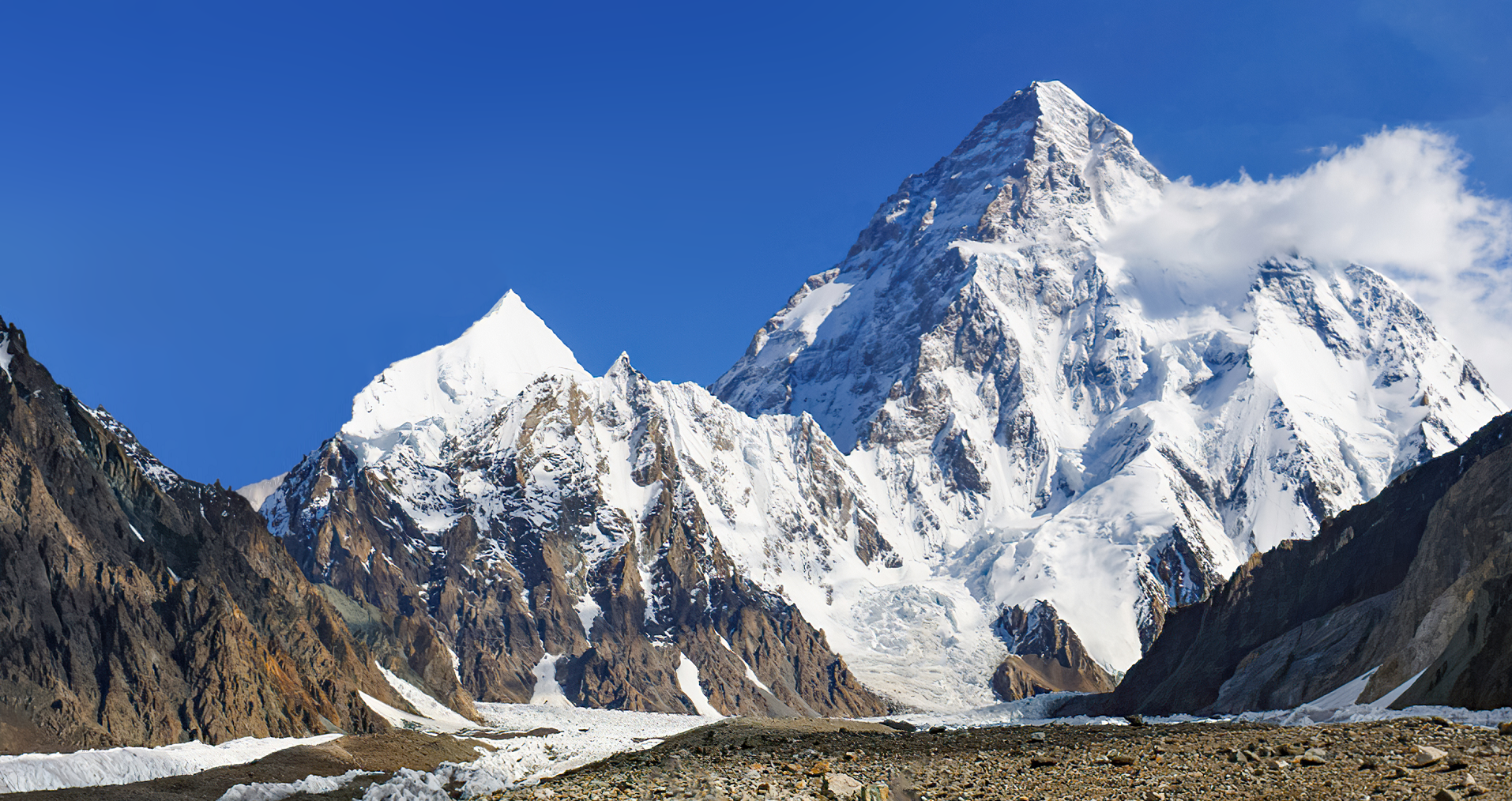
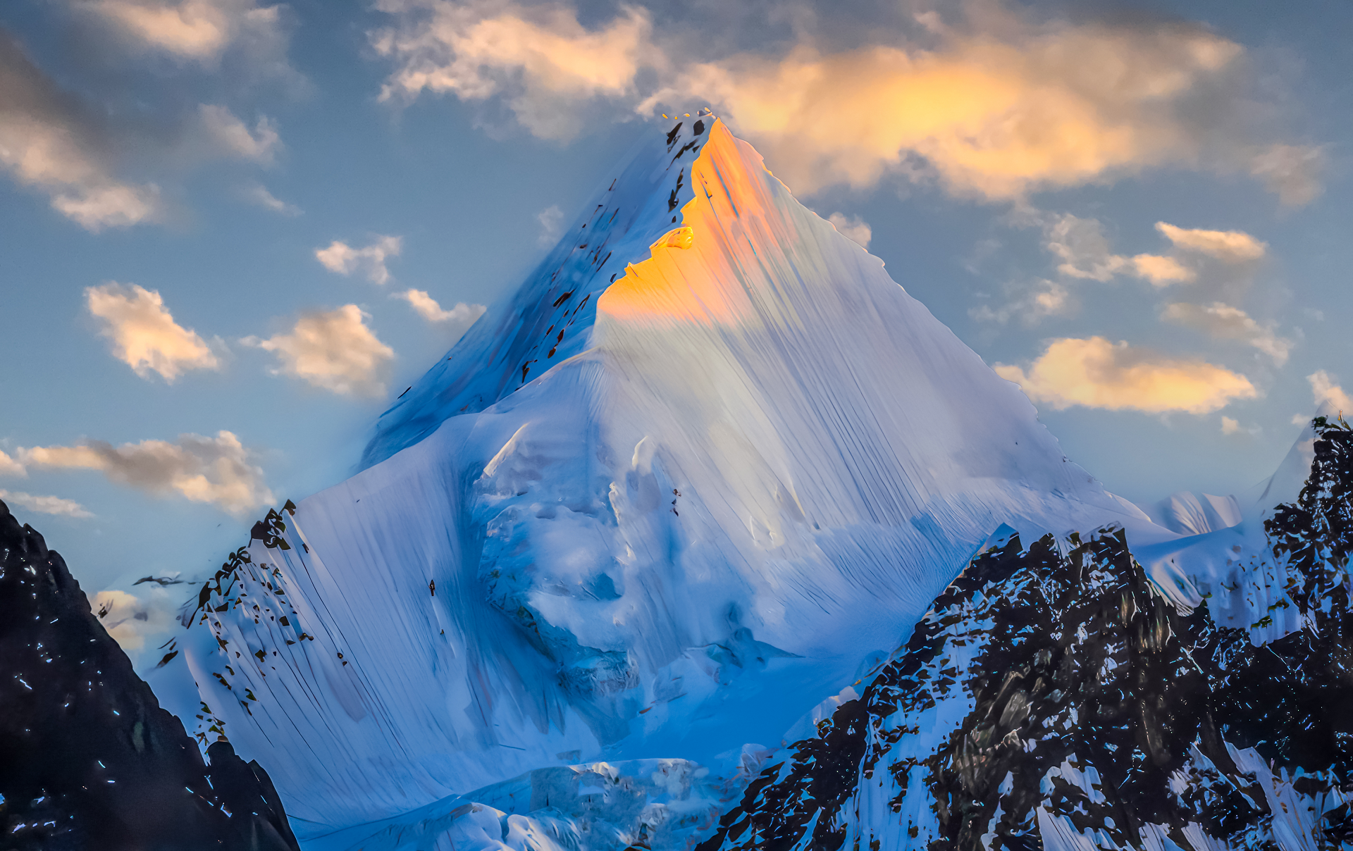
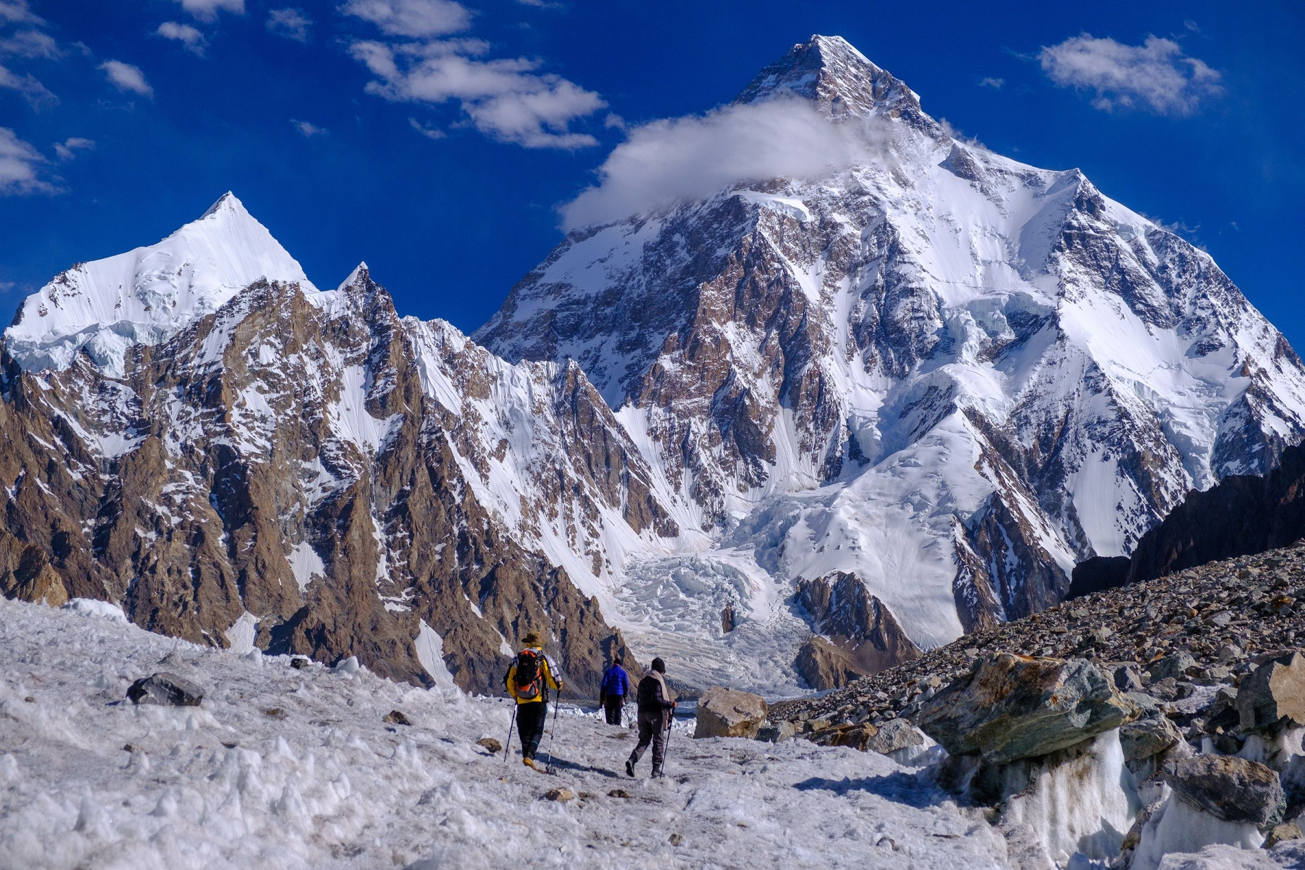
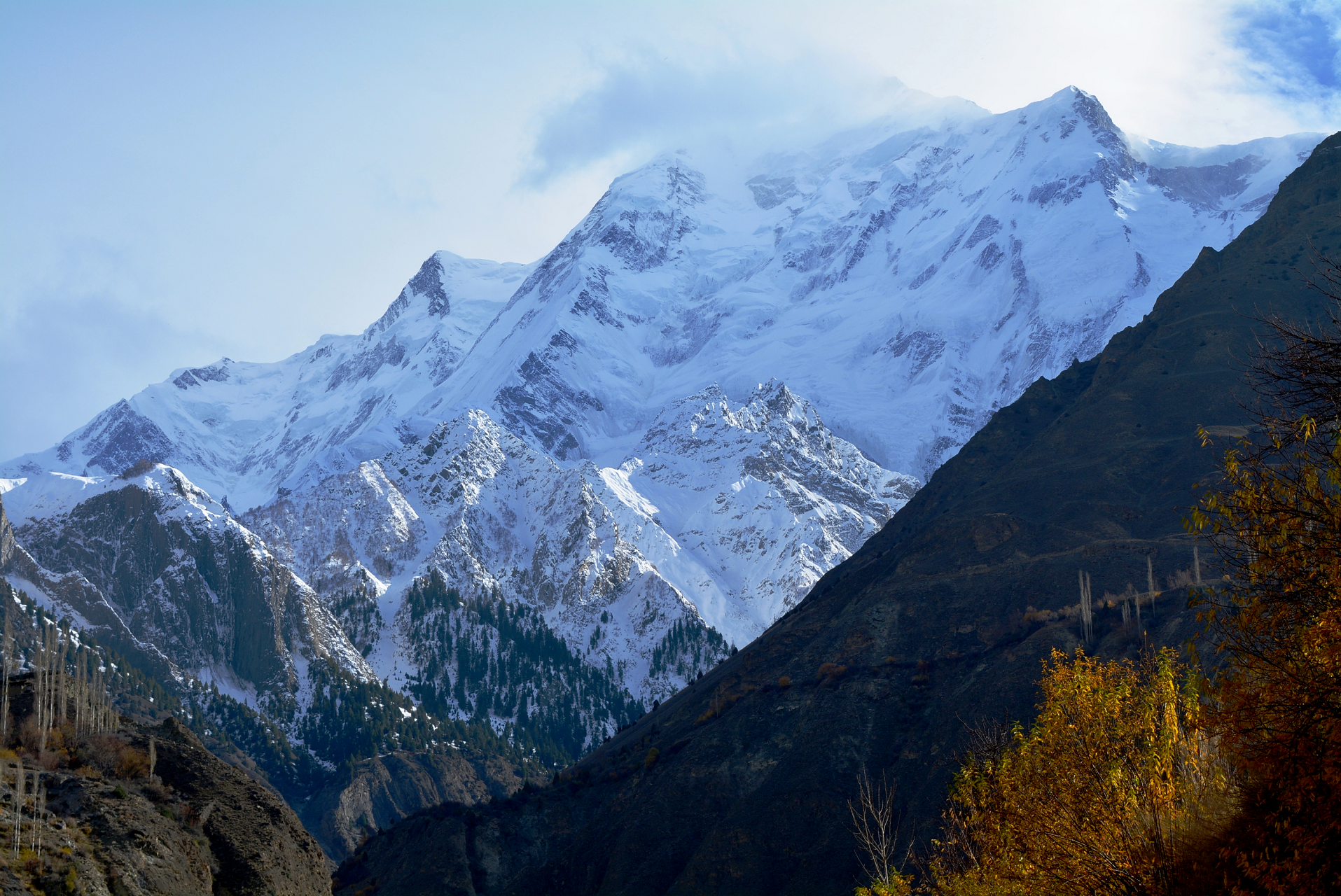
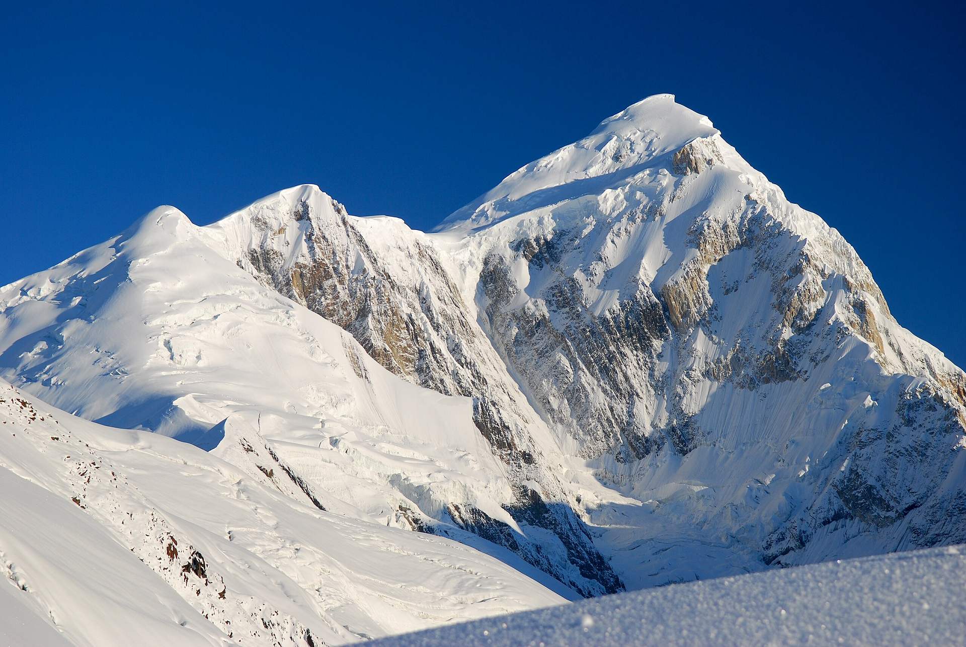
K2, at 8,611 metres (28,251 ft) above sea level, is the second-highest mountain on Earth, after Mount Everest at 8,849 metres (29,032 ft).[5] It lies in the Karakoram range, partially in the Gilgit-Baltistan region of Pakistan-administered Kashmir and partially in the China-administered Trans-Karakoram Tract in the Taxkorgan Tajik Autonomous County of Xinjiang.[6][7][8][a]
K2 became known as the Savage Mountain after George Bell—a climber on the 1953 American expedition—said, “It’s a savage mountain that tries to kill you.”[9] Of the five highest mountains in the world, K2 has long been the deadliest: prior to 2021, approximately one person had died on the mountain for every four who reached the summit.[9][10][11] After an increase in successful attempts, as of August 2023, an estimated 800 people have summited K2, with 96 deaths during attempted climbs.[11]
Also occasionally known as Mount Godwin-Austen,[12][3][13] other nicknames for K2 are The King of Mountains and The Mountaineers’ Mountain,[14] as well as The Mountain of Mountains after prominent Italian climber Reinhold Messner titled his book about K2 the same.[15] Although the summit of Everest is at a higher altitude, K2 is a more difficult and dangerous climb. This is due in part to its more northern location, where inclement weather is more common.[16] The summit was reached for the first time by the Italian climbers Lino Lacedelli and Achille Compagnoni on a 1954 Italian expedition led by Ardito Desio.
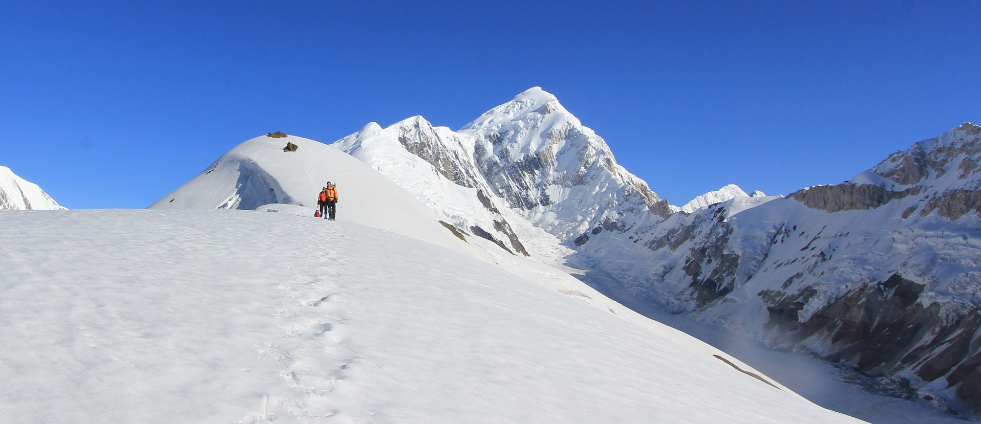
Most ascents are made during July and August, typically the warmest times of the year.[17] In January 2021 K2 became the final eight-thousander to be summited in the winter by a team of Nepalese climbers led by Nirmal Purja and Mingma Gyalje Sherpa.[18][19]
K2’s eastern face remains un-climbed.[20]
This article uses material from the Wikipedia article K2, which is released under the Creative Commons Attribution-Share-Alike 4.0 International License (view authors).
 I | 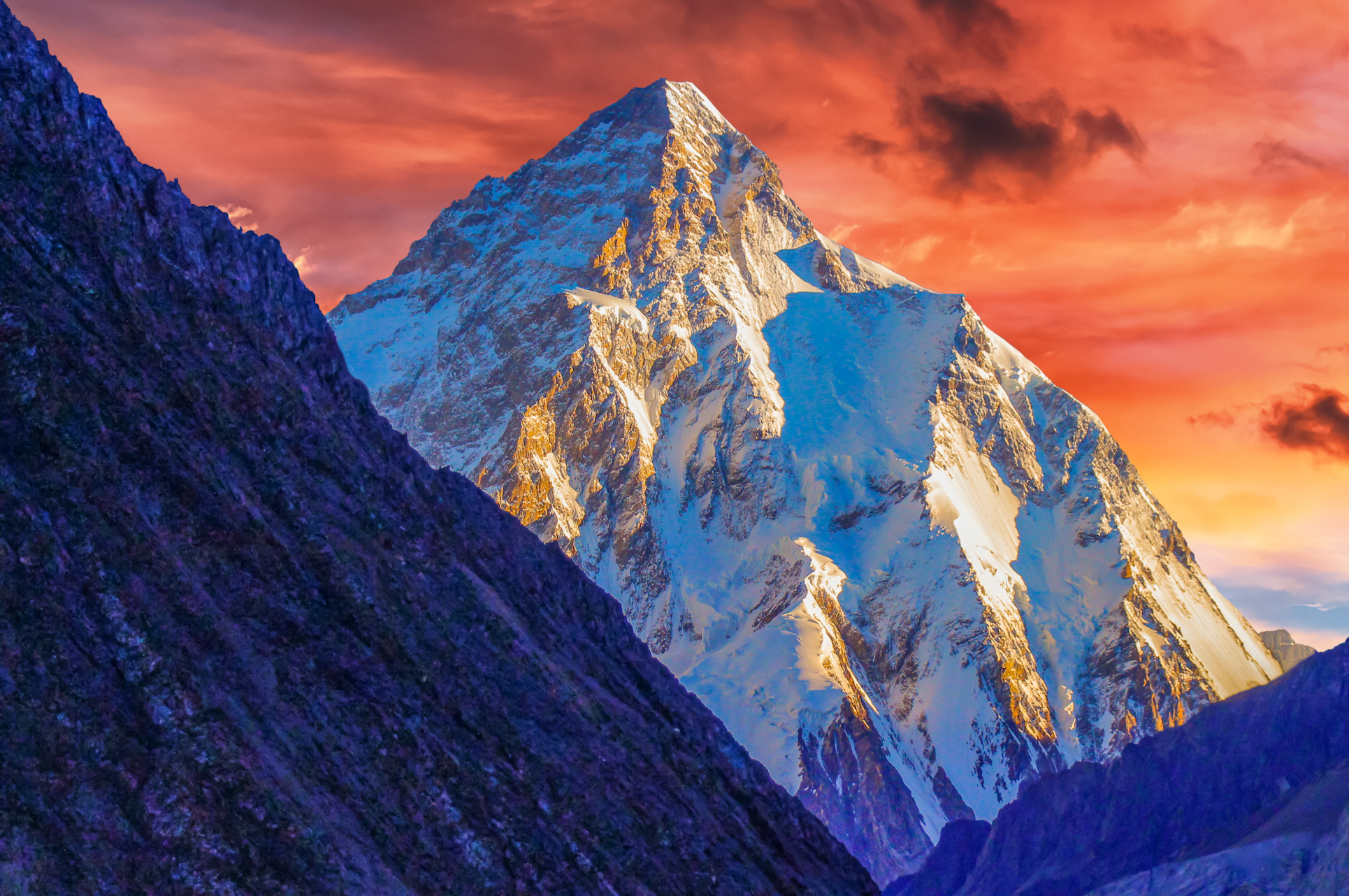 Ghulam Hussain (iStock) |
 Ghulam Hussain (iStock) | 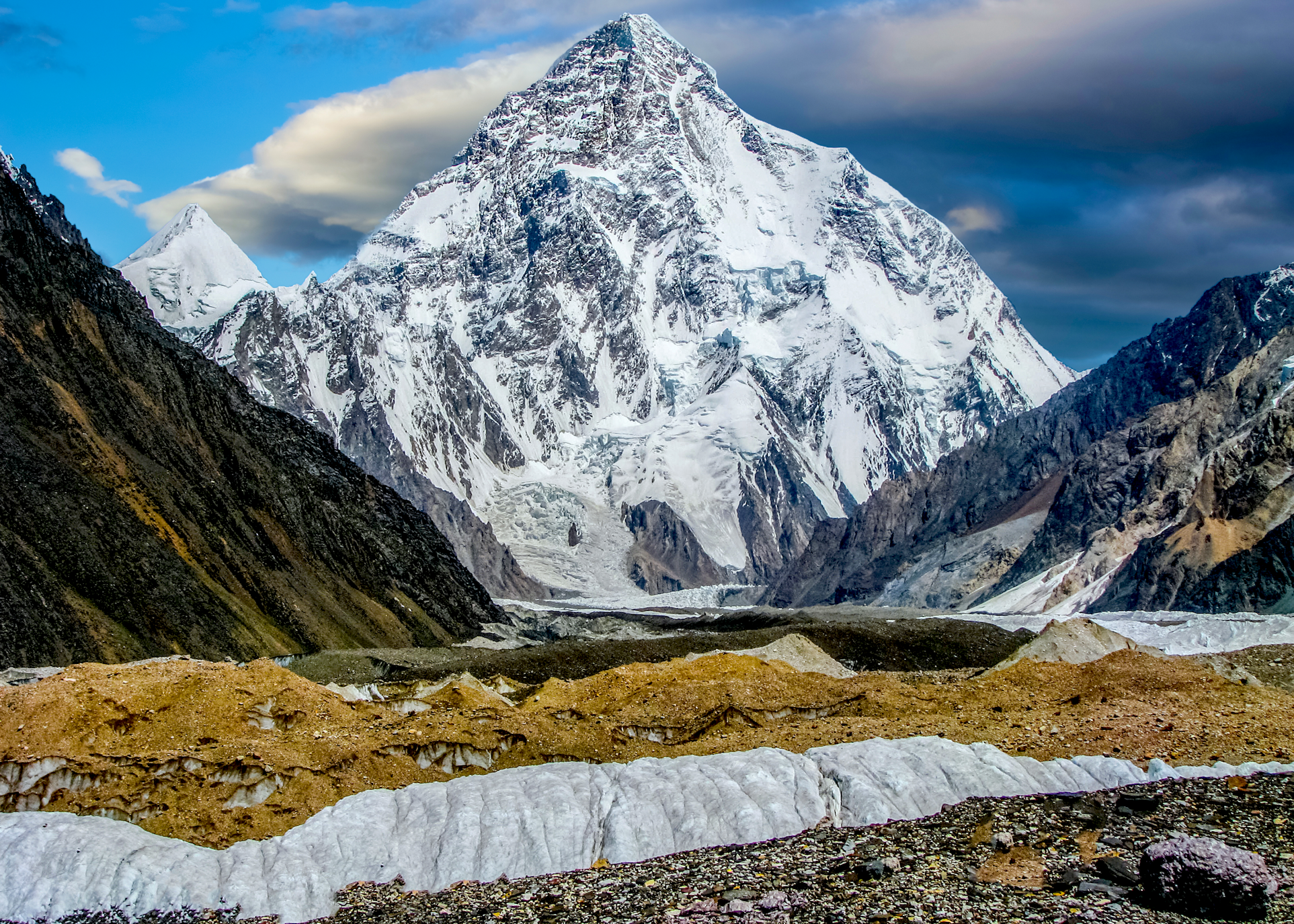 Ghulam Hussain (iStock) |
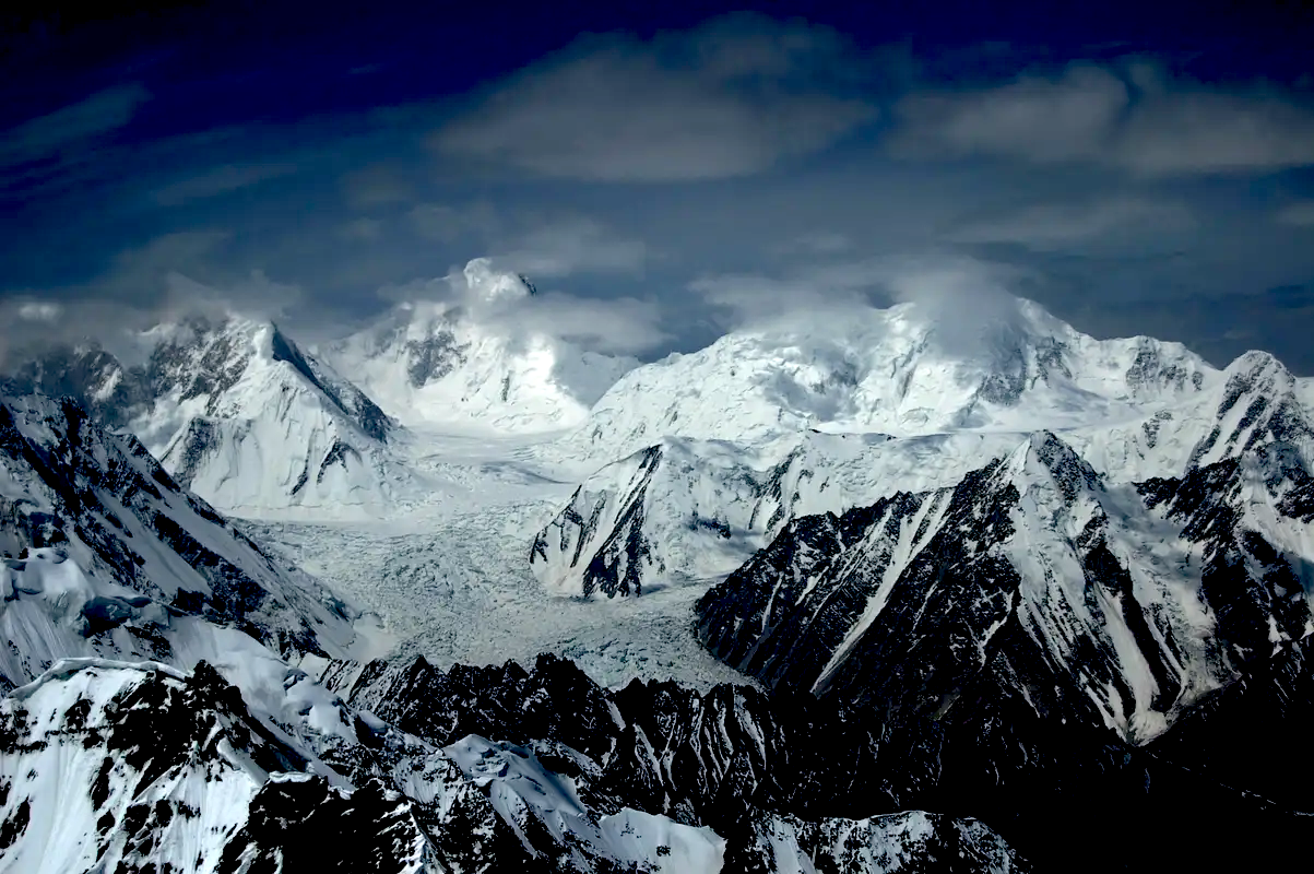
 Ghulam Hussain (iStock) | 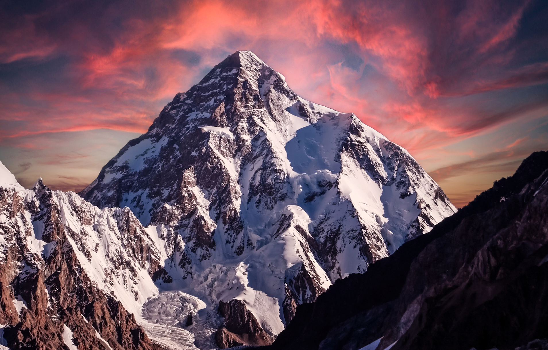 Ghulam Hussain (iStock) |
 Ghulam Hussain (iStock) | 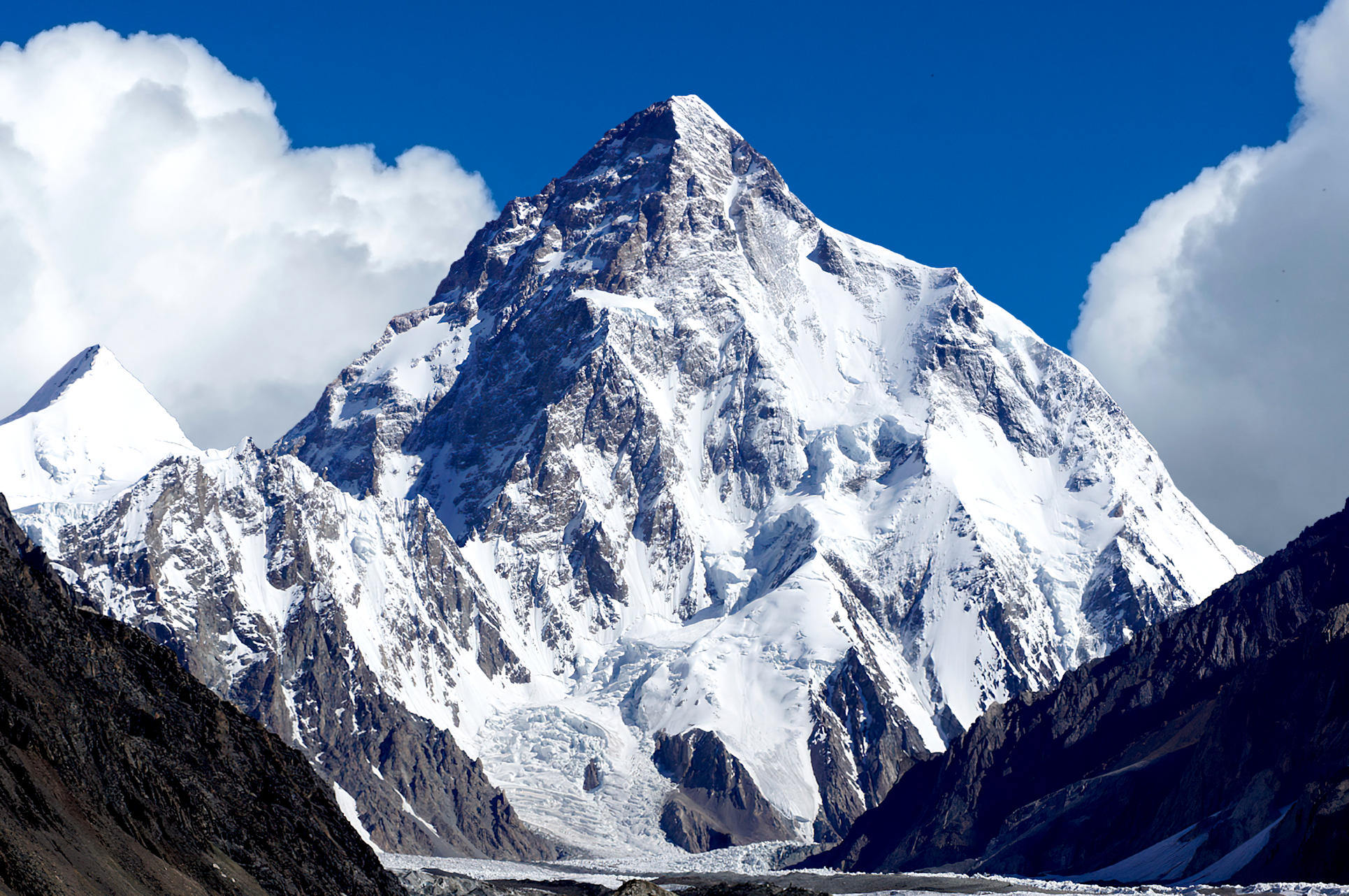 Ghulam Hussain (iStock) |
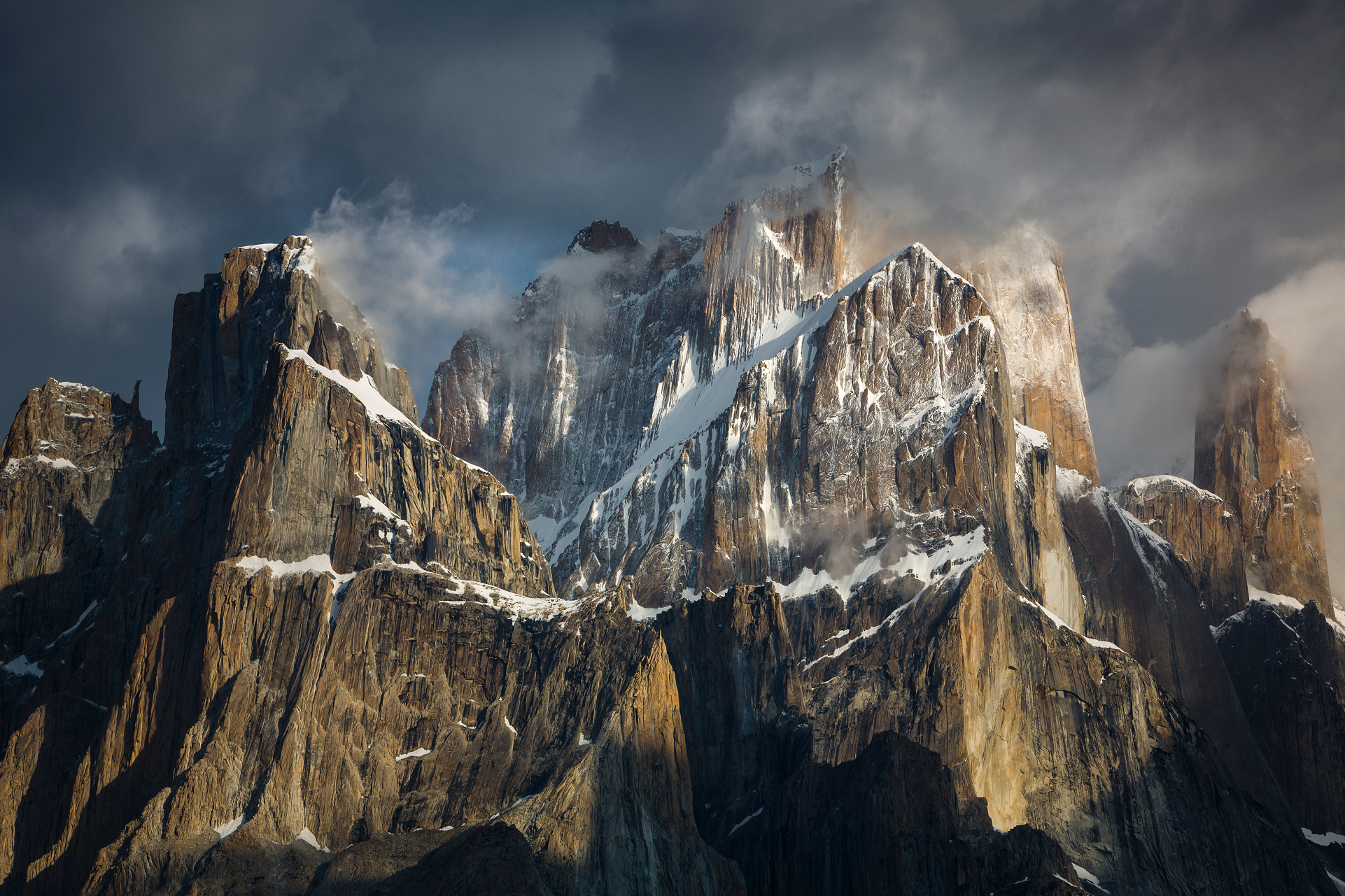
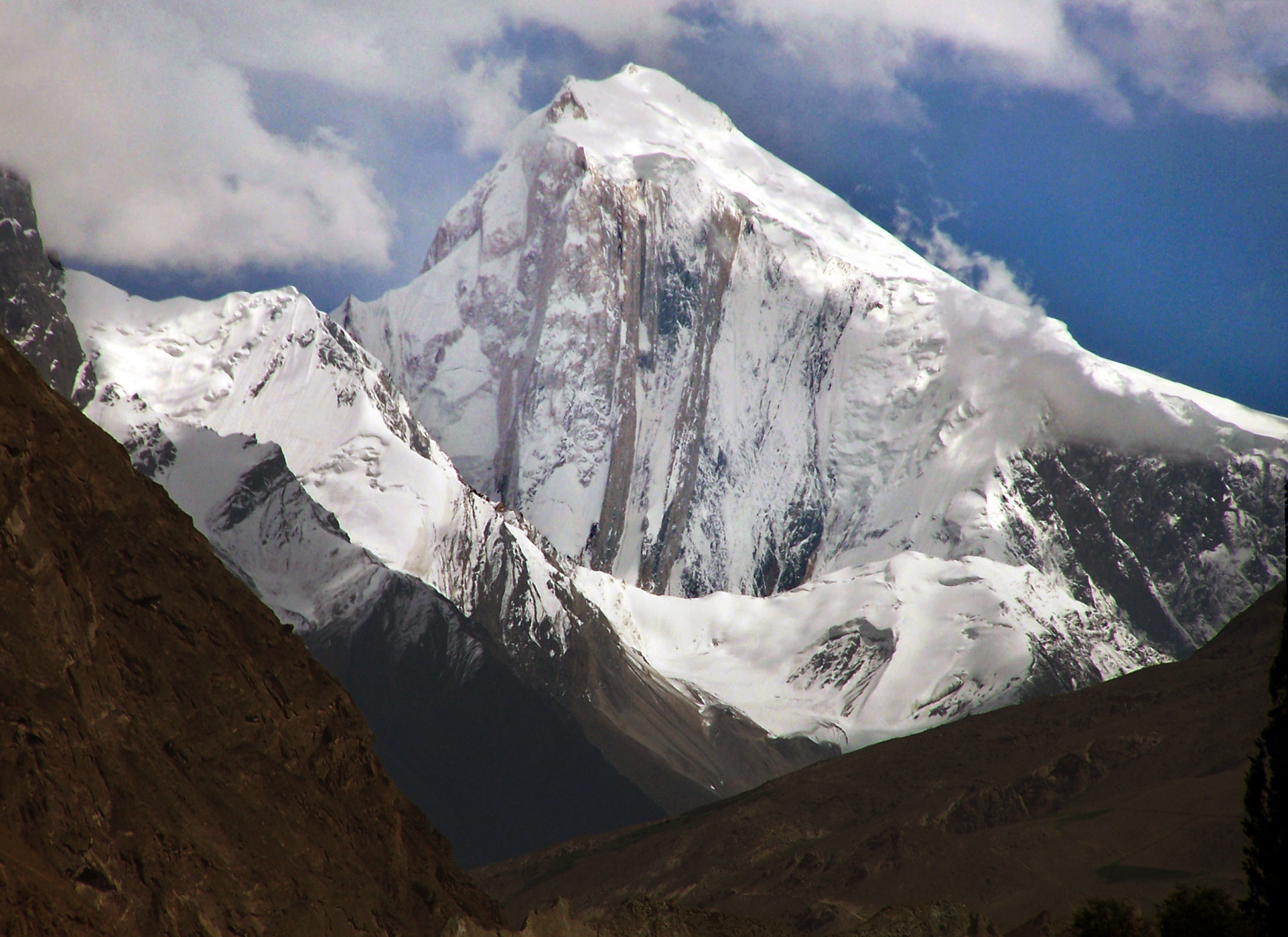
Gasherbrum IV (Urdu: گاشر برم ۔ ۴; simplified Chinese: 加舒尔布鲁木IV峰; traditional Chinese: 加舒爾布魯木IV峰; pinyin: Jiāshūěrbùlǔmù IV Fēng), surveyed as K3, is the 17th highest mountain on Earth and the 6th highest in Pakistan, as well as the highest independent mountain under eight thousand metres in Pakistan.
One of the peaks in the Gasherbrum massif, its immense West Face looms over the glacial junction of Concordia. The Name “Gasherbrum” is often claimed to mean “Shining Wall”, presumably a reference to this face’s tendency to reflect the rays of the setting sun, but in fact it comes from “rgasha” (beautiful) and “brum” (mountain) in Balti, hence it actually means “beautiful mountain.”[3]
Despite its lower height relative to the surrounding eight-thousanders, Gasherbrum IV is a venerated challenge among mountaineers.[4]
This article uses material from the Wikipedia article Gasherbrum IV, which is released under the Creative Commons Attribution-Share-Alike 4.0 International License (view authors).
 Ghulam Hussain (iStock) |  I |
 |  |
 Florian Ederer (Wikipedia) | 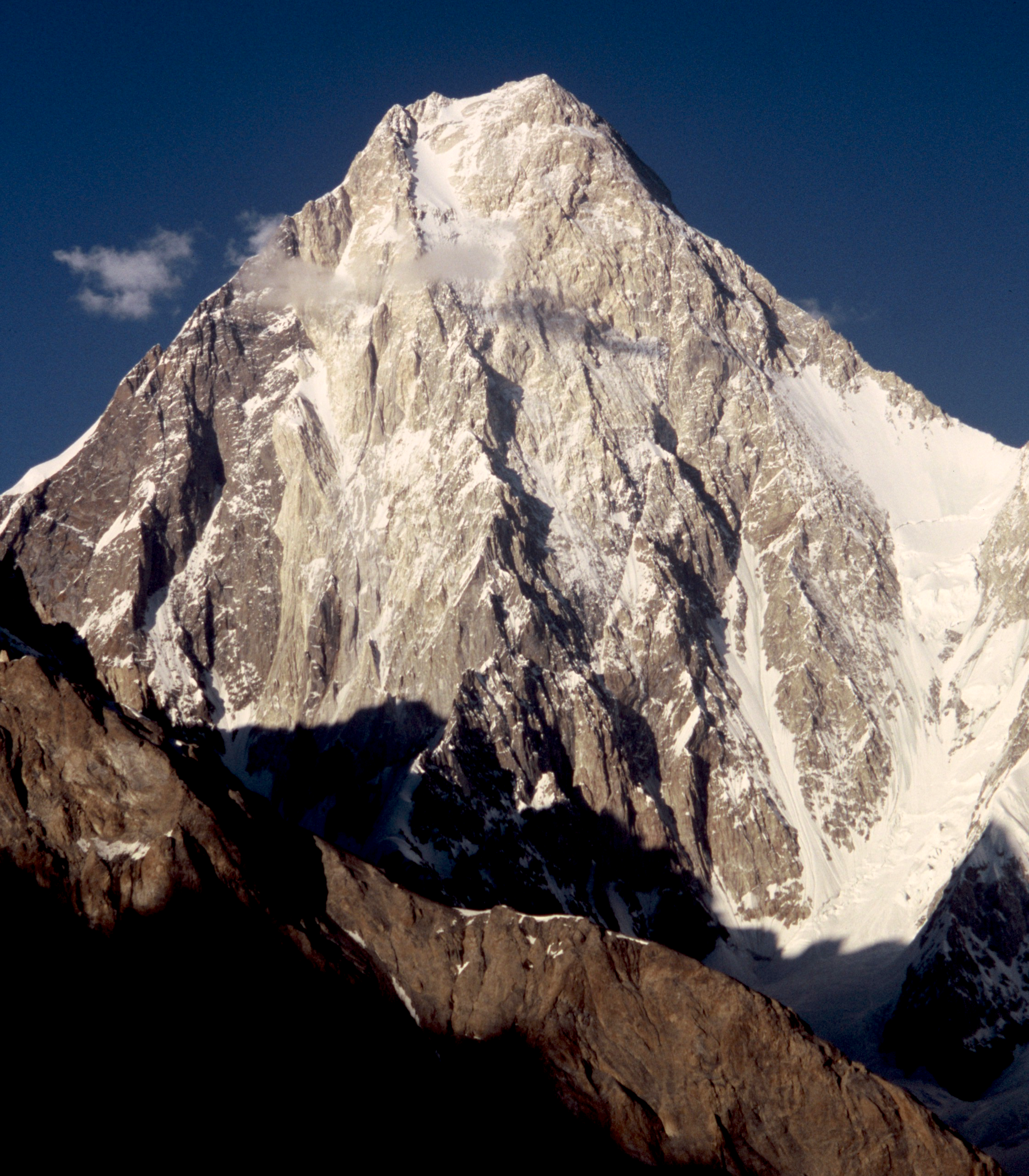 Florian Ederer (Wikipedia) |

![]()
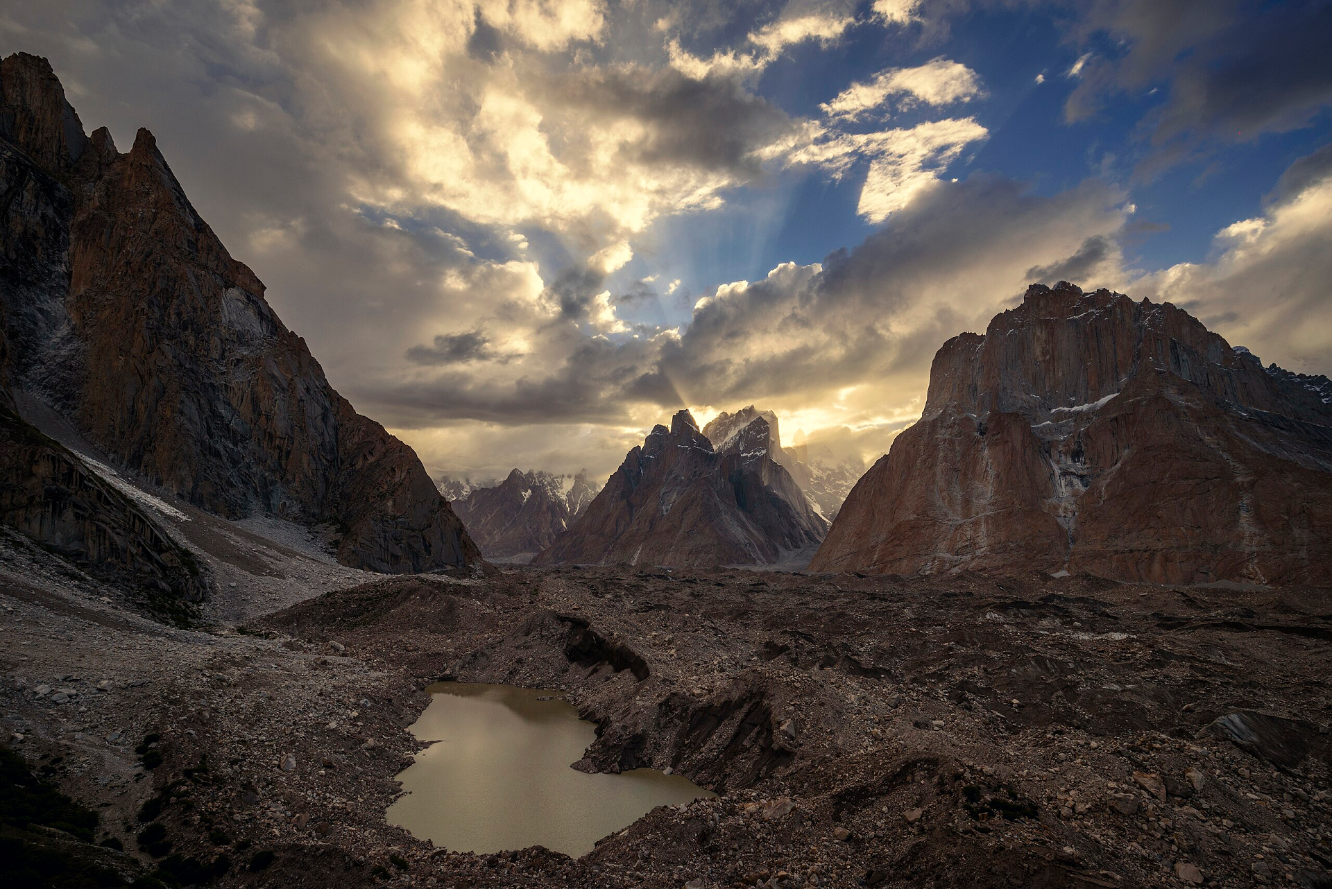
The Trango Towers (Urdu: ٹرینگو ٹاورز) are a family of rock towers situated in the Gilgit-Baltistan region, in the northern part of Pakistan. The Towers have some of the world’s largest cliffs and offer some of the most challenging big wall climbing opportunities. Each year, climbers from around the world embark on expeditions to the Karakoram region to climb these granite faces.[1] The Trango Towers are situated to the north of the Baltoro Glacier and are part of the Baltoro Muztagh, which is a sub-range within the Karakoram mountain range. The highest point within the group is the summit of Great Trango Tower at 6,286 m (20,623 ft), the east face of which features the world’s greatest nearly vertical drop.
Structure of the group
All of the Trango Towers lie on a ridge, running northwest to southeast, with Trango Glacier to the west and the Dunge Glacier to the east. Great Trango itself is a large massif, with three distinct summits: Main (6,286 m (20,623 ft)), East (6,231 m (20,443 ft)), and West (6,223 m (20,417 ft)). It is a complex combination of steep snow/ice gullies, steeper rock faces, and vertical to overhanging headwalls, topped by a snowy ridge system.
Just northwest of Great Trango is the Trango Tower (6,239 m (20,469 ft)), often called “Nameless Tower“. This is a very large, pointed, rather symmetrical spire which juts 1,000 m (3,300 ft) out of the ridgeline. North of Trango Tower is a smaller rock spire known as “Trango Monk.” To the north of this feature, the ridge becomes less rocky and loses the large granite walls that distinguish the Trango Towers group and make them so attractive to climbers; however, the summits do get higher. These summits are not usually considered part of the Trango Towers group, though they share the Trango name. Trango II (6,237 m (20,463 ft)) lies northwest of the Monk, and the highest summit on the ridge, Trango Ri (6,363 m (20,876 ft)), lies northwest of Trango II.
Just southeast of Great Trango (really a part of its southeast ridge) is the Trango Pulpit (6,050 m (19,850 ft)), whose walls present similar climbing challenges to those of Great Trango itself. Further, to the south is Trango Castle (5,753 m (18,875 ft)), the last large peak along the ridge before the Baltoro Glacier.
This article uses material from the Wikipedia article Trango Towers, which is released under the Creative Commons Attribution-Share-Alike 4.0 International License (view authors).
 Mtzendo (Wikipedia) | 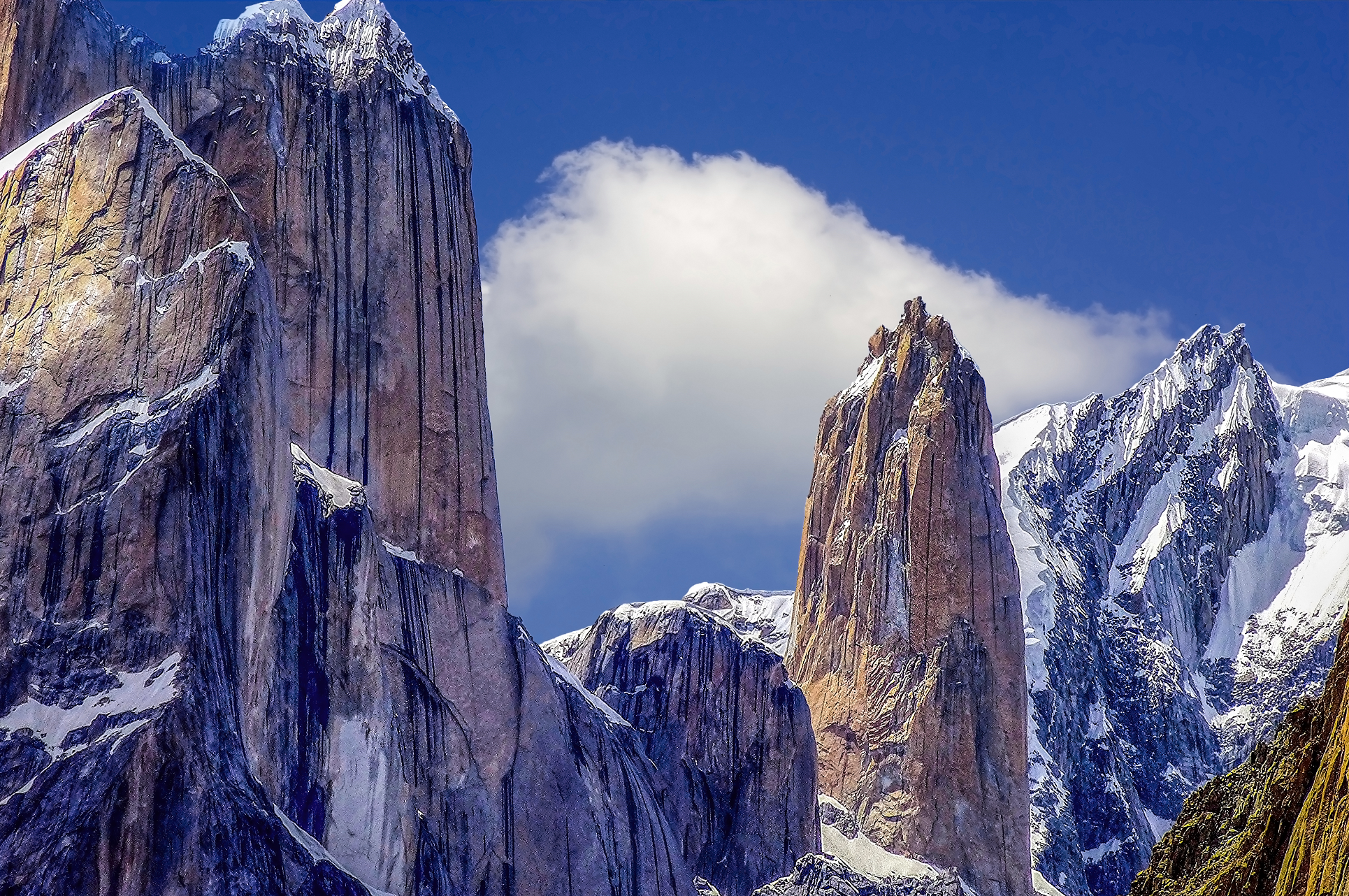 Ghulam Hussain (iStock) |
 Maqsood Aktar (Wikipedia) | 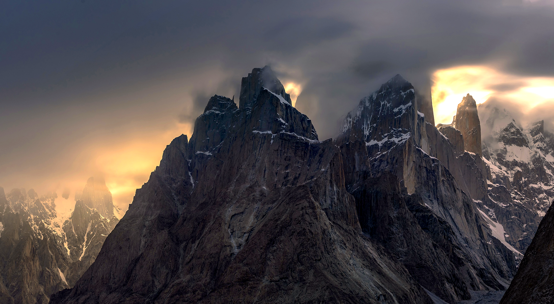 Maqsood Aktar (Wikipedia) |
 Ghulam Hussain (iStock) | 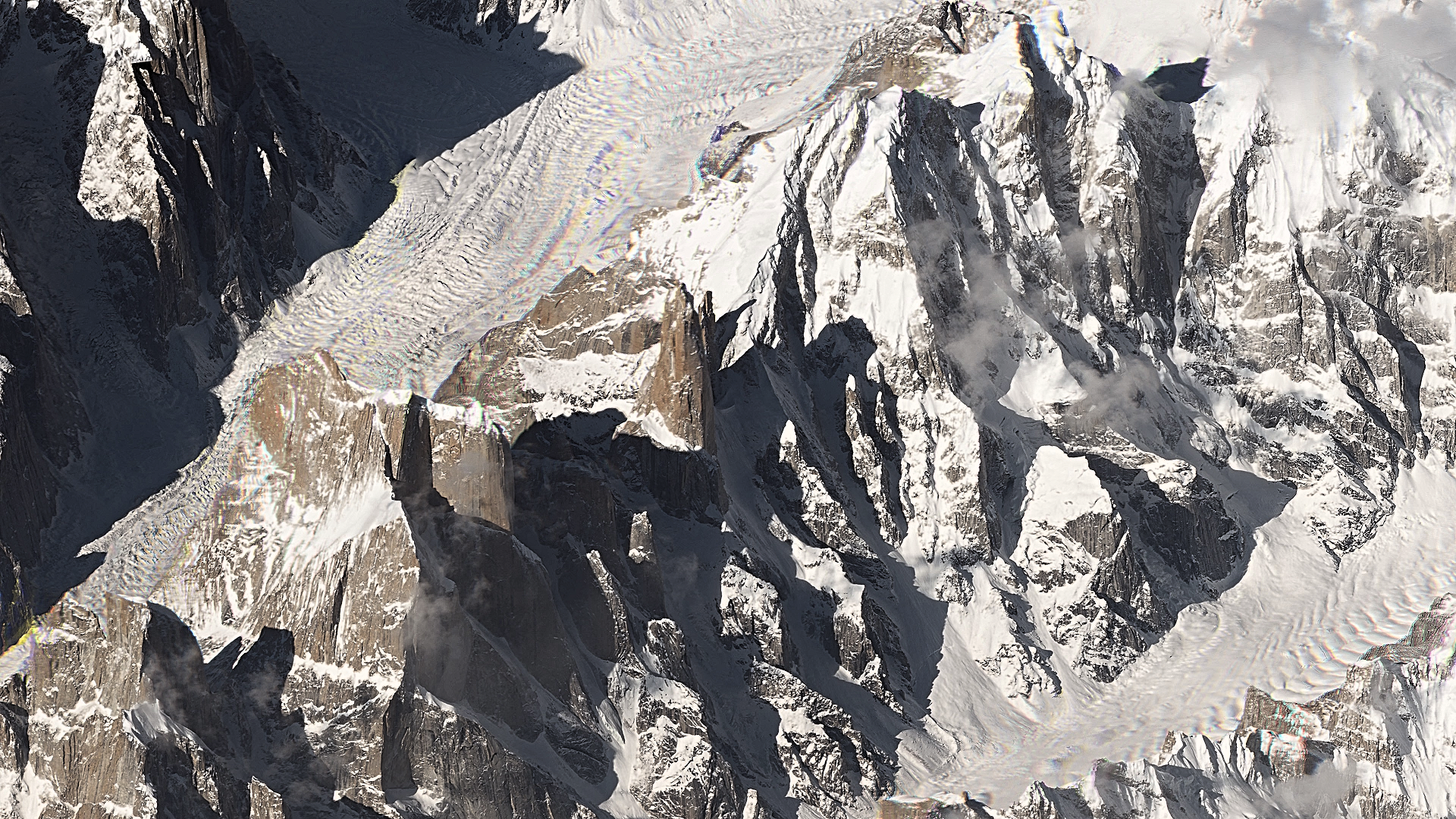 Planet Labs (Wikipedia) |
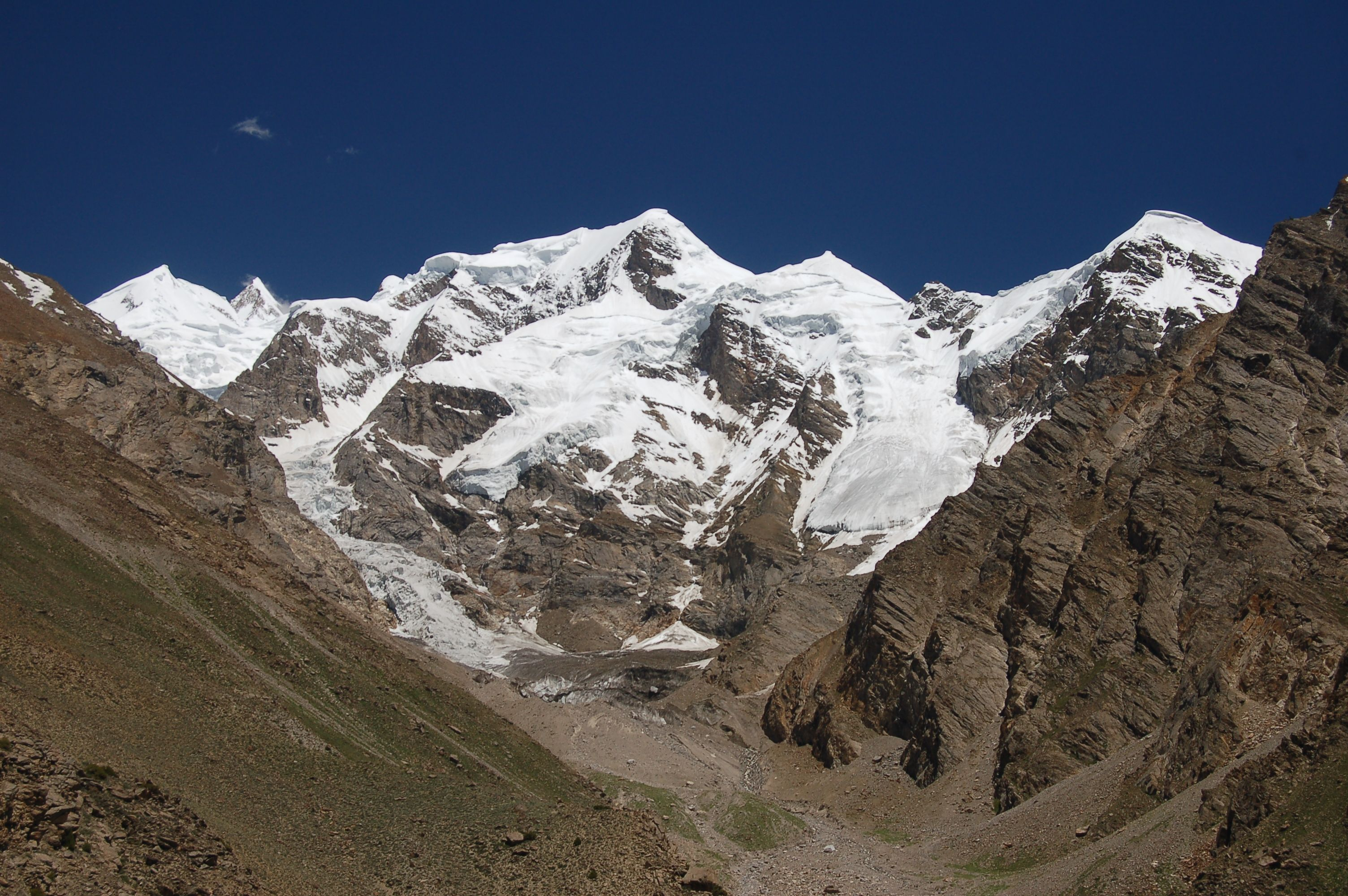
Distaghil Sar Panoramic
 |
Fayeem Avzl (Wikipedia)

Disteghil Sar or Distaghil Sar (Urdu: دستاغل سر) is the highest mountain in the Baltin Bar Nallah Shishkat Hunza, part of the Karakoram mountain range in Gilgit-Baltistan, Pakistan. It is the 19th-highest mountain on Earth, the 7th-highest in Pakistan, and the first of the high peaks after Shishapangma to be the tallest independent summit of its own subrange. Disteghil sar is a Wakhi language word suggested by the Wakhi people of [2] meaning “above the inner ranch.” The mountain has a 3-kilometre-long (1.9 mi) top ridge above 7,400 meters elevation, with three distinct summits: Northwest, 7,885 m; Central, 7,760 m; and Southeast, 7,696m or 7,535m.
Climbing history
The first attempt to climb Distaghil Sar was made in 1957 by an English expedition led by Alf Gregory. That team attempted to climb the mountain from the south and the west, they reached 21,300 feet (6,500 m) but were defeated by bad weather.[3][4] Unfavourable weather also foiled a 1959 Swiss attempt over the southeast ridge led by Raymond Lambert.[5]
The first successful ascent was made in 1960 by Günther Stärker and Diether Marchart [de] who were part of an Austrian expedition led by Wolfgang Stefan. The expedition climbed the western part of the south face and continued over the southwest ridge to reach the highest summit on 9th June.[6][5]
The eastern summit is independent of the main, western, summit and about 100m lower; it was first climbed over the east face in 1980 by a Polish expedition which included Tadeusz Piotrowski. All participants of the expedition reached the summit.[7] It was reascended in 1983.
It was more than 20 years before a second successful ascent of the highest, western summit. The Himalayan Index lists another ascent of the peak in 1980 and a Spanish team made an ascent in 1982 by following a route close to the one taken in 1960.[8]
Two attempts over the daunting north face, in 1988 and 1998,[9] were unsuccessful.
An attempt on the north ridge in 2008 was abandoned soon after the party arrived because dramatic changes to the terrain, which had occurred over the previous ten years or so, had resulted in conditions becoming extremely dangerous.[10][11]
This article uses material from the Wikipedia article Distaghil Sar, which is released under the Creative Commons Attribution-Share-Alike 4.0 International License (view authors).
 Rizwan Saddique I | 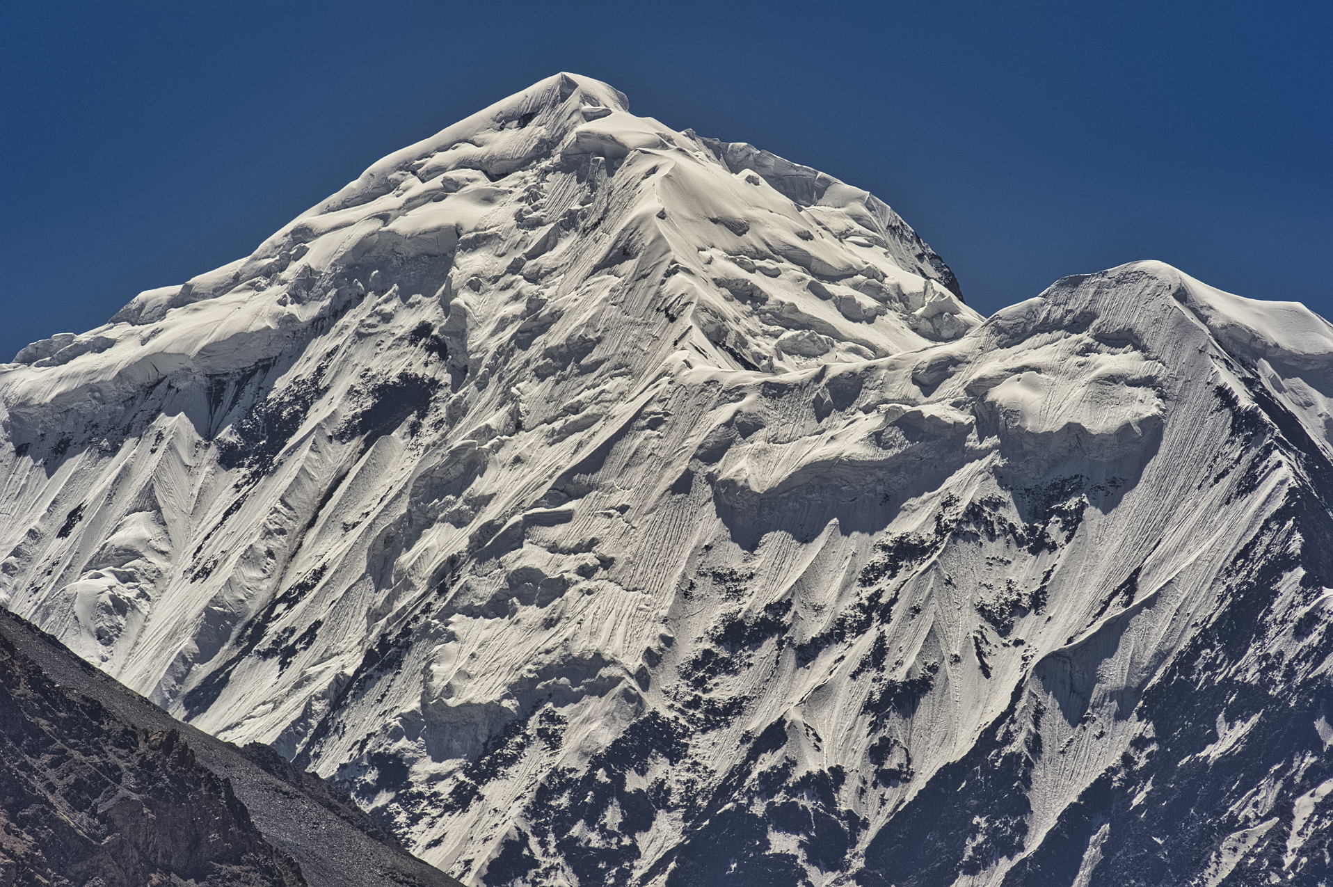 Pavalache Stelian (Dreamstime) |
 I |  Marc Breuil (Pulkayak) |
 I | 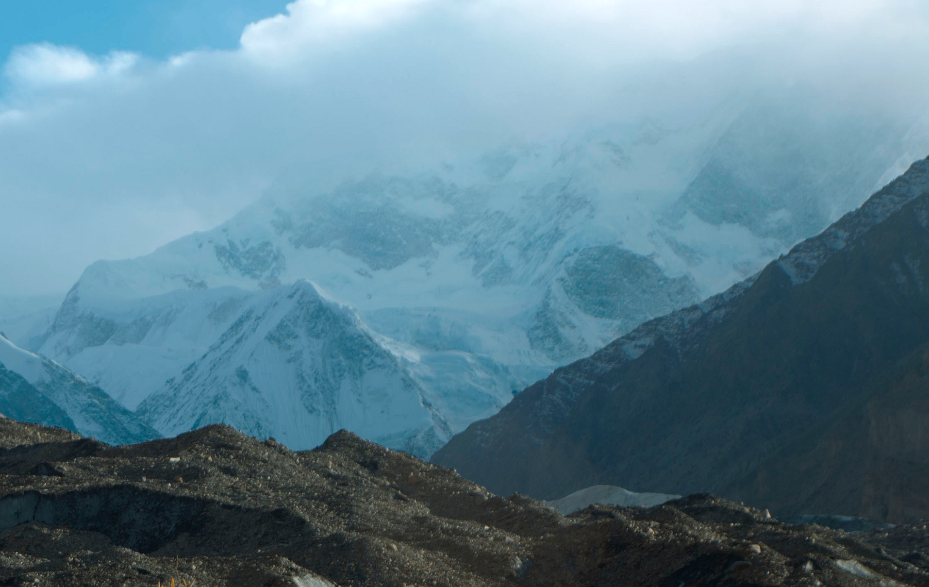 Fayeem Avzl (Wikipedia) |
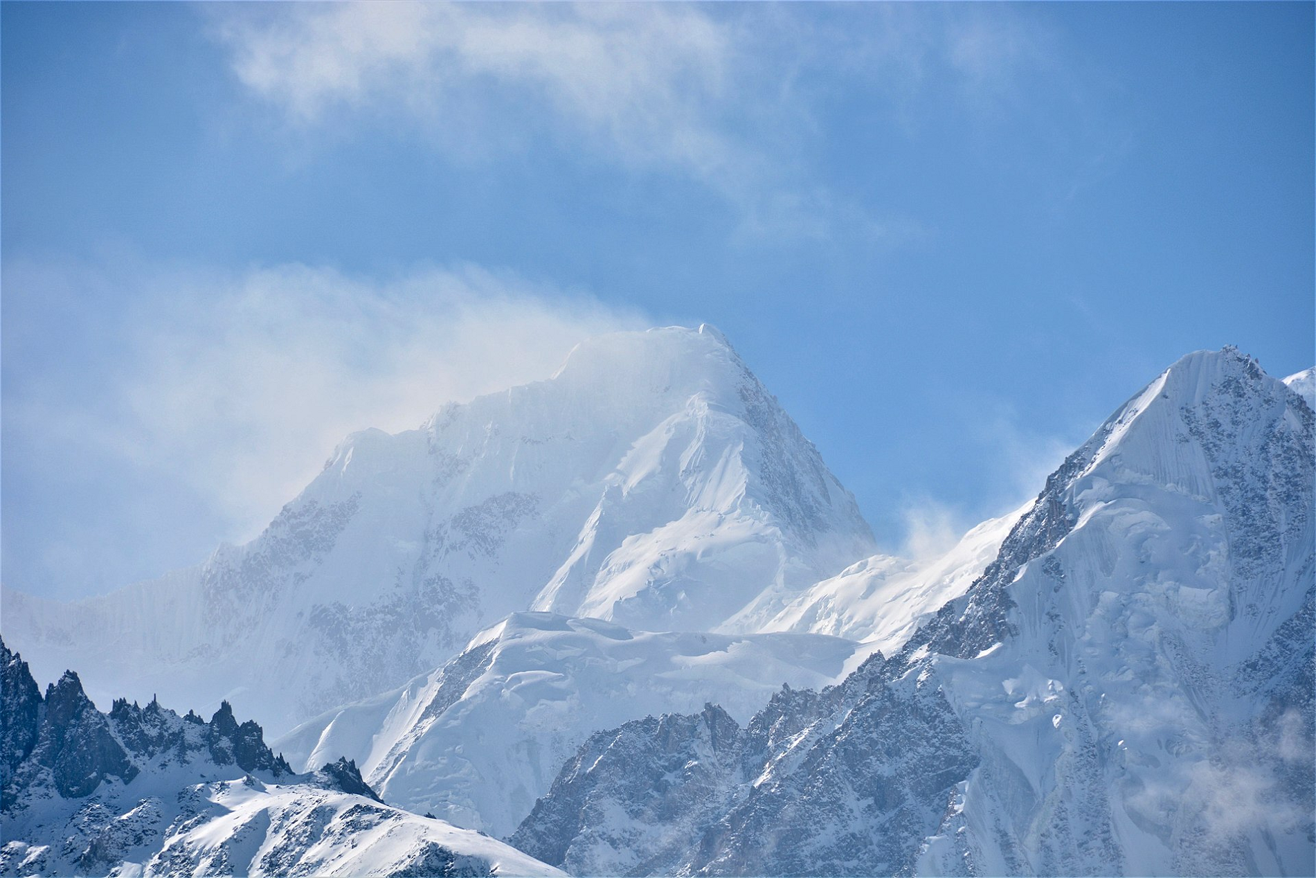
Kunyang Chhish Panoramic
 |
BigLee (Summit Post)

![]()
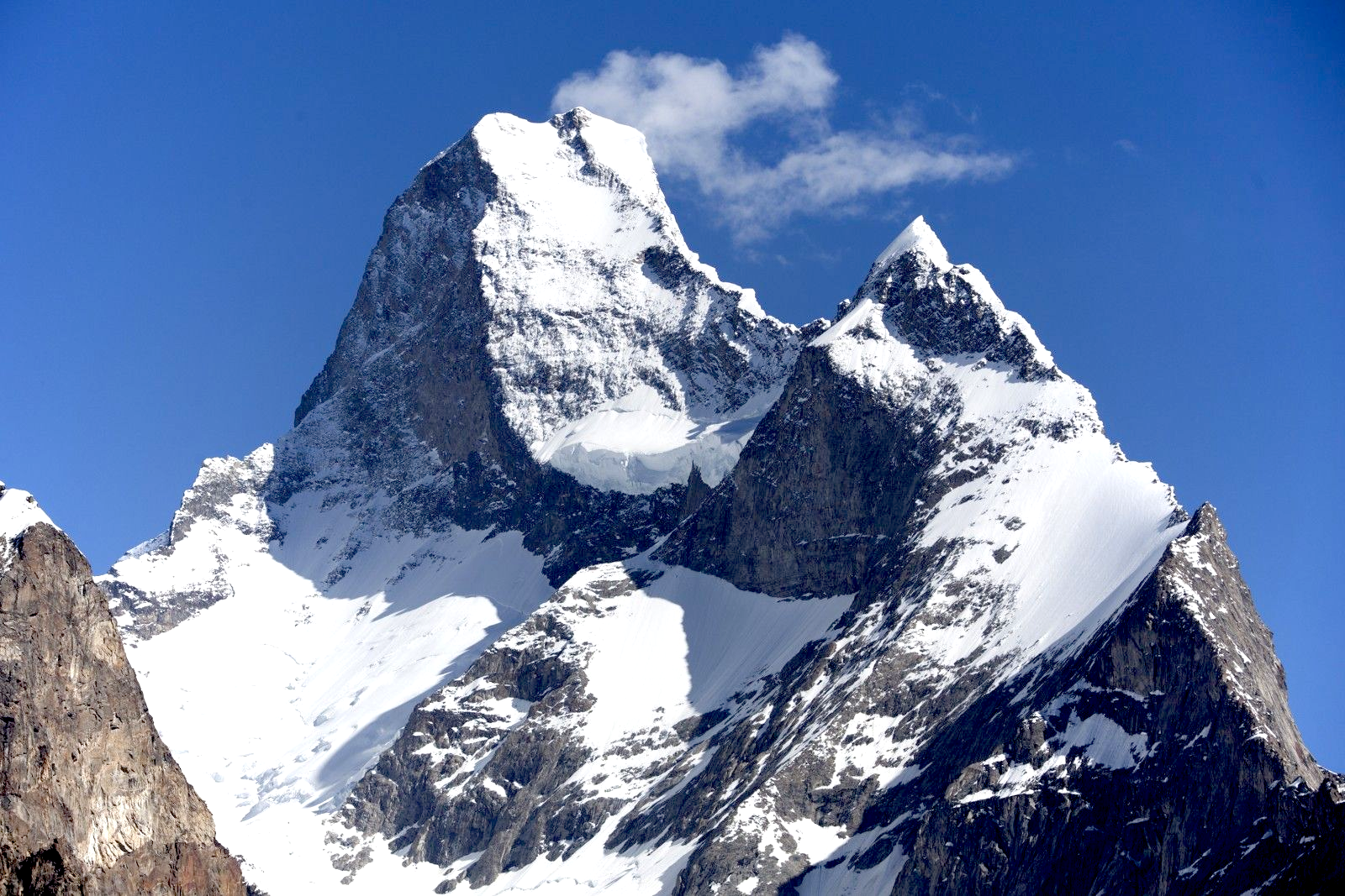
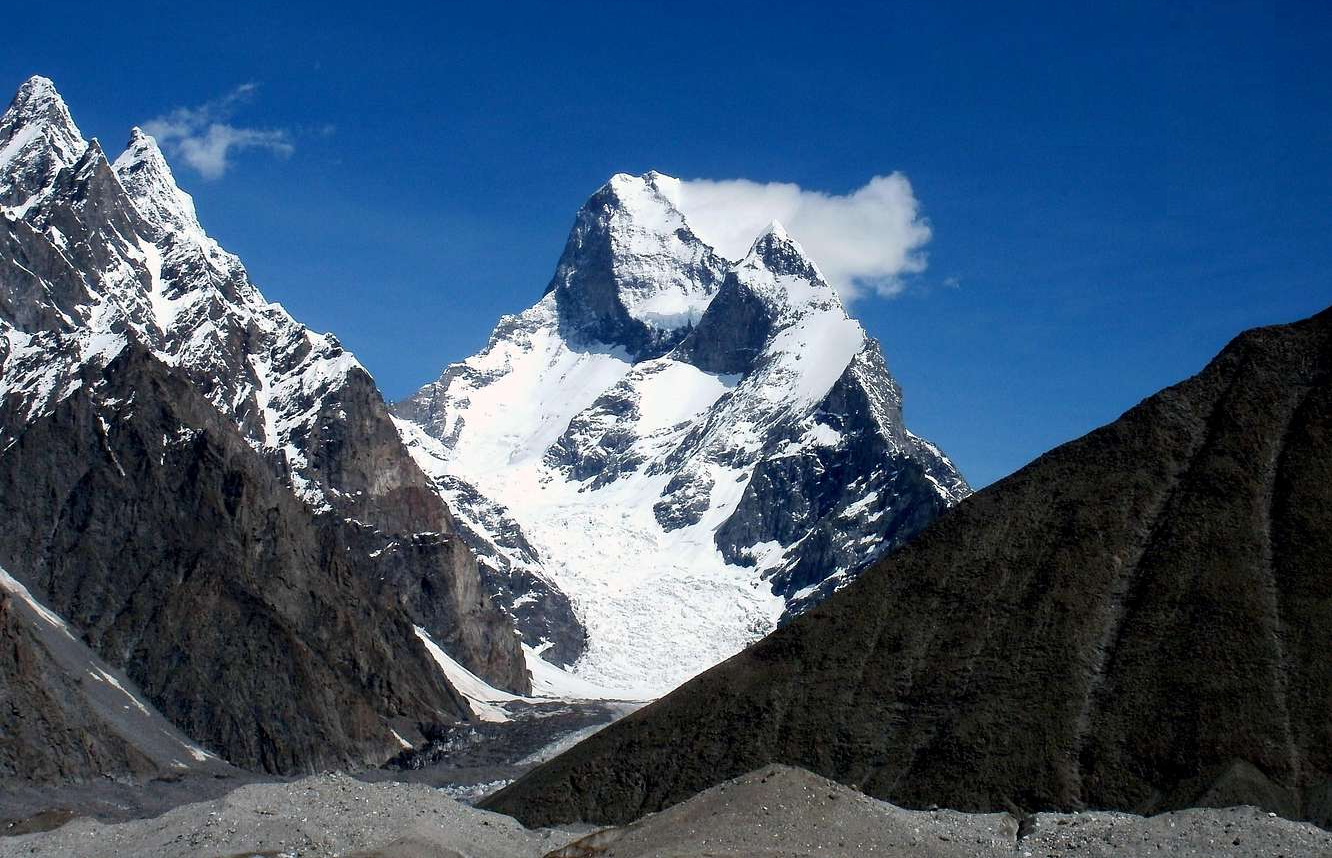
Kunyang Chhish is the second-highest mountain in the Hispar Muztagh, a subrange in the Karakoram mountains in Pakistan. An alternate variations of the name are Kunyang Kish and Khinyang Chhish.[3] Its height, also sometimes given as 7,823 metres (25,666 ft), is ranked 21st in the world.
Location
Kunyang Chhish is located along the northern flank of the Hispar Glacier, one of the major glaciers of the Karakoram. It is the source of the Yazghil glacier that terminates in the heart of Shimshal Valley. It rises northeast of the confluence of the Hispar Glacier and the Kunyang Glacier, while Distaghil Sar (the highest peak of the Hispar Muztagh) dominates the Kunyang Glacier on its northern end.
Notable features
Kunyang Chhish is the 21st highest mountain in the world. It is also notable for its rise above local terrain: for example, it rises almost 4,000 metres (13,000 ft) above its southern base camp on the Kunyang Glacier, and it rises 5,500 metres (3.4 mi) above the Hunza valley in about 33 kilometres (108,000 ft). Though it shares a high key col with its parent Distaghil Sar to the north, it is a steep, pointed, and complex peak compared to Distaghil, which has a more rounded profile.
Not counting the two Pumari Chhish summits 4 kilometres (2.5 mi) to the ENE, the Kunyang Chhish massif has five peaks:
- Kunyang Chhish Main, 7,852 metres (25,761 ft)
- Kunyang Chhish South, 7,620 metres (25,000 ft), 700 m SSW, with a prominence of only about 100 metres (330 ft)
- Kunyang Chhish East 7,400 metres (24,300 ft), 2 km ESE, 240-metre (790 ft) prominence.
- Kunyang Chhish West, 7,350 metres (24,110 ft), 1.5 km W, 170-metre (560 ft) prominence. Also known as Pyramid Peak.
- Kunyang Chhish North, 7,108 metres (23,320 ft), 6 km NNE, 517-metre (1,696 ft) prominence.
This article uses material from the Wikipedia article Kunyan Chhish, which is released under the Creative Commons Attribution-Share-Alike 4.0 International License (view authors).
 |  |
 Theprotrekker (Wikipedia) | 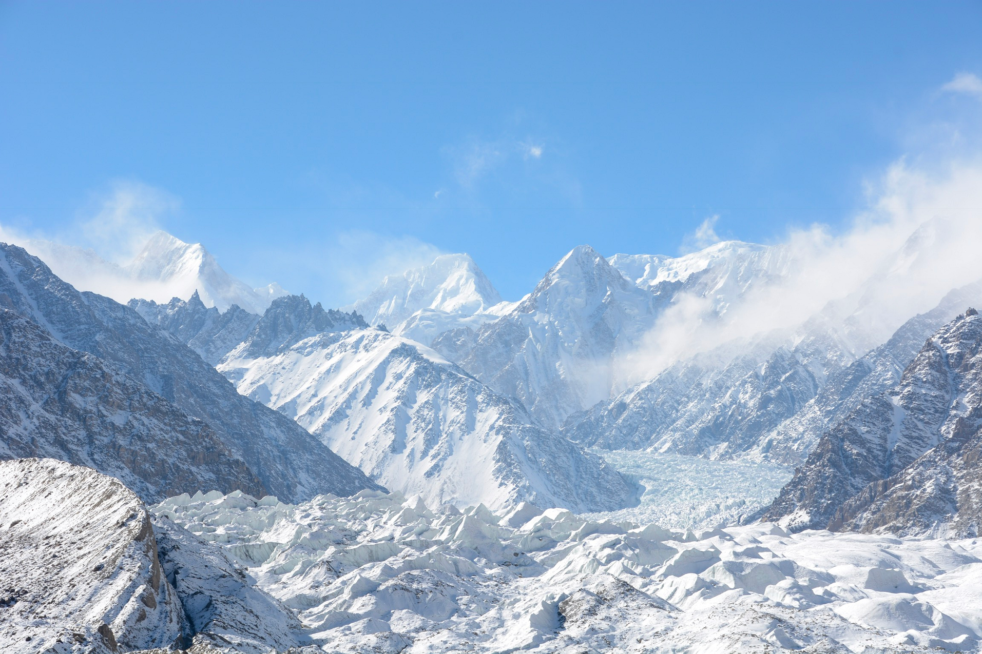 Theprotrekker (Wikipedia) |
 BigLee (Summit Post) | 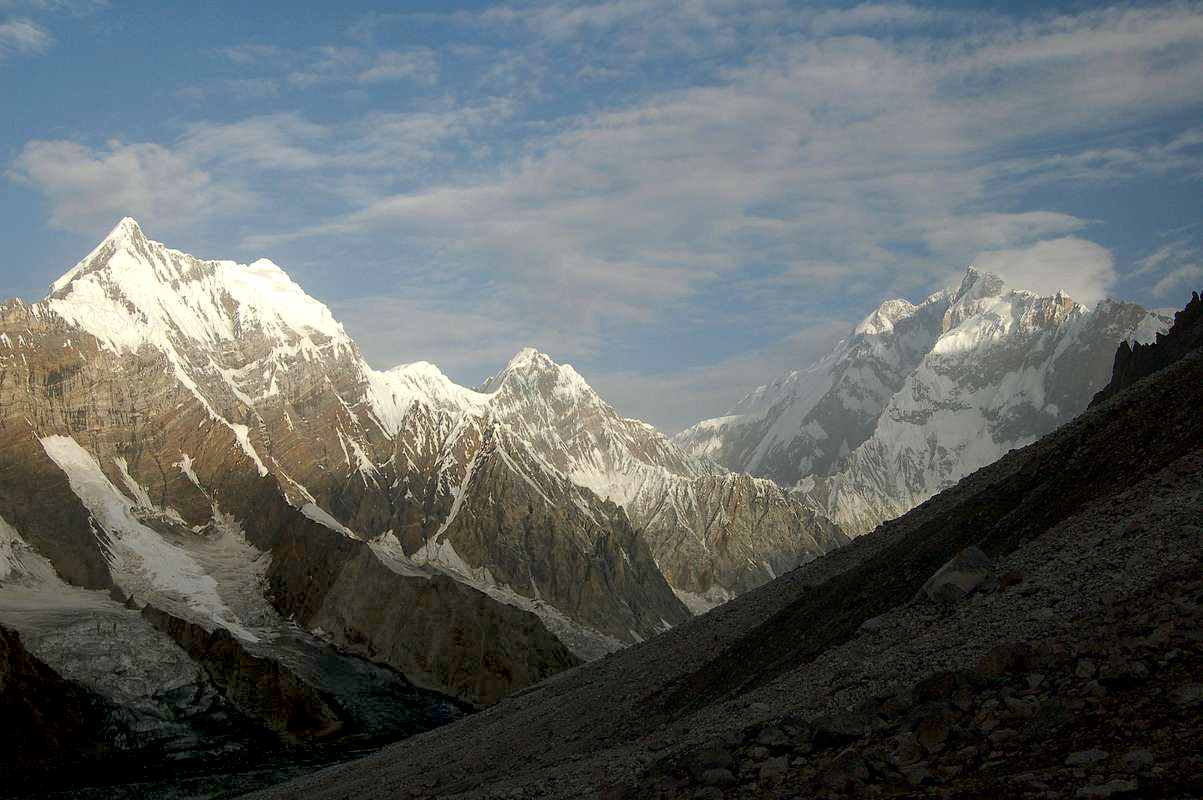 BigLee (Summit Post) |
 BigLee (Summit Post) | 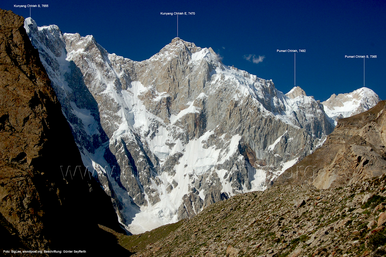 BigLee (Summit Post) |
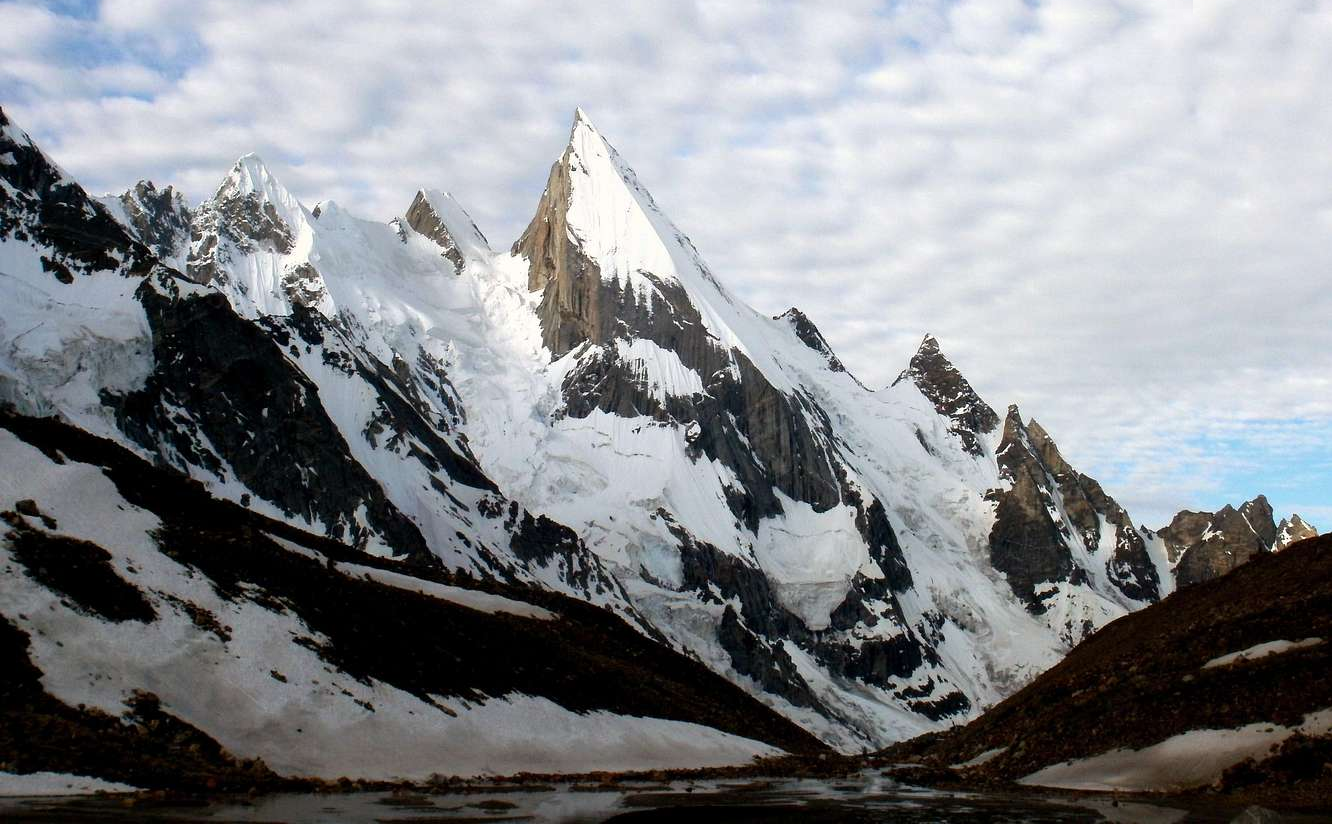
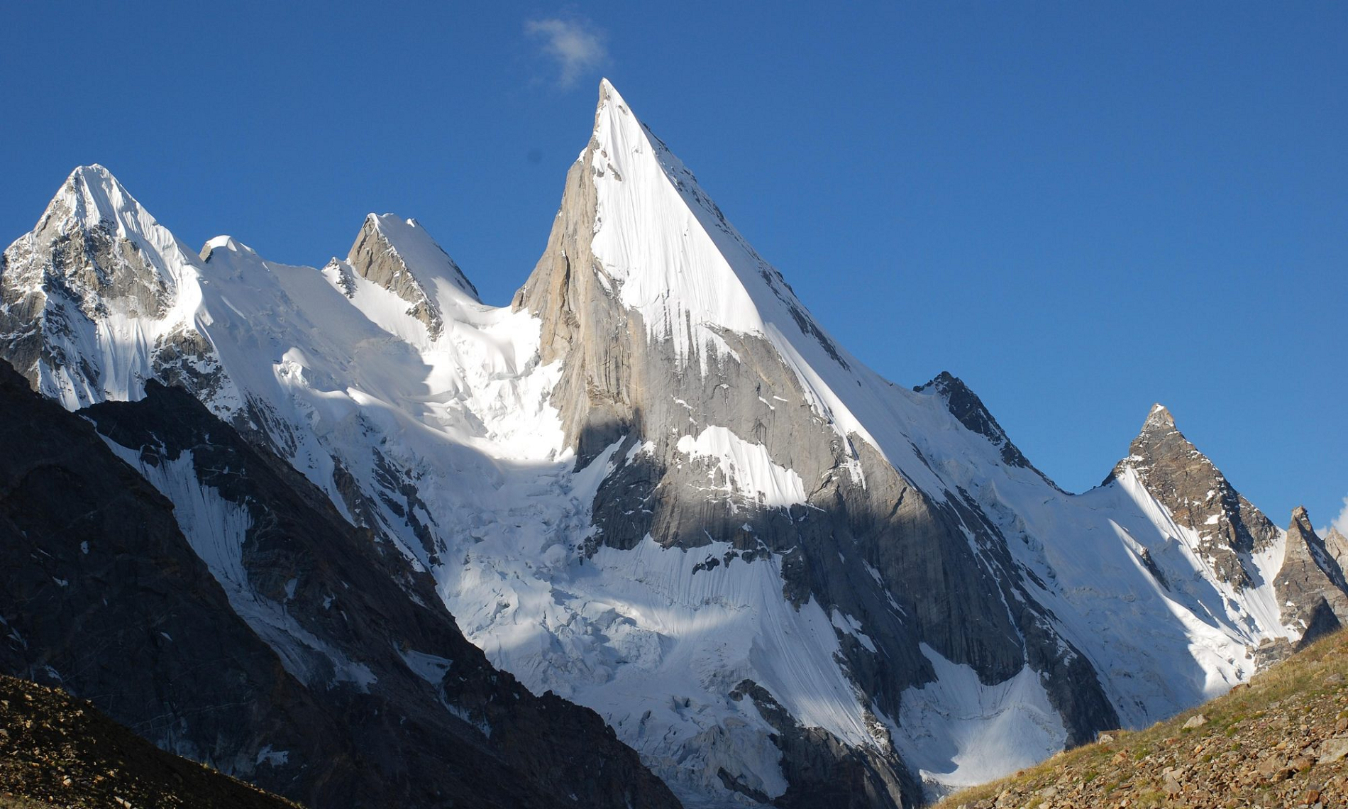
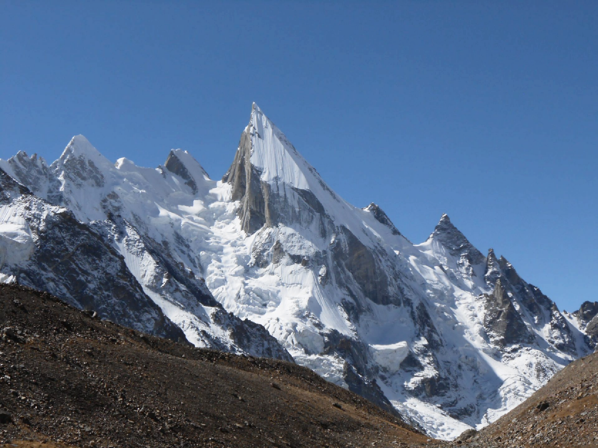
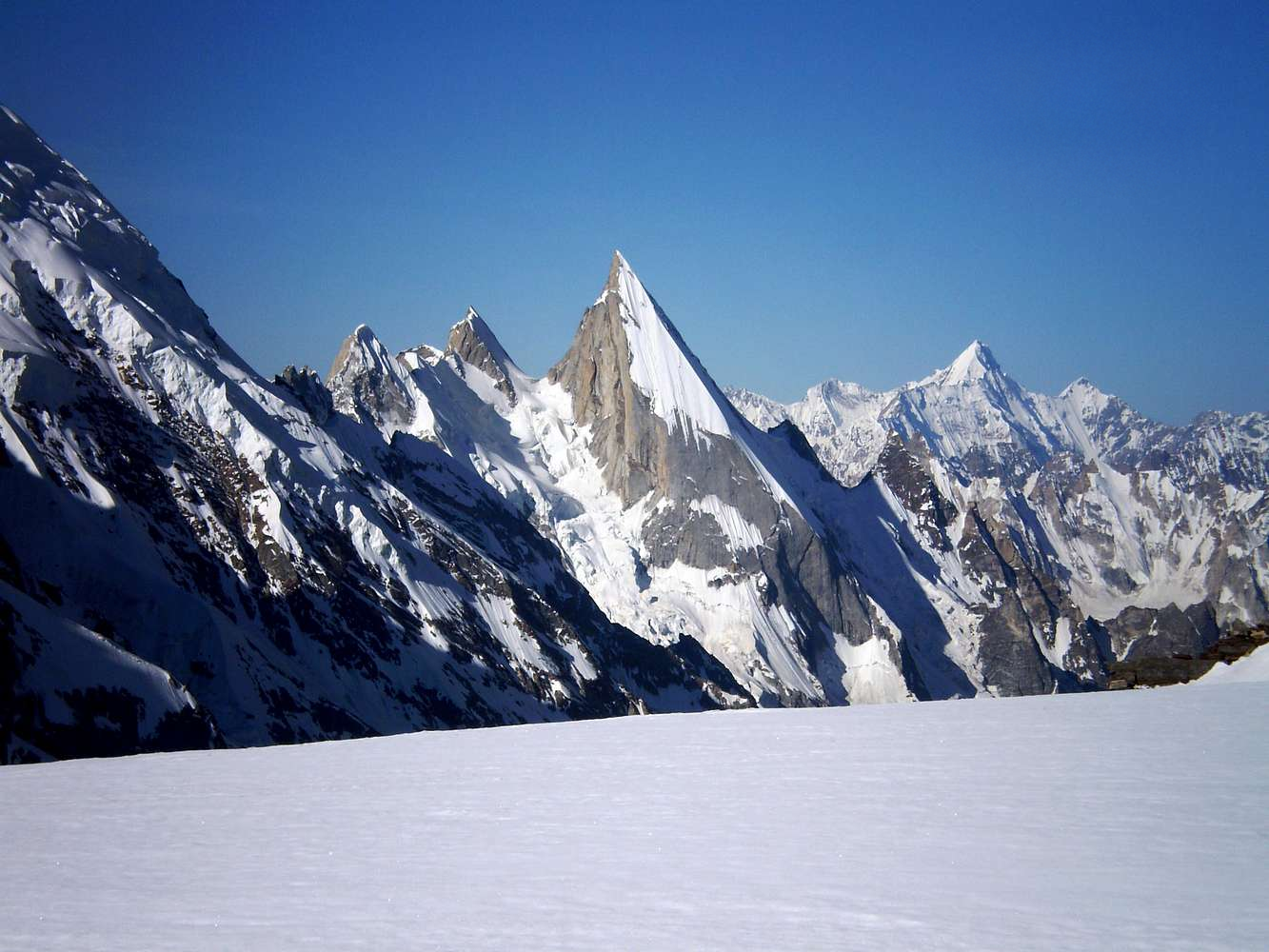
Laila Peak Panoramic
 Treethot Polrajlum (Wikipedia) |
Laila Peak (Urdu: لیلی چوٹی) is a mountain located in the Hushe Valley, near the Gondogoro Glacier within the Karakoram. Situated in the Gilgit-Baltistan region of Pakistan, Laila Peak has an elevation of 6,096 meters (20,000 ft). Its distinctive feature is its spear-like shape, and its northwest face presents a challenging slope of 45 degrees, spanning over 1500 vertical meters.
Laila Peak has been successfully climbed by mountaineers such as Simon Yates, among others. According to the local inhabitants of Hushe, this peak has been summited only twice, with a total of just seven individuals having reached its summit.[2]
Laila Peak was climbed in winter for the first time by Spanish mountaineers Alex Txikon and José Fernandez in February 2013.[3]
The height of Laila Peak in the Hushe Valley has been a subject of controversy and discrepancy. Various sources and maps have mentioned different elevations for the peak. Some believe it to be around 6200 meters, while others suggest it as 6614 meters. However, according to a Japanese mountaineering map by Tsuneo Miyamori published in 2003, the height of Laila Peak is listed as 6096 meters.[4]
First skiers and snowboarders Laila Peak
In the summer of 2005, Fredrik Ericsson and Jörgen Aamot from Scandinavian countries undertook the first-ever ski attempts on Laila Peak. While they were unable to reach the summit, they did manage to ski down the North-West face of the peak. They described Laila Peak as “one of the most amazing mountains they have ever seen, like a needle it points straight up in the sky”.
Frederik and Jörgen reached the base camp of Laila Peak (4150 metres) on June 18, 2005, and they were at Camp1 (5000 metres) on June 22. They made their first attempt to summit on Friday, June 24. They started climbing from 5000 metres at 2:30 am and after seven hours of climbing when they were only 100 metres from the summit, they realized that it was too icy to continue, and started skiing down on the North-West face of Laila Peak towards Gondogoro Glacier.[5]
The second group ever to attempt to ski the mountain was Paul Holding (UK), Brendan O’Sullivan (Ireland), Ed Blanchard Wrigglesworth (Spain) and Luca Pandolfi (Italy). All were the first snowboarders (two on splitboards) on the mountain except for Ed Blanchard Wrigglesworth, who was on skis. They reached the col at 5,400m only to find that the whole left side of the face had avalanched down to rock while they were climbing from the south side, scuppering any attempts for that year. A full account of their story can be found here.
This article uses material from the Wikipedia article Laila Peak (Hushe Valley), which is released under the Creative Commons Attribution-Share-Alike 4.0 International License (view authors).
 Treker786 (Summit Post) | 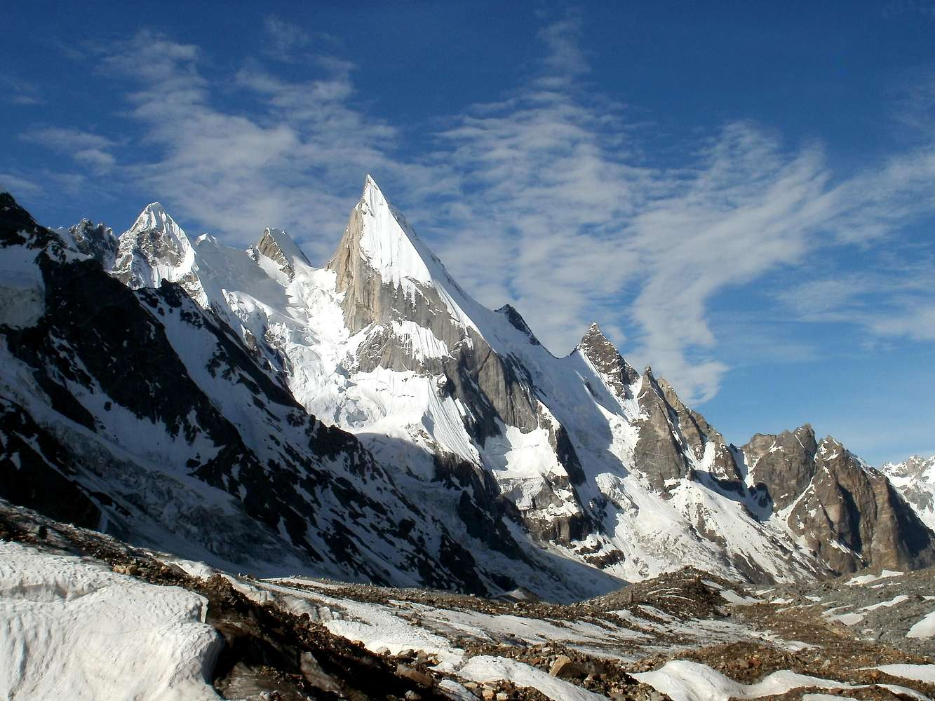 Treker786 (Summit Post) |
 |  |
 Treker786 (Summit Post) | 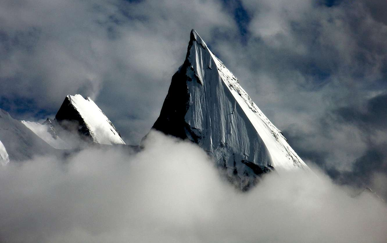 Treker786 (Summit Post) |
Angel Sar Panoramic
 Ghulam Hussain (iStock) |

Angel Sar also known as Angelus or Angel Peak (Urdu: اینجل سر) is a 6,802-metre (22,316 ft) high mountain in the Baltoro Muztagh range of Gilgit–Baltistan, Pakistan. The peak is on the southwest ridge of K2, the second highest mountain on Earth. The mountain was first climbed on 9 August 1983 by Michel Afanassieff and Claude Stucki.[5][6]
Climate
Based on the Köppen climate classification, Angel Sar is located in a tundra climate zone with cold, snowy winters, and cool summers.[7] Weather systems are forced upwards by the mountains (orographic lift), causing heavy precipitation in the form of rainfall and snowfall. October through November is the monsoon season. The months of June, July, and August offer the most favorable weather for visiting or climbing this peak.[8]
This article uses material from the Wikipedia article Angel Sar, which is released under the Creative Commons Attribution-Share-Alike 4.0 International License (view authors).
 Ghulam Hussain (iStock) | 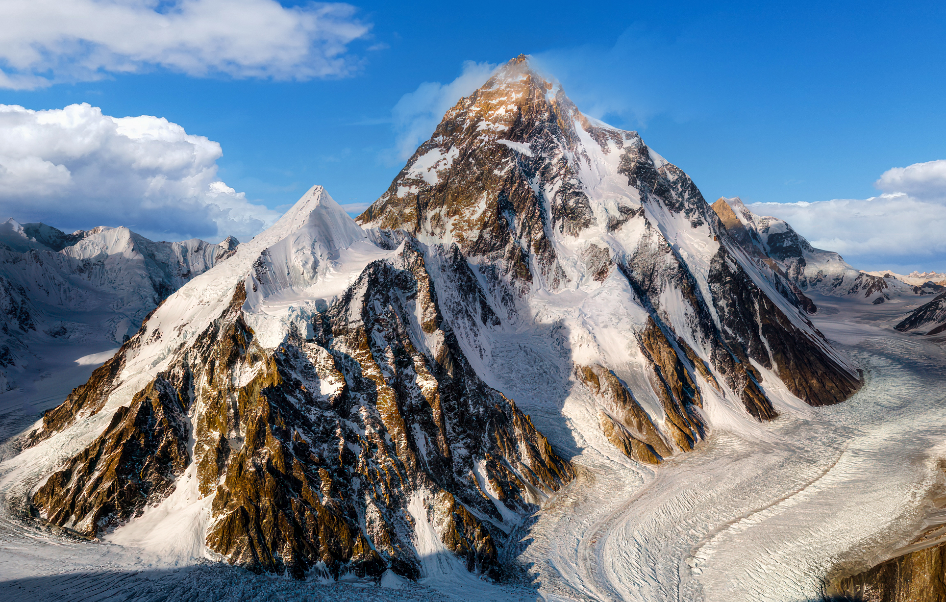 Ghulam Hussain (iStock) |
 IMamaev Andrei (Wikipedia) |  Mountains of Travel Photos |
 I |  Afzal (Summit Post) |

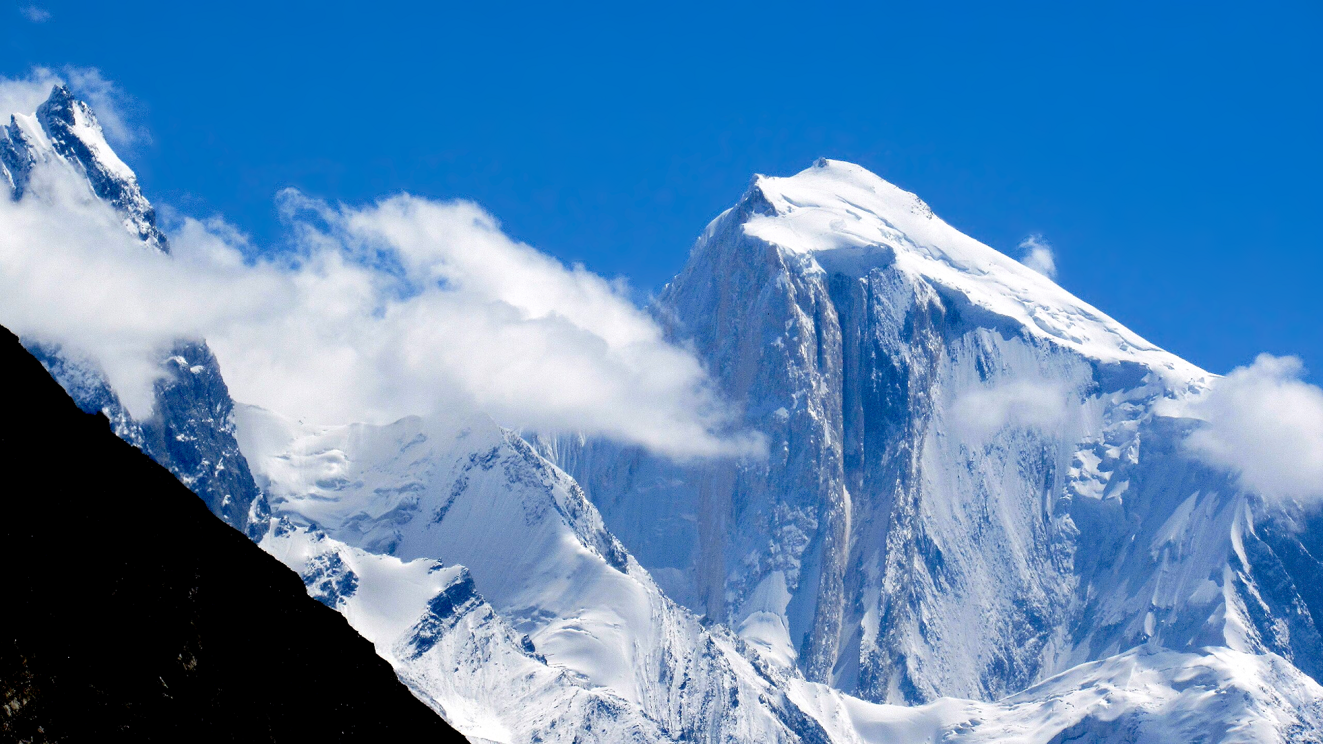
Muztagh Tower (Urdu: مز تاغ ٹاور), also Mustagh Tower; Muztagh: icy mountain), is a mountain situated in Baltoro Muztagh, which is a segment of the Karakoram range. It straddles the border of the Gilgit–Baltistan region of Pakistan and the Xinjiang Uyghur Autonomous Region of China. Muztagh Tower is located between the basins of the Baltoro and Sarpo Laggo glaciers.[2]
Early prominence
The Mustagh Tower gained attention through a photograph captured by Vittorio Sella during the 1909 Italian expedition to K2. The picture was taken from the upper Baltoro, from a vantage point located due southeast of the mountain. In this photograph, the twin summits of Mustagh Tower appeared perfectly aligned, giving the mountain the appearance of a slender tooth and making it seem extremely impregnable. This image was featured in a book on mountaineering in 1941 with the caption “The Last Citadel”.[3]
First and second ascents
Nearly five decades after Vittorio Sella’s photograph was taken, in 1956, his image served as inspiration for two separate expeditions that raced to achieve the first ascent of Mustagh Tower. Interestingly, both teams discovered that the mountain’s routes were less steep than what Sella’s photograph had suggested.[4] The British expedition, consisting of John Hartog, Joe Brown, Tom Patey and Ian McNaught-Davis, approached the peak from the Chagaran Glacier on the west side and successfully reached the summit via the Northwest Ridge on July 6.[5][6][7] They achieved this feat five days ahead of the French team, consisting of Guido Magnone, fr:Robert Paragot, André Contamine, and Paul Keller, who climbed the mountain from the east.[8][9] François Florence waited for the two parties at the camp IV during 42 hours without a radio, when they went, reached the summit and came back to this camp.[10]
Notable ascents and attempts
- 1984: Northwest Ridge 2nd of route, 3rd of peak by Mal Duff, Tony Brindle, Jon Tinker and Sandy Allan (all UK).[11][12]
- 1990: The fourth ascent was made by Göran Kropp and Rafael Jensen.[13][14]
2012: On 25 August, 56 years after the first ascent of this mountain, three Russians made an ascent by the centre Northeast Face. Sergei Nilov, Dmitry Golovchenko and Alexander Lange reached the top and made a new route. The ascent lasted for 17 days.[16][17]
2008: On 24 August 2008, the Northeast Face was climbed by two Slovenian alpinists, Pavle Kozjek and Dejan Miškovič. They bivouacked on the crest after 17 hours of climbing. They decided not to go to the summit due to strong winds. Just after they started descending, Kozjek fell to his death.[15]
This article uses material from the Wikipedia article Muztagh Tower, which is released under the Creative Commons Attribution-Share-Alike 4.0 International License (view authors).
 Skazzjy (iStock) |  JossK (iStock) |
 I | 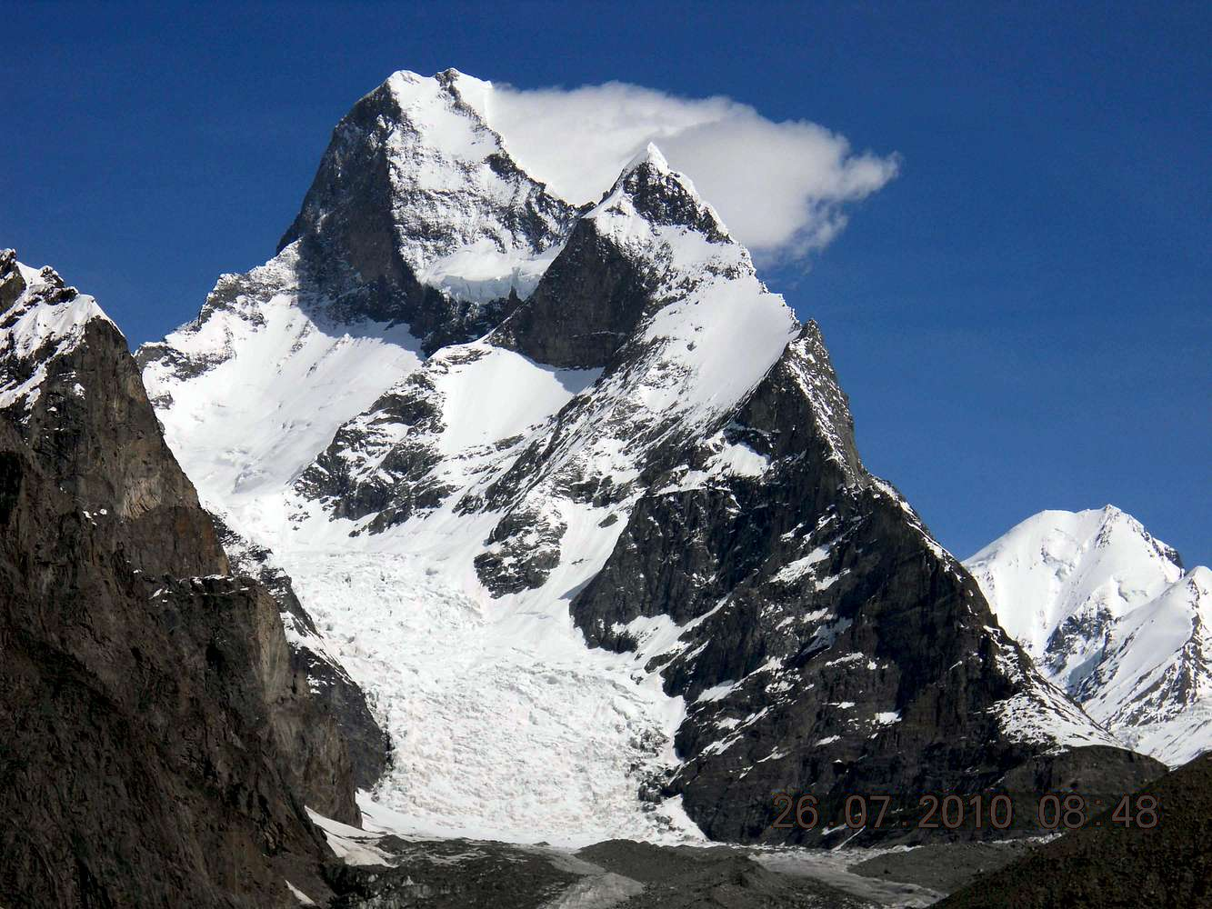 Treker786 (Summit Post) |
 Treker786 (Summit Post) |  I |
Rakaposhi Panoramic
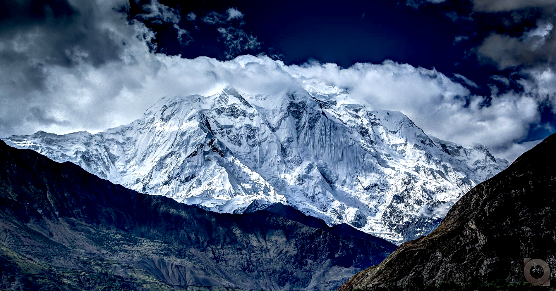 |

Rakaposhi (Burushaski: رآکاپوݜی, lit. ‘Shining Wall’;[4] Urdu: راکاپوشی) also known as Dumani (Burushaski: دومآنی, lit. ‘Mother of Mist’) is a mountain within the Karakoram range in Gilgit-Baltistan in Pakistan.[3] It is situated in the middle of the Nagar and Bagrote valleys. The mountain is extremely broad, measuring almost 20 kilometres (12 mi) from east to west. It is the only peak on earth that descends directly and without interruption for almost 6,000 meters from its summit to its base.[4]
Geography
Rakaposhi is a mountain in the Karakoram mountain range in the Gilgit-Baltistan region of Pakistan, about 100 km (62 mi) north of the city of Gilgit.[1] It is the 27th-highest mountain in the world and ranked 122nd by prominence. Rakaposhi rises over the Nagar Valley.
The first successful recorded ascent was in 1958 by Mike Banks and Tom Patey, members of a British expedition, via the southwest Spur/Ridge route.[5] It was over 20 years before another team succeeded in reaching the summit, in 1979.[6]
Park
Rakaposhi is also known as Dumani (“Mother of Mist” or “Mother of Clouds”).[7] The people of Nagar and Bagrot Valley have dedicated the Rakaposhi range mountain area as a community park. The minister for the northern areas inaugurated the park.[citation needed] The Rakaposhi mountain range is the home of endangered species such as Marco Polo sheep, snow leopard, brown bear, and wolves.[citation needed]
Notable features
Rakaposhi is notable for its exceptional rise over local terrain. On the north, it rises 5,900 metres (19,357 ft) in only an 11.2 km (7 mi) horizontal distance from the Hunza River. There are views of Rakaposhi from the Karakoram Highway on the route through Nagar. A tourist spot in the town of Ghulmet (located in the Hunza Valley) called “Zero Point of Rakaposhi” is the closest view point of the mountain.
Taghafari
Taghafari, Tagafari or Tagaferi is the base camp of Rakaposhi from the Nagar side.
This article uses material from the Wikipedia article Rakaposhi, which is released under the Creative Commons Attribution-Share-Alike 4.0 International License (view authors).
 Rizwan.shinaki (Wikipedia) | 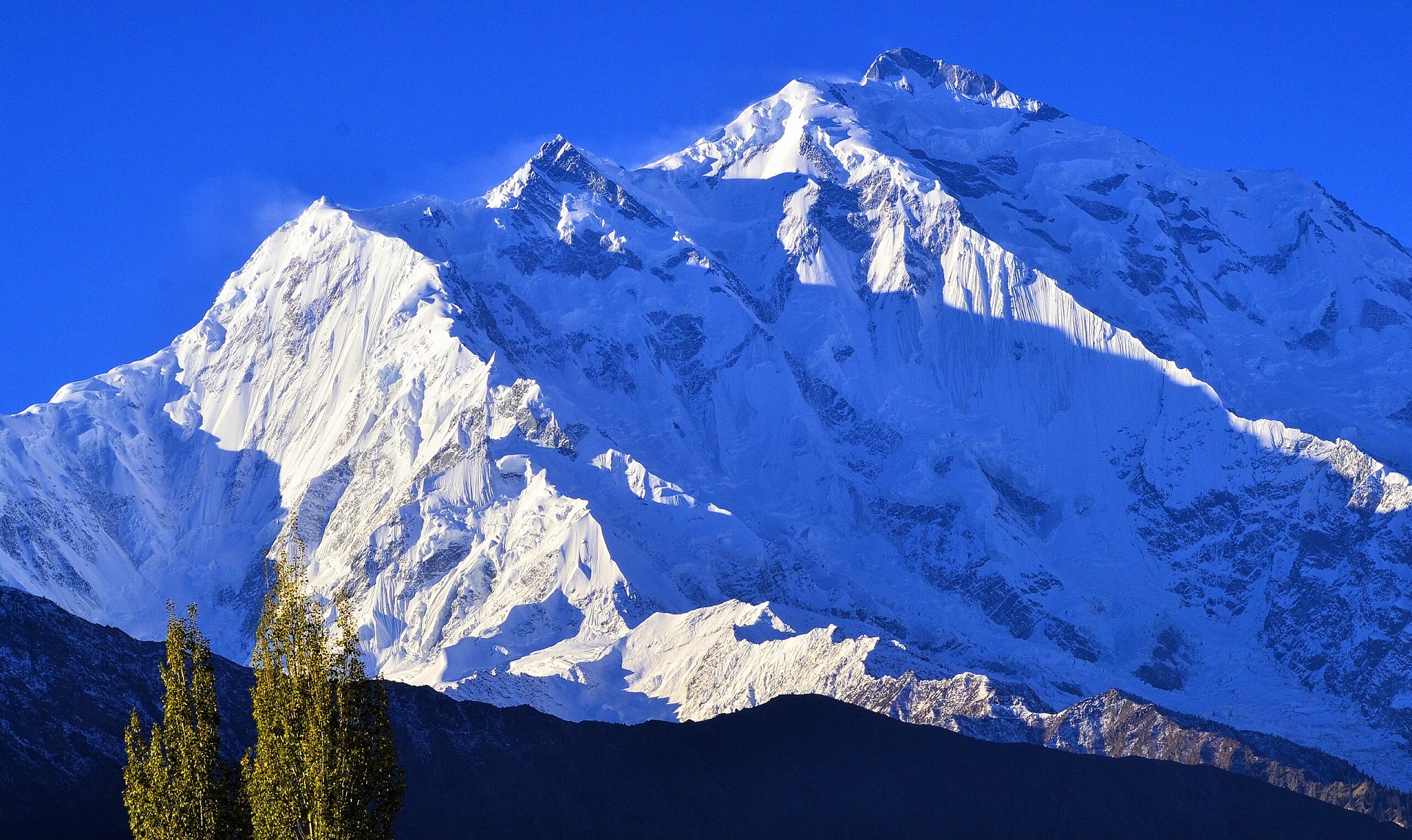 Gudupk (Wikipedia) I |
 Jameel Ahmed (Wikipedia) | 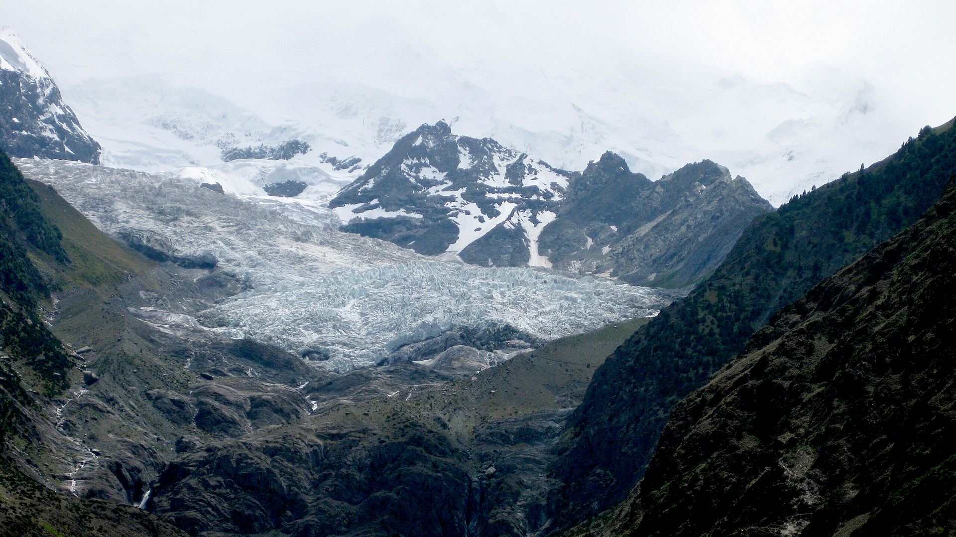 Urooj (Wikipedia) I |
 Alimusoler I |  Rizwan Karim (Wikipedia) |
 Obaid Hassan Qureshi (Wikipedia) | 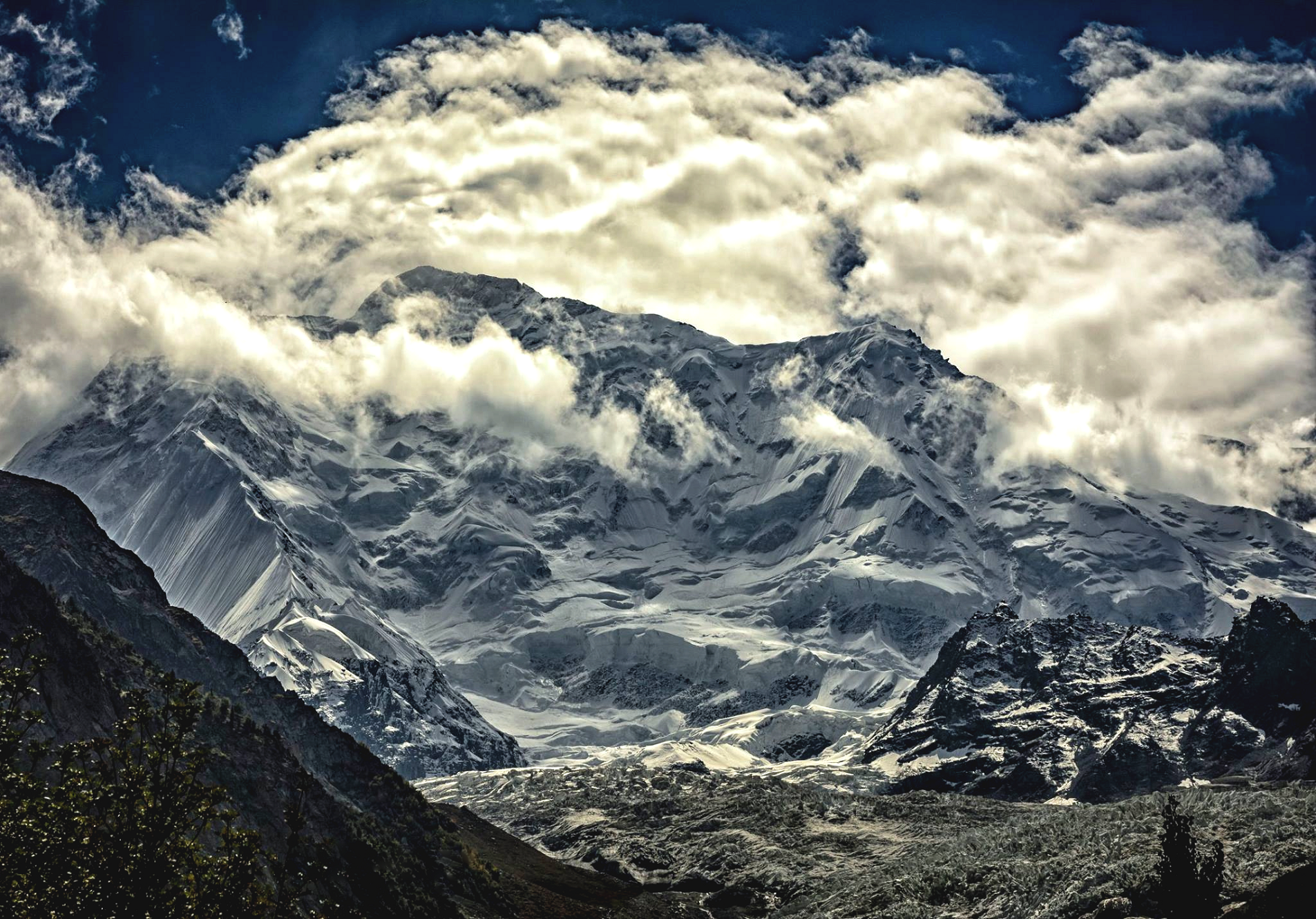 Faisal.aashiq9 (Wikipedia) |
Spantik Panoramic
 |
Karakorum Expeditions

Spantik, also known as Golden Peak, is a mountain situated in the Spantik-Sosbun subrange within the Karakoram range. It is located in Shigar District, of the Gilgit-Baltistan region administered by Pakistan. The northwest face of Spantik is dominated by a pronounced pillar of creamy yellow marble which reaches up its north face to 300 m below the summit. Its distinctive appearance has given the peak its Buruskaski name, “Ganesh Chish” or Golden Peak.[1] This outcropping is renowned for its exceptionally challenging climbing route, famously referred to as the “Golden Pillar”.[2]
Spantik is positioned to the east of Diran (7,266 m) and northeast of Malubiting (7,458 m).[3] There are various routes leading to the mountain, including paths from the Arandu village in Shigar District, as well as routes originating from the Hopar Valley in Nagar District.
Climbing history
The southeast ridge presents a challenging ascent, spanning 2,700 metres (8,900 ft) over a lateral distance of 7.6 km. The terrain along this ridge is diverse, ranging from rocky outcrops to snow, ice, and scree. The incline along this route generally remains under 30 degrees, with a few sections reaching up to 40 degrees. The most frequently chosen route for climbers follows the southeast ridge, a line that was originally attempted by the Bullock Workman party in 1906.[citation needed]
The mountain has become popular with organised commercial expeditions, due to its relative ease of ascent and scarcity of objective dangers.[citation needed] The short 3-day approach trek across straightforward terrain also provides for easy access and gradual acclimatization.
First ascents
The first recorded attempt to climb Spantik was in 1906 by the American couple Fanny Bullock Workman and Dr. William Hunter Workman. They reached an altitude 1,000 feet below the summit.[4] In 1955, Germans Reiner Diepen, Eduard Reinhardt and Jochen Tietze made the first successful ascent of Spantik via the Chogolungma Glacier up the southeast ridge.[4]
In 1978, separate Japanese expeditions made successful summits via the southeast ridge[5] and the unclimbed south ridge.[6]
In 1985, a Dutch expedition made the fourth successful summit of Spantik, and the first ascents by female climbers Antoinette Briët, Sabine Deneer, and Dr. Margreet Hogeweg.[7]
In 1987, George Fowler and Anthony Victor Saunders made the first ascent of Spantik’s “Golden Pillar” via its northwest face.[4] The route would not be summited again until 2000.[8][9]
In 1989, a Swiss-German expedition saw the next successful summits by female climbers, made by Irene Oehringer, Ursula Heynert, Eva Höllinger, Gerhild Kurze, and Monika Weber.[10]
In 2009, a Korean expedition by Kim Hyung-il, Kim Pal-bong, and Min Jun-young made a new route on Spantik’s northwest face, climbing in alpine style.[11] The 2,300 m route, Dream 2009 was climbed from July 8 to 14th and graded VI WI4 M8.[12]
This article uses material from the Wikipedia article Spantik, which is released under the Creative Commons Attribution-Share-Alike 4.0 International License (view authors).
 Mäddis (Wikipedia) I | 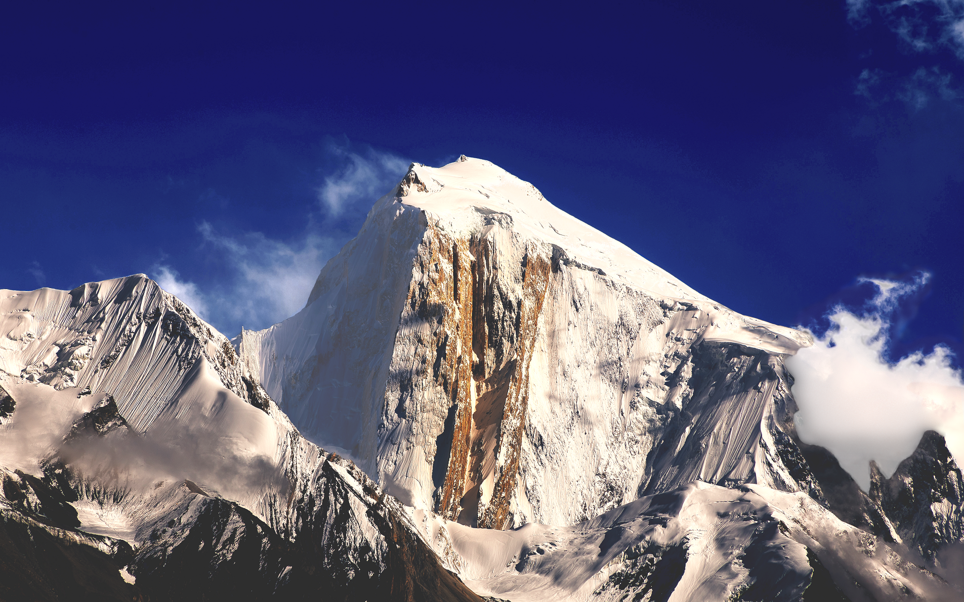 Muhammad Bin Masood (Wikipedia) |
 Tariq Sulemani (iStock) | 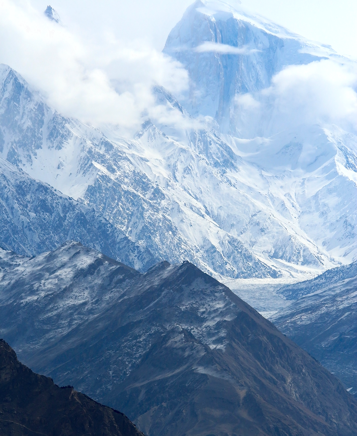 Imran Shah (Wikipedia) |
 Nawabtanweer (Wikipedia) | 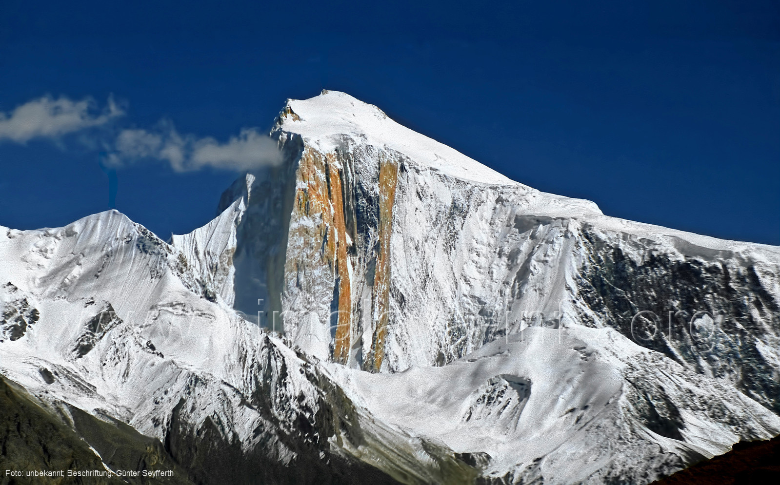 I I |
