
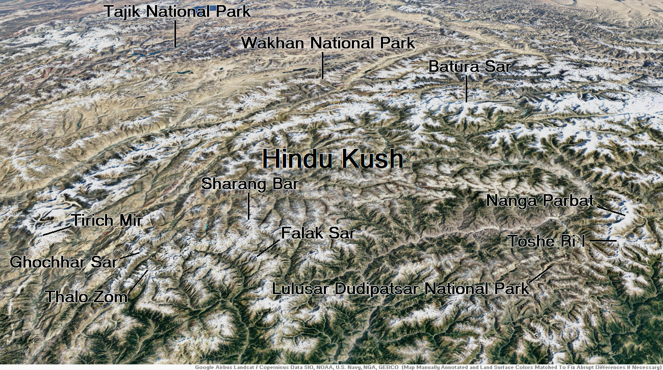
Map of Hindu Kush
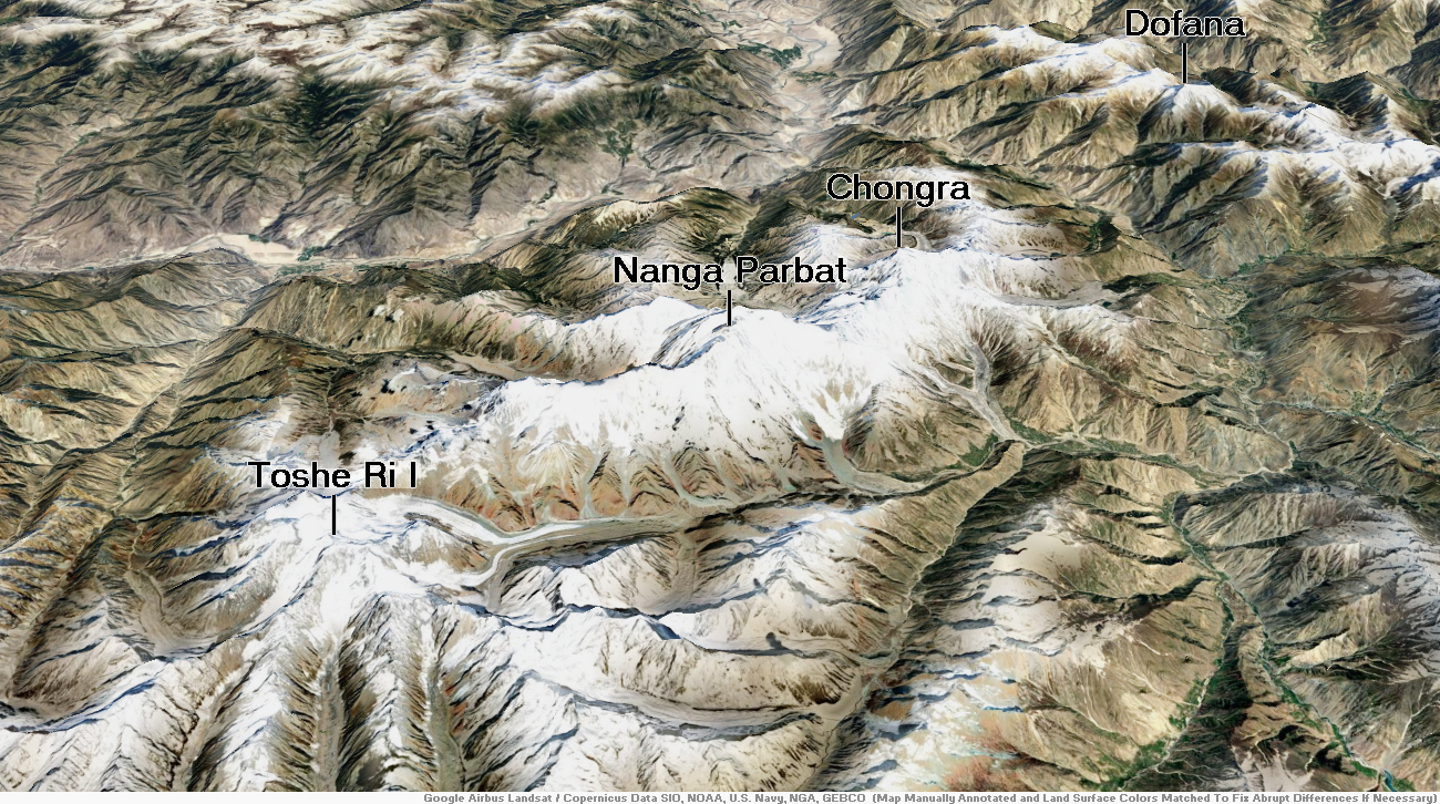
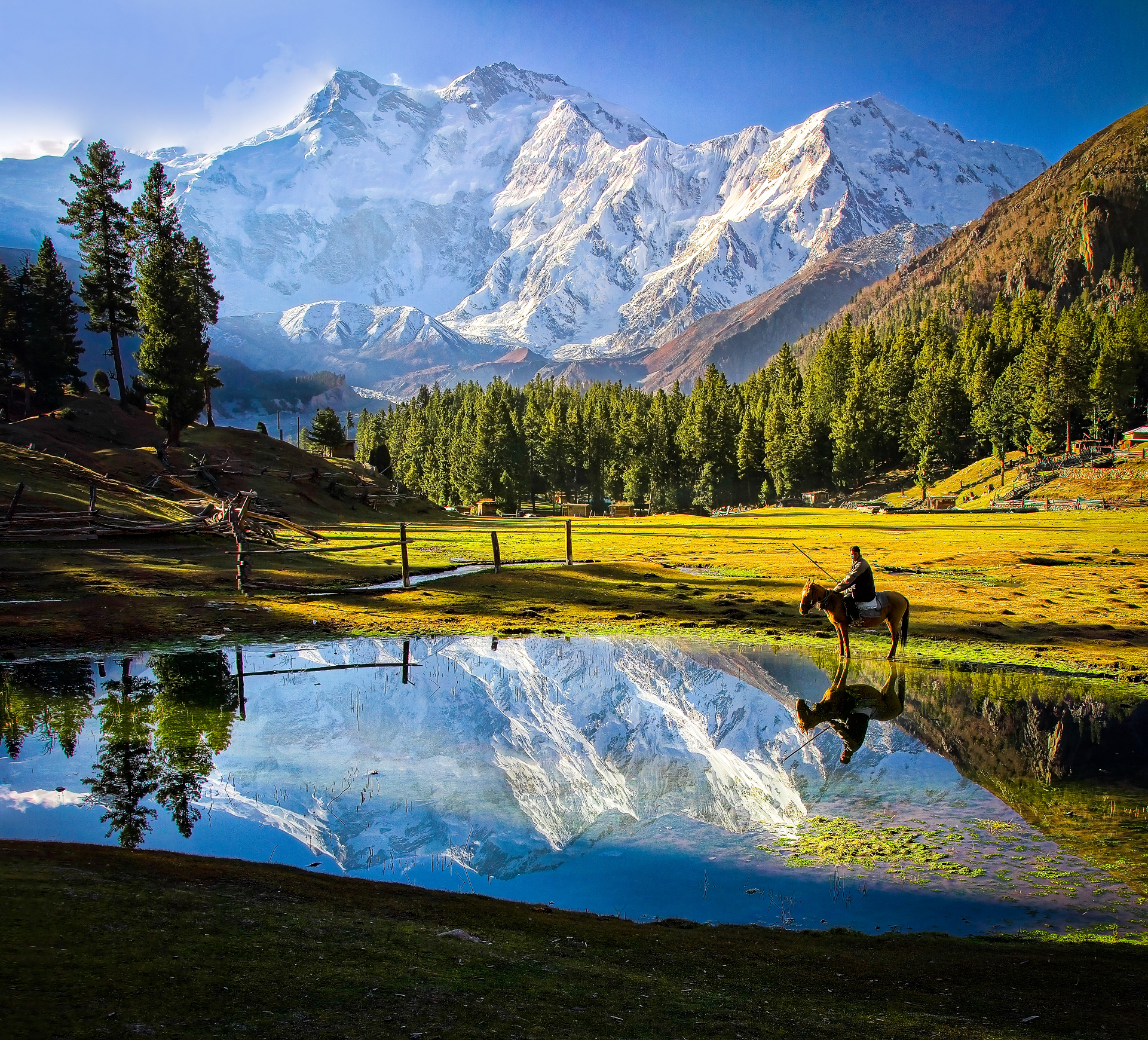
Nanga Parbat Region
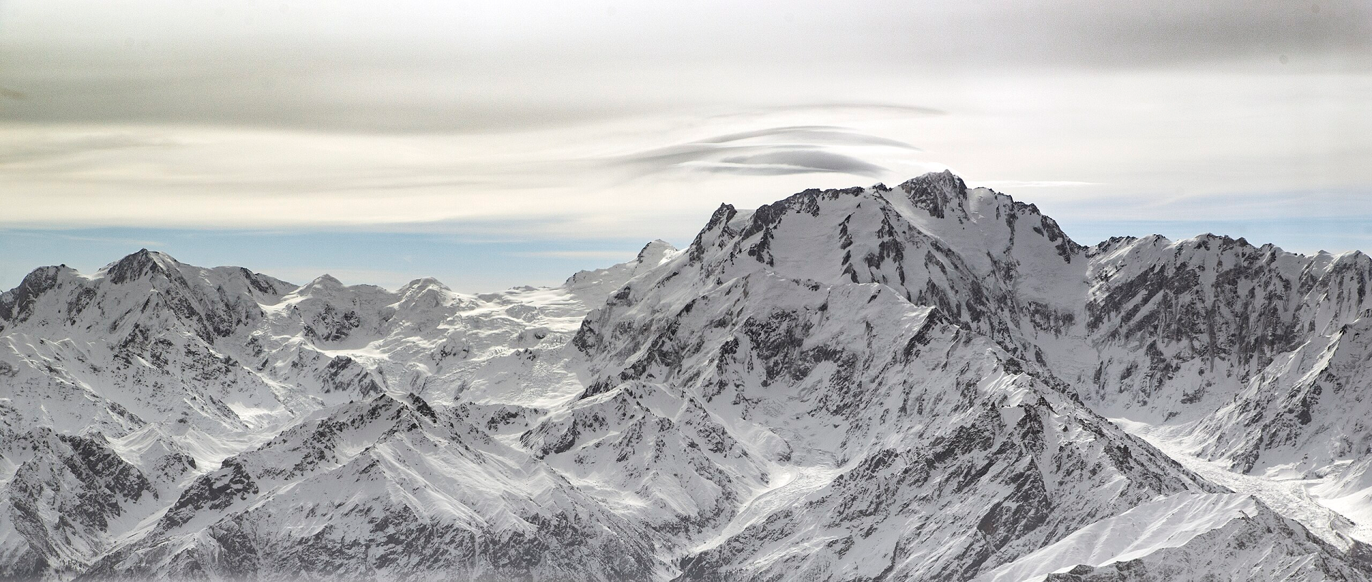
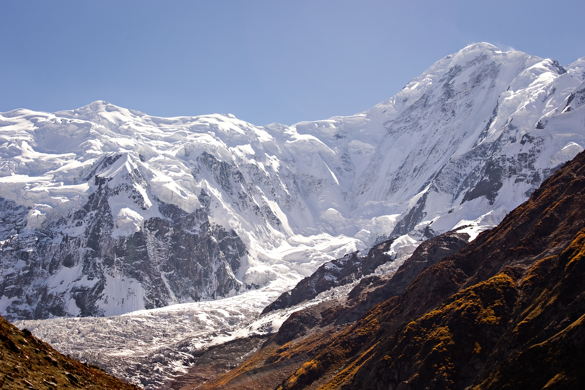
Nanga Parbat Panoramic 1
Khankayani512 (Wikipedia)
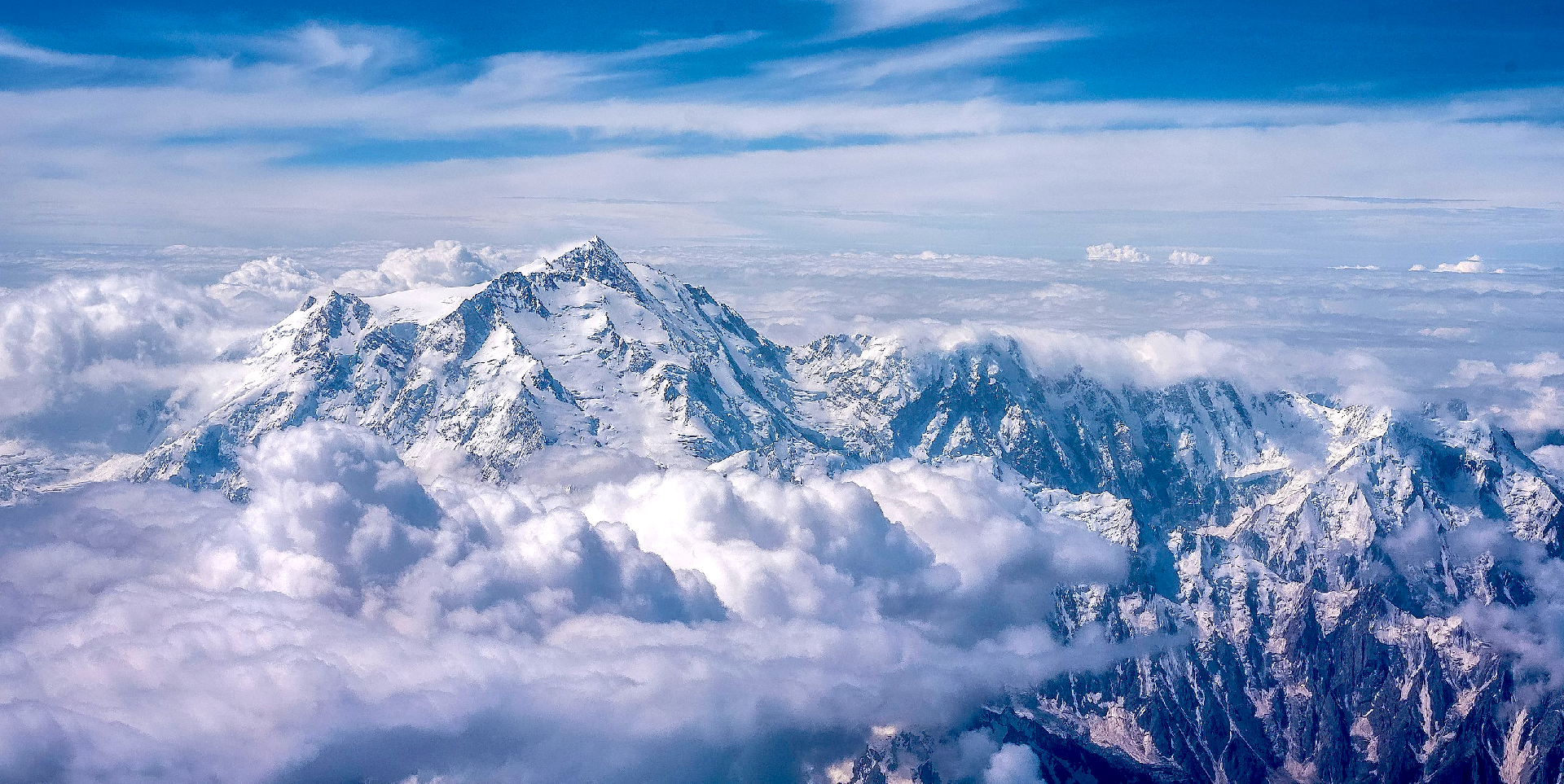
Nanga Parbat Panoramic 2
Moiz Ismaili (Wikipedia)

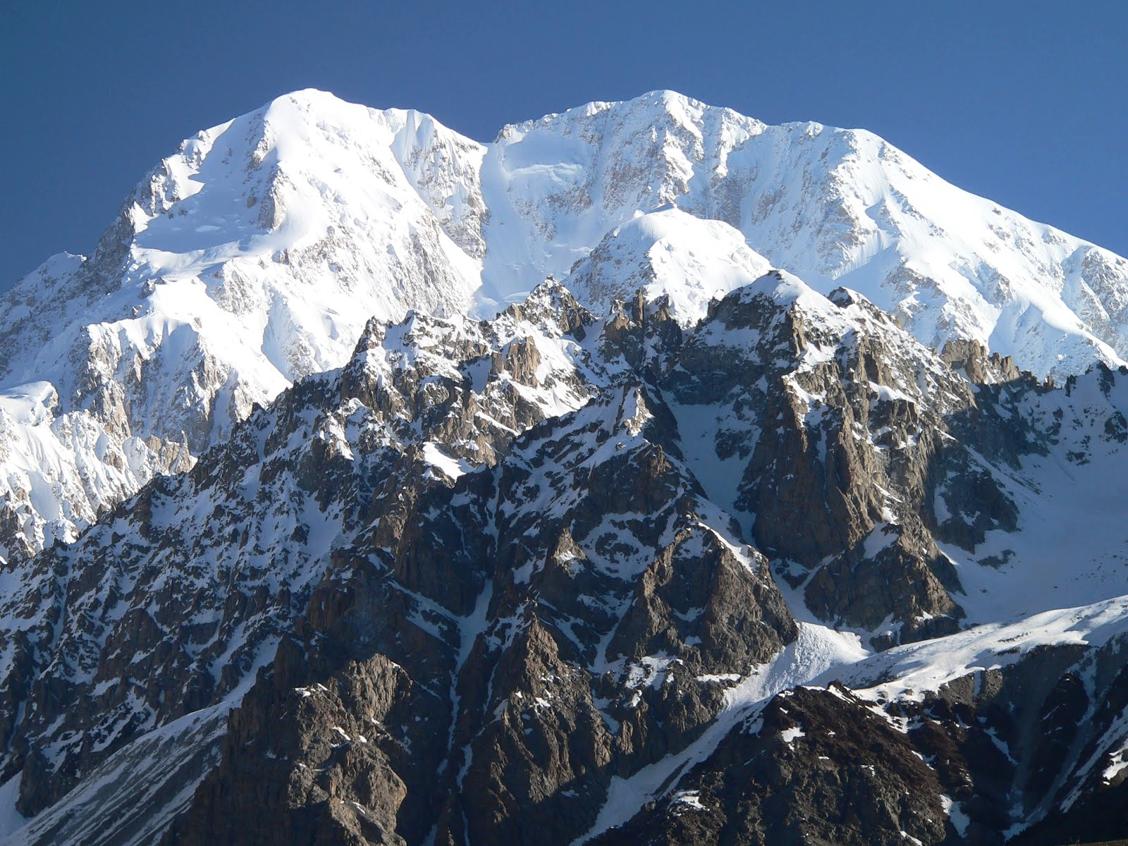
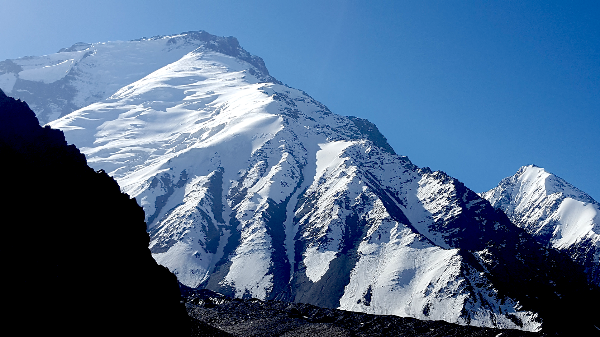
Nanga Parbat (Urdu: نانگا پربت) (Urdu: [nəŋɡa pərbət̪]; lit. ’naked mountain’), known locally as Diamer (Shina: دیآمر, lit. ‘King of the Mountains’), is the ninth-highest mountain on Earth and its summit is at 8,126 m (26,660 ft) above sea level.[3] Lying immediately southeast of the northernmost bend of the Indus River in the Gilgit-Baltistan region of Pakistan-administered Kashmir, Nanga Parbat is the westernmost major peak of the Himalayas, and thus in the traditional view of the Himalayas as bounded by the Indus and Yarlung Tsangpo/Brahmaputra rivers, it is the western anchor of the entire mountain range.[4]
Nanga Parbat is one of the 14 eight-thousanders.[5] An immense, dramatic peak rising far above its surrounding terrain, it has the second-highest prominence among the 100 tallest mountains on Earth only behind Mount Everest. Nanga Parbat is notorious for being an extremely difficult climb, and has earned the nickname Killer Mountain for its high number of climber fatalities and pushing climbers to the test of their limits.[6] According to Guinness World Records, Nanga Parbat is the fastest growing mountain in the world, growing taller at a rate of 7 mm (0.27 in) per year.[7]
Etymology
The name Nanga Parbat is derived from the Sanskrit words nagna and parvata, which, when combined, translate to “Naked Mountain”.[8][9][10] The name refers to the south face, which is usually snowless.[11] The mountain is known locally by its Tibetan name Diamer or Deo Mir, meaning “huge mountain”.[12]
Location
Nanga Parbat forms the western anchor of the Himalayan Range and is the westernmost eight-thousander. It lies just south of the Indus River in the Diamer District of Gilgit–Baltistan in Pakistani-administered Kashmir. In some places, the river flows more than 7 kilometres (4+1⁄2 miles) below the high-point of the massif. To the north is the western end of the Karakoram range.[13]
This article uses material from the Wikipedia article Nanga Parbat, which is released under the Creative Commons Attribution-Share-Alike 4.0 International License (view authors).
 Tahsin Anwar Ali (Wikipedia) |  IAasim85 (Wikipedia) I |
 INataliia Milko (iStock) I | 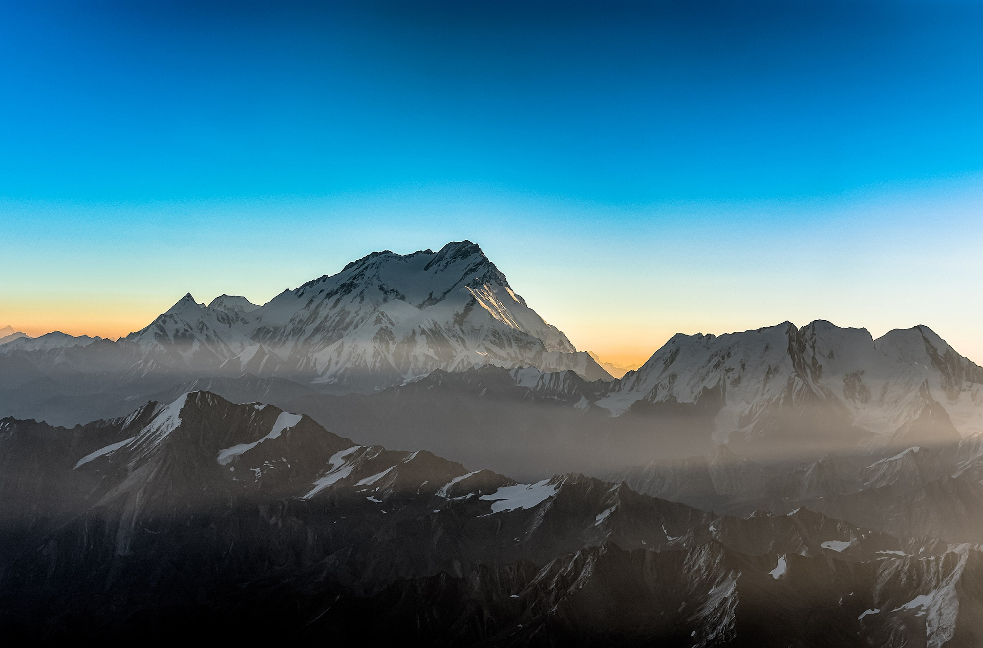 Adnan Kakazai (Wikipedia) |
 IARFayyazr (Wikipedia) I | 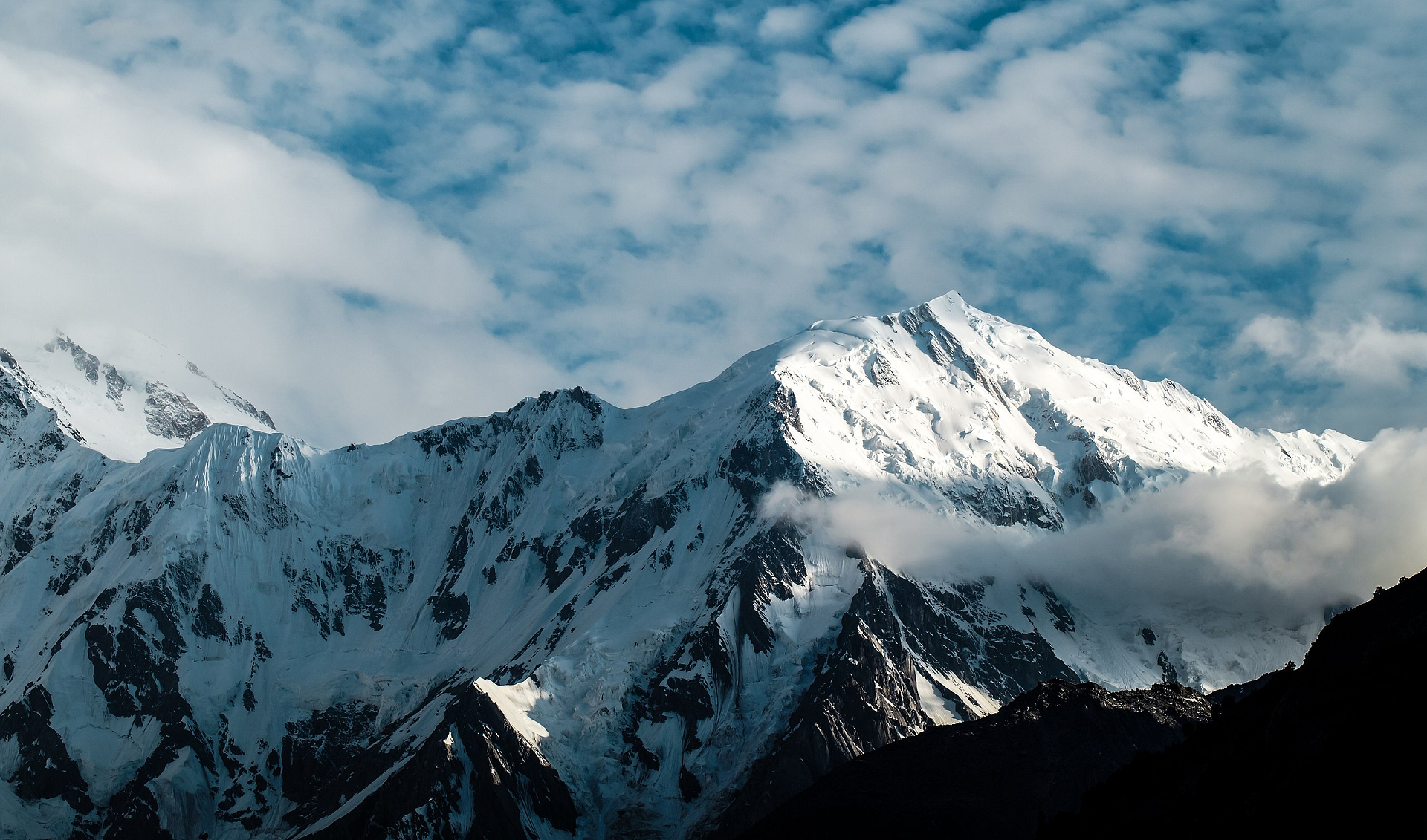 Moaz Aqeel Chishti (Wikipedia) |
 IWaqas Afzal (Wikipedia) I |  Shirjeel Imran Malik (Wikipedia) |
Batura Sar (Urdu: بتورا سر), also referred to as Batura I, is the 25th-highest mountain on Earth[1]. It is the highest peak of the Batura Muztagh, which is the westernmost subrange of the Karakoram range. It forms the apex of the Batura Wall, a continuously high part of the backbone of the Batura Muztagh.
Alternate forms of the name of this peak are Batura, Batura I, and Batura I East.
Location
Batura Sar and the Batura Wall lie near the middle of the Batura Muztagh between Shindar shander valley Nagar and Gojal Hunza, which is the only part of the Karakoram which is west of the Hunza-Nagar River. The river curves around the southwest, west, and northwest sides of the Batura Muztagh. Batura wall bisects Gojal hunza and Bar Valley Nagar. In turn, the Upper Hunza (Gojal Valley) lies in the Hunza District of the Gilgit-Baltistan.
Notable features
Batura Sar is the 25th highest mountain in the world and the second most prominent peak in the Karakoram range.[2] Since it lies at the northwest end of the Karakoram, there is no higher peak north or west of it in the world.
The Batura Wall is notable for being a long (approximately 11.3 km) and imposing ridge over 7000m. Batura is a very ridge-like peak, rather than a pointed spire.
Although it is just slightly higher (according to the usual figures) than nearby Rakaposhi, it is not nearly as famous, since it is set back much further from the Hunza Valley.
This article uses material from the Wikipedia article Batura Sar, which is released under the Creative Commons Attribution-Share-Alike 4.0 International License (view authors).
 Baltistan Tours | 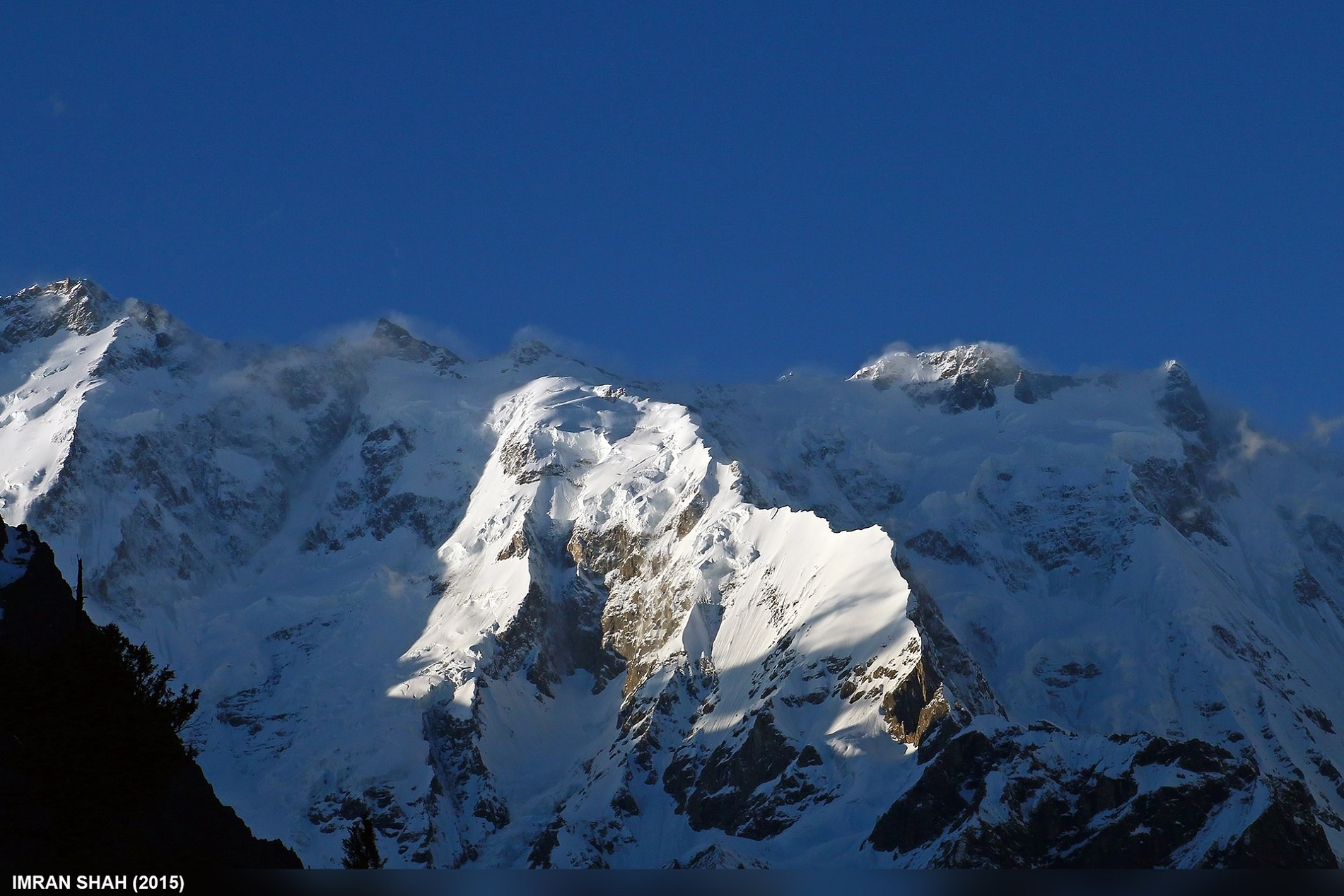 Imran Shah (Flickr) |
 IImran Shah (Wikipedia) |  Imran Shah (Wikipedia) |

Tirich Mir Region
![]()
![]()
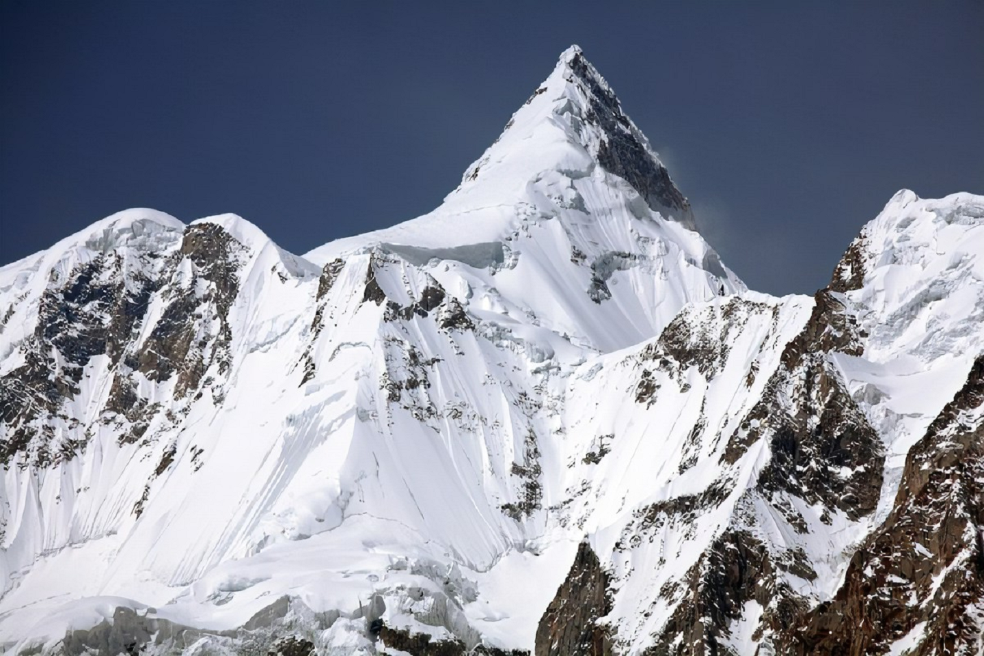
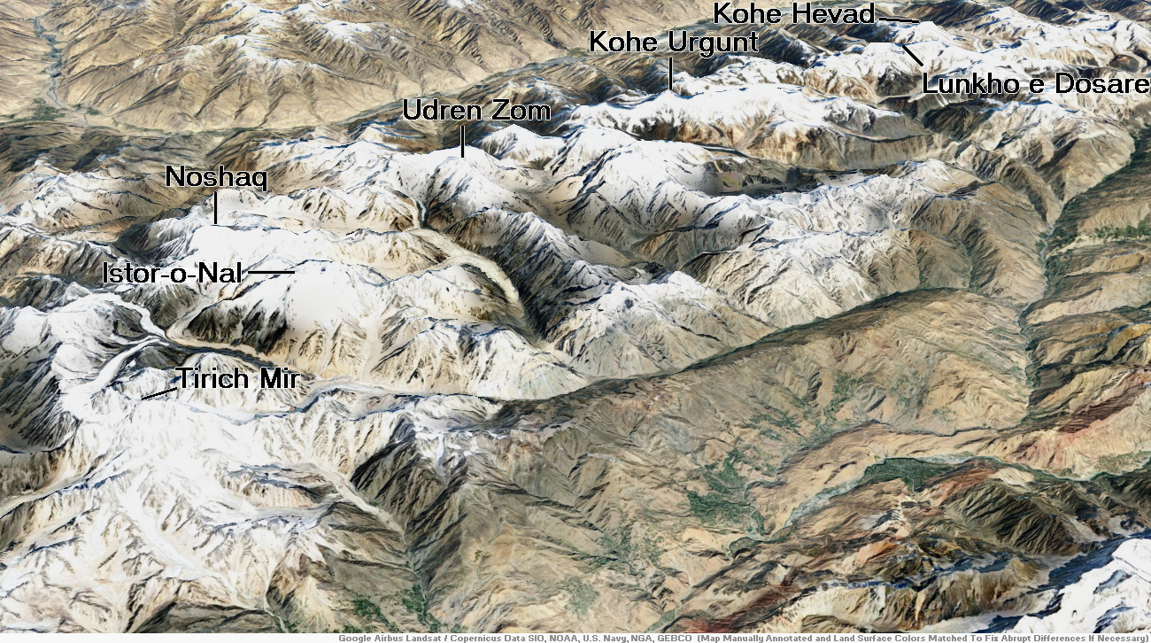
Terich Mir (also spelled Terichmir, Tirich Mir and Turch Mir) is the highest mountain of the Hindu Kush range, and the highest mountain in the world outside of the Himalayas–Karakoram range, at 7,708 meters (25,289 ft) above sea level. It is located in the Chitral District of Khyber Pakhtunkhwa, Pakistan.
It’s the 33rd highest peak in the world. The first recorded ascent of the mountain was on 21 July 1950 by a Norwegian-British expedition consisting of Arne Næss, P. Kvernberg, H. Berg, and Tony Streather,[2] depicted in the documentary film Tirich Mir til topps. Tirich Mir overlooks the town of Chitral, and can be easily seen from the main bazaar. It is the closest mountain to Aconcagua which is higher than Aconcagua, and thus determines Aconcagua’s topographic isolation.[3]
It is the highest mountain in the province of Khyber Pukhtunkhwa. In fact, it is the highest mountain of Pakistan outside the Gilgit-Baltistan region.
The last village situated in Chitral District before the mountain begins is the village of Tirich.[citation needed] This valley begins at Soorwaht, where Tirich River meets Torkhow River from the west, up to Shagrom—the last permanent settlement of the valley. From that point onwards, there are summertime grazing pastures and shepherd huts leading up to the snout of the lower Tirich glacier, which goes further up to Tirich Concordia, where glaciers from seven sub-valleys slide down and join at the Concordia glacial confluence.[citation needed]
It is believed the origin of the name Tirich Mir is “King of Tirich” as Tirich is the name of a side valley of the Mulkhow valley of Chitral which leads up to Tirich Mir. An alternative etymology derives this name from the Wakhi language. In Wakhi, trich means shadow or darkness and mir means king, so Tirich Mir means king of darkness. It could have gotten this name as it creates long shadows on the Wakhan side of its face.[citation needed]
This article uses material from the Wikipedia article Terich Mir, which is released under the Creative Commons Attribution-Share-Alike 4.0 International License (view authors).
 I | 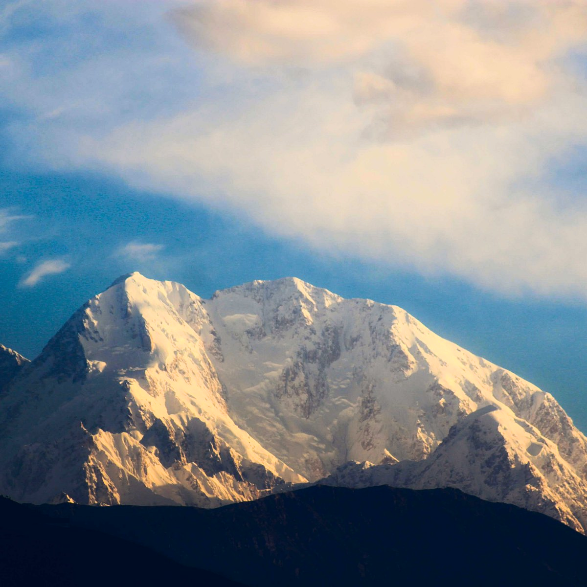 Daniyah Sehar |
 IUsmanqazi1994 (Wikipedia) | 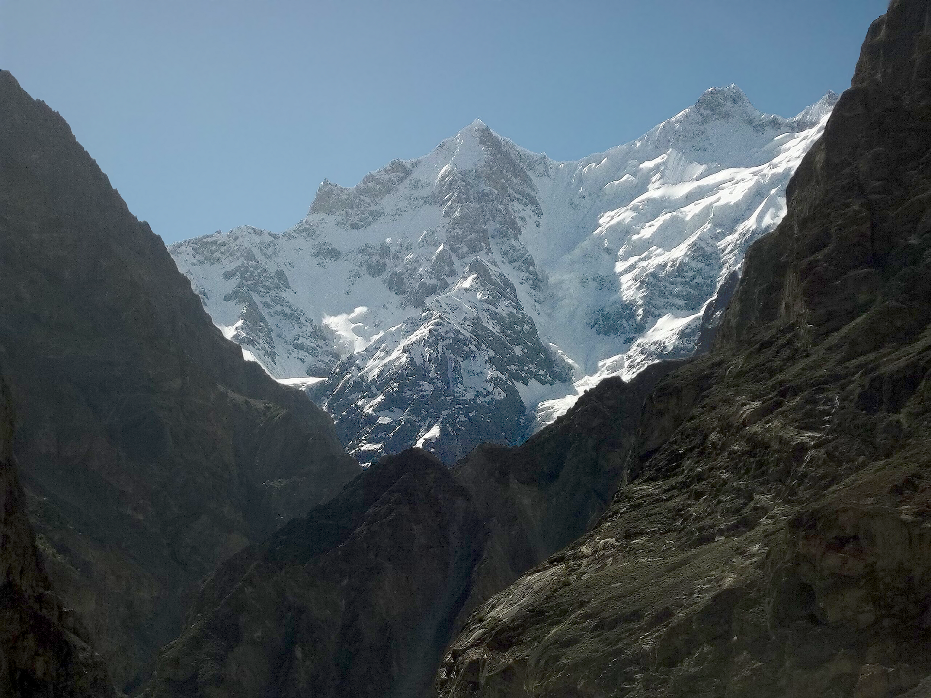 Sbuttar (Wikipedia) I |
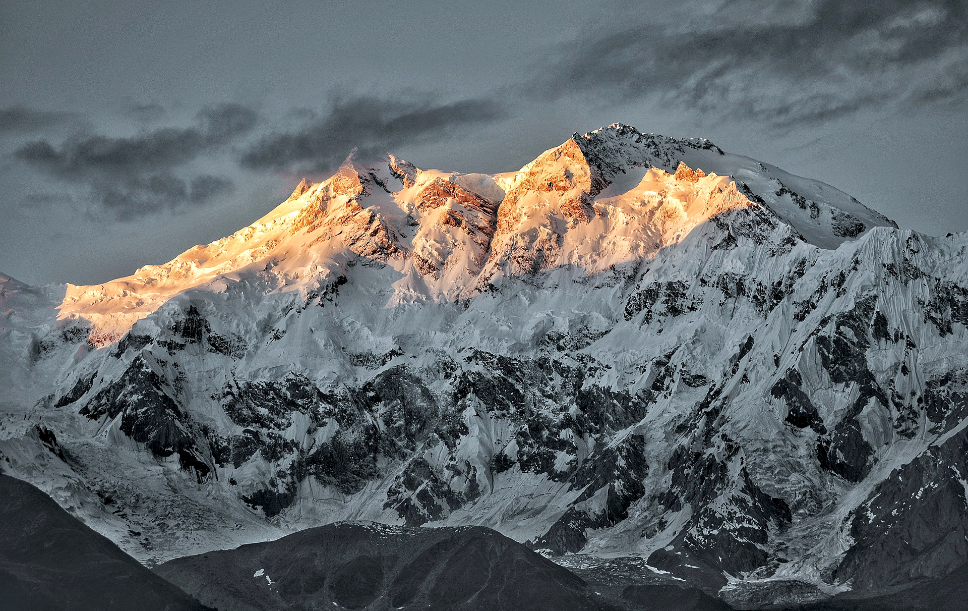
Noshaq Panoramic 1

Eric Gilbertson (Country High Points)
Noshaq Panoramic 2

Eric Gilbertson (Country High Points)

![]()
Noshaq, also called Noshakh or Nowshakh (Dari: نوشاخ, Nowshākh, lit. “new horn”), is the second highest peak in the Hindu Kush Range after Tirich Mir at 7,492 m (24,580 ft). It lies on the border of Afghanistan and Pakistan. The north and west sides of the mountain are in Afghanistan whereas the south and eastern sides are in Pakistan. Noshaq is Afghanistan’s highest mountain and is located in the northeastern corner of the country along the border with Pakistan. It is the westernmost 7,000 m (22,966 ft) peak in the world. The easiest access to Noshaq is from Wakhan Afghanistan.
Climbing history
Noshaq main was first climbed by a Japanese expedition in 1960 led by Prof. Yajiro Sakato.[1][2] Other members of the expedition were Goro Iwatsubo and Toshiaki Sakai. The climb followed the normal Afghanistan approach, the West ridge from the Qadzi Deh Glacier. The normal Afghanistan approach route is by the west ridge.
Noshaq East, Noshaq Central and Noshaq West were first climbed in 1963 by Austrians Dr. Gerald Gruber and Rudolf Pischenger.
The Tiroler Hindukusch-Ski-Expedition of Akademischer Alpenklub Innsbruck (Austria) made the first ski descent from the summit of Noshaq in 1970.[3] The famous meteorologist Karl Gabl was a member of the team.[4]
The first winter ascent was 13 February 1973 by Tadeusz Piotrowski and Andrzej Zawada, members of a Polish expedition, via the north face. It was the world’s first winter climb of any 7000 m peak. Until now it is the only winter ascent of this mountain.[5]
Between the Soviet invasion of Afghanistan in 1979 and the fall of the Taliban in 2001, the mountain was very difficult to access because of political turmoil in the region.[6] In 2011, National Geographic noted that the trail to the summit was again accessible to climbers, with hopes of opening the area up for tourism.[7][8]
This article uses material from the Wikipedia article Noshaq, which is released under the Creative Commons Attribution-Share-Alike 4.0 International License (view authors).
 Eric Gilbertson (Country High Points) | 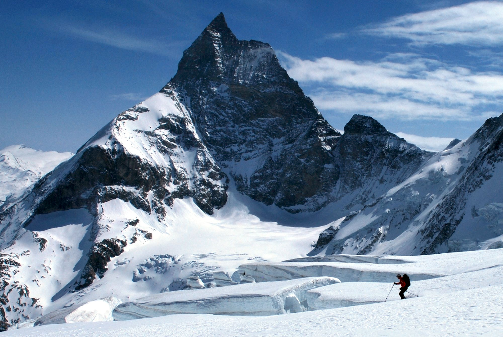 U.S. Air Force I |
 IHug Media I |  Louis Meunier (Wikipedia) |
 IEric Gilbertson (Country High Points) |  IEric Gilbertson (Country High Points) |
 IEric Gilbertson (Country High Points) | 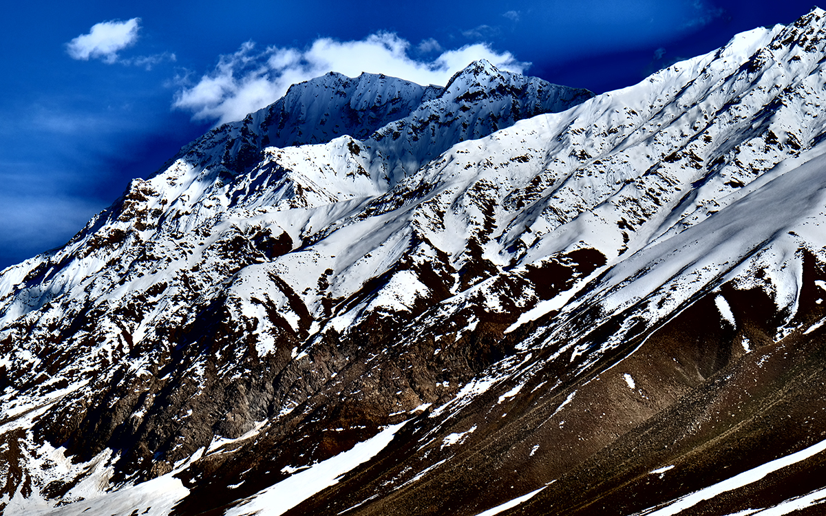 Hanifa Yousoufi (Sierra Club) |
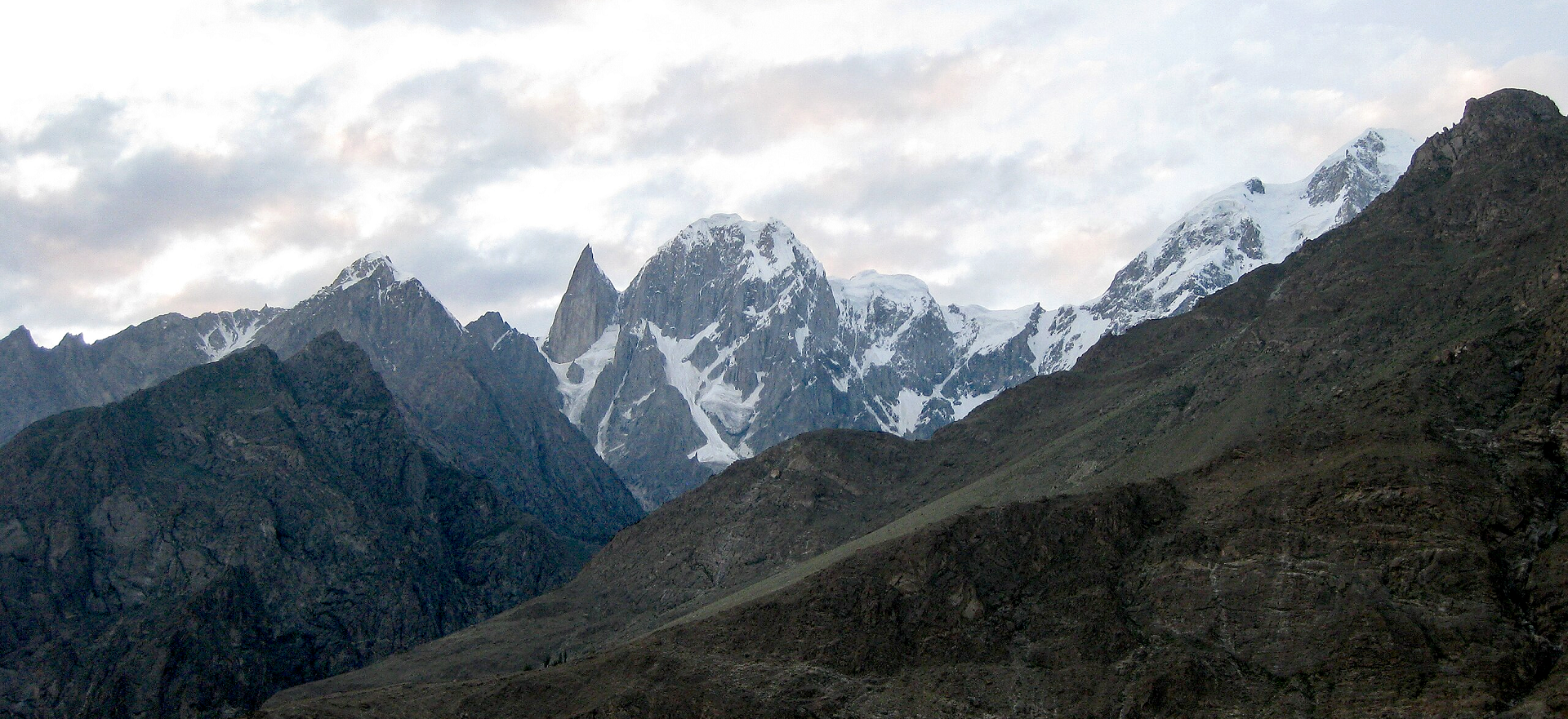
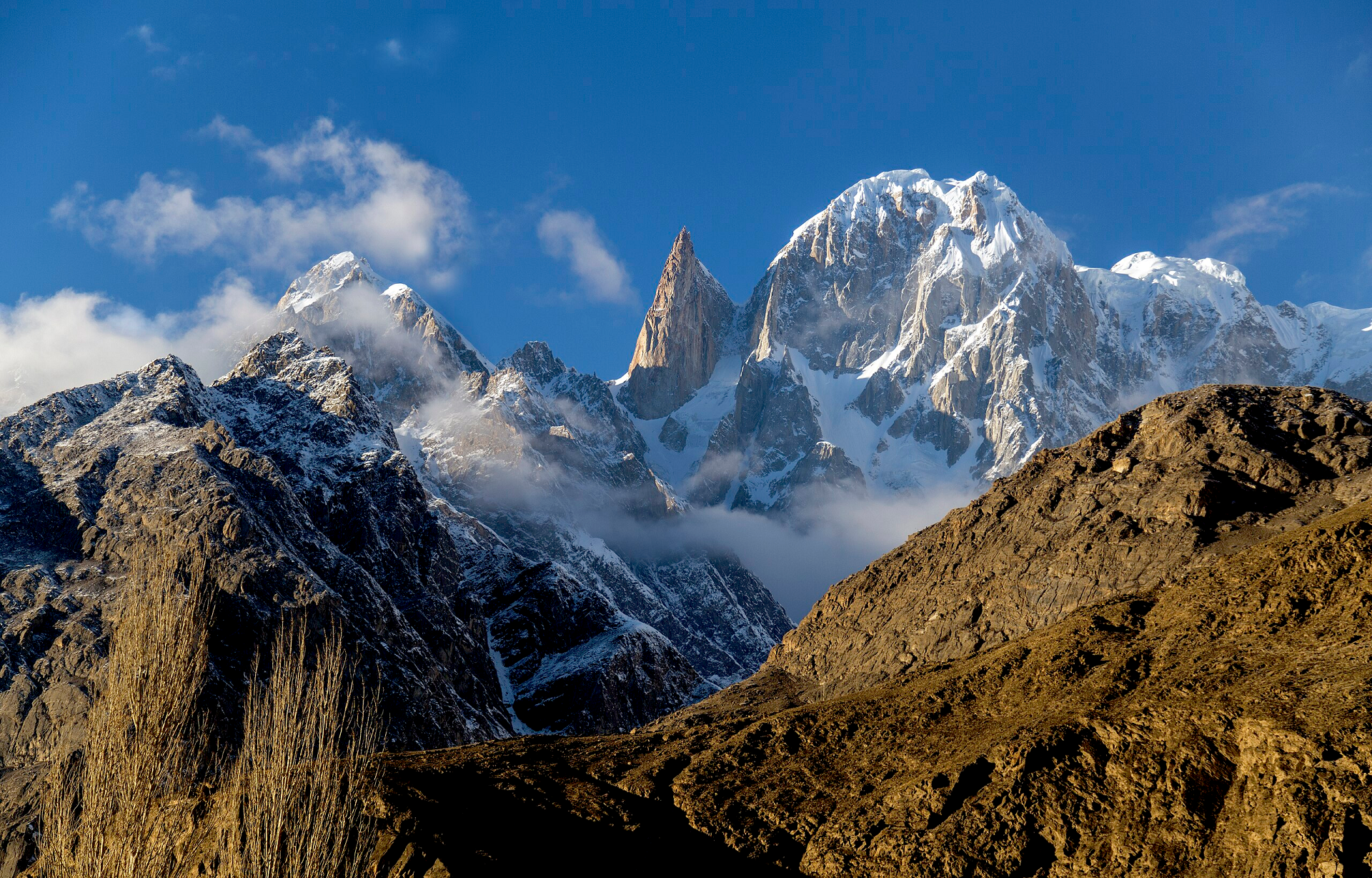
Hunza Peak Panoramic
Urooj (Wikipedia)
![]()
![]()
Hunza Peak (Urdu: ہنزہ چوٹی) lies in the westernmost subrange of the Karakoram range in Pakistan, along with the Ladyfinger Peak (Bublimating).[1] It lies on the southwest ridge of the Ultar Sar massif, the most southeasterly of the major groups of the Batura Muztagh. The whole massif rises precipitously above the Hunza Valley to the southeast.
This peak has at least two known routes, both first climbed in 1991. Both routes were done in alpine style, the first by a Swedish expedition and the second by a British team, which included Caradog Jones and Mick Fowler.
While the nearby Ladyfinger Peak has little prominence above the saddle with Hunza Peak, it is a sharp, relatively snowless rock spire among the peaks around it.
This article uses material from the Wikipedia article Hunza Peak, which is released under the Creative Commons Attribution-Share-Alike 4.0 International License (view authors).
 Imran Niazi (Wikipedia) |  Gudupk (Wikipedia) |
 Uzair889 (Wikipedia) |  Waqas Afzal (Wikipedia) |
 Adnan Wahab Khan (Wikipedia) | 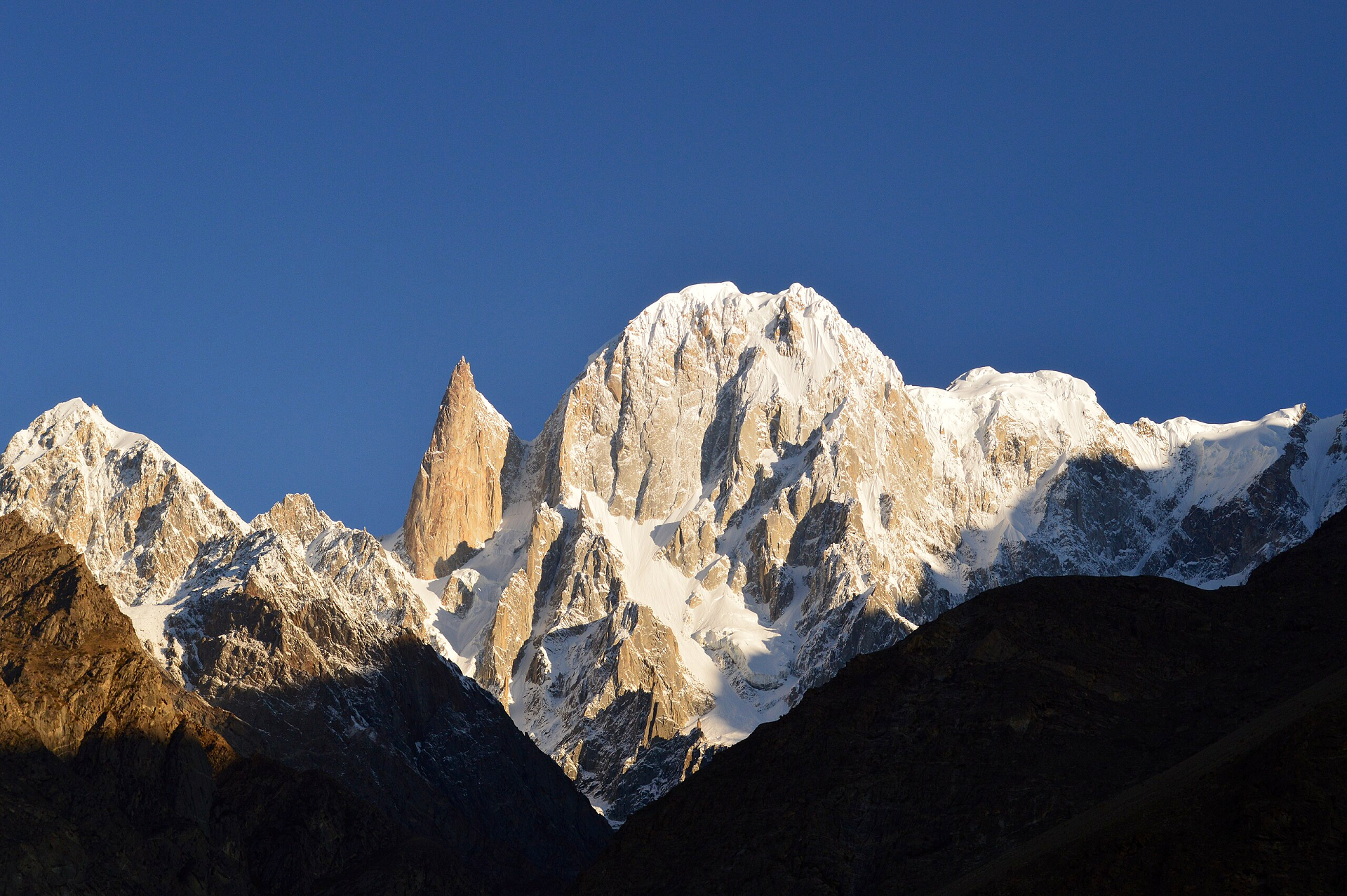 Mirzaabdulhaque (Wikipedia) |

![]()
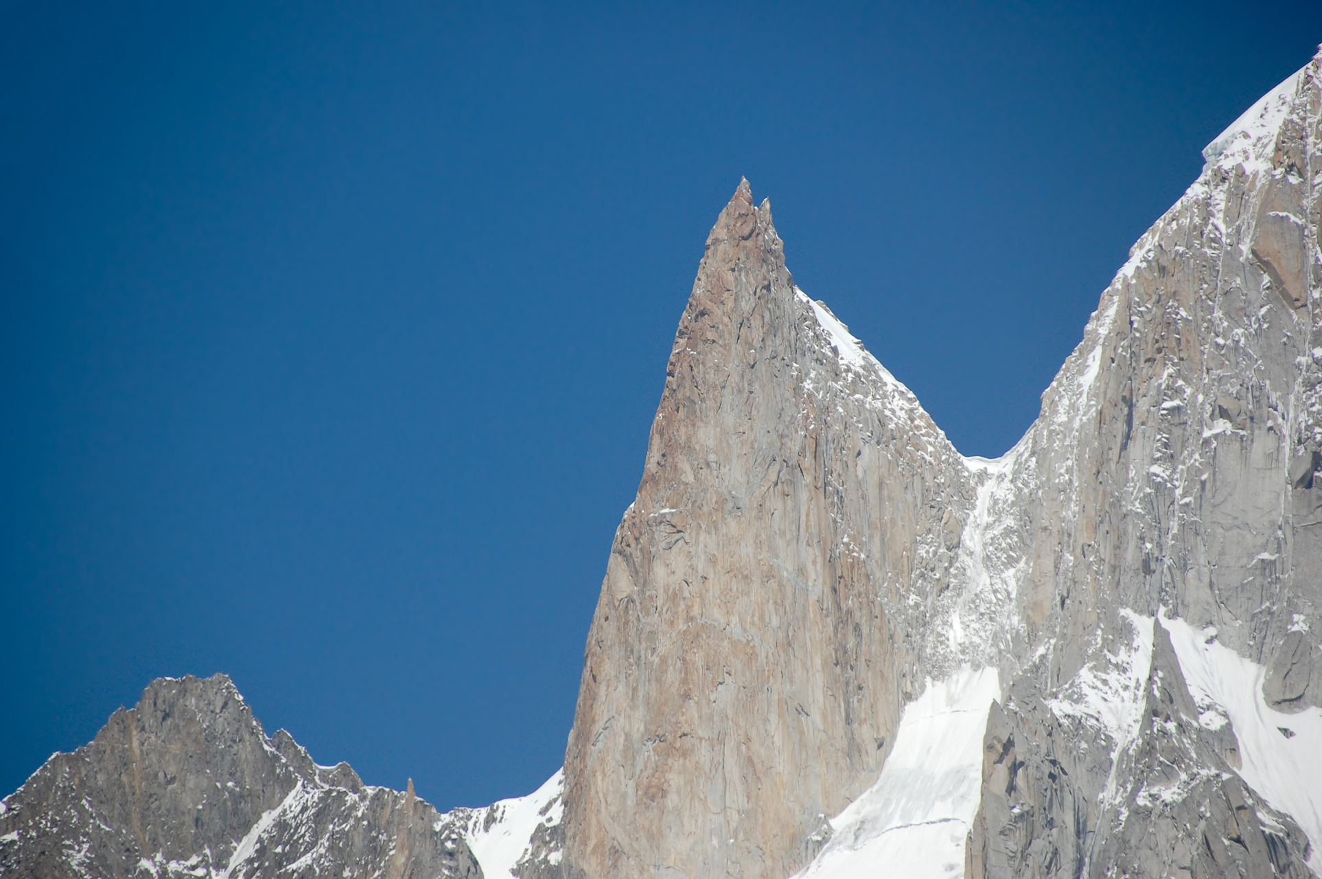
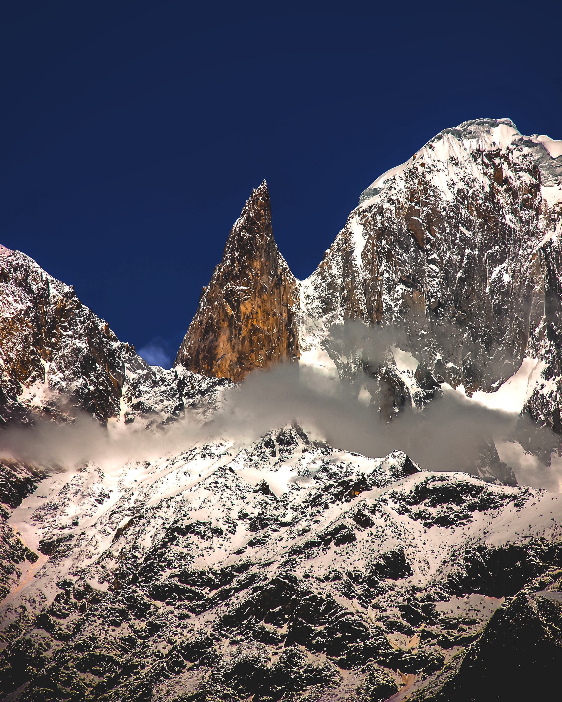
The Bublimotin, Bubli Motin, Bublimating or Ladyfinger Peak (Urdu: لیڈی فنگر), is a distinctive rock spire in the Batura Muztagh, the westernmost subrange of the Karakoram range in Pakistan. It lies on the southwest ridge of the Ultar Sar massif, the most southeasterly of the major groups of the Batura Muztagh. The whole massif rises precipitously above the Hunza Valley to the southeast.
Bublimotin is a sharp, relatively snowless, rock spire among the nearby peaks, although it has little prominence above the saddle with nearby Hunza Peak. It provides a 6,000 metres (20,000 ft) rock climb (with a very serious alpine approach) and has been the scene of some notable paragliding.
An interesting folk tale about the peak (Bubli mo Ting, literally meaning ‘Bubli’s peak’) is that Kisar, a (magical) prince from Baltistan, came to Hunza on one of his adventures and married a princess, a gas, called Bubli. When he received news that his first wife in Baltistan, Langabrumo, had been kidnapped (by a phut or a deu, one story says, but according to Lorimer’s book it is a king from another country), he immediately made preparations to set off and rescue her. He took Bubli up to this mountain, (later named after her), and handed her a sack of grain as well as a hen or chicken (a qarqamuts). She must have asked whether – and when – he would be back and he told her: “Every year give this chicken a single grain to eat. When the sack is empty, I will return. Until that time, stay here.” He left, and, they say, Bubli is waiting there still.
This article uses material from the Wikipedia article Ladyfinger Peak, which is released under the Creative Commons Attribution-Share-Alike 4.0 International License (view authors).
 Muhammad Khurram Shahzad (Wikipedia) |  Hamzaniazii (Wikipedia) I |
 Maria Ly (Wikipedia) I | 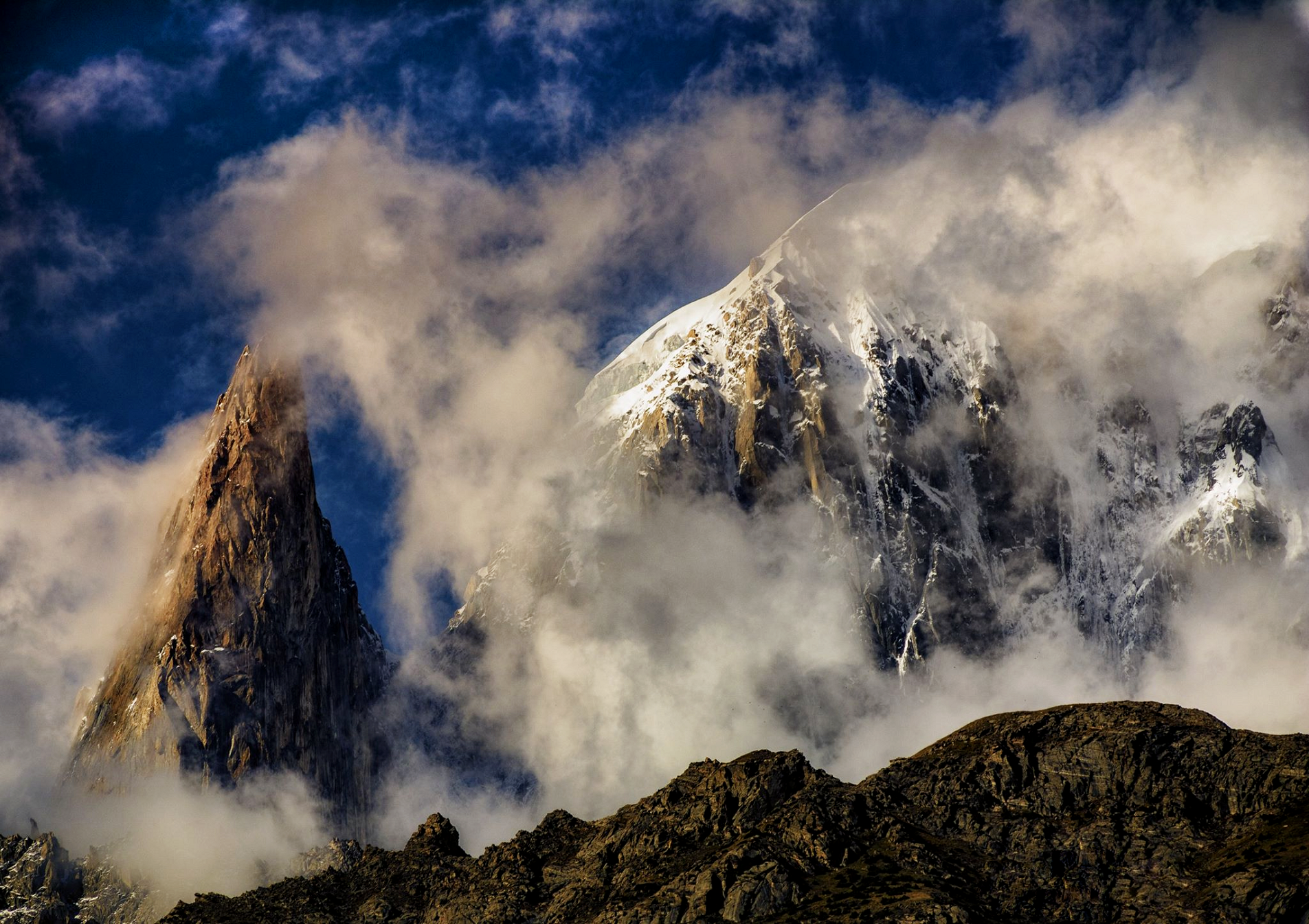 Faisal.aashiq9 (Wikipedia) |
 Taseer Beyg (Wikipedia) | 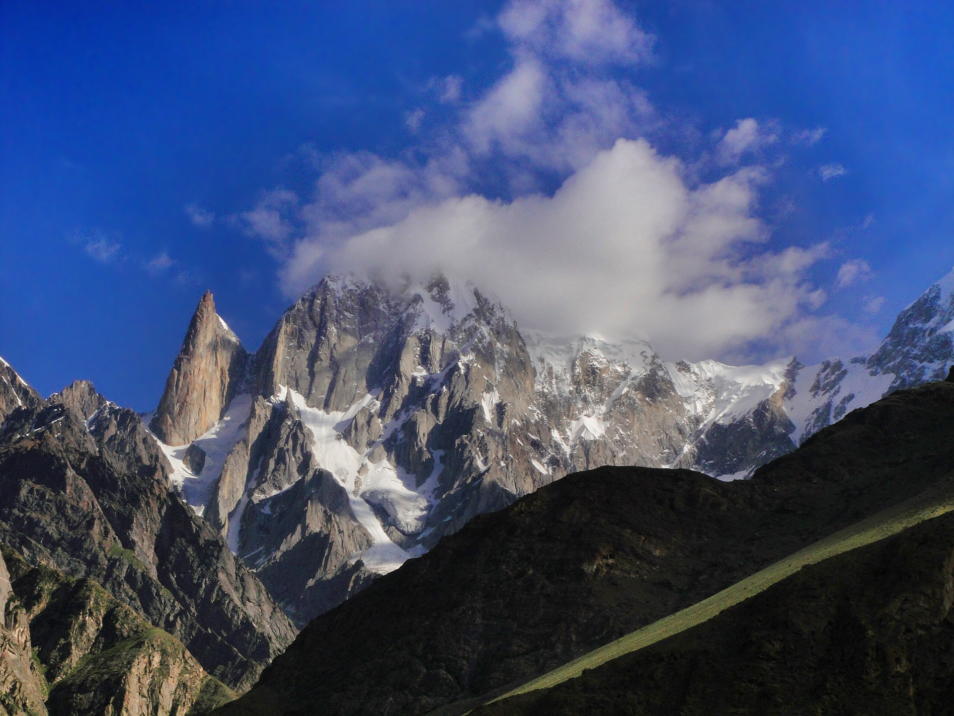 Ateek Sheikh (Wikipedia) |
