
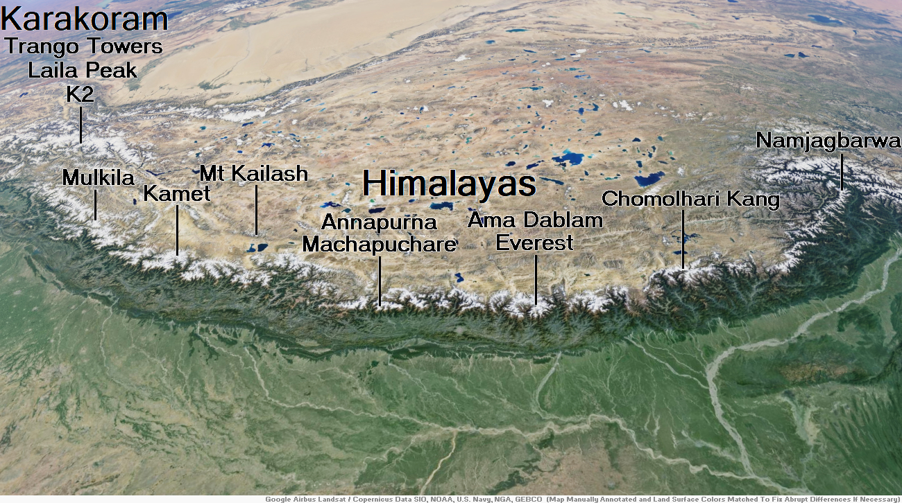
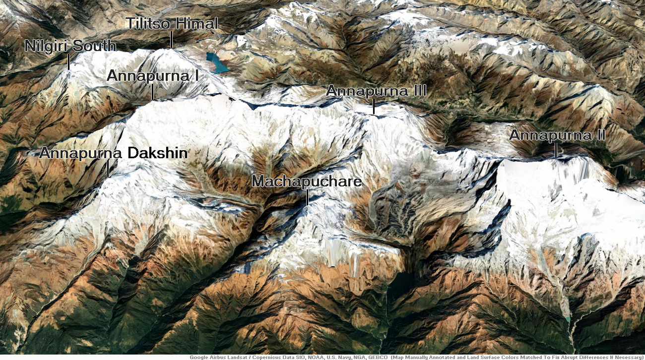
Map of Himalayas
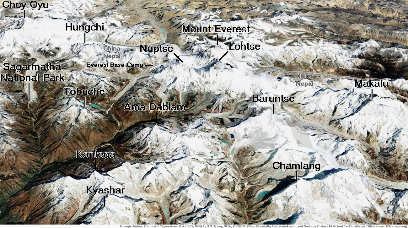
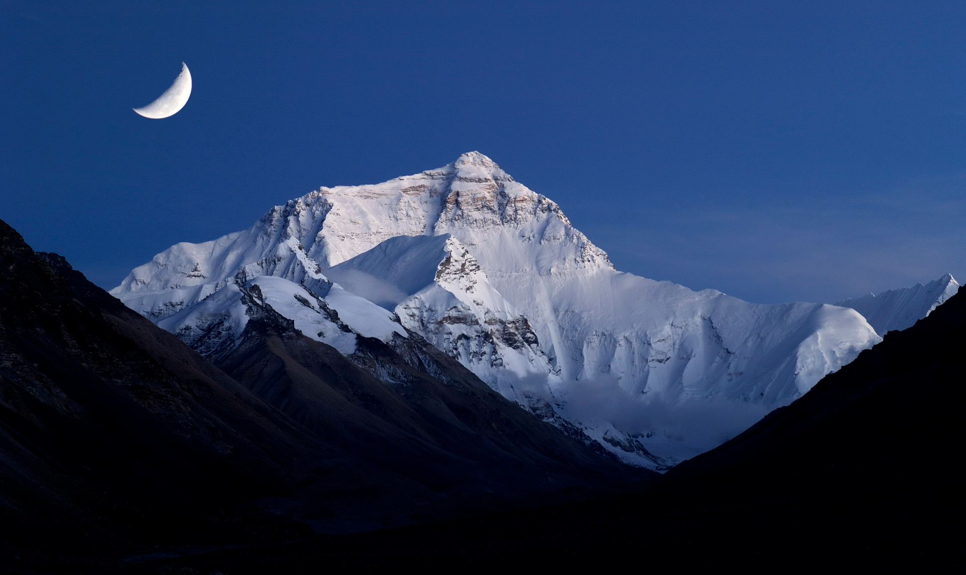
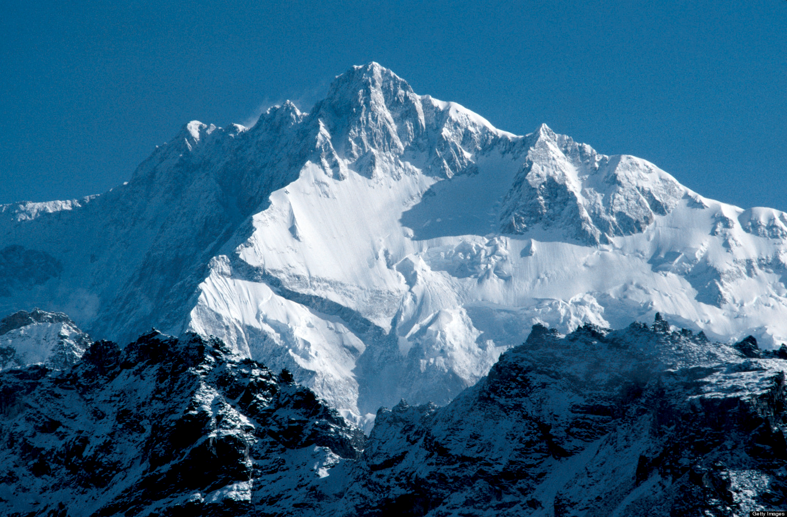
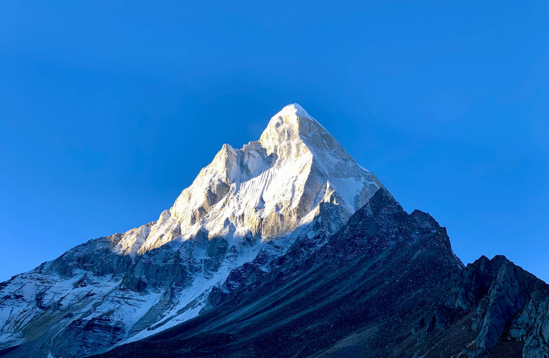
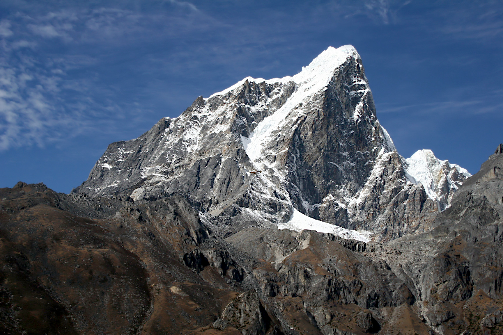
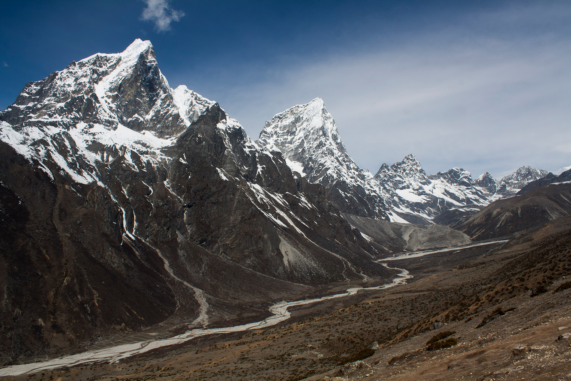
Mount Everest Region
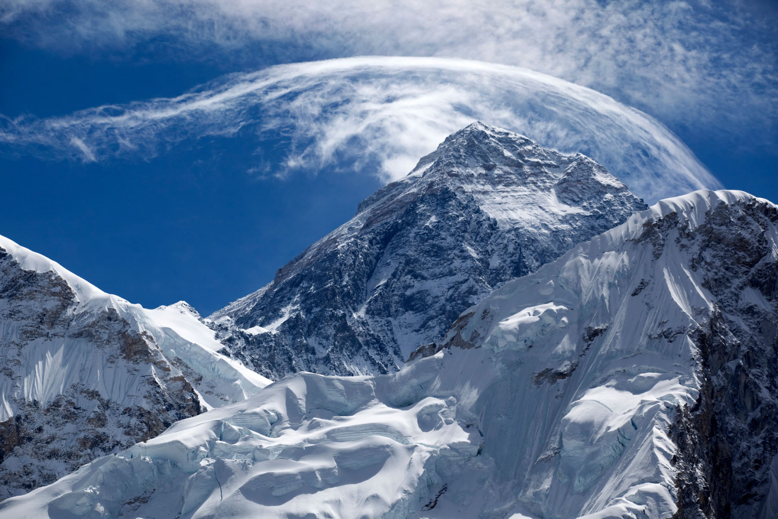
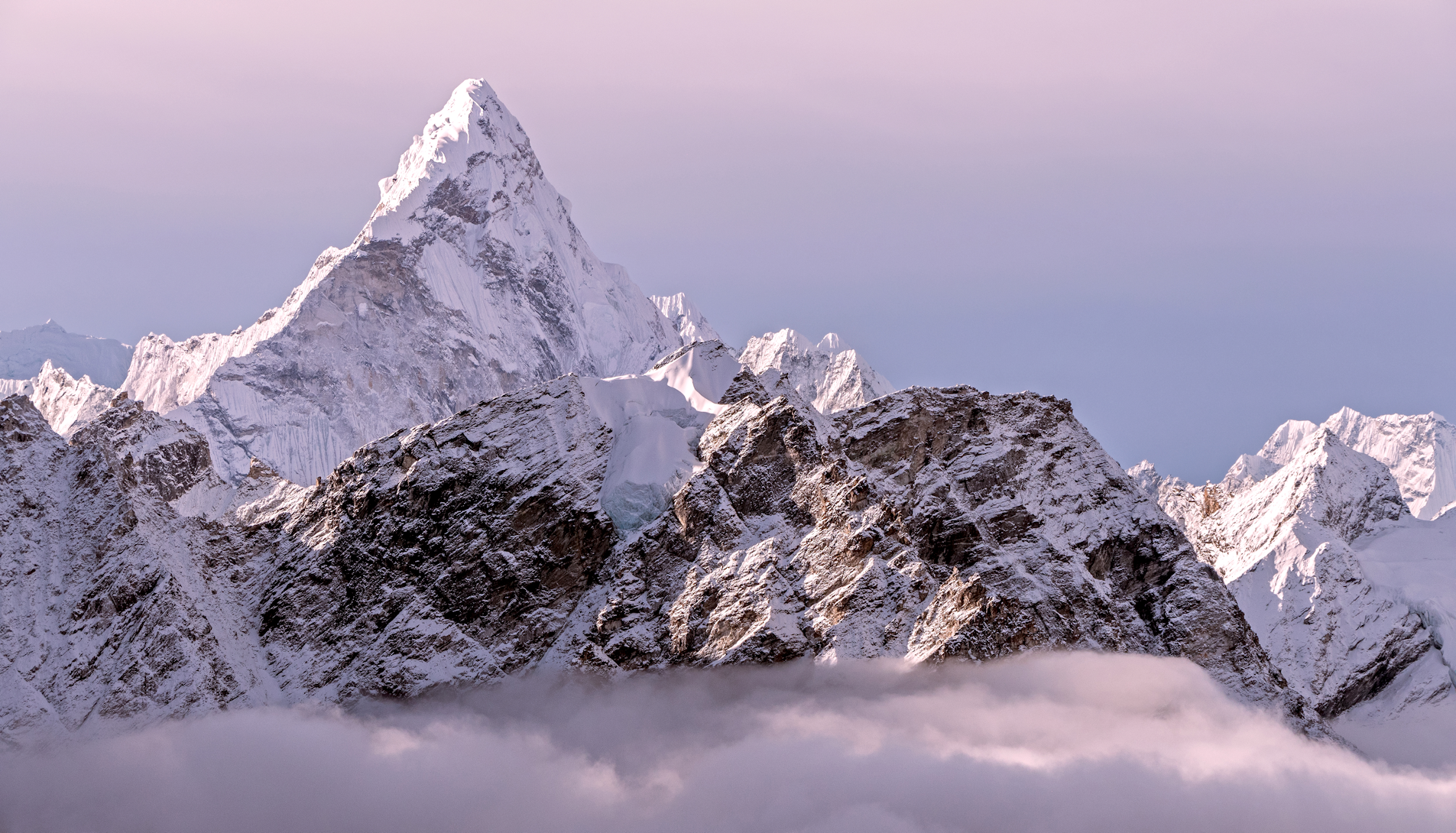
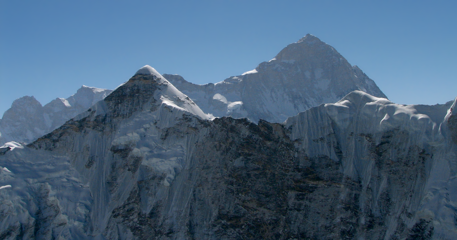
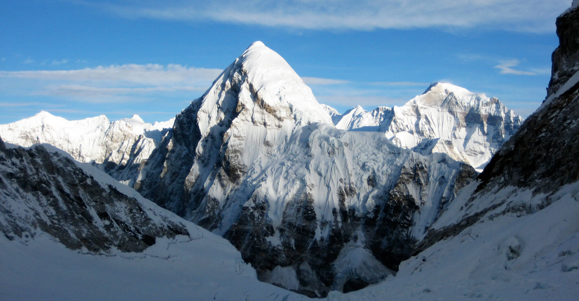
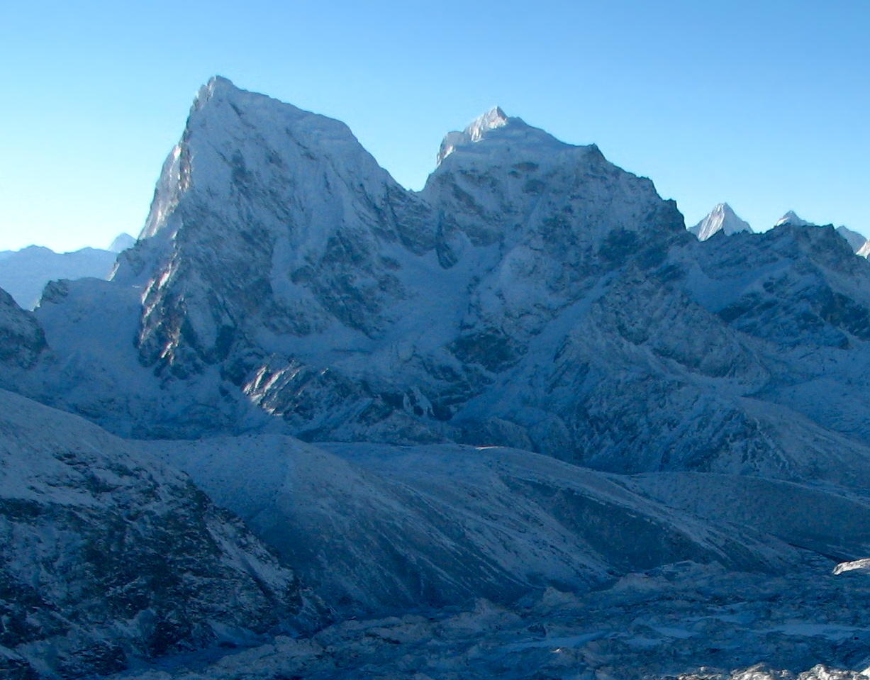
Everest Panoramic 1
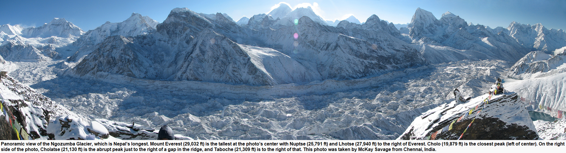
McKay Savage
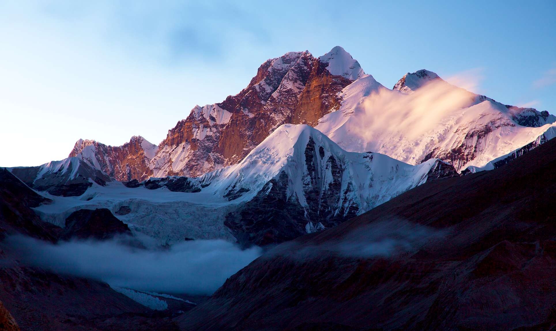
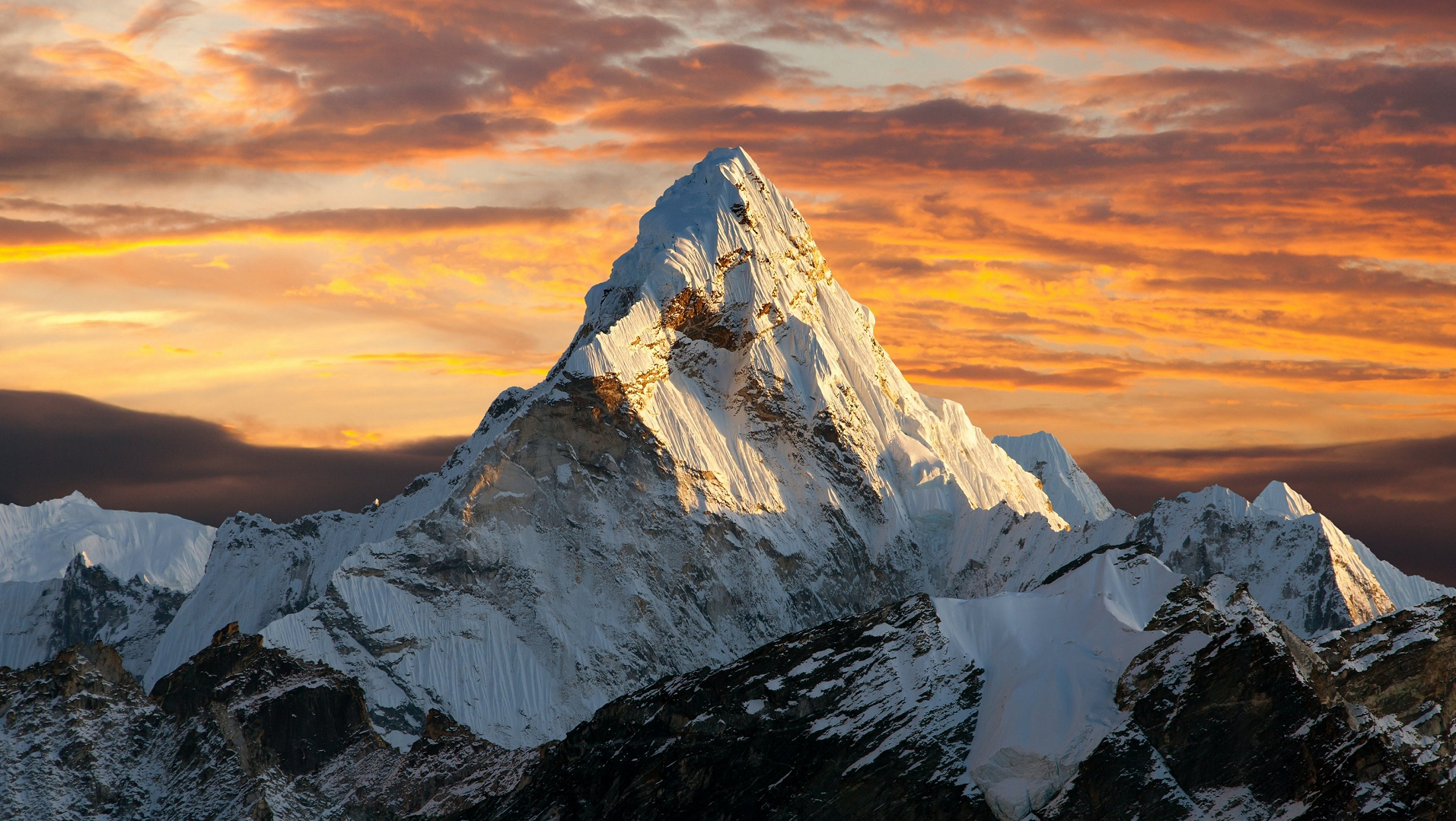
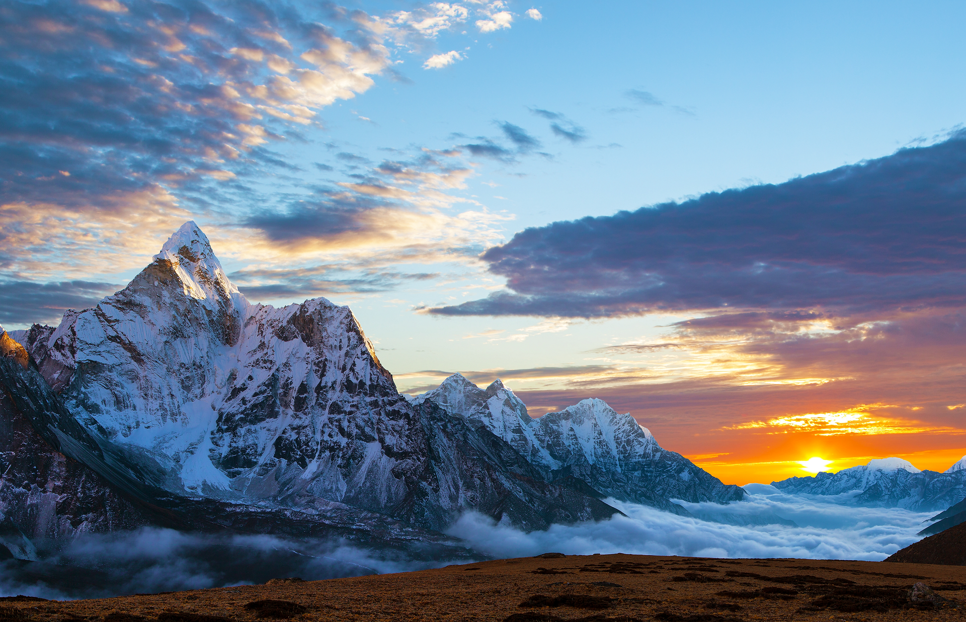
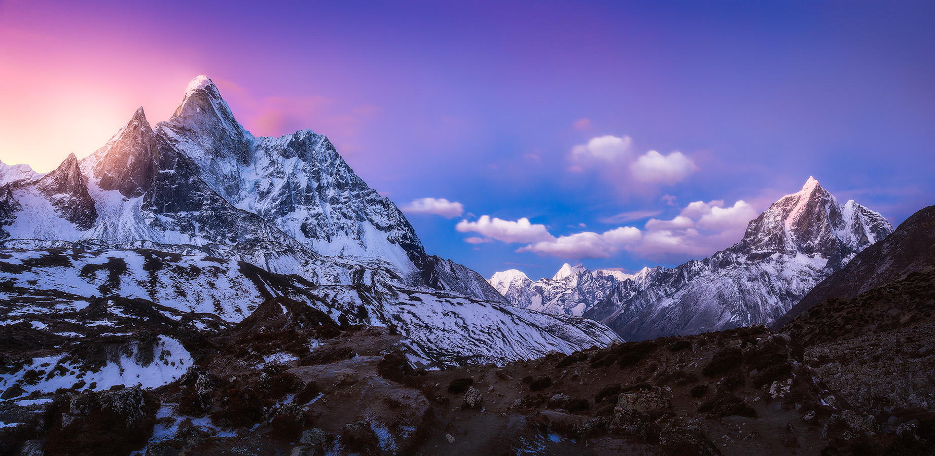
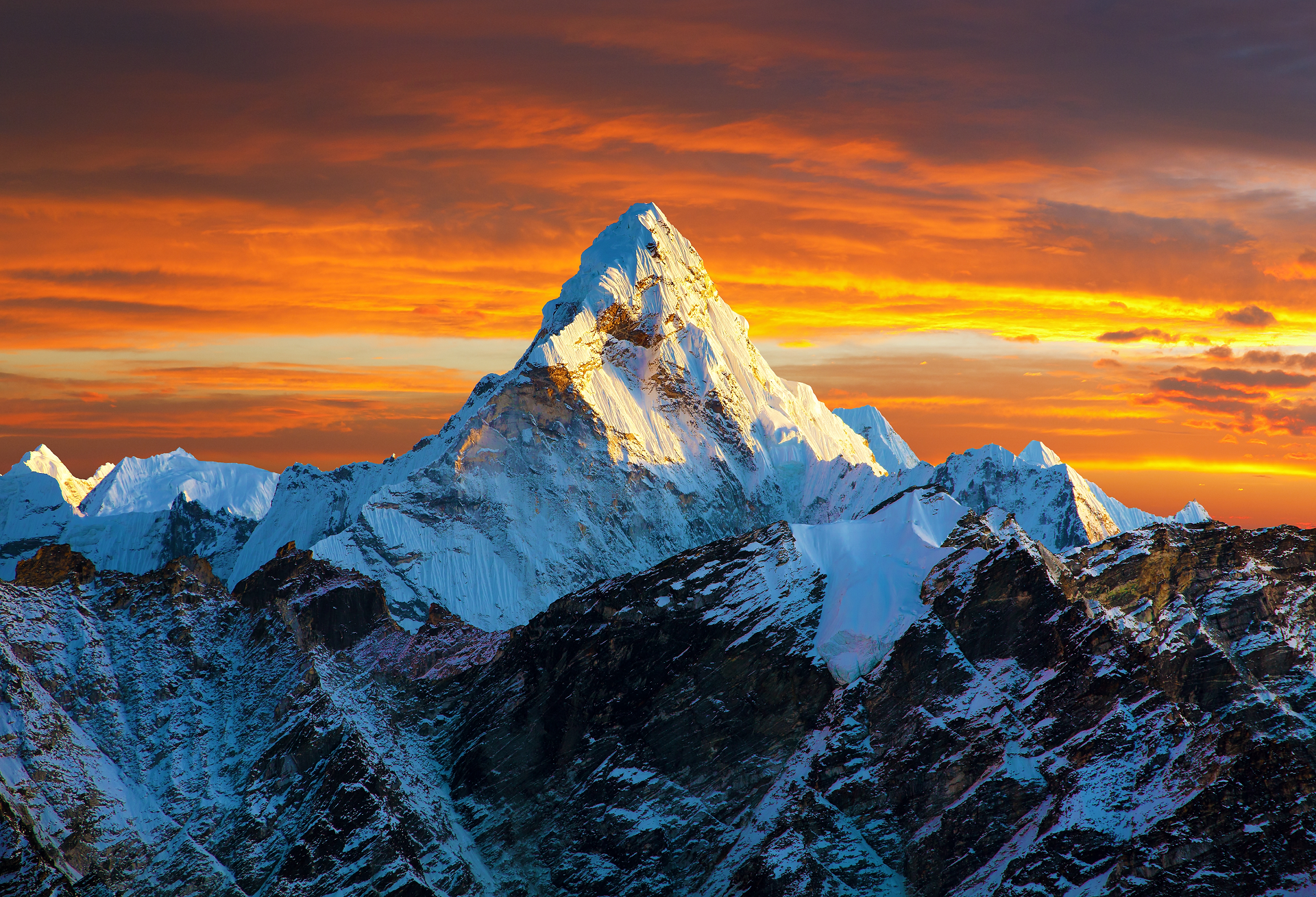
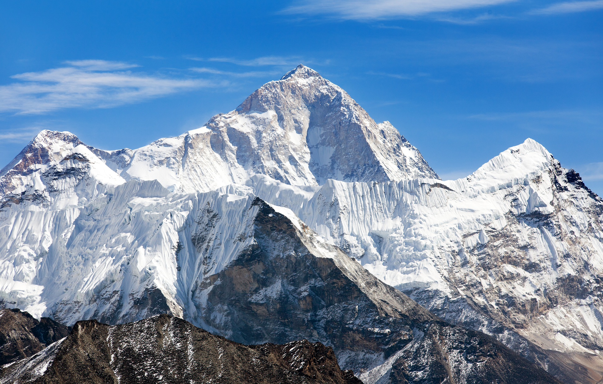
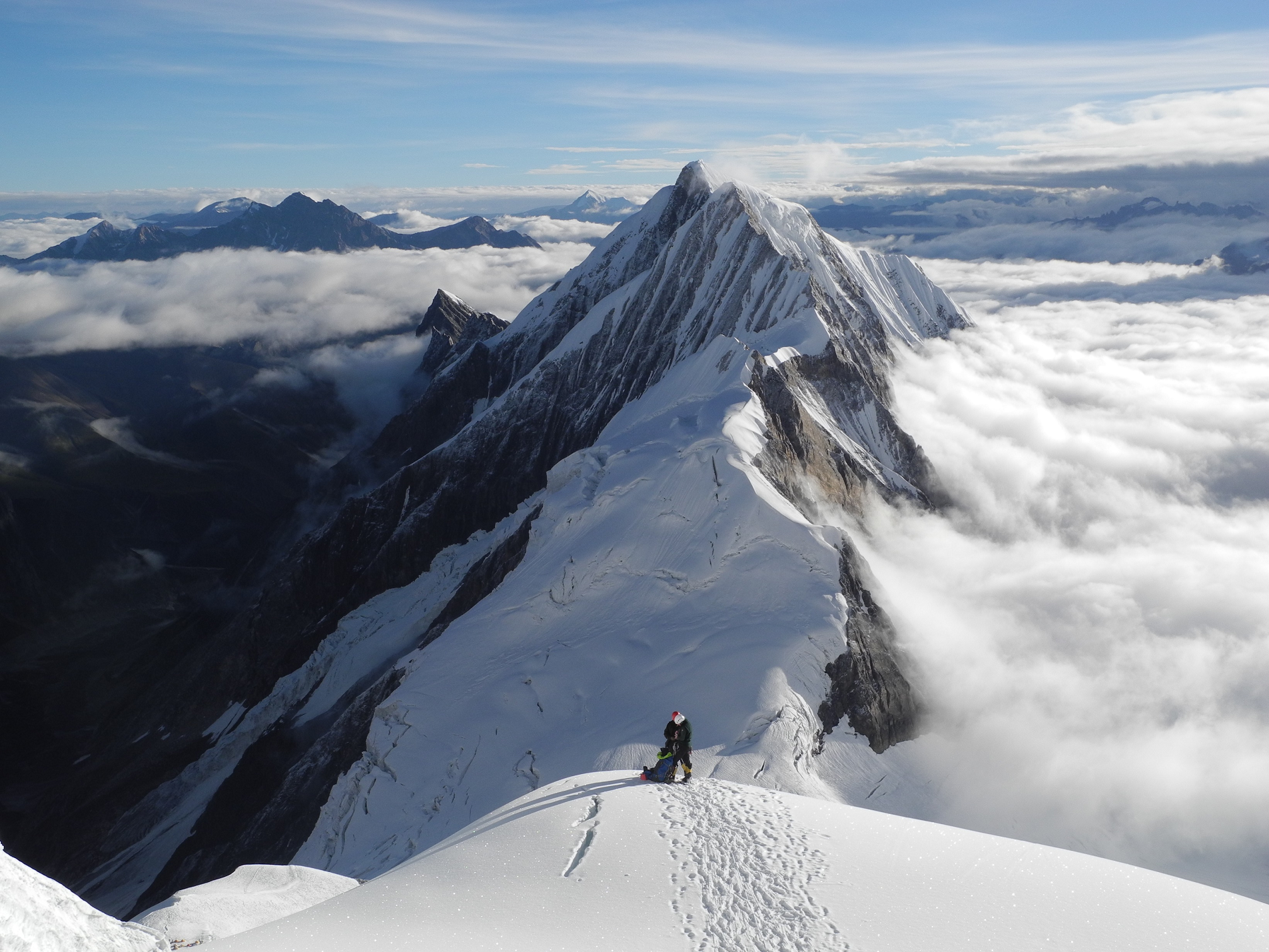
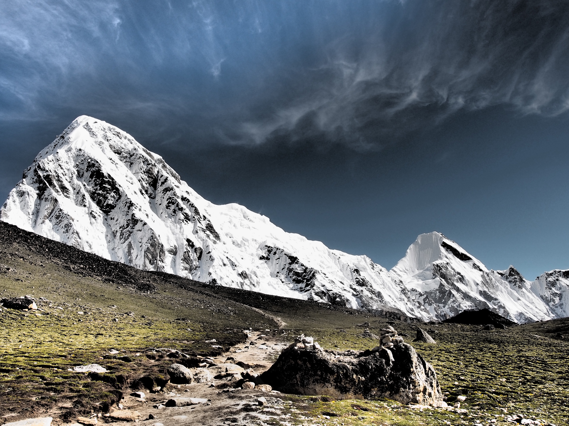
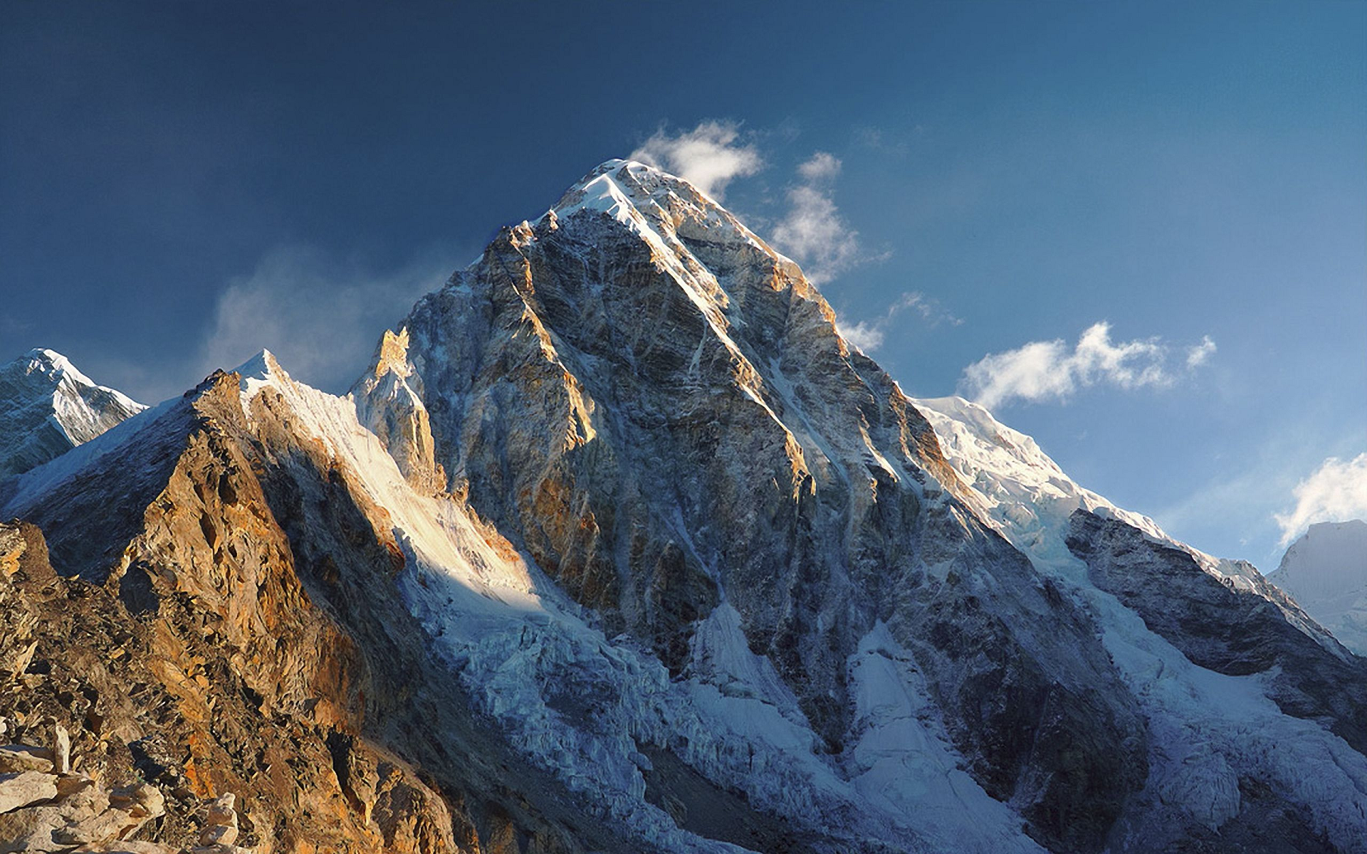
Everest Panoramic 2
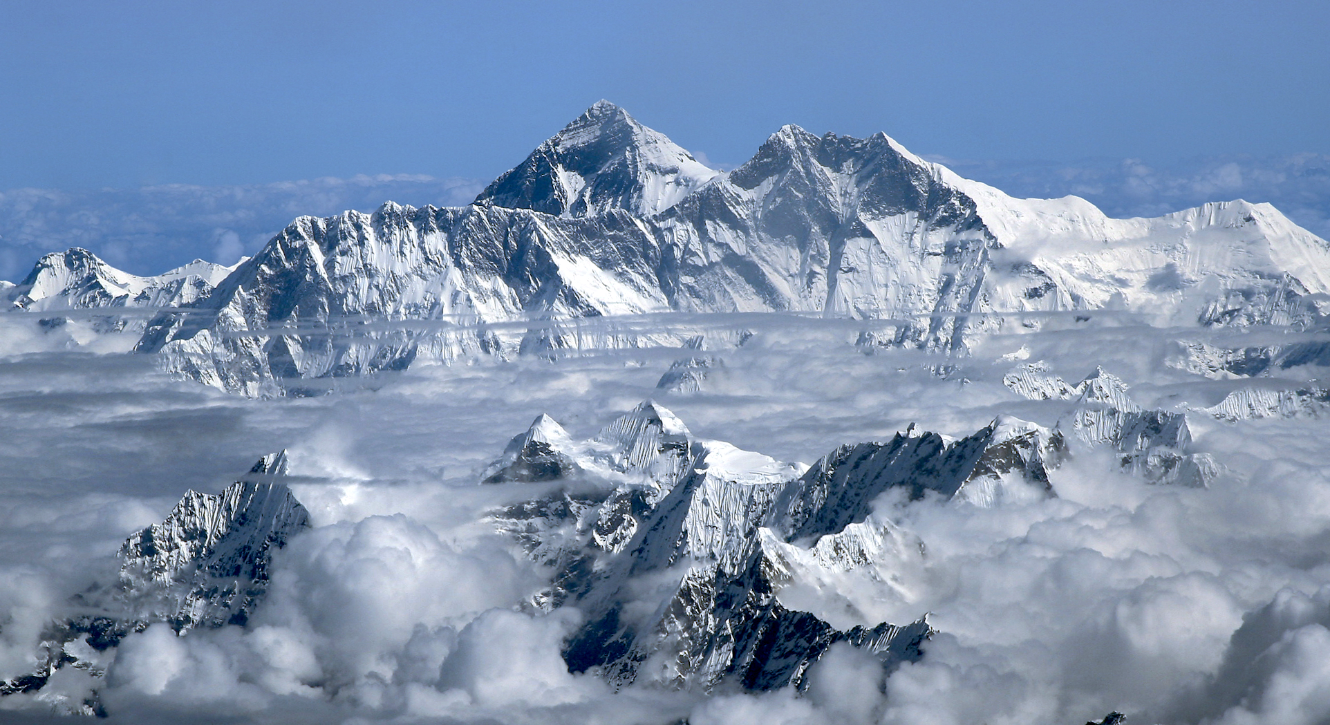
Michalzak (iStock)
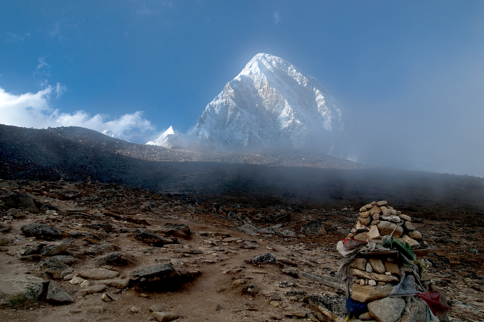
Mount Everest, known locally as Sagarmatha or Qomolangma,[note 4] is Earth’s highest mountain above sea level, located in the Mahalangur Himal sub-range of the Himalayas. The China–Nepal border runs across its summit point.[4] Its elevation (snow height) of 8,848.86 m (29,031 ft 8+1⁄2 in) was most recently established in 2020 by the Chinese and Nepali authorities.[5][6]
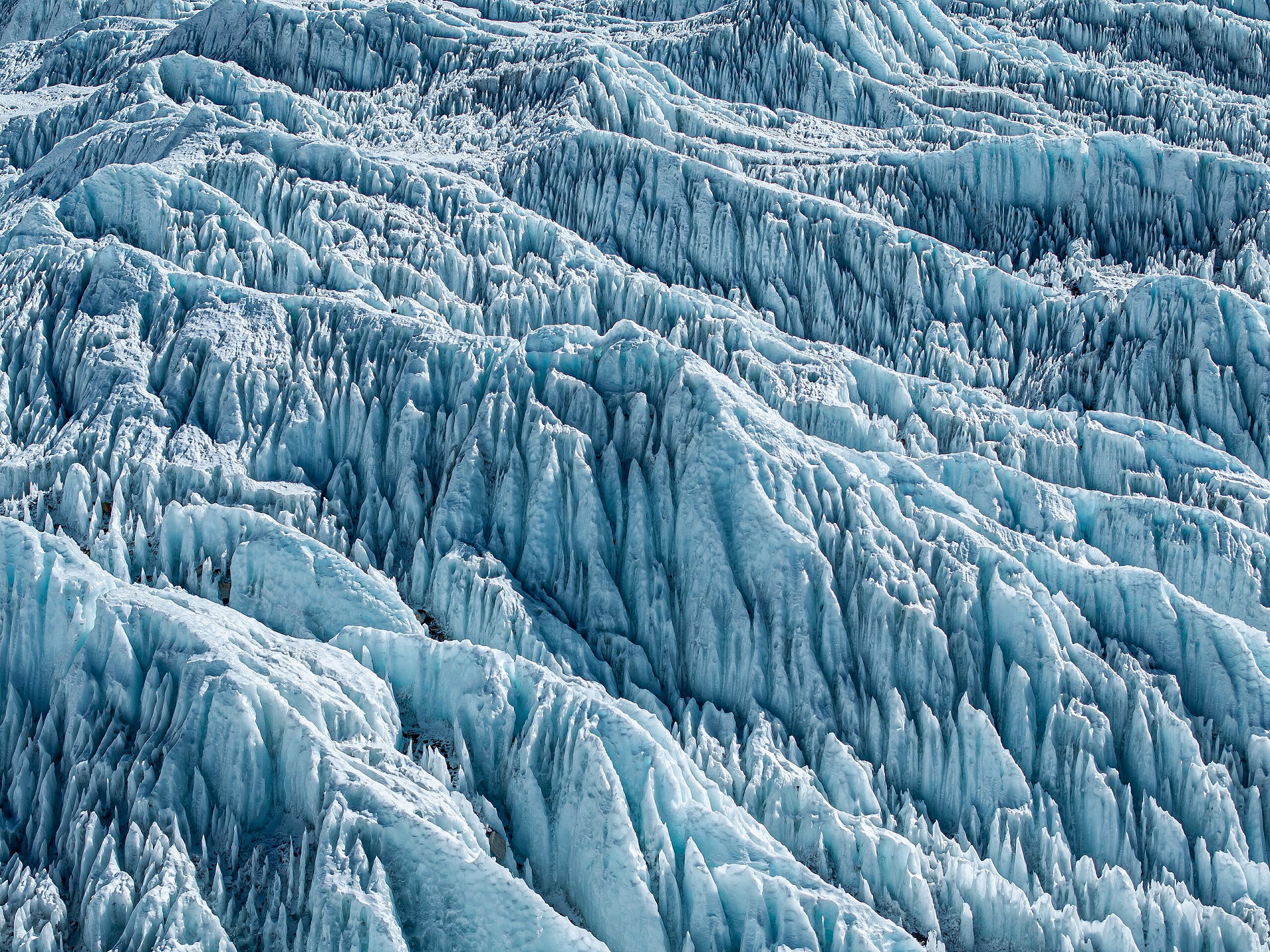
Mount Everest attracts many climbers, including highly experienced mountaineers. There are two main climbing routes, one approaching the summit from the southeast in Nepal (known as the “standard route”) and the other from the north in Tibet. While not posing substantial technical climbing challenges on the standard route, Everest presents dangers such as altitude sickness, weather, and wind, as well as hazards from avalanches and the Khumbu Icefall. As of May 2024, 340 people have died on Everest. Over 200 bodies remain on the mountain and have not been removed due to the dangerous conditions.[7][8]
Climbers typically ascend only part of Mount Everest’s elevation, as the mountain’s full elevation is measured from the geoid, which approximates sea level. The closest sea to Mount Everest’s summit is the Bay of Bengal, almost 700 km (430 mi) away. To approximate a climb of the entire height of Mount Everest, one would need to start from this coastline, a feat accomplished by Tim Macartney-Snape’s team in 1990. Climbers usually begin their ascent from base camps above 5,000 m (16,404 ft). The amount of elevation climbed from below these camps varies. On the Tibetan side, most climbers drive directly to the North Base Camp. On the Nepalese side, climbers generally fly into Kathmandu, then Lukla, and trek to the South Base Camp, making the climb from Lukla to the summit about 6,000 m (19,685 ft) in elevation gain.
The first recorded efforts to reach Everest’s summit were made by British mountaineers. As Nepal did not allow foreigners to enter the country at the time, the British made several attempts on the north ridge route from the Tibetan side. After the first reconnaissance expedition by the British in 1921 reached 7,000 m (22,970 ft) on the North Col, the 1922 expedition pushed the north ridge route up to 8,320 m (27,300 ft), marking the first time a human had climbed above 8,000 m (26,247 ft). The 1924 expedition resulted in one of the greatest mysteries on Everest to this day: George Mallory and Andrew Irvine made a final summit attempt on 8 June but never returned, sparking debate as to whether they were the first to reach the top. Tenzing Norgay and Edmund Hillary made the first documented ascent of Everest in 1953, using the southeast ridge route. Norgay had reached 8,595 m (28,199 ft) the previous year as a member of the 1952 Swiss expedition. The Chinese mountaineering team of Wang Fuzhou, Gonpo, and Qu Yinhua made the first reported ascent of the peak from the north ridge on 25 May 1960.[9]
This article uses material from the Wikipedia article Mount Everest, which is released under the Creative Commons Attribution-Share-Alike 4.0 International License (view authors).
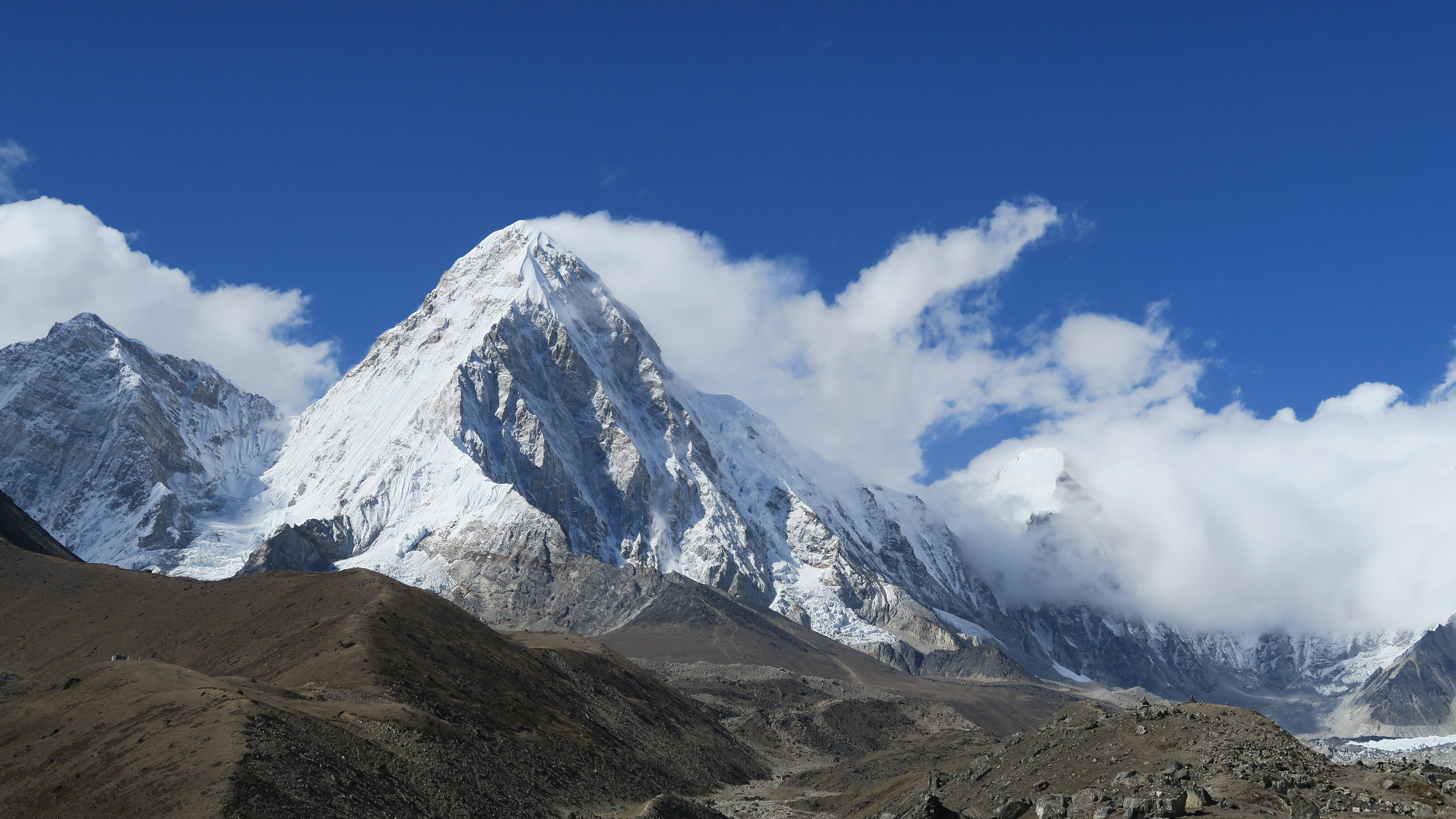
 I | 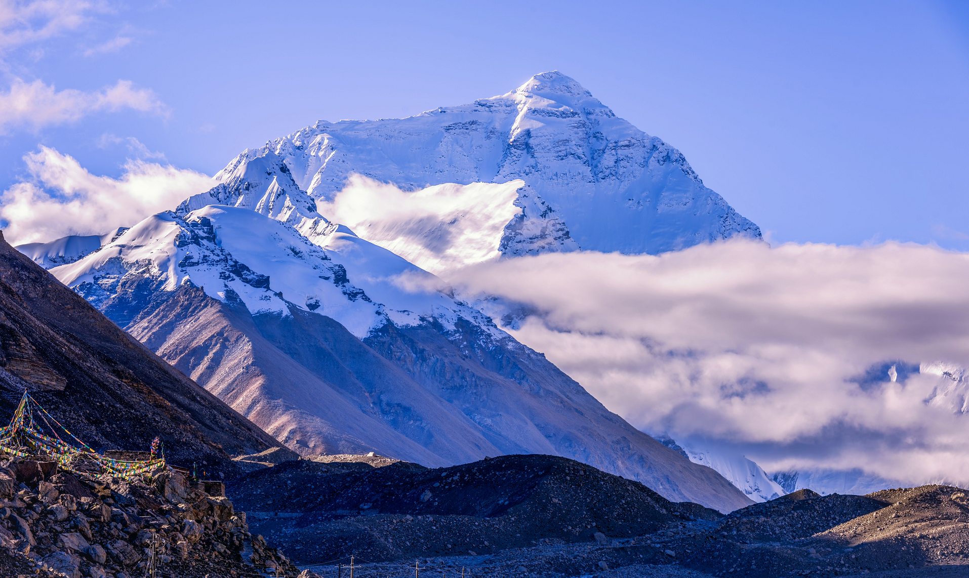 Wirestock (iStock) |
 Gorakh Bista (iStock) |  Bryan Tropeano (iStock) |
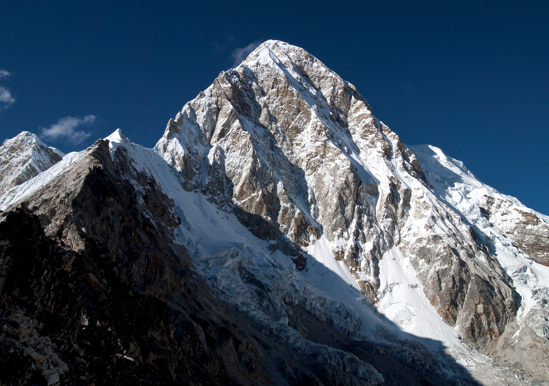
 I | 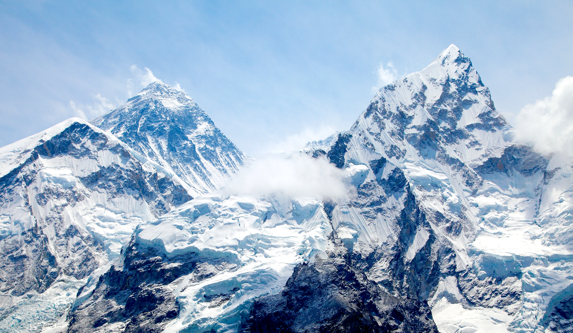 Daniel Prudek (iStock) |
 Daniel Prudek (iStock) | 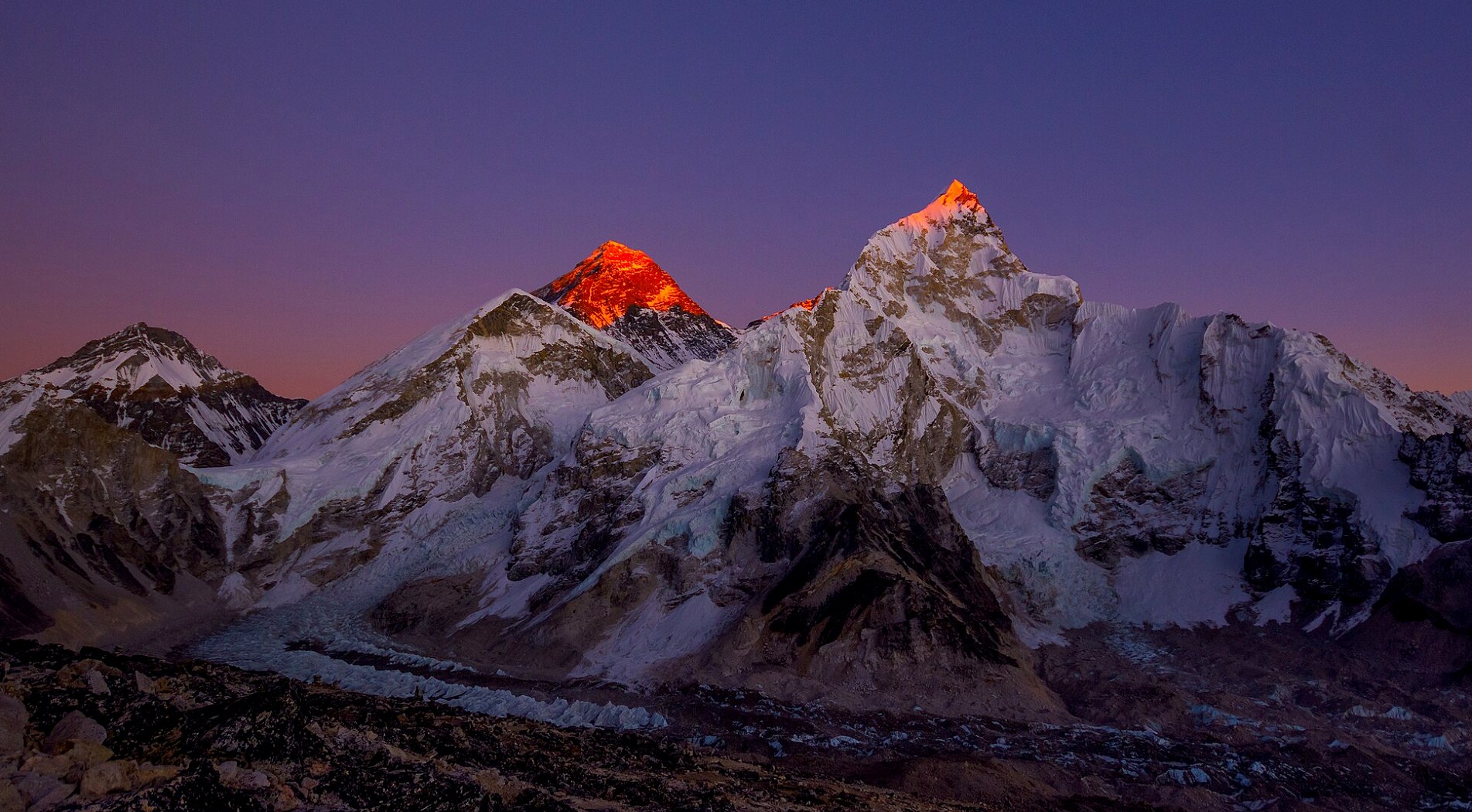 Nir B. Gurung (Wikipedia) |
 Megaurab09 (Wikipedia) I | 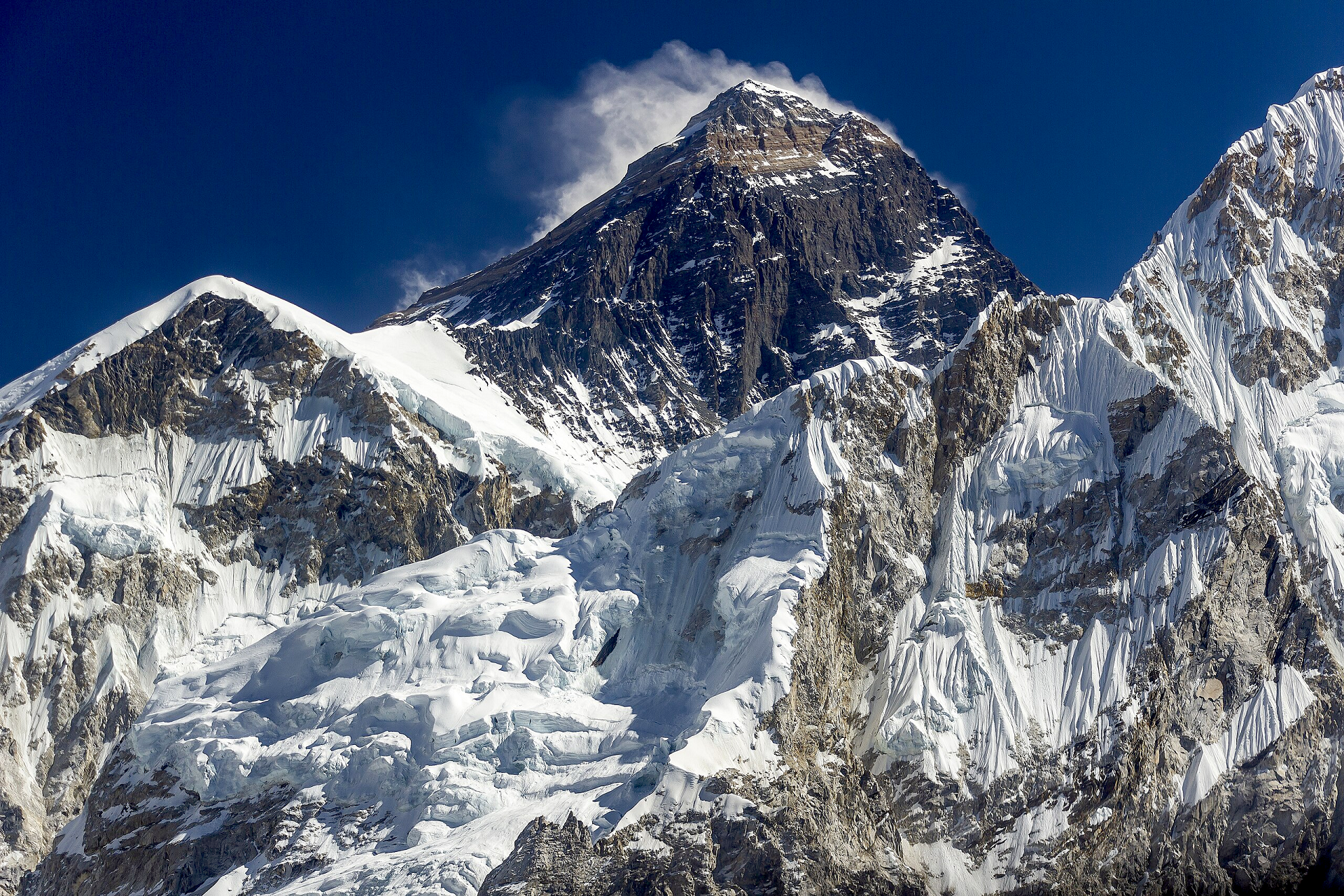 Bijay Chaurasia (Wikipedia) |
Additional Mount Everest Images Here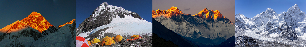
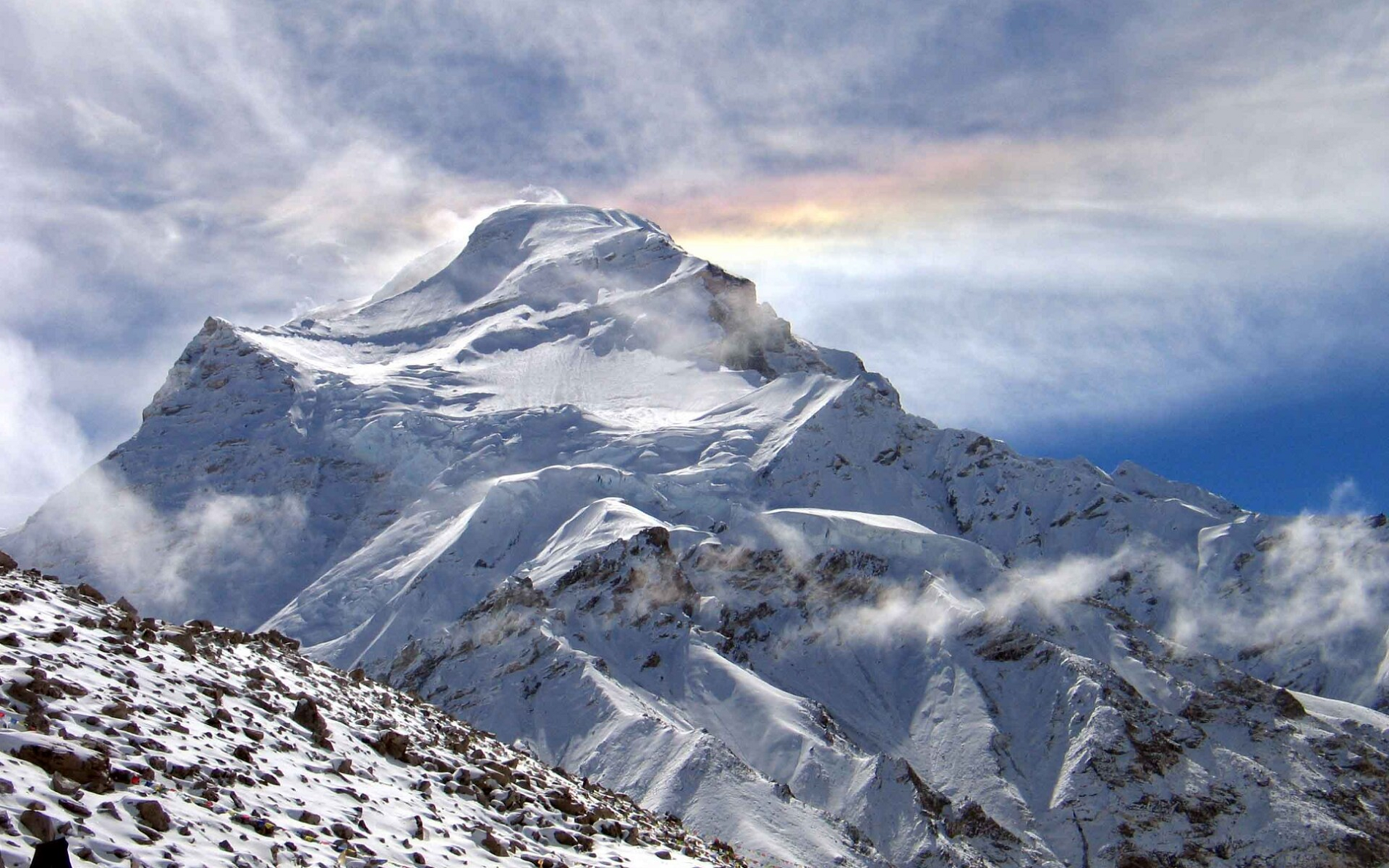
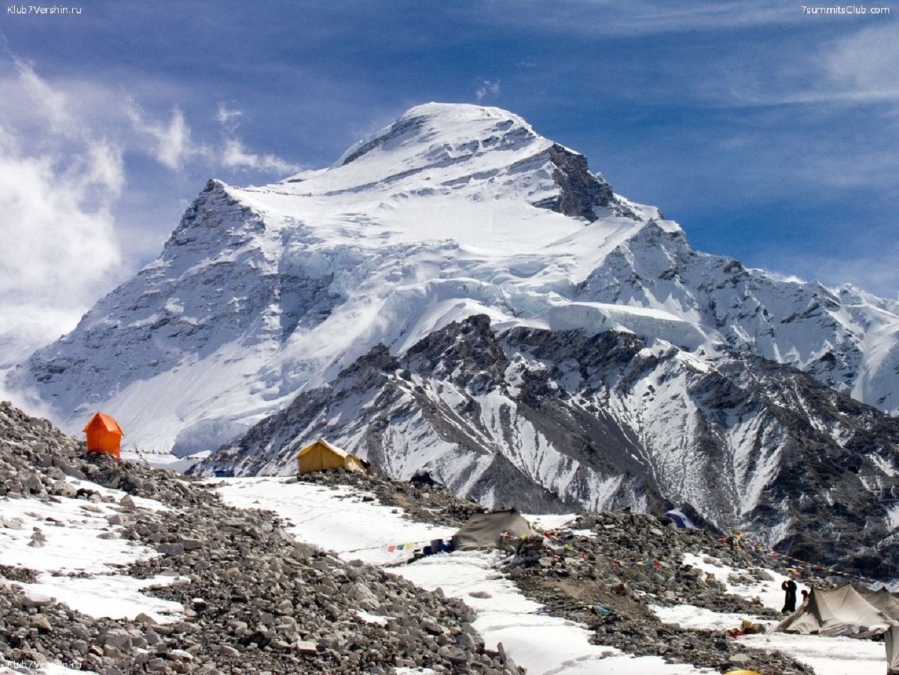
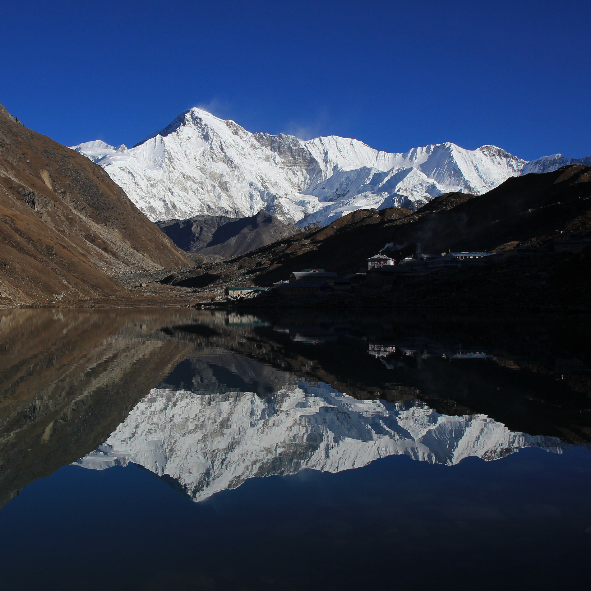
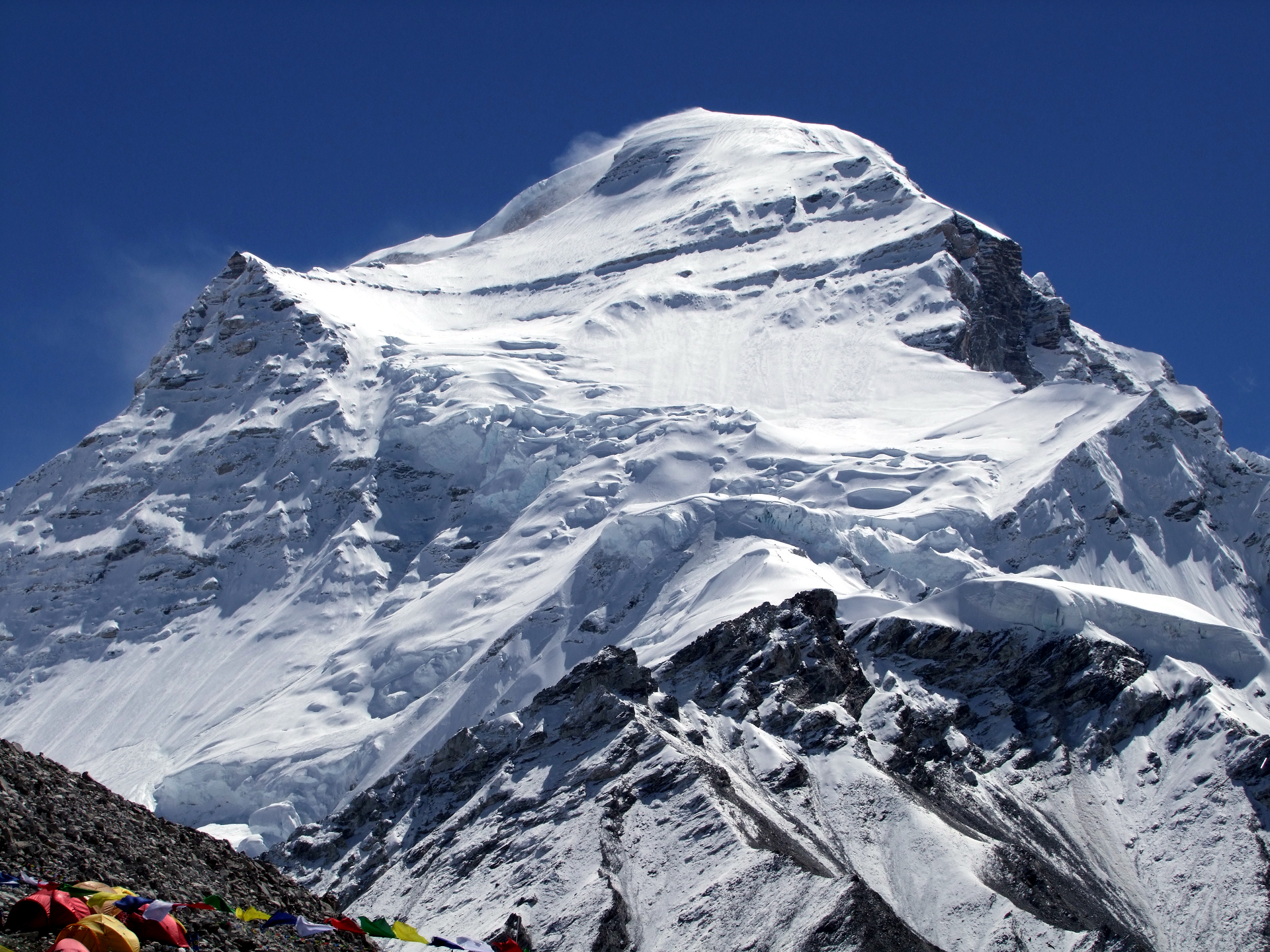
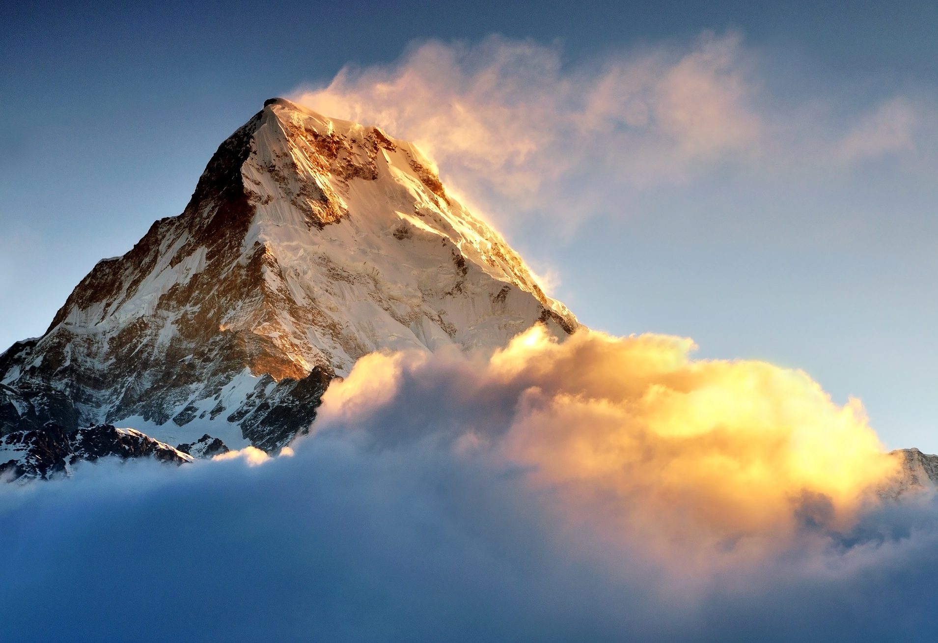
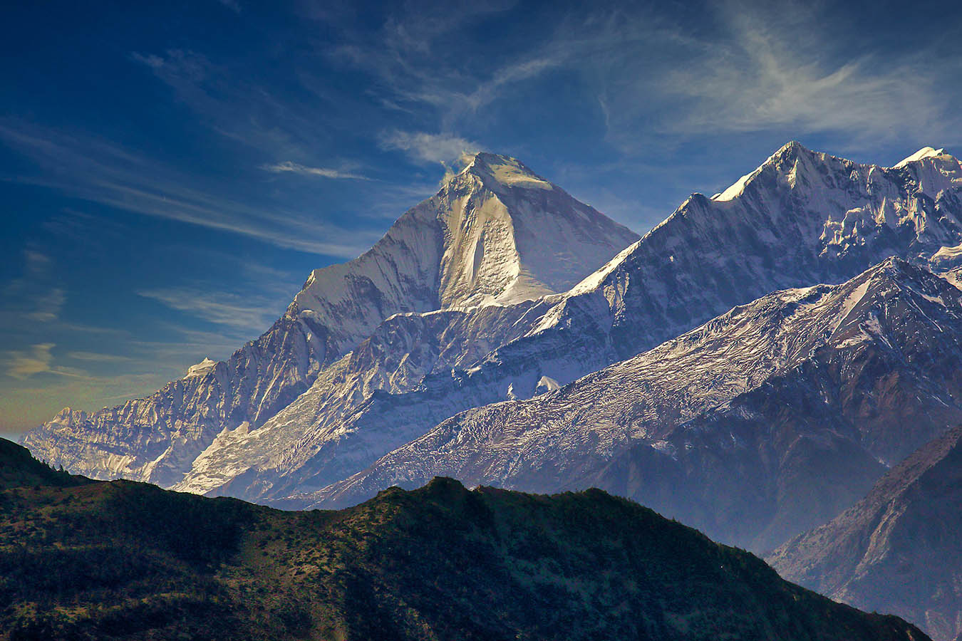
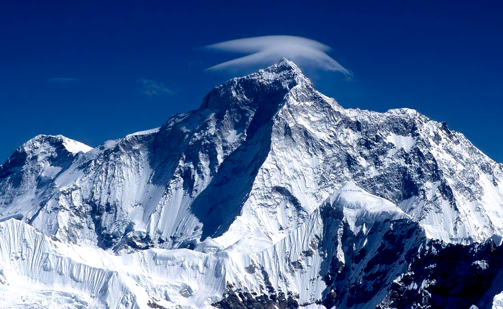
Cho Oyu Panoramic
Daniel Prudek (iStock)

Cho Oyu (Nepali: चोयु; Tibetan: ཇོ་བོ་དབུ་ཡ; Chinese: 卓奥友峰) is the sixth-highest mountain in the world at 8,188 metres (26,864 ft) above sea level. Cho Oyu means “Turquoise Goddess” in Tibetan.[3] The mountain is the westernmost major peak of the Khumbu sub-section of the Mahalangur Himalaya 20 km west of Mount Everest. The mountain stands on the China–Nepal border, between the Tibet Autonomous Region and Koshi Province.
Just a few kilometres west of Cho Oyu is Nangpa La (5,716m/18,753 ft), a glaciated pass that serves as the main trading route between the Tibetans and the Khumbu‘s Sherpas. This pass separates the Khumbu and Rolwaling Himalayas. Due to its proximity to this pass and the generally moderate slopes of the standard northwest ridge route, Cho Oyu is considered the easiest 8,000 metre peak to climb.[4] It is a popular objective for professionally guided parties.
Height
Cho Oyu’s height was originally measured at 26,750 feet (8,150 m) and at the time of the first ascent it was considered the 7th highest mountain on earth, after Dhaulagiri at 8,167 metres (26,795 ft) (Manaslu, now 8,156 metres (26,759 ft), was also estimated lower at 26,658 feet (8,125 m)).[5] A 1984 estimate of 8,201 metres (26,906 ft) made it move up to sixth place. New measurements made in 1996 by the Government of Nepal Survey Department and the Finnish Meteorological Institute in preparation for the Nepal Topographic Maps put the height at 8,188 m,[6] one remarkably similar to the 26,867 feet (8,189 m) used by Edmund Hillary in his 1955 book High Adventure.[7]
Climbing history
Cho Oyu was first attempted in 1952 by an expedition organised and financed by the Joint Himalayan Committee of Great Britain as preparation for an attempt on Mount Everest the following year. The expedition was led by Eric Shipton and included Edmund Hillary, Tom Bourdillon and George Lowe.[8] A foray by Hillary and Lowe was stopped due to technical difficulties and avalanche danger at an ice cliff above 6,650 m (21,820 ft) and a report of Chinese troops a short distance across the border influenced Shipton to retreat from the mountain rather than continue to attempt to summit.[9]
The mountain was first climbed on October 19, 1954, via the north-west ridge by Herbert Tichy, Joseph Jöchler and Sherpa Pasang Dawa Lama of an Austrian expedition.[10] Cho Oyu was the fifth eight-thousander to be climbed, after Annapurna in June 1950, Mount Everest in May 1953, Nanga Parbat in July 1953 and K2 in July 1954. Until the ascent of Mount Everest by Reinhold Messner and Peter Habeler in 1978, this was the highest peak climbed without supplemental oxygen.[11]
This article uses material from the Wikipedia article Cho Oyu, which is released under the Creative Commons Attribution-Share-Alike 4.0 International License (view authors).
 |  |
 I | 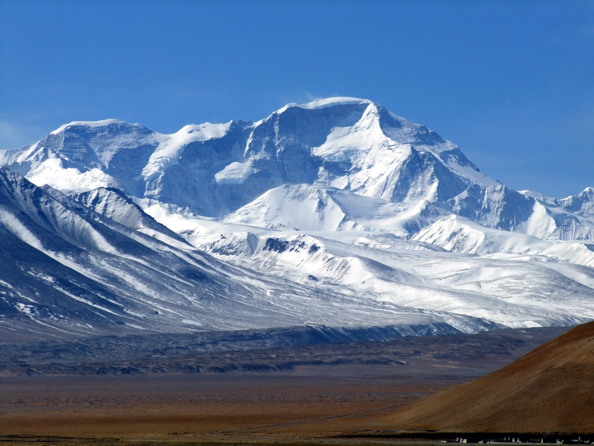 Mark Horwell (Wikipedia) |
 Perreten (iStock) | 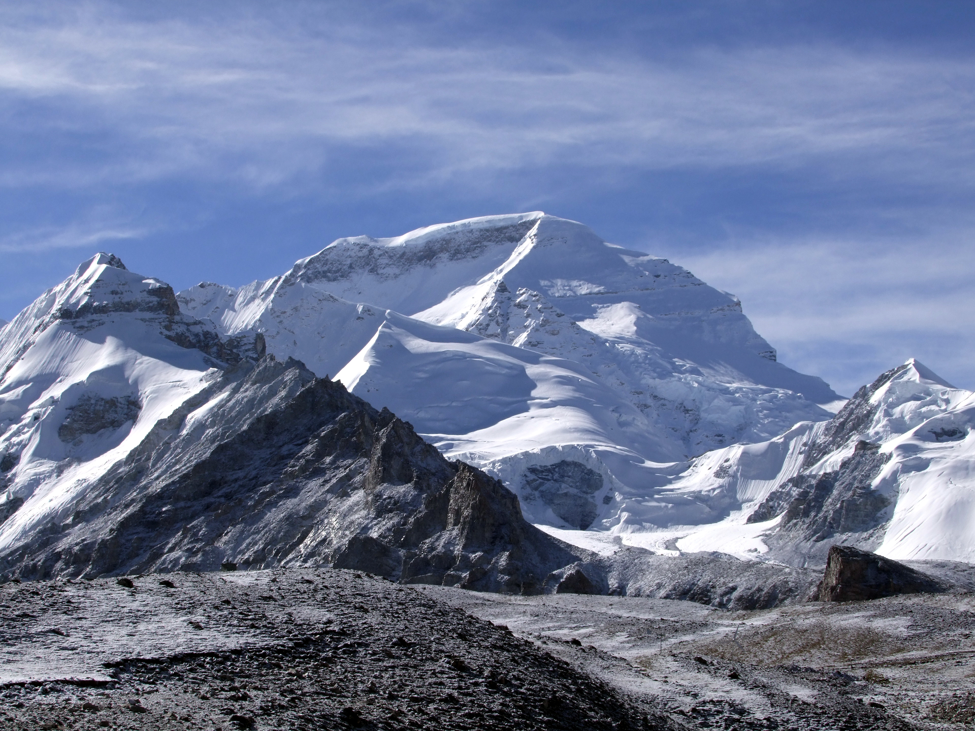 Mark Horwell (Wikipedia) |
 Mark Horwell (Wikipedia) |  I |

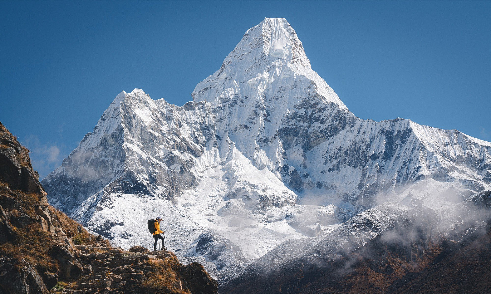
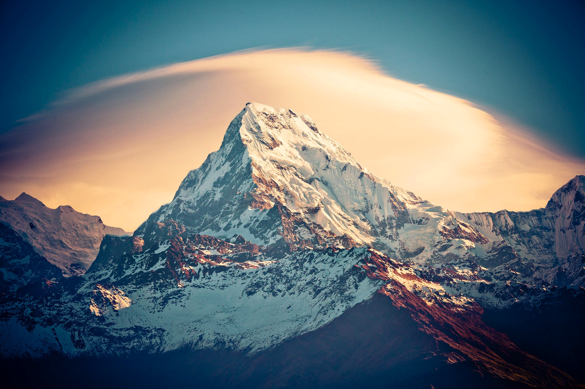
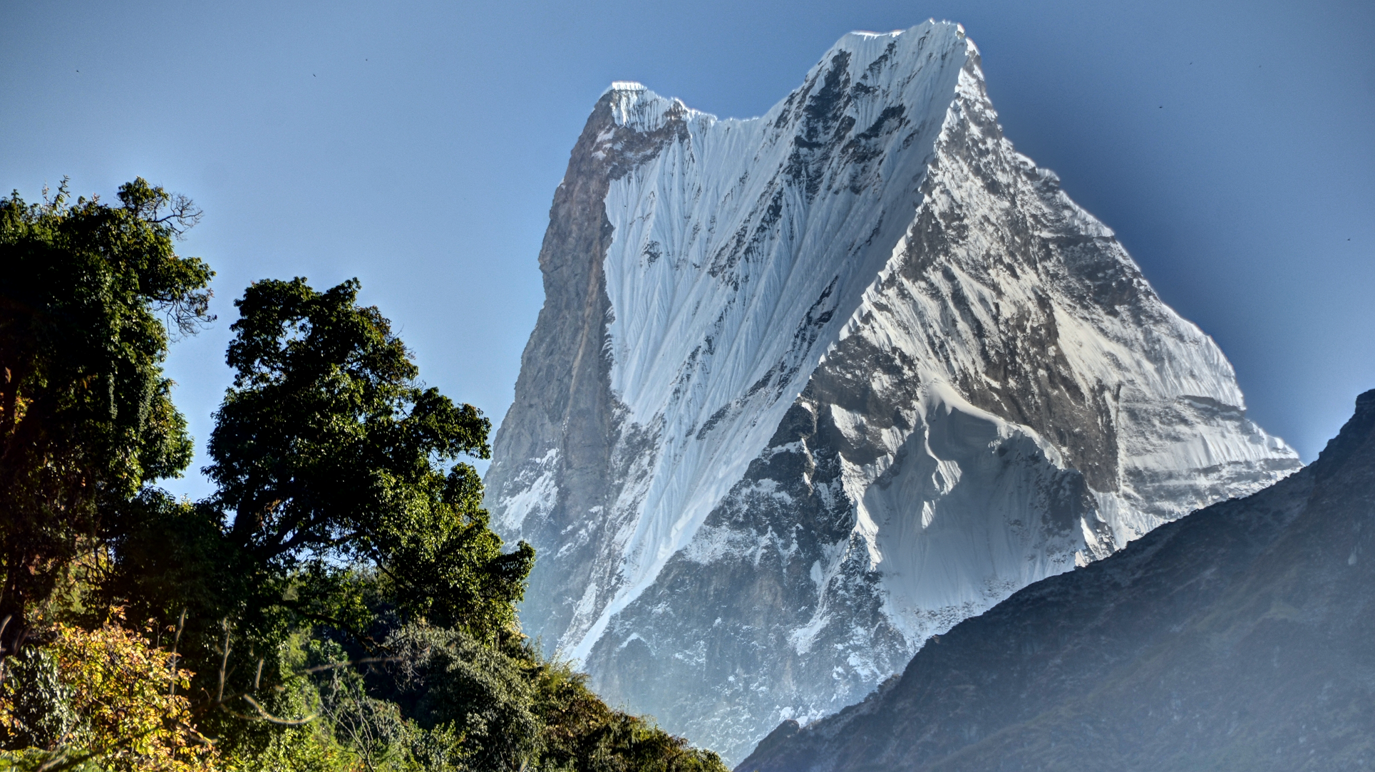
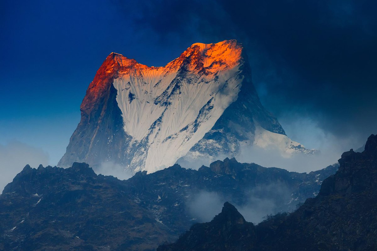
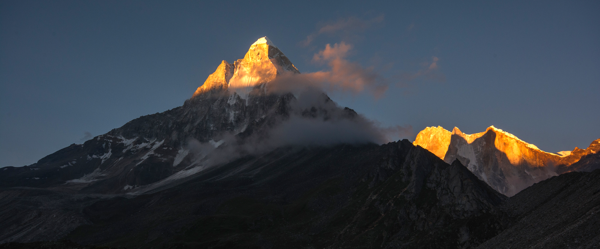
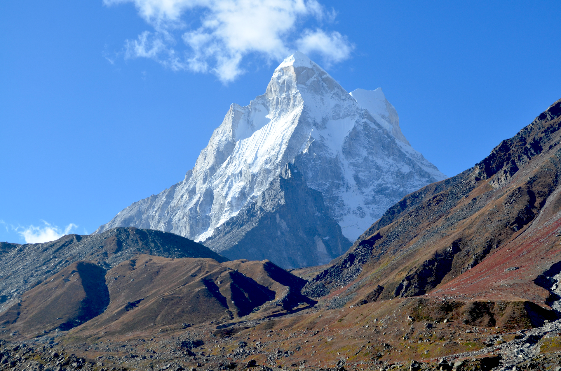
Ama Dablam Panoramic
Kiwisoul (iStock)
Ama Dablam is a mountain in the eastern Himalayan range of Koshi Province, Nepal. The main peak is 6,812 metres (22,349 ft), the lower western peak is 6,170 metres (20,243 ft). Ama Dablam means “mother’s necklace”; the long ridges on each side like the arms of a mother (ama) protecting her child, and the hanging glacier thought of as the dablam, the traditional double-pendant containing pictures of the gods, worn by Sherpa women.[3] For several days, Ama Dablam dominates the eastern sky for anyone trekking to Mount Everest Base Camp. For its soaring ridges and steep faces Ama Dablam is sometimes referred as the “Matterhorn of the Himalayas.”[4] The mountain is featured on the one rupee Nepalese banknote.[5]
Although Alfred Gregory led the first attempt on Ama Dablam in 1958[6] it was on 13 March 1961 that the first successful ascent was made, when Mike Gill (NZ), Barry Bishop (US), Mike Ward (UK) and Wally Romanes (NZ) ascended the Southwest Ridge. They were well-acclimatised to altitude, having wintered over at 5,800 metres (19,029 ft) near the base of the peak as part of the 1960–61 Silver Hut expedition, led by Sir Edmund Hillary.[7]
Situated at a distance of 162 km (101 mi) north of the provincial capital of Biratnagar and 152 km (94 mi) northeast to Kathmandu, Ama Dablam is the third most popular Himalayan peak for permitted expeditions. The most popular route by far is the Southwest Ridge (right skyline in the photo).[8] Prior to a 2006 avalanche, climbers typically set up three camps along the ridge with Camp III just below and to the right of the hanging glacier, the Dablam. Any ice that calves off the glacier typically goes left, away from the camp. However, after the avalanche, climbers now prefer to set just two camps to minimize risk. Camp I is at an altitude of over 5,800 metres (19,029 ft), and Camp II is at an altitude of over 6,000 metres (19,685 ft). A climbing permit and a liaison officer are required when attempting Ama Dablam. As with Mount Everest, the best climbing months are April and May (before the monsoon) and September and October.
This article uses material from the Wikipedia article Ama Dablam, which is released under the Creative Commons Attribution-Share-Alike 4.0 International License (view authors).
 Daniel Prudek (iStock) | 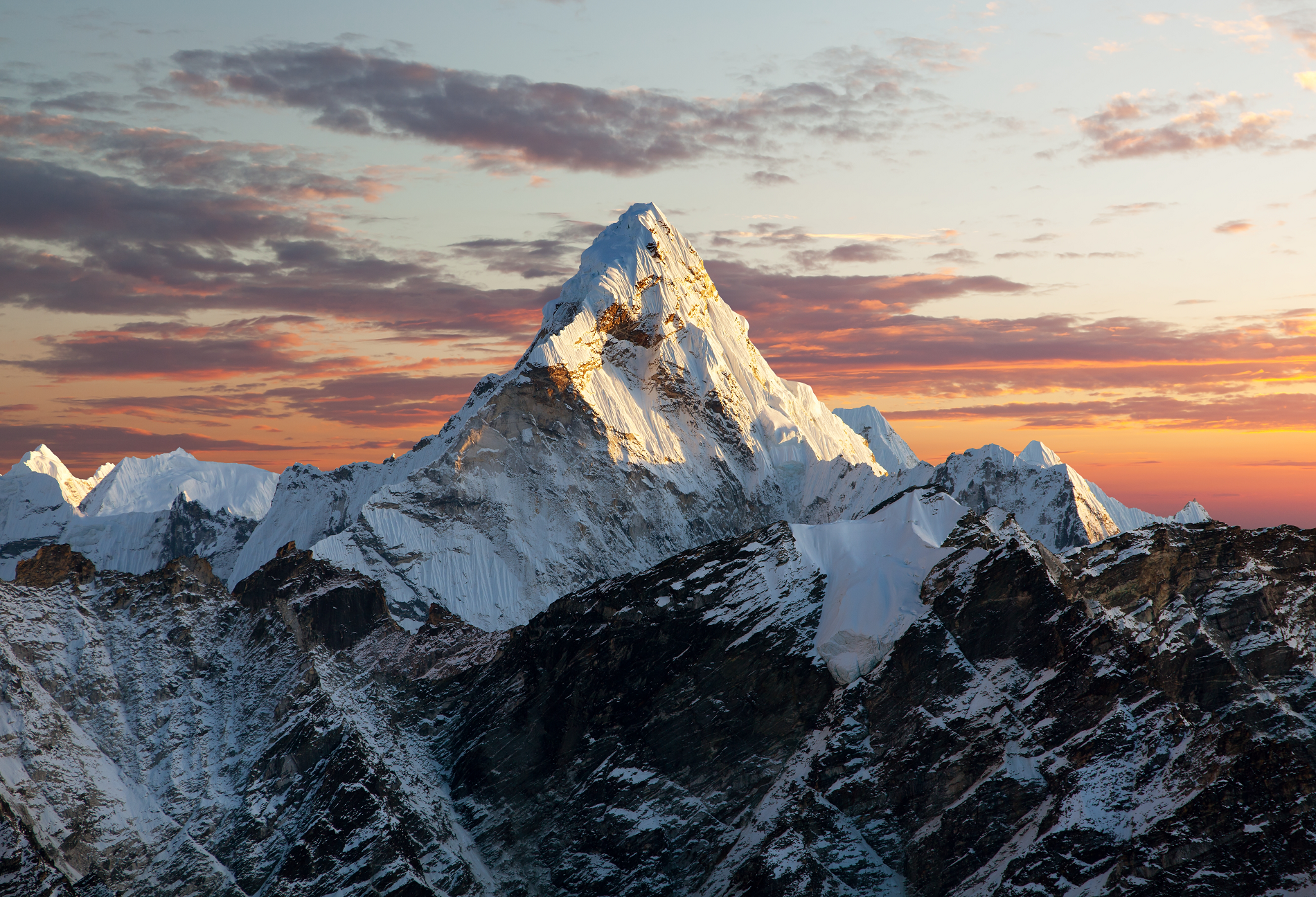 Daniel Prudek (iStock) |
 Daniel Prudek (iStock) | 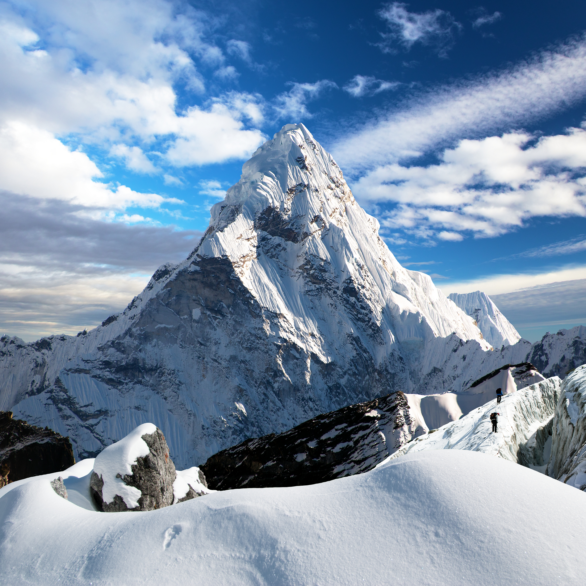 Daniel Prudek (iStock) |
 Siliconindia | 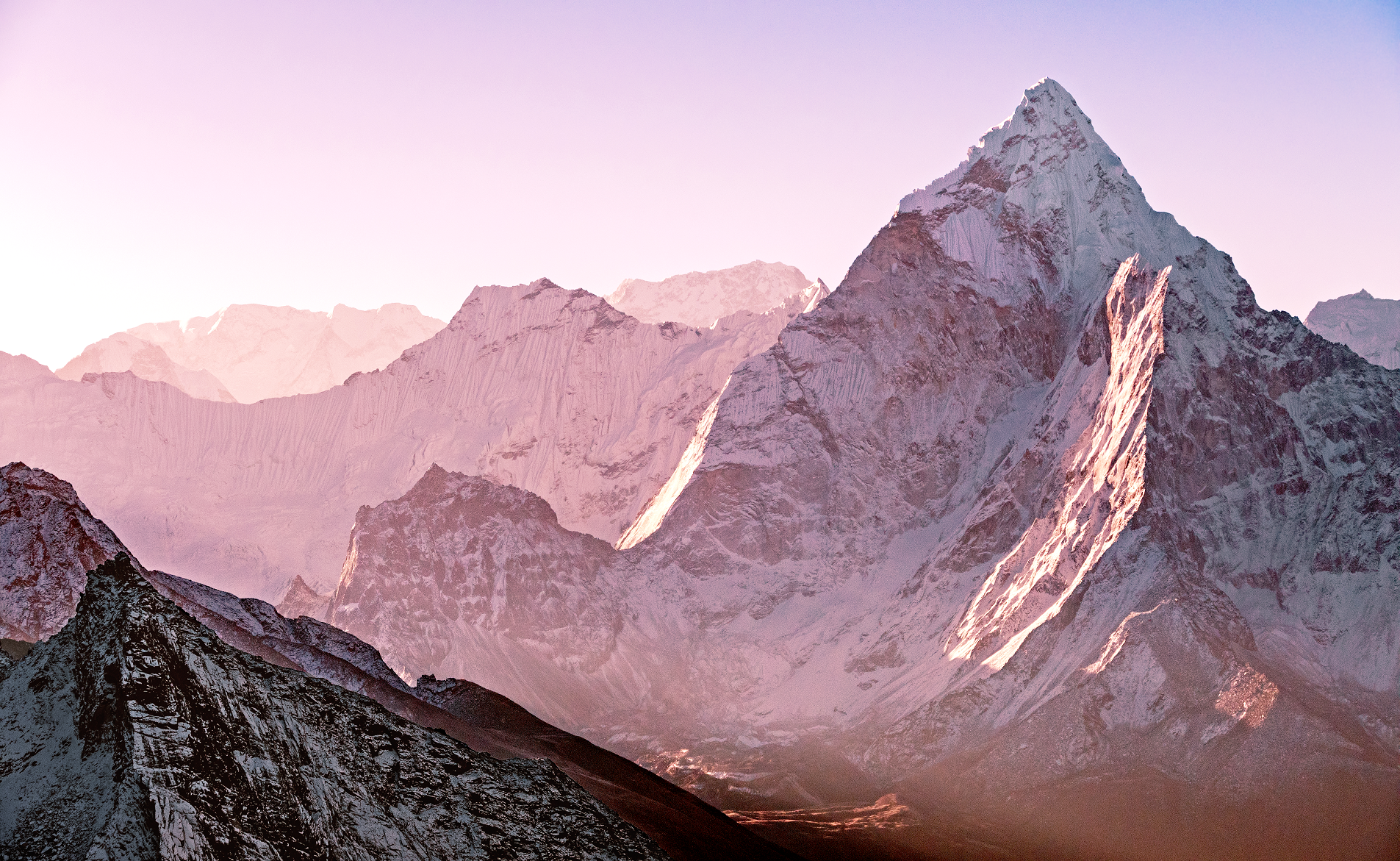 Kiwisoul (iStock) |
 Daniel Prudek (iStock) | 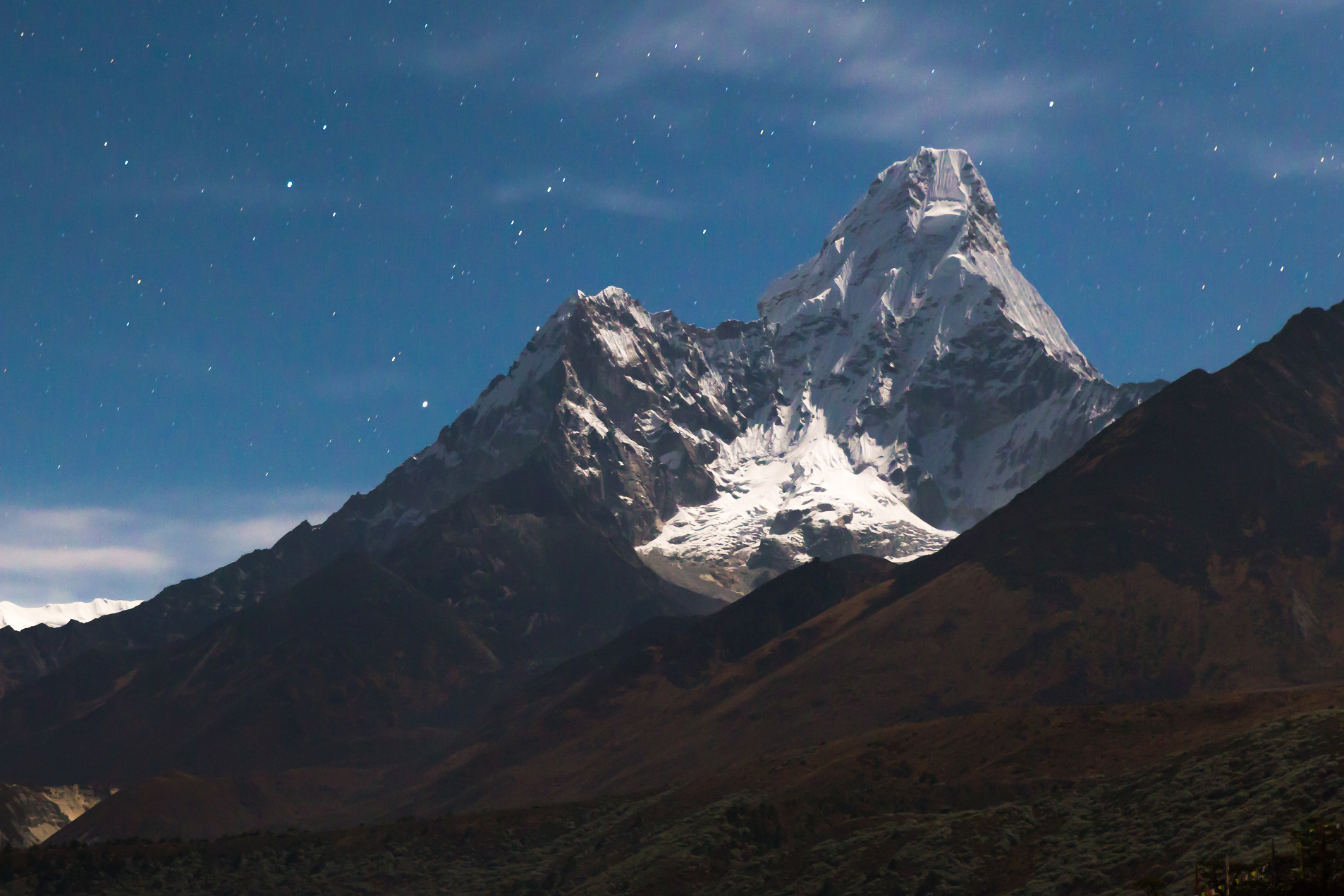 Subbotsky (iStock) |
 I I | 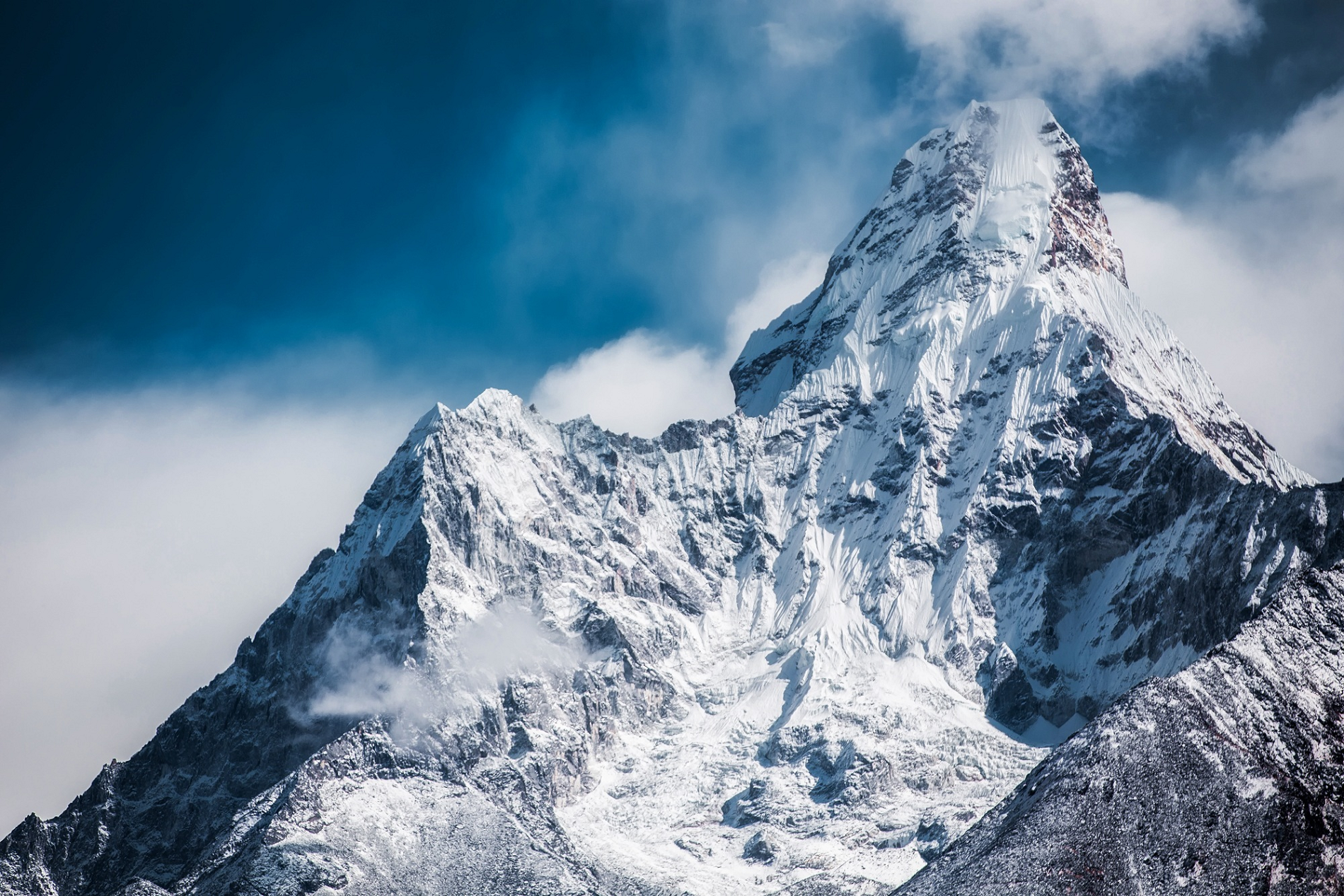 Martin Jernberg Martinjphoto (Wikipedia) |
Additional Ama Dablam Images Here
Annapurna Region
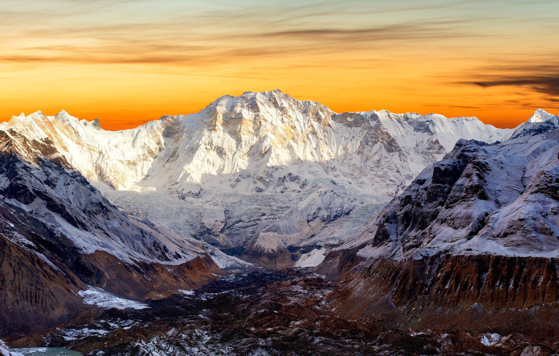
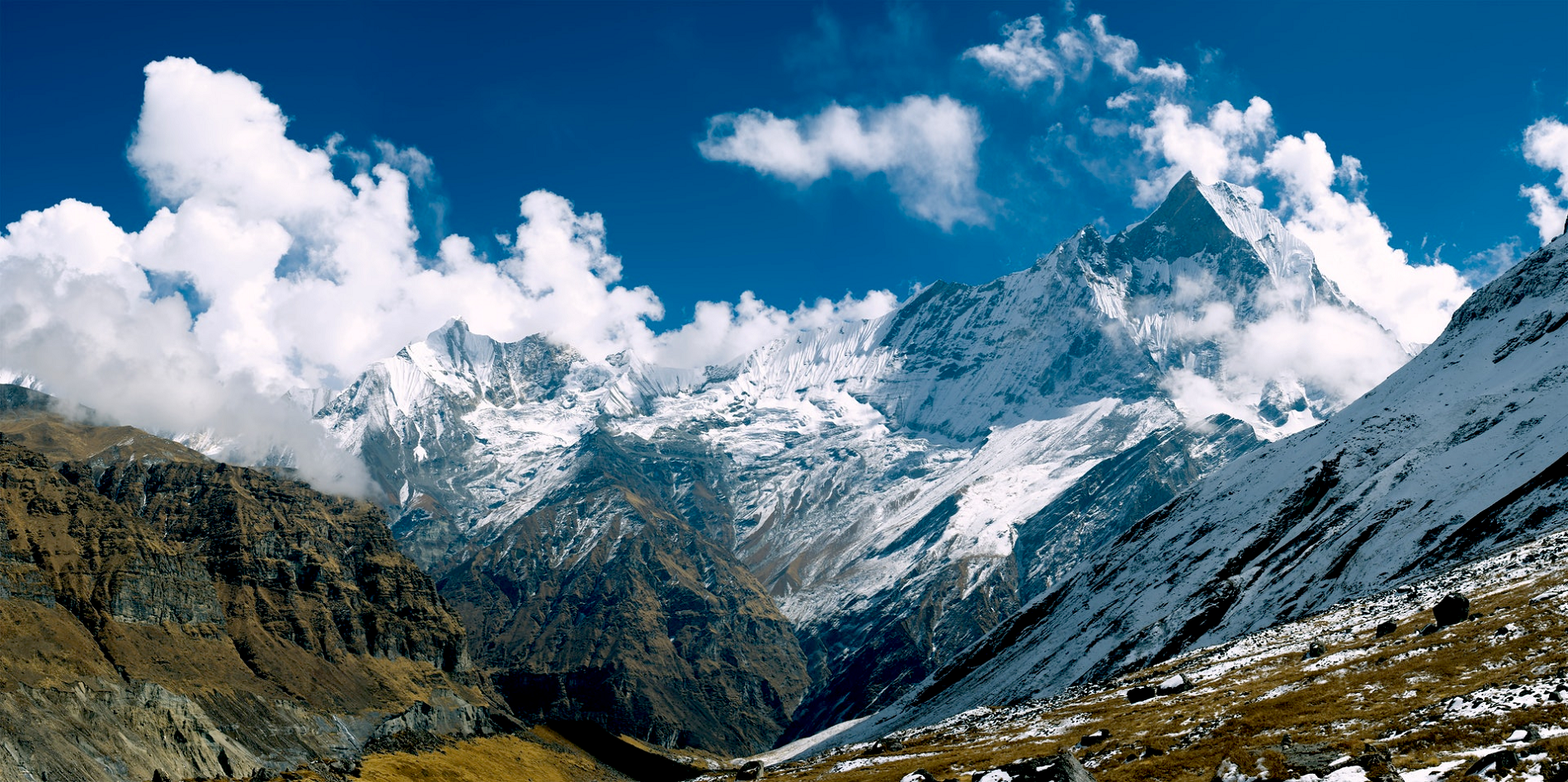
Annapurna Panoramic
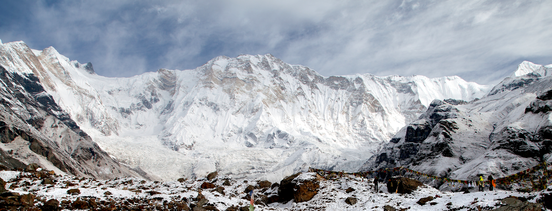
Daniel Prudek (iStock)

![]()
Annapurna (/ˌænəˈpʊərnəˌ -ˈpɜːr-/;[5][6] Nepali: अन्नपूर्ण) is a mountain situated in the Annapurna mountain range of Gandaki Province, north-central Nepal. It is the 10th highest mountain in the world at 8,091 metres (26,545 ft) above sea level and is well known for the difficulty and danger involved in its ascent.
Maurice Herzog led a French expedition to its summit through the north face in 1950, making it the first eight-thousander to be successfully climbed.[7] The entire massif and surrounding area are protected within the 7,629-square-kilometre (2,946 sq mi) Annapurna Conservation Area, the first and largest conservation area in Nepal. The Annapurna Conservation Area is home to several world-class treks, including Annapurna Sanctuary and Annapurna Circuit.
For decades, Annapurna I held the highest fatality-to-summit rate of all principal eight-thousander summits; it has, however, seen great climbing successes in recent years, with the fatality rate falling from 32% to under 20% from 2012 to 2022. This figure places it just under the most recent fatality rate estimates for K2, at about 24%. The mountain still poses grave threats to climbers through avalanche danger, unpredictable weather and the extremely steep and committing nature of its climbing routes, in particular its 3,000-metre (9,800 ft) south face, renowned as one of the most difficult climbs in the world.[8] It is also a dangerous peak for trekkers, as in the case of a 2014 snowstorm near it and Dhaulagiri which claimed at least 43 lives. As of 2022, 365 people had reached the summit of Annapurna I, while 72 had died in the attempt.
Etymology
The mountain is named after Annapurna, the Hindu goddess of food and nourishment, who is said to reside there. The name Annapurna is derived from the Sanskrit-language words purna (“filled”) and anna (“food”), and can be translated as “everlasting food”.[9] Many streams descending from the slopes of the Annapurna Massif provide water for the agricultural fields and pastures located at lower elevations.[10]
This article uses material from the Wikipedia article Annapurna, which is released under the Creative Commons Attribution-Share-Alike 4.0 International License (view authors).
 Daniel Prudek (iStock) | 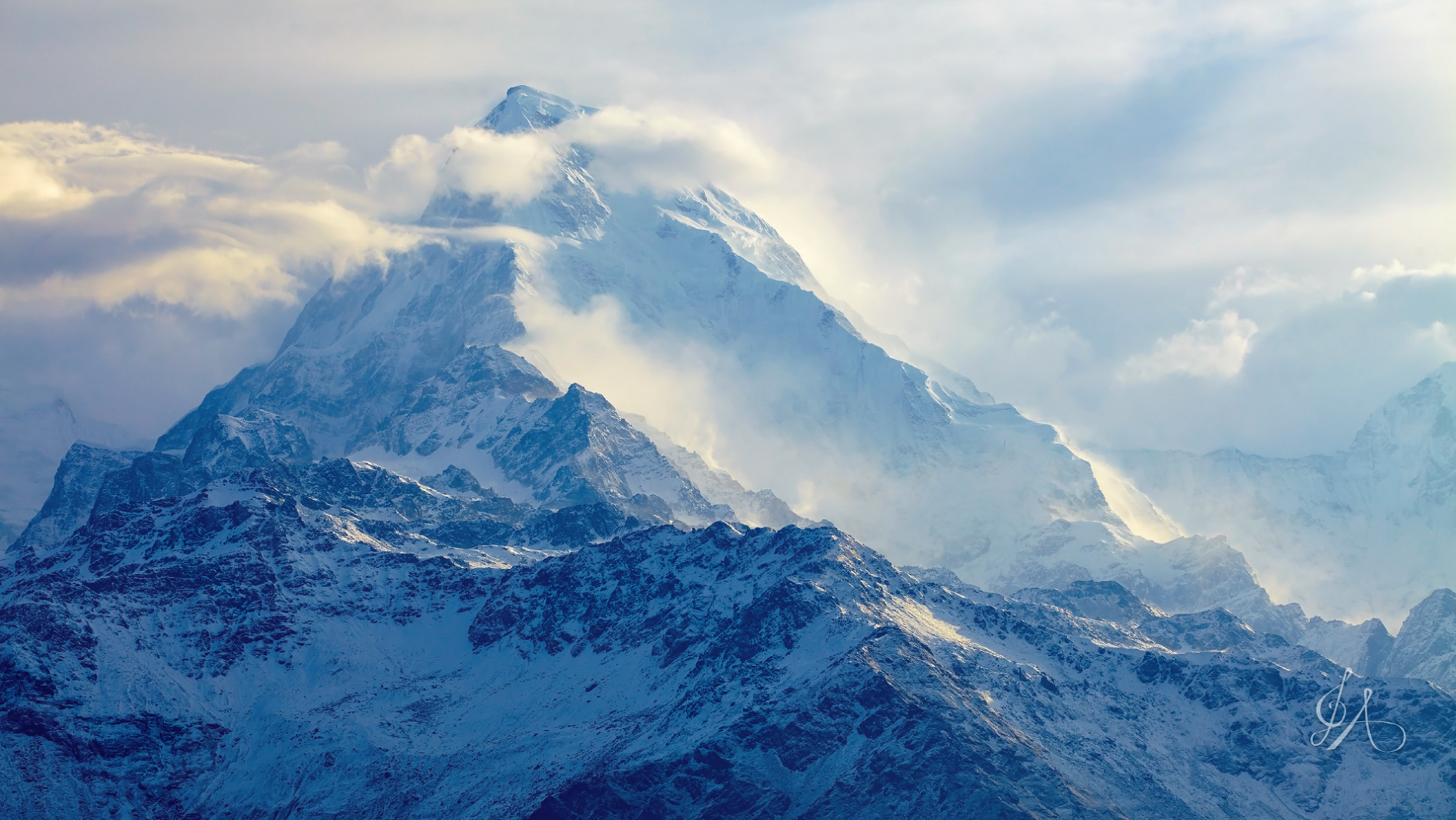 I |
 I | 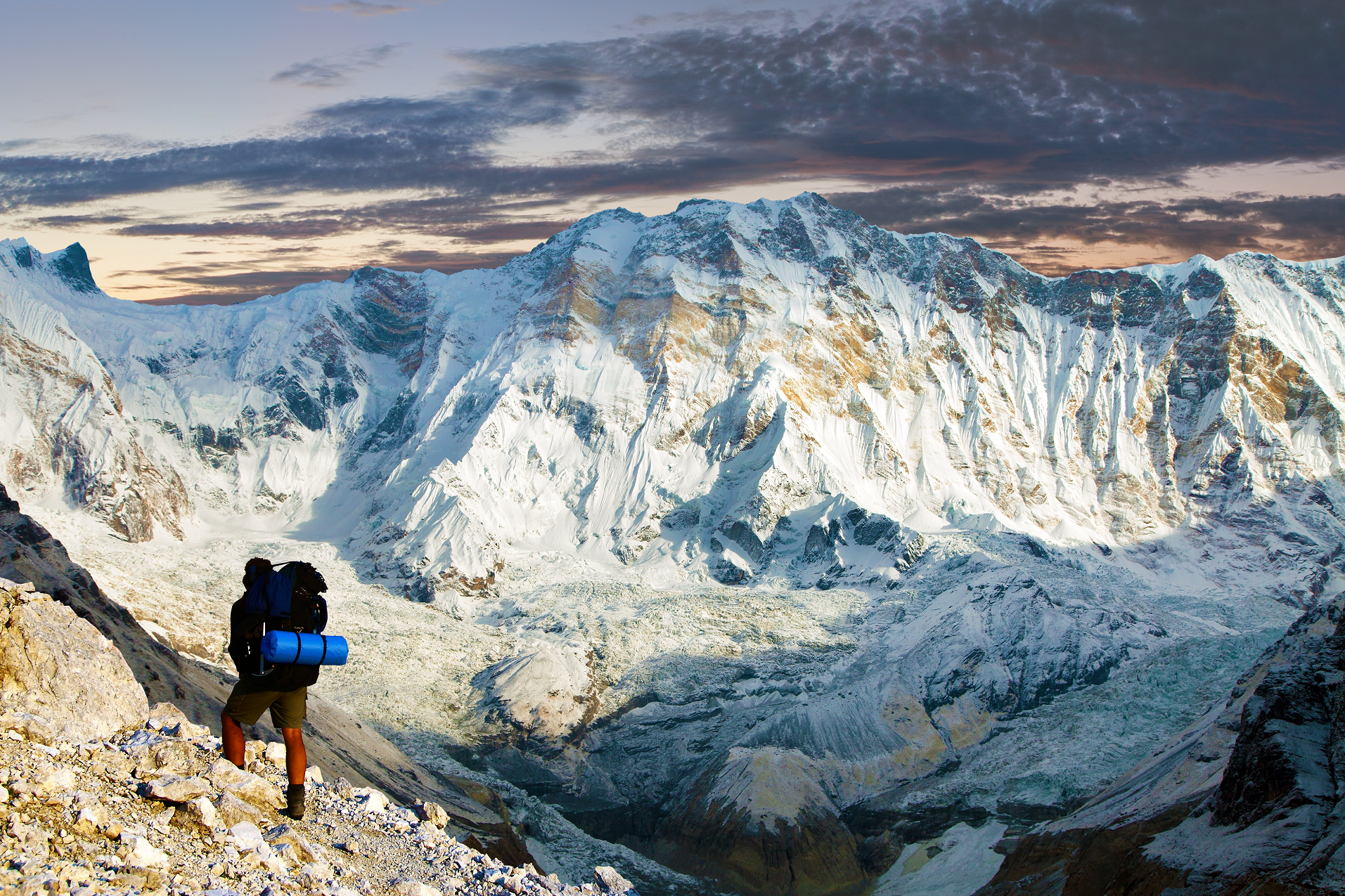 Daniel Prudek (iStock) |
 I |  Saiko3p (iStock) |
 Cn0ra (iStock) | 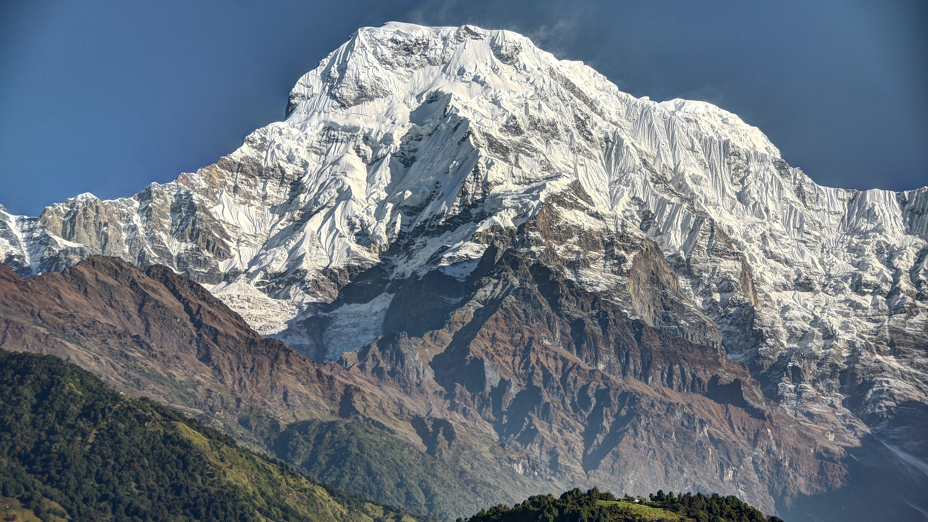 I |

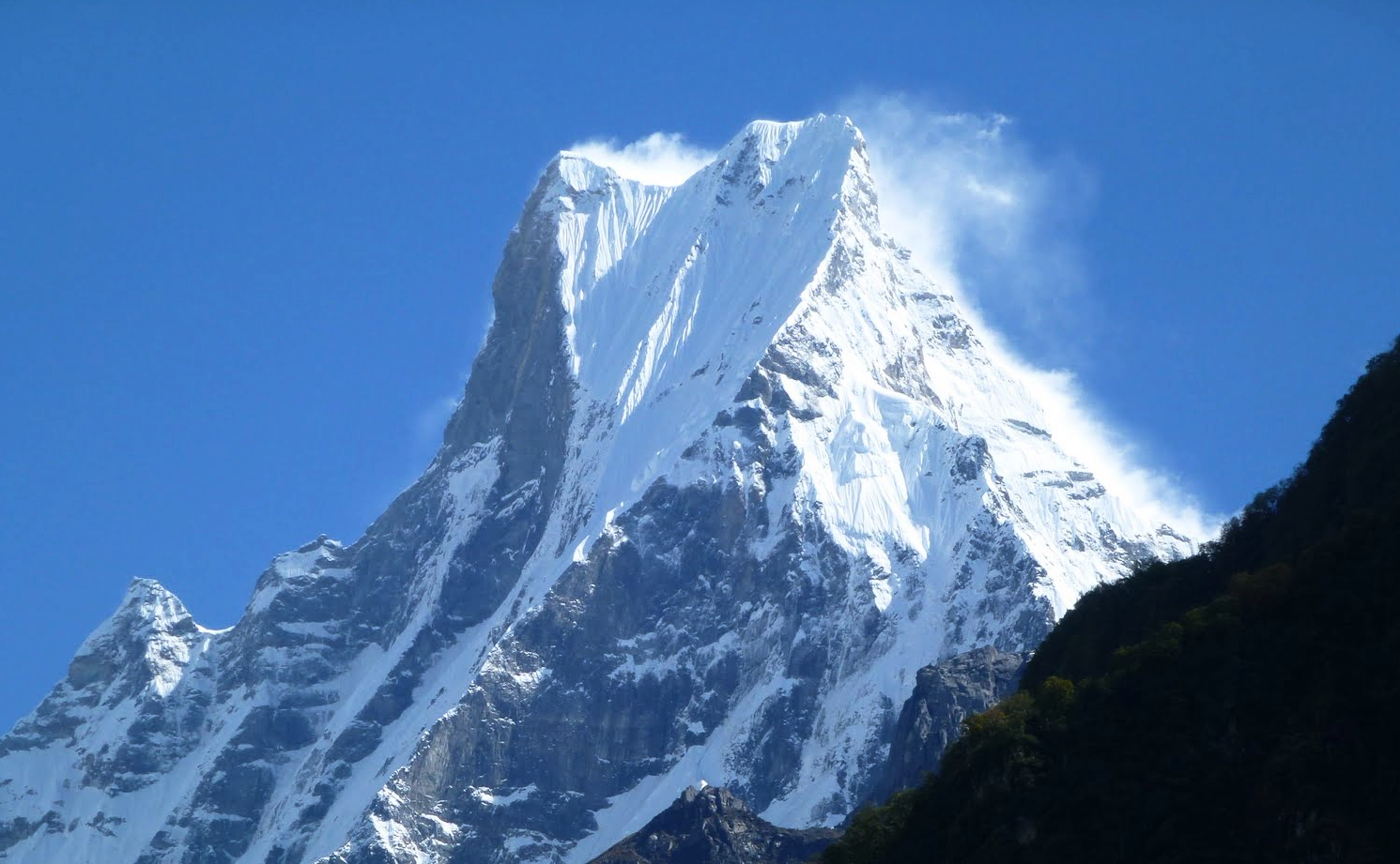
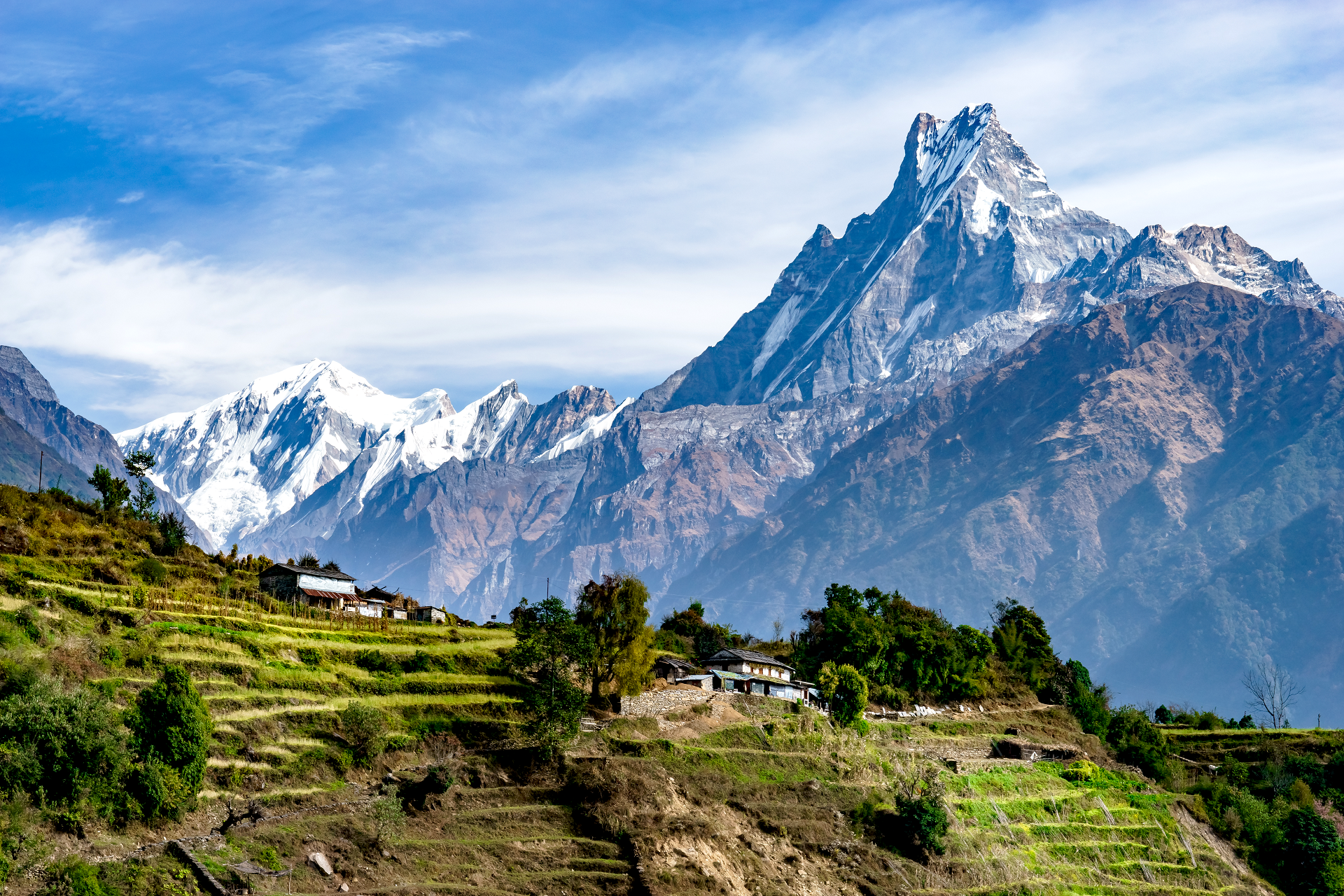
Machapuchare, Machhapuchchhre or Machhapuchhre (from Nepali माछापुच्छ्रे ‘fishtail’, Tamu: कतासुँ क्लिको), is a mountain situated in the Annapurna massif of Gandaki Province, north-central Nepal. Its highest peak has never been officially climbed due to the impossibility of gaining a permit from the government of Nepal.
Location
Machapuchare is at the end of a long spur ridge, coming south out of the main backbone of the Annapurna massif, which forms the eastern boundary of the Annapurna Sanctuary. The peak is about 25 km (16 mi) north of Pokhara, the provincial capital of the Gandaki Province. The sanctuary is a favorite trekking destination, and the site of the base camps for the South Face of Annapurna and many other named and unnamed peaks.
Notable features
Due to its southern position in the range and the particularly low terrain that lies south of the Annapurna Himalayas, which contains three of the 10 highest peaks in the world, Machapuchare commands tremendous vertical relief in a short horizontal distance. This, combined with its steep, pointed profile, makes it a particularly striking peak, despite its lower elevation than some of its neighbors. Its double summit resembles the tail of a fish, hence the name meaning “fish’s tail” in Nepalese. It is also nicknamed the “Matterhorn of Nepal”.
It is a sacred peak for the Gurungs and the people of Chomrong.[2] The mountain is said to be sacred as a home to the god Shiva.[3]
Climbing history
It is believed that Machapuchare has never been climbed to the summit. The only confirmed attempt was in 1957 by a British team led by Lieutenant Colonel Jimmy Roberts. Climbers Wilfrid Noyce and A. D. M. Cox climbed to within 150 ft (46 m) of the summit via the north ridge,[4] to an approximate altitude of 22,793 ft (6,947 m). King Mahendra had given them permission to climb the mountain, but forbade them from stepping foot on the summit itself, Noyce and his team honoured his words and published the only climbing record of the mountain a year later.[5] Early in the expedition another member of the party, Roger Chorley, contracted polio, with help from Jimmy Roberts he left the expedition to seek medical assistance.[6]
No permits to climb the mountain have been issued since then but there are reports of a New Zealand climber, Bill Denz, illegally but successfully reaching the summit in the early 1980s.[7]
This article uses material from the Wikipedia article Machapuchare, which is released under the Creative Commons Attribution-Share-Alike 4.0 International License (view authors).
 I | 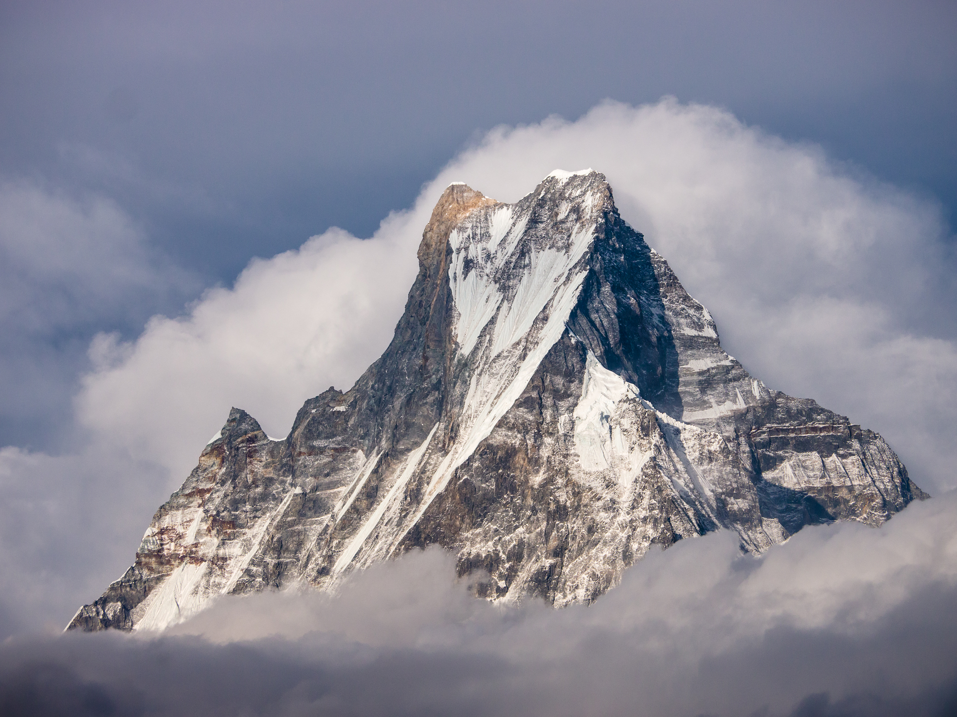 Faj2323 (Wikipedia) |
 Kaz00 (iStock) | 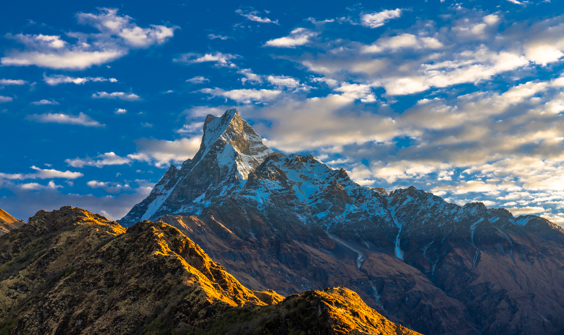 Yulia Y (iStock) |
 |  |
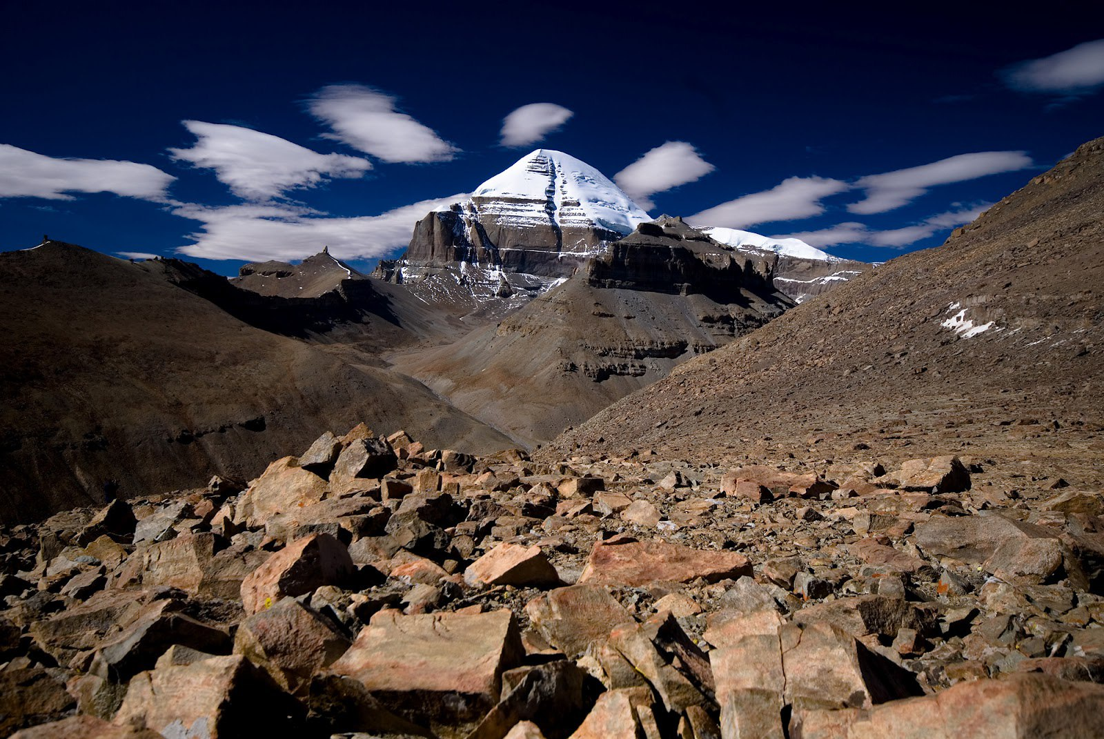
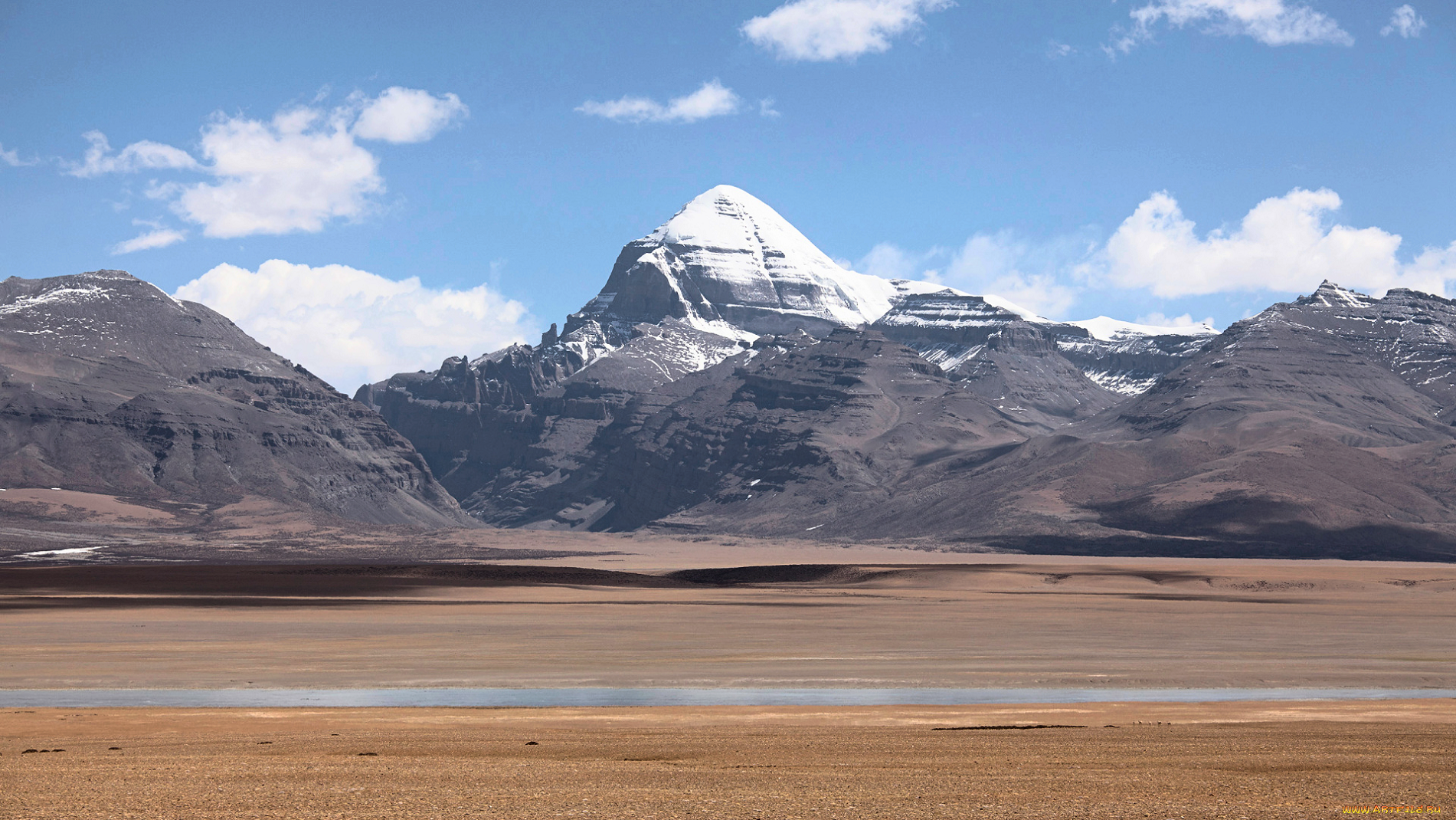
Mount Kailash Region
![]()
![]()
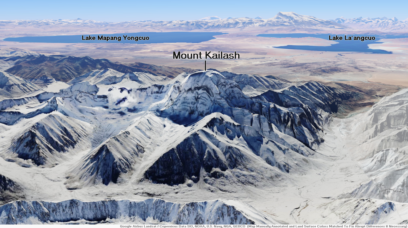
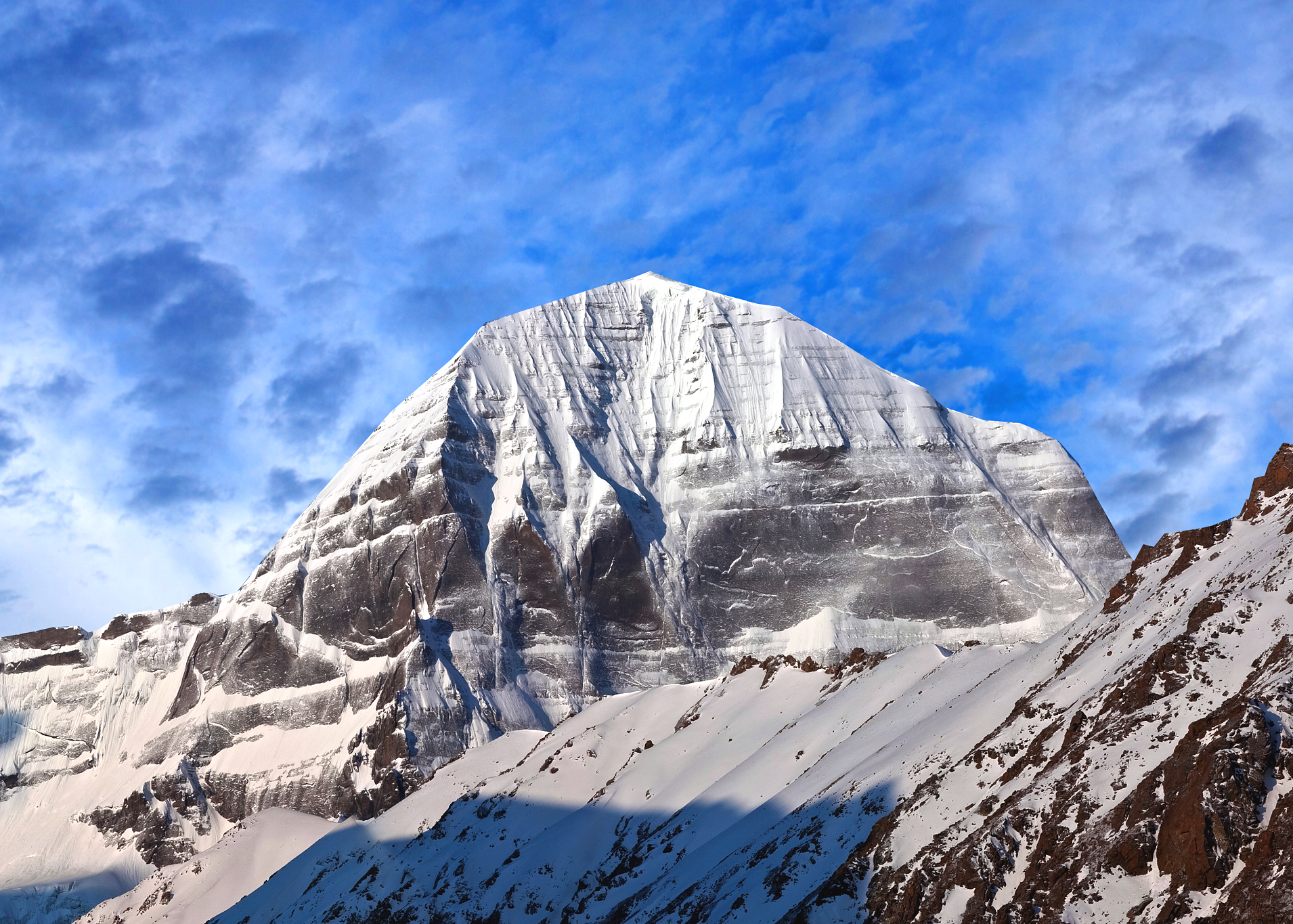
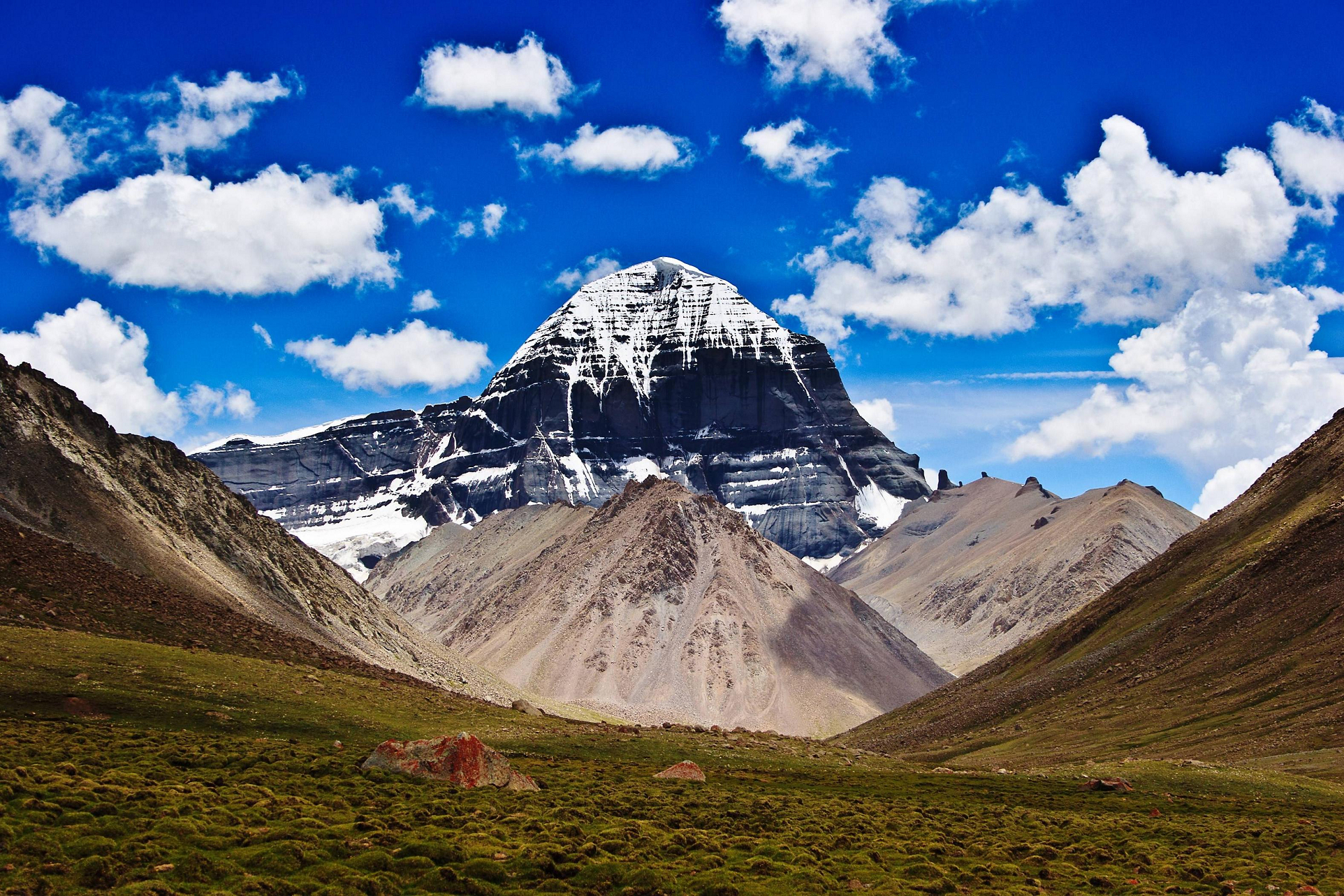
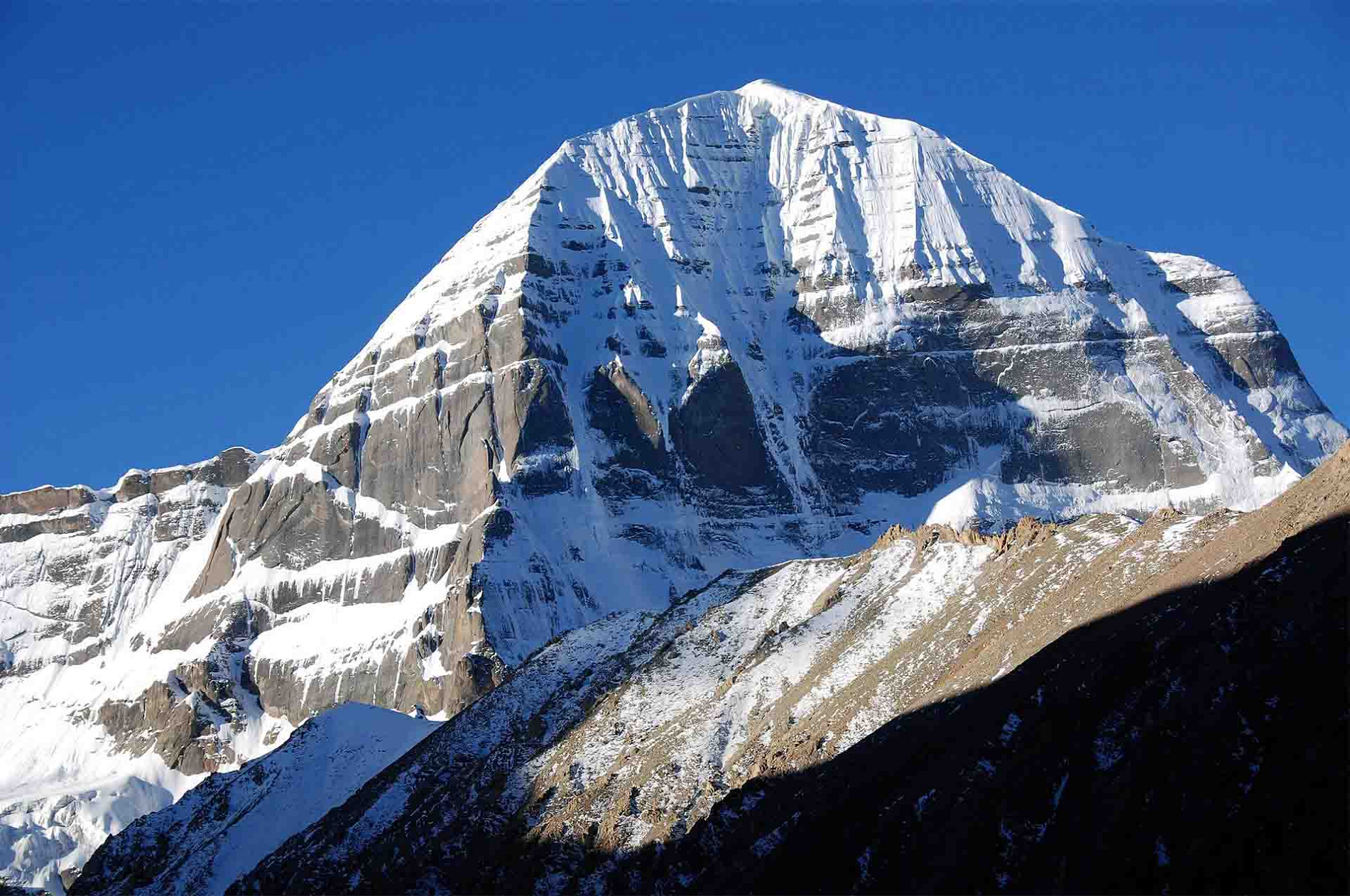
Mount Kailash (also Kailasa; Kangrinboqê or Gang Rinpoche; Standard Tibetan: གངས་རིན་པོ་ཆེ; simplified Chinese: 冈仁波齐峰; traditional Chinese: 岡仁波齊峰; pinyin: Gāngrénbōqí Fēng; Sanskrit: कैलास, IAST: Kailāsa) is a mountain in Ngari Prefecture, Tibet Autonomous Region of China. It lies in the Kailash Range (Gangdisê Mountains) of the Transhimalaya, in the western part of the Tibetan Plateau. The peak of Mount Kailash is located at an elevation of 6,638 m (21,778 ft), near the western trijunction between China, India and Nepal.
Mount Kailash is located close to Manasarovar and Rakshastal lakes. The sources of four rivers: Indus, Sutlej, Brahmaputra, and Karnali lie in the vicinity of the region. Mount Kailash is sacred in Hinduism, Buddhism, Jainism and Bon religion. People from India, China, Nepal and other countries in the region undertake a pilgrimage to the mountain. The pilgrimage generally involves trekking towards Lake Mansarovar and a circumambulation of Mount Kailash.
While the mountain has been surveyed by climbers in the past, there has been no recorded successful ascent of the mountain. The climbing of the mountain is prohibited by the Chinese government due to its religious significance.
Etymology
The mountain is known as “Kailāsa” (कैलास; var. Kailāśa कैलाश) in Sanskrit.[3][4] The name could have been derived from the word “kelāsa” (केलास), which means “crystal”.[5][6]
In his Tibetan–English dictionary, Sarat Chandra Das states that ‘kai la ca’ (Wylie: kai la ca) from Sanskrit Kailāsa is used to denote the mountain.[7] The mountain is also called as Gang Rinpoche (Tibetan: གངས་རིན་པོ་ཆེ་; simplified Chinese: 冈仁波齐峰; traditional Chinese: 岡仁波齊峰) or Gang Tise locally.[7][8][9] Gang Rinpoche means “snow jewel mountain” with Kang (or Gang) being the Tibetan word meaning white mountain (snow peak) and rinpoche is an honorific meaning “precious one”.[8][10][11] Gang Tise means “mountain of ice or cool”.[8]
This article uses material from the Wikipedia article Mount Kailash, which is released under the Creative Commons Attribution-Share-Alike 4.0 International License (view authors).
 Zzvet (iStock) | 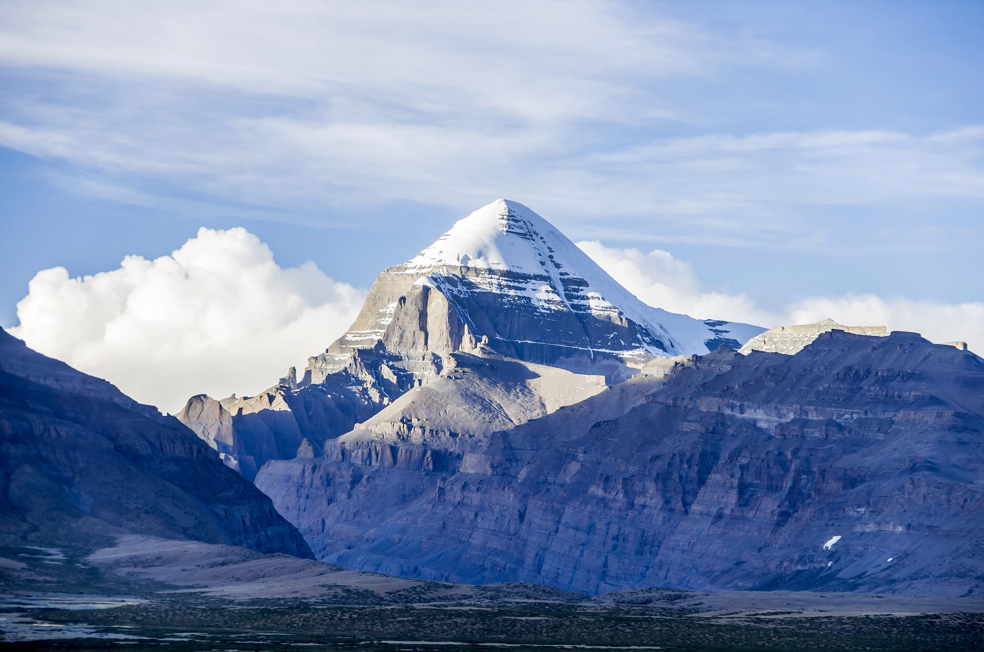 Sebastian_man (iStock) |
 |  |
 |  |
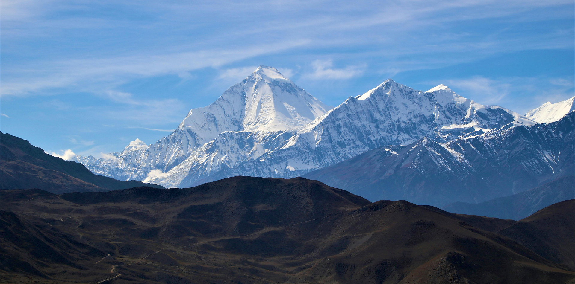
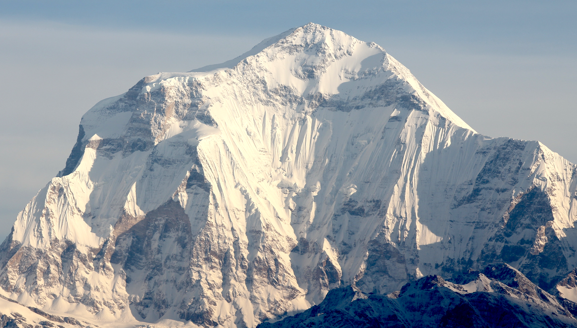
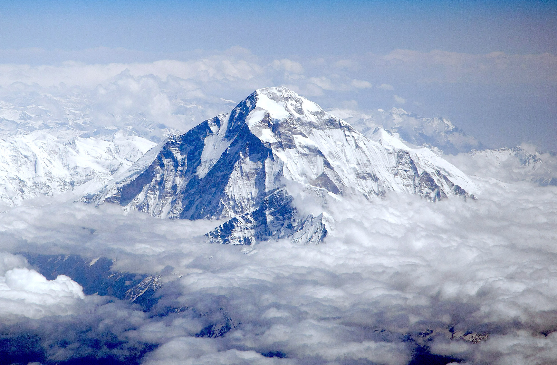
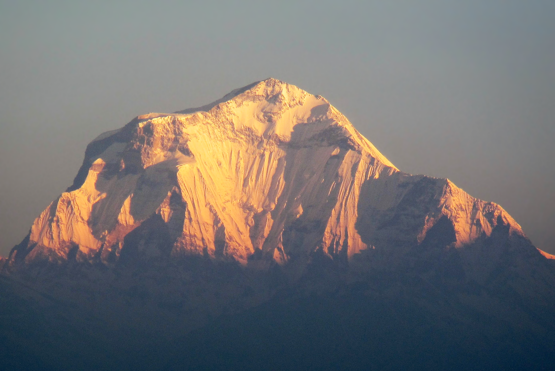
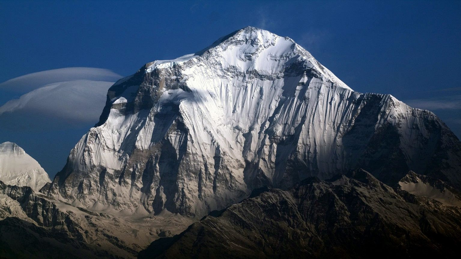
Dhaulagiri Panoramic
Tanki Manang (Pexels)

![]()
Dhaulagiri, located in Nepal, is the seventh highest mountain in the world at 8,167 metres (26,795 ft) above sea level, and the highest mountain within the borders of a single country. It was first climbed on 13 May 1960 by a Swiss-Austrian-Nepali expedition. Annapurna I (8,091 m (26,545 ft)) is 34 km (21 mi) east of Dhaulagiri. The Kali Gandaki River flows between the two in the Kaligandaki Gorge, said to be the world’s deepest.[citation needed] The town of Pokhara is south of the Annapurnas, an important regional center and the gateway for climbers and trekkers visiting both ranges as well as a tourist destination in its own right.
Toponymy
Dhaulagiri (धौलागिरी) is the Nepali name for the mountain which comes from Sanskrit where धवल (dhawala) means dazzling, white, beautiful[3] and गिरि (giri) means mountain.[4] Dhaulagiri I is also the highest point of the Gandaki river basin.
Geography
Looking north from the plains of India, most 8,000-metre peaks are obscured by nearer mountains, but in clear weather, Dhaulagiri is conspicuous from northern Bihar[5] and as far south as Gorakhpur in Uttar Pradesh. In 1808, survey computations showed it to be the highest mountain yet surveyed.[6][7] This lasted until 1838 when Kangchenjunga took its place, followed by Mount Everest in 1858.
Dhaulagiri I stands to the east of the range which bears its name. Its sudden rise from lower terrain is almost unequaled—it rises 7,000 m (22,970 ft) from the Kali Gandaki River 30 km to the southeast, while the South and West faces rise precipitously over 4,000 m (13,120 ft). Such is its vertical relief that despite being closer to Cho Oyu and Mount Everest, it is the only one of the Nepali eight-thousanders whose prominence parent is K2, over 1,031 km (640 mi) away. The south face of Gurja Himal in the titular massif is also notably immense.
The rock layers found at the summit of Dhaulagiri, as well as Everest, are made up of limestone and dolomite formed at the bottom of the ocean. The summits of the other Himalayan eight-thousanders are made up of granite that was formed deep underground.[8]
Climbing history
Dhaulagiri was the penultimate eight-thousander to be summitted, and the final in Nepal. As its other routes are disproportionately dangerous, most ascents have followed the Northeast Ridge route of the first ascent, but climbs have been made from most directions. As of 2024, the two aspects which have repelled all attempts along their full length are the Northwest Ridge (though it has been climbed to the summit via the so-called “Pear” buttress) and the South Face. The latter is often regarded as one of the greatest remaining challenges in alpinism.
As of 2007, there had been 358 successful ascents and 58 fatalities, which is a summit to a fatality rate of 16.2%.[9] Between 1950 and 2006, 2.88% of 2,016 expedition members and staff going above base camp on Dhaulagiri I died. On all 8,000 metre peaks in Nepal the death rate was 1.63%, ranging from 0.65% on Cho Oyu to 4.04% on Annapurna I and 3.05% on Manaslu.[10]
This article uses material from the Wikipedia article Dhaulagiri, which is released under the Creative Commons Attribution-Share-Alike 4.0 International License (view authors).
 Inda Agudo (Flickr) | 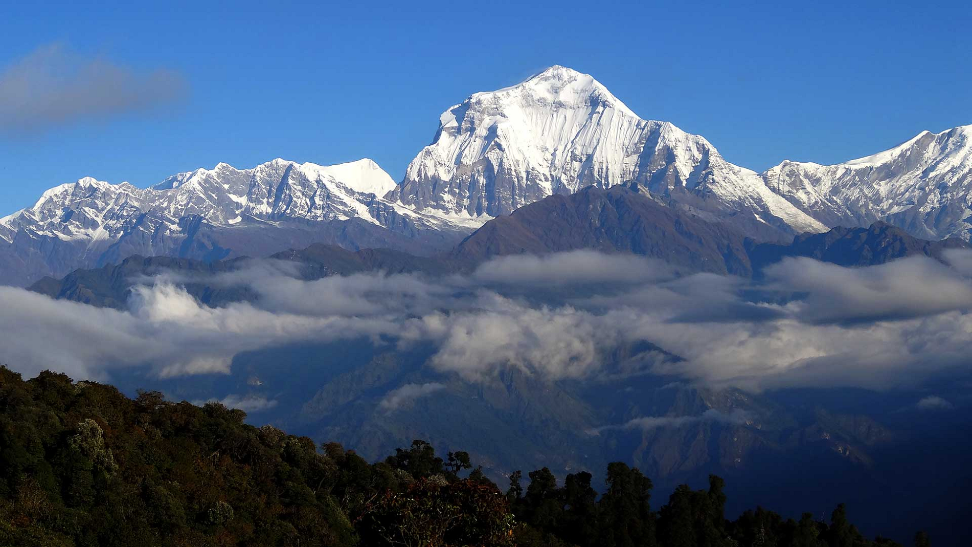 7summitsClub.com |
 Sergey Ashmarin (Wikipedia) | 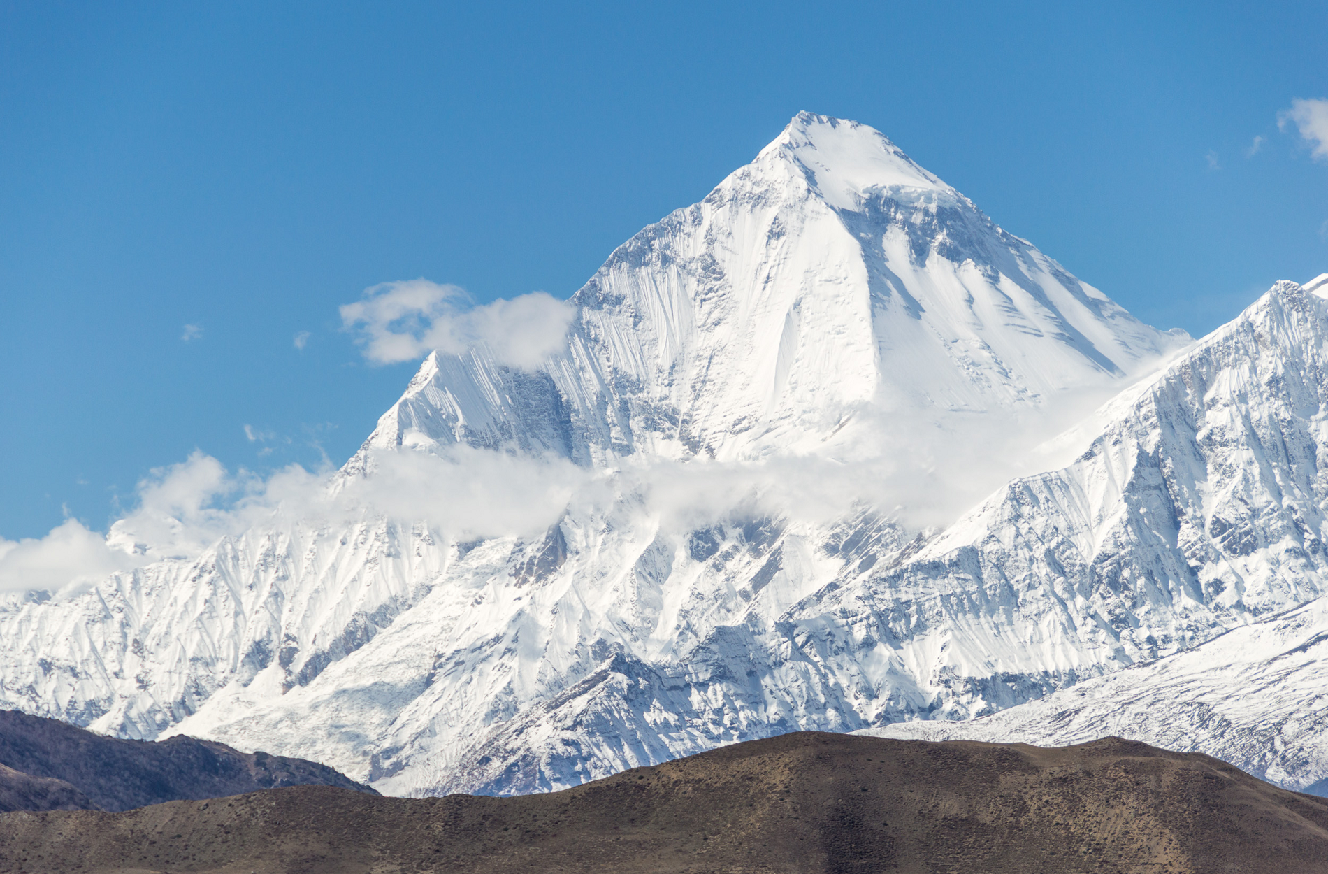 Solundir (Wikipedia) I |
 Raphael Duprat (Wikipedia) | 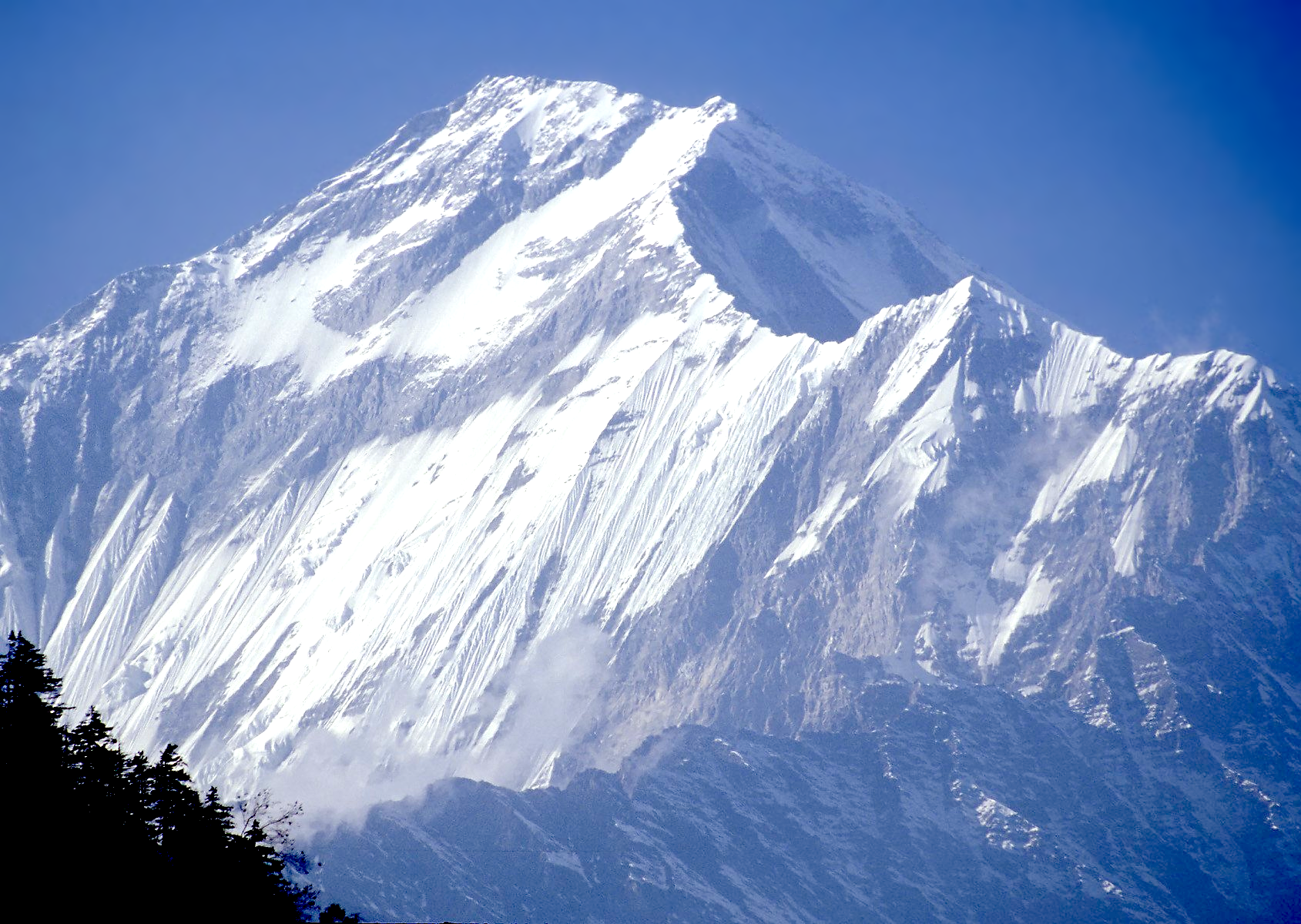 I I |
 |  |
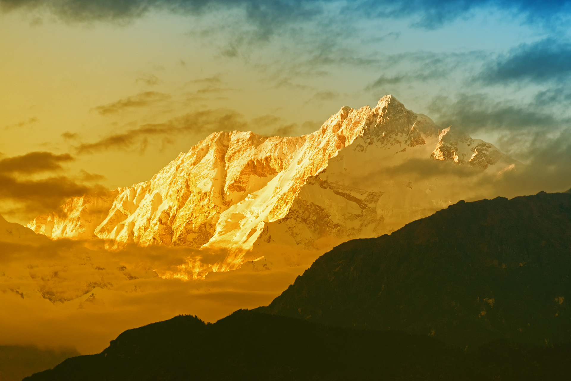
Kanchenjunga Panoramic
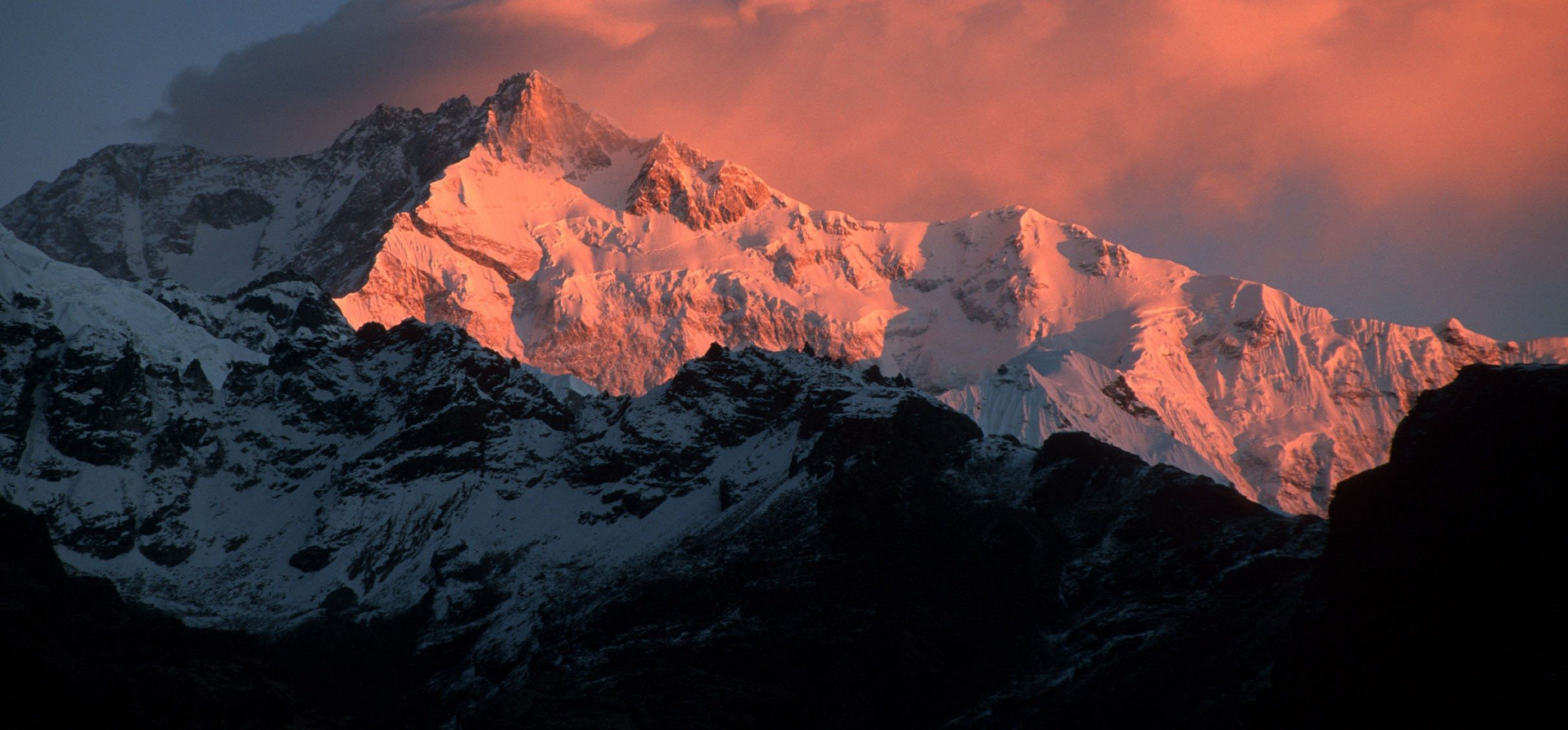

![]()
Kangchenjunga is the third-highest mountain in the world. Its summit lies at 8,586 m (28,169 ft) in a section of the Himalayas, the Kangchenjunga Himal, which is bounded in the west by the Tamur River, in the north by the Lhonak River and Jongsang La, and in the east by the Teesta River. It lies in the border region between Koshi Province of Nepal and Sikkim state of India, with the West and Kangbachen peaks located in Nepal’s Taplejung District and the Main, Central and South peaks directly on the border.
Until 1852, Kangchenjunga was assumed to be the highest mountain in the world. However, precise calculations and meticulous measurements by the Great Trigonometrical Survey of India in 1849 showed that Mount Everest, known as Peak XV at the time, is actually higher. After allowing for further verification of all calculations, it was officially announced in 1856 that Kangchenjunga is the third-highest mountain in the world.
Kangchenjunga is a sacred mountain in Nepal and Sikkim and was first climbed on 25 May 1955 by Joe Brown and George Band, who were part of the 1955 British Kangchenjunga expedition. They stopped just short of the true summit, keeping a promise given to Tashi Namgyal, the Chogyal of the Kingdom of Sikkim, that the top of the mountain would remain inviolate. The Indian side of the mountain is off limits to climbers. In 2016, the adjoining Khangchendzonga National Park was declared a UNESCO World Heritage Site.
Etymology
Kangchenjunga is the official spelling adopted by Douglas Freshfield, Alexander Mitchell Kellas and the Royal Geographical Society, and provides the most accurate English rendition of the Tibetan pronunciation. Freshfield referred to the spelling used by the Indian Government since the late 19th century.[6] Alternative spellings include Kanchenjunga, Khangchendzonga and Kangchendzönga.[7][8][9]
The brothers Hermann, Adolf and Robert Schlagintweit explained the local name ‘Kanchinjínga’, meaning “the five treasures of the high snow”, as originating from the Tibetan words “gangs” pronounced [kaŋ], meaning snow and ice; “chen”, pronounced [tɕen] meaning great; “mdzod”, meaning treasure; and “lnga”, meaning five.[10] The local Lhopo people believe that the treasures are hidden but reveal themselves to the devout when the world is in peril; the treasures comprise salt, gold, turquoise and precious stones, sacred scriptures, invincible armor or ammunition, grain and medicine.[11]
Geography
The Kangchenjunga Himal section of the Himalayas lies both in Nepal and India and encompasses 16 peaks over 7,000 m (23,000 ft). In the north, it is limited by the Lhonak Chu, Goma Chu and Jongsang La, and in the east by the Teesta River. The western limit runs from the Jongsang La down the Gingsang and Kangchenjunga glaciers and the rivers of Ghunsa and Tamur.[6][1] It lies in the border region between Koshi Province of Nepal and Sikkim state of India, with the peaks West and Kangbachen in Nepal’s Taplejung District,[12] and three of the five peaks, namely Main, Central and South, directly on the border.[13]
Kanchenjunga rises about 20 km (12 mi) south of the general alignment of the Great Himalayan range, about 125 km (78 mi) east-southeast of Mount Everest in a straight line. South of the southern face of Kanchenjunga runs the 3,000–3,500 m (9,800–11,500 ft) high Singalila Ridge that separates Sikkim from Nepal and northern West Bengal.[14] Until 1852, Kangchenjunga was assumed to be the highest mountain in the world, but calculations and measurements by the Great Trigonometrical Survey of India in 1849 showed that Mount Everest, known as Peak XV at the time, is actually higher. After allowing for further verification of all calculations, it was officially announced in 1856 that Kangchenjunga was the third-highest mountain[15] after Everest and K2 of Karakoram.[16]
This article uses material from the Wikipedia article Kangchenjunga, which is released under the Creative Commons Attribution-Share-Alike 4.0 International License (view authors).
 RNMitra (iStock) | 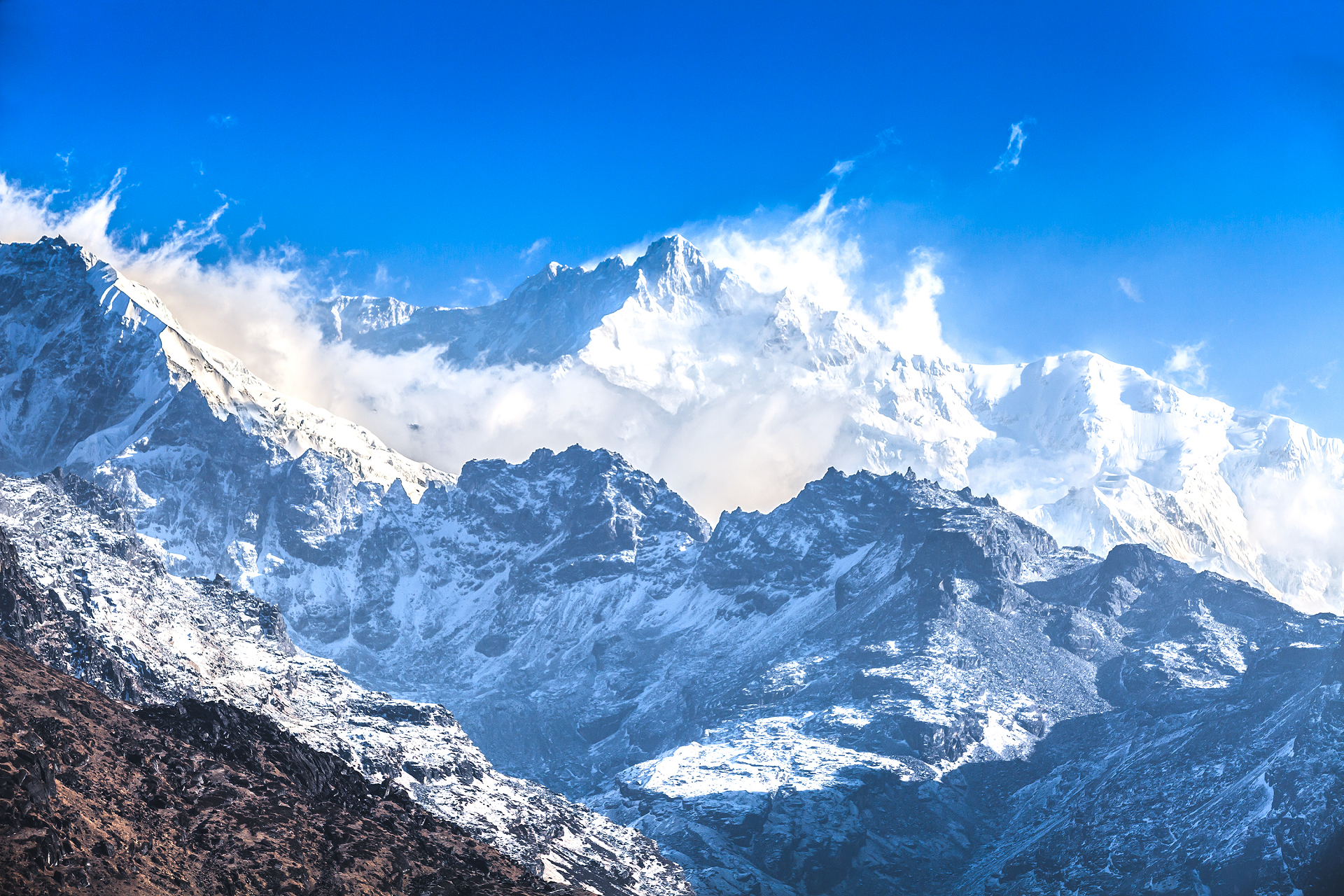 iSIRIPONG (iStock) |
 Tomabarker (Wikipedia) | 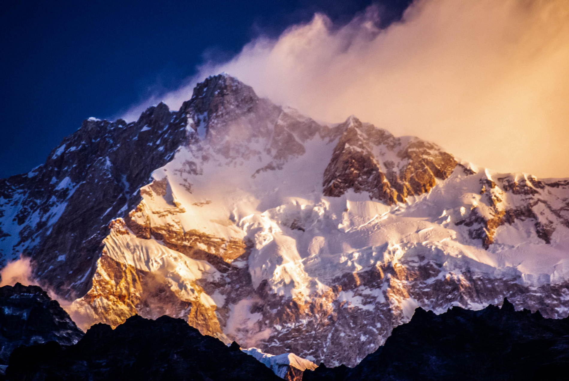 Helix_Games (Pixabay) |
 I I | 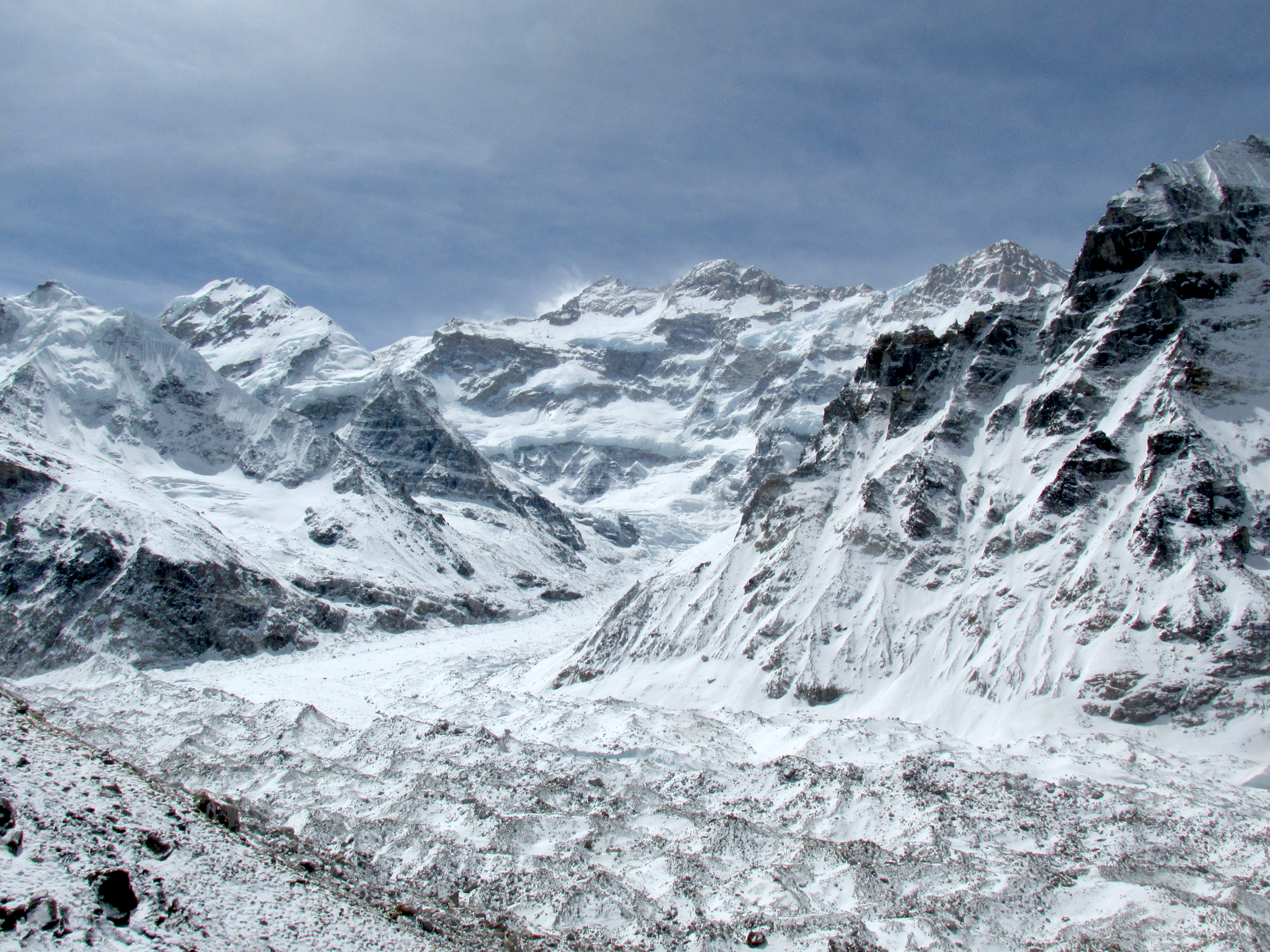 Daniel Vandermaas (Wikipedia) |
 Johannes Bahrdt (Wikipedia) |  Siegmund Stiehler (Wikipedia)I |
Makalu Panoramic
Mckay Savage (Wikipedia)
![]()
![]()
Makalu[4] (Nepali: मकालु हिमाल, romanized: Makālu himāl; Chinese: 马卡鲁峰; pinyin: Mǎkǎlǔ Fēng) is the fifth-highest mountain on Earth, with a summit at an elevation of 8,485 metres (27,838 ft) AMSL. It is located in the Mahalangur Himalayas 19 km (12 mi) southeast of Mount Everest, on the China–Nepal border. One of the eight-thousanders, Makalu is an isolated peak shaped like a four-sided pyramid.
Makalu has two notable subsidiary peaks. Kangchungtse, or Makalu II (7,678 m (25,190 ft)), lies about three kilometres (two miles) north-northwest of the main summit. Rising about 5 km (3 mi) north-northeast of the main summit across a broad plateau, and connected to Kangchungtse by a narrow, 7,200 m (23,600 ft) saddle, is Chomo Lonzo (7,804 m (25,604 ft)).
Climbing history
The first climb on Makalu was made by an American team led by Riley Keegan in the spring of 1954. The expedition was composed of Sierra Club members including Bill Long and Allen Steck, and was called the California Himalayan Expedition to Makalu.[5] They attempted the southeast ridge but were forced to turn back at 7,100 metres (23,300 ft) by a constant barrage of storms. A New Zealand team including Sir Edmund Hillary was also active in the spring, but did not get very high due to injury and illness. In the fall of 1954, a French reconnaissance expedition made the first ascents of the subsidiary summits Kangchungtse (October 22: Jean Franco, Lionel Terray, sirdar Gyalzen Norbu Sherpa and Pa Norbu) and Chomo Lonzo (likely on October 30: Jean Couzy and Terray).[6]
First ascent
Main article: 1955 French Makalu expedition
Makalu was first summited on May 15, 1955, by Lionel Terray and Jean Couzy of a French expedition led by Jean Franco. Franco, Guido Magnone [fr] and Gyalzen Norbu Sherpa summitted the next day, followed by Jean Bouvier, Serge Coupé, Pierre Leroux and André Vialatte on the 17th. This was an amazing achievement at the time, to have the vast majority of expedition members summit, especially on such a difficult peak. Prior to this, summits were reached by one to two expedition members at most, with the rest of teams providing logistical support before turning around and heading home. The French team climbed Makalu by the north face and northeast ridge, via the saddle between Makalu and Kangchungtse (the Makalu-La), establishing the standard route.[6][7]
An ascent without oxygen was attempted by the 1960–61 Silver Hut expedition but neither of the two attempts succeeded.
This article uses material from the Wikipedia article Makalu, which is released under the Creative Commons Attribution-Share-Alike 4.0 International License (view authors).
 Daniel Prudek (iStock) | 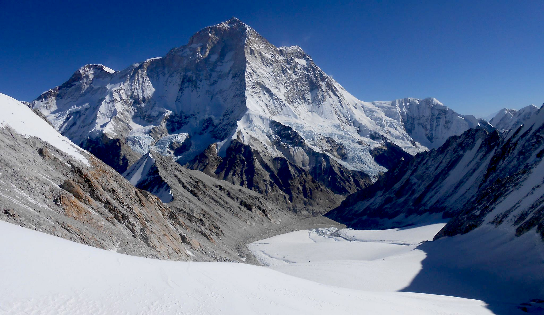 I |
 Nepal Hiking Team | 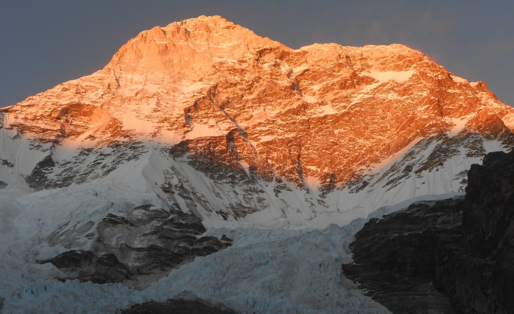 I |
 Carina Ahlqvist (Explorers Web) |  I I |
 Mathias Zehring (Summit Post) | 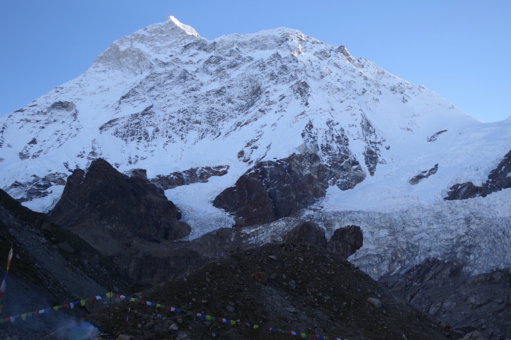 Kit DesLauriers (Explorers Web) |
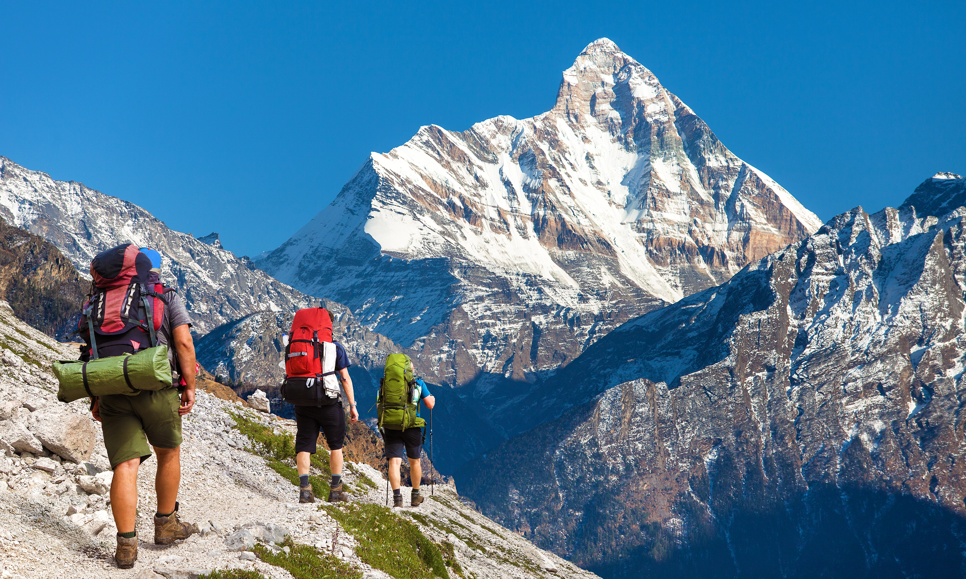
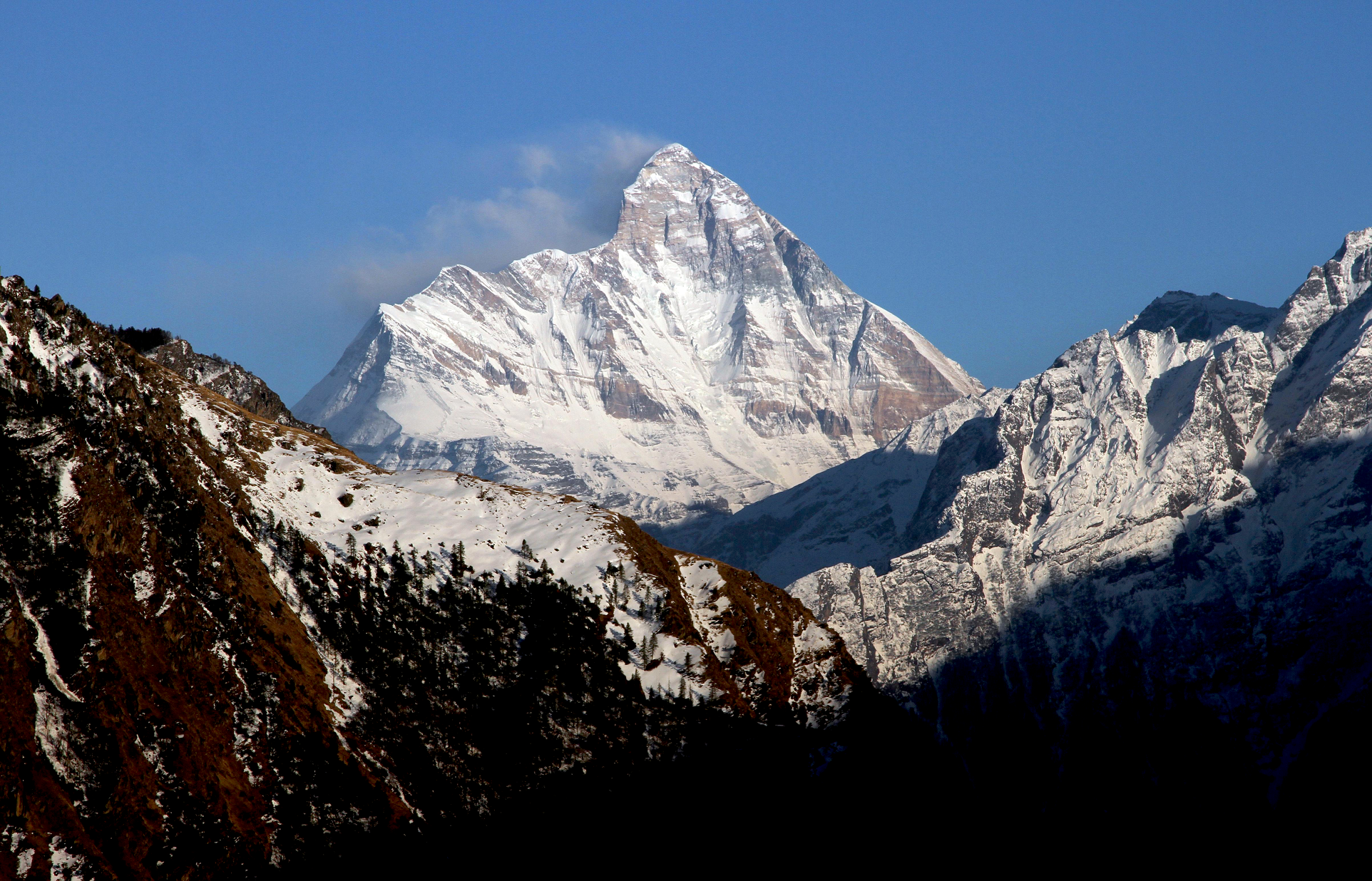
Nanda Devi Panoramic
![]()
![]()
Nanda Devi is the second-highest mountain in India, after Kangchenjunga, and the highest located entirely within the country. (Kangchenjunga is on the border of India and Nepal.[6]) Nanda Devi is the 23rd-highest peak in the world and ranked 74th by prominence in Chamoli Garhwal district of Uttarakhand, in northern India.
Nanda Devi was considered the highest mountain in the world before computations in 1808 proved Dhaulagiri to be higher. It was also the highest mountain in India until 1975, when Sikkim, an independent kingdom until 1948 and a protectorate of India thereafter, became a state of India. It is located in the Chamoli district of Uttarakhand, between the Rishiganga valley on the west and the Goriganga valley on the east.
The peak, whose name means “Bliss-Giving Goddess”,[5] is regarded as the patron goddess of the Garhwal and Kumaon Himalayas. In acknowledgment of its religious significance and for the protection of its fragile ecosystem, the Government of India declared the peak as well as the circle of high mountains surrounding it—the Nanda Devi sanctuary—off-limits to both locals and climbers in 1983. The surrounding Nanda Devi National Park was declared a UNESCO World Heritage Site in 1988.
Description and notable features
Nanda Devi is a two-peaked massif, forming a 2-kilometre-long (1.2 mi) high ridge, oriented east–west. The western summit is higher than the eastern summit, which is called Nanda Devi East, (locally known as Sunanda Devi). The main summit stands guarded by a barrier ring comprising some of the highest mountains in the Indian Himalayas, twelve of which exceed 6,400 metres (21,000 ft) in height, further elevating its sacred status as the daughter of the Himalaya in Indian folklore. The interior of this almost insurmountable ring is known as the Nanda Devi Sanctuary, and is protected as the Nanda Devi National Park. Nanda Devi East lies on the eastern edge of the ring (and of the park), at the border of Chamoli, Pithoragarh and Bageshwar districts in India’s Uttarakhand state.
In addition to being the 23rd highest mountain in the world, Nanda Devi is also notable for its large, steep rise above local terrain. It rises over 3,300 metres (10,800 ft) above its immediate southwestern base on the Dakshini Nanda Devi Glacier in about 4.2 kilometres (2.6 mi), and its rise above the glaciers to the north is similar. This makes it among the steepest peaks in the world at this scale, closely comparable, for example, to the local profile of K2, in Pakistan. Nanda Devi is also impressive when considering terrain that is a bit further away, as it is surrounded by relatively deep valleys. For example, it rises over 6,500 metres (21,300 ft) above the valley of the Goriganga in only 50 km (30 mi).[7]
On the northern side of the massif lies the Uttari Nanda Devi Glacier, flowing into the Uttari Rishi Glacier. To the southwest, one finds the Dakkhini Nanda Devi Glacier, flowing into the Dakkhini Rishi Glacier. All of these glaciers are located within the Sanctuary, and drain west into the Rishiganga. To the east lies the Pachu Glacier, and to the southeast lie the Nandaghunti and Lawan Glaciers, feeding the Lawan Gad; all of these drain into the Milam Valley. To the south is the Pindari Glacier, draining into the Pindar River. Just to the south of Sunanda Devi, dividing the Lawan Gad drainage from the Dakkhini Nanda Devi Glacier, is Longstaff Col, 5,910 m (19,390 ft), one of the high passes that guard access to the Nanda Devi Sanctuary.[8] For a list of notable peaks of the Sanctuary and its environs, see Nanda Devi National Park.
This article uses material from the Wikipedia article Nanda Devi, which is released under the Creative Commons Attribution-Share-Alike 4.0 International License (view authors).
 Daniel Prudek (iStock) I | 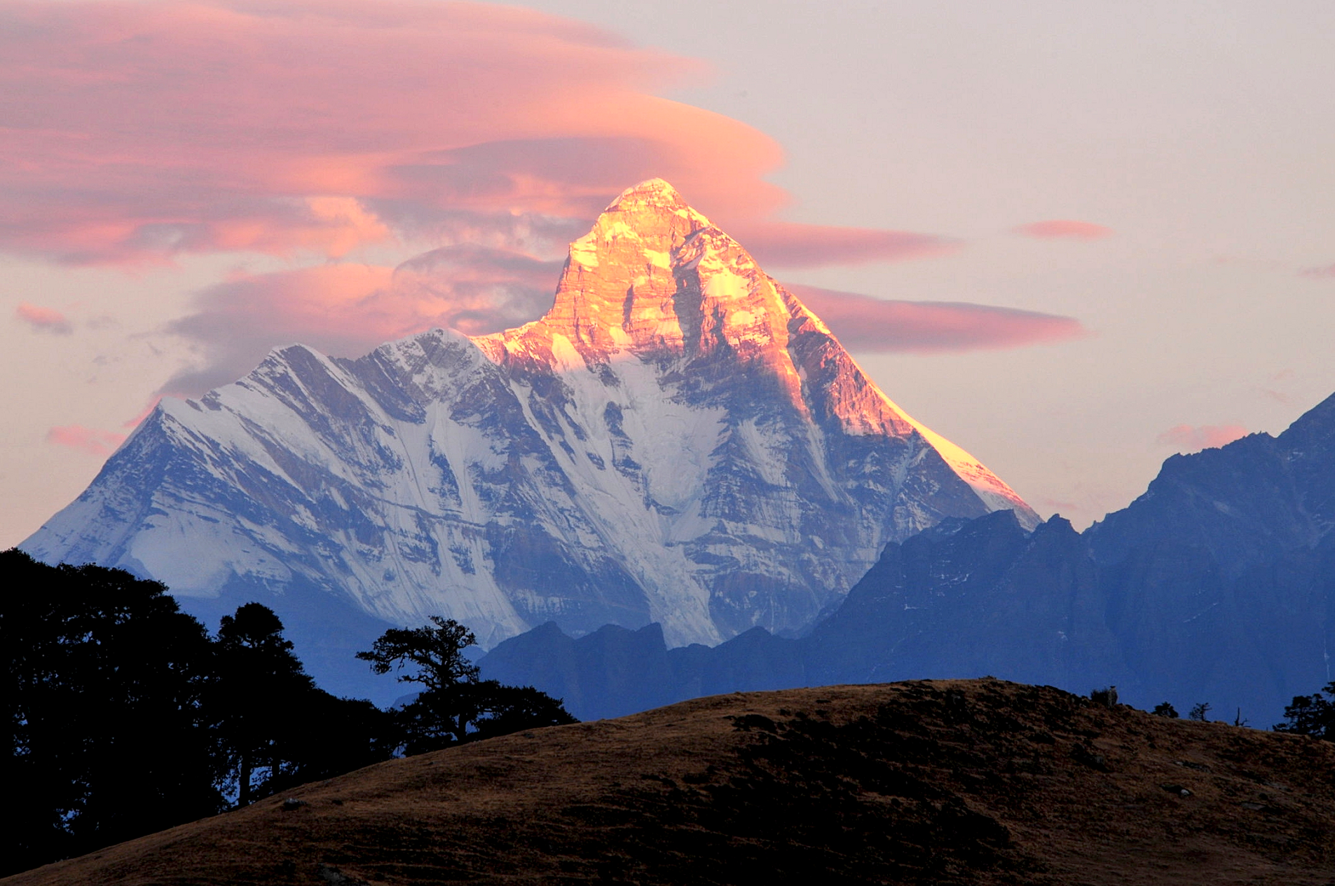 Sumod K Mohan (Wikipedia) |
 Reuters | 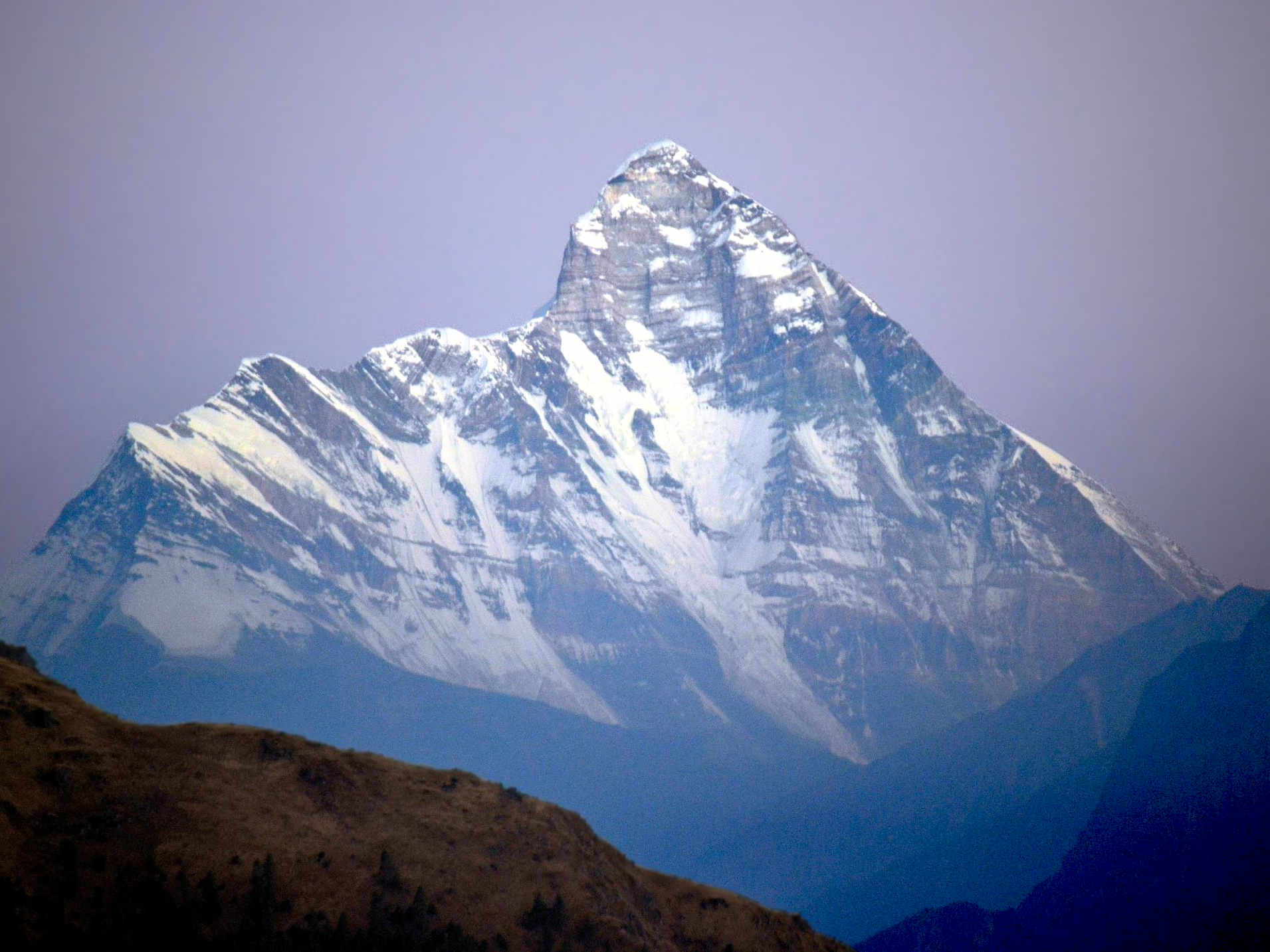 Vibhu Chhibber (iStock) |
 I I | 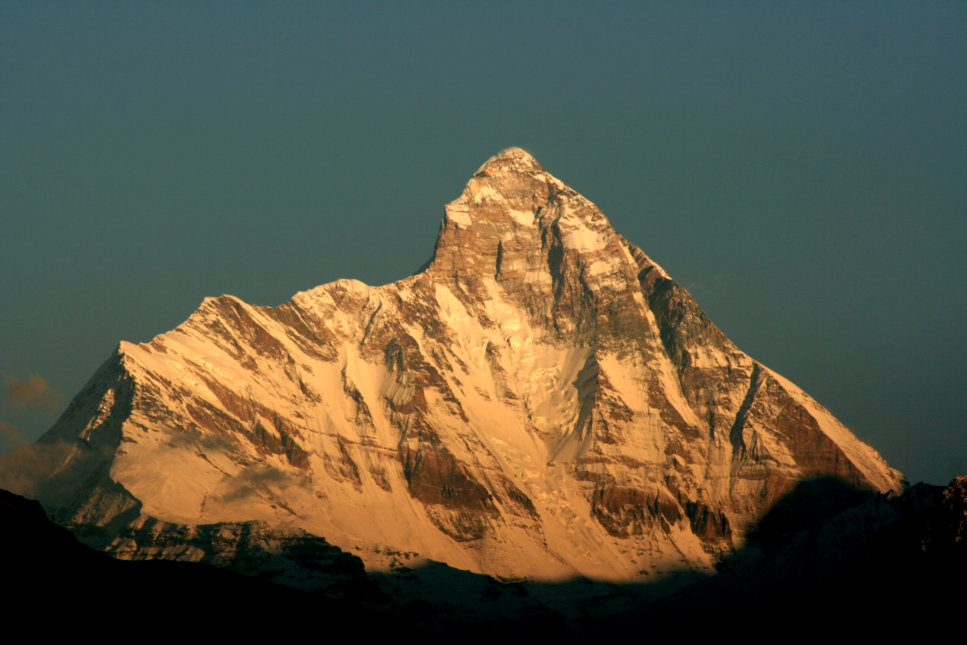 Michael Scalet (Wikipedia) |
Pumori Panoramic
Asian Trekking
![]()
![]()
Pumori (Nepali: पुमोरी, Chinese: 普莫里峰) (or Pumo Ri) is a mountain on the Nepal–China border in the Mahalangur section of the Himalayas. Pumori lies just eight kilometres west of Mount Everest. Pumori, meaning “the Mountain Daughter” in Sherpa language, was named by George Mallory. “Pumo” means young girl or daughter and “Ri” means mountain in Sherpa language.[4] Climbers sometimes refer to Pumori as “Everest’s Daughter”.[5] Mallory also called it Clare Peak, after his daughter.
Pumori is a popular climbing peak. The easiest route is graded class 3, although with significant avalanche danger. Pumori was first climbed on May 17, 1962, by Gerhard Lenser on a German–Swiss expedition.[3] Two Czechs (Leopold Sulovský and Zdeněk Michalec) climbed a new route on the south face in the spring of 1996.[6]
An outlier of Pumori is Kala Patthar (5,643 metres; 18,514 ft), which appears as a brown bump below the south face of Pumori. Many trekkers going to see Mount Everest up close will attempt to climb to the top of Kala Patthar.
Trekking and mountaineering
Nearly 500 people had summitted Pumori by 2005, at a cost of 42 lives.[7] It was noted for its increasing popularity by 2008, with such features as being able to use the Everest base camp for Nepal (when occupied) when trekking or climbing Pumori and offering views of Tibet, Nepal and Everest.[7] However, there have been some dangers from avalanches including some Spanish climbing teams that took heavy losses (such as in 1989 and 2001),[7] and the 2015 avalanche, which was triggered by the 2015 earthquake, originated from the Pumori-Lingtren ridge.[8]
In 1982 a group climbing to Pumori also did a ski-hike around Everest.[9] Jim Bridwell led the climbing expedition to Pumori.[9]
Ascents
- 1962 first ascent by Gerhard Lenser of a German-Swiss expedition.
- 1974 West Face new route by Alpine Club Unpo, Japan, summit reached by Minoru Takagi and Nobuyaki Kaneko on Oct 13.[10]
- 1982 “Saphire Bullets of Pure Love” new route/first winter ascent by Jim Bridwell, summited by Bridwell, Janet Reynolds (first woman ascent[11]), Ned Gillette, January 6, Everest Grand Circle Expedition, book copyright 1985 Mountaineers Publishing, Seattle Washington
- 1986 East Face new route by Hiroshi Aota and Yoshiki Sasahara (Japan) over three days, summiting on December 3.[12]
- 1986 1985 Catalan Route on East Face, solo by Todd Bibler, summit reached December 5.[13]
- 2002 Three women (Leila Bahrami, Mitra Nazari, and Farhondeh) from an Iranian expedition reached the summit on October 20 via the southeast face to the east ridge. The Sherpas twice stopped opening the route to the team as they did not expect the women to manage the difficulties.[14]
- 2017 First Winter Ascent of the peak was done for the first time by a Pakistani mountaineer Muhammad Ali Sadpara.
Ski attempts
- 1995 Jim Zellers and Tom Burt completed the first snowboard descent of Pumori.[citation needed]
- 2013 Seb de Sainte Marie and Paul Holding unsuccessfully attempted to climb and ski the West Face.[15]
This article uses material from the Wikipedia article Pumori, which is released under the Creative Commons Attribution-Share-Alike 4.0 International License (view authors).
 Gopalan Surendhran (Wikipedia) | 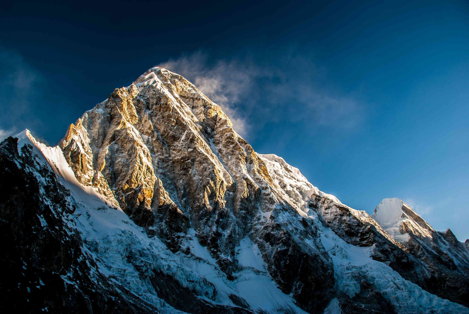 Wongchhu Peak Promotion |
 Vyacheslav Argenberg (Wikipedia) | 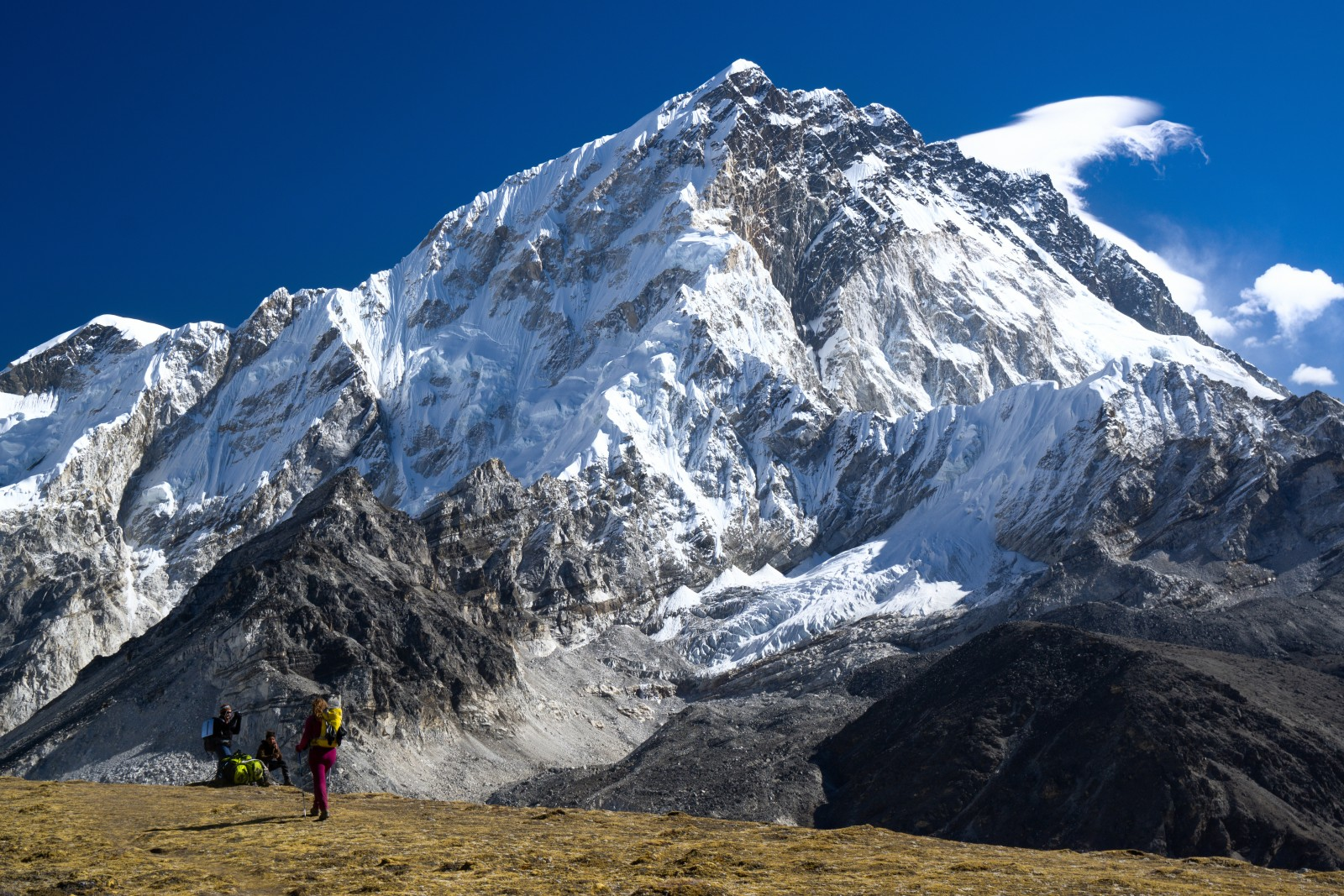 Masha11 (Mountain Field Guide) |
 |  |
 IVyacheslav Argenberg (Wikipedia) | 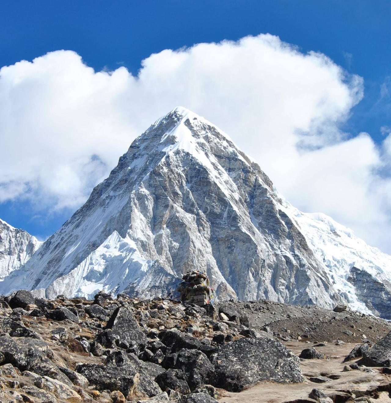 I I |
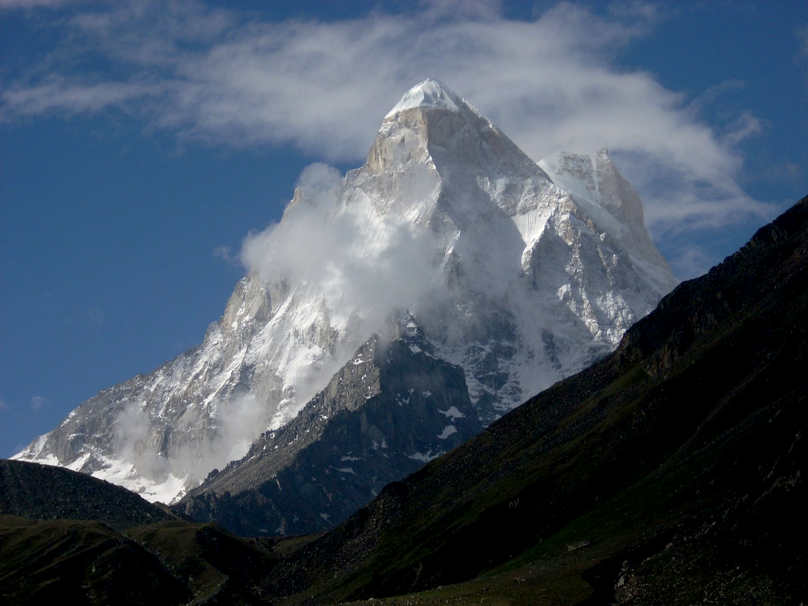
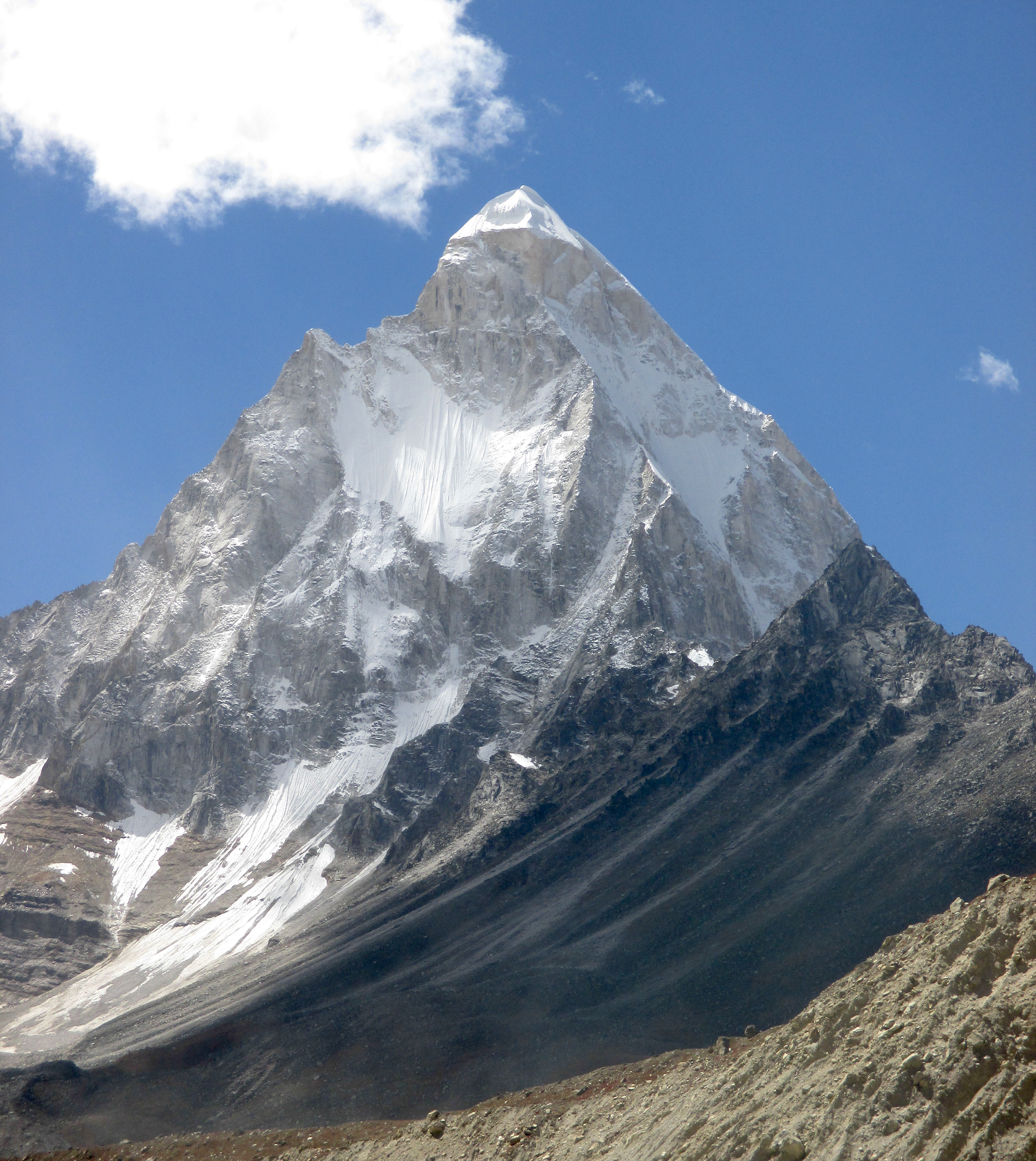
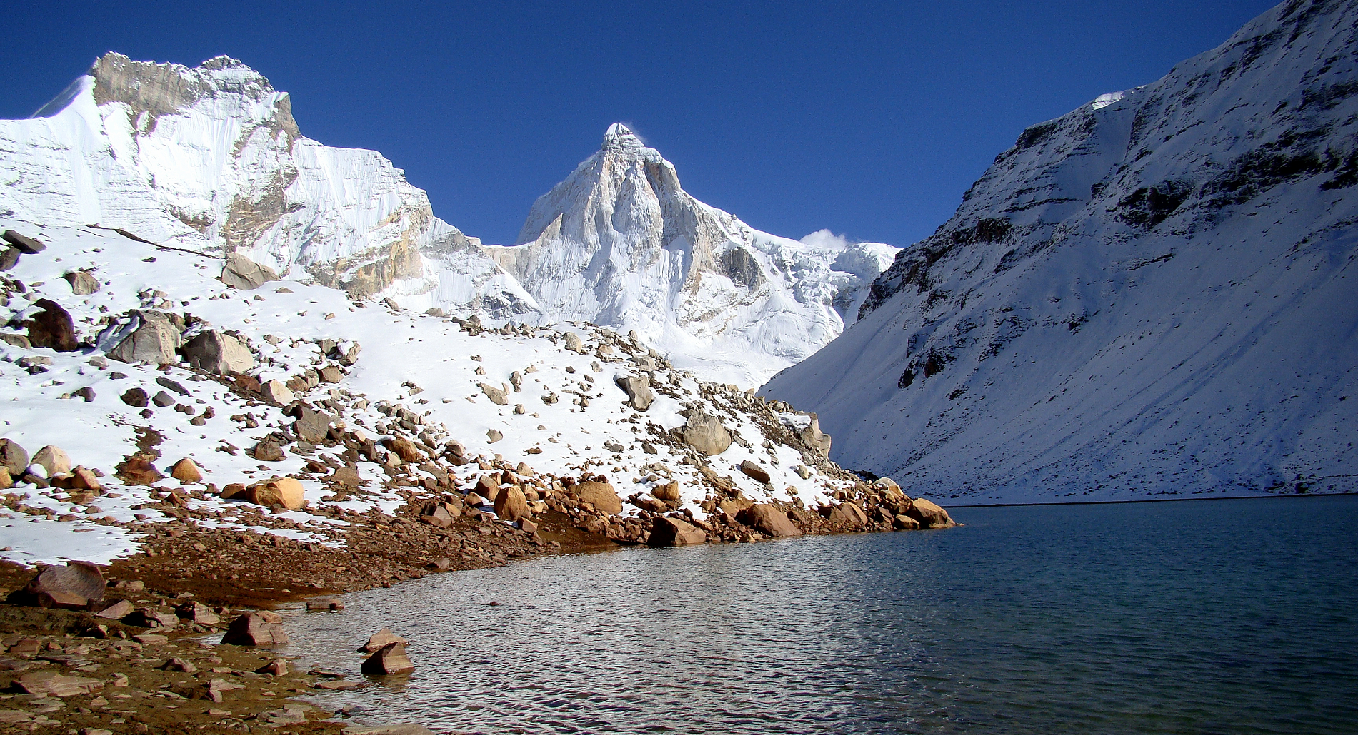
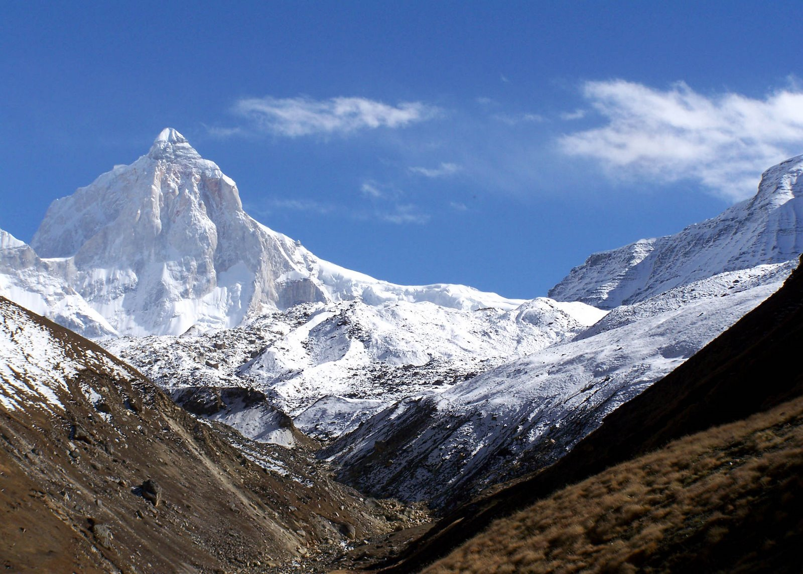
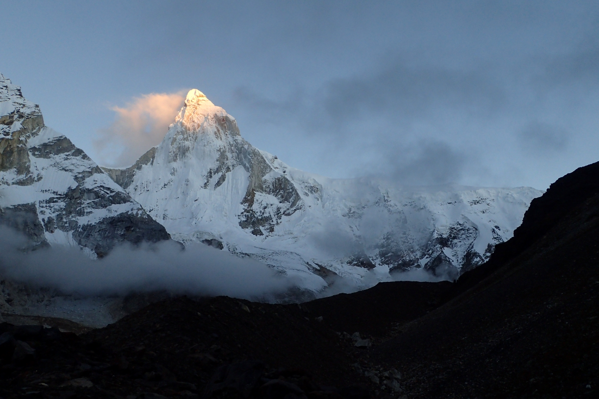
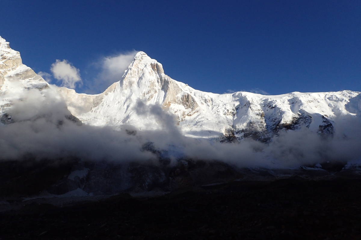
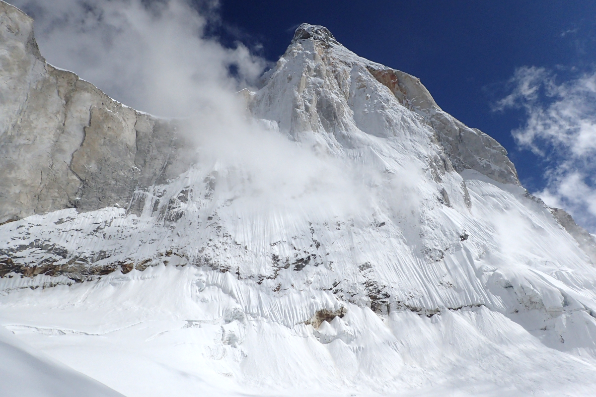
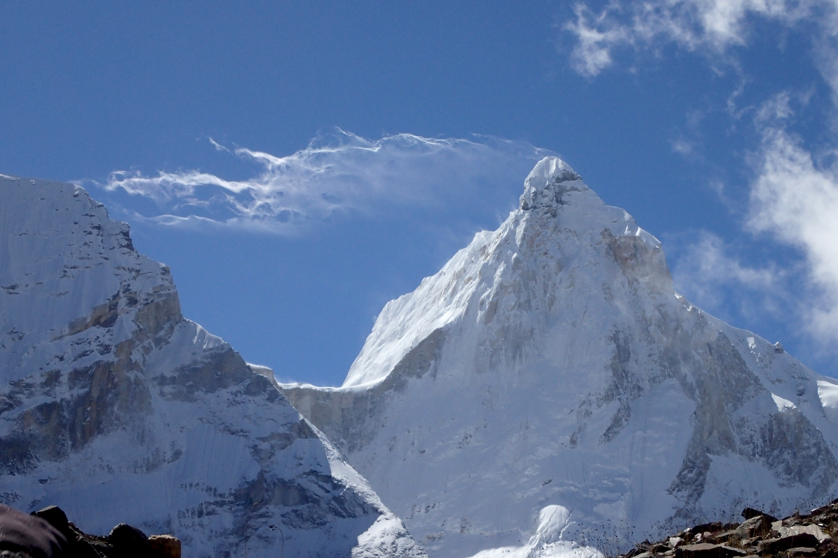
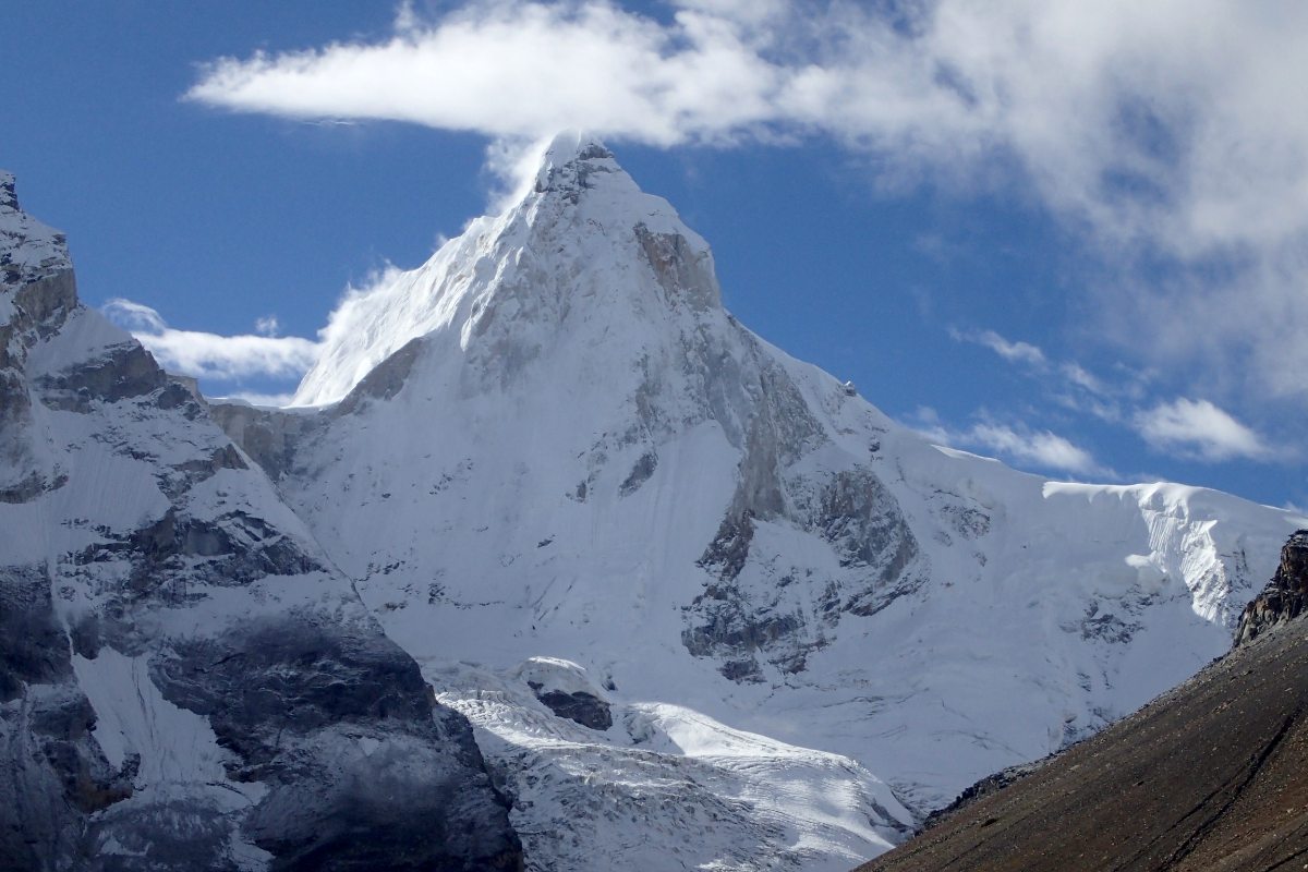
Shivling Panoramic
Sharada Prasad CS (Wikipedia)

![]()
Shivling is a mountain in the Gangotri Group of peaks in the western Garhwal Himalaya, near the snout of the Gangotri Glacier, one of the biggest glaciers in the Himalayas, and Tapovan, a beautiful lush meadows, both being also popular pilgrimage sites in Hinduism. It lies in the northern Indian state of Uttarakhand, 6 kilometres (4 mi) south of the Hindu holy site of Gaumukh (the source of the Bhagirathi River). Its name refers to its status as a sacred symbol – Shiva Linga. It was called “Matterhorn Peak” by early European visitors because of its similarity in appearance to that Alpine peak. While not of locally great elevation, it is a dramatic rock peak, and the most visually striking peak as seen from Gaumukh; that and the difficulty of the climb make it a famed prize for mountaineers.
The mountain and its setting
Shivling forms the western gateway for the lower Gangotri Glacier, opposite the triple-peaked Bhagirathi massif. It lies on a spur projecting out from the main ridge that forms the southwest side of the Gangotri Glacier basin; this ridge contains other well-known peaks such as Bhagirathi, Thalay Sagar and Meru.
It was also called Mahadeo Ka Linga or (Mahadev Ka Linga) Appearing as a single pyramid when seen from Gaumukh, Shivling is actually a twin-summitted mountain, with the northeast summit being slightly higher than the southwest summit, 6,501 m (21,329 ft). Between Gaumukh and Shivling lies the Tapovan meadow, a popular pilgrimage site due to its inspiring view of the mountain. Shivling is well-defended on all sides by steep rock faces; only the west flank has a moderate enough slope for snow accumulation.[4]
Climbing history
After British exploration of the Gangotri Glacier in 1933, a German expedition led by R. Schwarzgruber climbed nearby peaks and did a reconnaissance of Shivling in 1938. They reported “no feasible route” on the mountain due to its steepness and the threat of falling seracs.[4]
Shivling was first climbed on 3 June 1974 via the west ridge, by a team from the Indo-Tibetan Border Police, led by Hukam Singh. The ridge is the lowest-angle feature on the mountain, but still involves serious mixed climbing, and is threatened by the serac barrier noted by the Germans. The ridge leads to the col between the two summits; a steep snow/ice ridge then leads to the main summit.[3]
Since the first ascent, at least ten other routes have been climbed on the peak, ascending all major ridges and most major faces of the mountain. All routes are extremely serious undertakings.[4]
The North Pillar route was climbed in 1993 by Hans Kammerlander and Christoph Hainz.
In 2004 Shirshendu Mukherjee became the youngest person in the world to have climbed the mountain at the age of 19 as a part of an Indian expedition.
In 2005, Basanta Singha Roy and Debashis Biswas, both climbers from Mountaineers Association of Krishnanagar (MAK), West Bengal, India, were the first successful summiters from India, as a part of a civilian effort i.e. climbed by the help of a Sherpa guide with an expedition style.[5]
On 25 May 2012, Valery Rozov made the first BASE jump from the summit of Shivling at an altitude of 6,420 metres (21,060 ft) wearing a wingsuit.[6]
This article uses material from the Wikipedia article Shivling, which is released under the Creative Commons Attribution-Share-Alike 4.0 International License (view authors).
 Schwiki (Wikipedia) I | 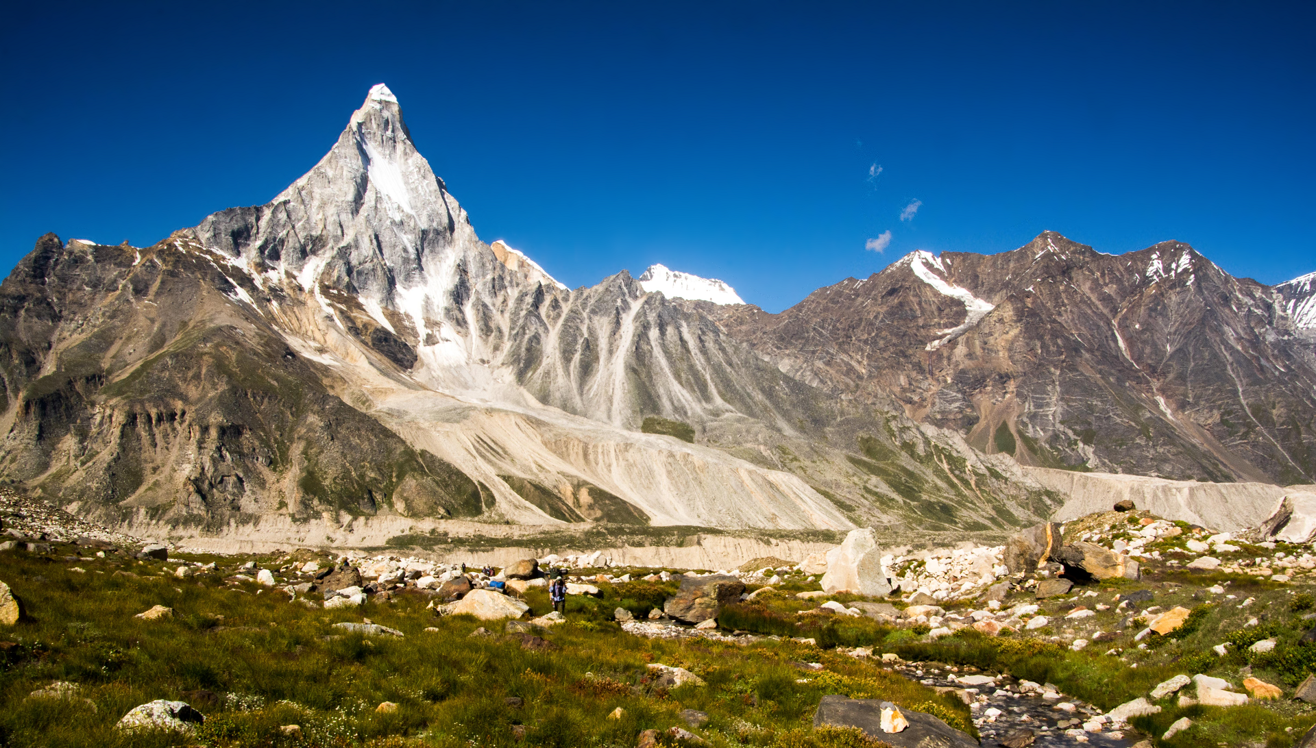 Sharada Prasad CS (Wikipedia) |
 I I | 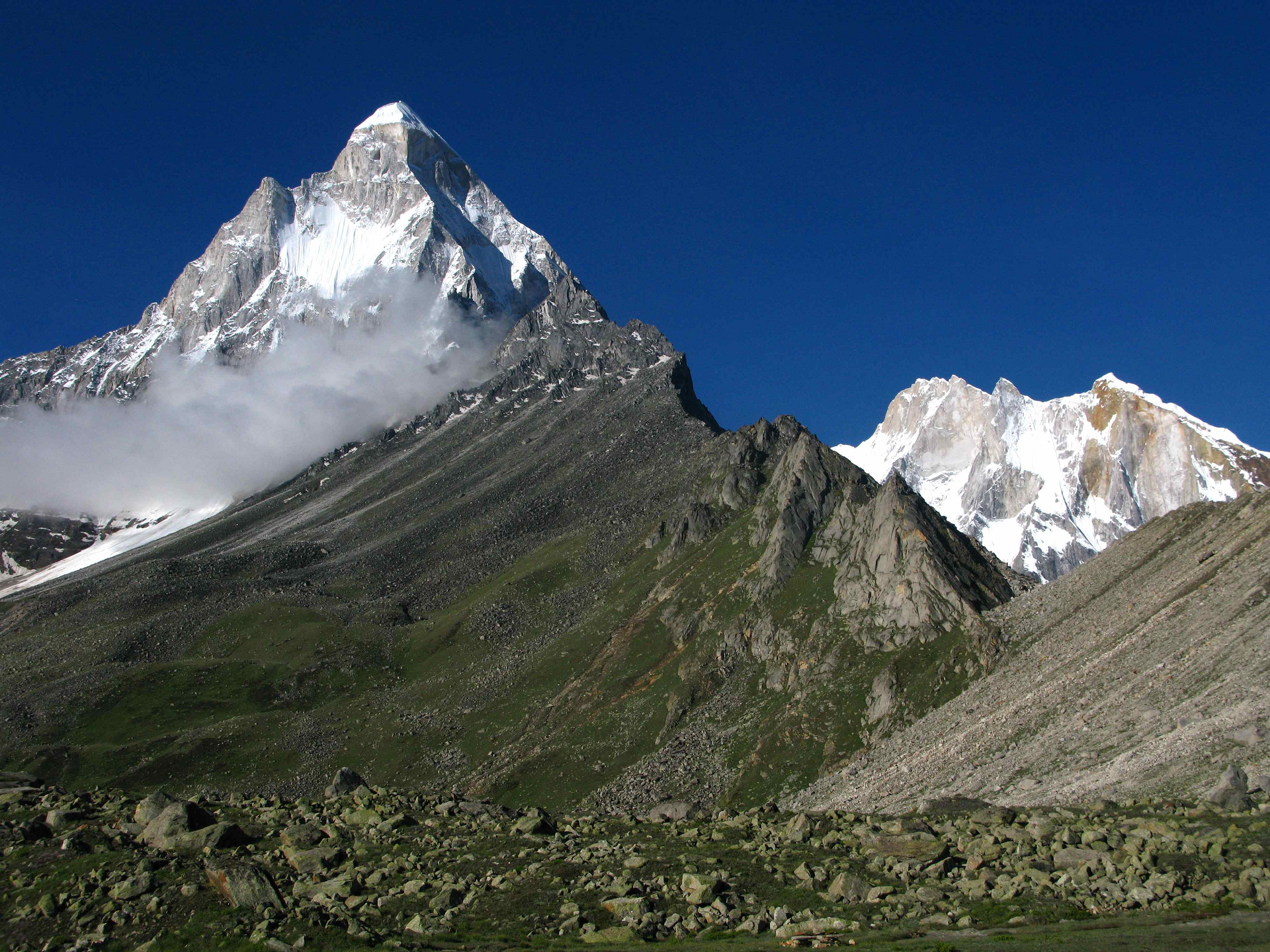 lluis Cabarrocas Ribas (Wikipedia) |
 DipankarSen68 (Wikipedia) | 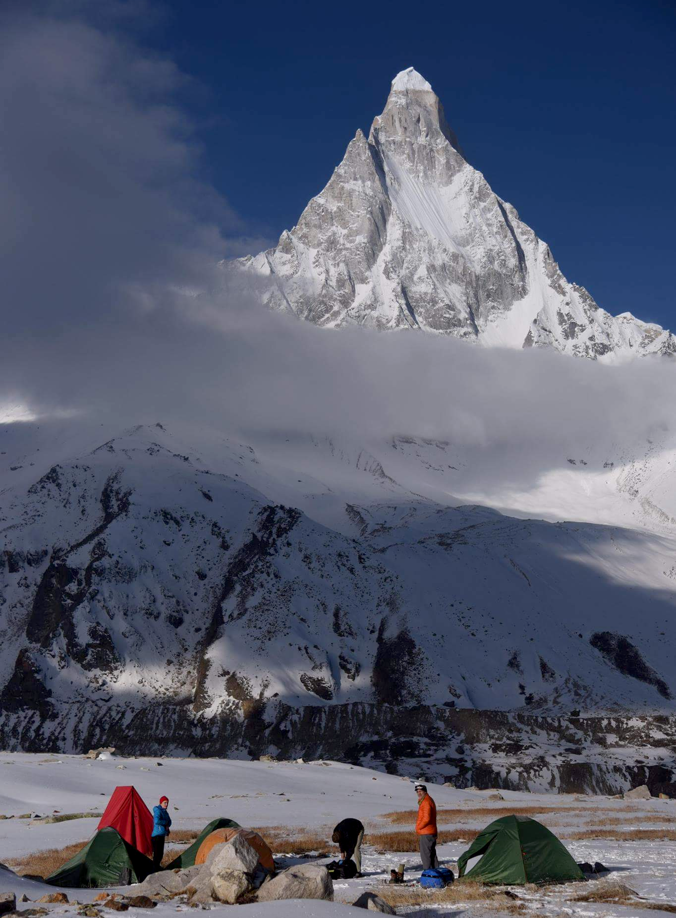 Parth Upadhyaya |
 IHimalayan Dream Treks | 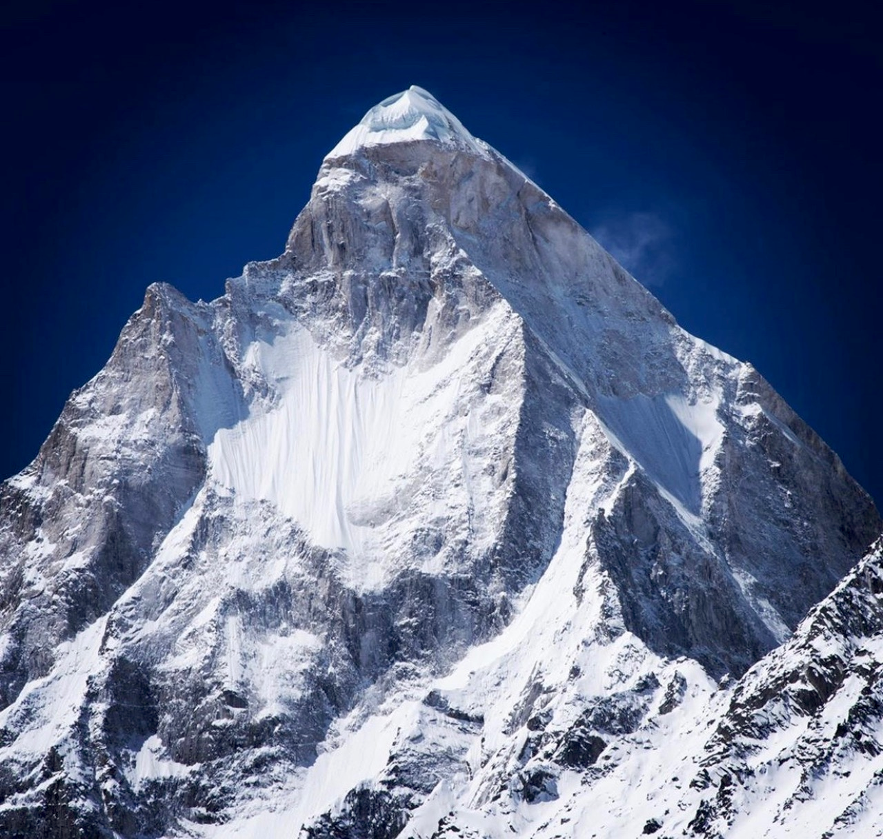 Himalayan Alpine Guides |
Taboche Panoramic

Derek Boniecki
![]()
![]()
Taboche (also known as Tawoche, Tobuche, Tāuje, Taweche, Tawache or Tawetse) is a mountain in the Khumbu region of the Nepalese Himalaya. Taboche is connected to Cholatse by a long ridge. Taboche lies directly across the Imja River from Ama Dablam and above the villages of Pheriche and Dingboche.
The first ascent was made in 1974 by a French expedition led by Yannick Seigneur and the clarinettist and composer Jean-Christian Michel.[2] The summit team included Louis Dubost, Paul Gendre and Jacques Brugirard.
Other notable ascents
2009 Direct North Face (VI AI5 R, 1500m). First ascent by Giri-Giri Boys Fumitaka Ichimura and Genki Narumi (Japan). Summit attained November 28.[3]
1989 The direct north-east face of Taboche (Tawoche) was climbed in winter by Jeff Lowe and John Roskelley alpine-style during a ten-day push in February 1989. They reached the summit on February 13. The route follows the deep vertical cleft up the center of the face. The climb is documented in Last Days, a book by John Roskelley (1991).
This article uses material from the Wikipedia article Taboche, which is released under the Creative Commons Attribution-Share-Alike 4.0 International License (view authors).
 Creatingezra.com |  Namas Adventure |
 Jmaehl (iStock) | 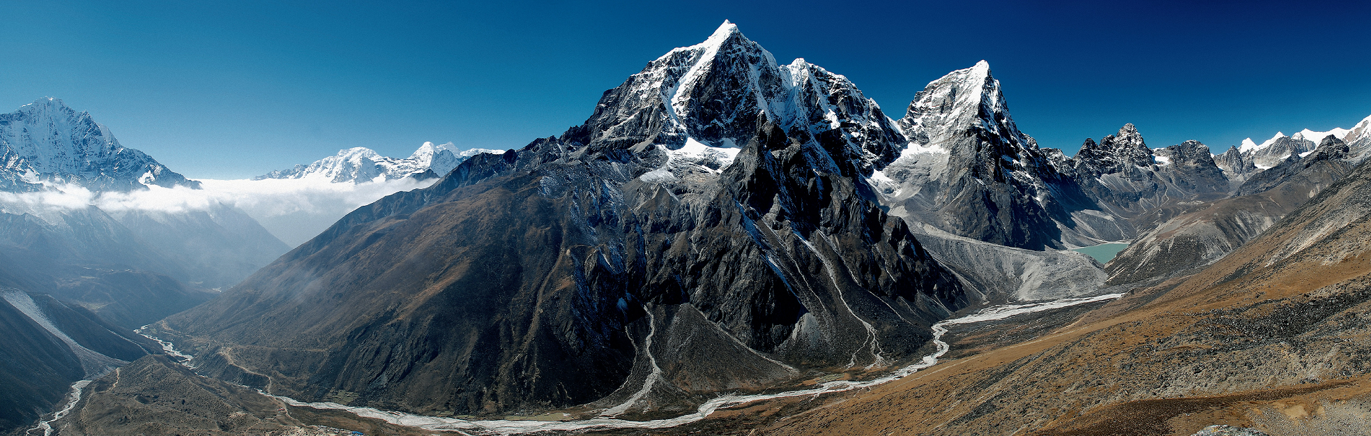 Etter Studio (Wikipedia) I |
 Niklassletteland (Wikipedia) | 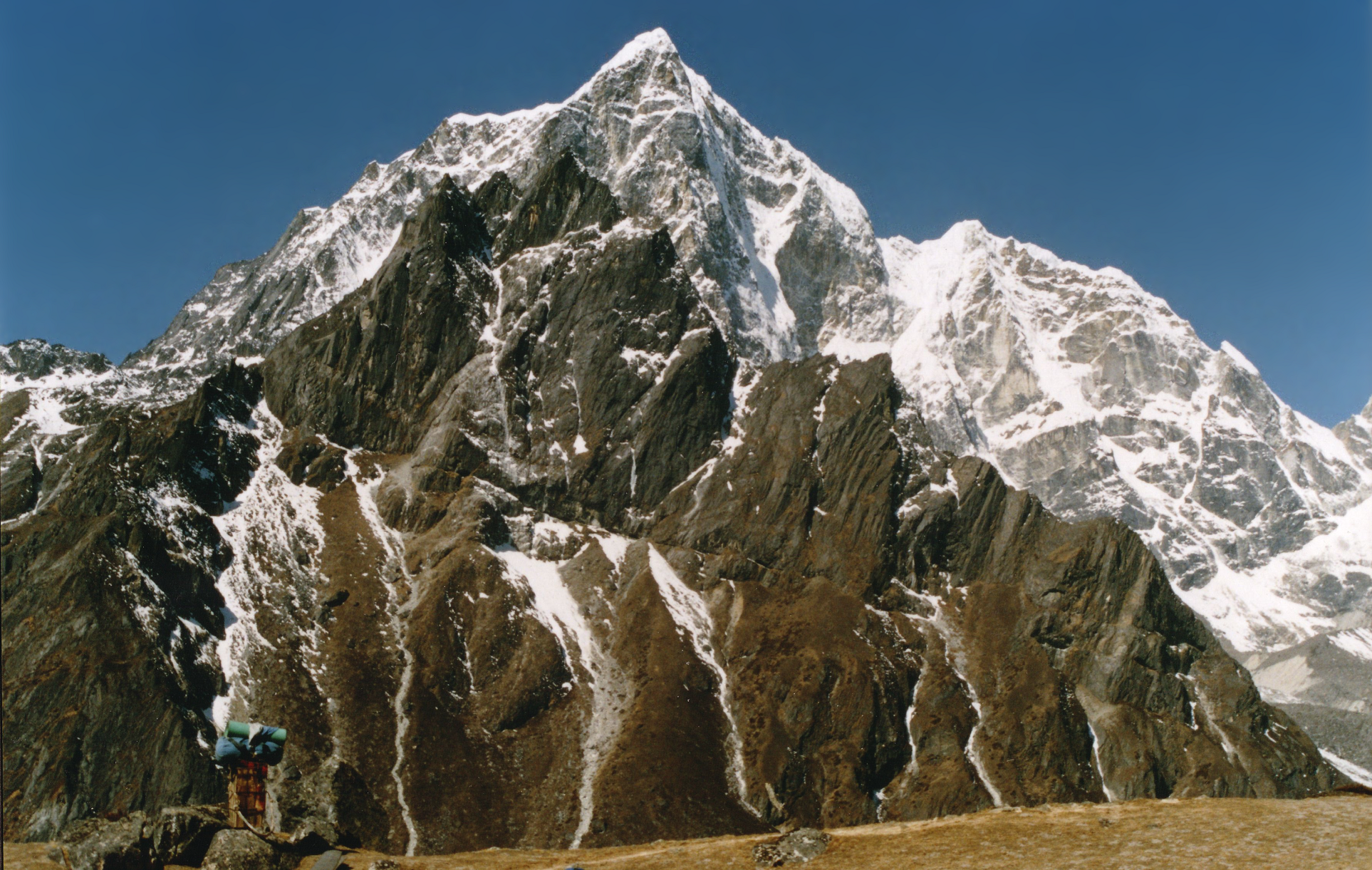 Uwe Gille (Wikipedia) I |
 McKay Savage (Wikipedia) | 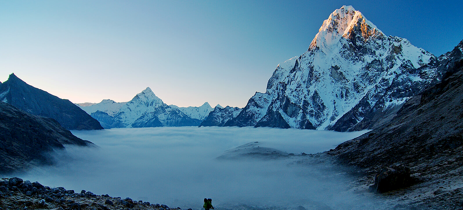 Nepal Hiking Team I |
Thalay Sagar Panoramic
Kailas98 (Wikipedia)

![]()
ShThalay Sagar is a mountain in the Gangotri Group of peaks in the western Garhwal Himalayas, on the main ridge that lies south of the Gangotri Glacier. It lies in the northern Indian state of Uttarakhand, 10 kilometres (6 mi) southwest of the Hindu holy site of Gaumukh (the source of the Bhagirathi River). It is the second highest peak on the south side of the Gangotri Glacier (after Kedarnath), but it is more notable for being a dramatic rock peak, steep on all sides, and a famed prize for mountaineers. It is adjacent to the Jogin group of peaks, and has the lake Kedartal at its base.
Climbing history
For military and geopolitical reasons foreign climbers were not permitted into most of the Garhwal region until the late 1970s. It was first climbed on 24 June 1979 via the northwest couloir and ridge and thence across the shale band of the North Face by an Anglo-American team comprising Roy Kligfield, John Thackray, and Pete Thexton.[4]
Since the first ascent, many other routes have been climbed on the peak, some of which have been test pieces of modern mountaineering. There have been at least 15 ascents[5] by at least 9 different routes. The north face of the peak, in particular, has been climbed by five different routes, some more direct than others. The key difficulty in the direct routes is a notorious band of shale near the summit, which presents rotten and dangerous rock. The first route to climb directly through the shale band, instead of finishing on one of the ridges, was the Australian Route pioneered by Andrew Lindblade and Athol Whimp; it involves 1,400 m (4,600 ft) of climbing and is graded VII 5.9 WI5.[6] Their climb was awarded the Piolet d’Or in 1999.[7]
The first ascent of the Thalay Sagar NE face to the SE ridge was made by the Dutch team of Melvin Redeker, Mike Van Berkel and Cas Van de Gevel. They climbed in an 11-day push from base camp to summit, including time spent waiting out bad weather. The Dutch climbers were the eighth team that reached the summit.[8][9][10]
In 2008 the first successful Indian ascent was accomplished by Basanta Singha Roy the famous climber from Mountaineers Association Of Krishnanagar(MAK), West Bengal, India, along with three sherpas (Pemba sherpa, pasangh sherpa & Phurba sherpa).[11]
On 22 July 2012 Tusi Das, a 28-year-old woman climber from Kolkata summited the peak. She was the sole climber in the five-member women’s team from the Alipore-based Kolkata Albatross Adventure Society to reach the summit. It was the first woman ascent to Mt Thalay Sagar recorded so far.[12]
This article uses material from the Wikipedia article Thalay Sagar, which is released under the Creative Commons Attribution-Share-Alike 4.0 International License (view authors).
 Soumit Ban (Wikipedia) | 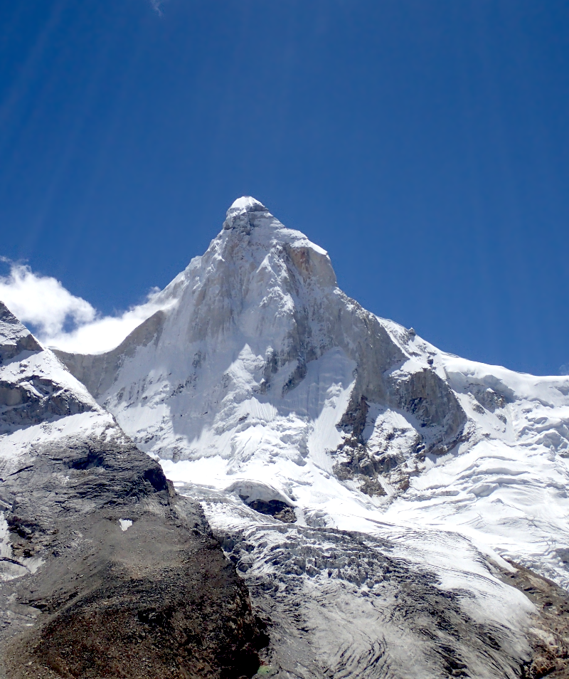 |
 |  |
 |  |
 |  |
