
Map of Eastern Rift Mountains


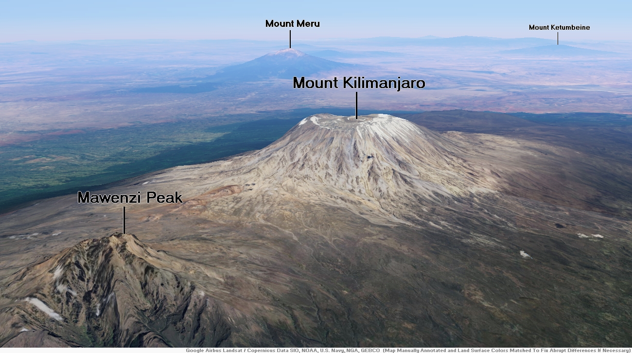
Mount Kilimanjaro Region
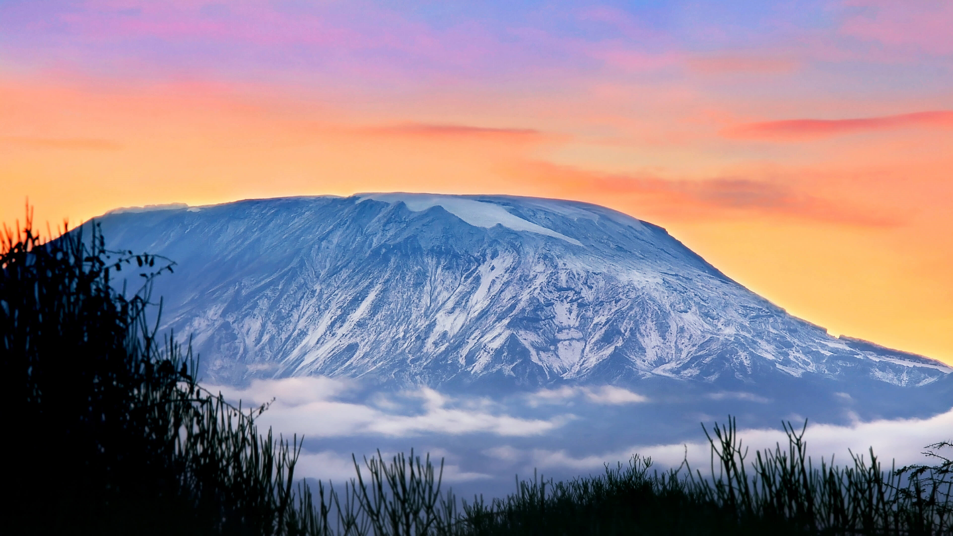
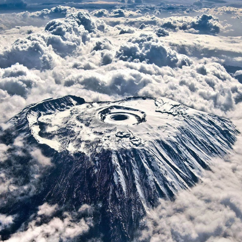
Mount Kilimanjaro Panoramic


![]()
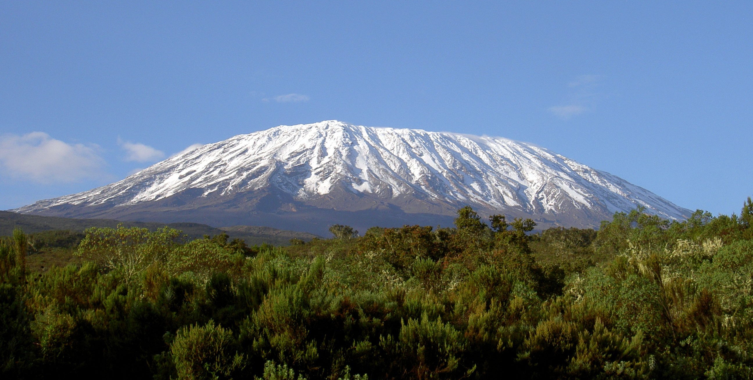
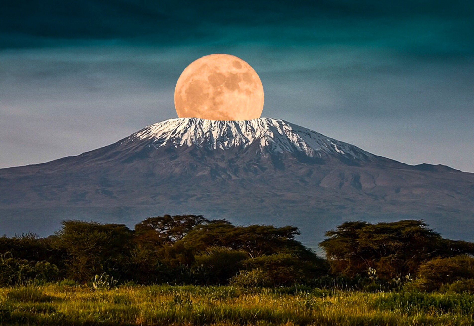
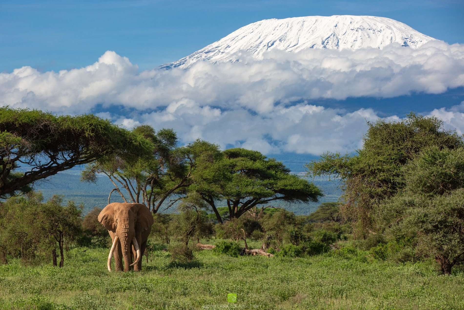
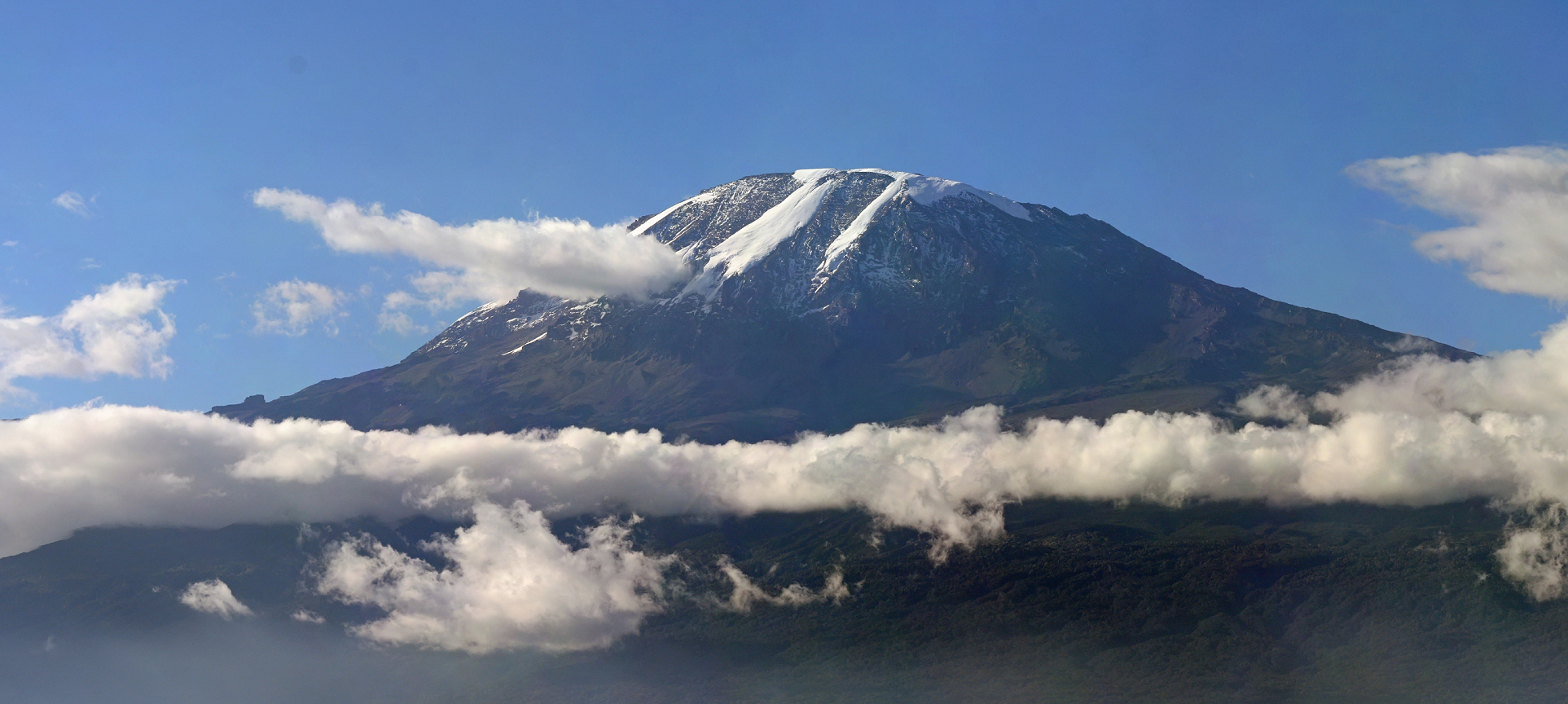
Mount Kilimanjaro (/ˌkɪlɪmənˈdʒɑːroʊ/)[4] is a dormant volcano in Tanzania. It is the highest mountain in Africa and one of the highest free-standing mountain above sea level in the world, at 5,895 m (19,341 ft) above sea level and 4,900 m (16,100 ft) above its plateau base. It is also the highest volcano in the Eastern Hemisphere and the fourth most topographically prominent peak on Earth.
Kilimanjaro’s southern and eastern slopes served as the home of the Chagga Kingdoms until their abolition in 1963 by Julius Nyerere. The origin and meaning of the name Kilimanjaro is unknown, but may mean “mountain of greatness” or “unclimbable”. Although described in classical sources, German missionary Johannes Rebmann is credited as the first European to report the mountain’s existence, in 1848. After several European attempts, Hans Meyer reached Kilimanjaro’s highest summit in 1889.
The mountain was incorporated into Kilimanjaro National Park in 1973. As one of the Seven Summits, Kilimanjaro is a major hiking and climbing destination. There are seven established routes to Uhuru Peak, the mountain’s highest point. Although not as technically challenging as similar mountains, the prominence of Kilimanjaro poses a serious risk of altitude sickness.
One of several mountains arising from the East African Rift, Kilimanjaro was formed from volcanic activity over 2 million years ago [5]. Its slopes host montane forests and cloud forests. Multiple species are endemic to Mount Kilimanjaro, including the giant groundsel Dendrosenecio kilimanjari. The mountain possesses a large ice cap and the largest glaciers in Africa, including Credner Glacier, Furtwängler Glacier, and the Rebmann Glacier. This ice cap is rapidly shrinking, with over 80% lost in the 20th century. The cap is projected to disappear entirely by the mid-21st century.
Toponymy
The origin and meaning of the name Kilimanjaro is disputed. Although the Chagga people of the Kilimanjaro region have no name for the mountain, they call its two peaks Kipoo and Kimawenze. The peaks’ names—usually rendered Kibo and Mawenzi—mean “spotted” in reference to Kibo’s snow and “broken top” due to Mawenzi’s jagged peak. “Kilimanjaro” may originate from the Chagga calling the mountain unclimbable—kilemanjaare or kilemajyaro—and explorers misinterpreting this as its name. This Kichagga language etymology relies on kileme, “that which defeats”, or kilelema, “that which has become difficult or impossible”. The -jaro could be derived from njaare, a bird, or jyaro, a caravan.[6]
Early Western etymologies used a compound Swahili origin, with kilima translated as “mountain”.[6] In 1860, Johann Ludwig Krapf wrote that the Swahilis used the name Kilimanjaro and that it meant either “mountain of greatness” or “mountain of caravans”, with a translation of njaro as greatness or jaro as “caravans”.[6][7] In 1885, Scottish explorer Joseph Thomson reported “white mountain” as an alternative, with njaro denoting whiteness.[6][8] This Swahili etymological approach is criticized as kilima is a diminutive of mlima (mountain) and actually means “hill”. However, mlima may have been misreported as kilima via conflation with the two peaks’ names, Kipoo and Kimawenze.[6]
Krapf mentions an 1849 visit with a Wakamba chief that called the mountain Kima jajeu, meaning “mountain of whiteness”.[6][9] Another explanation is that jyaro may refer to a god or a deity that guarded the mountain from trespassers.[6]
In the 1880s, the mountain became part of German East Africa and was called Kilima-Ndscharo in German.[10] In 1889, Hans Meyer reached the highest summit on Kibo, which he named Kaiser-Wilhelm-Spitze for Kaiser Wilhelm.[11] Following the Zanzibar Revolution and the formation of Tanzania in 1964, the summit was renamed Uhuru Peak: “Freedom Peak” in Swahili.
This article uses material from the Wikipedia article Mount Kilimanjaro, which is released under the Creative Commons Attribution-Share-Alike 4.0 International License (view authors).
 |  |
 Suzie Qkiu | 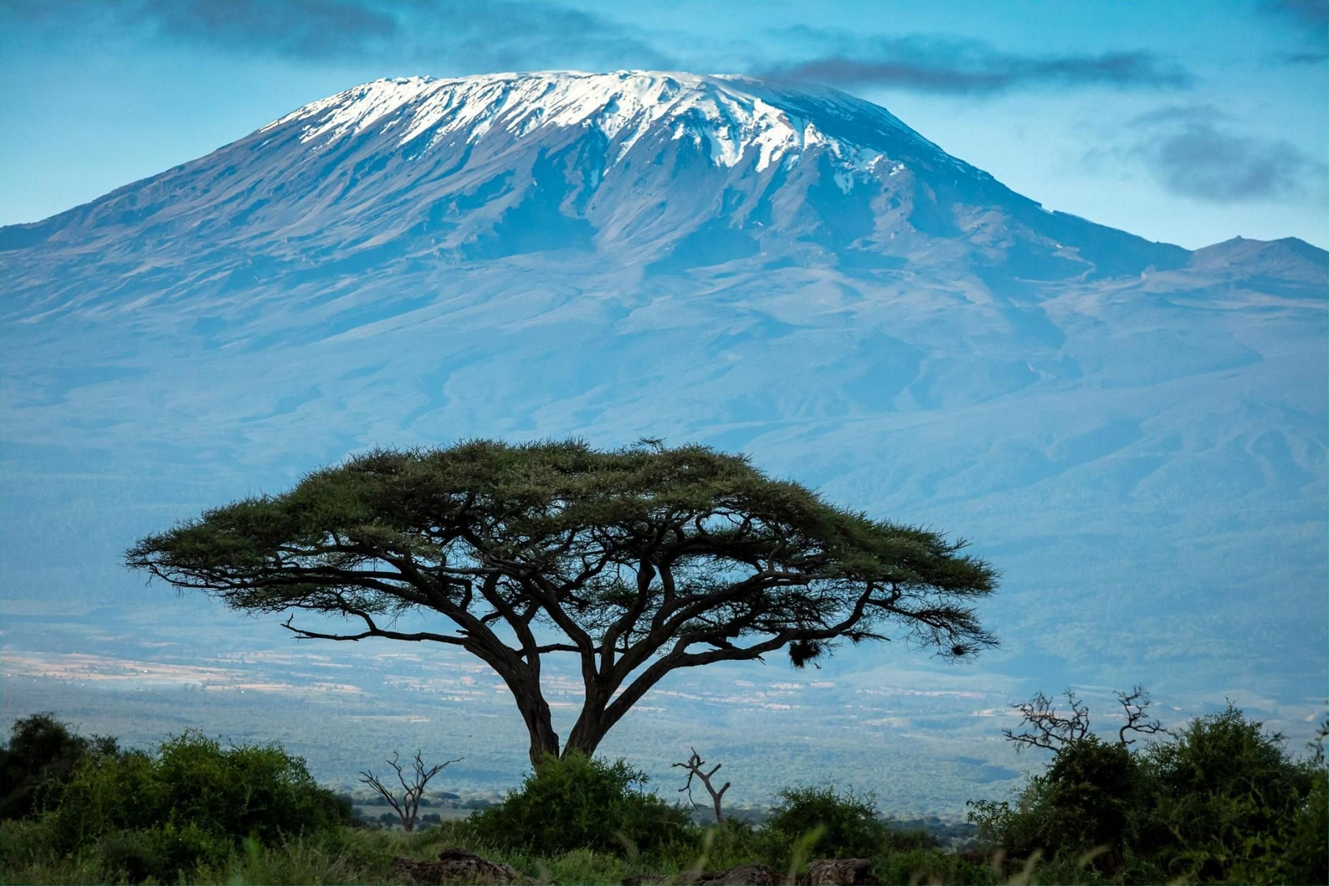 I |
 I I | 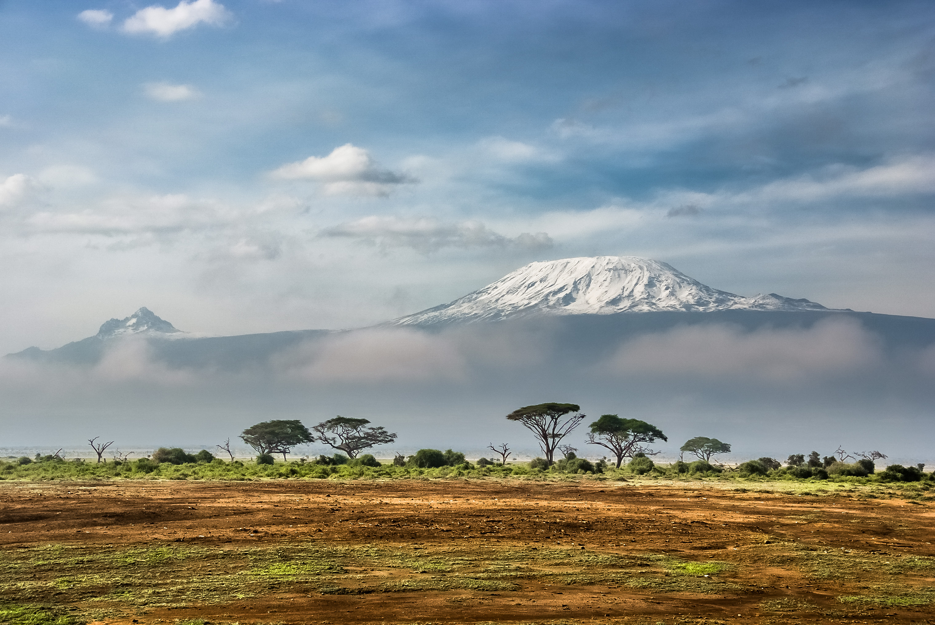 Sergey Pesterev (Wikipedia) |
 Muhammad Mahdi Karim (Wikipedia) | 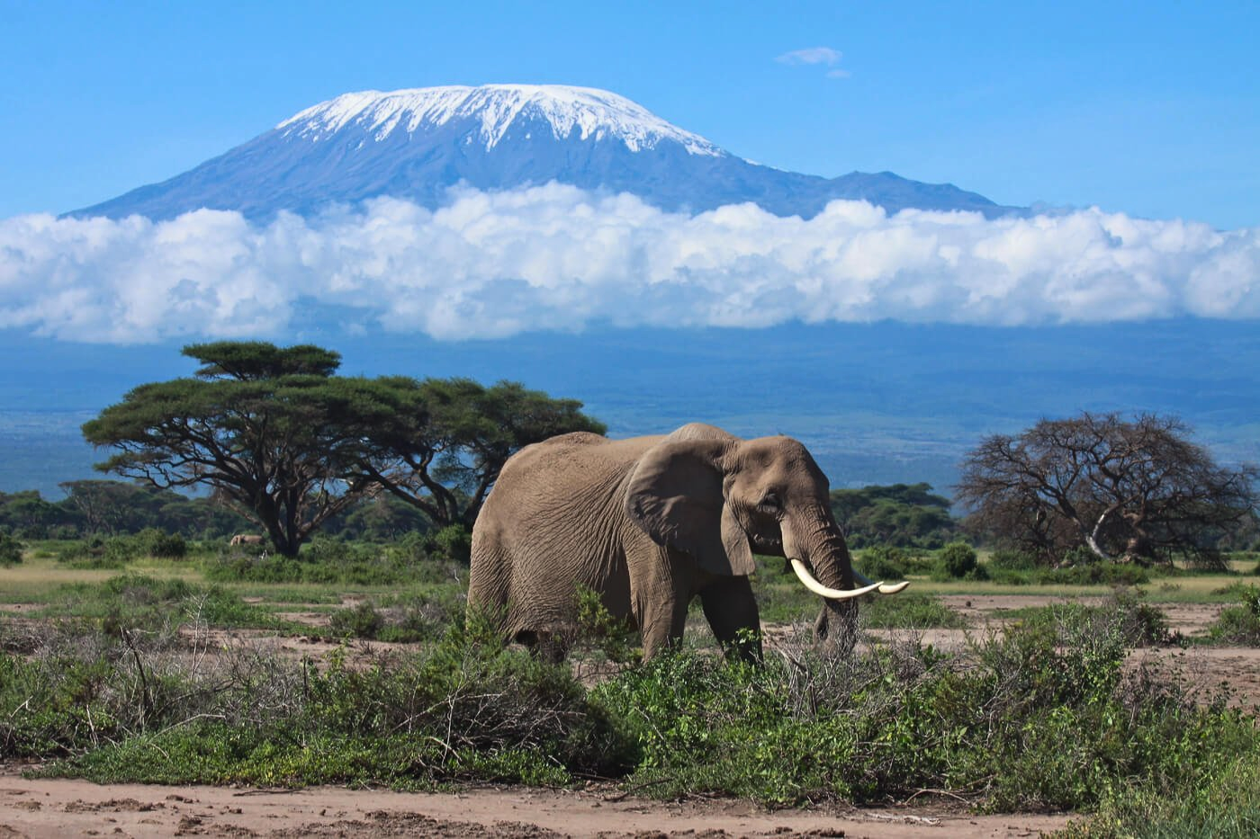 I I |

![]()
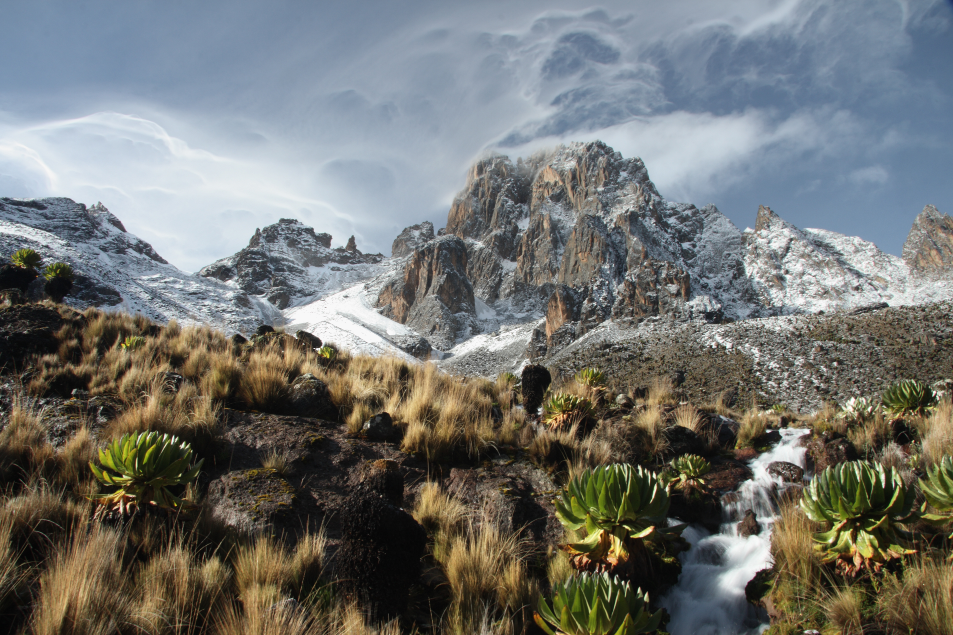
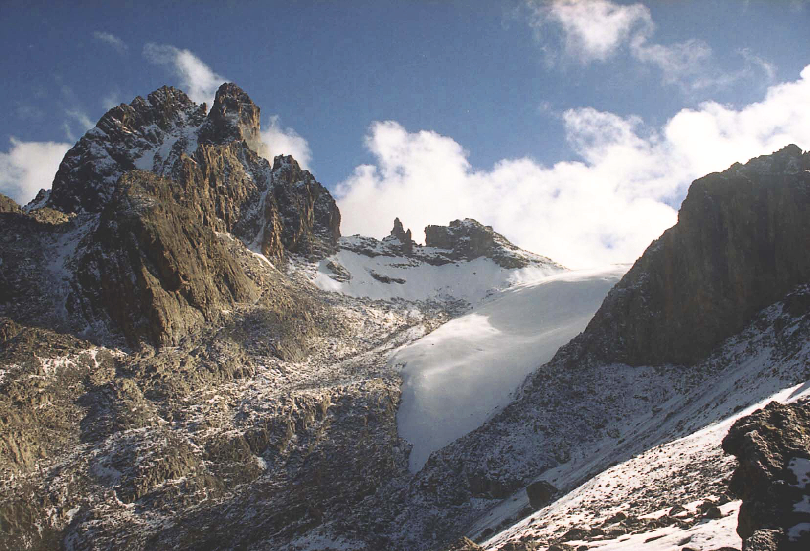
Mount Kenya (Meru: Kĩrĩmaara, Kikuyu: Kĩrĩnyaga, Kamba: Ki nyaa, Embu: Kĩ nyaga) is an extinct volcano in Kenya and the second-highest peak in Africa, after Kilimanjaro.[5] The highest peaks of the mountain are Batian (5,199 metres (17,057 feet)), Nelion (5,188 m (17,021 ft)) and Point Lenana (4,985 m (16,355 ft)). Mount Kenya is located in the former Eastern and Central provinces of Kenya; its peak is now the intersection of Meru, Embu, Kirinyaga, Nyeri and Tharaka Nithi counties, about 16.5 kilometres (10.3 miles) south of the equator, around 150 km (90 mi) north-northeast of the capital Nairobi.[6][5] Mount Kenya is the source of the name of the Republic of Kenya.
Mount Kenya is a volcano created approximately 3 million years after the opening of the East African Rift.[7] Before glaciation, it was 7,000 m (23,000 ft) high. It was covered by an ice cap for thousands of years. This has resulted in very eroded slopes and numerous valleys radiating from the peak.[8][9] There are currently 11 small glaciers, which are shrinking rapidly, and may disappear by 2050.[10] The forested slopes are an important source of water for much of Kenya.[11]
There are several vegetation bands from the base to the peak.[12] The lower slopes are covered by different types of forest. Many alpine species are endemic to Mount Kenya, such as the giant lobelias and senecios and a local subspecies of rock hyrax.[13] An area of 715 km2 (276 sq mi) around the centre of the mountain was designated a National Park and listed as a UNESCO World Heritage Site in 1997.[14] The park receives over 16,000 visitors per year.[15][11]
Mount Kenya National Park
Main article: Mount Kenya National Park
Mount Kenya National Park, established in 1949, protects the region surrounding the mountain. Currently, the national park is within the forest reserve which encircles it.[16] In April 1978 the area was designated a UNESCO Biosphere Reserve.[17] The national park and the forest reserve, combined, became a UNESCO World Heritage Site in 1997.[14]
The Government of Kenya had four reasons for creating a national park on and around Mount Kenya. These were the importance of tourism for the local and national economies, preserving an area of great scenic beauty, conserving the biodiversity within the park, and preserving the water catchment for the surrounding area.[11]
Kenya’s government has announced a project to discourage animals from straying into small holdings surrounding the Park and devastating crops, which will see the Park enclosed by an electric fence with five electrified strands. Kenya’s Rhino Ark Trust, a non-profit organization, has been putting up fences in key areas around the country. As of 2021, 250 kilometres (160 miles) out of a planned 450 kilometres (280 miles) have been constructed in the Mt. Kenya area.[18] The fence discharges an electric shock, but is not dangerous to humans or animals.[19]
Local culture
The main ethnic groups living around Mount Kenya are Kikuyu, Ameru, Embu and Maasai. The first three are Bantus while the Maasai are Nilotes. The mountain is as an important aspect of their cultures. They arrived in the Mount Kenya area in the last several hundreds of years.
This article uses material from the Wikipedia article Mount Kenya, which is released under the Creative Commons Attribution-Share-Alike 4.0 International License (view authors).
 Wandering Nomad (iStock) | 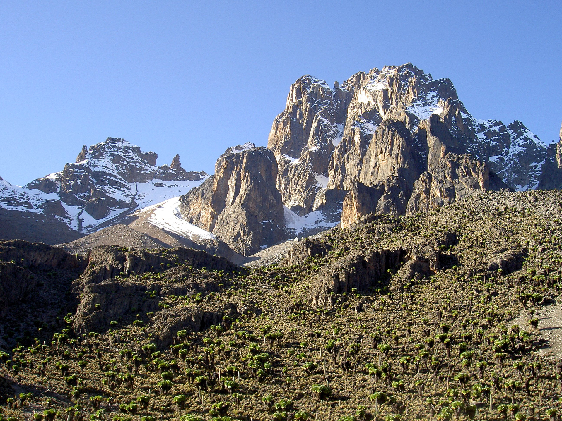 Chris 73 (Wikipedia) |
 Josski (Dutch Wikipedia) | 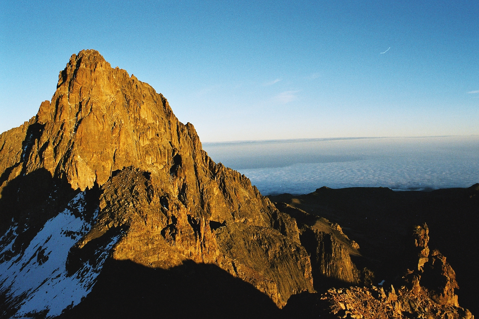 Hdahlmo (Wikipedia) |
