
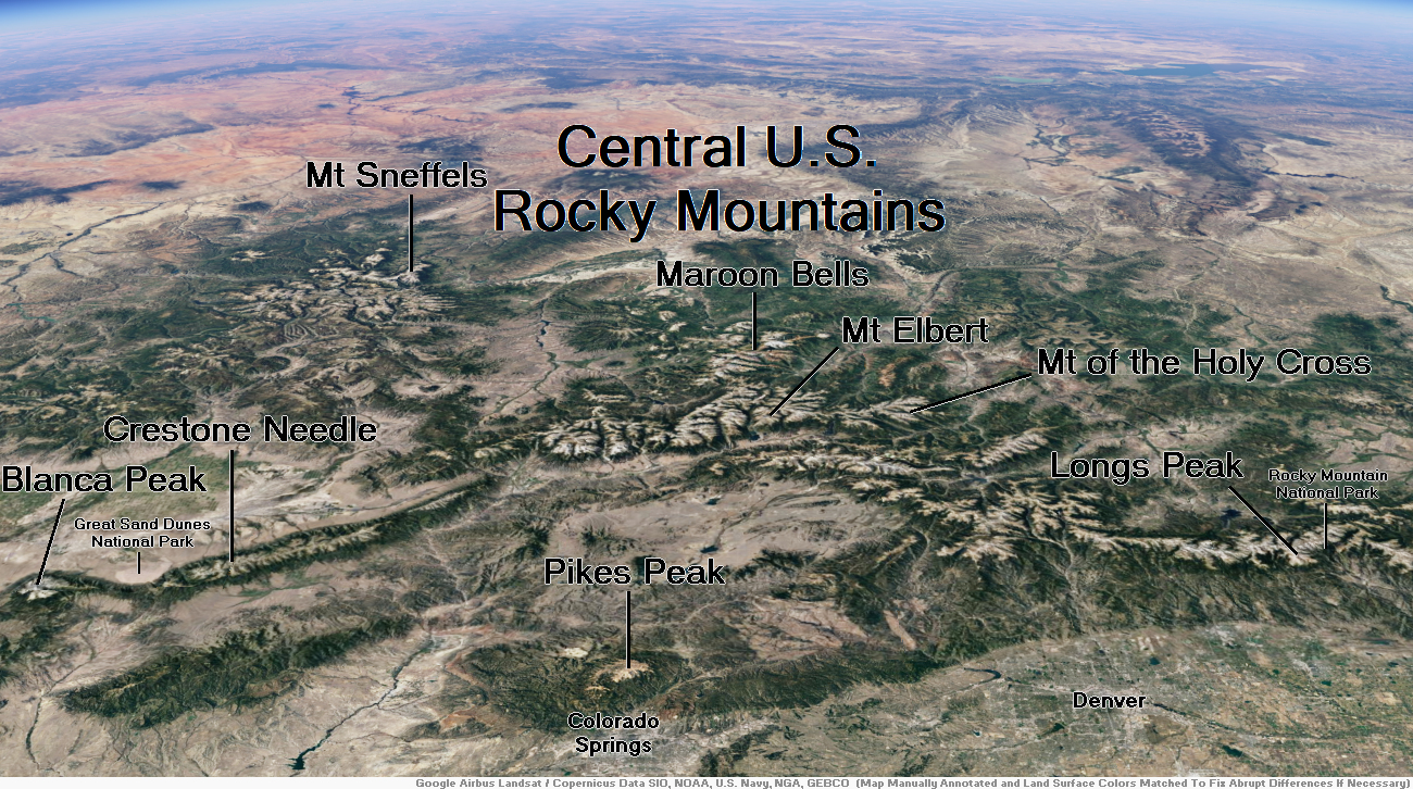
Map of Central U.S. Rockies
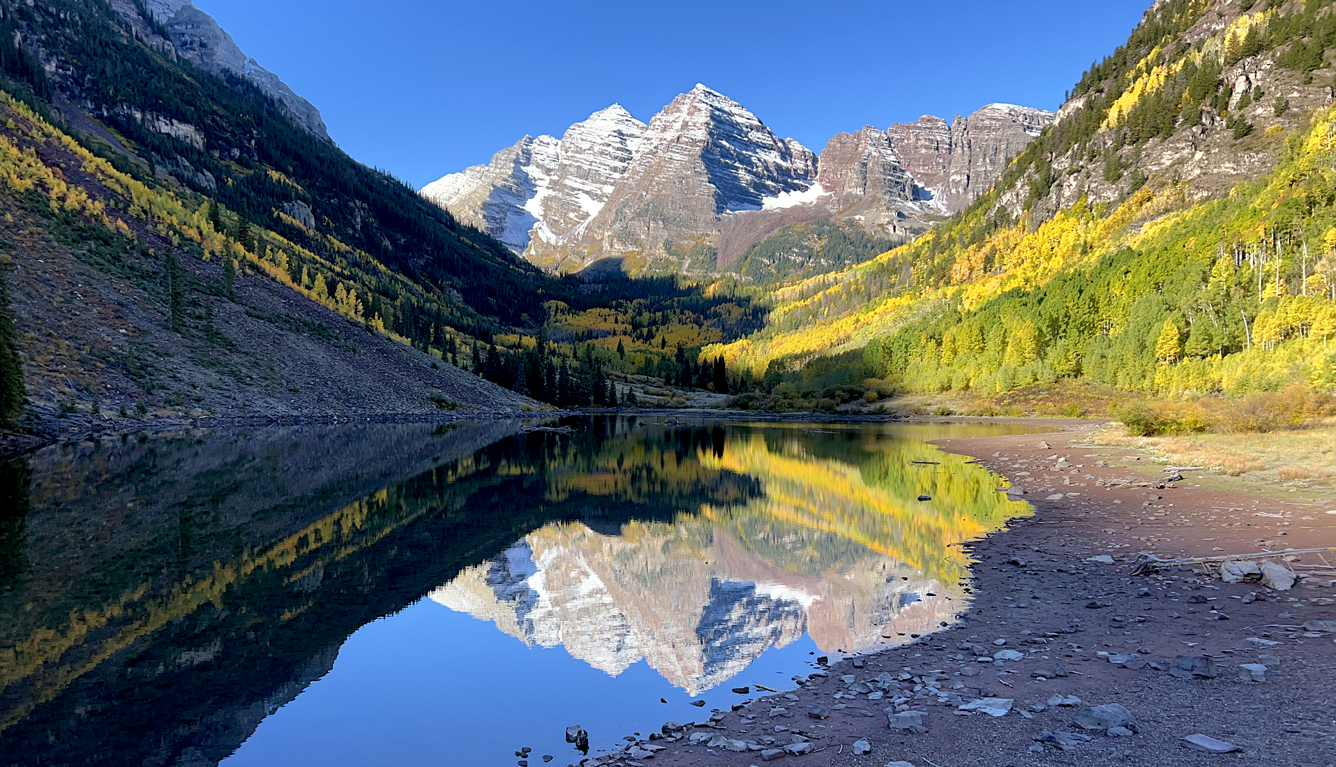
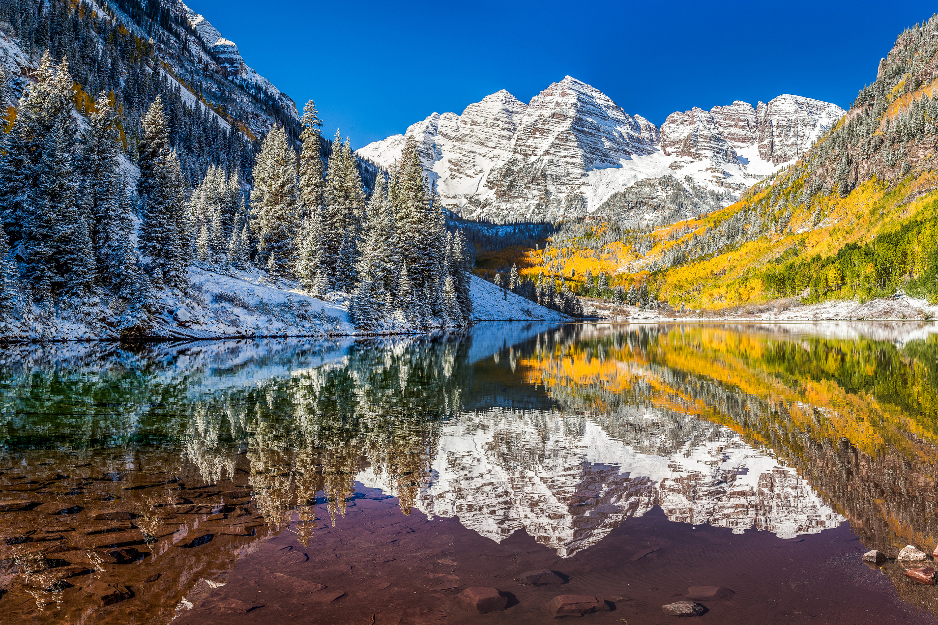
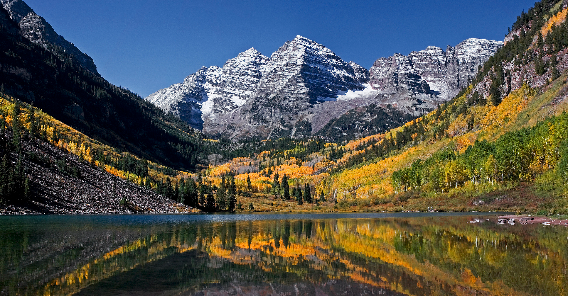
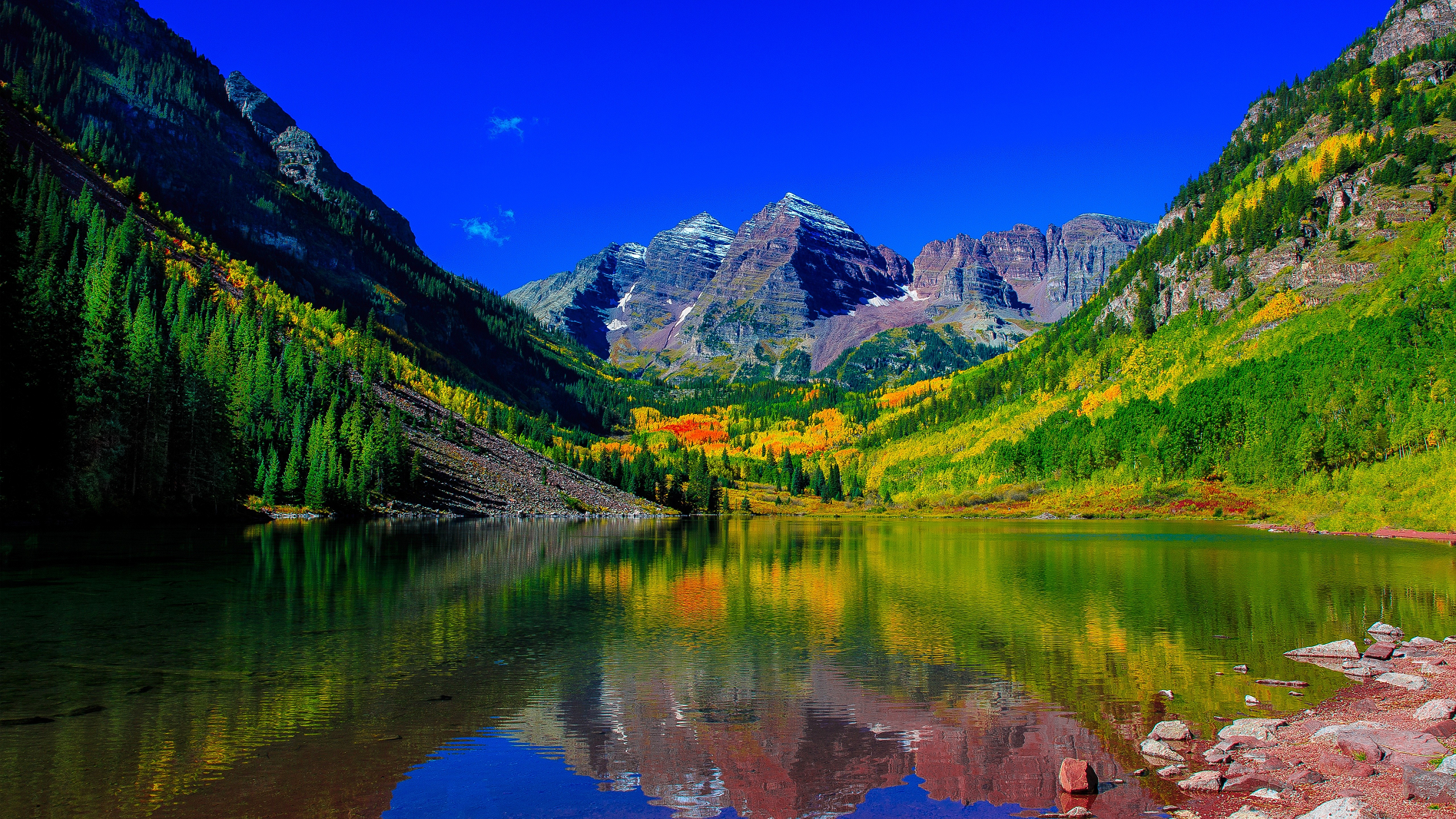
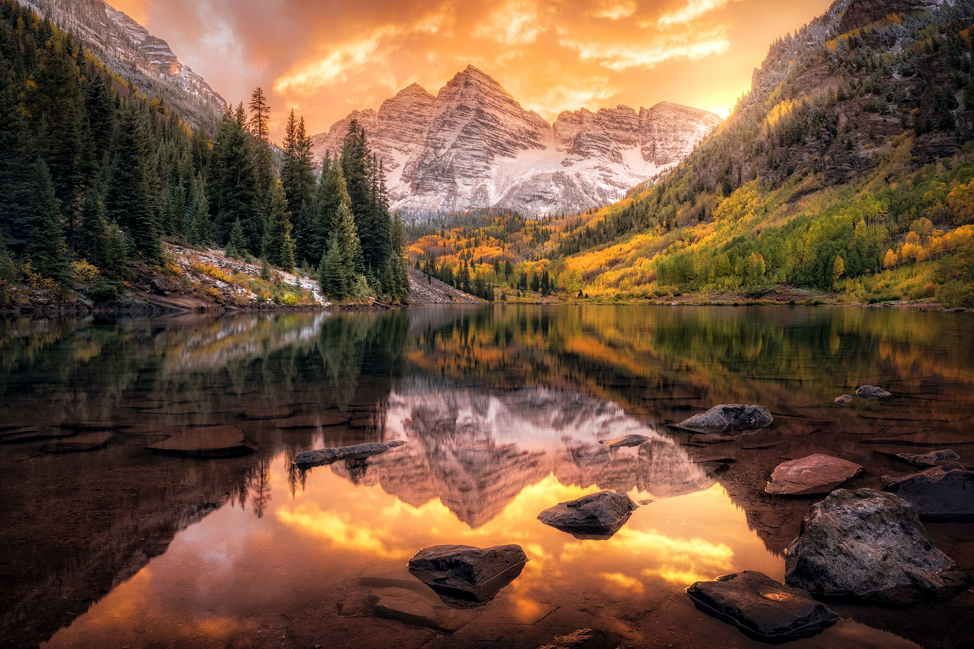
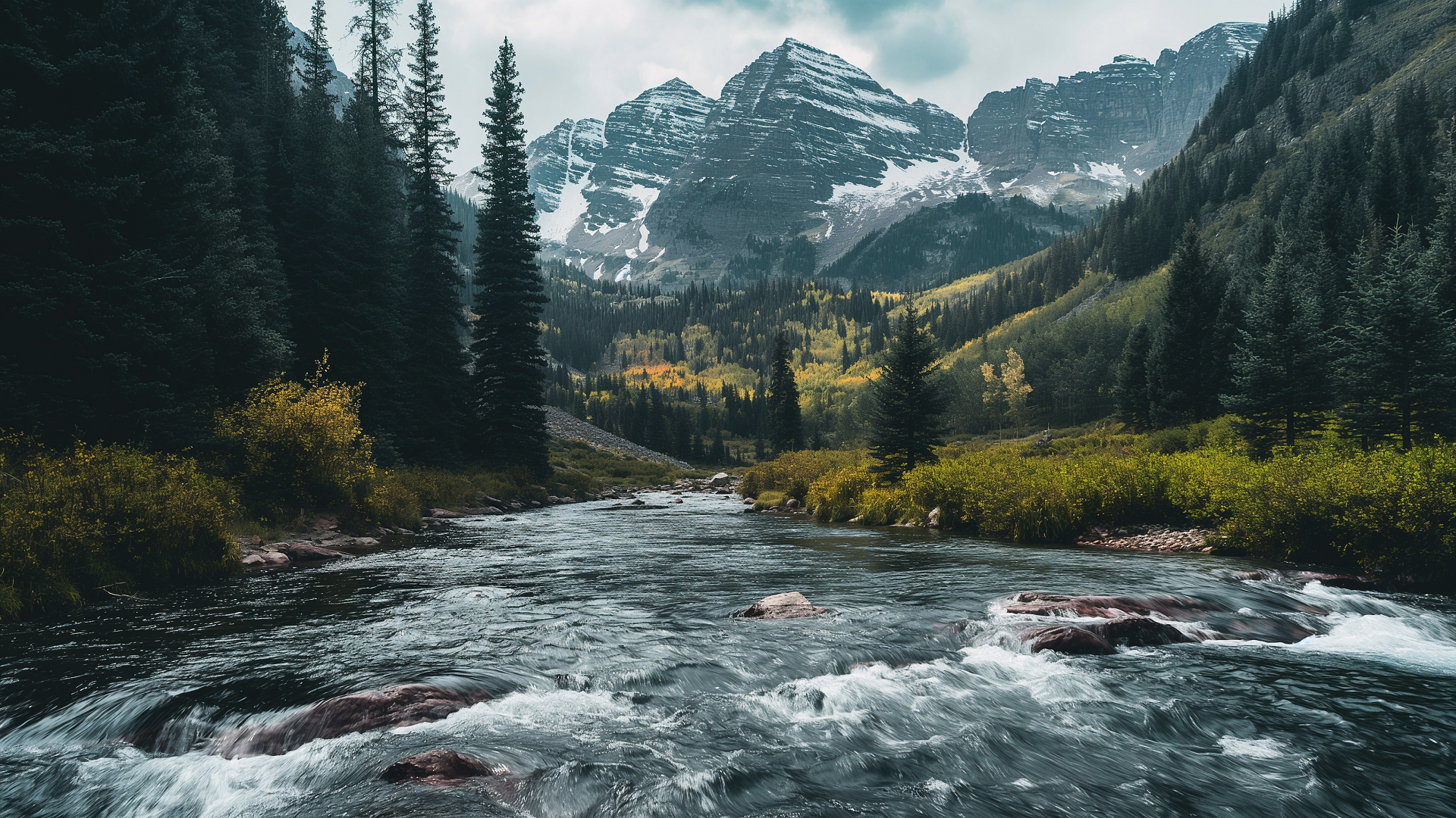
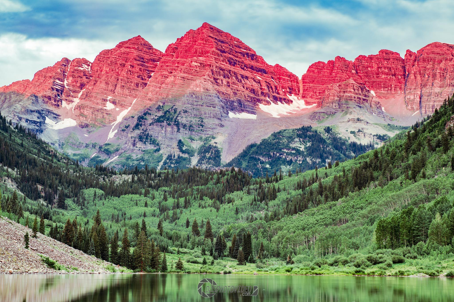
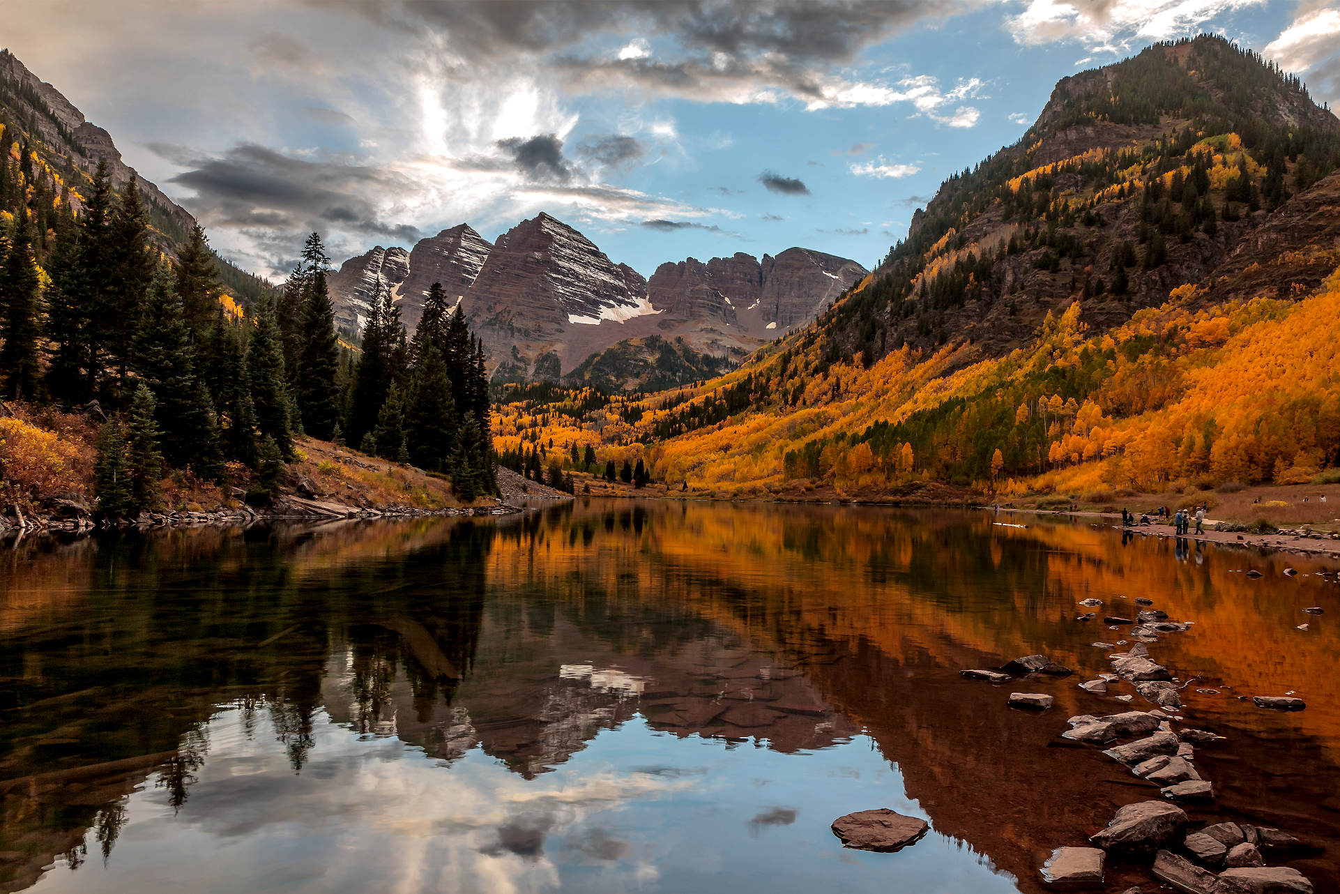
Maroon Bells Region
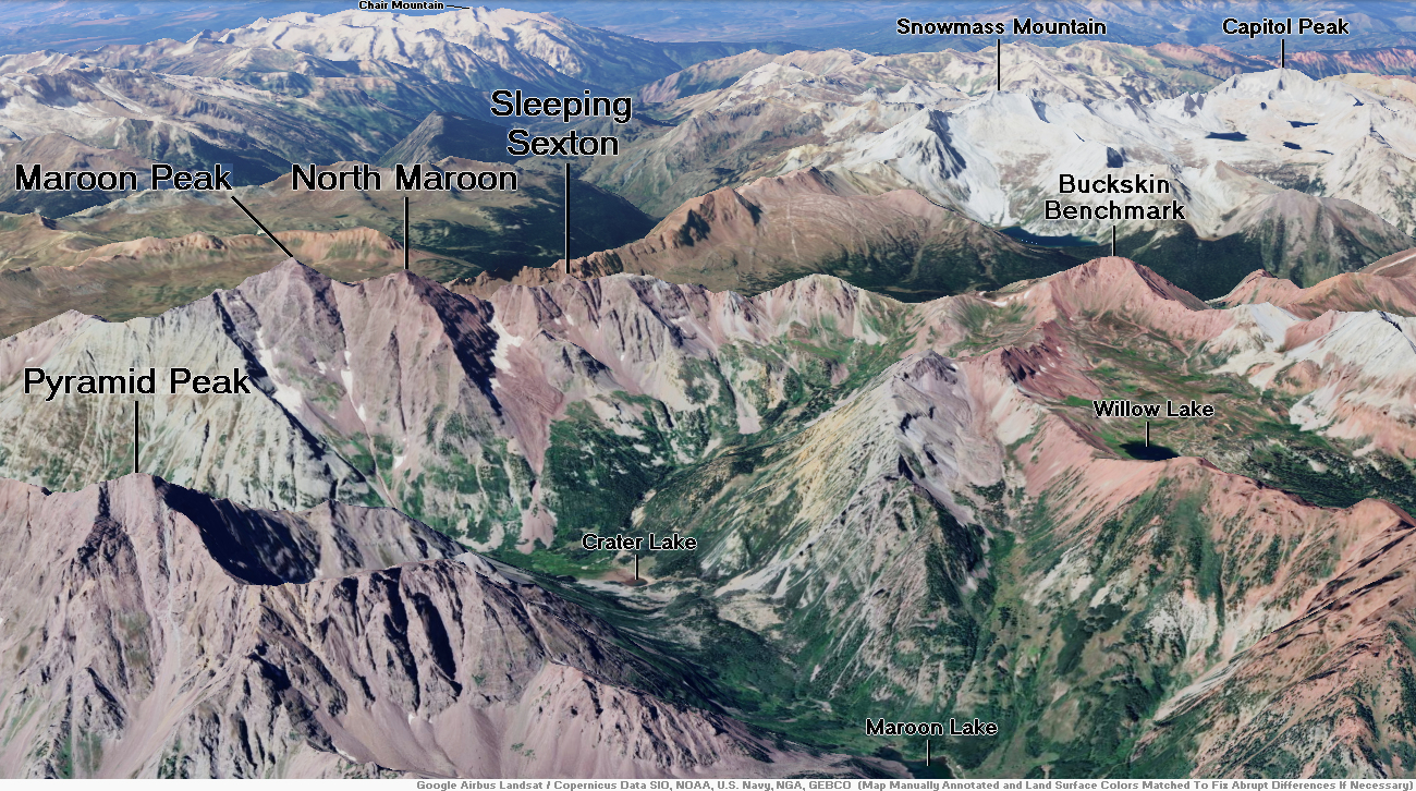
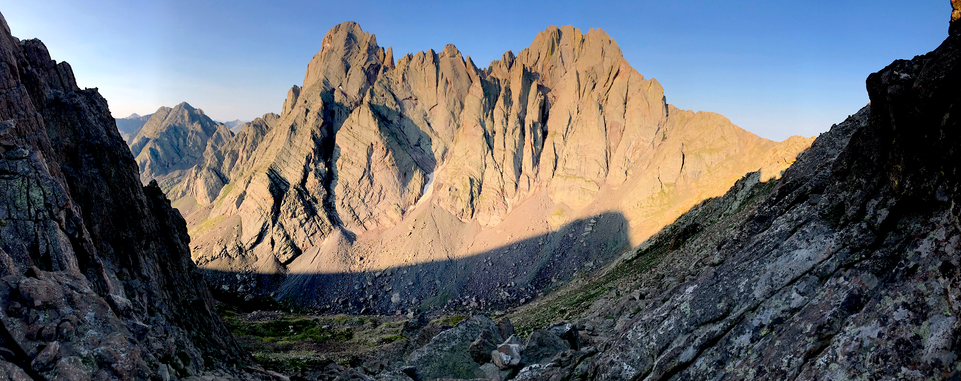
Maroon Bells Panoramic
Chris Broyles
Sep 24, 2025 at 8:44 am
The Maroon Bells are two peaks in the Elk Mountains, Maroon Peak and North Maroon Peak, separated by about half a kilometer (0.3 miles).[6] The mountains are on the border between Pitkin County and Gunnison County, Colorado, United States, about 19 kilometres (12 mi) southwest of Aspen. Both peaks are fourteeners. Maroon Peak, at 4,317 metres (14,163 ft), is the 27th highest peak in Colorado. North Maroon Peak, at 4,273 metres (14,019 ft), is the 50th highest (depending on how they are counted). The view of the Maroon Bells to the southwest from the Maroon Creek valley is very heavily photographed. The peaks are located in the Maroon Bells–Snowmass Wilderness of White River National Forest.[7][8] Maroon Bells-Snowmass Wilderness was one of five areas in Colorado designated as wilderness in the original Wilderness Act of 1964. The Wilderness area surrounds the extremely popular Maroon Bells Scenic Area, which is a major access point for Wilderness travel.[9]
Geology
The Maroon Bells are composed of Maroon Formation mudstone. Mudstone is weak and fractures readily, giving rise to dangerously loose rock along almost any route. A US Forest Service sign on the access trail warns would-be climbers of “downsloping, loose, rotten and unstable” rock that “kills without warning”. The mudstone is also responsible for the Bells’ distinctive maroon color. The Bells got their “deadly” reputation in 1965 when eight people died in five separate accidents.
Maroon Lake, elevation 2,920 m (9,580 ft), occupies a basin that was sculpted by Ice Age glaciers and later dammed by a landslide and rockfall debris from the steep slopes of Sievers Mountain above the valley floor.
Recreation
The Maroon Bells are an increasingly popular destination for the day and overnight visitors; around 300,000 people visit the Bells every season.[10] Due to the large volume of visitors, a bus service runs every day from 8am-5pm from mid-June through the first weekend in October. During these times, and with just a few exceptions, personal vehicle access is limited to those with handicap placards or disability license plates. The bus runs from Aspen Highlands to Maroon Lake every 20 minutes. The Maroon Bells scenic area features several hiking trails ranging from short hikes near Maroon Lake to longer overnight backpacking trips into the Maroon-Snowmass Wilderness.[11][12]
This article uses material from the Wikipedia article Maroon Bells, which is released under the Creative Commons Attribution-Share-Alike 4.0 International License (view authors).
 Kanonsky (iStock) | 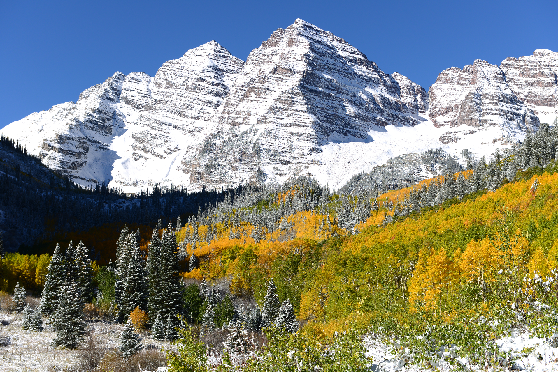 SeanXu (iStock) |
 |  |
 |  |
 DJS Photo Video I | 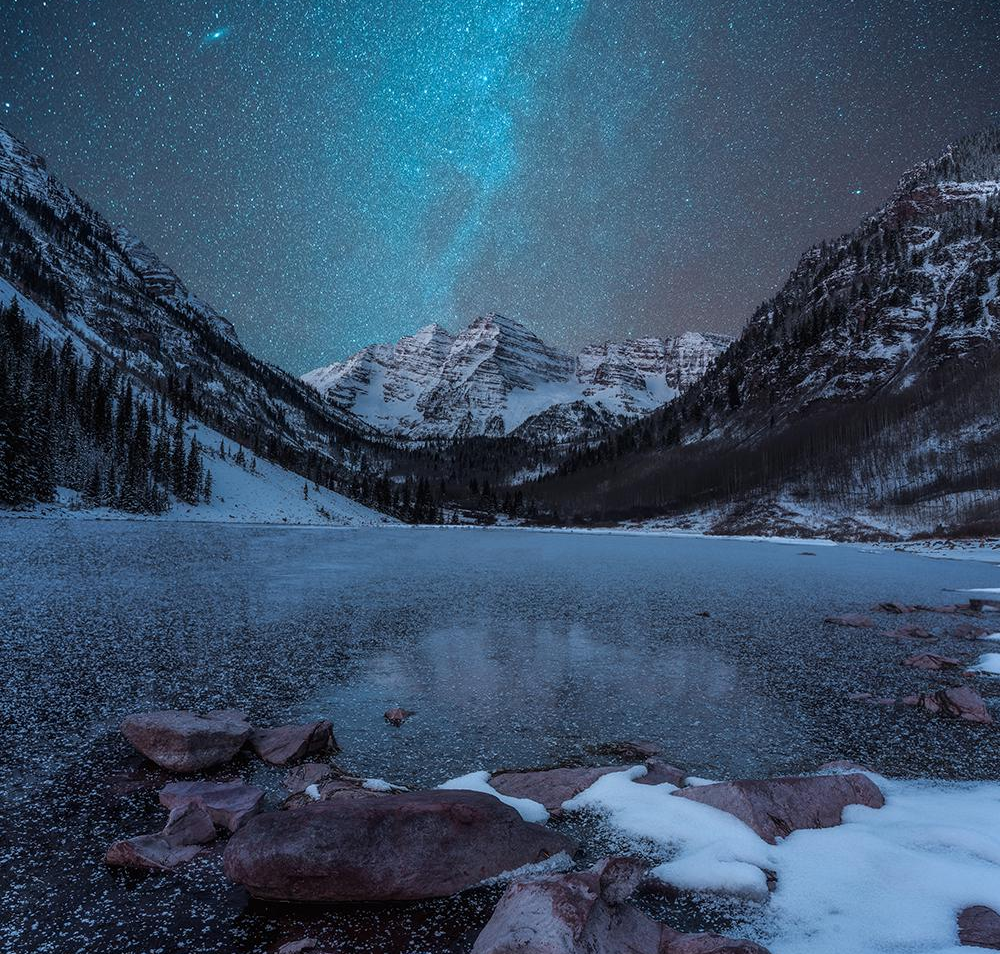 Metal_Gear_Awesome (Reddit) |
 Gcosoveanu (iStock) I | 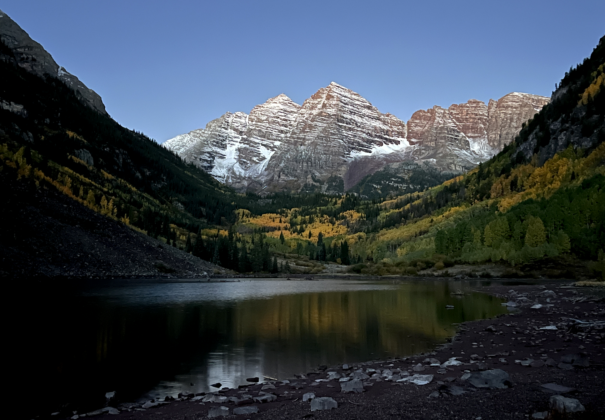 Chris Broyles Sep 24, 2025 at 6:25 am |
Additional Maroon Bells Images Here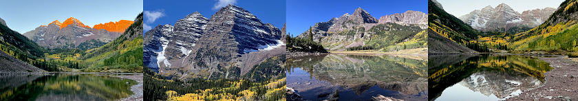
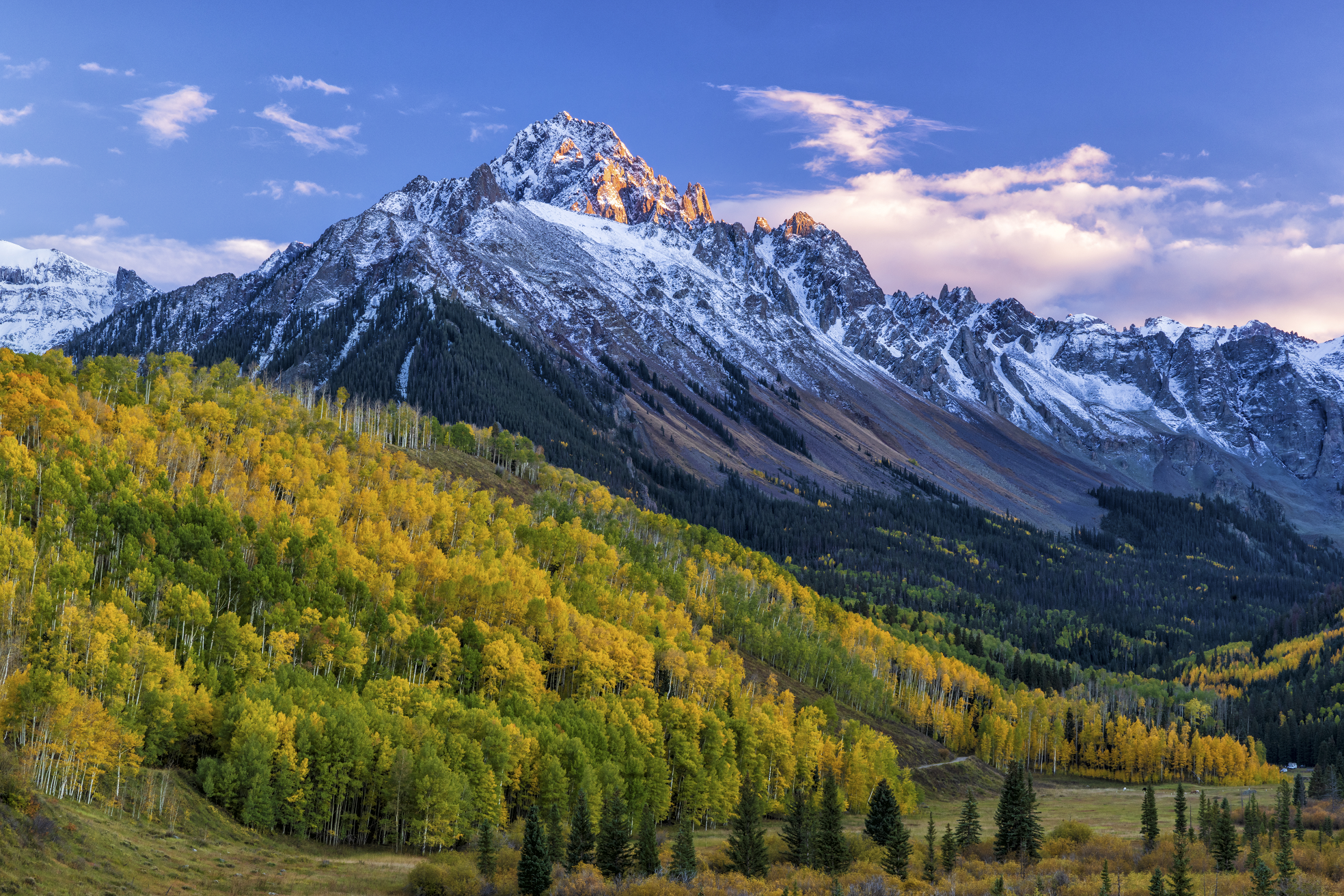
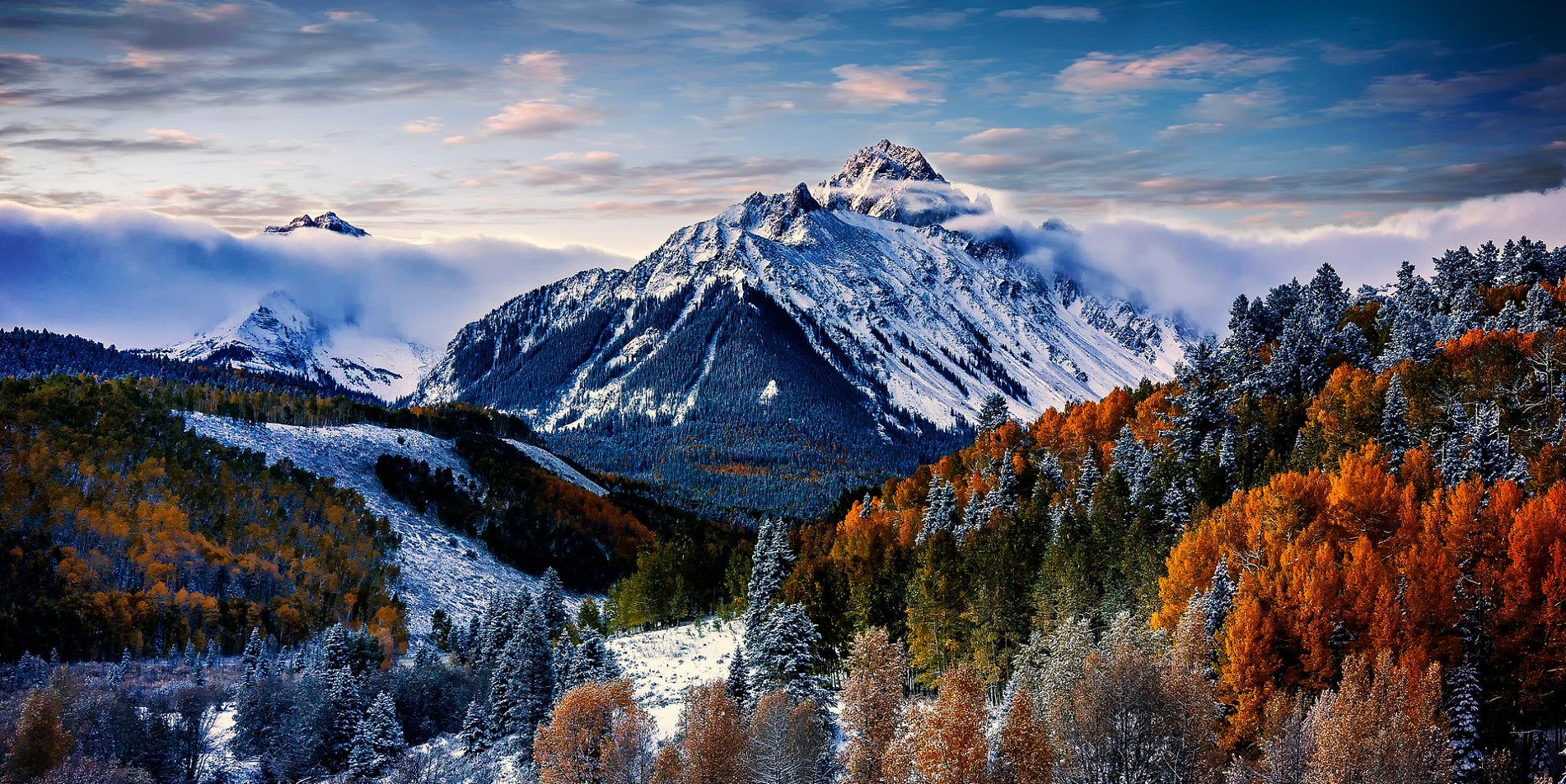
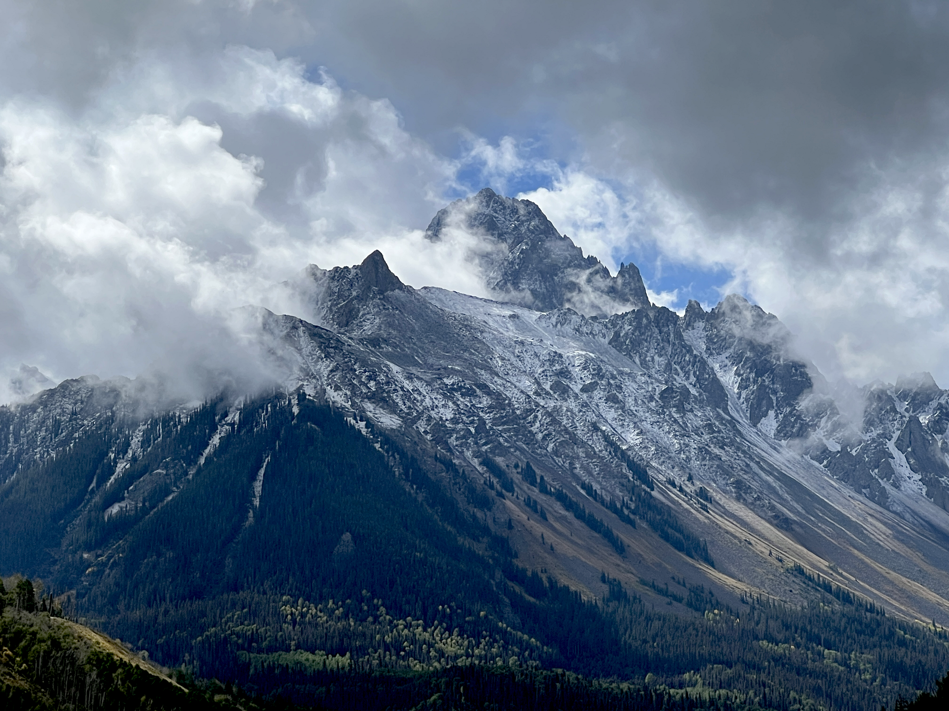
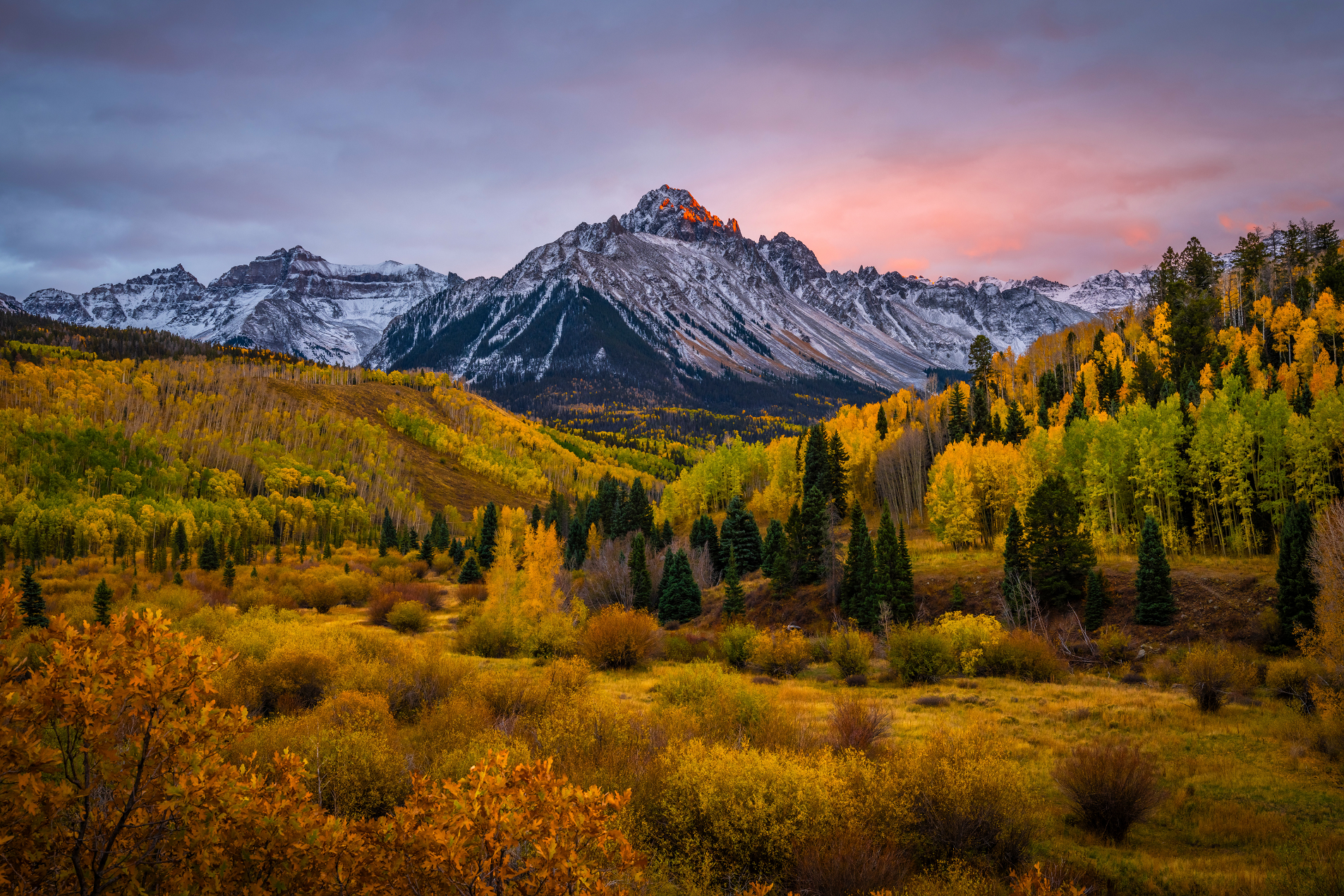
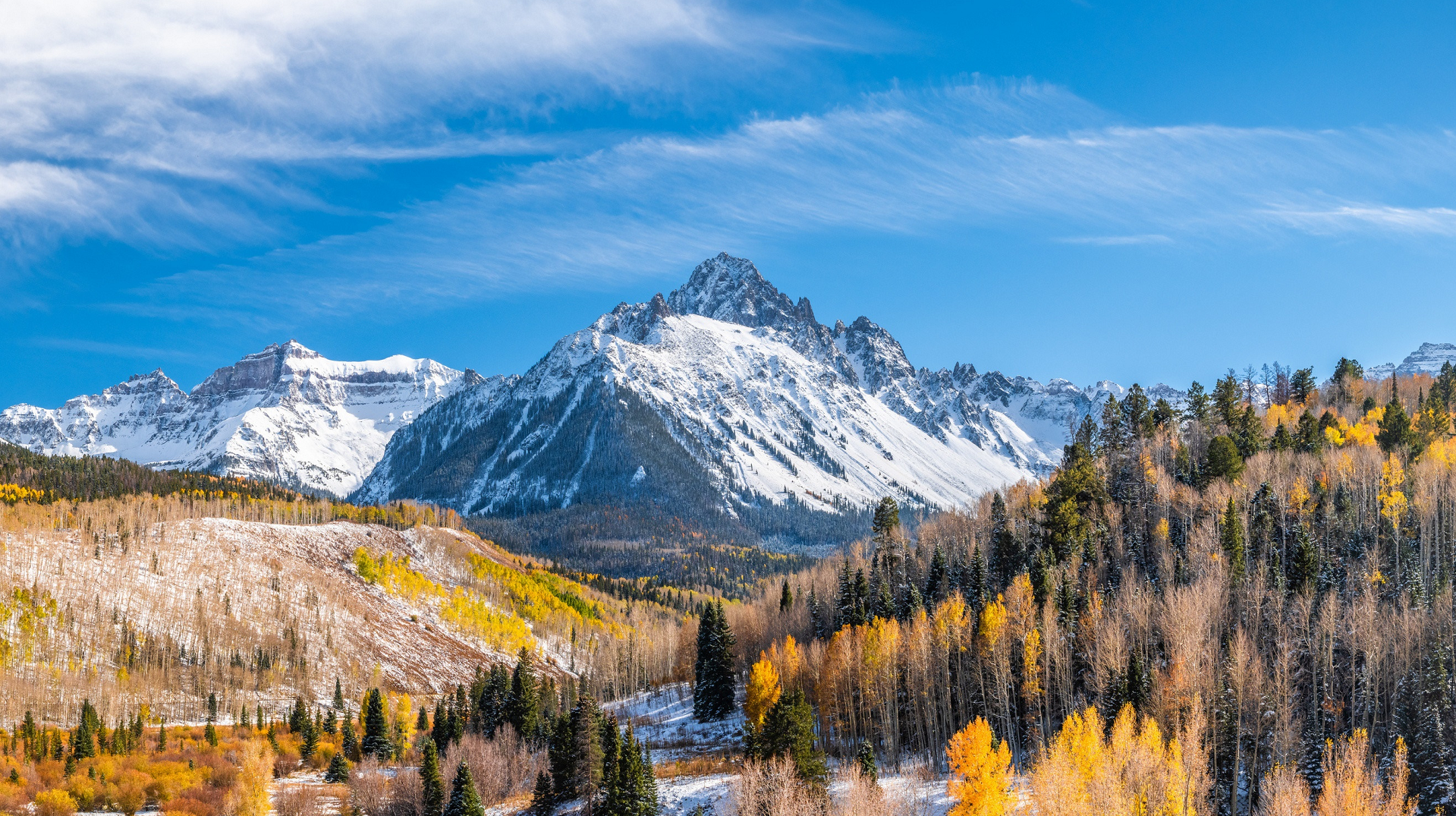
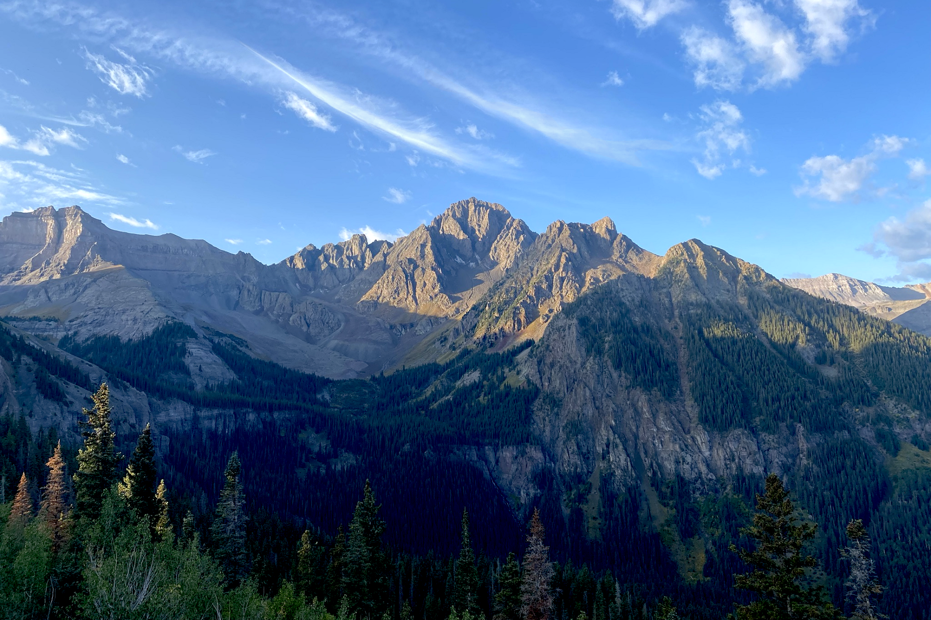
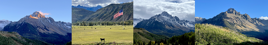
Mount Sneffels Region

Mount Sneffels Panoramic
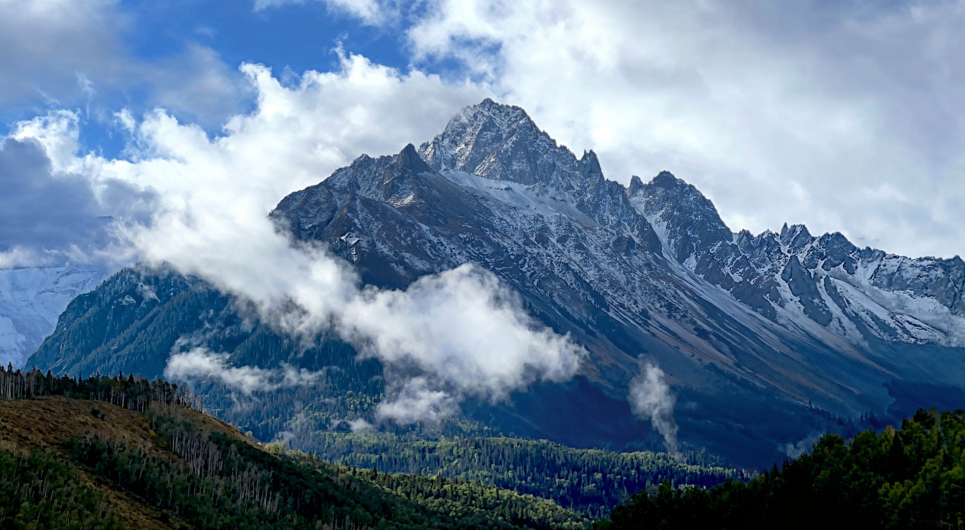
Chris Broyles
“A Hug From God” with an Arm, Hand and Two Eyes – Sep 23, 2025 at 8:51 am

Mount Sneffels is the highest summit of the Sneffels Range in the Rocky Mountains of North America. The 14,153-foot (4313.93 m) fourteener is located in the Mount Sneffels Wilderness of Uncompahgre National Forest, 6.7 miles (10.8 km) west by south (bearing 256°) of the City of Ouray in Ouray County, Colorado, United States. The summit of Mount Sneffels is the highest point in Ouray County.[3][2][4]
Mountain
Mount Sneffels is notable for its great vertical relief, as it rises 7,200 feet above the town of Ridgway, Colorado 6 miles to the northeast.
The primary route to the summit follows a creek bed up from Yankee Boy Basin and is rated class 3.[6] A secondary route follows a ridge line to the summit from the saddle of Blue Lakes Pass.
Mount Sneffels was named after the volcano Snæfell, which is located on the tip of the Snæfellsnes peninsula in Iceland. That mountain and its glacier, Snæfellsjökull, which caps the crater like a convex lens, were featured in the Jules Verne novel A Journey to the Center of the Earth. An area on the western flank of Mount Sneffels gives the appearance of volcanic crater. Geologically, the mountain is a Tertiary aged igneous stock (Ti) composed of intermediate rock (monzonite, monzodiorite, granodiorite, and minor monzogranite) intruded into a volcanic stack of older San Juan Volcanics (Tsj).[7]
Seen from the Dallas Divide on State Highway 62, Mount Sneffels is one of the most photographed mountains in Colorado.[citation needed] It is also depicted on Colorado driver licenses and I.D. cards as of 2023.[8]
This article uses material from the Wikipedia article Mount Sneffels, which is released under the Creative Commons Attribution-Share-Alike 4.0 International License (view authors).
 Lightphoto (iStock) I | 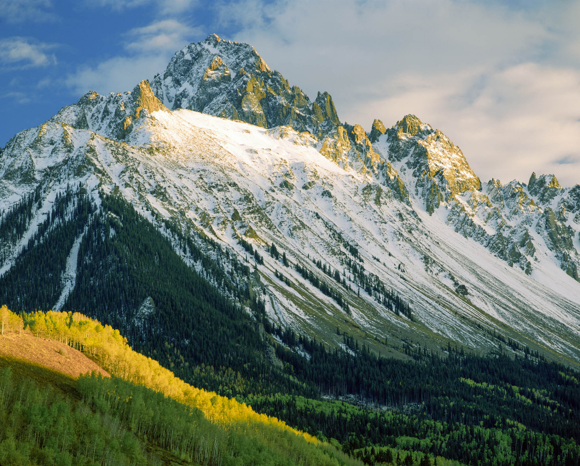 John Fielder (Colorado Encyclopedia) |
 Dave Soldano | 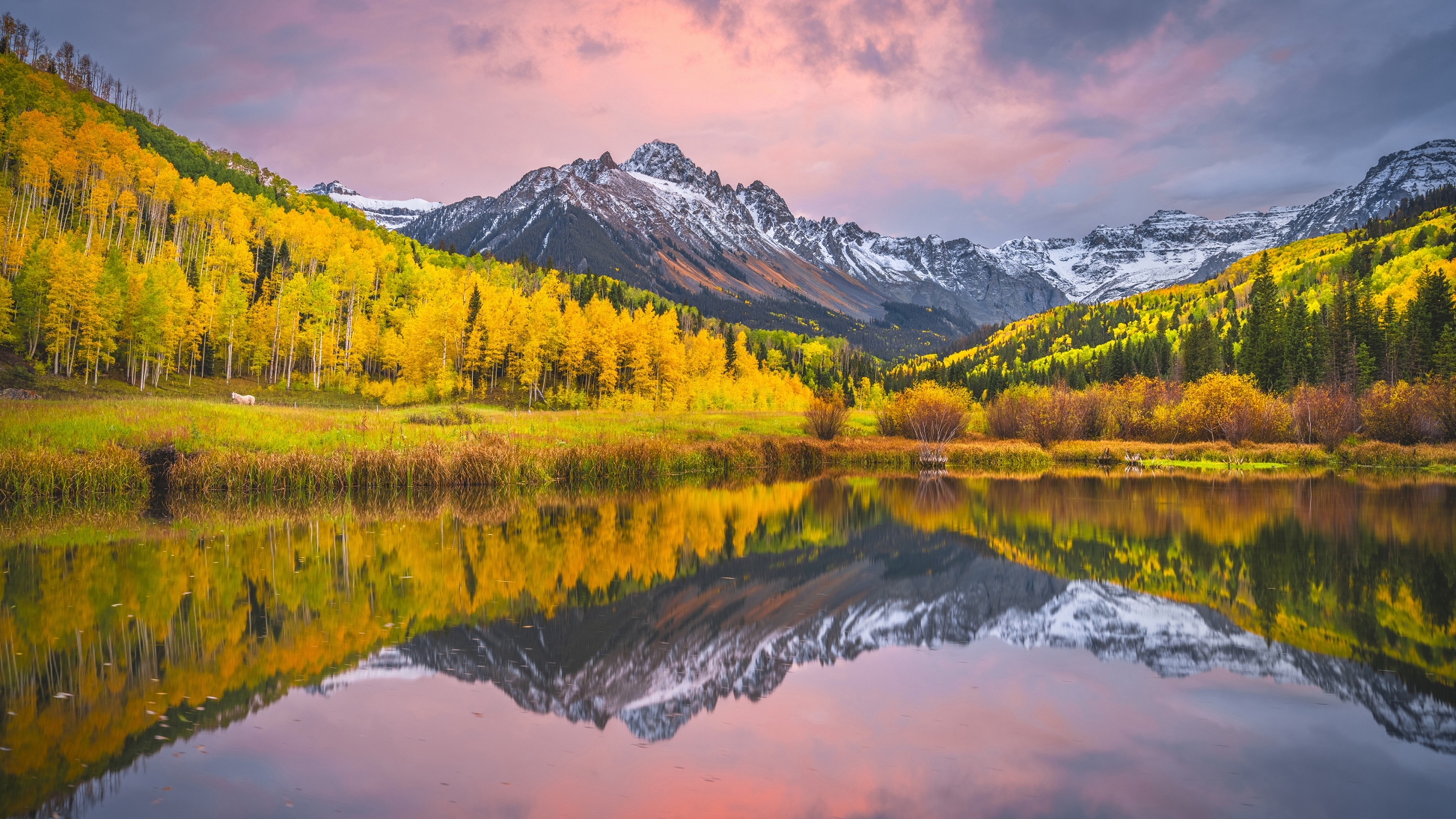 I |
 Chris Broyles Sep 23, 2025 at 10:41 am | 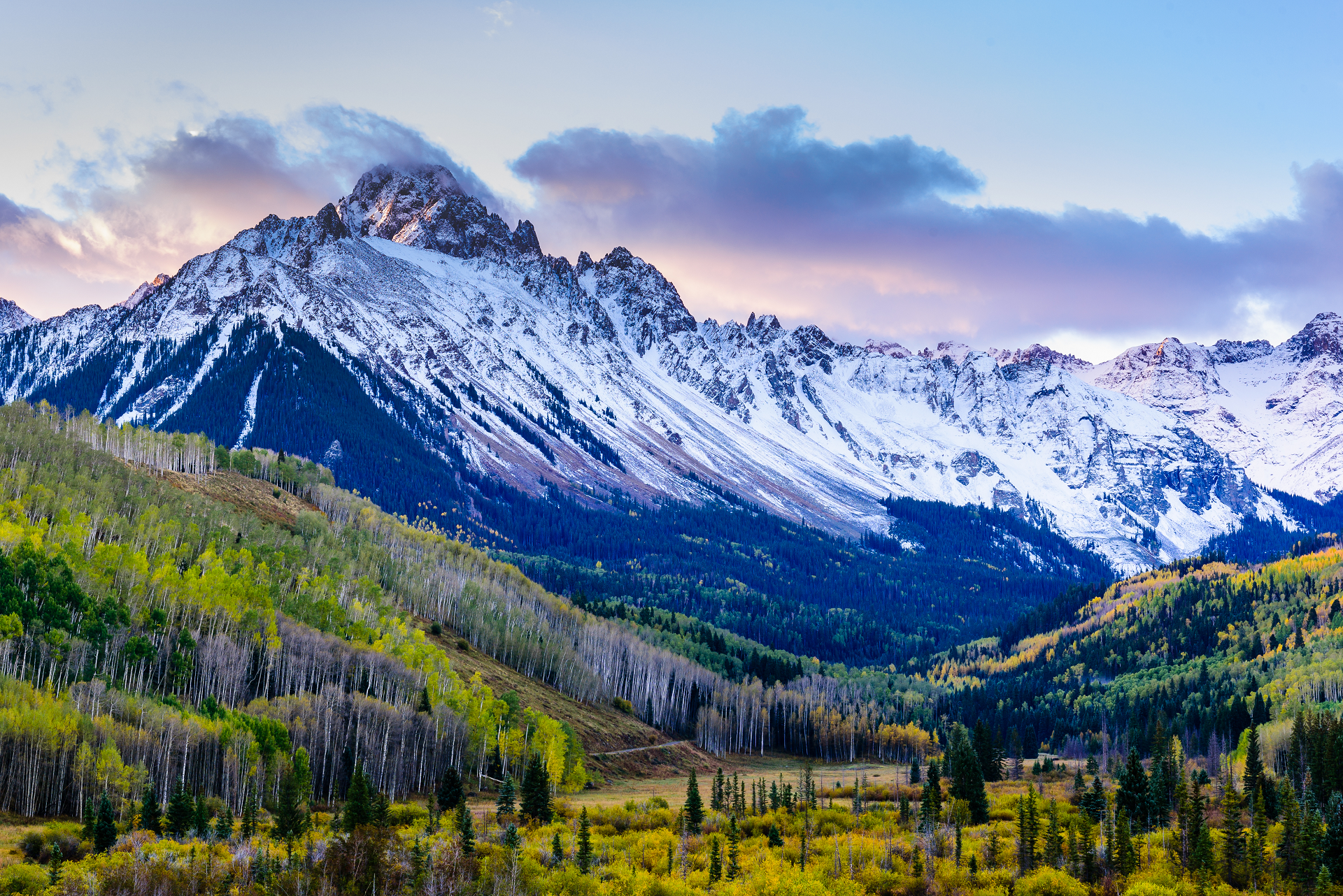 Gary Gray (iStock) I |
 |  |
 Chris Broyles Sep 11, 2021 at 7:40 am | 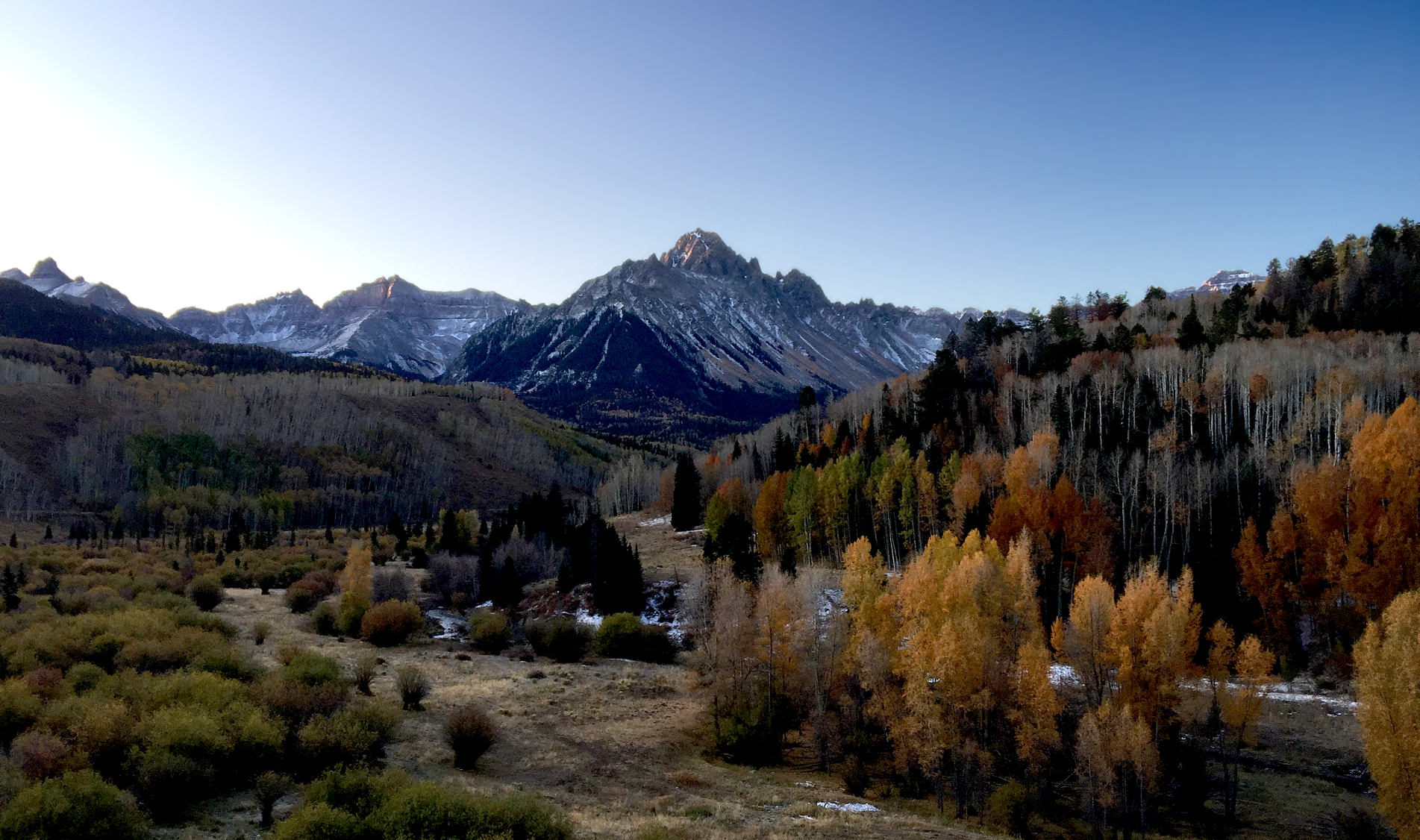 Chris Broyles Oct 12, 2019 at 7:27 am |
Additional Mount Sneffels Images Here
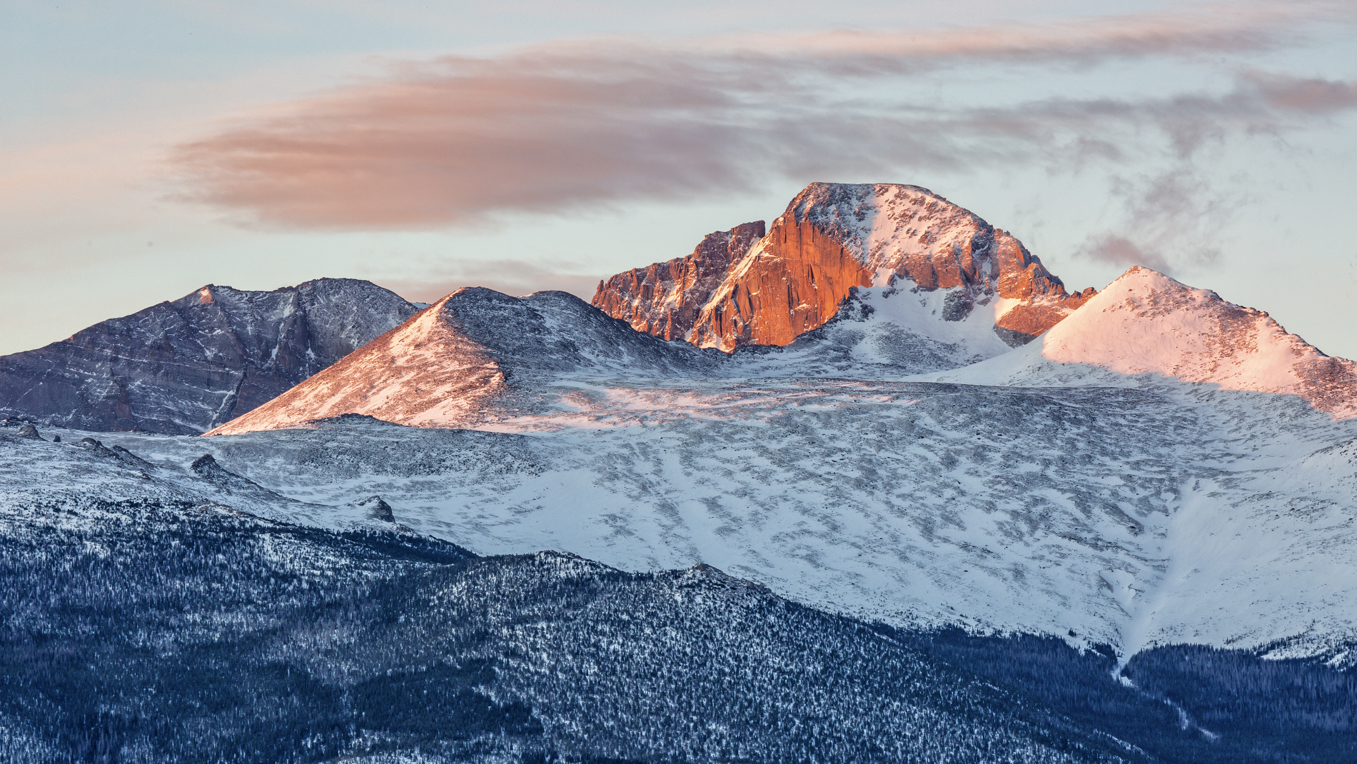
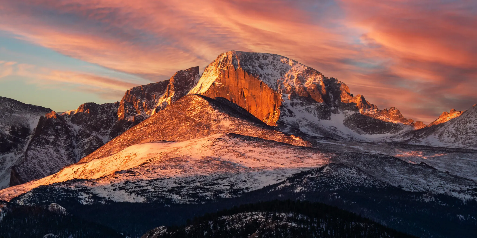
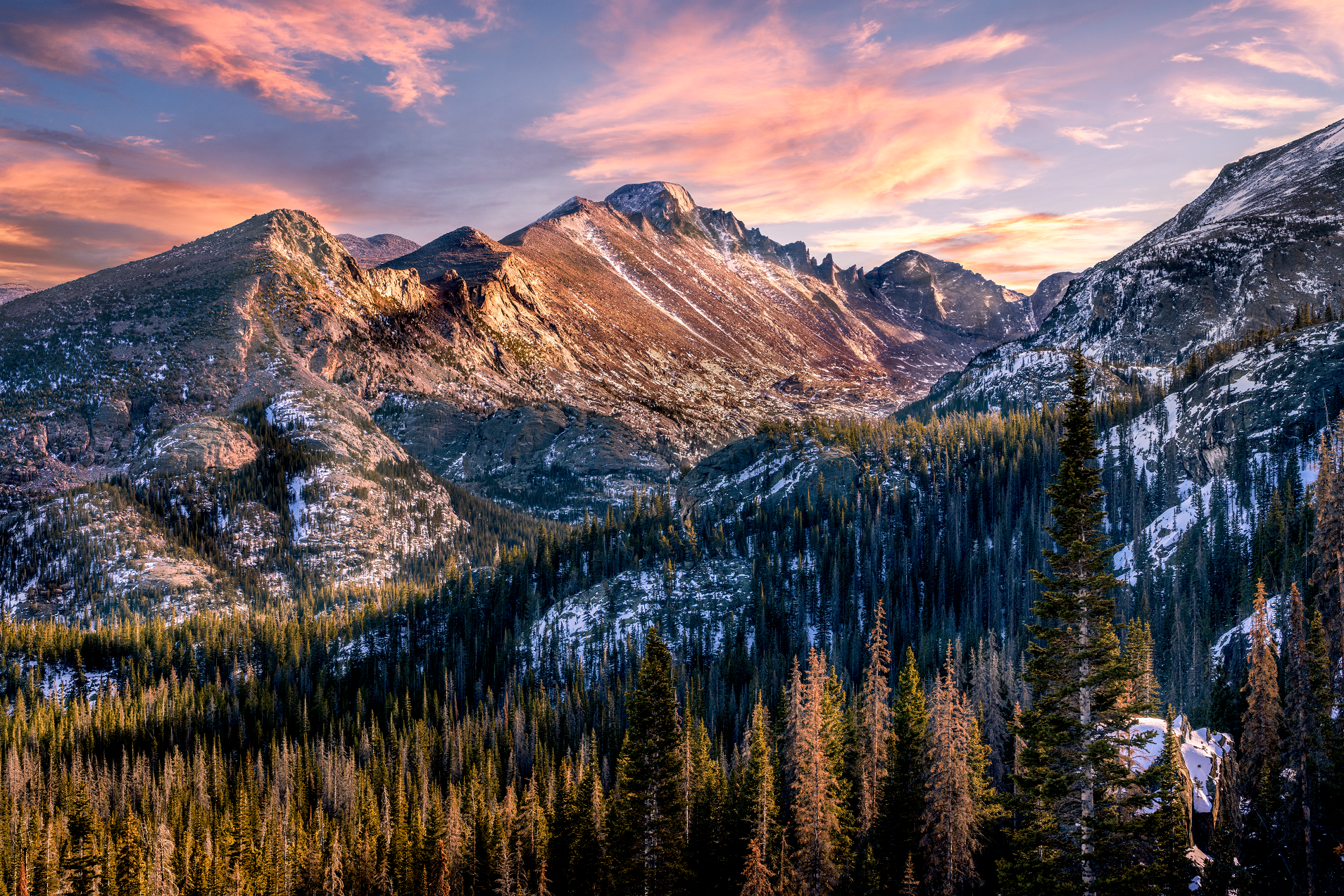
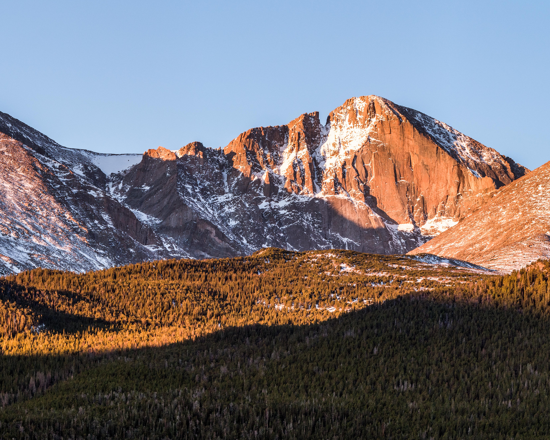
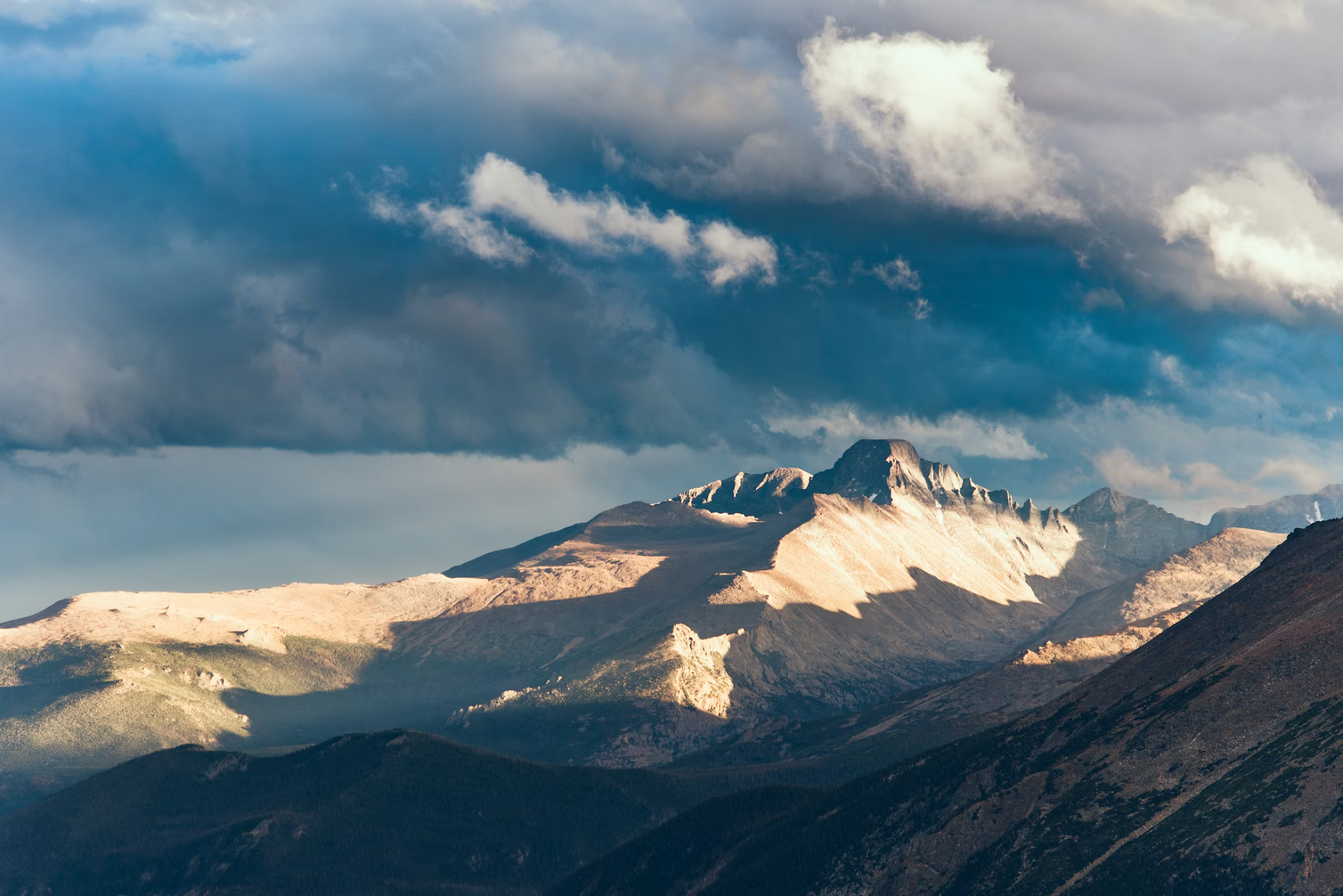
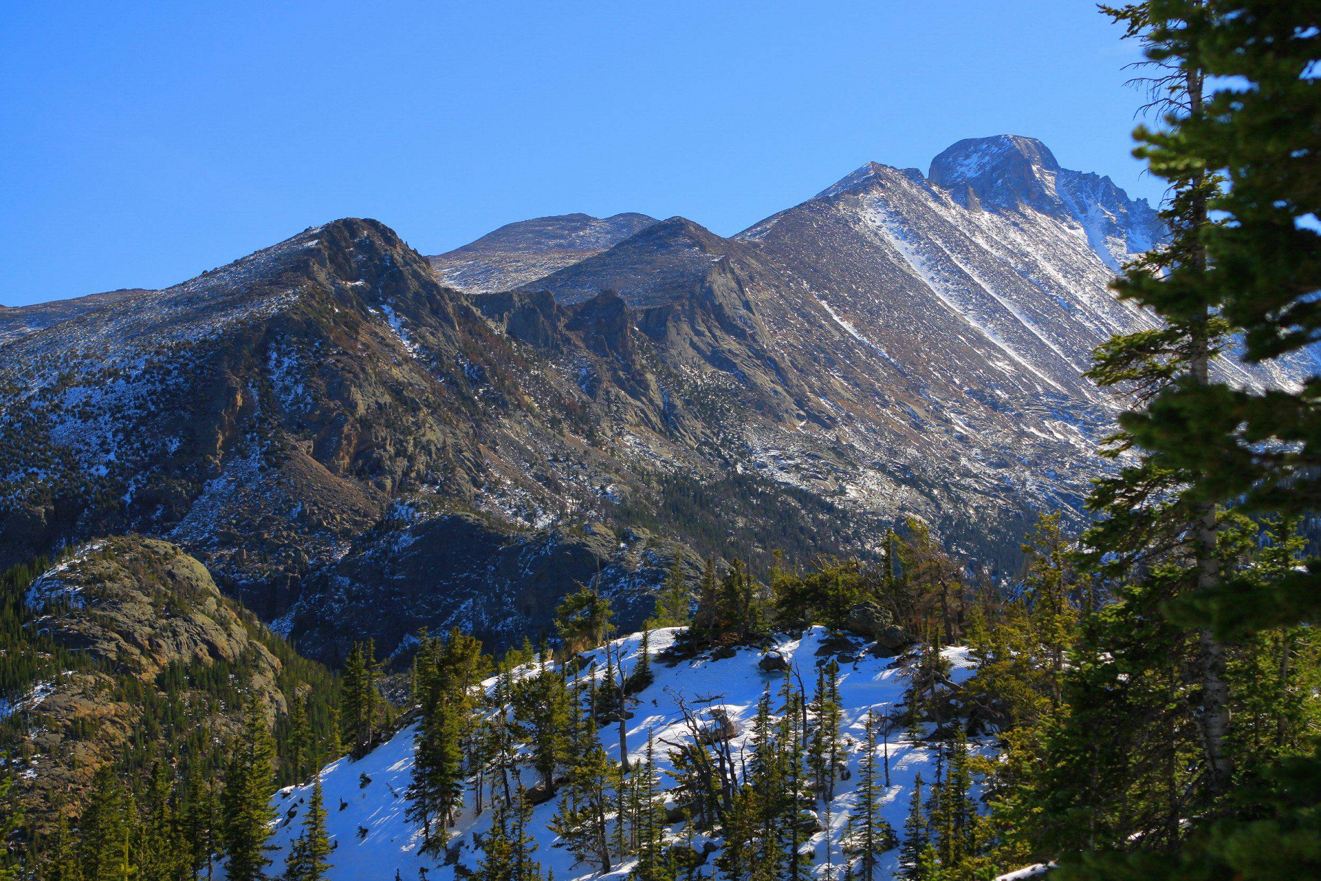
Longs Peak Region
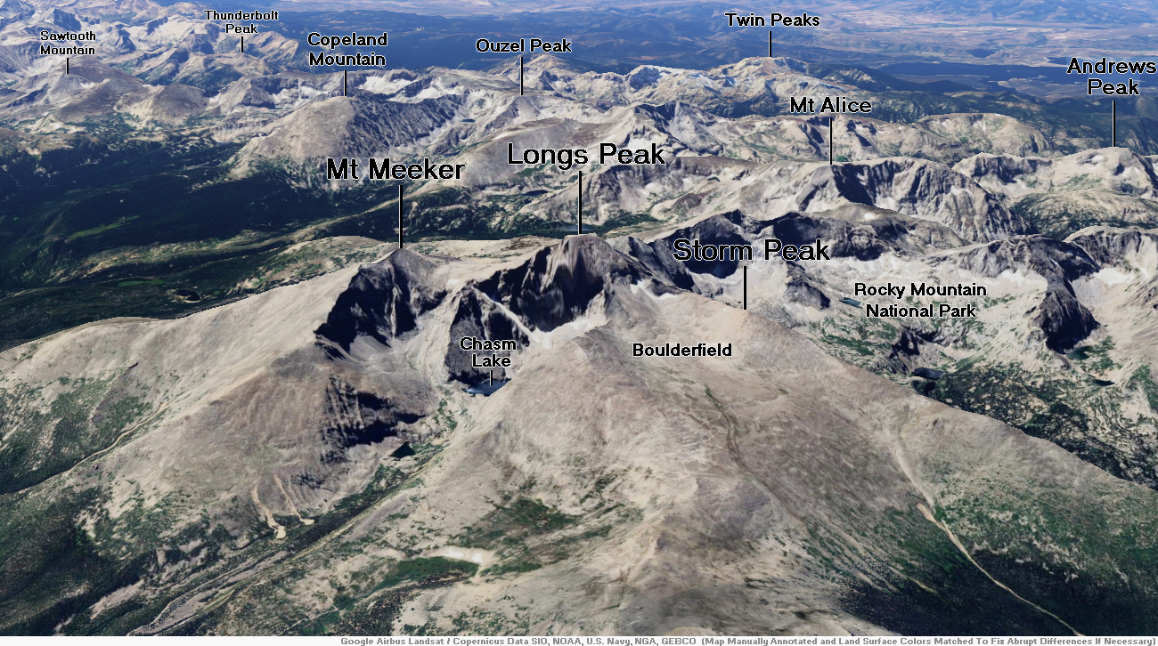
Longs Peak Panoramic
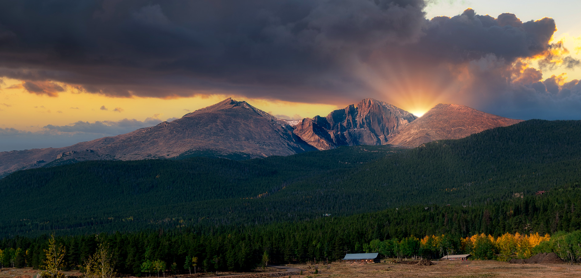
G. Lamar (Wikipedia)


Longs Peak is a mountain in the northern Front Range of the Rocky Mountains of North America. The 14,256-foot (4345.22 m) fourteener is located in the Rocky Mountain National Park Wilderness, 9.6 miles (15.5 km) southwest by south (bearing 209°) of the Town of Estes Park, Colorado, United States. Longs Peak is the northernmost fourteener in the Rocky Mountains and the highest point in Boulder County and Rocky Mountain National Park. The mountain was named in honor of explorer Stephen Harriman Long and is featured on the Colorado state quarter.[3][2][4][a][6][7]
Description
Longs Peak can be seen behind Mt. Meeker from Longmont, Colorado and more directly from Loveland, Colorado, as well as from most of the northern Front Range Urban Corridor. It is one of the most prominent mountains in Colorado, rising 9,000 feet (2,700 m) above the western edge of the Great Plains.
The peak is named for Major Stephen Harriman Long,[8][9] who is said to have been the first to spot the Front Range on June 30, 1820, during an expedition on behalf of the U.S. government.
Together with nearby Mount Meeker, with an elevation of 13,911 feet, the two mountains are sometimes referred to as the Twin Peaks (not to be confused with a nearby lower mountain called Twin Sisters).
This article uses material from the Wikipedia article Longs Peak, which is released under the Creative Commons Attribution-Share-Alike 4.0 International License (view authors).
 Lightphoto (iStock) | 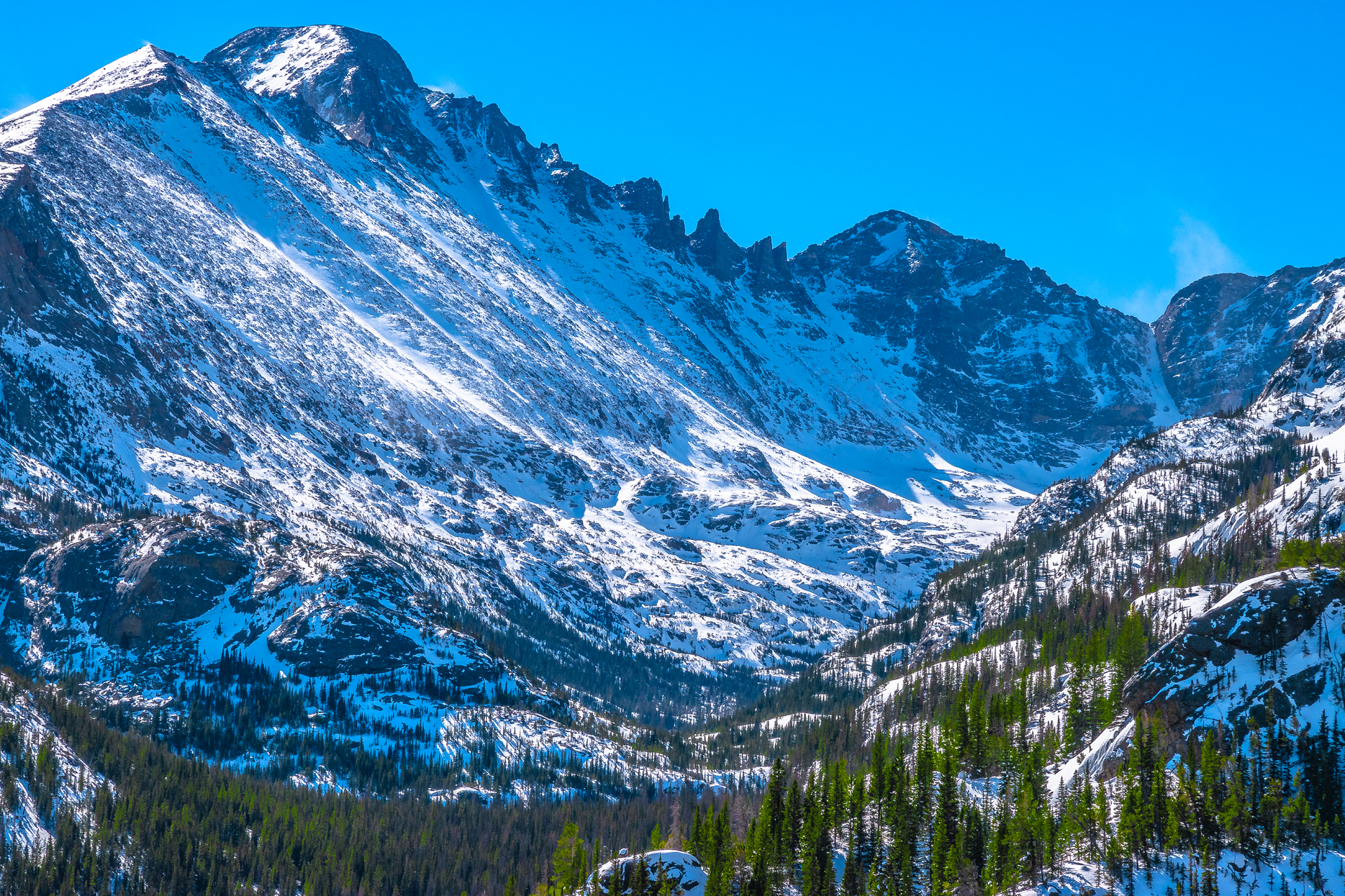 Jeremy Janus (iStock) |
 I | 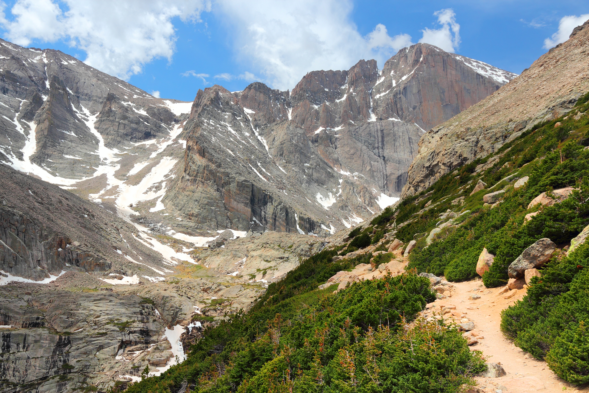 Tupungato (iStock) |
 PixelviewMedia (iStock) | 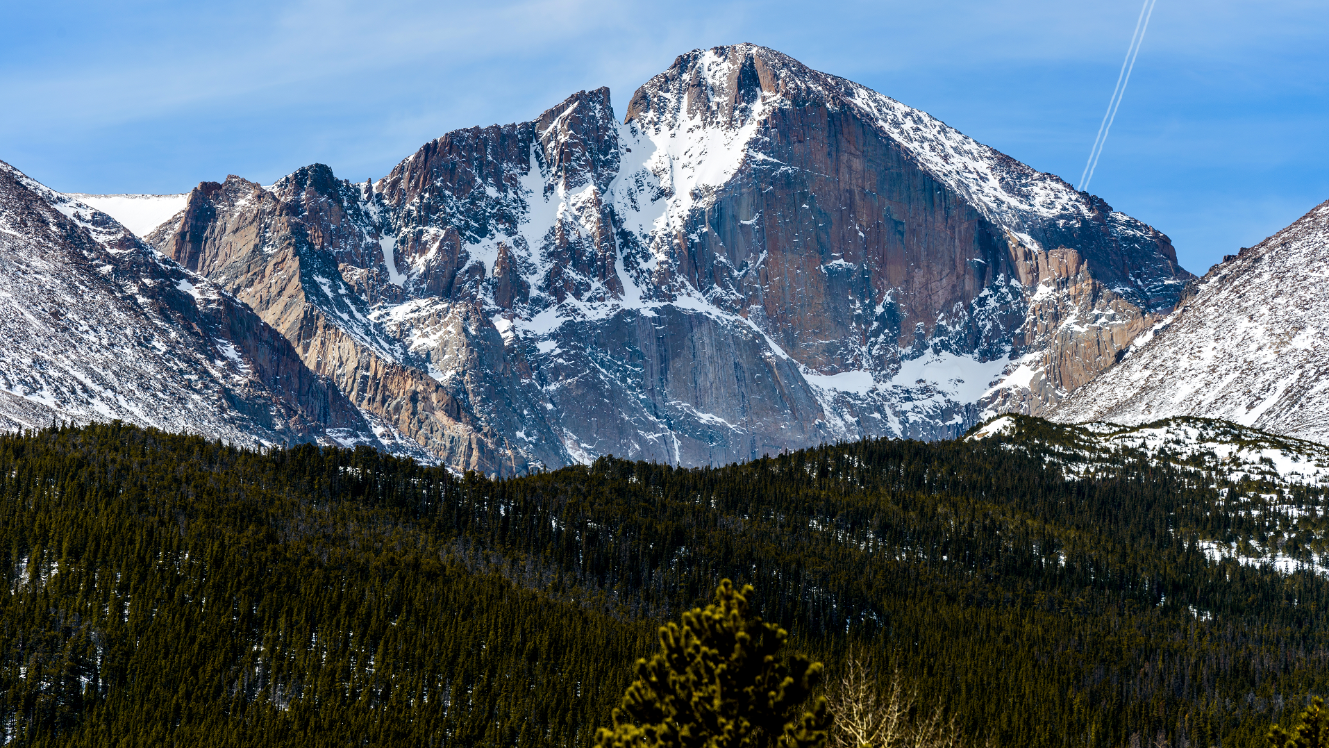 SeanXu (iStock) |
 I | 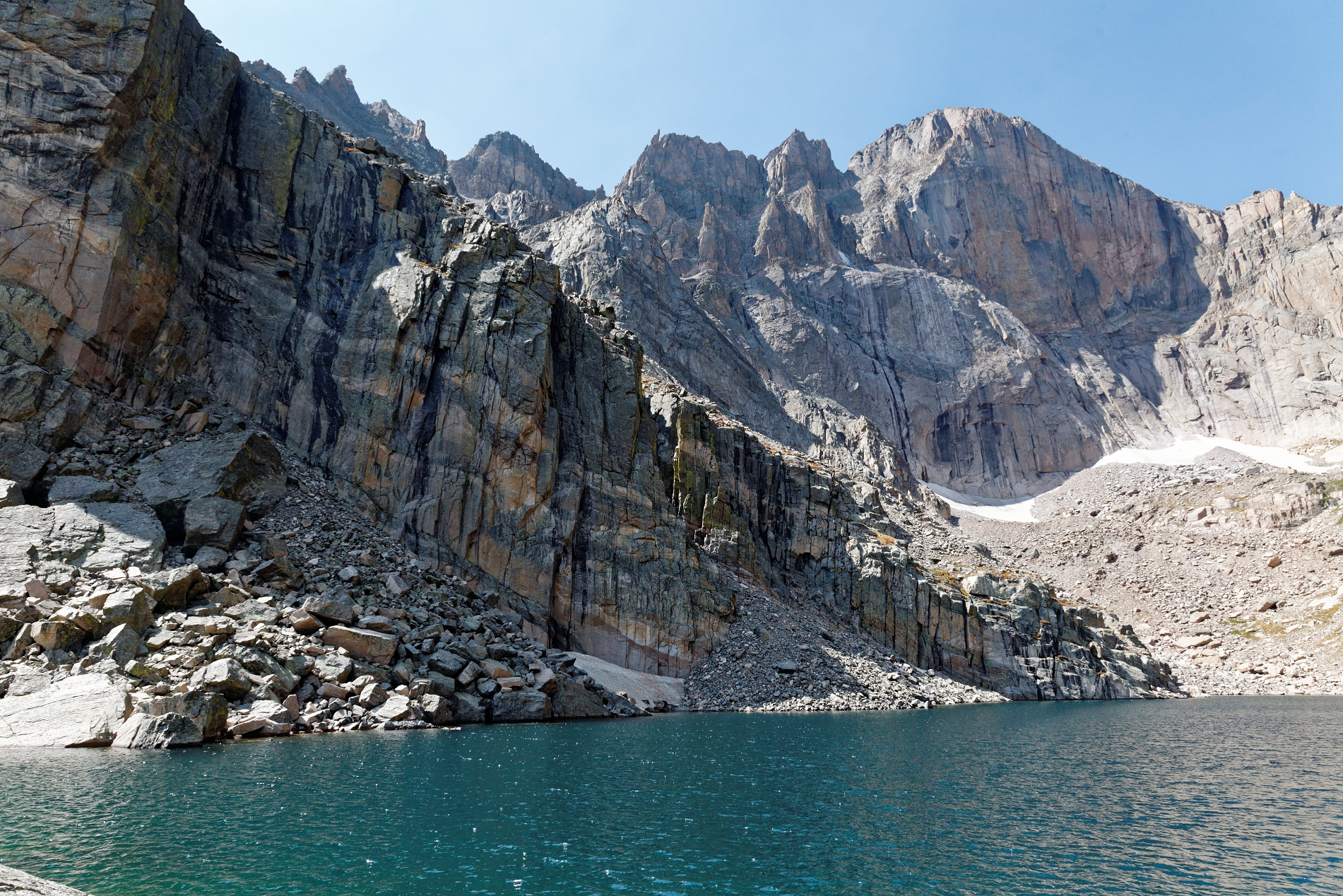 Kimon Berlin (Wikipedia) |
 |  |
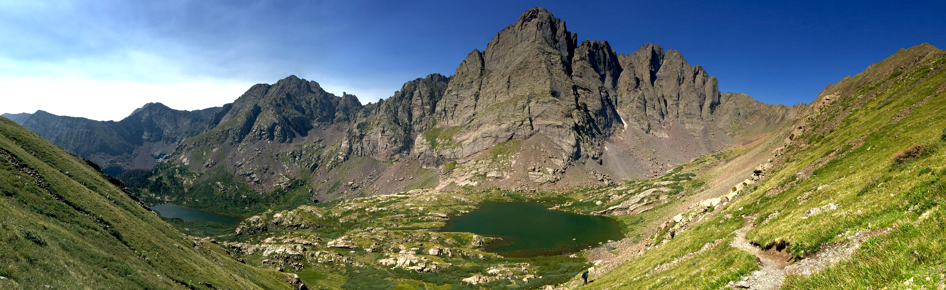
Crestone Peak Region
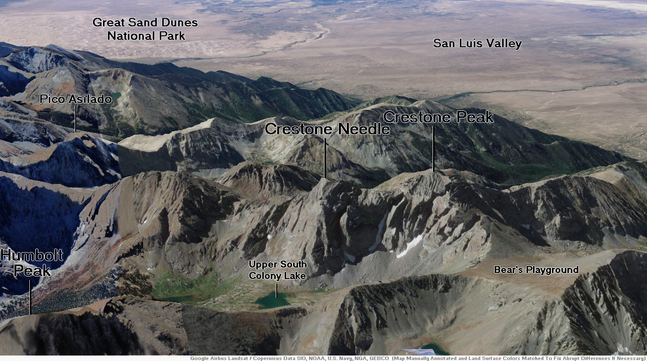
Crestone Peak Panoramic 1
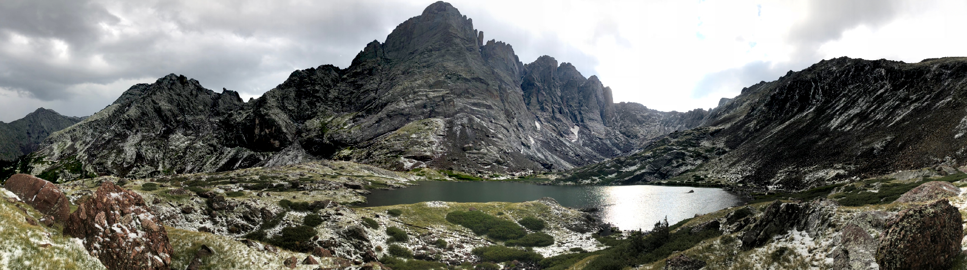
Timothy Broyles
July 29, 2018 at 6:13 pm
Video of Hailstorm at Crestone Needle on July 29, 2018 (by Chris Broyles) – 1 Min 18 Sec
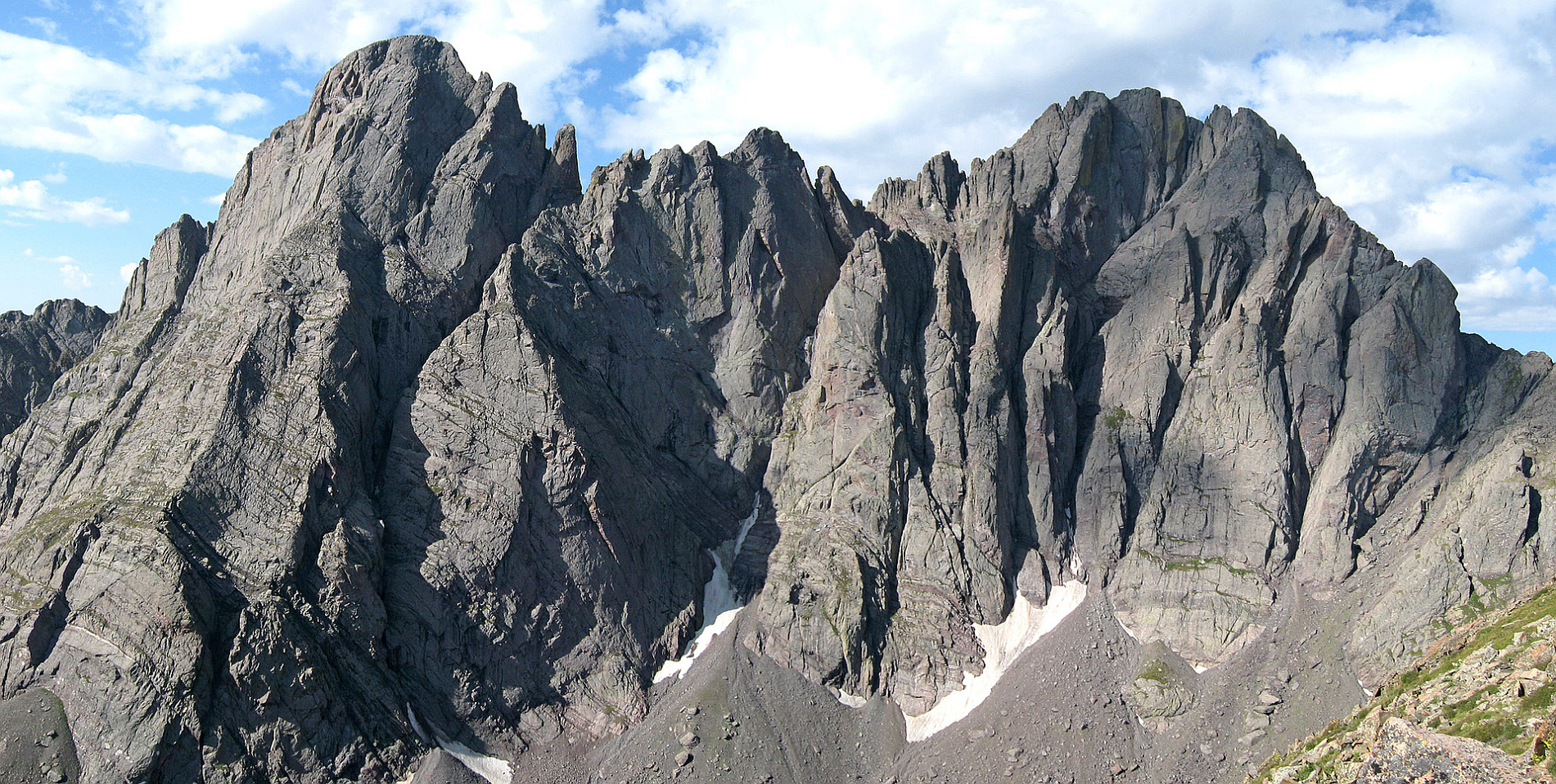
Crestone Peak Panoramic 2
Chris Broyles
July 29, 2018 at 10:35 am
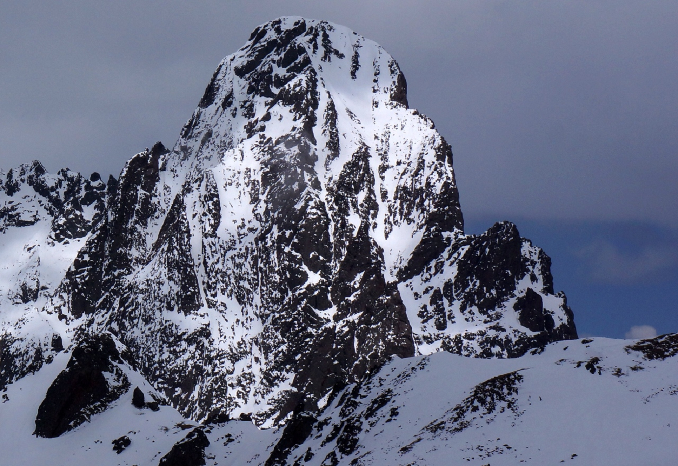
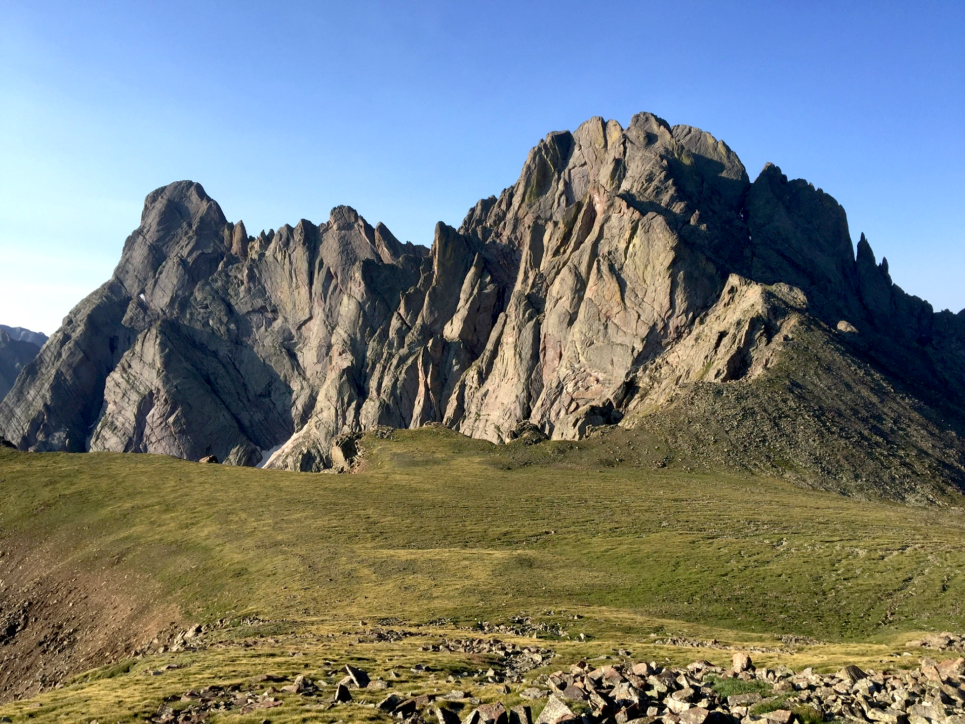
Crestone Needle is a high mountain summit of the Crestones in the Sangre de Cristo Range of the Rocky Mountains of North America. The 14,194.8-foot (4,327 m) fourteener is located 6.9 miles (11.1 km) east-southeast (bearing 108°) of the Town of Crestone in Saguache County, Colorado, United States.[2][3][5] The Crestones are a cluster of high summits in the Sangre de Cristo Range, comprising Crestone Peak, Crestone Needle, Kit Carson Peak, Challenger Point, Humboldt Peak, and Columbia Point. They are usually accessed from common trailheads.
Climbing
While not as high as Crestone Peak, and connected to it by a high, jagged ridge, Crestone Needle is regarded as a worthy climb in its own right. The easiest route is the South Face (or South Couloir), usually accessed via Broken Hand Pass from South Colony Lakes. This is a slightly exposed scramble with a few tricky moves, and is one of the more difficult standard routes among the Colorado fourteeners. However the classic route on the mountain is the Ellingwood Arete, also known as the Ellingwood Ledges Route. This is a steep ridge on the northeast side of the peak, leading directly up from the Upper South Colony Lake basin to the summit. It is a mildly technical rock climb (5.7 on the Yosemite Decimal Scale). It is particularly popular because of its inclusion in the well-known book Fifty Classic Climbs of North America by Steve Roper and Allen Steck.[6]
The peak consists mainly of granite and conglomerate. Knobby handholds are frequent near the summit. Snow fields linger around the peak throughout the summer.
Almost all fatalities on the peak occur on either the Class 4 traverse from Crestone Peak or the technical Ellingwood Ledges Route.
This article uses material from the Wikipedia article Crestone Needle, which is released under the Creative Commons Attribution-Share-Alike 4.0 International License (view authors).
 I I | 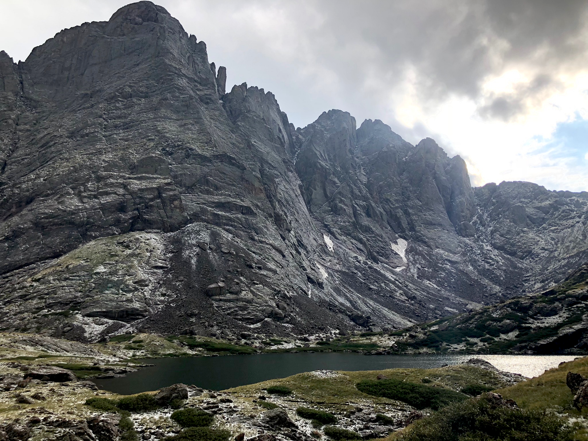 Timothy Broyles July 29, 2018 at 6:12 pm |
 Dskendall (Peakery) I | 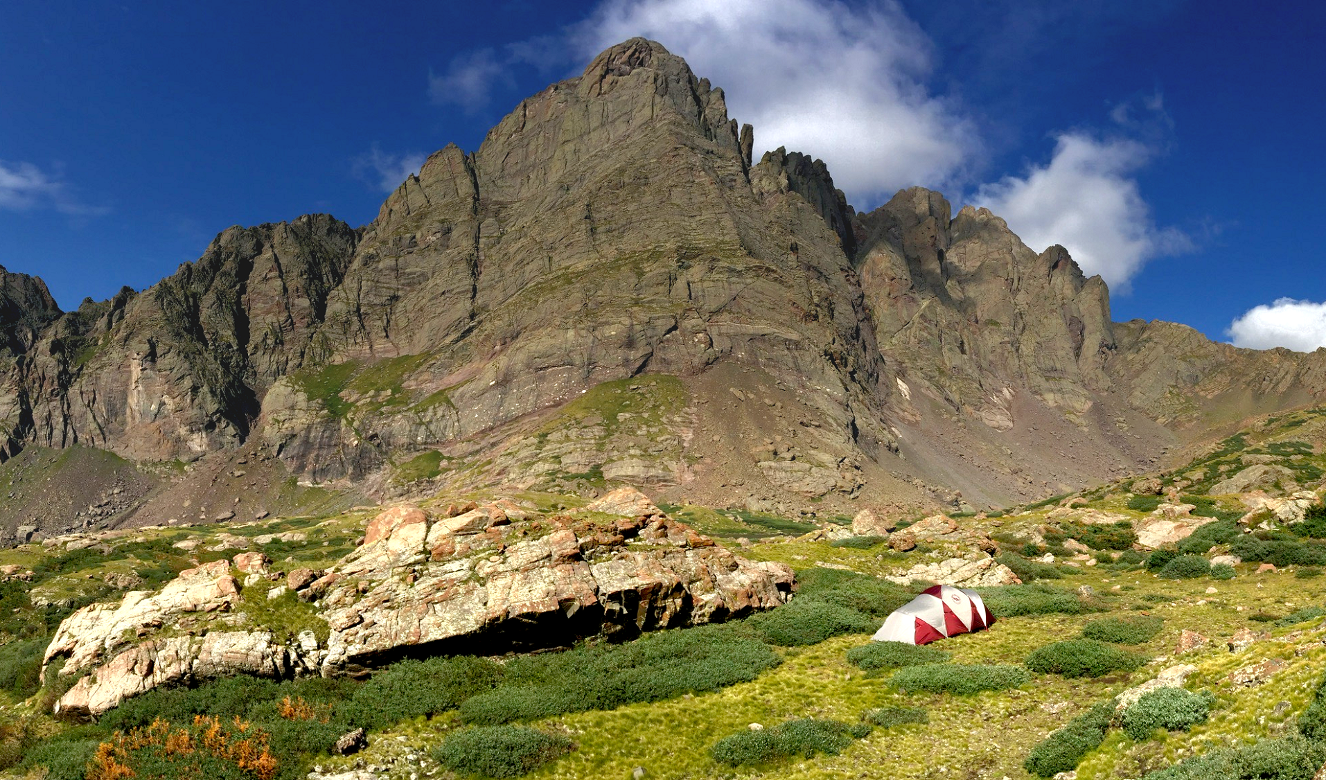 Chris Broyles July 27, 2018 at 9:22 am |
 Ethan Broyles July 28, 2018 at 7:05 am | 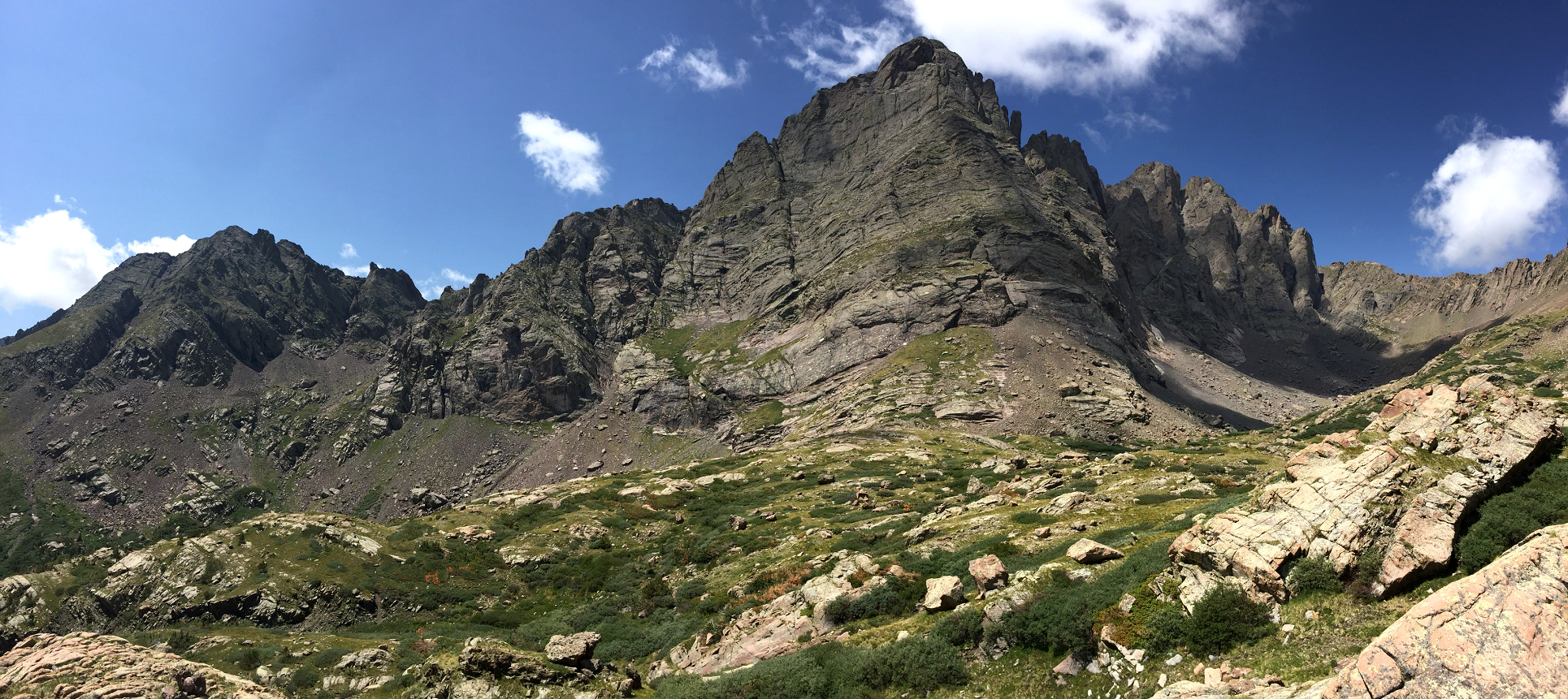 Michael Broyles July 27, 2018 at 11:46 am |
 Skykilo |  Skykilo |
 Chris Broyles July 28, 2018 at 7:45 am | 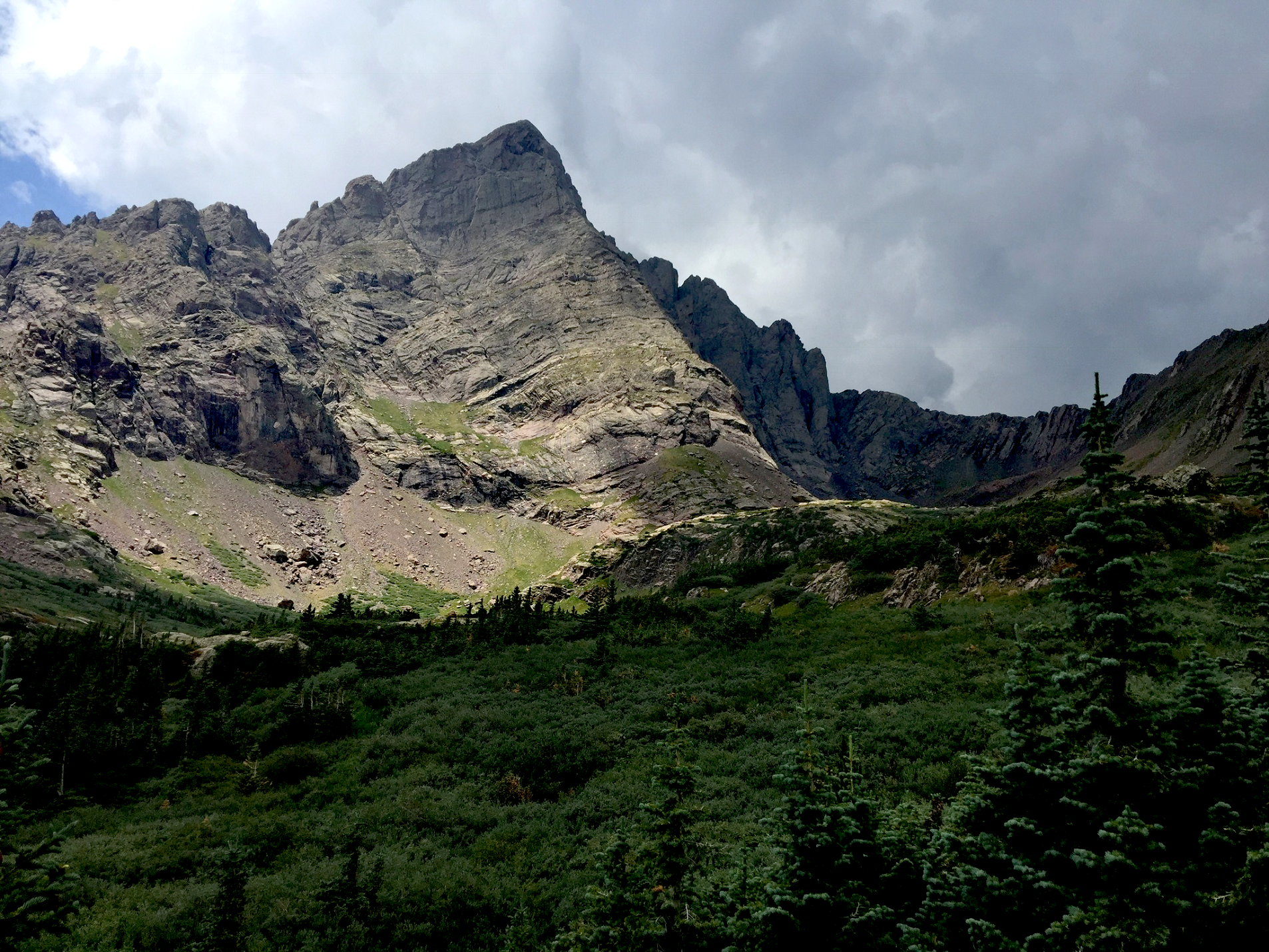 Chris Broyles July 26, 2018 at 12:45 pm |
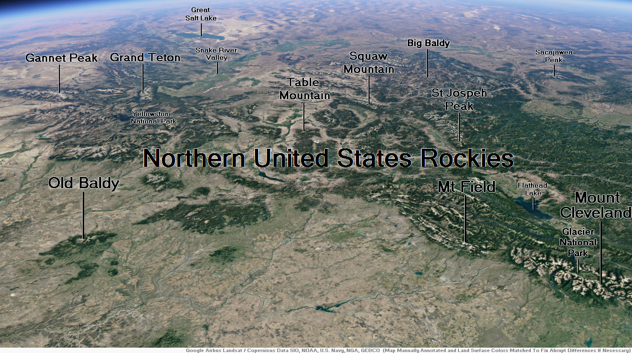
Map of Northern U.S. Rockies
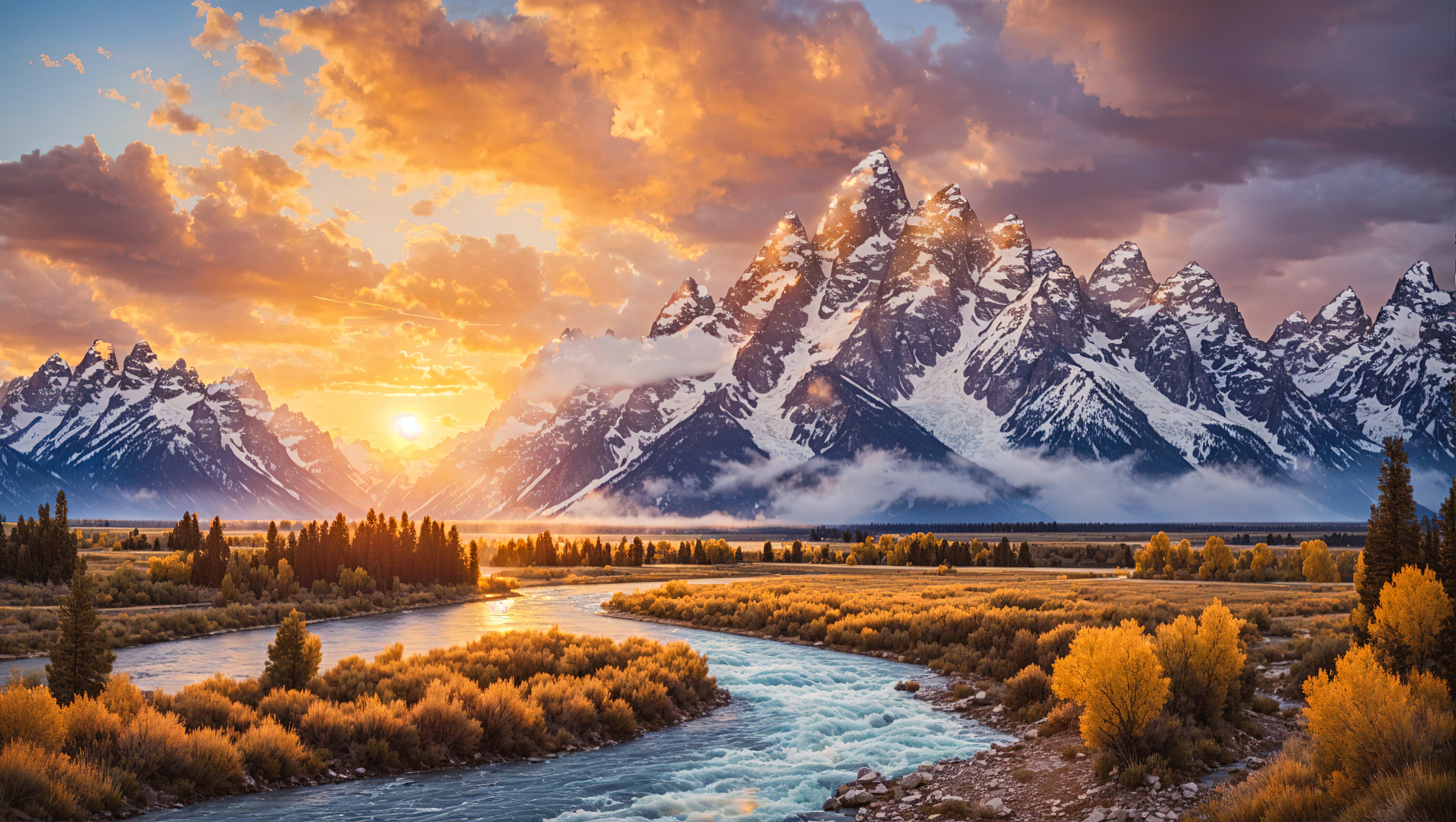
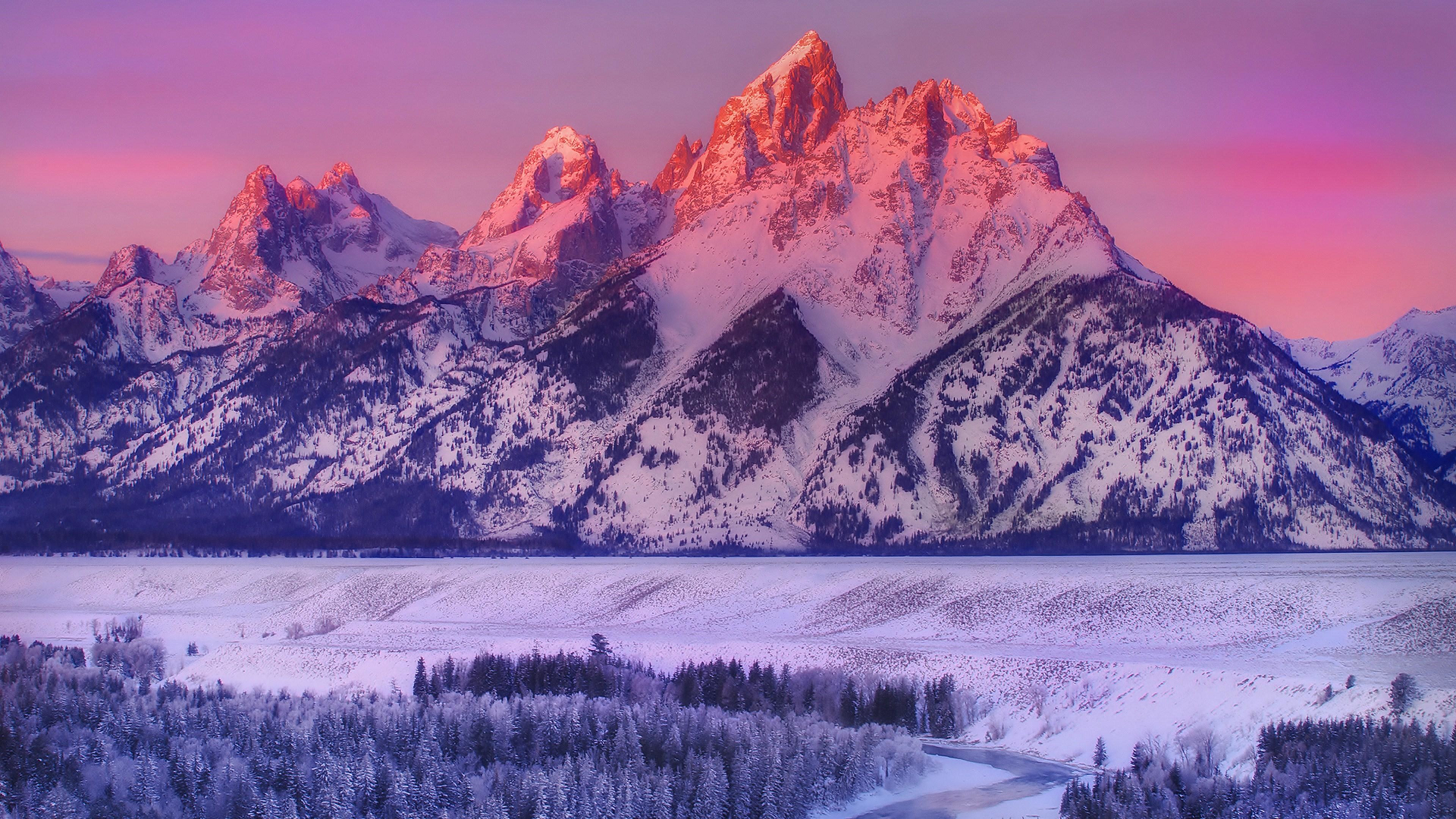
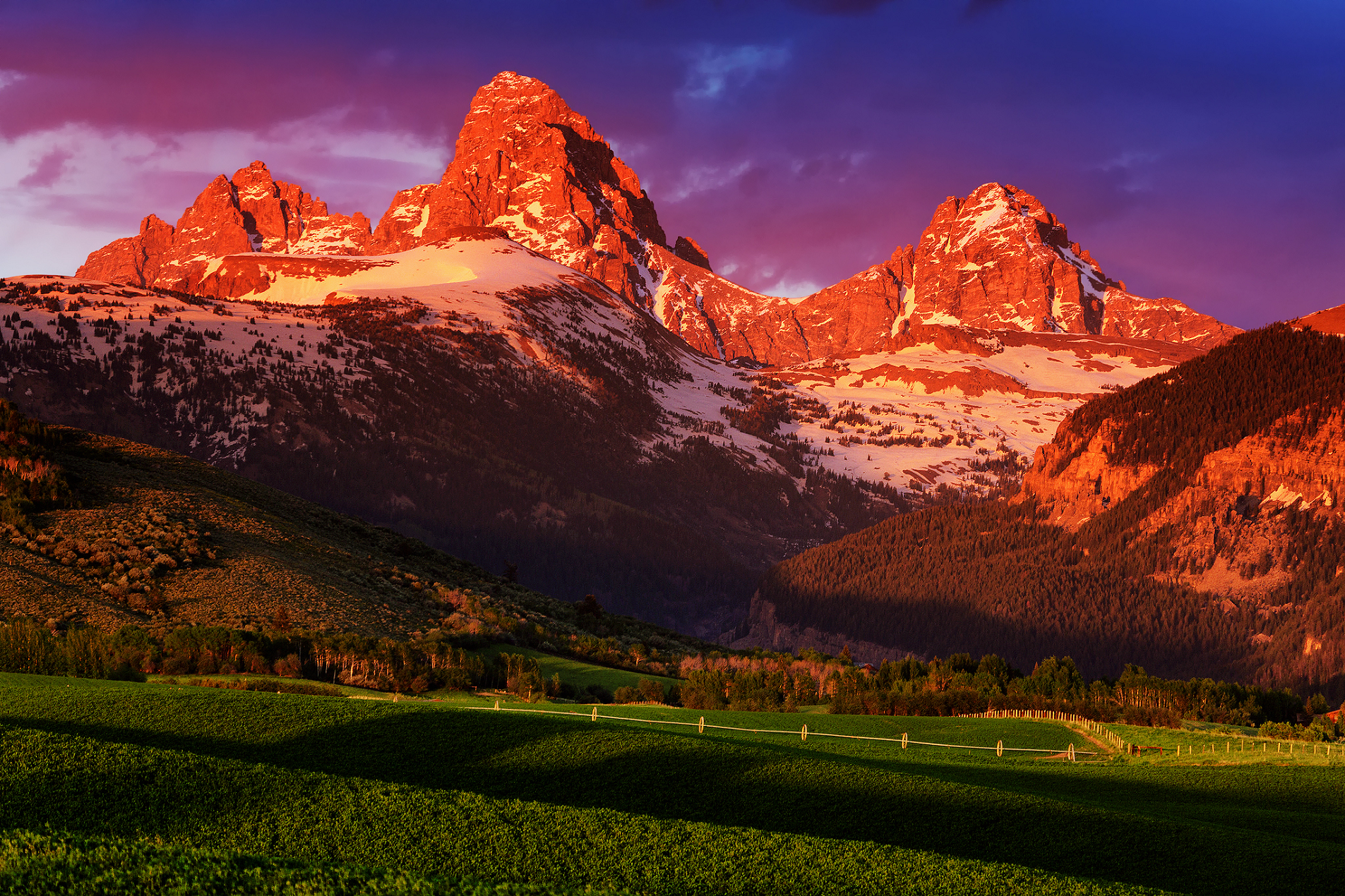
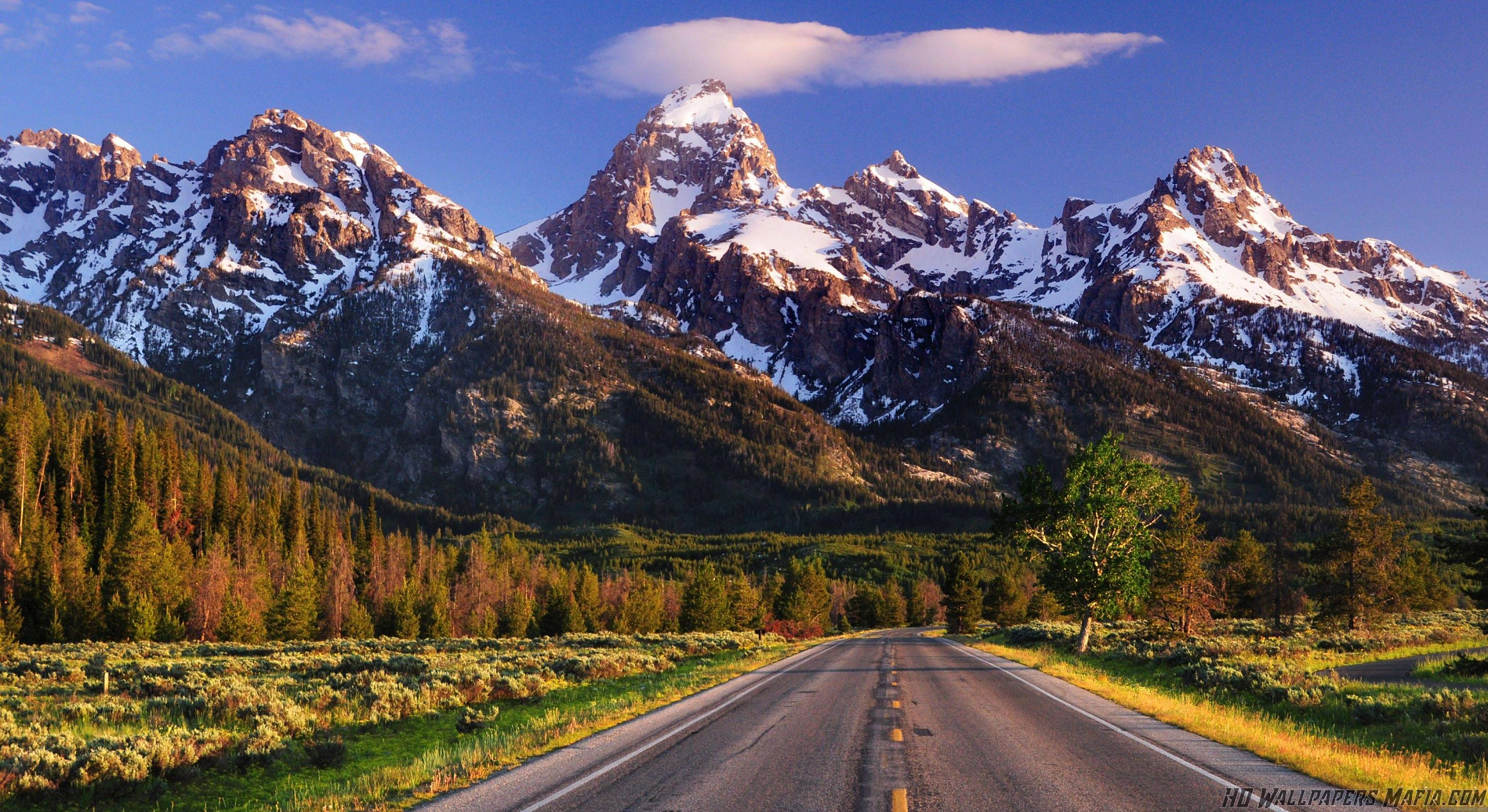
Grand Teton Region
Grand Teton Panoramic
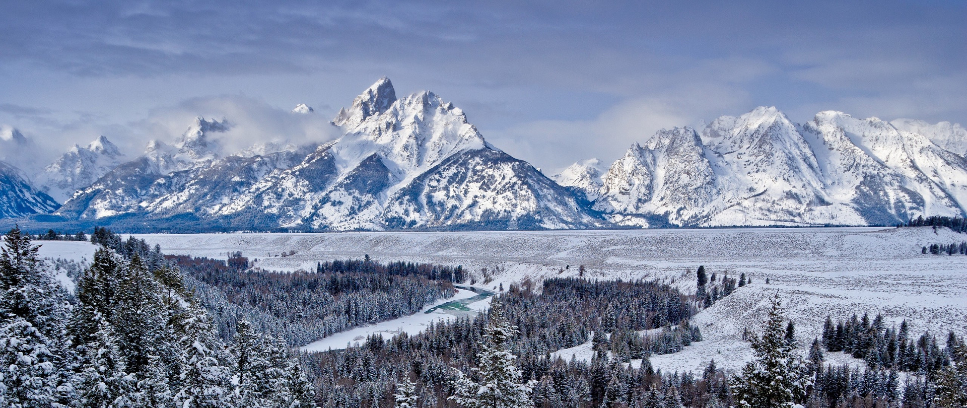
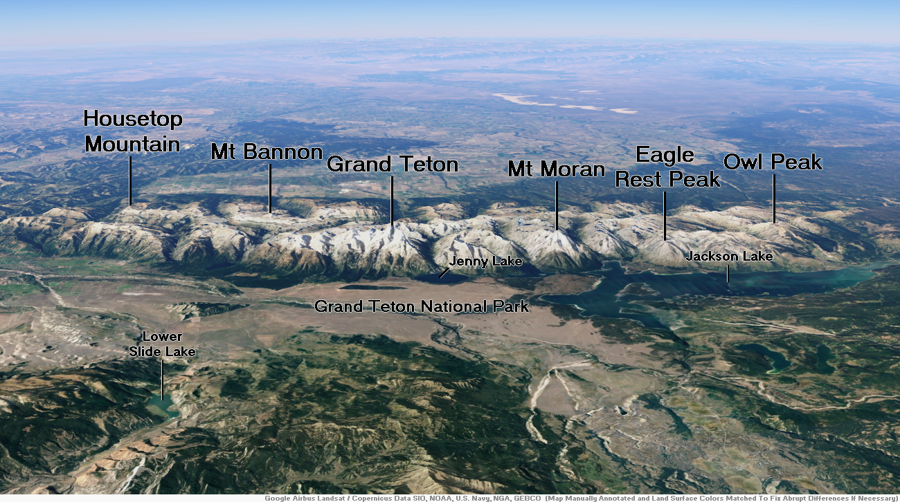
Grand Teton is the highest mountain of the Teton Range in Grand Teton National Park at 13,775 feet (4,199 m)[2] in Northwest Wyoming. Below its north face is Teton Glacier. The mountain is a classic destination in American mountaineering via the Owen-Spalding route (II, 5.4), the North Ridge and North Face.
Geography
See also: Geology of the Grand Teton area
Grand Teton, at 13,775 feet (4,199 m),[1] is the highest point of the Teton Range, a subrange of the Rocky Mountains, which extend from northern British Columbia to northern New Mexico. It is the second highest peak in the U.S. state of Wyoming after Gannett Peak, the parent peak. The mountain is entirely within the Snake River drainage basin, which it feeds by several local creeks and glaciers.[2] It is considered part of the Cathedral Group next to Teewinot Mountain and Mount Owen (Wyoming) and Middle Teton. Below its north face is Teton Glacier.
The mountain began its uplift 9 million years ago, during the Miocene.[4] Several periods of glaciation have carved Grand Teton and the other peaks of the range into their current shapes.[5]
This article uses material from the Wikipedia article Grand Teton, which is released under the Creative Commons Attribution-Share-Alike 4.0 International License (view authors).
 Mahmoud Younes (iStock) | 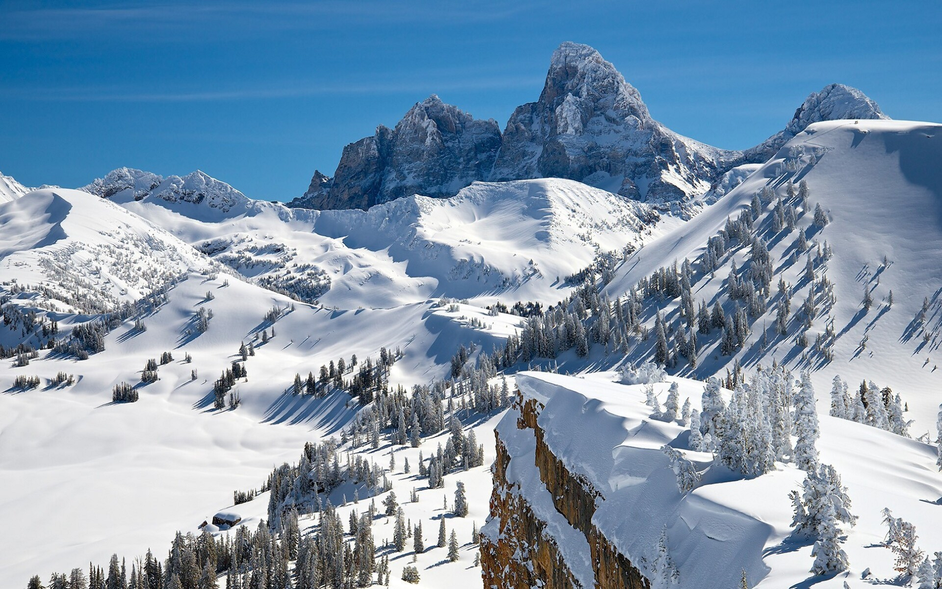 I I |
 |  |
 |  |
 |  |
Gannett Peak[4] is the highest mountain peak in the U.S. state of Wyoming at 13,810 feet (4,210 m). It lies in the Wind River Range within the Bridger Wilderness of the Bridger-Teton National Forest. Straddling the Continental Divide along the boundary between Fremont and Sublette counties, it has the second greatest topographic prominence in the state (7076′) after Cloud Peak (7077′), and is the highest ground for 290.36 miles (467.29 kilometers) in any direction.
Overview
Geographically, Gannett Peak is the apex[clarification needed] of the entire Central Rockies, the largely continuous chain of mountains occupying the states of Wyoming, Idaho and Montana. Named in 1906 for American geographer Henry Gannett,[5] the peak is also the high point of the Wind River Range. The mountain slopes are located in both Bridger-Teton National Forest and Shoshone National Forest.
Gannett is the highest peak within what is better known as the Greater Yellowstone Ecosystem and is the highest peak in the Rocky Mountains outside of Colorado. The 896-acre (3.63 km2) Gannett Glacier, which is likely the largest single glacier in the American portion of the Rocky Mountains, extends across the northern slopes of the mountain. Minor Glacier is situated in the western cirque of the peak while Dinwoody and Gooseneck Glaciers can be found on the southeast side of the mountain.
Gannett Peak is in the heart of a remote and rugged wilderness. Because of this, its elevation, and extreme weather, it is often considered by mountaineers to be one of the most difficult U.S. state high points to reach, after Denali and possibly Granite Peak.[6]
This article uses material from the Wikipedia article Gannett Peak, which is released under the Creative Commons Attribution-Share-Alike 4.0 International License (view authors).
 Tim Daniel (Dreamstime) |  Andy Dorais I |
 |  |
Bearhat Mountain Region
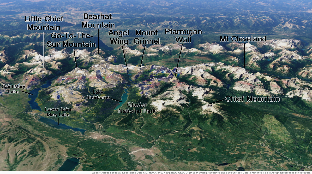
Bearhat Mountain Panoramic

Sanghwan Kim (iStock)
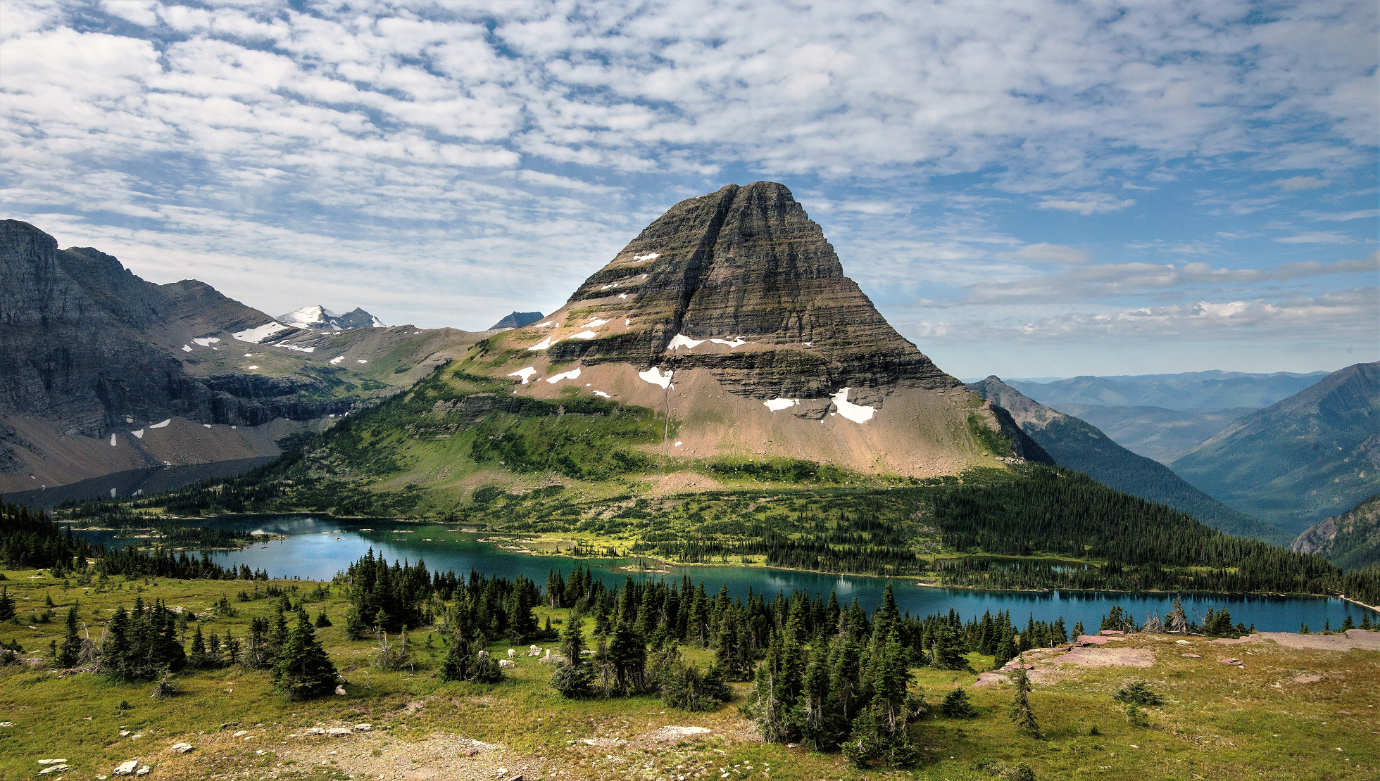
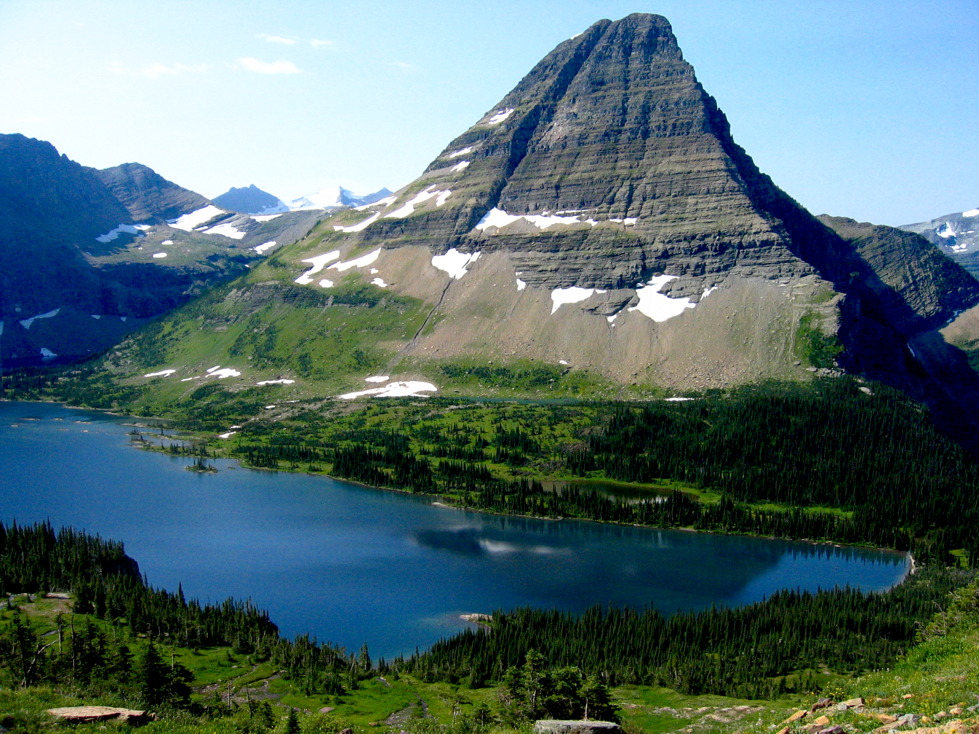
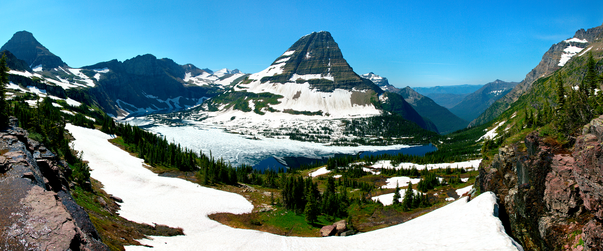
Bearhat Mountain (8,689 feet (2,648 m)) is located in the Lewis Range, Glacier National Park in the U.S. state of Montana.[3] Bearhat Mountain is immediately west of Hidden Lake. The mountain was named after a Kootenai Native American, and was officially adopted by the U.S. Board on Geographic Names in 1932.[2]
Based on the Köppen climate classification, Bearhat Mountain has an alpine climate characterized by long, usually very cold winters, and short, cool to mild summers.[4] Temperatures can drop below −10 °F with wind chill factors below −30 °F.
Geology
Like other mountains in Glacier National Park, Bearhat Mountain is composed of sedimentary rock laid down during the Precambrian to Jurassic periods. Formed in shallow seas, this sedimentary rock was initially uplifted beginning 170 million years ago when the Lewis Overthrust fault pushed an enormous slab of precambrian rocks 3 mi (4.8 km) thick, 50 miles (80 km) wide and 160 miles (260 km) long over younger rock of the cretaceous period.[5]
This article uses material from the Wikipedia article Bearhat Mountain, which is released under the Creative Commons Attribution-Share-Alike 4.0 International License (view authors).
 Stephen Liang (Wikipedia) |  Jeffrey Ross (iStock) I |
 Andrew Parlette (Wikipedia) | 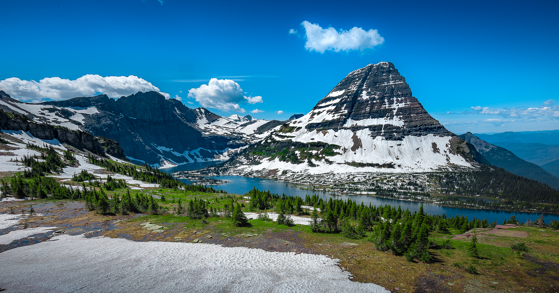 Srongkrod (iStock) I |
 |  |
 |  |

![]()
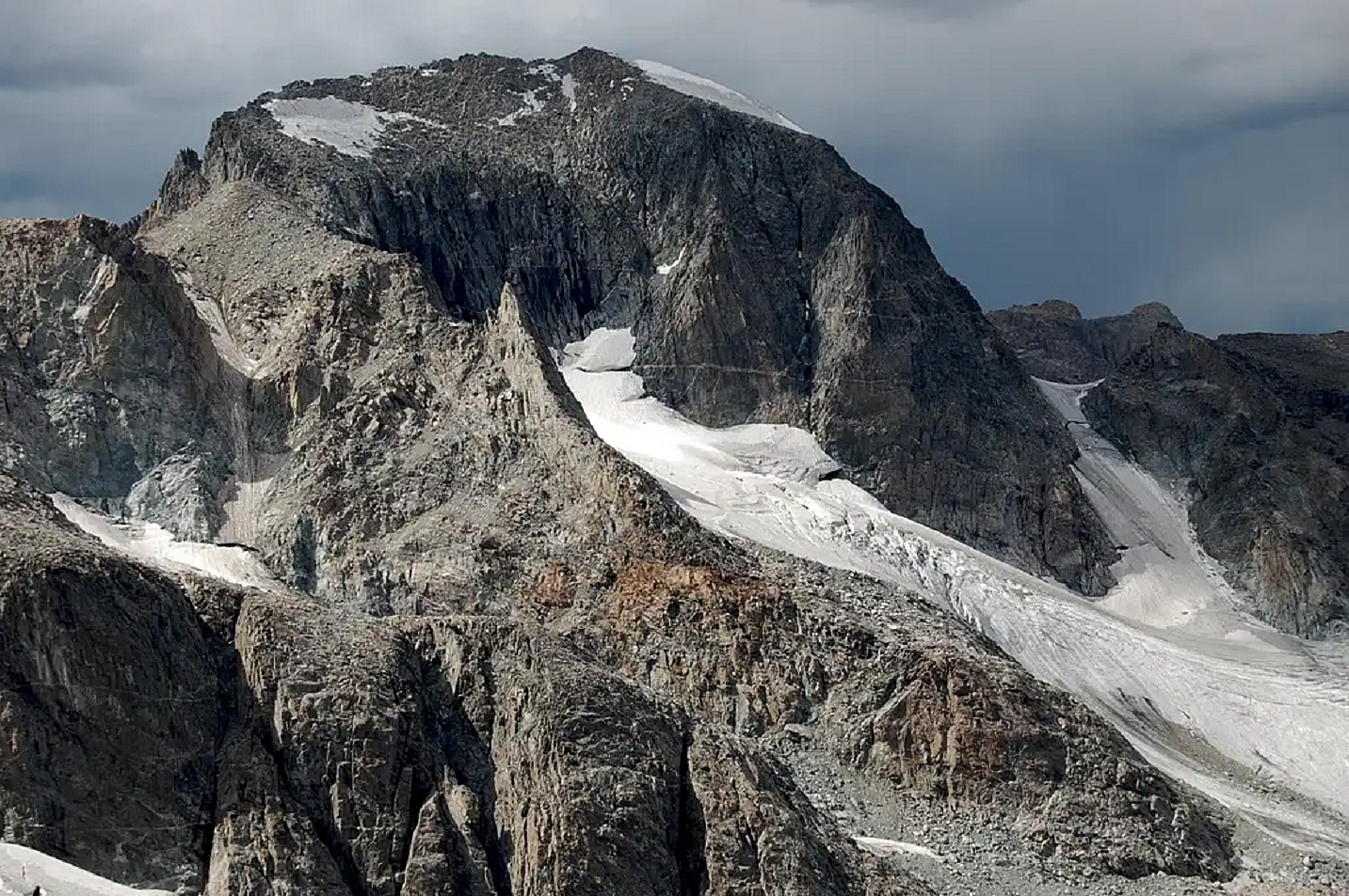
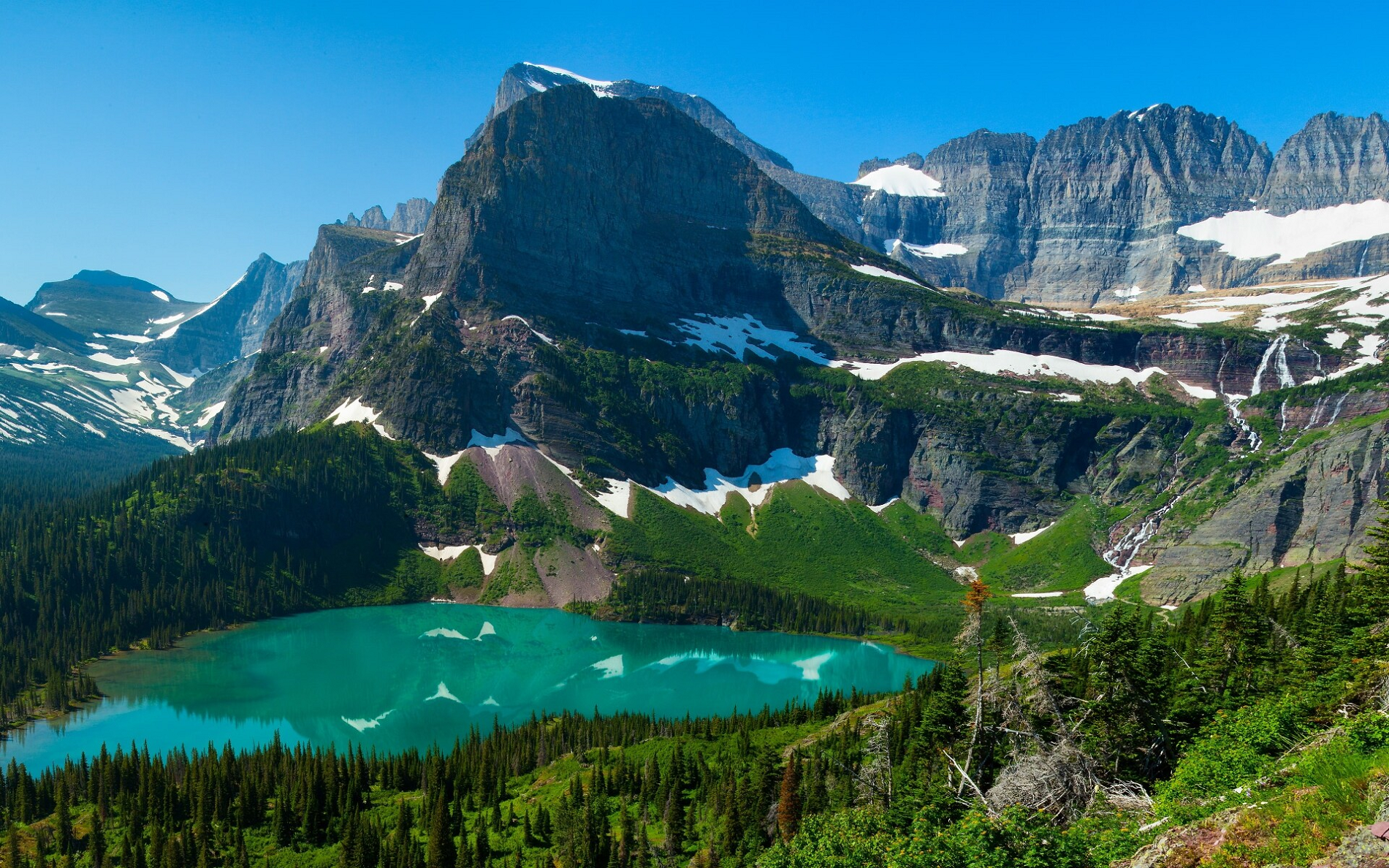
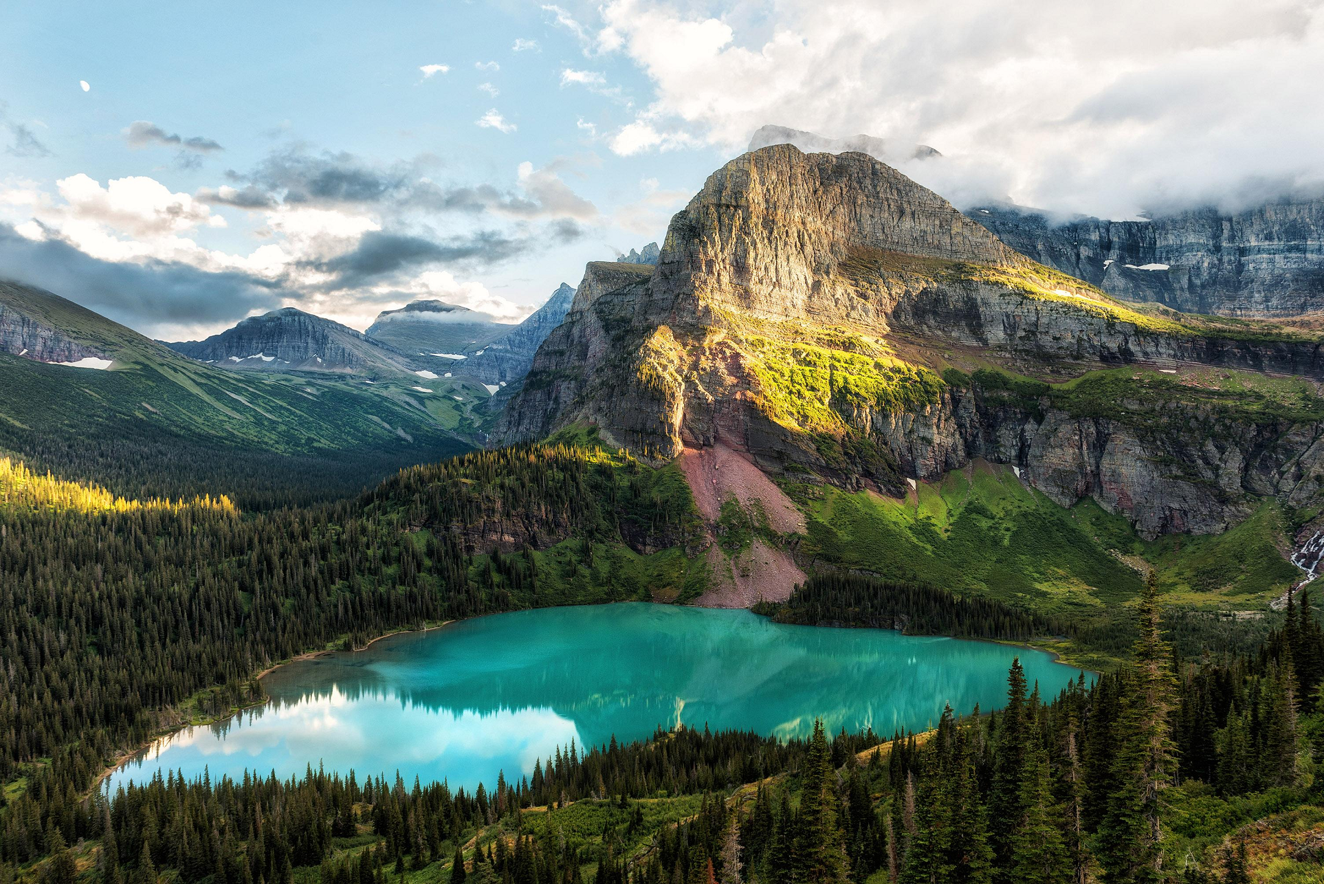
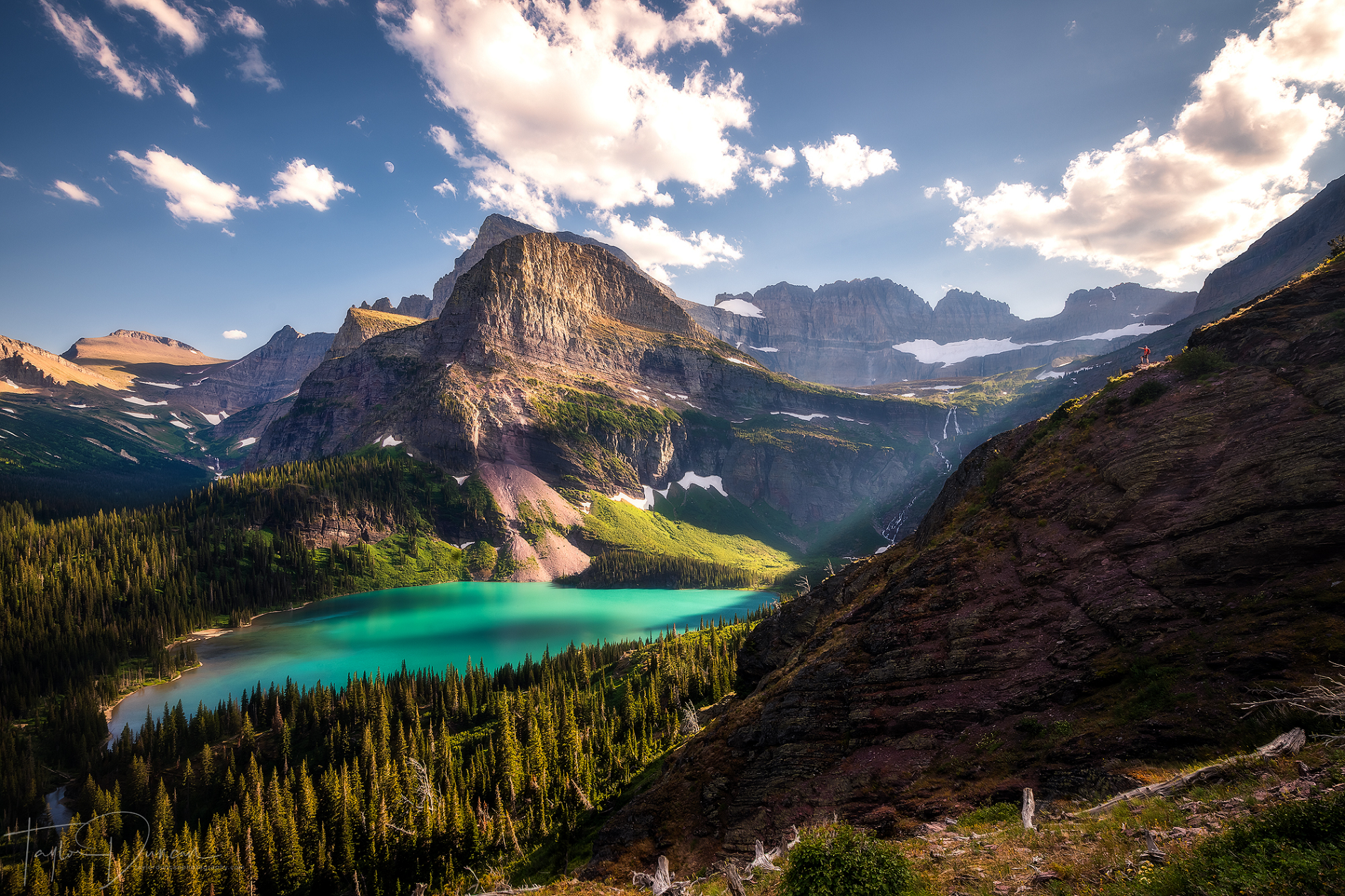
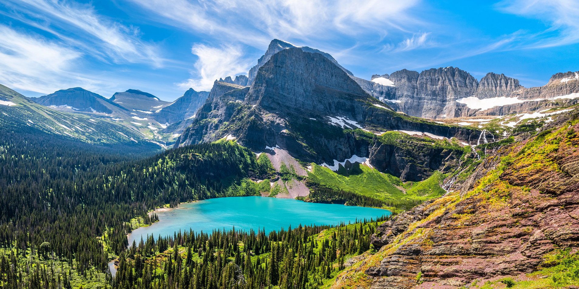
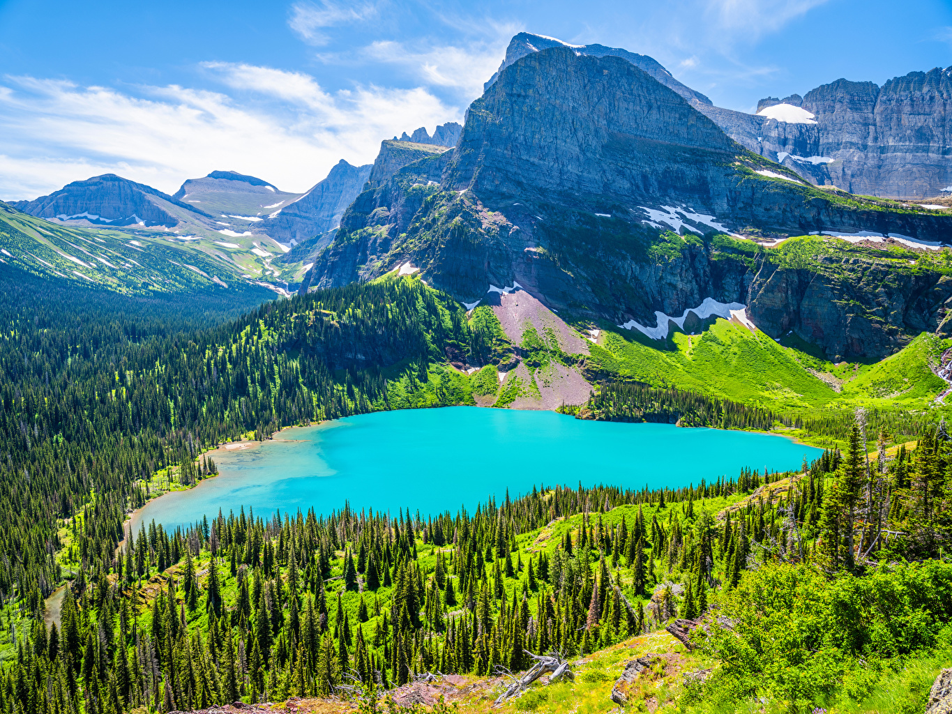
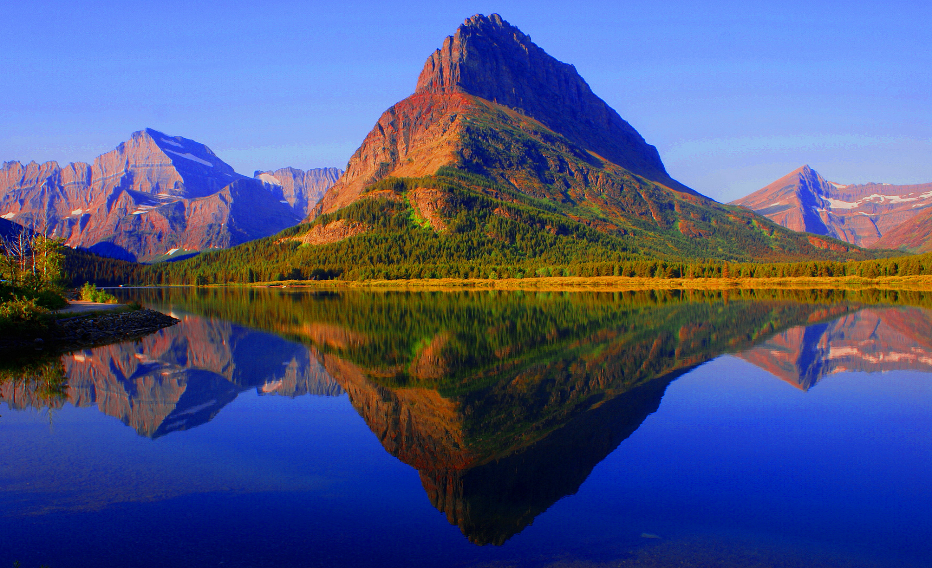
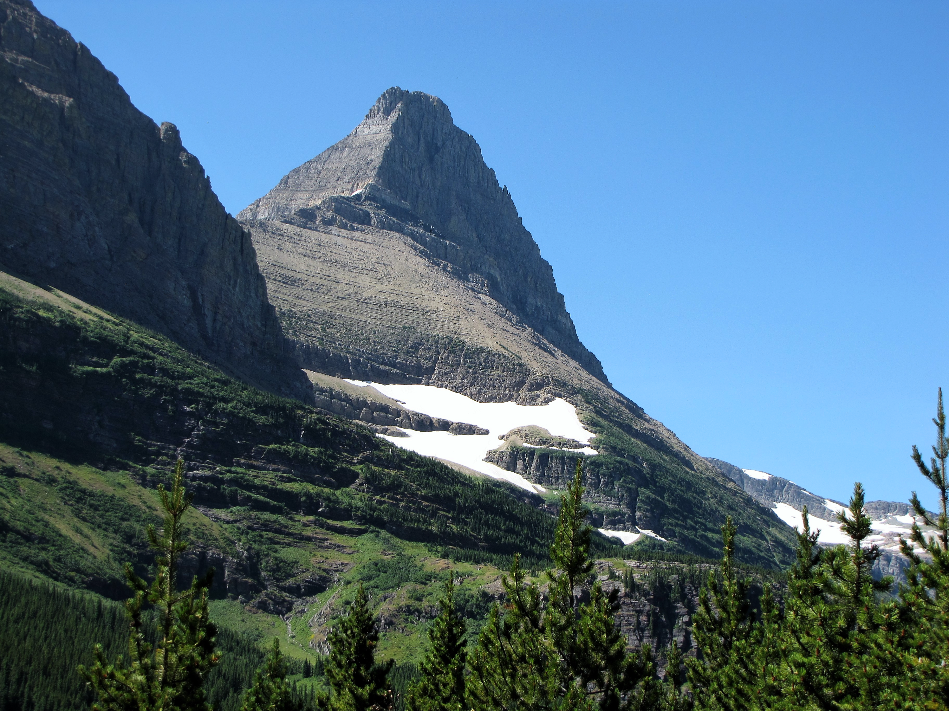
Angel Wing is a 7,430-foot (2,260-meter) elevation mountain summit located in the Lewis Range, of Glacier National Park in the U.S. state of Montana. It is situated one mile east of the Continental Divide, in Glacier County. It can be seen from the Many Glacier area, and up close from the Grinnell Glacier Trail. Topographic relief is significant as the north aspect rises nearly 2,500 feet (760 meters) above Grinnell Lake in one-half mile.
Climate
Based on the Köppen climate classification, Angel Wing is located in an alpine subarctic climate zone with long, cold, snowy winters, and cool to warm summers.[4] Temperatures can drop below −10 °F with wind chill factors below −30 °F. Precipitation runoff from the peak drains into Grinnell and Cataract Creeks, which are part of the St. Mary River drainage basin.
Geology
Like other mountains in Glacier National Park, Angel Wing is composed of sedimentary rock laid down during the Precambrian to Jurassic periods. Formed in shallow seas, this sedimentary rock was initially uplifted beginning 170 million years ago when the Lewis Overthrust fault pushed an enormous slab of precambrian rocks 3 mi (4.8 km) thick, 50 miles (80 km) wide and 160 miles (260 km) long over younger rock of the cretaceous period.[5] The summit is composed of Empire Formation of the Neogene period, and it overlays the Grinnell Formation which is a layer of sandstone and argillite.[6]
This article uses material from the Wikipedia article Angel Wing (Glacier National Park), which is released under the Creative Commons Attribution-Share-Alike 4.0 International License (view authors).
 I |  Distress Bark (Wikipedia) |
 |  |
 |  |
Mount Grinnell Panoramic
Traveler100 (Wikipedia)
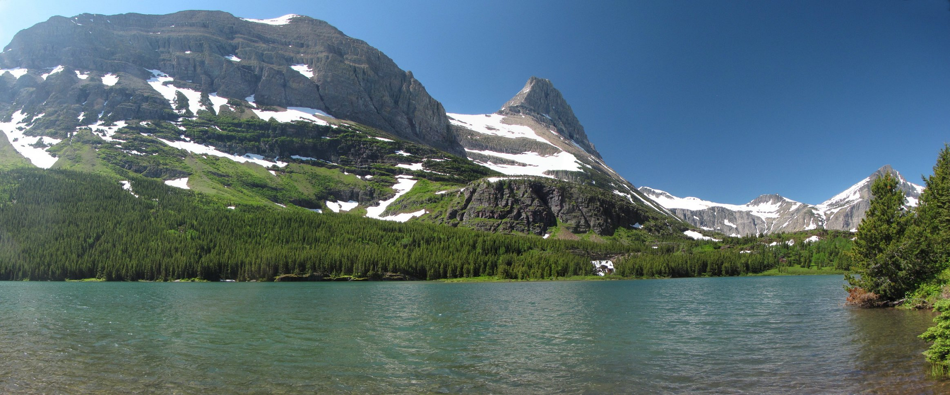
Mount Grinnell is a peak located in the heart of Glacier National Park in the U.S. state of Montana. Lying just east of the Continental Divide in the Many Glacier region of the park, the peak is flanked to the northwest by Swiftcurrent Glacier and to the south by Grinnell Glacier.[3] Mount Grinnell is named after George Bird Grinnell.[4] From the Many Glacier Hotel on Swiftcurrent Lake, the eastern arm of Mount Grinnell, known as Grinnell Point, hides the main summit.
This article uses material from the Wikipedia article Mount Grinnell, which is released under the Creative Commons Attribution-Share-Alike 4.0 International License (view authors).
 |  |
 I | 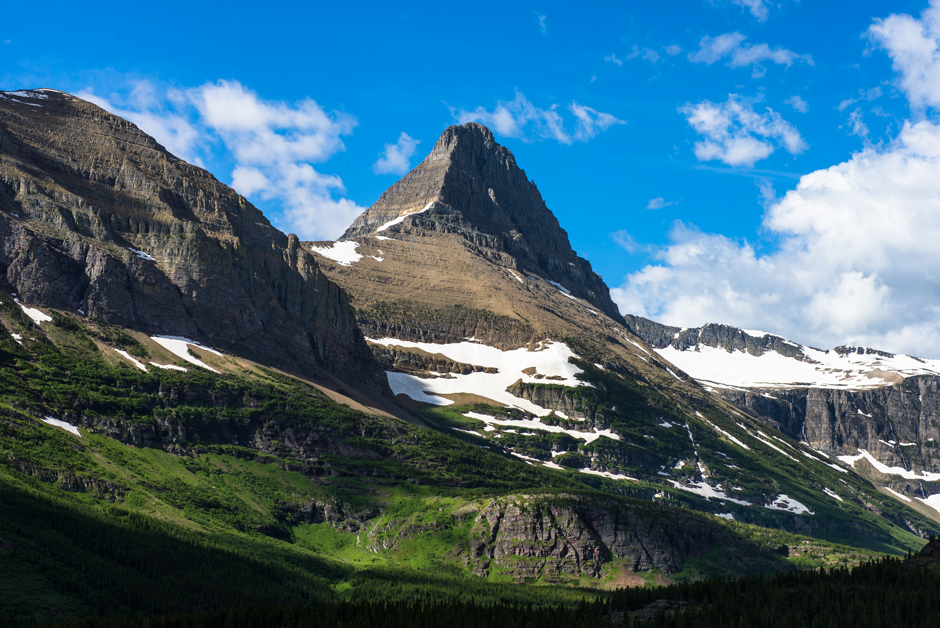 Srongkrod (Wikipedia) |
 Mongo (Wikipedia) | 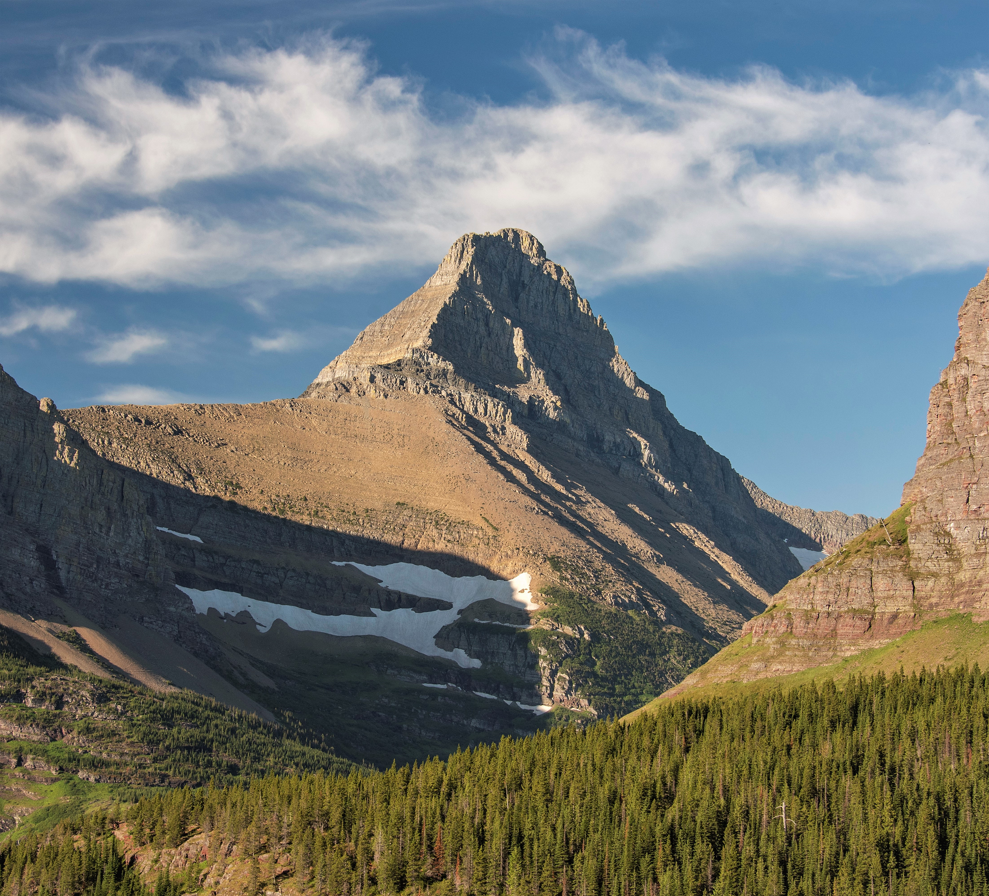 Oliver Dodd (Wikipedia) |
