
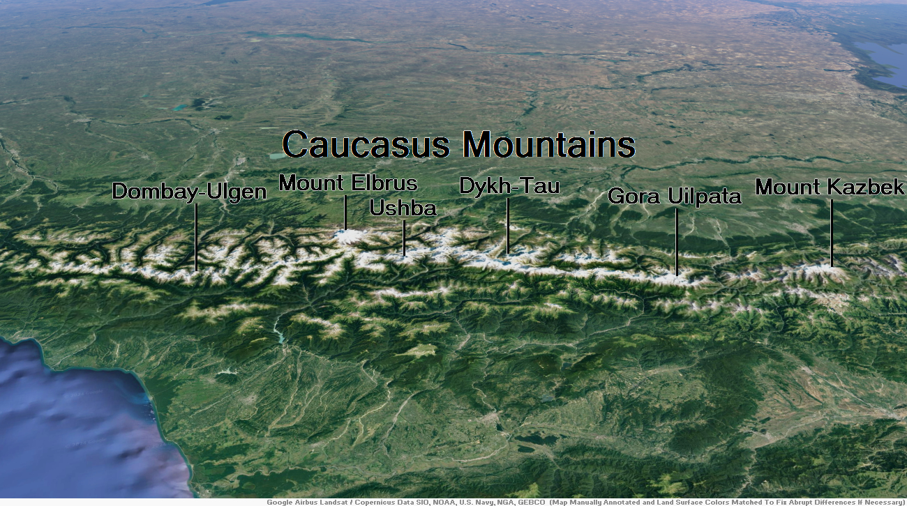
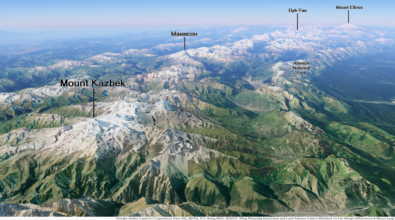
Map of Caucasus Mountains
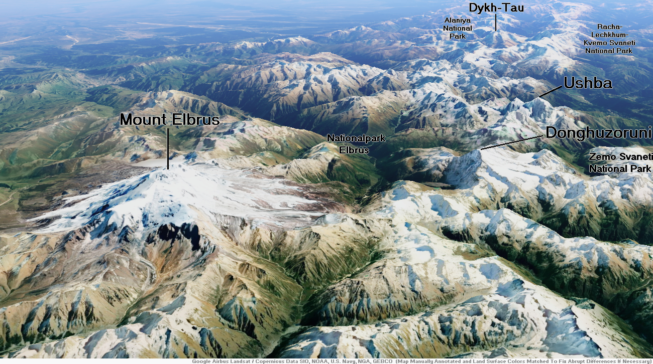
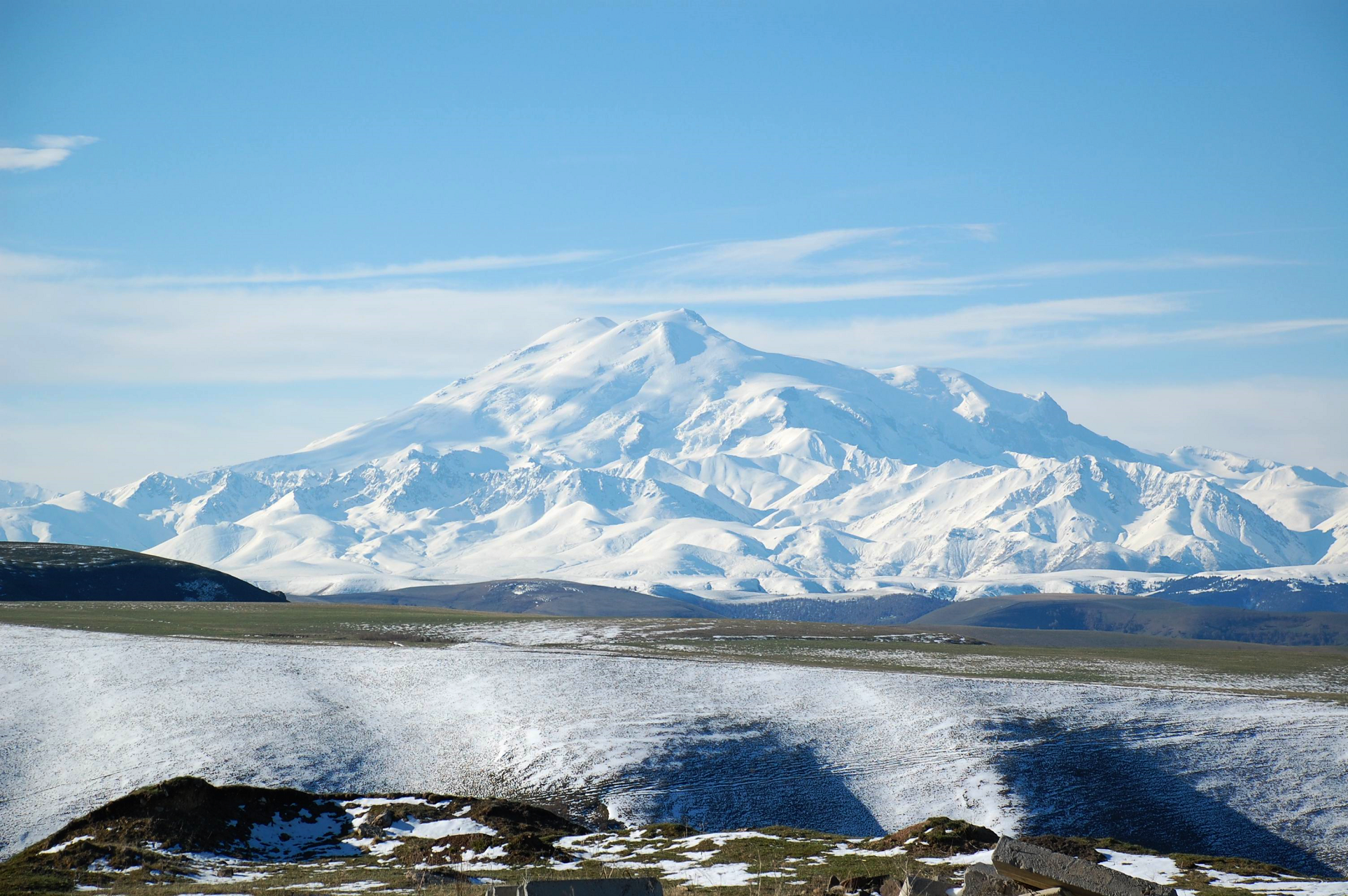
Mount Elbrus Region
![]()
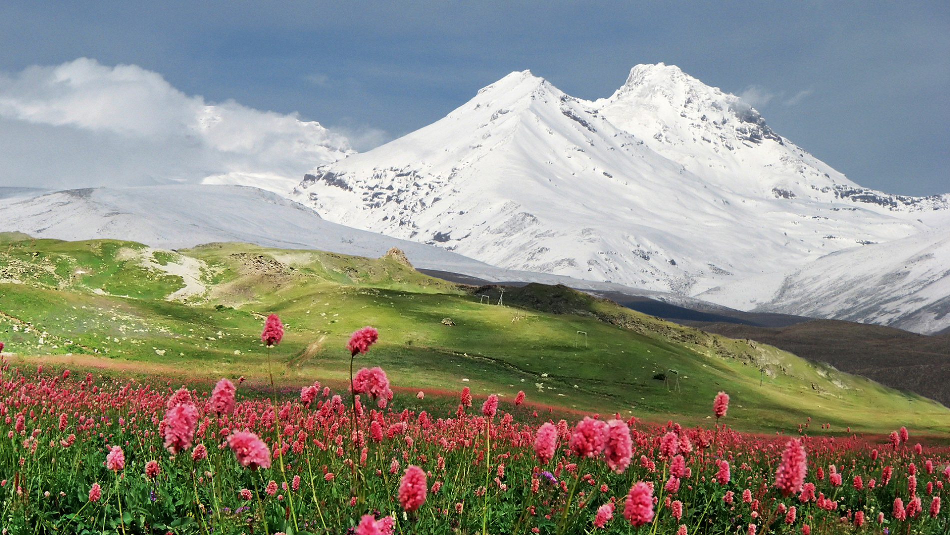
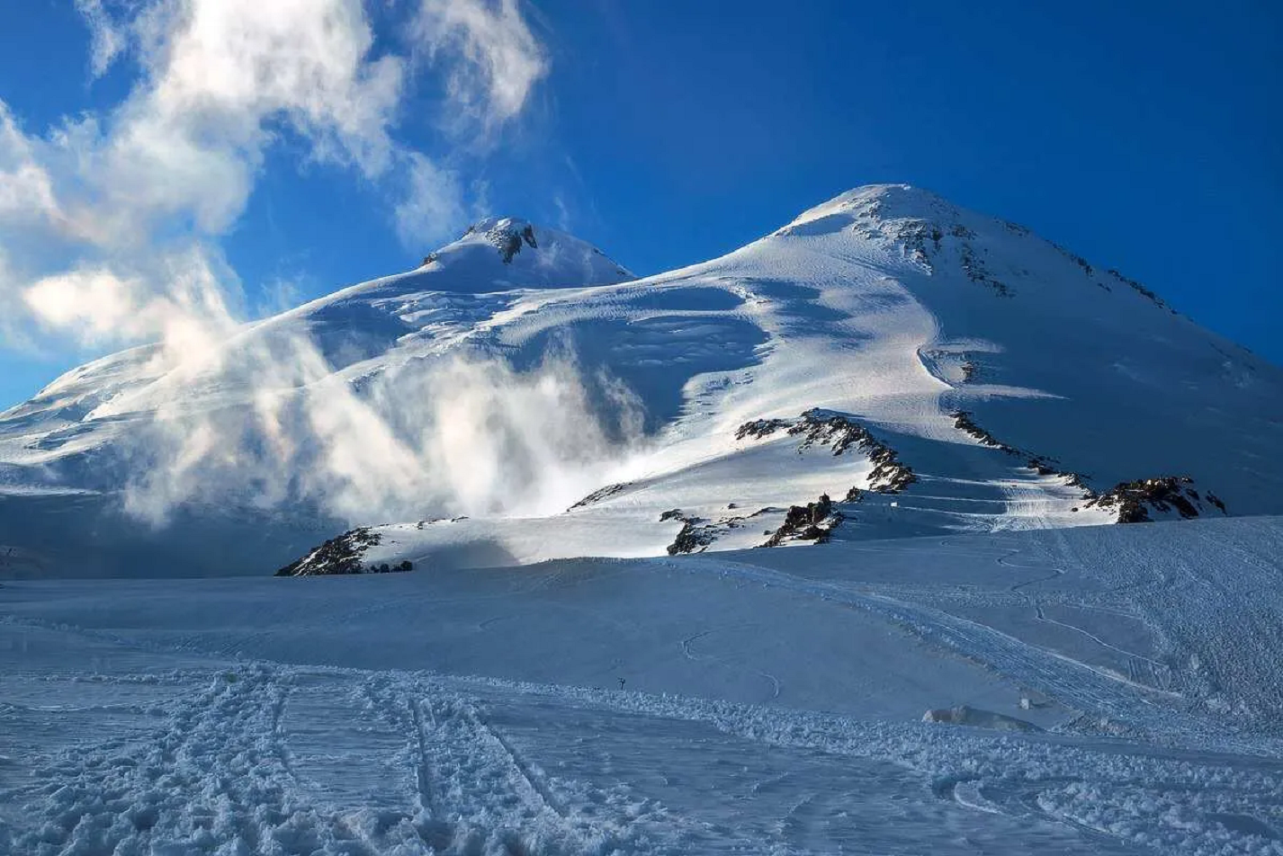
Mount Elbrus[a] is the highest mountain in Russia and Europe. It is a dormant stratovolcano rising 5,642 m (18,510 ft) above sea level, and is the highest volcano in the supercontinent of Eurasia, as well as the tenth-most prominent peak in the world.[7] It is situated in the southern Russian republic of Kabardino-Balkaria in the western extension of Ciscaucasia, and is the highest peak of the Caucasus Mountains.
Elbrus has two summits, both of which are dormant volcanic domes. The taller, western summit is 5,642 metres (18,510 ft);[2] the eastern summit is 5,621 metres (18,442 ft). The eastern summit was first ascended on 10 July 1829 by a Circassian man named Khillar Khashirov, and the western summit in 1874 by a British expedition led by F. Crauford Grove and including Frederick Gardner, Horace Walker and the Swiss guide Peter Knubel.[citation needed]
Etymology
The name Elbrus /ˈɛlbrus/ seems to have a connection with Alborz[8][9] (also called Elburz), which is also the name of a long mountain range in northern Iran. The name is derived from Avestan Harā Bərəzaitī, a legendary mountain in Iranian mythology. Harā Bərəzaitī reflects Proto-Iranian *Harā Bṛzatī, which was reformed into Middle Persian as Harborz, and into Modern Persian as Alborz.[8] Bṛzatī is the feminine form of the adjective *bṛzant (“high”), the reconstructed ancestor of Modern Ossetian bærzond (“high”, “peak”), Modern Persian barz (“high”), berāzande (“elegant”), and boland (“high”, “tall”),[8] and Modern Kurdish barz (“high”). Harā may be interpreted as “watch” or “guard”, from Indo-European *ser (“protect”).[8] Circassians use the name “Uash-ha Makhua” which means “The mountain of happiness”, The name “Mingi Taw” used by Karachays and Balkars means “Eternal Mountain” in Turkic languages.[10]
Geography Situation
Elbrus is situated in the northwest of the Caucasus, 100 kilometres from the Black Sea and 370 kilometres from the Caspian Sea, which is visible from Elbrus[dubious – discuss] on exceptionally clear days.[11] It rises 5,642 metres above the sea level. Located eleven kilometres north of the Greater Caucasus Watershed, marking the border with Georgia, it is on the border of the Russian republics of Kabardino-Balkaria and Karachay-Cherkessia. It is the highest peak in both Russia and Europe.[12]
This article uses material from the Wikipedia article Mount Elbrus, which is released under the Creative Commons Attribution-Share-Alike 4.0 International License (view authors).
 |  |
 |  |

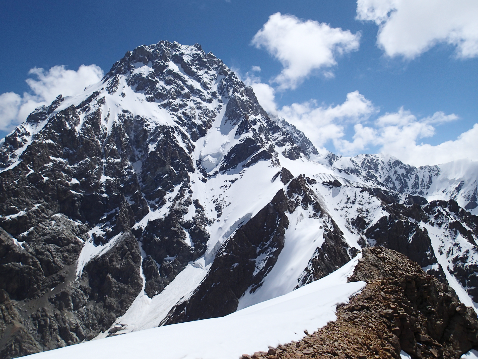
Dykh-Tau or Dykhtau (Russian: Дыхтау, Karachay-Balkar: Дых тау that is derived from Turkic “dik dagh” which means Jagged Mount), is the second-highest mountain in Russia and Europe, standing at 5,205 m (17,077 ft) above sea level. It is located in Kabardino-Balkaria, Russia; its peak standing about 5 km (3 mi) north of the border with Georgia.[citation needed]
Access
Dykh-Tau is best accessed from the north (Russia). Bezingi village may be reached from Nalchik in Kabardino-Balkaria with infrequent public transport, here a 4WD vehicle must be hired. Thus Bezingi Alpine Camp is reached at 2,180 meters (7,150 ft). From here it takes a further 2 days to reach the base of the climb.[2]
Climbing routes
This is one of the Caucasian Peaks, facing the Bezingi Wall across the Bezingi Glacier. The first ascent in 1888 by Albert Mummery and Heinrich Zurfluh of Meiringen was a major achievement at the time.[3] Their route up the SW Ridge is no longer used as the normal route which is now the North Ridge graded 4B (Russian Grading).[citation needed]
Starting from Misses Kosh the ridge is accessed by crossing the West Ridge of Misses-Tau then continuing to the Russian Bivouac located by a hanging glacier descending from the North Ridge of Dykhtau, 4 hours from Misses-Kosh. Once a notch between Misses-Tau and Dykhtau is gained, the North Ridge is followed to the summit. Allow 2 and a half days from the Russian Bivouac, there are several good bivouac sites on the North Ridge (Details and map Archived 2016-03-04 at the Wayback Machine).
This article uses material from the Wikipedia article Dykh-Tau, which is released under the Creative Commons Attribution-Share-Alike 4.0 International License (view authors).
 Masa Sakano | 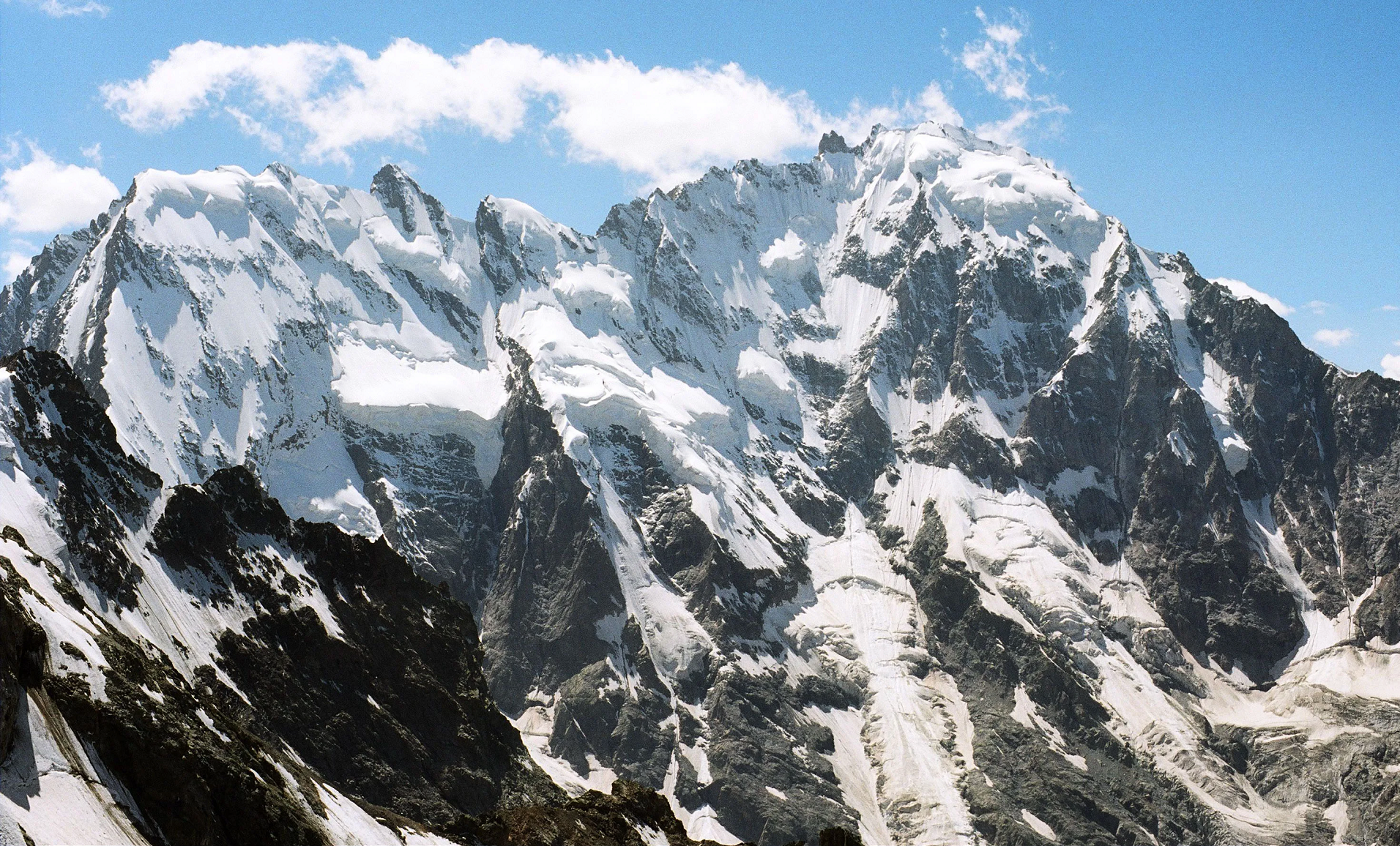 I |
 Shaman17 (Wikipedia) | 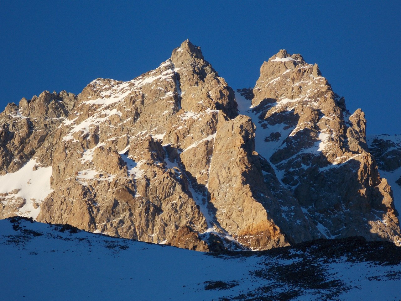 I |

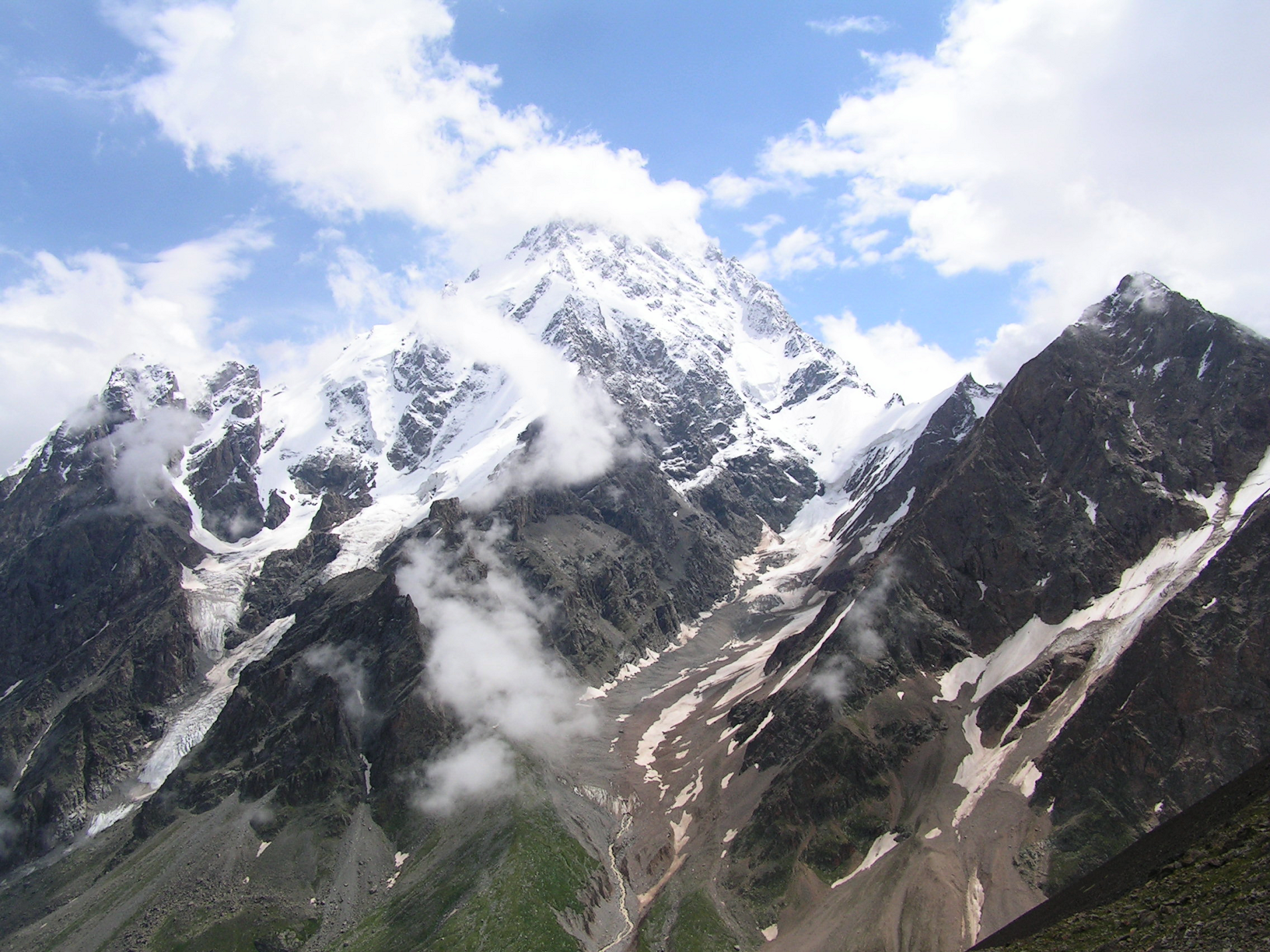
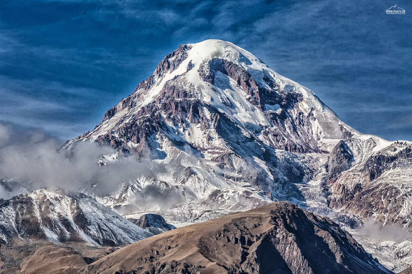
Mount Kazbek Region
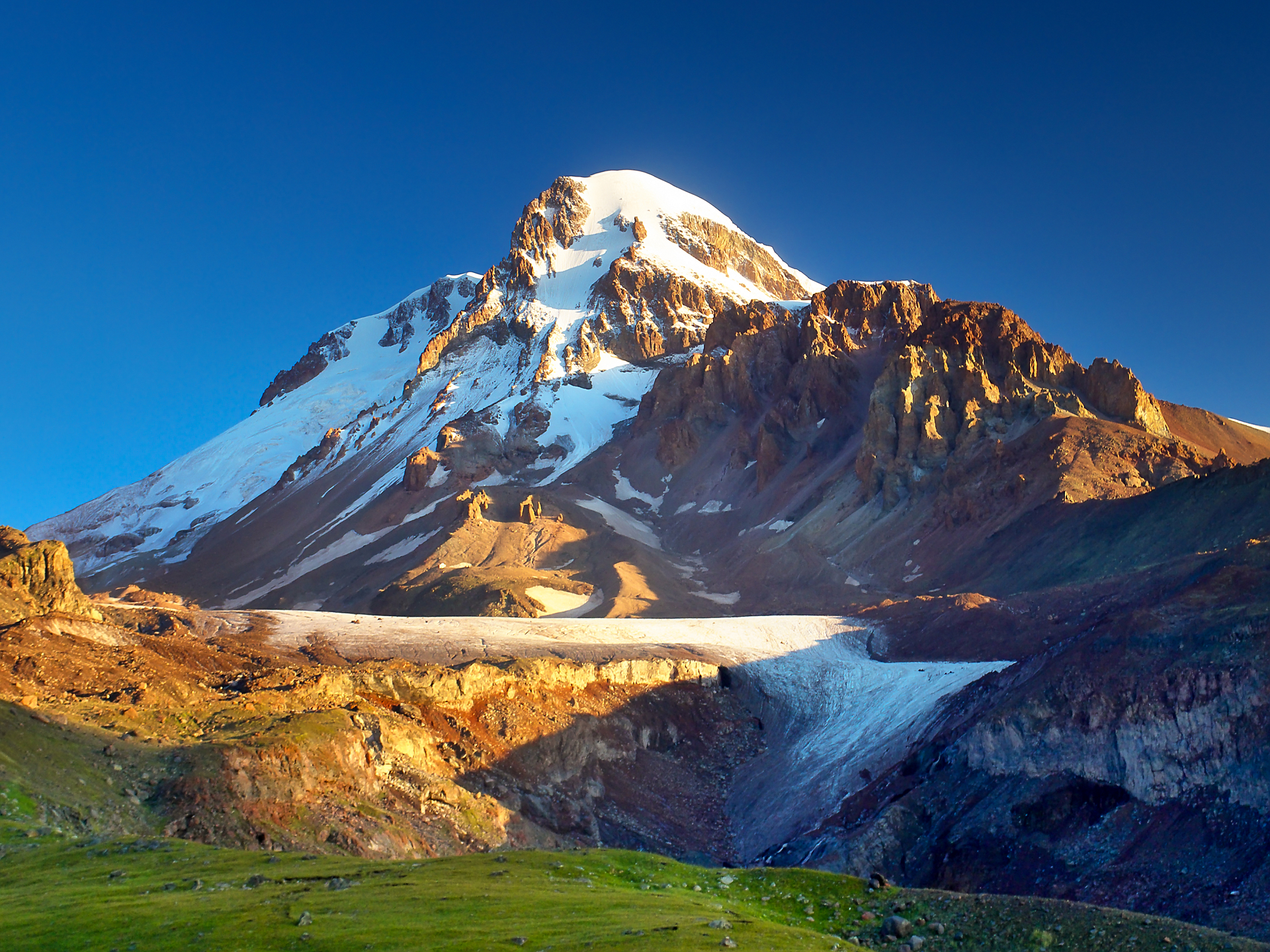
Mount Kazbek or Mount Kazbegi[a] is a dormant stratovolcano and one of the major mountains of the Caucasus, located in Georgia, just south of the border with Russia.[6]
Lying at 5,054 meters (16,581 ft) above at sea level, Mount Kazbek is the highest mountain in Eastern Georgia. It is also the third-highest peak in the country (after Mount Shkhara and Janga). Kazbegi is the second-highest volcanic summit in the Caucasus, after Mount Elbrus. The summit lies directly to the west of the town of Stepantsminda and is the most prominent geographic feature of the area.[6] The last eruption occurred c. 750 BCE.[6]
Origin of the name
The name Kazbegi is disputed; some claims are it is named after a Circassian nobleman who lived on it, other claims are it is named after local nobleman Dimitri Chopikashvili (grand father of the Georgian writer Aleksandre Kazbegi) who was given the title of “Kazbeg” by Georgian king Erekle II. The word “Kazbek” means a “nobleman” in Kabardian language. The title appeared under Georgian king Rostom in the 17th century. The name of the mountain in Georgian, Mqinvartsveri, translates to “Glacier Peak” or “Freezing Cold Peak”.[7] The Ingush name Beshloam and Chechen name Bashlam translates as “Molten Mount”.
Location
Kazbek is located on the Khokh Range, a mountain range which runs north of the Greater Caucasus Range, and which is pierced by the gorges of the Ardon and the Terek. At its eastern foot runs the Georgian Military Road through the pass of Darial 2,378 meters (7,805 feet).[8] The mountain itself lies along the edge of the Borjomi–Kazbegi Fault (which is a northern sub-ending of the North Anatolian Fault). The region is highly active tectonically, with numerous small earthquakes occurring at regular intervals. An active geothermal/hot spring system also surrounds the mountain. Kazbek is a potentially active volcano, built up of trachyte and sheathed with lava, and has the shape of a double cone, whose base lies at an altitude of 1,770 meters (5,800 feet).[8] Kazbek is the highest of the volcanic cones of the Kazbegivolcanic group which also includes Mount Khabarjina (3,142 metres).
This article uses material from the Wikipedia article Kazbek, which is released under the Creative Commons Attribution-Share-Alike 4.0 International License (view authors).
 Biletskiy (Dreamstime) | 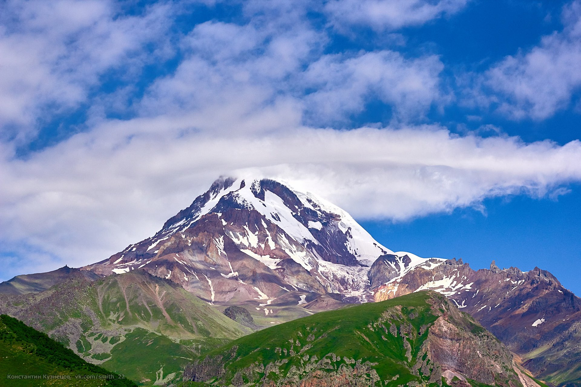 I |
 Paata.ge I |  Aragat (Climbing Georgia) |
![]()
