
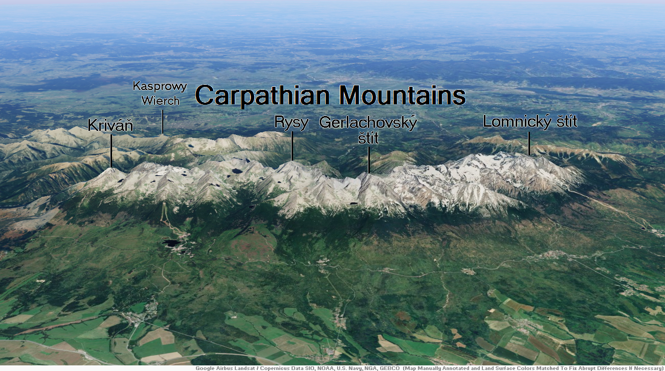
Map of Carpathian Mountains
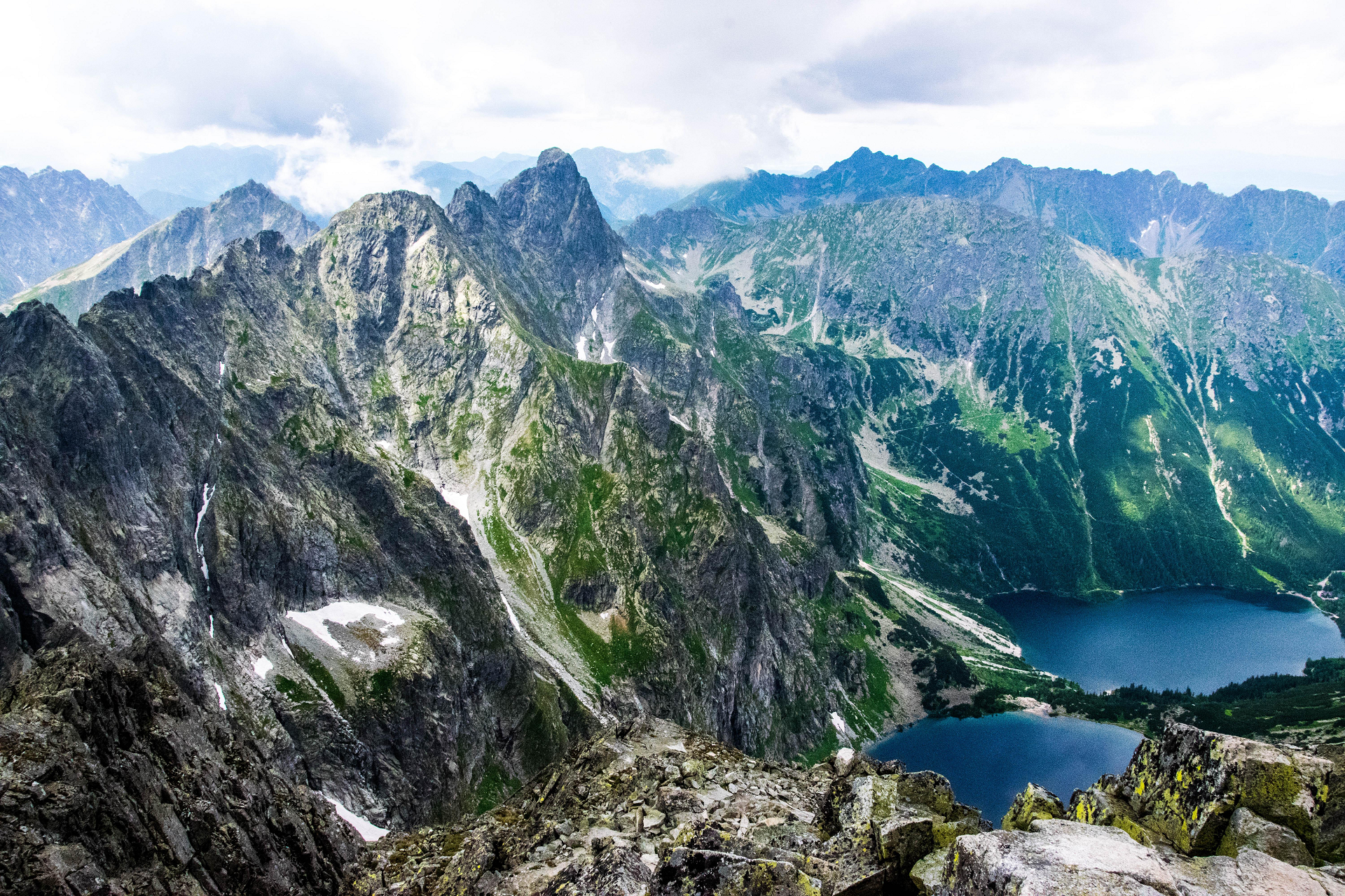
Mieguszowiecki Szczyt Wielki Region

Mięgoszowiecki Szczyt, Mięguszowiecki Szczyt Wielki (German: Groe Mengsdorfer Spitze, word. Ve?k? Mengusovsk? ?t?t, węg. Nagy-Menguszfalvi-cs[1], 2439 m above sea level[2], according to previous measurements of 2438 m) – the summit of the High Tatras, located in the main ridge of the Tatra Mountains on the Polish-Slovak border, between Cubryna (separation is separated by the Hińczowa Passage, 2323 m) and Mięguszowieckie Góra.Mięguszowiecka Przełęcz Wyżnia It is the second highest peak in Poland (20th in the Tatra Mountains) and the highest of the Mięguszowiecki Peaks (the highest in Poland, if only the main top can be taken as a criterion; the “Polish” apex of the Draws is not the main mount[3]). Its northern wall is the highest wall in the Tatras with a slope exceeding 45° it reaches 1043 m high. Alfred Martin wrote of him in 1908: “One of the most powerful and beautiful peaks of the High Tatras.”[4]
Mięgoszowiecki Peak rises above two main valleys. On the Polish, north side, it is the Valley of Rybi Potok, after the southern, Slovak Valley of Hińczów, which is one of the floors of the Mięguszowiecki Valley[5]. From the name of this last valley comes the name of the Mięguszowieckie Peaks and other surrounding objects, and the name of the valley comes from the village of Mięguszowce, to which these areas once belonged. In the climbing environment, the peak is commonly called Mięgusz or referred to as the MSW[6].
This article uses material from the Wikipedia article Mięguszowiecki Szczyt, which is released under the Creative Commons Attribution-Share-Alike 4.0 International License (view authors).
 I I |  Aneta Pawska (Wikipedia) |
 |  |
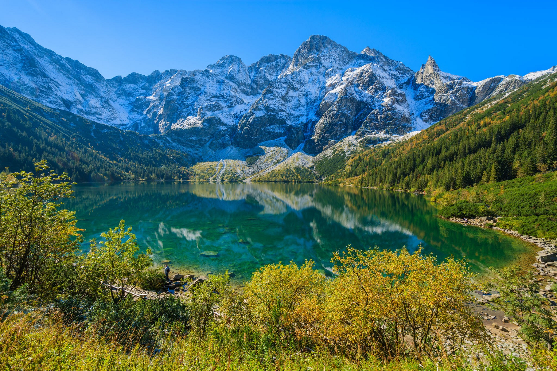
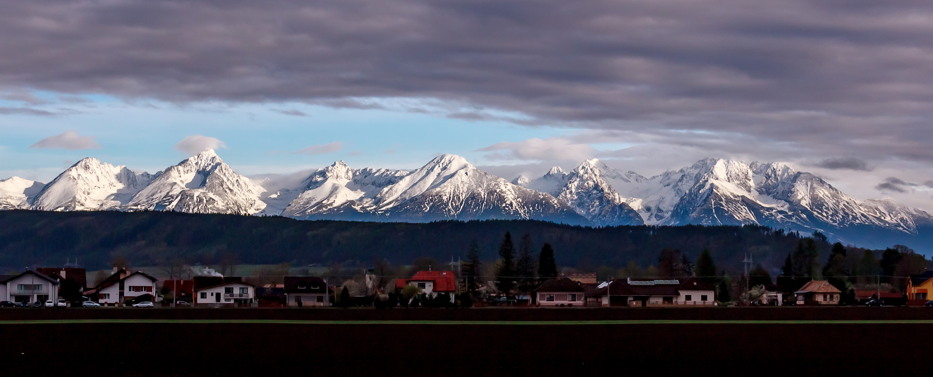
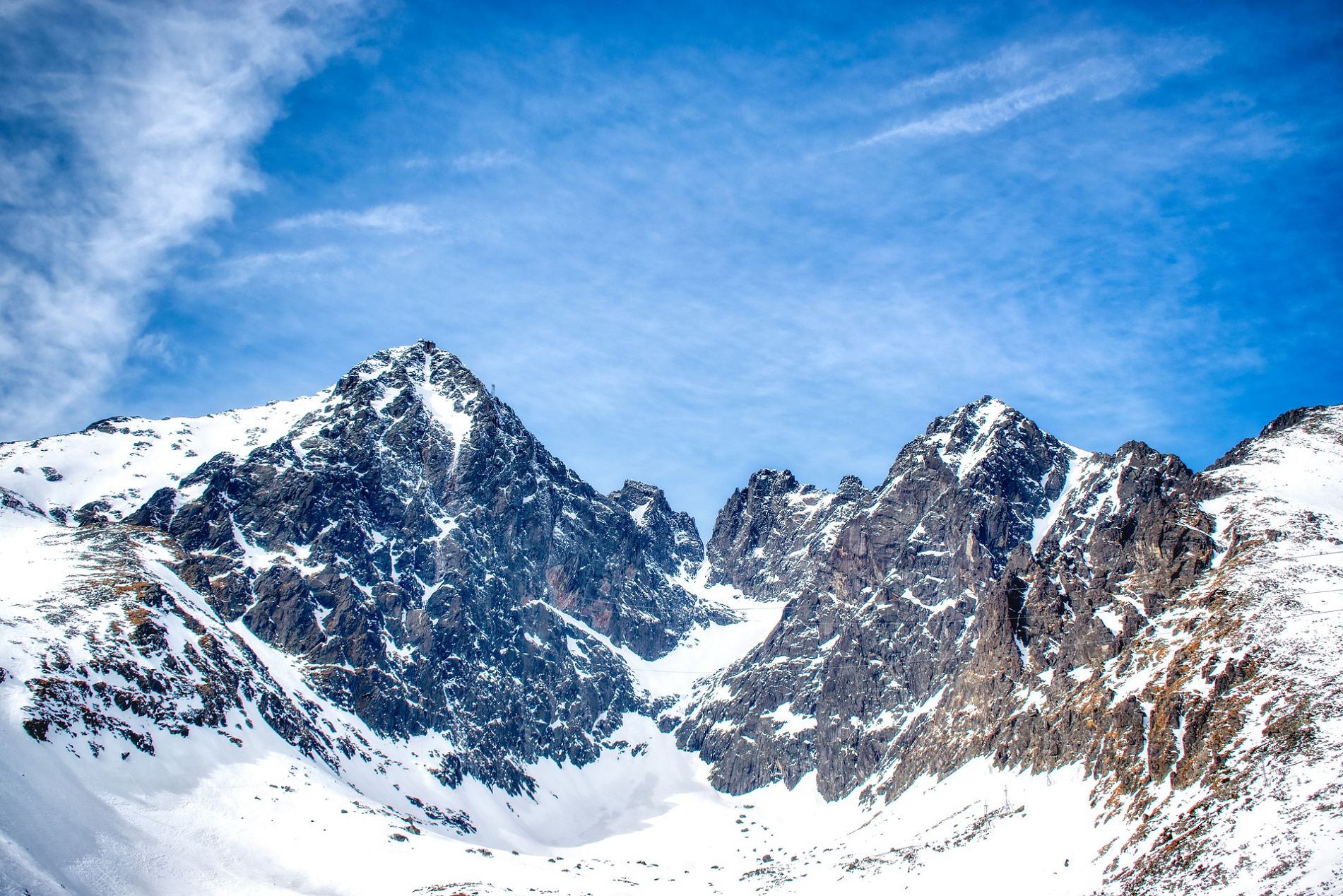
Gerlachovský štít Panoramic


Gerlachovský štít (Slovak pronunciationⓘ, translated into English as Gerlachov Peak, German: Gerlsdorfer Spitze, Hungarian: Gerlachfalvi-csúcs), informally referred to as Gerlach, is the highest peak in the High Tatras, in Slovakia, and in the Carpathian Mountains. Its elevation is usually listed at 2654.4 m above mean sea level. The mountain features a vertical rise of approximately 2,000 metres (6,600 ft) above the valley floor.[4]
Mistaken for an average mountain in the rugged High Tatras range in the more distant past, it has since played a symbolic role in the eyes of the rulers and populations of several Central European nations, to the point that between the 19th and mid-20th century, it had four different names with six name reversals. Due to geopolitical changes, it was successively the highest mountain of the Kingdom of Hungary, and of Czechoslovakia, Slovakia and then Czechoslovakia again within the span of less than three decades of the 20th century.
Gerlachovský štít shares its geology and ecology with the rest of the High Tatras. With the travel restrictions imposed by the Eastern Bloc, the mountain was particularly treasured by Czechs, East Germans, Hungarians, Poles, and Slovaks as a high mountain available for them to climb. Although local authorities have since restricted access to the peak, it continues to attract its share of visitors.
Present Names
Gerlachovský štít means the “Peak (of the village) of Gerlachov“. The Slovak colloquial (unofficial) name is Gerlach. The Polish official names are Gerlach or Gierlach, while its Polish colloquial names are Girlach and Garłuch.[5][6][7] The name of the village of Gerlachov itself is of German origin, because the Spiš region around the High Tatra Mountains in Slovakia used to be inhabited by German settlers for several centuries.
This article uses material from the Wikipedia article Gerlachovský štít, which is released under the Creative Commons Attribution-Share-Alike 4.0 International License (view authors).
 Pavol Svetoň (Wikipedia) I |  Jakub Krajňák (Wikipedia) |
 Midnight Runner (Wikipedia) | 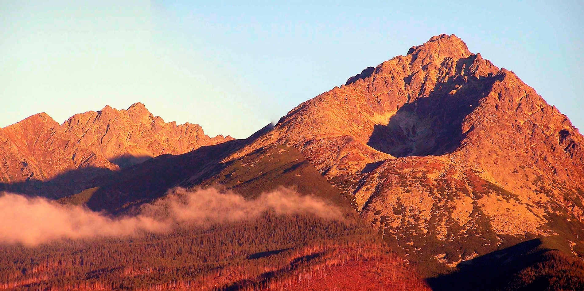 Pavol Svetoň (Wikipedia) I |

![]()
Lomnický štít (English: Lomnica Peak[1][2] or Lomnický Peak[3][4], Hungarian: Lomnici-csúcs, German: Lomnitzer Spitze, Polish: Łomnica) is one of the highest and most visited mountain peaks in the High Tatras mountains of Slovakia. Connected by cable car to Tatranská Lomnica, its summit is 2,634 metres (8,642 ft) above sea level, making it the second highest peak in the High Tatras after Gerlachovský štít (2654 m).
Local shoemaker and amateur miner Jakab Fábry stated he made an ascent around 1760–1790, but the first recorded ascent was made by the English traveler Robert Townson and guide on 16 August 1793. He measured the elevation of the peak to be 2633 m, a meter below the actual elevation.[5] The first winter ascent was made in 1891.
In the past, Lomnický štít was called as Vater (Father), Grossvater (Grandfather), Königsberg (King’s Mountain), Królowa Tatr and Królowa Tatrzańska (Princess of the Tatra), Petra altissima kesmarkiensis and allerhöchster Kaisermärkerfels (Highest cliff of Kežmarok), höchste Kaisermärker Spitze (Highest peak of Kežmarok), késmárki hegyek (Hills of Kežmarok), Kesmarker Spitze or Lumnitzer Spitze (Peak of Kežmarok or Peak of Lomnica)[citation needed].
Since 1940, tourists have reached the peak by cable car. They are allowed to stay on the peak for 50 minutes. The cable car system is normally closed in the month of May for annual maintenance. It is also possible to climb the peak from Lomnický Saddle, but this is only permitted with a mountain guide.
There is a solar observatory and weather station permanently staffed year round at the terminus of the cable car.
This article uses material from the Wikipedia article Lomnický štít, which is released under the Creative Commons Attribution-Share-Alike 4.0 International License (view authors).
 I |  Petr Vilgus (Wikipedia) |
