
Map of Appalachian Mountains

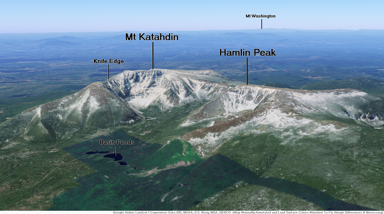
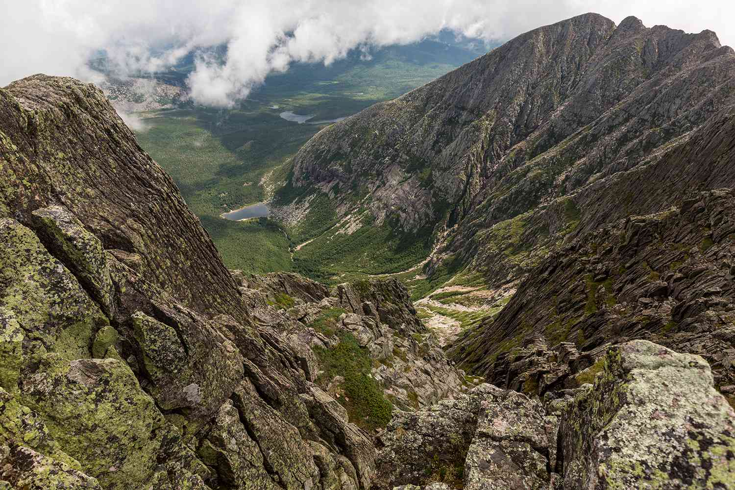
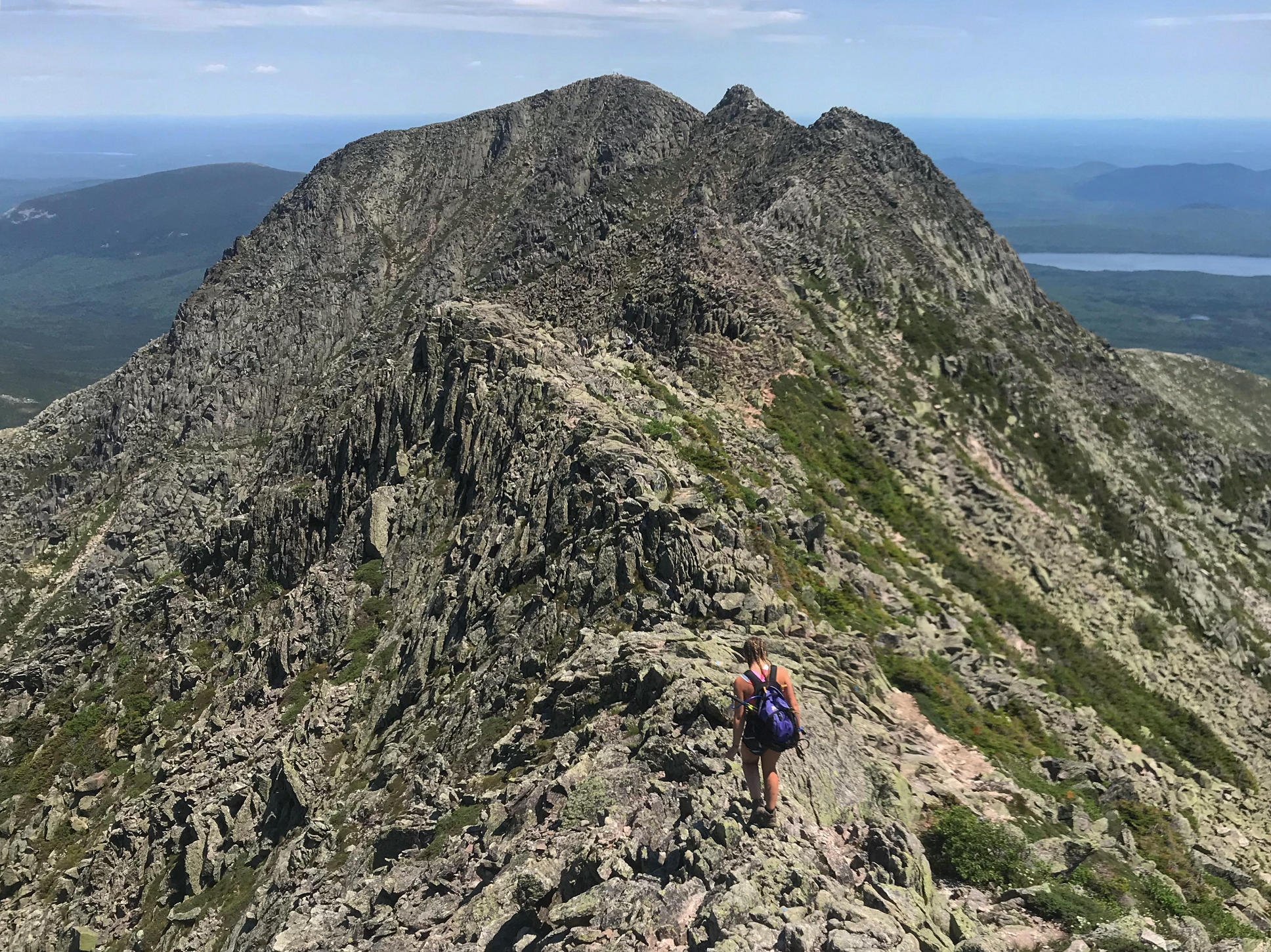
Mount Katahdin Region
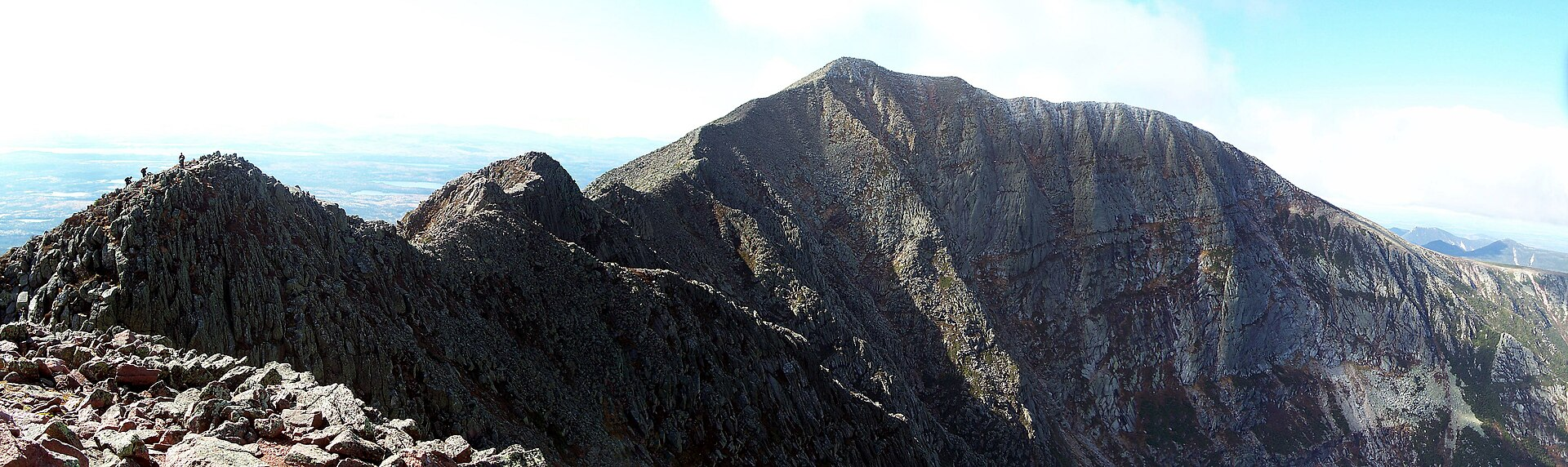
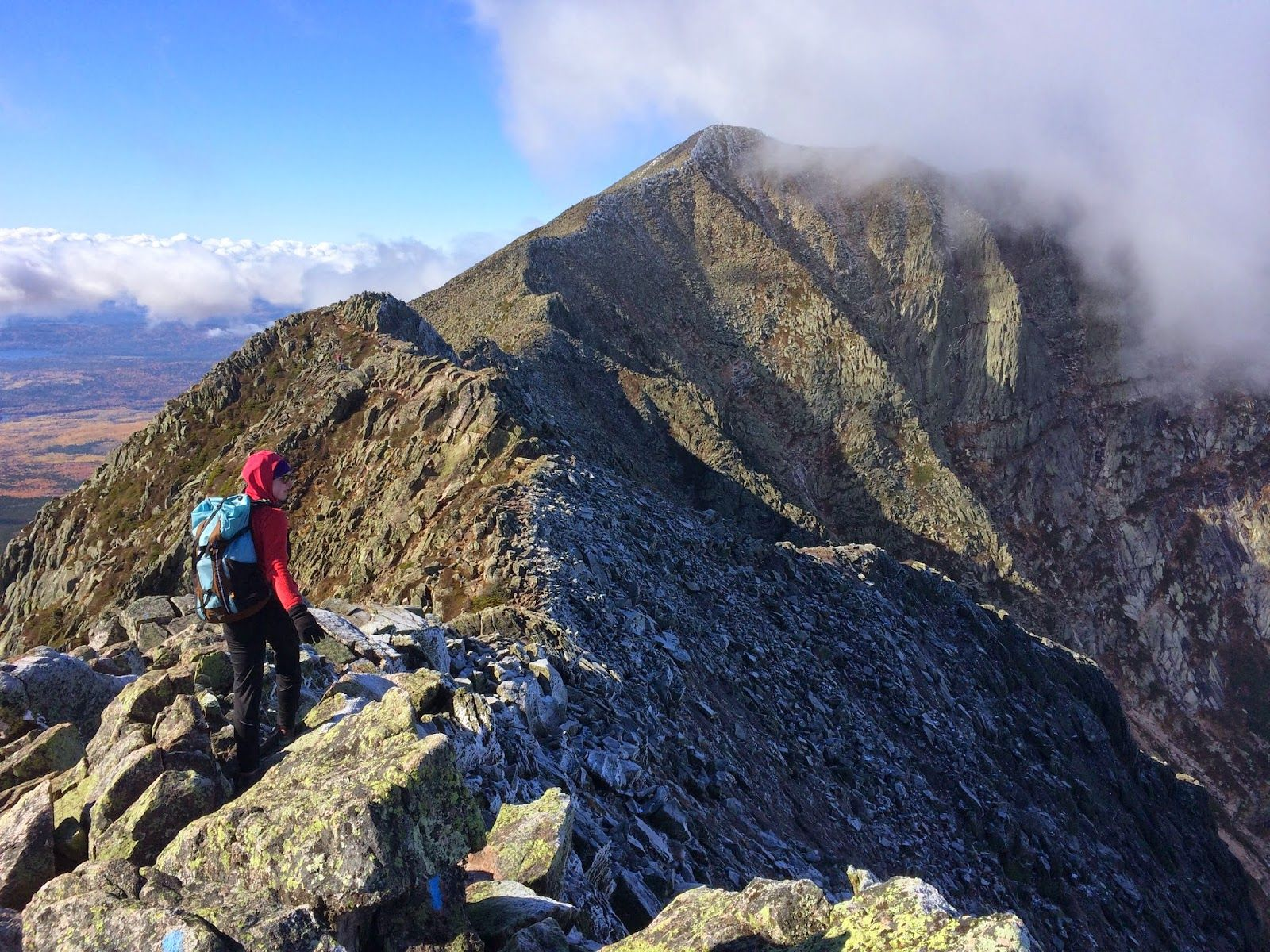
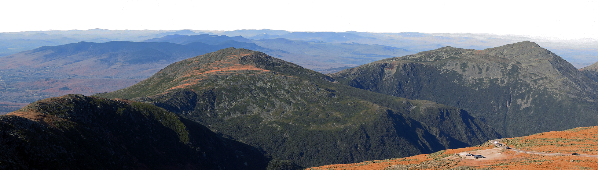
Mount Katahdin Panorama

![]()
Mount Katahdin (/kəˈtɑːdɪn/ kə-TAH-din) is the highest mountain in the U.S. state of Maine at 5,269 feet (1,606 m). Named Katahdin, which means “Great Mountain”,[3] by the Penobscot Native Americans, it is within Northeast Piscataquis, Piscataquis County, and is the centerpiece of Baxter State Park. It is a steep, tall massif formed from a granite intrusion weathered to the surface. The flora and fauna on the mountain are typical of those found in northern New England, with the summit hosting fragile and endangered alpine tundra.
Katahdin has been known to the Native Americans in the region for thousands of years and was known to Europeans at least since 1689. It has inspired hikes, climbs, journal narratives, paintings, and a piano sonata.[4] The area around the peak was protected by Governor Percival Baxter starting in the 1930s. Katahdin is the northern terminus of the Appalachian Trail and is near a stretch known as the Hundred-Mile Wilderness. Though part of the Appalachian Mountain system, Katahdin is isolated from the range, and sits largely on its own as a monadnock. The nearest higher mountains in any direction are the high peaks of the Presidential Range, around 170 miles (270 km) to the south-west.
In 1967, Mount Katahdin was designated as a National Natural Landmark by the National Park Service.[5]
The mountain is commonly called just “Katahdin”,[6] though the official name is “Mount Katahdin” as decided by the US Board on Geographic Names in 1893.[7]
Geology
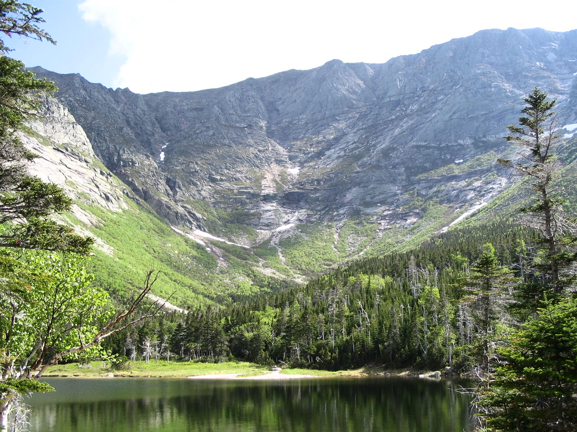
Katahdin is part of a laccolith that formed in the Acadian orogeny when an island arc collided with eastern North America approximately 400 million years ago. On the sides of Katahdin are four glacial cirques carved into the granite by alpine glaciers and in these cirques behind moraines and eskers are several ponds.[8]
In Baxter State Park, many outcrops of sedimentary rocks have striations, whereas Katahdin Granite and Traveler Rhyolite lava have weathered surfaces on which striations are commonly not preserved. Bedrock surfaces of igneous rocks which were buried by glacial sediments and only recently exposed have well preserved striations, as in the vicinity of Ripogenus Dam. Several outcrops of sedimentary rocks along the Patten Road show striations, especially on the north side of the road at Hurricane Deck. A few outcrops near the Patten Road just north of Horse Mountain are striated, as are several outcrops of sedimentary rocks along the road from Trout Brook Farm northward to Second Lake Matagamon.
This article uses material from the Wikipedia article Mount Ktahdin, which is released under the Creative Commons Attribution-Share-Alike 4.0 International License (view authors).
 |  |
 |  |
 I I | 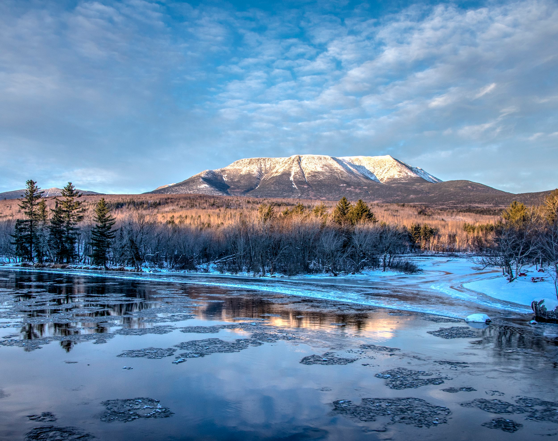 Friends of Baxter State Park |
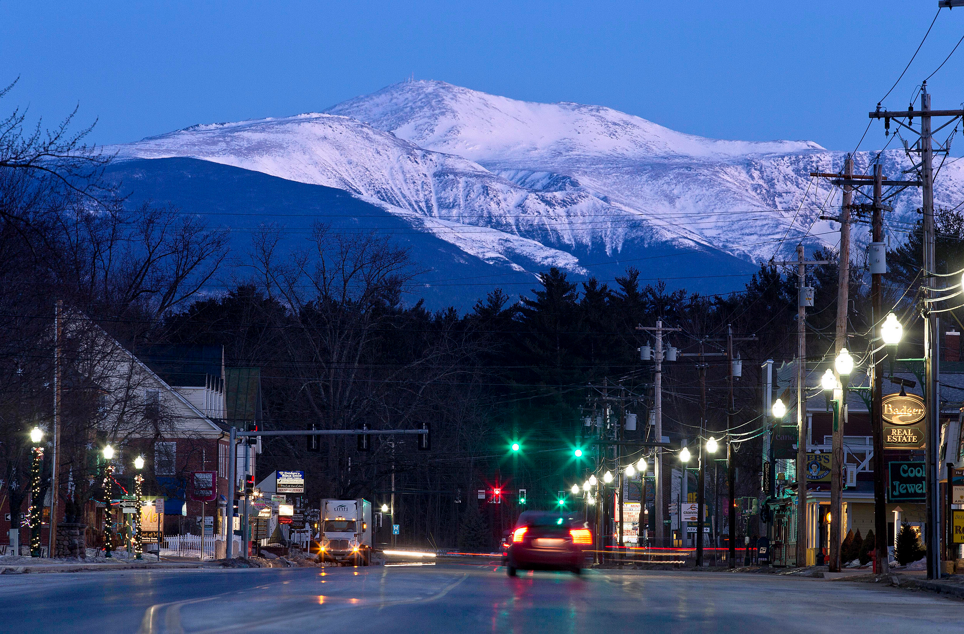
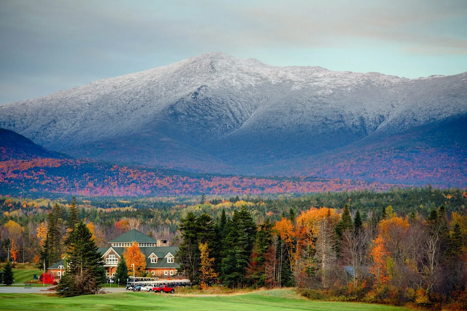
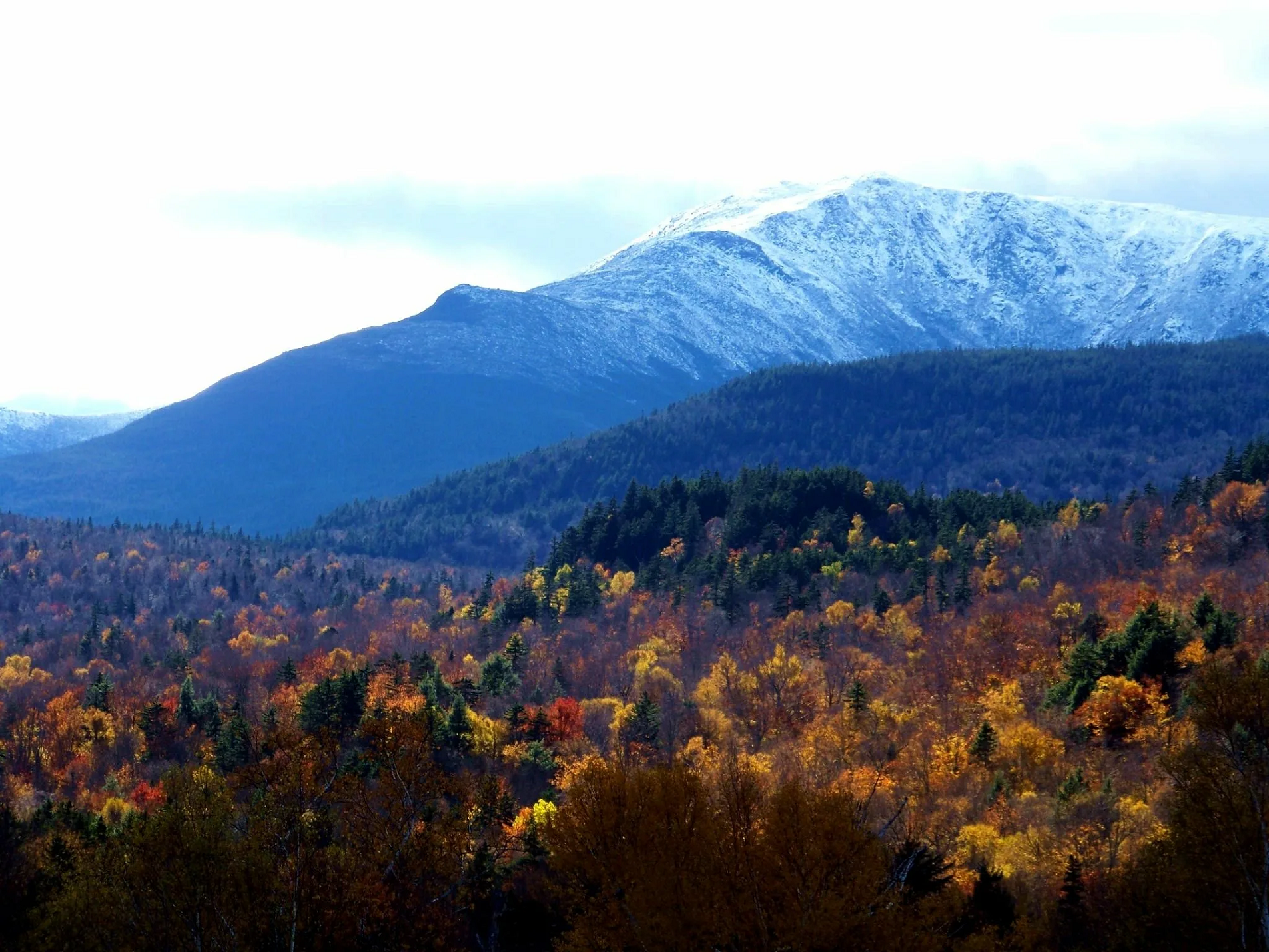
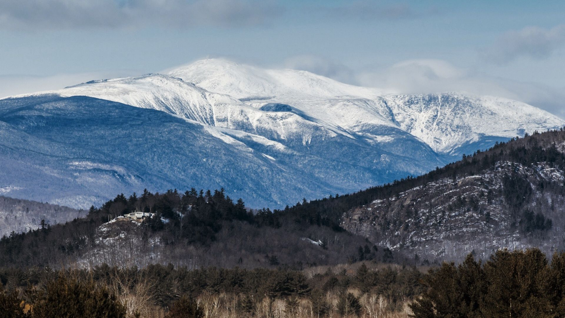
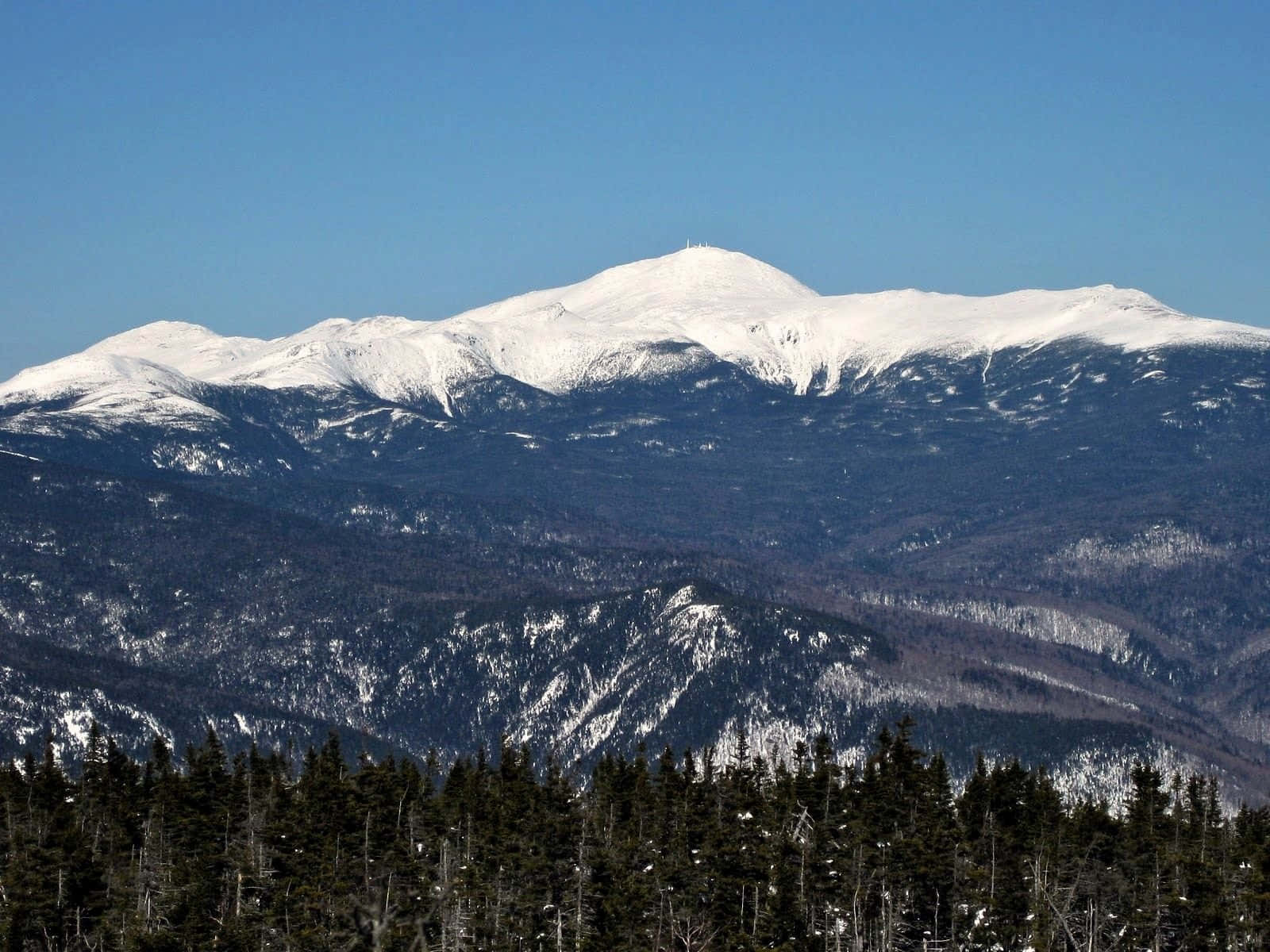
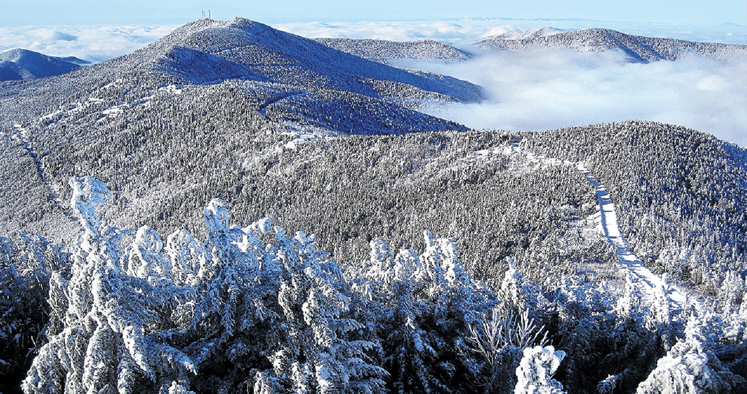
Mount Washington Region
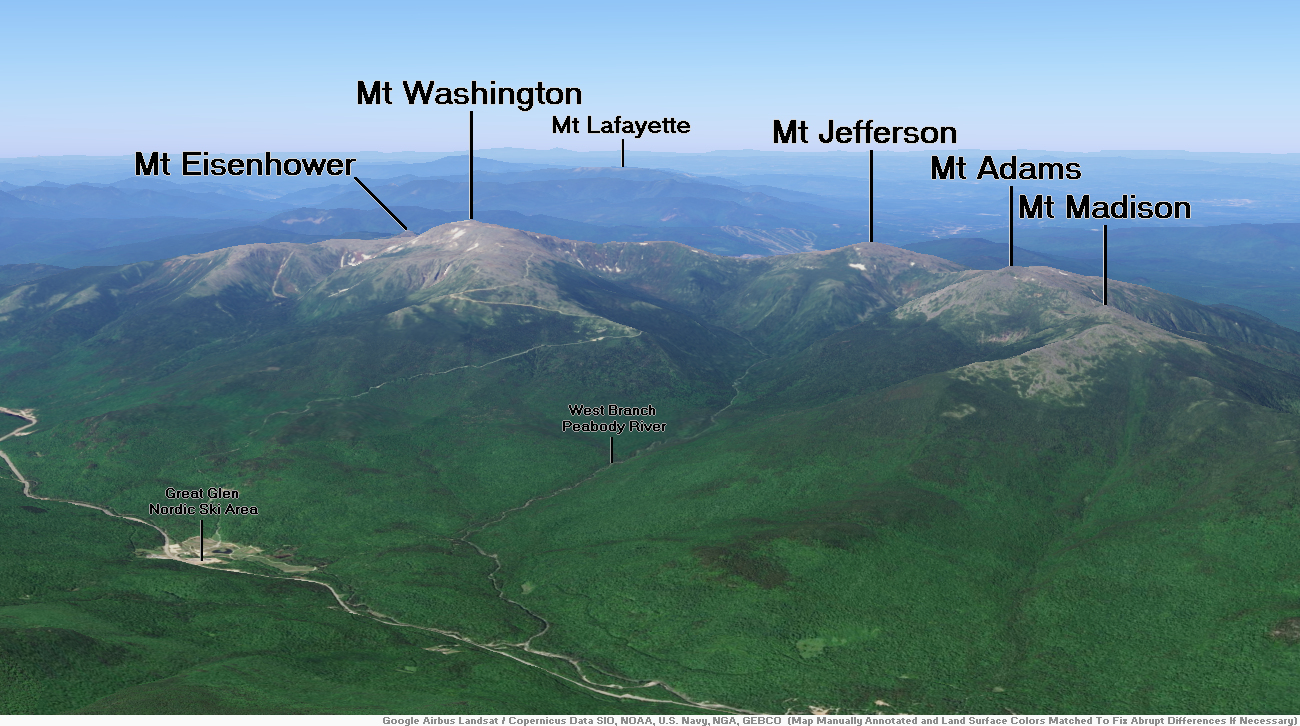
Mount Washington Panorama
Robert Linsdell (Wikipedia)

Mount Washington is an ultra-prominent mountain in the state of New Hampshire. It is the highest peak in the Northeastern United States at 6,288.2 ft (1,916.6 m) and the most topographically prominent mountain east of the Mississippi River.
The mountain is notorious for its erratic weather. On the afternoon of April 12, 1934, the Mount Washington Observatory recorded a windspeed of 231 miles per hour (372 km/h) at the summit, the world record from 1934 until 1996. Mount Washington still holds the record for highest measured wind speed not associated with a tornado or tropical cyclone.[4][a]
The mountain is located in the Presidential Range of the White Mountains, in Coös County, New Hampshire. The mountain is in several unincorporated townships, with the summit in the township of Sargent’s Purchase. While nearly the whole mountain is in the White Mountain National Forest, an area of 60.3 acres (24.4 ha) surrounding and including the summit is designated as Mount Washington State Park.
The Mount Washington Cog Railway ascends the western slope of the mountain, and the Mount Washington Auto Road climbs to the summit from the east. The mountain is visited by hikers from various approaches,[6] including the Appalachian Trail, which traverses the summit.[7] Other common activities include glider flying, backcountry skiing, and annual cycle and running races such as the Auto Road Bicycle Hillclimb and Road Race.
History
Before European settlers arrived in the region, the mountain was known by various indigenous peoples as Kodaak Wadjo (“the top is so hidden” or “summit of the highest mountain”) or Agiochook or Agiocochook (“the place of the Great Spirit” or “the place of the Concealed One”).[8] The Algonquians called the summit Waumbik, “white rocks”.[8][9] The Abenaki people inhabiting the region at the time of European contact believed that the tops of mountains were the dwelling place of the gods and did not climb them out of religious deference to their sanctity.
In 1524, Giovanni da Verrazzano became the first European to mention the mountain. Viewing it from the Atlantic Ocean, he described what he saw as “high interior mountains”.[11]
In 1642, Darby Field claimed to have made the first ascent of Mount Washington.[12] Field climbed the mountain in June of that year to demonstrate to the Abenaki chief Passaconaway that the Europeans bargaining for tribal land were not subject to the gods believed to inhabit the summit, a primarily political move that facilitated colonists’ northern expansion.[10] Field again summited Agiocochook in October 1642 on an early surveying expedition that created maps of land as far as Maine, which allowed people from the Massachusetts colony to identify arable coastal areas.[10]
This article uses material from the Wikipedia article Mount Washington, which is released under the Creative Commons Attribution-Share-Alike 4.0 International License (view authors).
 |  |
 |  |
 |  |
Mount Mitchell Region
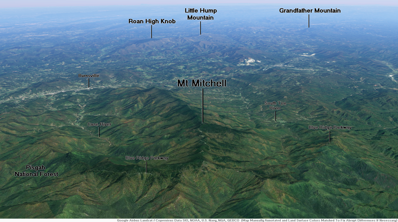
Mount Mitchell (Attakulla in Cherokee)[3] is the highest peak of the Appalachian Mountains and the highest peak in mainland North America east of the Mississippi River. It is located near Burnsville in Yancey County, North Carolina in the Black Mountain subrange of the Appalachians about 19 miles (31 km) northeast of Asheville. It is protected by Mount Mitchell State Park and surrounded by the Pisgah National Forest. Mount Mitchell’s elevation is 6,684 feet (2,037 m) above sea level.[1] Mount Mitchell is ranked 31st by topographic isolation.
Geography
The peak is the highest mountain in the United States east of the Mississippi River,[4][5] and the highest in all of eastern North America south of the Arctic Cordillera. The nearest higher peaks are in the Black Hills of South Dakota and the highland foothills of Colorado. The mountain’s topographic isolation is calculated from the nearest discernible single higher point: Lone Butte, which is 1,189 miles (1,913 km) away in southeastern Colorado.[citation needed]
History
Mount Mitchell was the highest mountain of the United States from 1789 until the Louisiana Purchase in 1803 when Mount Elbert became the highest mountain claimed by the United States. Mount Mitchell was also the most isolated peak in the United States from 1789 until the Treaty of Guadalupe Hidalgo in 1848 when Mount Whitney became the most isolated.
The Cherokee people, who long occupied this area as part of their homeland, called the mountain Attakulla.[3] European-American settlers first called the mountain Black Dome for its rounded shape. They later named it after Elisha Mitchell, a professor at the University of North Carolina, who first explored the Black Mountain region in 1835. He determined that the height of the range exceeded by several hundred feet that of Mount Washington in New Hampshire. The latter had been commonly thought at the time to be the highest point in the United States east of the Rocky Mountains. Mitchell fell to his death at nearby Mitchell Falls in 1857, where he had returned to verify his earlier measurements.[citation needed]
A 4.6-mile (7.4 km) road (NC 128) connects the scenic Blue Ridge Parkway to a parking lot where a steep paved 980-foot (300 m) trail leads through a conifer forest to the summit. The 40-foot (12 m) stone observation tower on the summit was torn down in late 2006. A new observation deck was constructed and opened to visitors in January 2009.[6]
This article uses material from the Wikipedia article Mount Mitchell, which is released under the Creative Commons Attribution-Share-Alike 4.0 International License (view authors).
 Anthony Heflin (Dreamstime) | 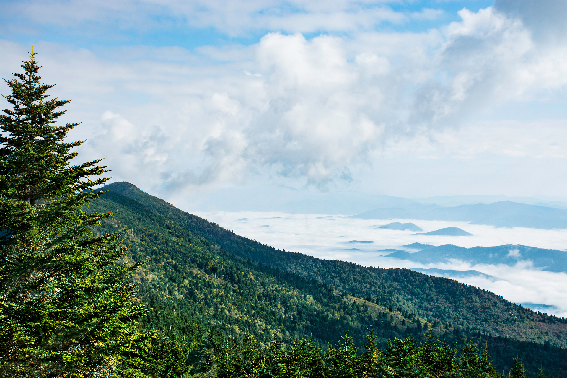 Margaret619 (Dreamstime) |
 |  |

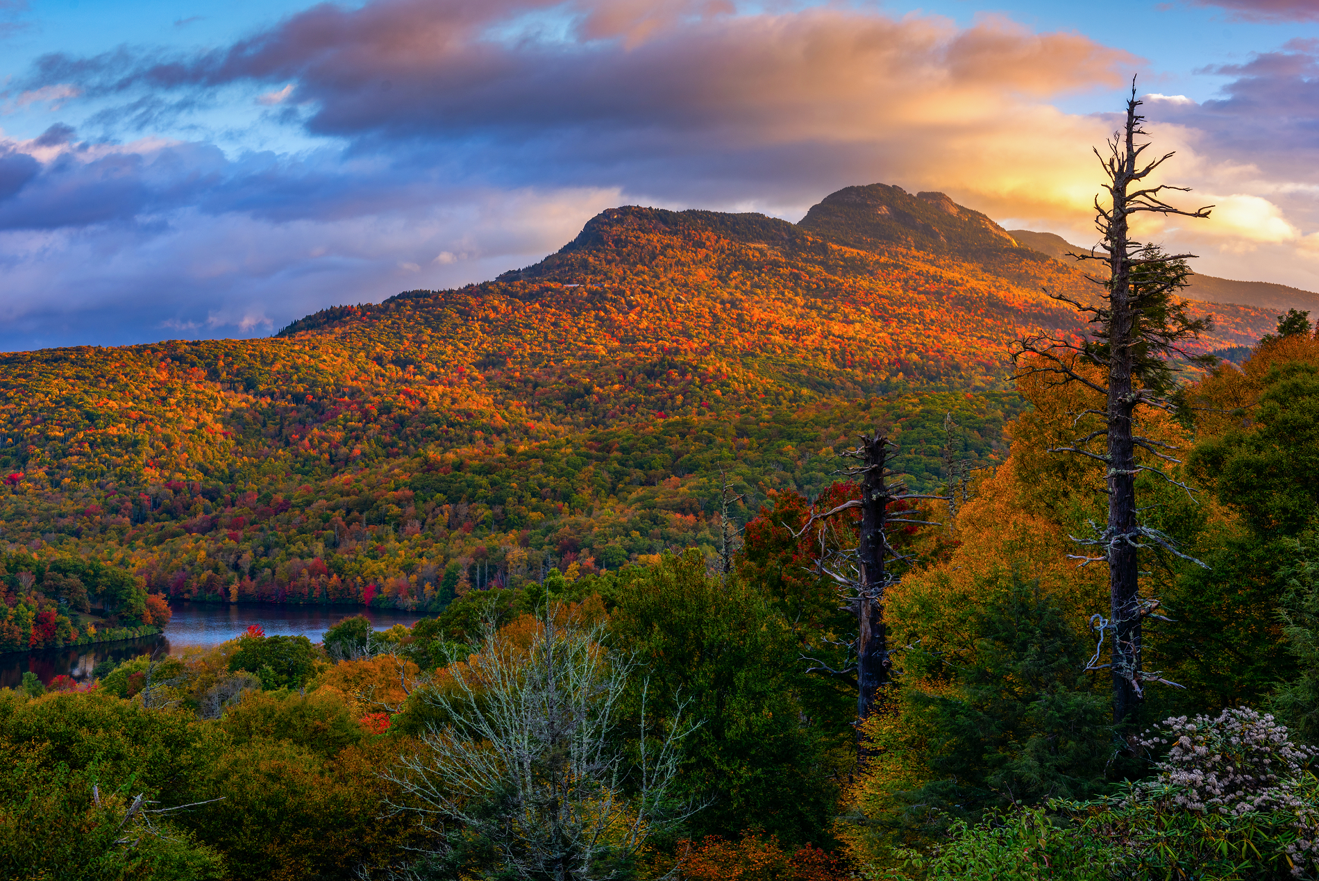
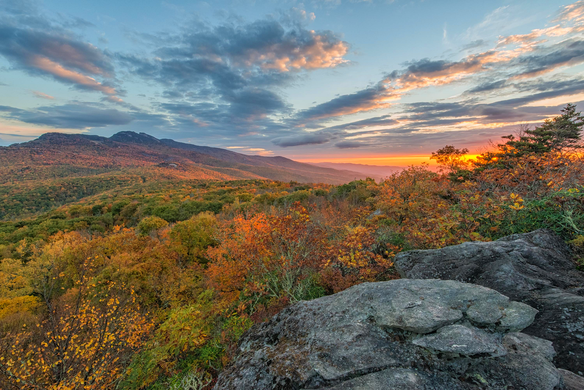
![]()
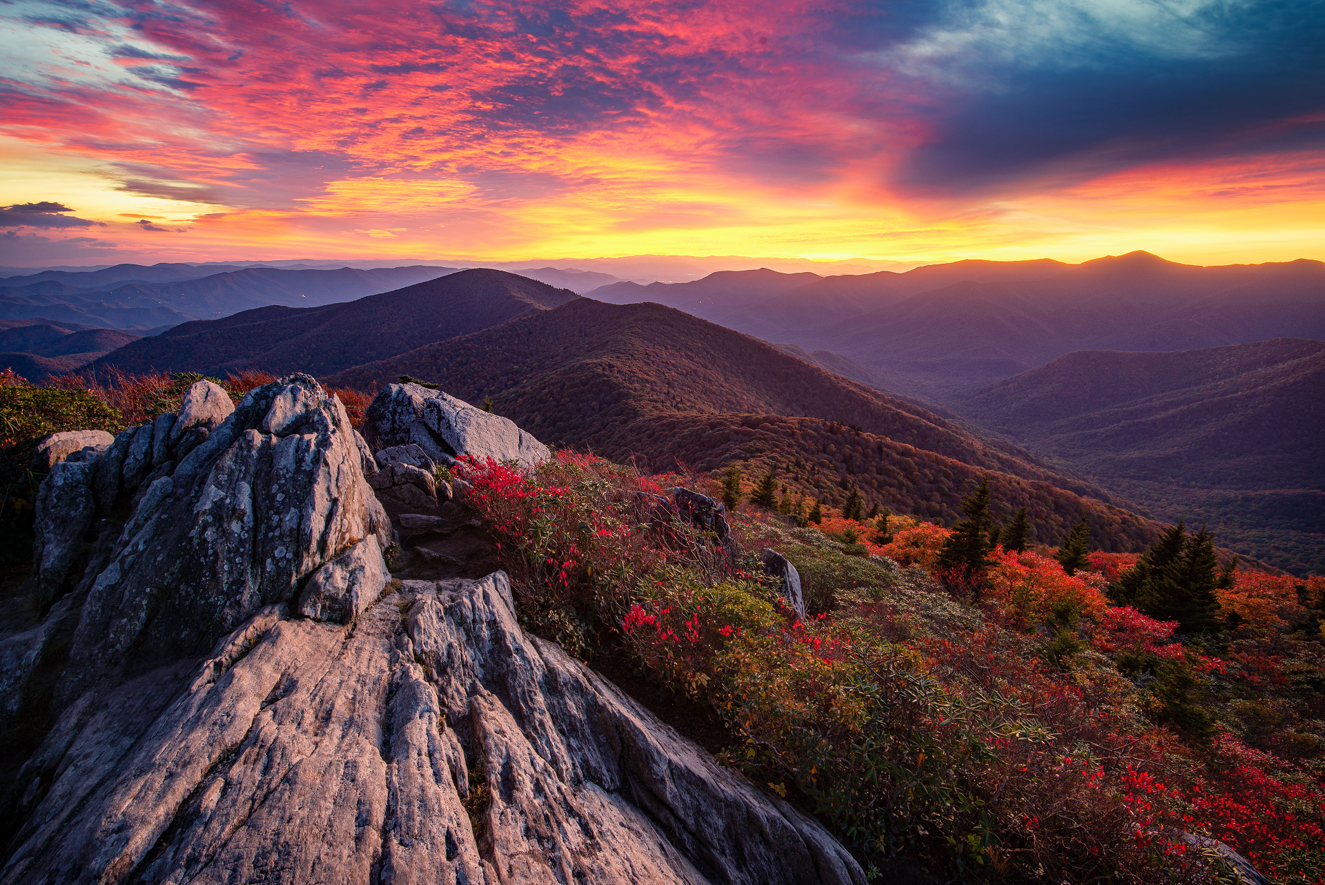
Grandfather Mountain[1] is a mountain, a non-profit attraction, and a North Carolina state park near Linville, North Carolina. At 5,946 feet (1,812 m), it is the highest peak on the eastern escarpment of the Blue Ridge Mountains, one of the major chains of the Appalachian Mountains. (Nearby Mt. Mitchell, the highest peak east of the Mississippi River, is on the western escarpment.) The Blue Ridge Parkway passes by the south side of the mountain and also passes over the nearby Grandmother Gap. It is located at the meeting point of Avery, Caldwell (highest point), and Watauga (highest point) counties.
Era of private ownership
Until 2008, Grandfather Mountain was privately owned and operated as a nature preserve and tourist attraction. It was and still is best known for its mile-high swinging bridge, the highest in America, built in 1952 by Hugh Morton. The bridge links two of the mountain’s rocky peaks, and is known as the “swinging” bridge due to its tendency to sway in high winds. Morton inherited the mountain from his grandfather and developed the tourist attractions. He died on June 1, 2006, at the age of 85. After Morton’s death, he donated all of his photographs, including many of Grandfather Mountain, Mildred the Bear, and many other aspects of life on the mountain to the University of North Carolina at Chapel Hill.[2]
Grandfather Mountain State Park
On September 29, 2008, North Carolina Governor Mike Easley announced that the state had agreed to purchase 2,600 acres (11 km2) of the undeveloped portions of Grandfather Mountain from the Morton family for $12 million.[3] The area has been added to the North Carolina State Park system, becoming the 34th North Carolina state park. The Morton family established the Grandfather Mountain Stewardship Foundation to continue to operate the travel destination as an educational nature park. Grandfather Mountain State Park was officially established in 2009.[4] The “backcountry” portion of the mountain that comprises the state park is now regularly (in favorable weather) patrolled by state park rangers and other state law enforcement personnel.
As part of the purchase agreement, the state acquired part of the mountain commonly referred to as the “backcountry” in fee simple, and it also acquired a conservation easement and right of first refusal over the remaining “attraction side” of the mountain. In addition, the Morton family agreed to form a new non-profit organization and transfer ownership of the attraction to it. This arrangement was made as an alternative to the state acquiring the entire mountain, because some of the traditional activities at Grandfather Mountain conflict with state park management policies.[citation needed]
On September 18, 2011, the park had a grand opening celebration for its first office area,[5] which is 3 miles (4.8 km) from the Profile Trail-head[6] on NC 105.
This article uses material from the Wikipedia article Grandfather Mountain, which is released under the Creative Commons Attribution-Share-Alike 4.0 International License (view authors).
 Aheflin (iStock) |  I |
 Skip Sickler (Grandfather Mtn Stewardship) | 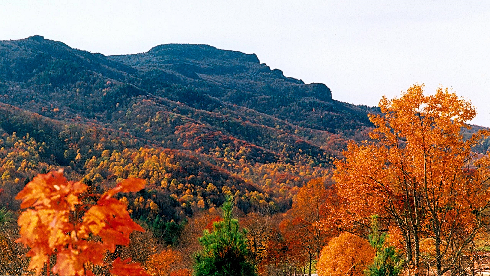 I I I |
